
Driving Through Time - The Digital Blue Ridge Parkway

Search Results:
-
Land Acquisition Maps Section 2-E
1939
-
 Ringstones and "Corner Break"
January 10, 1939
-
 Oblique view
January 10, 1939
-
 Oblique View of structure
January 10, 1939
-
 Masonry Detail
January 10, 1939
-
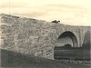
 Bridge at Mulberry Gap
January 10, 1939
-
 Arch ring
January 10, 1939
-
 Log House
January 20, 1939
-
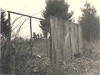
 Two sheds formerly owned by Glen Miller
January 20, 1939
-
 Part of shed
January 20, 1939
Items in Query
Results: 19
Refine Your Search
Types (2)
Photographs (18) Maps (1)Locations (7)
Milepost 248 (9) Milepost 250 (2) Milepost 256 (2) Milepost 261 (2) Milepost 268 (2) Milepost 259 (1) Section 2E (1)Sections (2)
2D (16) 2E (3)Counties (1)
Ashe (19)

