
Driving Through Time - The Digital Blue Ridge Parkway

Search Results:
-
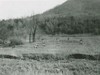
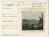
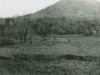
 Wheats Valley
20th Century
-
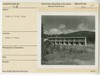 Peaks of Otter Lodge
20th Century
-
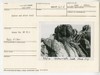
 Elk herd in Peaks of Otter area
20th Century
-
 Peaks of Otter. Access to relocation, looking east
20th Century
-
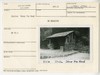 Shelter Sharp Top Road
20th Century
-
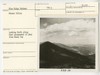
 View of Sharp Top
20th Century
-
 Peaks of Otter Lodge
20th Century
-
 Peaks of Otter from Sharp Top
20th Century
-
 Elk herd in Peaks of Otter area
20th Century
-
 Before and after trail
20th Century
Items in Query
Results: 511
Refine Your Search
Types (3)
Photographs (507) Maps (3) Drawings, Plans, and Projections (1)Locations (36)
Peaks of Otter (115) Sharp Top Mountain (Va.) (92) Peaks of Otter Lodge (Va.) (45) Peaks of Otter Bus Station and Camp Store (38) Peaks of Otter Visitor Center (30) Milepost 86 (27) Peaks of Otter Campground (21) Virginia State Route 43 at Little Stony Creek (17) Section 1K (15) Peaks of Otter Picnic Area (14) Milepost 87 (10) Sharp Top Overlook (9) Milepost 90 (8) Milepost 98 (7) Headforemost Mountain Overlook (6) Peaks of Otter Service Station (6) Flat Top Mountain (Va.) (5) Sharp Top Mountain Bus Shelter (5) Intersection of Blue Ridge Parkway at Virginia State Route 43 (4) Milepost 99 (4) Pine Tree Overlook (4) Bobblets Gap Overlook (3) Goose Creek Valley Overlook (3) Milepost 93 (3) Milepost 97 (3) Section 1J (3) Bearwallow Gap (2) Big Spring (Va.) (2) Milepost 95 (2) Powell Gap (2) Blue Ridge Quarry (1) Milepost 65 (1) Milepost 71 (1) Milepost 79 (1) Milepost 94 (1) Montvale Overlook (1)Sections (4)
1K (489) 1J (15) 1L (5) 1H (2)Counties (1)
Bedford (511)

