
The Yadkin Road Marker, Pinehurst
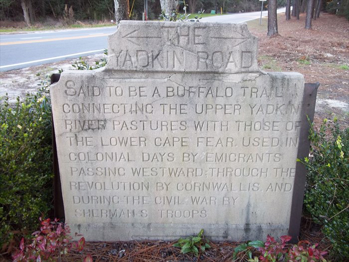
The Yadkin Road marker is made of cast concrete and stands several feet tall. The shape is roughly square but the upper corners and crest have been cut into a concave arch. The crest holds the words THE YADKIN ROAD. The word THE is flanked by arrows pointing east and west. The main inscription is on the square block below. Five of the markers were placed in 1927 with four extant.
Images:
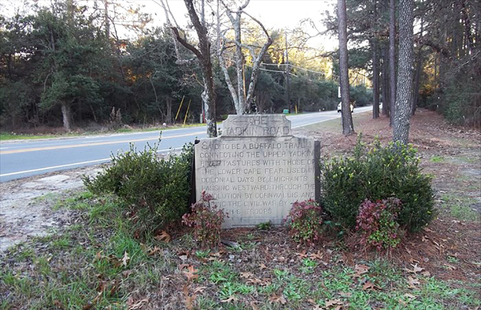
View of the memorial and Page Road
THE YADKIN ROAD
SAID TO BE A BUFFALO TRAIL / CONNECTING THE UPPER YADKIN / RIVER PASTURES WITH THOSE OF / THE LOWER CAPE FEAR. USED IN / COLONIAL DAYS BY EMIGRANTS / PASSING WESTWARD; THROUGH THE / REVOLUTION BY CORNWALLIS AND / DURING THE CIVIL WAR BY / SHERMAN’S TROOPS.
1927
35.202900 , -79.456620
View in Geobrowse
Gilkeson, Florence. “Historic Marker to Survive N.C. 211 Widening,” The Pilot (Southern Pines, NC), July 10, 2011, (accessed May 11, 2021) Link
LeCount, Sarah W. “Historic Architectural Resources Survey Report Phase II: Final Identification and Evaluation, Widening of US 211,” North Carolina Department of Cultural Resources, March 17, 2000, (accessed May 11, 2021) Link
“The Yadkin Road,” Waymarking.com, (accessed May 11, 2021) Link
“Yadkin Road,” Carolina Crossroads, carolinaxroads.com, March 2, 2017, (accessed May 11, 2021) Link
Yes
Cast concrete
James A. Wicker and Leonard Tufts
James McNeill Johnson wrote the inscription for the five markers. Michael Hill, of the Archives and History Division staff of the N.C. Department of Cultural Resources, believes Wicker and Tufts were probably inspired by the series of Boone Trail Highway markers that crisscross much of the United States. About 60 of the Boone markers were erected mostly in the western part of North Carolina through the efforts of J. Hampton Rich.
The original 1927 five markers were located:
(1) where the Yadkin Road crosses old US 1 at Manly,
(2) where the Yadkin Road crosses McDeed's Creek at the
US 1 overpass of Midland Road,
(3) just east of the traffic circle at Pinehurst,
(4) where the Yadkin Road crosses Page Road south of NC 211, and
(5) where the Yadkin Road crosses NC 211 near the entrance to
Pine Wild.
Four of the markers still exist; the one placed at McDeed's Creek is no longer
in place.
The Yadkin Road marker is located in the southwest quadrant of the intersection of NC 211 and Page Road (SR 1208) in Pinehurst, NC. The marker sits approximately ten feet from the edge of Page Road, and 165 feet from the existing edge of NC 211. Another three remaining markers are located at the Pinehurst Traffic Circle, the entrance to Pinewild County club on NC 211, and in Manly at the corner of Yadkin Road and May Street.
The marker is surrounded by trees and evergreen bushes.
 Know anything else about this monument that isn't mentioned here? If you have additional information on
this or any other monument in our collection fill out the form at the Contact Us link in the footer. Thank you.
Know anything else about this monument that isn't mentioned here? If you have additional information on
this or any other monument in our collection fill out the form at the Contact Us link in the footer. Thank you.


