
Vance County Iraq War Memorial, Henderson
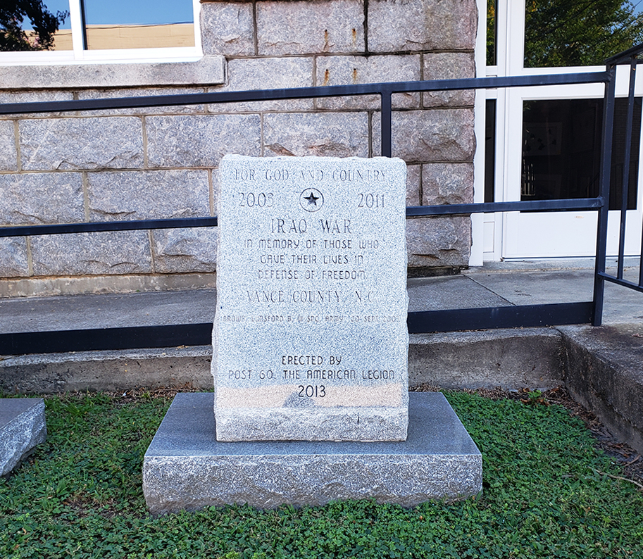
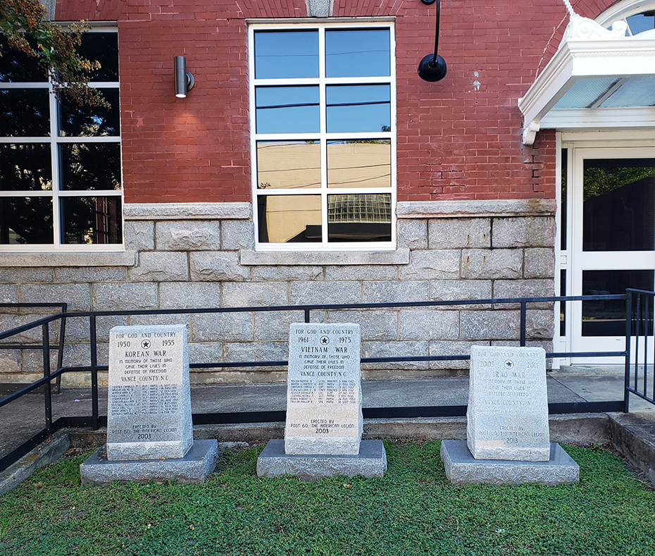
The memorial is a small lectern shaped granite block that lists the name of the one Army soldier from Vance County who died during the Iraq War. The inscription includes his name, rank and date of death. This memorial sits in a line with a Korean War and Vietnam War Memorial.
Images:
Three memorials on Young Street |
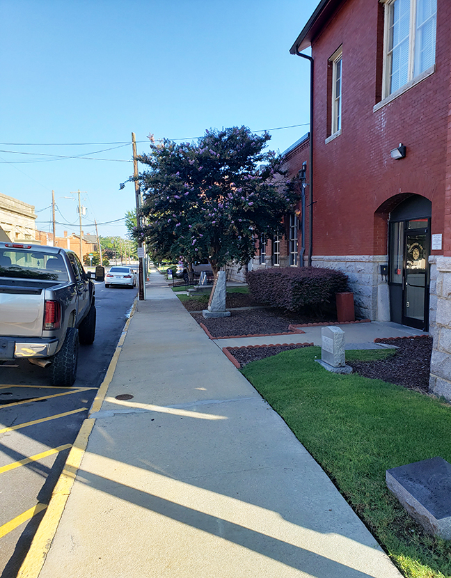
View of the memorials along Young Street |
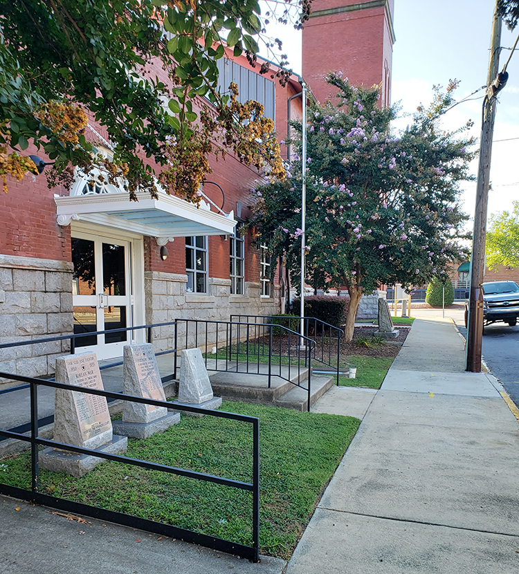
Side view of the memorials on Young Street
FOR GOD AND OUR COUNTRY / 2003 2001 / IRAQ WAR / IN MEMORY OF THOSE WHO / GAVE THEIR LIVES IN / DEFENSE OF FREEDOM / VANCE COUNTY NC / BROWN, LUNSFORD B. III SPC. ARMY SEPT. 2003 / ERECTED BY / POST 60 THE AMERICAN LEGION / 2013
2013
36.328090 , -78.402090
View in Geobrowse
No related materials.
Yes
Granite
Post 60, American Legion
This memorial and at least five other markers are located along Young Street near the intersection with N. Garnett St. in Henderson, NC. They are positioned along the sidewalk that runs next to Henderson Fire Department-Station #2. Near this memorial on Young street are the Vance County Vietnam War, Vance County Korean War, World War Two memorials, a “Rebel” firehouse dog memorial and time capsule. Further north on the grounds of the old Vance County Courthouse is the Leonard Henderson marker.
The memorial stands on the grass along the sidewalk.
This memorial, along with several others, was originally located in a small park near the railroad underpass on North Garnett Street across the street from First Methodist Church. It was surrounded by evergreen trees and shrubs. Geo coordinates: 36.328310 , -78.40098. The relocation occurred after 2019.
 Know anything else about this monument that isn't mentioned here? If you have additional information on
this or any other monument in our collection fill out the form at the Contact Us link in the footer. Thank you.
Know anything else about this monument that isn't mentioned here? If you have additional information on
this or any other monument in our collection fill out the form at the Contact Us link in the footer. Thank you.


