Yellow Mountain Trail Marker, Ingalls
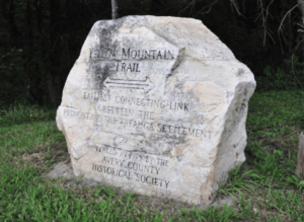
The Yellow Mountain Trail marker is a roughly five-sided boulder with a flat but unfinished front face bearing the incised inscription. Beneath the words YELLOW MOUNTAIN TRAIL is an arrow pointing in both directions. The stone stands between two feet and three feet tall.
YELLOW MOUNTAIN / TRAIL / EARLIEST CONNECTING LINK / BETWEEN THE / PIEDMONT AND WATAGUA SETTLEMENT /PLACED IN 1979 BY THE / AVERY COUNTY / HISTORICAL SOCIETY
1979
35.950220 , -82.002280
View in Geobrowse
Hardy, Michael. “Our Avery County: Monuments and Memorials in Avery County,” The Avery Journal Times (Newland, NC), July 19, 2014, (accessed May 16, 2023) Link
“Avery County Historical Museum,” Avery County Historical Museum, (accessed May 16, 2023) Link
“Our Earliest Highway: Bright’s Trace and the Yellow Mountain Road,” Mitchell County Historical Society, (accessed May 16, 2023) Link
Yes
Stone
Avery County Historical Society
The Yellow Mountain Trail was created by migrating deer, elk and buffalo long before the first European settlers. This area was also not permanently inhabited by Native Americans but was used as a hunting ground. The first Europeans to likely follow this trail were the Spanish explorers Hernando DeSoto and Juan Pardo in the 1540’s and 1560’s. The trail ran from near Morganton to eastern Tennessee. The trail was later used by settlers from the North Carolina Colony to push westward beyond the Eastern Continental Divide into lands the British had set aside for Native Americans.
The marker stands a short distance to the left of Sunny Brook Store on NC Highway 19E near the intersection with Brushy Creek Road in the Ingalls Community, NC.
The boulder sits on the grass, trees and bushes behind it.
 Know anything else about this monument that isn't mentioned here? If you have additional information on
this or any other monument in our collection fill out the form at the Contact Us link in the footer. Thank you.
Know anything else about this monument that isn't mentioned here? If you have additional information on
this or any other monument in our collection fill out the form at the Contact Us link in the footer. Thank you.