About
| Collections
| Authors
| Titles
| Subjects
| Geographic
| K-12
| Facebook  | Buy DocSouth Books
Collections >> Titles by Thomas H. Jones >> Map of Wilmington, N.C. from 1856 (View at 500%)
Plan of Wilmington, N.C., 1856
FROM the North Carolina Collection, University of North Carolina at Chapel Hill
Call number Cm912c W74 1856
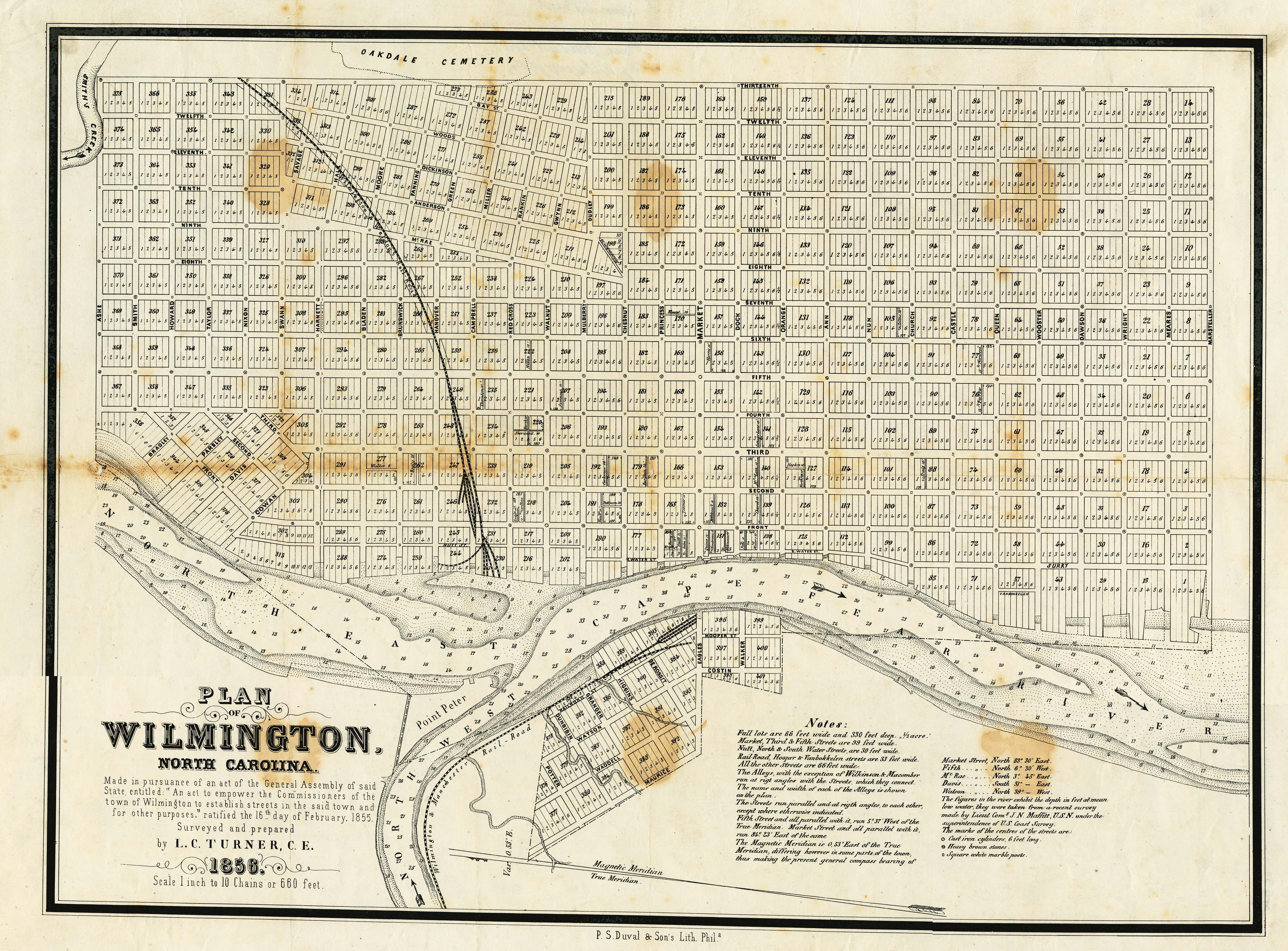
This map of the waterfront area of the city of Wilmington, North Carolina from 1856 shows what Wilmington was like shortly after Thomas H. Jones escaped slavery in 1849. Wilmington was one of the state's major port cities during the nineteenth century.
View this map at 20% | View this map at 40%
Titles by Thomas H. Jones
- Experience and Personal Narrative of Uncle Tom Jones; Who Was for Forty Years a Slave. Also the Surprising Adventures of Wild Tom, of the Island Retreat, a Fugitive Negro from South Carolina by Thomas H. Jones
- The Experience of Thomas H. Jones, who was a Slave for Forty-Three Years by Thomas H. Jones
- The Experience of Rev. Thomas H. Jones, Who Was a Slave for Forty-Three Years. Written by a Friend, as Related to Him by Brother Jones by Thomas H. Jones
Return to North American Slave Narratives Home Page
Return to The North Carolina Experience, Beginings to 1940 Home Page
Return to First-Person Narratives of the American South Home Page
Return to Documenting the American South Home Page
Return to The North Carolina Experience, Beginings to 1940 Home Page
Return to First-Person Narratives of the American South Home Page
Return to Documenting the American South Home Page