Geological Report of the Midland Counties of North Carolina:
Electronic Edition.
Emmons, Ebenezer, 1799-1863
Funding from the Institute for Museum and Library Services
supported the electronic publication of this title.
Text transcribed by
Apex Data Services, Inc.
Images scanned by
Bryan Sinche and Don Chalfant
Text encoded by
Apex Data Services, Inc., Melissa G. Meeks, and Jill Kuhn Sexton
First edition, 2002
ca. 810K
Academic Affairs Library, UNC-CH
University of North Carolina at Chapel Hill,
2002.

Source Description:
(title page) Geological Report of the Midland Counties of North Carolina.
(spine) North Carolina Geological Survey.
Ebenezer Emmons
xx, 351 p., ill.
New York
George P. Putnam & Co.
Raleigh
Henry D. Turner
1856
Call number C551 N87e 1856 c. 2 (North Carolina Collection, University of North Carolina at Chapel Hill)
The electronic edition is a part of the UNC-CH
digitization project, Documenting the American South.
The text has been entered using double-keying and verified against the original.
The text has been encoded using the
recommendations for Level 4 of the TEI in Libraries Guidelines.
Original grammar, punctuation, and spelling have been preserved. Encountered
typographical errors have been preserved, and appear in red type.
All footnotes are inserted at the point of reference within paragraphs.
Any hyphens occurring in line breaks have been
removed, and the trailing part of a word has been joined to
the preceding line.
All quotation marks, em dashes and ampersand have been transcribed as
entity references.
All double right and left quotation marks are encoded as " and "
respectively.
All single right and left quotation marks are encoded as ' and ' respectively.
All em dashes are encoded as --
Indentation in lines has not been preserved.
Running titles have not been preserved.
Spell-check and verification made against printed text using Author/Editor (SoftQuad) and Microsoft Word spell check programs.
Library of Congress Subject Headings
Languages Used:
- English
LC Subject Headings:
- Mines and mineral resources -- North Carolina.
- Geology -- North Carolina.
- Paleontology -- North Carolina.
- Coal -- Geology -- North Carolina.
Revision History:
- 2002-10-21,
Celine Noel and Wanda Gunther
revised TEIHeader and created catalog record for the electronic edition.
-
2002-01-30,
Jill Kuhn Sexton
finished TEI-conformant encoding and final proofing.
-
2001-06-30,
Melissa G. Meeks
finished TEI/SGML encoding
- 2001-06-17,
Apex Data Services, Inc.
finished transcribing the text.
[Spine Image]

[Title Page Image]
GEOLOGICAL REPORT
OF THE
MIDLAND COUNTIES
OF
NORTH CAROLINA.
BY
EBENEZER EMMONS.
Illustrated with Engravings.
NEW YORK:
GEORGE P. PUTNAM & CO.
RALEIGH:
HENRY D. TURNER.
1856.
Page verso
PRINTED BY HOLDEN & WILSON,
Raleigh, N. C.
Page iii
TO HIS EXCELLENCY THOMAS BRAGG,
Governor of North Carolina.
SIR:
It would be an omission of duty on my part to neglect to speak of the interest you have taken in the geological survey during the period you have held the high office of Chief Magistrate of North Carolina. Upon myself its influence has been cheering, and I hope its effects will be seen in the results of the survey.
The publication of this report has been delayed much longer than I expected, but it has arisen from causes beyond my control. It embodies what is now known of the mineral resources of the midland counties. I have intended in all of my statements to keep within the bounds of truth, and not to give them a coloring which future experience will not justify.
I submit it to your Excellency, regretting that it is not more worthy of your approbation.
I am, Sir,
Your Obedient Servant,
EBENEZER EMMONS.
RALEIGH, October 1, 1856.
Page v
PREFACE.
THIS Report is selected from the matter contained in my field notes, which has been accumulating during the period the survey has been in progress. My attention from the first was directed to the mineral interests of the midland counties, but at the commencement of the work, I was obliged to be satisfied with an examination of abandoned mines, and the indications which the country afforded of those which had not been observed. Since the second year of the survey, the opportunities for investigating its mines and mineral interests have been much greater, and I have improved them, when possible, for acquiring a more exact knowledge of their characteristics. The Deep river coalfield has been carefully re-examined along the outcrop of coal and its bituminous slate, and the results of these examinations tend to confirm the views I expressed in a former report. It will be perceived, that the products of this coalfield are more valuable than the friends of the Deep river improvements had anticipated. But I believe, if those improvements had been completed at an early day, the prospects at this time would be much better than at the present. The mining interests of this State are worthy of the consideration of the public. The auriferous ores are remarkable for their richness. The silver lead of the Lead Hill or Washington mine, is probably not exceeded in value by any mine in this country, and perhaps I may say, in any country. It yields zinc, lead, copper, silver and gold. The processes for the separation have been so simplified that all these metals may be preserved.
Page vi
The fluctuations in mining property, however, have injured its reputation in several notable instances. This has arisen from speculations. Many mines have been purchased with that view alone. They have been in the hands of stock companies; and it was more consonant to the feelings of parties to make money by the forced rise or fall of stocks, than by legitimate mining business. But this is now assuming a more permanent character, and the time is not distant when it will become one of the main sources of the wealth of the State.
The recorded observations embodied in this Report have been made by those who have been engaged in this survey. We have, it is true, received information from others; but at the same time it has been made a principle to see for ourselves, and to base every important inference, or doctrine, upon independent observations.
It would be unjust, however, to two distinguished individuals, to intimate that the geology of the State, and its resources, are now, for the first time, placed upon record. The Pioneer in these investigations was Prof. Olmsted, of Yale College. He was followed immediately by Prof. Mitchell, of Chapel Hill. Their examinations were practical, and highly valuable. Their reports are extremely scarce. I have not referred so frequently to their labors as I should, if I could have had access to them at the proper time. But geology has undergone important changes since their investigations were made, and these gentlemen would now put an entirely new phase upon their reports, were they in the field.
It will be seen that I have attempted to determine, more than had been done prior to the commencement of the survey, the age of the formations of this State. The use of the word AGE is comparative, and is always so understood by
Page vii
geological writers. Even in this sense of the word, there are great difficulties to be met and overcome, inasmuch as there are no immediate terms of comparison which can be employed; for instance, the lower part of the Deep river coal series which I have called the Permian, rests upon the Primary and Taconic rocks. But the Permian is not connected with the series which immediately preceded it, indeed the three older systems, the Silurian, Devonian and Carbonifeferous, are absent. The long interval during which these systems were being deposited, is a blank, upon the Atlantic slope. The regular succession is interrupted, and during these vastly extended periods, this slope was dry land.
While engaged collecting the matter of this Report, I have not neglected the agricultural interest; but it was thought proper to confine the communication to the subject already indicated. Should another be called for, I propose to pursue the plan which I have adopted in this. The western section of the State follows in the order I originally proposed.
The eastern counties embrace a field of great interest and importance, but it is quite different in its characters from the former, as most of the citizens of the State already know. I hope to complete the examinations of it this autumn and winter; and during the coming spring and summer, to complete also the survey of the western and south-western counties.
The additional labors which those who are now engaged in the survey have voluntarily undertaken, has impeded the common fieldwork which had been laid out, and has prevented its extension to the western and south-western counties. But this should not be regretted, inasmuch as its advantages will be increased. The additional work referred to, consists in the collection and arrangement of specimens of
Page viii
the rocks and simple minerals and fossils illustrative of its geology and mineral productions. They have been arranged in a room provided for the collection in the Capitol. Citizens and strangers visiting Raleigh will be able to form an opinion of the resources of the State by an examination of this collection.
It contains, as yet, only the products of the midland counties; and though it does not make a brilliant show, still it will be found a valuable depository for many purposes.
I deem it necessary only to add to the foregoing statements, the expression of my desire to complete the survey at an early day as possible, consistent with that degree of completeness which shall give satisfaction to its friends, and especially those who projected it.
It is important also to say, that in the printing of this Report, that several of the forms passed through the press without my supervision, and it will be seen that in them are many errors; these will be found in the proper place, corrected.
EBENEZER EMMONS,
Page ix
TABLE OF CONTENTS.
- CHAPTER I.
Natural Divisions of the State; the Three Parallel Belts or Zones; the Eastern Western and Midland Lines of Demarkation between them--Characteristics of these Zones, etc. 5--8. - CHAPTER II.
The Catawba--Its Manufacturing Sites--The Great Horse Shoe Bend and Falls in its vicinity. 8--18. - CHAPTER III.
Elementary facts and principles respecting the Igneous or Pyrocrystalline Rocks. 18--22. - CHAPTER IV.
Origin of the Sediments.--How distiguished from the Eruptive Rocks--thickness of the Sediments--their Classification, etc. 23--27. - CHAPTER V.
Of the Eruptive or Pyrocrystalline Rocks of the Midland Counties of North. Carolina--their Distribution, etc. 27--36. - CHAPTER VI.
Of the Laminated Pyrocrystalline Rocks--as Gneiss, Mica and Talcose Slates and Hornblende.--Limestone. 36--38. - CHAPTER VII.
Of the oldest Sediments--their Primary Character or Aspect--difficulty of distinguishing them from the true Primary or Pyrocrystalline Rocks by their Lithological Characters, etc. 38--41. - CHAPTER VIII.
The Rocks referred to, as belonging to the oldest known Sediments, belong in part to the Midland Counties.--They are Slate and Quartzites mainly, and their Sedimentary Origin is based mainly upon conformably Pebbly Beds.--They are found to be related to Rocks which are known in the North, and which there constitute the Taconic system. 41--45. - CHAPTER IX.
The Explanation of the term System.--The Determination of Systems did not take place in the order of their Age.--The Results which have been obtained by the Determination of their Order.--Species few in the oldest Rocks.--Lithological Character of the Sediments in North-Carolina. 45--48. - CHAPTER X.
Members of the Taconic system--Division into upper and lower--Minerals give character to the Rock they form in certain cases--Mica and Talcose slates--Agalmatolite--Quartz and its associates--Fossils, etc. 46--59. - CHAPTER XI.
Fossils of the lower Taconic Series. 59--64.
Page x - CHAPTER XII.
Upper division of the Taconic system and its series of rocks, Clay Slates, Chloritic Sandstones, Cherty beds, Flag stones, and Brecciated conglomerates. 65--69. - CHAPTER XIII.
On the Quartzite of North-Carolina--Varieties, Geological Relations, etc. 69--73. - CHAPTER XIV.
Origin of Vein Fissures, Dykes, etc.--General considerations relating to them--Kinds of Vein Stone or Gangue--Their relations to heat, etc,--Metallic Veins--Sulphurets--Oxides. 73--81. - CHAPTER XV.
Characters of a Vein Fissure--Distribution of Metal in a Fissure--Influence of Walls on the arrangement of the inclosed Ore and Rock, its parallel arrangement--Considerations respecting Iron. 82--92. - CHAPTER XVI.
Geological ranges of the Ores or Metals,--Are certain Metals confined to any certain Rocks? 92--97. - CHAPTER XVII.
Circumstances which favor the accumulation of Ore in Masses--State of the adjacent Rock, (sometimes called the country,) which appears to favor the accumulation of Ore in a Vein--Vicinity of Elvans--Passage of a Vein from one Rock to another--Condition of the Walls of a Vein. 97--107. - CHAPTER XVIII.
Directions of the axis of disturbance or the lines of faults and of Dyke Fissures--Direction of Vein Fissures--General conclusions, etc. 108--111. - CHAPTER XIX.
Repositories of the metals in the midland counties of North-Carolina--They belong to both divisions of the rocks, the primary or pyrocrystalline, and the sediments.--In the former, they are always in veins, or else in beds of the same epoch with the rock; in the latter, in veins, and in the condition of sediments.--Of the ores of iron. 112--128. - CHAPTER XX.
Repositories of the Metals continued.--Gold and its position, relations, etc. 128--136. - CHAPTER XXI.
Repositories of the Metals continued--Gold associated with Quartzite and Slate and frequently in irregular veins--Seams and natural Joints. 137--141. - CHAPTER XXII.
Repositories of the Metals continued.--Veins belonging to the Slates.--True Veins.--Arrangements of the materials filling the Fissures.--Right running Veins, or cross courses.--Conrad Hill Gold Mine.--Description of its Veins--their characteristics. 141--154. - CHAPTER XXIII.
Repositories of the Metals continued.--Auriferous Veins.--Gold Hill Gold Mine 154--179. - CHAPTER XXIV.
Repositories of the Metals continued--Gold Veins in the Syenitic Granite of the Salisbury
Page xiand Greensborough bolt--McCullock Gold Mine--Pioneer Mine--Fisher Hill Gold Mine, etc. 170-183.
- CHAPTER XXV.
Repositories of Metals continued--Silver; Washington Silver mine; its prolongation, prolongation, etc,--Character of the Veins at different depths, etc. 183-196. - CHAPTER XXVI.
Repositories of the Metals continued--Veins belonging to Granite--Copper considered as one of the Metals accompanying Gold--Copper Veins of the Granitic formation--North-Carolina and other Copper Mines of the Granitic districts. 196-208. - CHAPTER XXVII.
Repositories of the Metals continued--Lead and its combinations; its Geological Relations and Associations. 208--210. - CHAPTER XXVIII.
Repositories of the Metals continued--Zinc, its ores, geological relations and associations. 210-212. - CHAPTER XXIX.
Repositories of the Metals continued--Manganese, its ores, their geological position and relations. 213-214. - CHAPTER XXX.
Earthy Minerals and Rocks which possess a value in the Arts.--Steatite--Agalmatolite--Pseudo Burrhstone--Roofing State--Fire-stone--Fire-clay--Porcelain-clay--Building-stone--Porphyry--Antifriction Rocks, or Rocks which may be employed for the bearings of heavy wheels. 214-221. - CHAPTER XXXI.
Graphite--Its relations, extent, quality and uses. 221-227. - CHAPTER XXXII.
Deep River Coal Field--Masses which compose the formation--considerations respecting its age. 227--239. - CHAPTER XXXIII.
Geographical extent of the Coal Measures, together with the under and overlying Sandstones. 239-246. - CHAPTER XXXIV.
Quantity and quality of the Deep River Coal--Composition, etc. 246--254. - CHAPTER XXXV.
The Dan River Coalfield--Division of the beds composing it.--Conglomerates and Breccias.--Lower Sandstones--Coal Shales.--Upper Sandstones.--Conglomerates--and Brecciated Conglomerates. 254--261. - CHAPTER XXXVI.
Economical Products of the Coal Fields, and of the Red Sandstones. 261-268. - CHAPTER XXXVII.
The Advantages of Deep River for the Transportation of Iron, etc. 248--260; - CHAPTER XXXVIII.
History of the Opinions respecting the Age of the Deep and Dan River Formations. Division of the Series with Remarks sustaining it, 271--283.
Page xii - CHAPTER XXXIX.
Description of Organic Remains of the lower series of Deposits of Deep river, which have been denominated the Permian system. 283--293. - CHAPTER XL.
Of the Animal Remains of the Coal Measures of Deep and Dan rivers,--Notice of the Vertebral Remains of the Bristol Conglomerate, etc, 293. - CHAPTER XLI.
Fossils of the argillaceous blue slates equivalent to to the coal shale groups of the Thuringerwald, with remarks. - CHAPTER XLII.
The Coalfields of Deep river and of Richmond compared--1st as to their lithological characters; 2d as to their palæontological contents, and, 3d, the indications of their comparative age.
Page xiii
INTRODUCTION.
THE subjects treated of in this Report are mainly those which relate to the natural resources of the midland counties of the State. It therefore contains a statement of the water power, an account of the depositories of the metals, the materials used in construction, and those which are important to the arts and manufactures.
It is not, however, intended to intimate by the foregoing statement, that the principles of geology have been entirely omitted. If the subjects alluded to, were treated of without reference to principles, they would lose much of their interest and utility; for geological investigations cannot be successfully pursued, or their results understood, unless our researches are prosecuted under their guidance. It seemed necessary, therefore, to incorporate so much of the elements and principles of the science, as appear to be intimately related to the subjects treated of in this Report.
In its perusal, it may appear to some, that I have occupied too much space to the consideration of subjects which are interesting to a few only, or which may have reference to the author. To such, I will say, that it became necessary to make reference to what I have said and done at former times; but I believe I could not say less and leave the subjects so as to be understood. Others may not perceive that it is at all necessary that the elements and principles of geology should be at all important in communicating facts respecting the resources of the country. On this question, a medium course should probably be pursued. It is not necessary that every fact should be explained. It is only the most important; those which have a bearing upon practical questions.
I have avoided as much as possible, a discussion of points, which are purely theoretical, or, which appear to be disconnected with questions of utility. But there are connexions
Page xiv
of the practical with the theoretical, which it is important we should understand, and which should be stated.
Abroad, where the opinions of men, in a great measure, must be formed from oral or written reports, it is necessary that they should be consistent with facts and the commonly received theories. Consistency of theory with facts, gives a passport to descriptions, especially when they are true to nature.
If a mineral vein is described in language which is equally applicable to a trap dyke, a belief in its value would be with-held, for the former differs essentially from the latter; or, if the products of a mineral vein are represented as uniform in all its parts, the statement would be disbelieved, for it would be contrary to experience. The circumstances attending the filling of vein fissures differ from those which attend the filling of a fissure, containing only trappean matter.
Every newly explored geological field may furnish new matter, and may also bring to light new facts, some of which may be extraordinary, or which appear so to us, because they are new; but which in reality do not conflict with the known when fully investigated. Thus, the facts elicited respecting the coalfield of Deep river, present many new facts. It had become a prevalent belief, that the workable coal seams belong mostly to the epoch termed the carboniferous; an epoch already passed when the rocks of Deep river were deposited.
It was also maintained that coal is the product of a peculiar vegetation, which belonged to this period, and ceased to exist with it; and hence, it was not to be expected that valuable seams would be found in after periods. This opinion is not sustained by the facts elicited in the Deep river formation.
It appears that though coal is a vegetable product, it is not necessarily the product of a particular kind, and cannot be formed from others; neither is it necessary that they should grow in the carboniferous epoch; for the plants which have become coal in the Deep river rocks, differ entirely from those of the carboniferous rocks, they form another group; but yet they perform the same office. There is really no conflict of old with new facts; the conflict is with the
Page xv
new facts and old opinions, or rather, hasty generalization. Geologists erred in limiting nature. They introduced into science a dogma, which she repudiates. Deep river has a coalfield, with all its appurtenances. They are as largely developed as similar ones in the carboniferous epoch. Its iron ores in all their varieties, its bituminous slates and fine clays, its plant beds, etc., fully attest, that the epoch is entitled to the appellation, carboniferous.
The statement of the plain facts as to its coal, its qualities, etc., required, in this case, a full elucidation of its geology. No other course would be acceptable to a large class of readers. I have, therefore, not only described, with much minuteness, the beds which succeed each other, but have described and figured the organic remains which are found in them.
There may be details which appear unimportant to another class of readers; but they are requested to tolerate them for the sake of another party, who feel some interest in them, because they are wishing to compare this series or formation with another. These details are designed to advance not only economical or practical geology, but theoretical also.
Among the purely geological questions introduced in this Report, there is one which relates to the oldest sediments. In North-Carolina, the rocks of this epoch furnish a greater development of chert and porphyry, than the equivalent series in the Northern States; and the general result of this peculiarity, is such, as to obscure their relations, or rather to take from them the distinct lithological evidence of the epoch to which they undoubtedly belong. Indeed, to prove that they are sediments at all, required a series of observations, before the fact could be established. Accident may frequently disclose facts almost immediately after the question for solution is taken in hand; but geologists in another instance, may seek for light for years, upon a given question, before they can be satisfied respecting the ground they ought to take. The discovery of fossils in Montgomery county, sets the question of the origin of the rocks referred to, at rest; and this discovery is important geologically. It carries down the evidence
Page xvi
of life upon the globe to a much more distant epoch, than geologists had been led to believe. By this discovery, it appears that life received its introduction upon the globe in the earliest or oldest of the sediments. It is sometimes amusing to see the claim set up with an obvious feeling of pride, that North-Carolina has the highest peak east of the Rocky mountain range. It will no doubt be amusing to others, should I claim for North-Carolina, the honor of being the birth place of the oldest inhabitants of this globe. The fossils of Montgomery county, to which I refer, and to which I have given the family name, PALÆOTROCHIS, or old messenger, are quite likely to prove in reality, the oldest representatives of the mysterious principles, life, the harbinger of that immortal part which connects man with the celestials, and who does not feel that the birth place of life, and the birth place of the projenitor of our race, are interesting spots, and quite as much so, as the highest peak of the Black mountain, about which there is now so much contention by the aspirants for fame.
The repositories of the metals form a most important subject of inquiry in this State. It is here, that I have found unmistakable evidence that gold is one of the oldest metals of the globe, and that it is also a sediment; facts which I believe, are now for the first time, established. Mr. Murchison, one of the most distinguished European geologists, has expressed the opinion, that it is of recent origin, and that it first appeared at the surface, during the tertiary epoch. The facts disclosed in North-Carolina show, that it is first found in the oldest primaries, granites, hornblende, gneiss, mica, and talcose slate. From the debris of these rocks, it is first transferred to the sediments of the Taconic system, where it is associated with fossils. Subsequently it again appears in veins blended with sulphides of copper, iron, and with quartz. It is therefore, a product of the earliest pyrocrystalline rocks, and the oldest sediments instead of the newer.
In connection with the subject of mineral veins or repositories of the ores, the question, how they have been filled, I considered worthy of a discussion. It bears directly upon
Page xvii
their permanence, and although it appears, that there are many phenomena which remain unexplained, still, we may be assured, that the forces by which the process is accomplished, operated within the earth's crust, and that true veins were not filled from above. The most indicative of all the phenomena attending them, point to sublimations and to a source of material existing beneath; but like many phenomena, it would be unwise to construct a theory which looks only to a single class of causes which are concerned in this process. The source of the metals, is no doubt well determined; the great reservoir is the interior of the earth. When they are found in beds upon the surface, or bear it in caves and other places of this nature, it may be maintained, that they are derived from broken down rocks and veins.
I have described some of the most important and productive veins, with as much minuteness as the nature of this Report will admit. I have, however, passed unnoticed, many localities, where both copper and gold are known to occur; but they are not at present of sufficient importance to require attention, though I am sure many of them are destined to become important, when better plans for working them have been devised, and better roads to market have been opened.
A subject which requires a few words of explanation in this place, is the reference of certain rocks to the Taconic system. Of this system, I would not disguise the fact, that there exist among geologists differences of opinion. Some refer the series to the Silurian system. I doubt very much however, whether any geologist would be willing, after an examination of this series in Virginia and North-Carolina, to refer them to the latter, especially, as they are developed east of the Blue ridge; and I believe, that in these States, they will be unanimous in their opinions, that the Silurian does not exist in territories designated. But, there seems to be a disposition on the part of some, to regard the Silurian as extending to the base of the sediments. They would arbitrarily assign all the lower deposits to this system; but this course is certainly as unwise, as it is unscientific. If nature
Page xviii
has made a distinct boundary between the lower Silurian and the Taconic systems, it should be recognized.
At the present time, however, certain distinguished geologists are satisfied that the name Silurian does not cover all the older sediments, but they place the older series in the Cambrean system of Prof. Sedgewick. The adoption of the latter course, evidently indicates progress: it is an admission of a great fact, that we have both sediments and fossils below the Silurian; yet, the Cambrian system, as maintained by its author, really contains a part of what American geologists regard as lower Silurian. It has this fault, it contains too much. This fact I pointed out many years ago. A medium course might be pursued. The lower Silurian as developed in this country, might be regarded as a distinct system, and called Cambrian. The lines of demarkation are strongly defined. We have an upper horizon between the Lorrain shales and sandstones and the Shawangunk grits of New York, or the Medina sandstone. Below, the series or system is distinctly defined by the base of the Potsdam sandstone, or when this is absent, by the Calciferous sandstone, which rests unconformably upon the Taconic series, when the latter are present.
The rocks below the foregoing, consist of slates, limestones and conglomerates, none of which, at first, were supposed to be fossiliferous. Now, this view is known to be erroneous, but all the fossils yet discovered, differ specifically from those of the upper and lower Silurian series. The distinction between the Taconic system and Silurian, is much more strongly marked than it is between the Silurian and Devonian. There can be but little doubt respecting the propriety of making this separation I have proposed. It is but the carrying out of those principles which have been acted upon by Smith, Maclure, 'de Orbiny, Sedwick and Murchison. If these distinguished geologists have been wrong, respecting the principles which should govern their views of the characteristics of a system, it is time to abandon them. If on the contrary, their views are based on principles which commend
Page xix
themselves to our understandings, let them be followed. These are four leading facts, which go far towards establishing the Taconic system. Superposition of the Silurian, unconformability, specific differences in the organic remains, and a want of correllation of the members of one system with the other. Such being the fact with respect to the series in New York and Massachusetts, and such too, being in the main, the fact in North-Carolina, it is proper to apply the same name to them by which they are known or designated in the former States.
It is, however, time to drop the consideration of a subject, which cannot directly benefit the majority of the readers of this Report. We may profitably turn to the consideration of some of the results which must necessarily follow from the progress already made in the development of the resources of the State, and also to those which are likely to follow: First, there is a source of wealth which must flow directly from local discoveries; Second, there are indirect sources of wealth in the addition of dwellings and the increase of inhabitants, which, of course, increase the amount of taxable property. The agricultural interest cannot fail of being prosperous, when manufacturing villages spring up, or when a mine is profitably worked; they create a home market for the surrounding country. But North-Carolina contains those materials which elsewhere, are of sufficient importance, to build up large towns and large markets; I refer to her coal and iron, and when we take into the account, the fact, that both are of a superior quality, and inexhaustible in quantity, it is evident they must become a source of direct revenue and wealth, both to individuals and to the State; to the latter especially, through the increase of taxable property. So also, in proportion to the development, the North will become indebted to North-Carolina, because the North is her market, and hence the balance of trade will be in her favor, and Northern exchange will cease to command a premium at her hands. Such are some of the legitimate and certain results of development of the hitherto hidden resources. I cannot trace them out through all the ramifications.
Page xx
Suffice it to say, it is felt in the rise and the value of taxable property; in the growth of manufacturing towns, the impulse which will be given everywhere to agriculture, the improvement of roads, the construction of railways, by which the avenues to market will be laid open, and imparting thereby an efficient stimulus to enterprise throughout the State.
Page 1
REPORT
OF THE
NORTH-CAROLINA GEOLOGICAL SURVEY.
PRELIMINARY REMARKS.
THERE are three physical conditions of a country which promote the accumulation of wealth: 1. The existence of the raw materials out of which the mechanical instruments in civilized life are made; 2. The existence of the powers which are necessary to aid the mechanic in their construction, and 3. Cheap and certain means to convey the manufactured articles and natural products to a market.
If the foregoing statements are true, then, in conducting a geological survey of a country, the first enquiries should be, What materials exist within its bounds which may be converted into useful instruments in civilized life? Do those materials exist in sufficient abundance to make it an object to explore them? And are there water-powers which may be employed in their manufacture? and, lastly, can those products, either natural or artificial, be taken profitably to a market?
In regard to the importance of making enquiries respecting the existence as well as to the amount of raw materials within the territory of a State, such as gold, silver, copper, iron, etc., there can be but one opinion; but enquiries relative to water-power have not hitherto been regarded as of sufficient importance to occupy the attention of the geologist. But, inasmuch as this power is a source of wealth, and, moreover, as it depends upon the geological features of a country, or, in other words, dependent upon the operation of geological
Page 2
causes, it should not be lost sight of in a survey whose object is to make known the natural resources of a State.
Taking it for granted, then, that not only are the natural resources of a country worthy of attention, but also that which is necessary to convert the raw materials into useful forms almost equally so, I have, in accordance with this view, made the existing water-power in many instances a subject of special attention. The propriety of these enquiries may be made still more apparent, when it is considered that even the most valuable natural products may abound, but for the want of means for exploration and manufacture they really may be less valuable than the common stones of a field. There may be neither water-power nor fuel for exploration and manufacture; and being in the interior of a country, they must necessarily remain valueless to the people of a State. Natural products, then, are valuable in proportion to the available means of exploring them. We wish, then, to know the associations under which natural products occur, in order to estimate their value and determine the bearing which their existence may exert upon the prosperity of a State.
Governed by these views with respect to the objects and duties of the survey, I propose to state, in the first place, the facts respecting the water-power of a part of the State which has thus far been more immediately under examination--treating it as an auxiliary power, calculated to promote, directly, the prosperity and wealth of the State. Water-power, it is admitted, in a country like that of North-Carolina, is the cheapest and most convenient which can be employed for manufacturing purposes, and is preferable to steam, as it saves an immense amount of fuel and timber which may be required for other purposes. In order to obtain comprehensive views of the water-power of the State, it is necessary, in the first place, to direct the reader's attention to the topographical features of the State, which I propose to give very briefly in the following chapter. It is only upon such a statement the general adaptation of the country to certain general purposes can be understood.
Page 3
CHAPTER I.
Natural Divisions of the State; the Three Parallel Belts or Zones; the Eastern, Western and Midland Lines of Demarkation between them--Characteristics of these Zones, etc.
* 1. North-Carolina is naturally divided into three nearly parallel belts. The eastern lies along the seaboard, and upon that side is irregularly indented by intrusions of the sea upon the bordering land, but is more prominently characterized by extensive shallow sounds which communicate but imperfectly with the ocean. The soil of this belt is eminently sandy, and, along the coast, is subject to great changes both by the force of wind and water. On the west, this belt may be regarded as extending as far inland as the falls of the Roanoke, at Weldon, and the Buckhorn, on the Cape Fear, and the Yadkin, near the Grassy Isles. A waving line connecting these points, passing near Smithfield, in Johnston county, will mark approximately the western boundary of this belt. But this western boundary-line is nearly as irregular as the coast-line itself. In the immediate neighborhood of Raleigh, marine products are distinctly visible, and at many points the sands project far beyond the west line which I have just marked as approximately the west boundary-line. This zone is flat or gently rolling. The latter seems to have been produced by the action of waves after the sea had become shallow. Near the coast, this flat country is sixteen feet above storm tides. Notwithstanding the general flatness of the lower country, the Neuse, near Smithfield, has sufficient fall to create a good mill-site, and numerous living streams, rising in the rolling hills composed of sand, furnish many small mill-sites which are of considerable importance to the country. But this section of the State is by no means regarded as adapted to manufacturing purposes through the the aid of water-power, and hence will not require at this time further notice.
Page 4
* 2. The midland zone, comprehending the midland counties, is bounded westwardly by a line which skirts the outliers of the Blue Ridge. In these outliers I place the Saratown. Pilot and Brushy mountains. The Brushy mountains are situated about twelve miles east of Wilkesborough, and are prolonged south-westwardly through Lincoln, Rutherford and Cleaveland counties. This zone is hilly in all parts of it, but more so upon its western borders. The direction of the hills is about north 20°, 30° east; hence is somewhat variable in different parts of the belt. The streams, as they run southeast, must necessarily intersect this line, and in some instances the hills or ridges deflect the streams to the east, by which they seek a pass around the more formidable barriers, as in the case of the Yadkin in traversing Wilkes, Surry and Yadkin counties.
This belt is usually regarded as table-land, inasmuch as its rise is only in a moderate degree, when its breadth is taken into account. It may be regarded, too, as rising in a series of steps till it reaches the base of the Blue Ridge. Considered as a gently inclined plane, we find it somewhat broken by the transverse ridges already spoken of. When the rivers pass these, rapids and falls are created, which are generally favorable sites for manufacturing purposes. Those streams, however, which are deflected by the more formidable barriers, and which are nearly land-locked thereby, become navigable for small craft high up towards their origin in the Blue Ridge, as in the case of the Yadkin, Dan and Catawba, or at least may be made so by trifling expenditures.
* 3. The third zone or belt comprehends the western and mountainous parts of the State. The principal rivers of North-Carolina rise in its crest or its numerous spurs, and as this region is elevated, and presents an extended drainage surface, the supply of water to sustain the main trunks is abundant and never failing. This drainage slope of the Blue Ridge has certain peculiar features in that part immediately adjacent to the crest. This peculiarity consists in the comparative steepness of the ridge. Thus the descent is four or five times greater than upon the western side. The descent
Page 5
is exceedingly great. Beginning at the crest, I find that the greater part of the entire fall or descent to the ocean is made in the first six miles. The greater steepness of the Blue Ridge on the east side, though it may not be regarded as an anomaly, yet most of the northern part of the ridge, the west and north-west side, is the steepest. It might be suspected, from this fact, that the dip of the rocks in North-Carolina might be changed from south-east to north-west; but this is not the case. The dip is still to the south-east, and preserves the same characters as where the greatest steepness is upon the north-west side. The rise in five or six miles of the east side of the ridge is from twelve to fifteen hundred feet; about one-half of the ascent from the sea level to the lowest passes of the ridge has to be overcome in this distance. These features of the mountain ranges are very unfavorable to the construction of railways. So, also, the great inequality of the steepness of the south-east and north-west sides is a serious bar to the tunneling of it; for, though the east side may be approached in a favorable direction, still a tunnel must pierce the ridge only a few hundred feet below, because it cannot terminate on the north-west side within any reasonable distance from the summit, on account of the slight descent on that side; or, in other words, a tunnel can be carried in, but it cannot be brought out, within the required distance from the top, to make the enterprise of much consequence in overcoming the high grade of this part of the ridge. The general slope of the country is indicated by the direction of the rivers. The amount of the slope is usually small for the eastern half of the State. From Raleigh to Cape Hatteras it is between one hundred and eighty and two hundred miles. The slope is about one foot to a mile. The middle zone is also about one hundred and eighty miles wide. The descent is about ten feet to the mile, or not far from this number. As the attention of the reader will be directed to the midland counties, I do not propose to detain him by a detail of the features of the west. The farther consideration of the subject will be deferred to another time. Greensborough is eight hundred and forty-six feet above tide. The
Page 6
summit of the central road west of Greensborough, eight hundred and ninety-four. The summit west of Deep river, nine hundred and fifty-three feet above tide. The water of Buffalo creek is ten hundred and twenty-three, and the summit between the Buffalo and Bull-run, eleven hundred and twenty-five feet above tide at Charleston.
Taking the foregoing levels as approximations to the aggregate amount in feet of the fall of the principal rivers which traverse the State, we may form a tolerably correct estimate of the water-power which they are capable of furnishing, or, in other words, that the midland counties are richly furnished with this important element of wealth. I am now prepared to enter more into detail respecting the advantages certain localities possess for manufacturing purposes. I shall begin with the western rivers of the midland district.
CHAPTER II.
The Catawba--Its Manufacturing Sites--The great Horseshoe Bend and Falls in its vicinity.
* 4. The Catawba rises in the south-western flanks of the Blue Ridge. It interlocks with the French Broad and Yadkin, and as its waters are collected from so wide an expanse of country, it becomes an important river when it has reached the upper table-lands of this district. It is confined to narrow valleys by the spurs of the Blue Ridge; in this part of its course its current is not so rapid as the streams of New England, but still its rapids are rather numerous. These do not always afford good manufacturing sites. Its system of waters is composed of Broad river, Little Catawba, Linville
Page 7
river, and numerous smaller streams, originating in spurs of the Blue Ridge.
The most important section of the main trunk of this river for its water privileges, are situated between the Tuckasege ford and the great Horse-shoe bend, some six or seven miles above the former. In this limited section, the most important site is formed by the Horse-shoe bend itself.
At this place the river makes a circuit of twelve miles, according to a statement made by persons living near the place, or seven or eight, according to the statement of others. The extremities of this bend are about one mile apart, and the river falls, in making this circuit, thirty-two feet, or, as stated by persons at a distance, only twenty-seven-and-a-half feet. The lower extremity of this bend is just above the new bridge for the plankroad leading from Charlotte to Lincolnton. This fall may be made available for manufacturing purposes by a low wing dam and the construction of a race about one mile long. The river at this place is six hundred feet wide, and in the lowest stages carries a large amount of water. The water is sufficient to fill a race one hundred feet wide, four feet deep, one mile long; the advantages being still farther increased, from the circumstance that the water may be used twice in the lower half of the race, before it escapes into the river. This location is entirely unoccupied, and hence, there are no old structures or other incumbrances to interfere with the most convenient and economical use of this power. The advantages of this location are: 1. The amount of power afforded by the river; 2. Its entire safety and freedom from the danger of freshets; 3. Its accessibility; 4. Its good building sites, whether for mills or dwellings; 5. Its healthfulness, and 6. Its nearness to other sites: which, when their advantages are combined with this, hold out to capitalists great inducements to lay out a manufacturing town, upon an extensive and liberal plan. I have said that this location must be exempt from loss by freshets. In high water, the surplus will find its way around the great bend, and pass entirely around the structures which may be erected upon the race, and hence, pass harmlessly away. The condition
Page 8
of the surface along the race and its vicinity is favorable also to a most advantageous use of the power for the foundations of buildings for machinery. The site is accessible, and the cost for the construction of the race will be moderate, considering the great advantages which will be secured.
It is unnecessary to enter into details respecting the advantages which would necessarily follow from the occupation of this great water-power for manufacturing purposes. Situated as it is in a healthy region, in a country where the agricultural products may be increased indefinitely, and where, too, steps are being taken to construct a railway to an important market near the seaboard, it does not require the gift of prophecy to foresee that the foregoing proposed enterprise must be eminently successful.
The climate of North-Carolina is well adapted to the manufacturing of cotton in all its branches. The cost of maintaining laborers is much less than in New England. Fuel is plenty, its growth rapid; and into whatever channel a manufacturing spirit may be turned, it has the most flattering prospects of success. It is not now as in former years, when ways to market were unopened. Then, the utmost which could be done, was confined to the immediate section of country in which they were located. As it is, this home market will be retained, while the markets upon the seaboard may be competed for with every reason to expect success; for the interior of North-Carolina can manufacture goods cheaper by far than New England or New York. Her natural advantages put her upon vantage ground, and it only requires enterprize and the application of that capital which she now has invested out of her territory, to place her among the foremost of the manufacturing States.
In addition to the foregoing position already alluded to, at the great bend, the river still falls, and creates one mile, or a mile-and-a-half below the bridge, other important manufacturing sites. Both sides of the river are susceptible of great improvements. The west side is already profitably occupied in part by Mr. Tate. The opposite side, which, though not so convenient for taking out the water, may still be used by
Page 9
erecting suitable wing dams. These positions have more importance, from being in the vicinity of the power furnished by the great Horse-shoe bend, inasmuch as advantages are secured by proximity in manufacturing enterprises. There is a mutual advantage accruing, by the multiplication of mills in the neighborhood of each other. It is something to witness what our neigbors are doing; to see their improvements, and to obtain advice and assistance. But for repairs and the manufacture of machinery of all kinds, proximity secures the necessary mechanics for the many purposes for which their skill and experience are required. There is, therefore, in manufacturing towns, a concentration of skill and experience which may be relied upon, in cases of necessity. It saves the delays incident to those cases where all dependence is placed upon mechanics who are located at distant places. The falls below the great bend, the site of Mr. Tate's factory, is known as Mountain Island, as the river is divided at this place by a high island. The fall here is twenty-two feet, sufficient to secure the most important advantages to such manufacturing establishments as its favorable position may demand.
If the Wilmington and Charlotte road should be constructed and prolonged to Rutherfordton or Lincolnton, it will probably cross the Catawba at the Tuckasege ford, six miles below the great bend. This is now supposed to be the most favorable point for crossing. From this ford the river may be made navigable by locks and dams far up the river above the great bend. Such an improvement would connect the rich deposits of iron in Lincoln county with river navigation. This iron belt crosses the river just above Sherrill's ford. I may not, however, possess sufficient information respecting the improvements alluded to, to entitle me to an expression of an opinion, either of the position, feasibility of the undertaking, or of its use, provided it were once completed. I have little doubt, however, of the practicability of improving the river, as it was proposed many years ago. At the same time, other modes than those of locks and dams may be found
Page 10
better adapted to connect the important points which have been under consideration, with each other.
Perhaps I have dwelt too long on the importance of the great bend as a manufacturing site. The ways and means for communicating with this place have been greatly improved in a few years. It only requires enterprise and the investment of capital at this point and its vicinity to create an entirely new state of things in this part of the State; a new opening to prosperity and wealth, by the simple use of those natural advantages, which are now lying unimproved. It is by no means an extravagant expectation that this place will, at no very distant day, sustain ten thousand inhabitants, who will be engaged mainly in manufactures. Honor to the man who dares lead in an enterprise so important. His name would stand beside the Lawrences of the old Bay State, who not only became, by their enterprise, rich themselves, but opened the way for thousands also to enter upon a path of prosperity and wealth.
* 5. The south or Little Catawba, though carrying much less water than the Great Catawba, may be regarded as upon the whole, the most important manufacturing river. Its shoals are numerous and accessible, and the aggregate amount of water-power is immense. Of these shoals and rapids, the High Shoal is the most important and valuable. The fall is twenty-three feet over a ledge of gneiss. This site has probably no equal in the State for convenience and safety, unless it is the one upon the South Yadkin, which is owned by the Hon. Charles Fisher. Its capacity is not so great as that formed by the great bend already described. It cannot, of course, be compared with the latter, as to its capacity and power; but, considering the small capital it requires for using it, the height of the fall, and its accessibility, and the mineral property in immediate proximity to it; it certainly becomes one of the most valuable in North-Carolina, as I have already stated. So also it is safe, as no risk is incurred in building, so far as freshets are concerned, or need not, as the water is taken out at a point above, which secures all the buildings from danger. The High Shoal property contains, beside the
Page 11
fall, about ten square miles of land, upon which there are several iron mines, as well as gold and copper mines. Formerly, iron of the best quality was manufactured here. It could not, however, furnish it, except for home consumption. The iron ore is inexhaustable, but is not at present sought for, the company being engaged in working their gold mines, though not at a profit. The ore is the magnetic oxide, and is easily wrought, and makes a remarkably tough iron, being adapted to nail plates; and nails which were formerly manufactured here on a small scale, obtained a high reputation for toughness. This location being occupied and well known, requires no farther notice in this place. Should the Wilmington and Charlotte road be constructed, it will necessarily pass in its immediate vicinity, and hence increase its importance as a manufacturing site.
Below Lincolnton there are ten or eleven mill-sites which are adapted to manufacturing purposes--some of which possess remarkable advantages and are still unoccupied. They are situated along the river for twelve or fifteen miles. They vary in the amount of fall from seven to twenty-three feet, rarely, however, less than nine feet. To form an estimate of the capacity of this branch of the Catawba, I may compare it with a well-known stream, the Hoosick river, in Berkshire, Massachusetts. This river, in the upper part of its course, including that part of it between Cheshire and North Adams, and embracing a branch which comes from the Hoosick mountain, and which joins the Cheshire branch at North Adams, supplies power for moving thirty large mills, most of which manufacture cotton. The Hoosick, at Adams, is about half the size of the Little Catawba; yet it furnishes a power equivalent for turning 500,000 spindles, in a space of about twelve miles; and at the same time, there is no single location which can compare with the High Shoals of the Little Catawba. Iron, calico, satinetts and woollens are manufactured, giving employment to between 3000 and 4000 individuals, and making an important market for this part of the country. The Little Catawba can furnish twice the power in the same distance, and employ 10,000 persons, and
Page 12
create thereby a home market for the produce of all of this part of the country.
Should the manufacturing capacity of this section of country be filled, it would become one of the most populous parts of the State. The different branches of industry would sustain each other, while there would be at the same time an accumulation of wealth from the use of powers now lying dormant.
It is by these instrumentalities that public improvements, such as railways and canals, are sustained, and the facilities of travel, transportation and intercourse promoted; all of which are more or less mutually dependent upon each other.
I cannot, at the present time, make a full estimate of the capacity of the water-power in Lincoln, Gaston and Catawba counties. Enough has been said to show its importance and call the attention of capitalists to a field which promises so much to enterprize and investment of capital. Its importance will only be discovered by the progress of the several distinct interests which exist in this section of the State; for the iron and other mining interests no doubt will become very important, inasmuch as the raw material is abundant. So also, I find numerous materials required in their manufacture, as glass, clays for fine brick and pottery, etc.
* 6. The Yadkin is another stream which rises upon the flanks of the Blue Ridge, and which runs a course of three hundred and fifty miles in the State, including its windings. It leaves it in Richmond county, a large river, with water sufficient for the largest class of steamers. In its course it forms several most important sites for manufacturing towns. Its system of waters embraces Uwharrie, the South Yadkin, Abbot's creek, Swearing creek, Dutchman's and Muddy creek, and numerous other streams which interlock with the Dan, New and Catawba rivers. The main trunk of the Yadkin furnishes water which may be employed for manufactures and for navigation. The Narrows present an obstruction to its complete navigation, which cannot be overcome. From a point five miles above the Narrows, plans for making it navigable to Wilkesborough, have been proposed,
Page 13
and the enterprize is no doubt a feasible one. Above Wilkesborough, the Yadkin with its numerous branches furnishes numerous water-powers, some of which are employed in flouring grain and sawing timber. The country drained and watered by the Yadkin, is adapted to wheat and corn, and might also become a fine grazing country, if the attention of people were once directed to this branch of industry. Sheep and cattle would thrive well on the hills of Wilkes, Surry, Ashe, Davie and Yadkin.
As it regards sites for manufacturing towns, two seem to be quite prominent. The first is at the Trading ford, near the great railway bridge of the Central road. Something has been attempted here, but conflicting claims respecting the use of the power on different sides of the river prevent, at present, the completion of works which have been begun by parties competent to carry them out, and into successful operation. Thus, unforeseen difficulties have brought to an end, for the present, the improvements at this place. The shoals and rapids of Yadkin, below this point and above the Narrows, are in part occupied, but there is always a great surplus of water which is unemployed in the lowest stages of the river.
Milledgeville, five miles above the Narrows, and one-and-a-half miles below Stokes' ferry, is probably one of the most important of the manufacturing sites upon the river; or may become so. On the west side of the river there is a flouring establishment. This side, however, is too much hemmed in by the hills to admit of its growth into a manufacturing village, though there is an abundance of water. On the east or Milledgeville side, there is room for a wide race way and the erection of buildings for machinery. There is a fall of thirteen feet in four thousand, not including a rapid at the head of the fall, which has been used for a carding machine, but which is, itself, quite sufficient for a large factory. The middle, or one hundred feet of the river, is reserved as a public sluice for the benefit of the fishing interest. But sufficient water may be controlled by a wingdam for a race eighty feet wide, and carrying four feet of
Page 14
water. This race may extend three-quarters of a mile, and distribute its waters at intervals convenient for the mills required. Milledgeville is accessible, and the banks of the river being low, they present no obstacles to a good road. Indeed, it is to be hoped that the river may be improved from Stokes' ferry to Wilkesborough, by which the means for sustaining the manufacturing interests will be greatly increased.
One mile below Milledgeville, the plantation of Mr. Davis furnishes another equally valuable site for manufacturing. It is entirely unoccupied. The fall which is available is about thirteen feet, and the water can be disposed of in a race which will be free from danger in freshets. The situation of these two points, within a mile of each other, increases the relative value of each, and increases also the inducements to use these naturel powers for manufacturing purposes.
At Mrs. Locks, at the head of the Narrows upon the west side, there is another unoccupied water-power. There is, however, a want of space for a large establishment. The Yadkin falls rapidly in its passage through the Narrows, and its channel is narrow and exceedingly rocky. Fish do not attempt to ascend it during the night.
* 7. The South Yadkin is one of its principal branches. It joins the Yadkin in Davie county. It is analogous to the Little Catawba, and like that, has a very important water-power some five or six miles above its junction. This branch is navigable to the falls and about twelve miles above them. The actual descent or fall is twenty-two feet. This mill site becomes important both from the amount of water which may be employed, and the quantity of iron ore in its immediate vicinity, and its easy access by land and water. In certain respects, this fall has advantages over others; those particularly which have been enumerated. Both sides are adapted to use, and hence its full power may be employed. We can scarcely estimate the advantages which would be conferred upon this part of the State by the occupation of this power for manufacturing purposes. It has all the advantages
Page 15
of the great bend so far as cheapness of living is concerned, being situated in a fine agricultural region.
* 8. The water system of the Cape Fear embraces the Haw, Deep river, New Hope and Little river, with many smaller streams which are its tributaries--principally to the two first named. The Haw is the largest of the two, and is the most tumultuous stream, and furnishes the largest amount of water-power. Deep river is tortuous and sluggish up as far as Hancock's mills, where it becomes a more rapid stream, and hence it furnishes several important water-powers through its whole course. The tributaries of the Cape Fear are large below Fayetteville. For manufacturing purposes, it will be conceded that the Haw and Deep rivers are the most important. The Haw, for example, has twenty mill sites in about sixty miles. These are important, because the greater part of the country through which it passes is well adapted to the growth of the cereals. The first, two miles above Haywood, has a fall of ten feet. As the volume of water is large, and inasmuch too as it can be controlled to advantage, and as the river will be boatable as far as the site, it acquires very considerable importance. At the present time it is only occupied by a rickety mill, which might very well give place to something of greater importance. A mill site is formed every three miles in the sixty miles alluded to, and none of them are fully occupied. From Haywood to Wentworth, in Rockingham county, this river is truly a manufacturing stream. The country through which it flows is not so rich in minerals, but cotton and wheat are the staples of the lower half of its course, and tobacco the upper. The lowest fall is one of large capacity; and is, at least, equal to that required to turn 25,000 spindles; while the aggregate capacity of the Haw is equal to that which may be required to turn 500,000 spindles.
It is impossible to calculate the capacity of Deep river for manufacturing purposes. It is supposed that there will be a large surplus of water, which may be thus employed, at each of the dams constructed for the improvement of its navigation. Jones' falls is one of the most important upon the
Page 16
river. The fall in three thousand is twenty-four feet. It has been calculated that the discharge of water below the falls is equal to forty-four hundred and eight-two cubic feet per minute, an amount which is said to be considerably less than that above the falls, owing to a loss from evaporating.
Several water-powers have been occupied in part for many years in the vicinity of Franklinsville. In this part of the river there are six mill sites in a distance of about six miles. The whole capacity of these sites is equal to that required to turn 30,000 spindles during the lowest stages of water.
The Cape Fear has two well known falls; the Buckhorn and Smiley's. The first falls fourteen feet in two stages. The supply of water is sufficient to meet all the wants of navigation, and furnish a large surplus for mills. The river at Smiley's, falls thirty feet in three miles.
New Hope, which falls into the Haw two miles above the bridge at Haywood, is a sluggish stream in all the lower part, yet it has two mill sites of considerable importance.
There are several other tributaries of the Haw, which furnish good sites for mills: Back, Sellers and Kane creeks are mill streams of some importance. The latter, in Alamance county, is a valuable stream for country mills, and for small manufacturing establishments.
* 9. I shall not attempt to give, at this time, any statement respecting the water-power of the Neuse, Dan, Roanoke or Tar rivers; inasmuch as I have not obtained that local and specific information respecting them, which the subject demands. In general, however, it may be observed that their descent within the bounds of the State does not differ from that of the Yadkin and Cape Fear; and if so, they probably furnish an equal amount of water-power, and an equal number of sites adapted to manufacturing purposes. The falls of the Roanoke, at Weldon, furnish a large water-power, in part occupied; but capable of moving a much greater amount of machinery, should not be passed over unnoticed. The place itself is the most accessible one in the State; and hence, with its valuable water-power, it seems that ere long measures will be taken to use its advantages upon a much larger scale than they are at present.
Page 17
* 10. In the foregoing remarks, my object has been to direct the attention of capitalists to the subject; and I have mentioned certain points which are especially deserving of attention. When the whole field is brought under view, all must admit that this most important power is distributed over the midland counties in such a way as to give each section a participation in all those advantages which a power of this kind is capable of conferring. While the rivers and their tributaries water the soil and render it productive, they still furnish a surplus not only for the every day wants of man to prepare his lumber and grind his grain for domestic purposes, but enough also for manufacturing the cotton and the ores for a home or a distant market. The immediate wants of a neighborhood may be supplied, and enough left to be used for a more public purpose, which will bring a current of wealth and prosperity from abroad. An inspection of a map shows a very advantageous distribution of the rivers of North-Carolina. East of the Blue Ridge it is traversed obliquely by seven large rivers, all of which interlock with each other. Their course secures to each section through which they flow a great supply for vegetation. Even the hilly and mountainous New England, cannot claim a larger and more advantageous supply for the promotion of agriculture and the arts. New England has not suffered her advantages to go to waste. North-Carolina has been too quiet and too indifferent to her natural advantages. But the time of her indifference has past. Already experience has demonstrated that her public works, undertaken mainly by the State, secures those advantages which tell strongly upon the prosperity of the midland counties.
Experience sets right the public sentiment, and in beginning a system of improvement, founded upon natural advantages, it only requires time for their development, in order to secure a favorable expression of public opinion.
The principle end in view must always be a market for the surplus productions. A road to a market not only encourages the cultivation of the soil, but the development and use of the water-power of the country. If the cereals can be
Page 18
ground and prepared for market at home, it is better than to send them abroad. If cotton can be manufactured at home, the profits of labor are retained, and the productive property within the State increased thereby.
It is to those sections of the State which are supplied with means and instruments, that these observations apply.
To one who has been familiar with the disadvantages of a New England soil and climate, and who has witnessed the disappearance of formidable obstacles in prosecuting extensive public or private works by the force of the will, it will not seem strange that he should look with surprise on the little progress which a people under a better sun, with a better soil, and numerous natural advantages to encourage, have made in the last quarter of a century. When, however, a single public or private enterprise has been prosecuted to a successful termination, confidence is increased and timidity diminished. Every successful enterprise multiplies the friends of enterprise, and the results are being seen in the growth of villages, the erection of a better class of dwellings, and the circulation of money.
CHAPTER III.
Elementary facts and principles respecting the Igneous or Pyrocrystalline Rocks.
* 11. It is no doubt proper that a geological report should be restricted mainly to the communication of such facts and observations as relate to the objects of the survey. It cannot be expected that it will be devoted to the teaching of elementary geology; but it may be necessary, where peculiarities exist in the structure of the rocks, to place immediately
Page 19
before the reader a brief statement of the elements or principles of the science; besides, it will be found that certain conclusions which I have arrived at will be better understood, by first placing before the reader some of the most important of the elements of geology, than they can be by their omission.
* 12. All that is important, or is worth knowing in geology, has been obtained by observation; it has been worked out by hard labor in the field.
In this way, and by the aid also of principles and axioms which are universally received, and among which we may place the following, viz., that like causes produce like effects, geologists have arrived at certain conclusions respecting the origin of rocks, as well as to the interpretation of certain phenomena, and the agents also which have left their impression upon the accessible parts of the earth's crust. Of the agents which have left their marks upon the earth's crust, it is universally admitted that fire and water are the most general and important. Their marks are seen in the phenomena of each respective class, and known to be those which are fitting and agreeable to the effects which we see every day to belong to them. In the order of time the former stands first; but its agency must still be recognized. Assuming a very common opinion as true, that the earth has been an ignited mass, we shall not be unwilling to admit the conclusion that its agency has become much less, and that the marks which it now leaves upon the earth's crust are much more limited, than in the ancient periods of its history.
If the foregoing is true, water stands second in the order of time; but it also acquired its acme of power in the early periods, and is this day as influential in its proper sphere as ever; but in its common every day movements its operations are slow and scarcely perceptible.
* 13. These agents have given origin to two classes of rocks, which are known under the general apellations the igneous and the aqueous, each of which may be separated into subordinate kinds. In the igneous rocks, structure, or the peculiar arrangement of the parts composing the mass, forms
Page 20
the basis upon which the division is made. It appears that notwithstanding the fact that heat acts upon bodies uniformly, still the results are not uniform, because the circumstances which attend the cooling of the heated mass are not uniform. But as I have not time or space to make a full explanation of these varied results, I proceed at once to give the subordinate divisions to which I have referred. Igneous rocks, then, are divided into two general sections: 1. Those whose structure is distinctly crystalline throughout, as granite, sienite, gneiss, mica slate, hornblende, etc.; 2. Those whose structure is massive, or earthy and compact, or which contain in a compact base a few chrystaline particles, and is also vesicular, and may pass into incoherent particles. This section embraces the basalts, greenstone, porphyry, lava, volcanic ashes, etc.
Each of these sections, however, may be subdivided; thus, the section comprehending the granites and gneiss, and which have been called pyrocrystalline, are farther subdivided into the massive pyrocrystalline, and the laminated pyrocrystalline rocks; their crystallization being produced by fire, but having operated under different circumstances, has imparted to the rock a massive structure, and in another case a laminated one, like that of gneiss and mica slate.
* 14. The section embracing the basalts, porphyry, and which have been termed pyroplastic, are also divided into two subsections, which are founded upon the circumstances under which the masses have cooled, or condition under which the heat has operated. Thus, the first section contains those rocks which have cooled under water or great pressure. It contains basalt, greenstone and porphyry. They are called the subaqueous pyroplastic rocks. The second contains the lavas and all other volcanic products which are thrown into the atmosphere and cooled under the air, and are hence called sub-oerial.
* 15. It should be stated in this place, that, although the foregoing subdivisions are sufficiently exact for all practical purposes, still, rocks are sometimes met with, whose structure is intermediate, and may not be referred readily to either of
Page 21
the foregoing sections; and I may add, also, by way of explanation, that the rocks which are denominated laminated, are frequently called stratified, which is no doubt incorrect, inasmuch as stratified rocks should be placed in the sedimentary class, and belong entirely to another order of phenomena.
It may be inquired, why I have not followed the classification of others, and recognized a class which has been called metamorphic. The reason is this: All rocks may become metamorphic, and hence, by the application of certain agents, great changes in their structure; any rocks, therefore, may be metamorphic, or be metamorphic in part only; and hence, too, while we admit that rocks are changed or altered subsequent to their consolidation, it is evident the fact is not a fitting one to form in part the basis of a classification. The so-called metamorphic class are mere accidents in the world's history; and hence, it will be right to say, that a certain rock is metamorphic at a certain locality.
The term primary has been and is still applied to the pyrocrystalline rocks--meaning, simply, that they were consolidared before organic beings were created.
* 16. But, to make the foregoing classification more clear, and to show more distinctly the character of the respective masses, I proceed to state, that the particles in granite, though crystalline, are not arranged in parallel stripes or bands. In fig. 1, A, this peculiarity is represented. It may
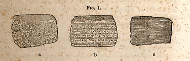
FIG. 1 [Pyrocrystalline rocks]
be traversed by plains or lines, as in the figure; but these are the natural joints, and serve only to divide the mass into angular blocks: while in fig. 1, B, the mass is divided into strips or lamina, each of which is separated from adjacentPage 22
ones, by the mica or hornblende, which is sometimes present. In gneiss, the lamina are usually thicker than in mica slate, represented in fig. 1. C. In Talcose slate, the lamina are usually curved, and the surface may be corrugated.
* 17. The structure of the pyroplastic rocks, those which have been moulded by fire, is represented in part by fig. 2, A, B, C. Basalt is columnar, as in fig. 1, B. An example of this rock is furnished in the natural walls of Rowan. A porphyry is rock which has a compact base, through which crystalline particles of felspar are disseminated, as in fig. 2, B.

FIG. 2 [Pyroplastic rocks]
The subærial pyroplastic is represented in C. The vesicular structure is often indistinct in the lower parts of the mass which have been subjected to pressure. So, also, the texture and cohesion are variable.There is no determinate order in the arrangement of the foregoing rocks, neither do they belong to ancient or modern periods exclusively, except in the laminated pyrocrystalline rocks, which, as a class, together with certain granites, are the oldest rocks of the globe; while certain granites, with the basalts, greenstones, and lavas, may be said to belong to all periods indiscriminately.
Page 23
CHAPTER IV.
Origin of the Sediments.--How distinguished from the Eruptive Rocks--thickness of the Sediments--their Classificacation, etc.
* 18. Sediments consist of abraded particles from pre-existing rocks. These, in most instances, form consolidated beds, the consolidation having taken place beneath the ocean, or beneath the waters which have received the transported matter from rivers. This matter sometimes remains in a soft condition, like the marls and sands of the low counties.
* 19. Sediments may be distinguished from the eruptive or pyrocrystalline rocks, 1st, by the presence of water-worn particles; 2d, by the presence of organic bodies, or fossils. The former is the most common character, inasmuch as fossils are extremely rare in the oldest sediments.
* 20. Geologists estimate the aggregate thickness of the sediments at ten or twelve miles, without including in the estimate those which are regarded as the oldest. This great accumulation of abraded matter is not known to exist at one place, the land not having been stationary beneath the sea, so as to receive the sediments all the time during which they have been accumulating. But different parts of the earth's surface have been covered with water at different periods. So that sediments have always been accumulating since water has been collected in the great depressions of the earth's surface.
* 21. This fact has been useful in classifying these deposits, belonging, as has been stated, to different periods; for it has been proved, by observation, that the different periods during which sediments have been accumulating, contain, entombed in them, different kinds of organic beings. But another kind of evidence, going to prove both the succession of the sediments and their capability of being separated into groups, is derived from the superposition of rocks.
Page 24
Superposition is, however, the highest proof of age; the oldest occupying the inferior position.
* 22. The bearing which fossils have to any scheme of classification which has been proposed, can be understood only by a knowledge of the following laws: 1. That species or kinds have had a limited duration; 2. That there has been a succession of species; and 3. That the species of one period, and which have become extinct, have never lived in any future period. The utility of the knowledge of fossils is based on these three laws. This knowledge is particularly useful in comparing rocks which are widely separated from each other, or in those cases where direct superposition cannot be observed. If, for example, certain rocks in Canada furnish a group of fossils similar to those of a given series in Tennessee, the inference would be, that they belonged to the same period, and hence occupy the same geological position; or, if we compare the fossils of the coal formation of England and America, it will be found that they are almost identical; and it is proved also, that the position relatively is the same in both countries, though separated from each other three thousand miles.
* 23. From the foregoing statement of facts, it will be perceived, that one great object in geological research is to identify periods and formations; for periods and formations have a similarity of character not only in their organic contents but also in the minerals connected with them.
We are interested in knowing the life character of the different groups of sediments, as it is from that that the history of the earth is to be deciphered. It is more than a life history, it is also a physical history; for in that, or in the phenomena they present us with, we may read the physical changes which the earth's surface has undergone. The life history and the physical history are often recorded on the same page of the stone book.
* 24. In order to see clearly the difference in the different groups of rocks, we should construct what is known as a geological column, on which we may indicate the relative positions of rocks by different colored zones, and adjacent to each
Page 25
zone place the fossils of each group. Such a column would not only show the relative position of the physical groups, but it would also indicate the epochs during the geologic time, the epochs being characterized by groups of different kinds of animals and plants. But this is not all; it would show an advance in rank, or a progress in an ascending scale represented in the passage of one zone to another upon the column. At the bottom, molusca, with low grades of animals and plants, would occupy the whole of the lower zone. In the next, we may observe a few fish which are the lowest representatives of the vertebrated class. In the next, the reptile; and a little higher, we should find the bird; and after this still, the lowest form of the mammal. The progress in rank seems to continue, till we reach the highest zone, or the last and present epoch. The progress is from a low to a higher rank; not from the simple to the complex, as some suppose: or from the imperfect to the perfect structure; for perfection of structure has reference to adaptation only; and, in this view, the structure of a molusk is as perfect as a mammal.
* 25. Now in the examination of the rocks of North Carolina, I have sought to identify them with those of other States and countries; or, in other words, to determine the relative position which they occupy in the geologic column or scale; as such determination furnishes a clue to their economical value as depositories of the valuable metals or products; it is, therefore, practically useful, while it advances or promotes the progress of the science.
* 26. The following scheme or table contains a list of the systems of rocks, arranged in the order of superposition.
The left hand column contains the names of the general systems recognized in different parts of the earth's surface, and the right those systems which are known in North Carolina:
Page 26
| General Systems. | Systems of North-Carolina. | |
| Cainozoic, | Recent and Tertiary. | Recent and Tertiary. |
| Mesozoic, | Cretaceous, | Cretaceous. |
| Mesozoic, | Oolite, | |
| Mesozoic, | Lias, | |
| Mesozoic, | New Red Sandstone. | New Red Sandstone? |
| Palæozoic, | Permian, | Permian? |
| Palæozoic, | Carboniferous, | . . . . |
| Palæozoic, | Devonian, | . . . . |
| Palæozoic, | Silurian, | . . . . |
| Palæozoic, | Taconic. | Taconic. |
| Eruptive or Pyrocrystalline. | Eruptive or Pyrocrystalline. |
* 27. The new red sandstone and permian are inserted with a query, as it is not satisfactorily determined whether the coal rocks of Deep and Dan rivers belong to the first or second, or to both. It will be observed, that several systems of rocks which are clearly recognized in other States are wanting in North-Carolina, as the silurian, devonian, carboniferous, and the lias and oolite; the two last are probably wanting, though it should be stated that the opinion has been expressed, by very competent geologists, that Deep and Dan river rocks belong to one or both of them.
Of the rocks which belong to the State, the tertiary or cretaceous occur in the lower counties; they are the depositories of the marls, and never contain the ores of the metals, excepting the earthy ores of iron and manganese. The rocks of the Deep and Dan rivers are important, as they contain beds of coal, ores of iron, fire clay, millstones, grindstones and freestones.
The taconic system, which belongs to the oldest sediments, and which will be fully described hereafter, occupies the midland counties in part, and the extreme western border. It contains the most important repositories of the ores. The eruptive or pyrocrystalline rocks are very generally distributed; they are also the repositories of the ores.
* 28. While I believe it is generally true that certain formations are more productive in metals and economic materials than others, still, there are evidently certain exceptions to the rule; and it may prove that certain districts are rich in metals, irrespective of the period to which the rocks of the district belong; thus that part of the taconic series west of
Page 27
the Blue Ridge, and which is referred to as occupying the midland counties, is rich in the ores, while the rocks of the same age west of the Blue Ridge are certainly very poor. It would seem, therefore, that the causes which have been operative in charging the rocks with ores, have been confined to certain districts of country. Yet it does not invalidate the conclusion that the metals or ores of a district belong to a distinct period; but in their distribution they have been only partial, or have rather been limited to certain parts of the system, which represents the period in question.
There is a general rule, however, with respect to the distribution of the ores, viz: they belong rather to the eruptive or pyrocrystalline rocks, and the primary division of the sediments, the palæozoic, or are more common to the oldest rocks of this division. It would appear, therefore, that the dissemination of the metals through the rocks took place in the early periods of its history, and prior to the mesozoic and cainozoic series.
* 29. Having stated a few of the elementary principles and facts belonging to the subject under consideration, I shall now proceed to describe the rocks which belong to the middle zone of the State; after which, I shall be prepared to describe, with considerable minuteness, the veins and repositories of the ores which belong to those rocks. The rocks of Deep and Dan rivers, with their rich and valuable contents, will come up for consideration in the last place, when the facts which throw light upon their relative age will be stated.
CHAPTER V.
Of the Eruptive or Pyrocrystalline Rocks of the Midland Counties of North-Carolina--their Distribution, etc.
* 30. The granitic formations, which are the subject matters
Page 28
of this chapter, form two continuous belts which cross the State in a north-east and south-west direction, or nearly so. The first or easterly belt is the widest, having Raleigh situated nearly centrally upon it. This belt furnished the stone of which the Statehouse is built, and hence some of its characteristics will be at once recalled by the reader. It may be called locally the Raleigh belt, or the Raleigh granite. The second belt has Salisbury and Greensborough situated centrally upon it in their respective districts. It differs from the eastern in certain particulars, and may, with propriety, receive a local name, the Salisbury and Greensborough granite belt. In some parts of the belt it is syenitic, and is frequently called sienite; but in other parts it is similar to the eastern belt in composition.
* 31. The color of the Raleigh granite is a light gray, passing occasionally into a dark gray. It is composed of quartz, felspar, and a very small quantity of dark colored mica; felspar is the most abundant element, and it is the color of this mineral which gives it its lighter shade. To the presence of this mineral also is due its disposition, in certain beds, to undergo a chemical change, by which it becomes soft and worthless as a building stone. The particles of felspar are of a uniform and medium size; the grain may be rather fine, but I believe never extremely coarse. So far as its texture therefore is concerned, the stable and hard parts of it are fitted for works of construction, though its defects are sometimes brought out when it is protected from the weather, as may be observed in the floor of the Statehouse. The defect first appears in a separation into rather thin lamina usually concentric; the lamina becoming visible, soon disintegrate and pass into a powdery condition, which are the first steps towards the formation of a porcelain clay. These concentric lamina were no doubt developed during its passage from a fluid to a solid state. The decomposition of felspar is supposed to be due to the presence of an alkali or alkaline earth. In the granite under consideration, it is potash; indeed, all the granites of North-Carolina have a kind of felspar which is technically called potash felspar.
Page 29
* 32. It is only from the decomposing granites that porcelian clay is produced, which, however, requires a perfect freedom from the oxides of iron and manganese. The test for good porcelian clay requires a perfect whiteness when subjected to the highest heat of a furnace. It is only the most thoroughly decomposed felspar that gives us a good clay. In the progress of its formation, and in the ultimate results of decomposition, we witness a most beautiful example of the molecular force. First, there is the separation into lamina, which is properly due to a mechanical force, but which exposes a larger surface of molecules to atmospheric influences; then a slight detachment of particles from each other, and by which the stability of the compound is disturbed, and which soon results in a complete separation of some of the potash. When the chemical affinity is so far weakened, the process of decomposition goes on rather rapidly, until the mineral felspar is completely disorganized, and is perfectly resolved into its original elements. But we must look at the process in another point of view. When certain elements are being detached in this way, they are by no means inert or inactive; they are in a state disposed to enter into new combinations, or the particles may simply combine together, kind with kind, and so unite as to produce solid elementary minerals; or they may combine and form new compound bodies. It is so in this case; that portion of the silica which was in combination with potash combines, and frequently forms minute crystals of quartz; but sometimes it is a hornstone. The iron ore also collects by itself, and forms balls consisting of the hydrous per oxide of iron, which may be, and often are, perfectly well defined and separate from the white mass of porcelain earth; while the manganese also, which is usually present in some form in the granite, combines and forms also concretions of the metallic oxide. Sometimes these chemical changes appear to be completed, and each new formed body to have become stable again; but frequently we may witness the changes in all its stages progressing slowly to the termination to which I have alluded, and in which they become, for a time at least, fixed bodies.
Page 30
Such changes are well worthy of notice, as they prepare us to comprehend other changes more complicated, and taking place, under circumstances which we might not expect. Such is the case in many mineral veins, to which reference will be made in its proper place. Similar changes occur in reducing rocks to a soil, and under certain circumstances recompositions take place in the soil, which operates injuriously on its productiveness. Soils are no doubt generally derived from solid rocks. In the south there is a peenlipeculiarityarity which makes the study of rocks, in connection with agriculture, more important than it is at the north; for, as was shown as long ago as 1824-25, by Prof. Olmsted, the debris from rocks forming the soil, remains in situ. The elements of the soil and of the rock therefore, are more alike; and a knowledge of the composition of the rock gives us information respecting the composition of the soil.
* 33. Relation of the Raleigh belt of granite to other members of the primary rocks.--When granite is spoken of, the expectation is, that it is an under lying rock. I have, however, intimated that cases are on record, in which it is shown that it is an overlying one. In the belt of granite under consideration, there is evidence which goes to show that it overlies gneiss, mica, slate, and hornblende. The most important locality which brings to light this relation, is about one or one-half miles west of Warrenton, in Warren county. These laminated rocks crop out from beneath the granite in this region. The exposure is uot extensive, but sufficiently so to establish the relation at this place. There are still others of the kind, but less conspicuous. But if the observation is correct at or near Warrenton, it seems to me that it establishes the fact for the whole belt.
It follows, from the foregoing, that it was projected through fissures in the gneiss or mica slate, and that from those it overflowed the country where it is now the upper rock.
This relation, however, is not new; for many years since I observed the same fact respecting the granites of Maine, which have become so celebrated in architecture. But in Maine, the area of the beds is limited, frequently only capping
Page 31
a hill, and from which the whole had been removed, leaving the beds of gneiss and hornblende exposed.
* 34. This belt of granite is peculiar in another respect, it furnishes no metalic veins; and is rarely traversed by trapdykes. This negative character is referred to, in consequence of its being in contrast with the Salisbury and Greensborough belt. It is of course unnecessary to attempt to explain the fact. We cannot account for the activity of those forces which are instrumental in filling fissures with metallic matters in certain districts, neither for their inactivity in others.
* 35. The geographical position of the Raleigh belt of granite may be defined approximately, by giving the names of the places through which its extreme outer edges pass, and connecting those places by lines; thus the western edge runs three miles west of Henderson, and one-and-a-half or two miles west of Raleigh, and from thence south-westwardly through the Buckhorn falls, on the Cape Fear river. From the latter place it is concealed by sands but appears to sweep around towards Rockingham and Richmond counties, as it appears there, and also upon the head waters of Turkey creek. Upon Turkey creek there are fine quarries of millstone.
The south-east edge passes through Weldon, where it forms a barrier across the Roanoke; thence to Belford, at the west boundary of Nash county; thence five miles west of Smithfield, in Johnston county. In this neighborhood it is concealed by sands.
The granite of Rocky Mount belongs to this belt: but it is separated from it by a belt of slate which extends from Gaston through Halifax and Belford, where it lies in contact with the granite. The breadth of this granite is from twenty to twenty-five miles.
* 36. In an economical point of view, very little need be said of this belt of granite. It makes a fine building material when it is firm, and resists the action of the weather. It contains a very few minerals, which, on exposure, weather out, and thus impairs its qualities. In the shade it however often becomes dark and dingy from the growth of lichens and fungi, whose growth seem to be favored by moisture,
Page 32
and perhaps also by the disengagement of potash from the felspar. This rock furnishes one of the most distinct unmixed granite soils in the State. It will be interesting to know its agricultural capabilities, and to ascertain whether it has, in any respects, advantages over the slate soil, in its vicinity.
* 37. The Salisbury and Greensborough belt of granite.--This is frequently a syenitic granite, that is, hornblende takes the place of mica. The grain and texture of the rock is not unlike that of the Raleigh granite. It is rarely coarse, and never contains large particles of quartz, mica, or hornblende. Felspar predominates over the other elements, and hence, as this is usually light colored, so the granite is generally a light gray. The disposition to crumble is greater than the rock already described, and frequently it is easily crushed by the hand, and large beds of it occur where it is soft, to a depth of twenty feet; indeed, large areas occur, in which we may not observe the rock at all, except in the form and condition of a debris. But in some places it furnishes a fine firm building material, capable of withstanding the influence of the weather. The weathering rock frequently exposes masses which are hard, and resist atmospheric influences a long time. These hard rocks are nuclei, which seem to have been formed by concretionary movements. They stand about upon the surface like boulders. The roads from Salisbury and Concord, and from the former place to Gold Hill, pass through or by fields of these rocks, which have been weathered out in the course of ages.
* 38. Notwithstanding the great similarity existing between this and the Raleigh granite, in texture and composition, still the two belts present a great contrast in other respects. This contrast appears in the numerous metallic veins and trap-dykes which traverse the Salisbury and Greensborough belt. Of the former, it will be sufficient to mention the North-Carolina copper mine, McCulloch gold mine, Phenix & Vanderburgh gold and copper mine, the Pioneer gold and copper mine, and the Boger & Hill copper mines. Trap-dykes are numerous at most places where the rock is exposed,
Page 33
and appear very conspicuous in many of the railroad cuttings. But, at certain points they are so numerous that the rock is obscured. The dykes are not composed of one material, but consist of the common amphibolic trap, quartz, felspar and thin seams of epidote; forming, together, a net work of eruptive rocks. When they decompose, the hornblende trap appears in dark green stripes, and many, when carefully examined, have assumed the structure of a sediment or a laminated rock, and which often appears like the dark green slates of the taconic system. This singular structure of an eruptive rock is interesting and important, as it proves that it may be produced in rocks which have been regarded as sediments, but which, in these cases, are the farthest removed from rocks of this description, and with which water has had nothing to do. The lamina are sometimes as thin as paper, and, from their appearance, cannot be distinguished from the slates referred to. They are bounded by walls of granite, and are frequently only from six to ten inches wide. We see the phenomena in the apparent slate or killas which border the gold and copper veins when they traverse granite. The slaty structure of the dykes, which has just been noticed, is in strong contrast with the columnar structure which frequently occurs, of which instances, the well known natural walls of Rowan and Stokes counties are familiar examples.
* 39. I have already alluded to some of the differences between this and the eastern belt, especially in the existence in the former of numerous metallic veins. It should be stated in this place, that the veins referred to are not distributed indiscriminately through the rock. On this subject, however, it is sufficient to state the fact, that they are confined mostly to the edges of the granite, or to the sides which are bordered by slate, of another formation. The veins which I have already enumerated lie along the south-east border, most of them within one or two miles of the slate.
The central railroad runs along the central part of the belt, and although there are many deep cuttings through the granite, still there is not a single instance in which those cuttings
Page 34
have intersected metallic veins--though, as I have said, the dykes exposed are very numerous.
The explanation of the foregoing facts respecting the occurrence and peculiar distribution of the metallic veins is difficult. We are not in possession of all the facts required, for a solution of the question. The fact which bears more immediately upon this subject, is the greater thickness of the granite mass in its centre, or along the line of railway. Vein fissures in this part of the rock may not reach the surface--or it may lie at a distance from the axis of disturbance, or of the eruptive force.
* 40. This belt of granite is from ten to fourteen miles wide. The belt will attract attention wherever it is crossed by the numerous trap-dykes in all parts of the districts; thus, in going from Roxborough to Yanceyville, from Graham to Guilford, or from Union county through Charlotte to Lincoln county, he will pass over the granite with its trap-dykes.
* 41. The eastern border of this belt passes four miles east of Roxborough, and from thence southwardly by the North-Carolina copper mine, and about two miles east of Lexington; thence one mile west of Gold Hill, and thence a few degrees west of south to the State line in South-Carolina.
The western border is about four miles east of Yanceyville; thence by the High Rock ford, on Haw river; thence five miles west of Jamestown, and crossing the Yadkin near Crump's ford; thence near the fork of the South Yadkin, and crossing the Catawba near the great horse show bend, and thence crossing the Little Catawba near Springs' mill, and passing out of the State, it takes the direction of Yorkville, in South-Carolina. The belt crosses the State obliquely; it takes an easterly sweep after passing north of Salisbury: it crosses the Dan just above Clarksville, near the junction of the Dan and Roanoke.
Notwithstanding the fissuration to which this rock has been subjected, it is comparatively barren in minerals, except the metallic oxides. Epidote is common, schorl rare, and the tourmalines unknown in connexion with it. In this respect it is similar to the eastern belt.
Page 35
* 42. This would be the proper place to discuss, at some length, the age of the trap-dykes and metallic veins of this formation; but, inasmuch as the subject of the formation of veins will come up in another place, I shall now leave this interesting question to a future time, barely observing that the bearing of the facts upon it go to show that the dykes were formed subsequent to the deposit of the adjacent slates, which are, no doubt, sediments of the Palæozoic age.
* 43. Granites of Lincoln, Gaston and Catawba Counties.--A person, on arriving at Lincolnton in the evening, would imagine that the streets were covered with snow. This whiteness of the streets, however, is not so glaring now as formerly. The soil is a decomposed white coarse granite, which explains the peculiar appearance referred to. The felspar is predominant here, but the mica being very light colored, and in rather large lamina, the whole rock appears whiter than usual. The granite of Lincoln and the counties named, occurs in veins both in gneiss and talcose, or mica slate. It is therefore a subordinate rock. It forms a network of veins in this region, and some veins are very wide.
This rock first appears about two miles east of Lincolnton; large plates of mica will probably be noticed first by the road side. The rock to which it belongs will be seen occasionally in the ditches. It is very abundant in and about Lincolnton, as if it was the principal rock. It extends over a wide area. Towards King's mountain the road passes for twelve miles upon it, or it is very frequently a prominent rock on the way side. To northwards from Lincolnton it may be traced ten or fifteen miles. Its breadth is not over three miles. This belt seems to have been extensively fissured, which circumstance gave origin to this eruption along a narrow belt which seems to lie between two systems of rocks; on the east are the slates of the taconic system, and on the west gneiss, mica slate and hornblende rock. I have not been successful in my searches for the ores in this rock. Schorl and lepidolite are the only minerals which I have discovered.
This granite resembles that which occurs at Chester, Chesterfield and Norwich, in Massachusetts--and which there
Page 36
contains many kinds of rare minerals, though the metals are absent, excepting some exceeding rare ones in minute quantity.
CHAPTER VI.
Of the Laminated Pyrocrystaline Rocks--as Gneiss, Mica and Talcose Slates and Hornblende.--Limestone.
* 44. The individual rocks which fall under the foregoing denominations occupy only limited areas. Indeed it is rather difficult to determine, in certain instances, the line of demarkation between gneiss and granite, as frequently there are passage beds connecting one with the other. I find passage beds in belts along the Crabtree, near Raleigh; but they are more remarkable near the line of junction with the slates, the ancient sediments along the western border of the granite. These beds are intersected by the road leading from Raleigh to Louisburg; but being quite indistinct, and moreover quite limited in the area they occupy, I have included them within the bounds of the eastern range of granite.
It may become necessary, on a farther examination, to separate them from the granite. There is no necessity for it now, inasmuch as in an economical point of view they are of little importance.
* 45. The most distinct belt of gneiss, and its related rocks the primary slates, bounds the Salisbury and Greensborough granite in Lincoln, Catawba and Iredell counties. The belt is narrow, and not only extends through the eastern part of the counties just named, but runs on through Davie and Forsythe to Rockingham county.
The locality where the rock under examination presents its typical form, is at Brevard's furnace, on Dutchman's creek. A
Page 37
deep cut exposes, at this place, a rather remarkable condition of the rock; it is in a concretionary condition, the concretions being upon the largest scale of development. The rock is gray, fine grained, and obscurely jointed. It presents the usual character of gneiss in its laminations and passages into mica slate and hornblende. In Rockingham county the rock is more schistose and fine grained, or rather approaches in structure and composition talcose slate, and a thin laminated kind of hornblende.
It seems unnecessary to dwell at greater length upon these rocks at this time. They have furnished very few metallic veins. They however lie between the granite and the oldest sediments; and as marking a geological as well as a geographical boundary, their place in the series should not pass unnoticed. These rocks, however, as they are largely developed along the Blue ridge, will receive the attention they deserve in the proper place.
* 46. Limestone of this series.--The most important rock which appears in intimate connexion with the foregoing, is a white granular limestone. The mode in which it should be described, or how it should be regarded, is not well settled in my own mind at least. Its position, at several localities, is certainly among the gneiss and mica slate and hornblende rocks, and its lamina or beds are nearly parallel with them; but still it has many characters which belong only to the eruptive rocks.
Bolejack's quarries in Stokes county is the most typical form under which it occurs. These quarries are four miles west of Germanton. The rock is white granular, rather coarse and firm, is free from magnesia, and lies in beds or thick laminated parallel masses, which incline at about 10° to the horizon. At Mr. Martin's beds, the limestone incloses foreign rocks, as quartz, slate and hornblende; but the lime it furnishes is good and strong.
Page 38
CHAPTER VII.
Of the oldest Sediments--their Primary Characters or Aspect--difficulty of distinguishing them from the true Primary or Pyrocrystalline Rocks by their Lithological Characters, etc.
* 47. A few years only have elapsed since geologists first attempted to discover the bottom rocks, their labors having been confined to the superior masses to which they were allured by the innumerable relics of the past, and among which they could revel with more pleasure than the antiquarian among the ruins of cities. It is difficult even now, to satisfy oneself what the real views of geologists now are of the bottom rocks; and it is a question which is still in the mouths of some, can they be distinguished and known, seeing they must have been subjected to many changes from the action of forces which were then powerful and energetic?
But notwithstanding the plausibility of such a question, there are still grounds for believing that the bottom rocks, or the oldest sediments, retain the marks of their origin, if not entirely intact, yet, sufficiently distinct and entire for their recognition. This view is founded on the probability, that when these rocks began to be laid down upon the sea bottom, the earth's crust had become stable, the inner forces had become comparatively quiet, and that their activity did not greatly exceed in intensity what is witnessed in our day. The time had come when the earth was to be inhabited; it had received its two outer envelopes, water and the atmosphere. These results had come to pass, or had taken place in the natural progress of things--were the result of laws which govern bodies placed in the condition the earth then was. The forces had died out, or had become weakened; and they ceased to be energetic, because the sources of their energy were spent. If the foregoing is true, it follows, that in the course of nature, the partially extinct powers could
Page 39
not be revived or awakened into life. Locally, they might still be energetic, but their general force was expended, and hence too, it would not be in accordance with the general condition then existing, for forces to act so intensely as to change sediments into those universal rocks, gneiss, mica slate and hornblende.
But to turn to the results of observation. A consistent interpretation of the phenomena connected with sediments certainly old, if not the oldest, prove in this country, and in Europe, that we reach a sedimentary base, or what appears to be such, below which, we have no evidence of still older beds. We find that they rest upon those universal rocks, gneiss, mica and talcose slate and horublende, to say nothing of granite as a substratum. The proof of rocks of sedimentary origin, reaches us from these deep seated beds, below which we can find nothing deeper or lower, bearing the character of sediments. The oldest beds are supposed to be azoic, but discoveries have proceeded downwards, and masses supposed to be destitute of organic remains have been giving them up to the tireless observations of geologists, so that it is yet unsafe to declare that the bottom beds are truly azoic.
The older, deep seated sediments, are sometimes distinguished with difficulty from the true primary series; their lithological characters very often belong to the same order. We might doubt their being sediments at all, were it not that they are associated with pebbly beds.
* 47. The masses which are obscure, are derived from those containing mica and talc, especially the former. This is due to the properties of these minerals, they are never reduced to rounded grains, but retain their form, or are merely splits; besides, when subjected to attrition, the size of their particles are rarely diminished, and hence, when reformed into rock, the characters of the parent rock are reproduced; hence, we find very good mica and talcose slates among the sediments: even in the coal measures, beds are not unfrequently occuring, which retain a decided primary aspect. But the abrasions in the first instance, and forming for the first time sedimentary beds, are still more like the original
Page 40
rocks from which they were derived; and hence, it may require the most careful observations, in order to arrive at the conclusion that they are sediments at all. It is not, then, their lithological characters which we seek, for the purpose of determining their origin, but the associated beds with which they are strictly conformable, which gives us the evidence in this particular upon which we may rely; and to repeat what has been already intimated, their sedimentary character rests mainly upon the occurrence of conformable pebble beds; yet the presence of fossils may yet come to our aid, and confirm their origin assigned to them.
* 49. Another source of difficulty, which meets us in the determination of the origin of rocks, are changes produced in them by proximity to, or by the contact with, igneous rocks. It is, however, real. In many suspicious cases, we have to consider what change is incident to that order of forces to which rocks were supposed to have been subjected. In the case of heat, we know that a rock must become indurated, according to the degree to which it has been exposed. Sandstone and sandy slate may become sonorous or ringing, like a well-baked brick--and still more so, when clay slates have been subjected to a strong heat, but short of fusion; the sound will be more like the ringing of cast-iron. No slates or sandstones ever emit a clear ringing sound when struck, unless they have been heated. The texture in those cases may be only slightly changed--it is always short of vitrification. This may seem at variance with certain varieties of quartz, which are apparently vitrified from heat--as flint, hornstone, and quartz beds, in the granular quartz rock. The apparent vitrification is due to a chemical combination of the particles, or to a cause independent of, and distinct from, heat.
* 50. In North-Carolina, we have to deal with rocks of an obscure origin and character; and hence, I have dwelt upon principles which appear to flow from the facts we meet with in its geology. The first questions which a geologist would ask respecting these obscure rocks would be, to what period do they belong, and to what series in this country are they
Page 41
related? These are the questions which I put to myself, (and which have been often repeated,) at the beginning of the survey. Do they harmonize with the rocks of a known epoch in our country? For we want to bring, if possible, every series into correlation with some other series, both as physical groups and in their organic contents. Such a correllation would establish the identy of their epoch. The law or rule is, that agreement in these respects, constitutes agreement in the most essential characters. I shall treat of the characteristics of these ancient rocks of North-Carolina, and show their correlations, in the next chapter.
CHAPTER VIII.
The Rocks referred to, as belonging to the oldest known Sediments, belong in part to the Midland Counties. They are Slate and Quartzites mainly, and their Sedimentary Origin is based mainly upon conformable Pebbly Beds. They are found to be related to Rocks which are known in the North, and which there constitute the Taconic System.
* 51. The formations of the midland counties which occupy the largest extent of surface, are slates and silicious rocks which have been called quartzites. It is a formation which was described as long ago as 1824--'7, by Professors Olmsted and Mitchell, both of whom fully understood its importance.
The slates are variable in color and composition. They are mineralogically clay, chloritic and talcose slates, taking silica into their composition, at times, and even passing into fine grits or honestones, but still variable in coarseness. In the order in which they lie, the talcose slates and quartzites are the inferior rocks, though quartzites occur also in the condition of chert, flint or hornstone, in all the series.
Page 42
* 52. But the foregoing slates, with their associates, standing by themselves, though they might be regarded as sediments, yet, the proof thereof would be wanting, and geologists might consistently differ as to their origin. But it fortunately happens, that after dilligent search, numerous beds containing rounded pebbles were discovered; and hence it follows, that their origin is established. They must have been formed in the sedimentary period; and hence, we are interested in the farther enquiry respecting the true epoch to which they belong; and therefore the enquiry, can they be brought into correllation with other known formations, whose period has been determined, is a question too important to be passed over.
* 53. Taking the principles which have been laid down for our guide, we may first try or compare them with several systems or series of the palæozoic division, and see how their correllation will then stand. 1. The carboniferous. With this system it is scarcely necessary to compare these rocks at all. The fossils and the formations are so well known and so well defined, that the analogies, even, are very remote. No one would admit that the resemblances between the slates of the two series can bring them into correllation; and besides, the carboniferous slates always contain coal plants, of which there is not the remotest semblance in those of North-Carolina.
The series beneath the carboniferous, the devonian, is made up of slates, limestones and olive sandstones, in which there are either bands of fossils, or, as in the cases of limestones, they are highly charged with very conspicuous ones, which could not escape the notice of the most careless geologist. The North-Carolina slates and quartzites have no nearer relation to the devonian than to the carboniferous.
The silurian system is divided into upper and lower; the upper is rich in limestones, shaly limestones and slates, all of which are rich in peculiar fossils. There are no beds in North Carolina which have even a remote resemblance to this division of the silurian system. The lower division, however, requires a very careful comparison with the rocks
Page 43
of this State; besides, there are geologists who assume that the North-Carolina series are lower silurian disguised by the action of heat or metamorphism.
The lower division is composed of sandstone, limestone, slate, shale and gray sandstones. I have mentioned the rocks in the ascending order. Mineralogically, the sandstone is not unlike some beds of sandstone in North-Carolina. The limestones, which succeed and repose upon the sandstone in the silurian system, are rich in conspicuous fossils, belonging to the several orders of animals. In North-Carolina, there are no fossils, and the relation of the limestones which occur, are unlike those of the silurian system. The upper beds of lower silurian are also highly fossiliferous, and of peculiar kinds; and as they neither occur in them, and as the sandstones and shales appear to have no existence in the slate, it seems too great an assumption to regard the North-Carolina slates and quartzites as lower silurian.
An older system of slates, quartzites and limestones, etc., lie beneath the silurian system, which at one time were ranked with the primary rocks, are now well known at the north as sediments; and though several distinguished geologists regard them as lower silurian, still the grounds of that belief are too slender for general acceptation; and since they are beneath the silurian, they cannot, consistently, form a part of the system. These infra silurian rocks, occupy the western slopes of the Green mountain range, they repose directly upon the primary series, and continue for more than twelve hundred miles in this country in one continued belt. No sediments of an older date intervene in all this distance between them and the primary referred to.
In these ancient infra silurian sediments, I think we can recognize those of the slate system of North Carolina.
1. In position they appear to agree; and though they are not overlaid by the silurian on the east side of the Blue Ridge, yet we may see the same conformity with certain talcose slates beneath, as at the north. The quartz rock of Montgomery, Orange and Randolph counties, gives us the
Page 44
base from which may be traced the proteiform beds, which make up what we may here call the slate system.
2. The great paucity of fossils, and probably absence of all traces of organization in the lowest talcose slate, makes the correlation of the rocks in the two sections of our country quite evident.
3. The chloritic and aluminous slates, with their veins of milky quartz, are also alike in each district.
4. The passage of slates into quartzite, hornstone and fine grits, are also alike in kind; but in North-Carolina the fine grits and hornstones are more common.
5. The quartz rock is identically the same both at the north and south.
When, therefore, there are so many points of agreement, and so few of disagreement, it appears to me the rocks of the two sections should be regarded as the same; or, in other words, as belonging to one and the same system.
* 54. This system has been named the TACONIC SYSTEM, from a range of mountains lying in Berkshire county, Massachusetts, just west of the Hoosic mountain range, or Green mountains. It is here, that the rocks of the system, in part, are so well exhibited; though the western flanks of the Green mountain, in their whole length, belong to the series.
Were it not that the rocks under consideration in North-Carolina can be referred to a series already known, described and named, I should confer upon them some other title. But as it is, it is in accordance with the present rule of geologists to extend a given name to all the rocks of that epoch, however widely they may be separated. Thus we may recognize and adopt the name silurian, though the country of the ancient Silures formed only a part of Wales, England. West of the Blue Ridge we have the evidence of continuity. The taconic system which flanks the Green mountain, extends southwards to the Warm Springs of Buncombe county. On the east side, the system, traced in the direction of its strike, extends into Virginia and Maryland. We see no more of it till we reach Rhode Island. Whether it is discontinued, or is overlaid and concealed by tertiary, is not satisfactorily determined.
Page 45
I deem it unnecessary to dwell upon this subject. It became necessary to state those facts which bear upon the question respecting the period to which these sediments belong, and to make such comparisons of them with formations at a distance, and whose period had been determined as one calculated to establish a correllation with them. Whether an exact identity is established or not may not appear perfectly satisfactory, yet I think there can be but one opinion respecting them, viz., that they are among the oldest sediments of this country, and may be regarded as the bottom rocks.
CHAPTER IX.
The Explanation of the term System.--The Determination of Systems did not take place in the order of their Age.--The Results which have been obtained by the Determination of their Order.--Species few in the Oldest Rocks.--Lithological Character of the Sediments in North-Carolina.
* 55. The term system denotes a series of rocks which are linked together by their natural history characters. The animals and plants of the series are confined to them; they neither occur above nor below. This is what I mean by natural history characters. The rule stated, like other rules, is not absolute nor stringent. It allows a few species to pass beyond the limits prescribed, but limits them as a whole; it requires that it should be true, in the same country especially. At wide distances, however, for example the silurian of England and America, the species may be more variable: and the identity may be replaced by analogous species in part. While some are identical, others may occur which are analogous only with those at wide distances from each other. The
Page 46
series, however, should occupy the same, or nearly the same geological horizon, or occur in the same relations. No one species which lived in the beginning of a period necessarily lived through it; they often occupy a given part, or are confined to the base--the middle or superior part. In the same series at a distance, a given species which occupies the bottom of a system, may appear later in the same system at a distance.
* 56. The determination of systems was not made in the order of their age. Geologists did not first determine the bottom rocks; for example, the carboniferous system was made out long before the devonian or silurian; and the bottom rocks are really the last which have been made out. The plainest and easiest cases were first made out and distinguished; but each determination opened the way for subsequent successful labor in another series. The order in which the work seems to have progressed was in the descending order.
* 57. The results which have been brought to light by the determination of systems and the relations they occupy, are interesting and even important in an economical point of view. As it regards the order of creation, it is found that those of the lowest rank only belong to the oldest, while those of the highest rank are found only in the newest. Taking the whole series together, progress from the low to the high is clearly established. We may expect to find, then, in the bottom rocks of North-Carolina, only the lowest forms of organization.
There is not only the foregoing facts to be noticed, but it should be mentioned also, that we can expect to find only a few species. The species in the early stages of life were limited; the individuals may have been numerous. Species are multiplied in the later stages. These are general facts which have been determined by geologists.
* 58. Lithological Characters.--I have already spoken of the difficulty which I experienced in determining the facts respecting the origin of the slates and certain rocks associated with them. At first, it seemed that they should be grouped
Page 47
with the oldest laminated rocks, the talcose and mica slates of the primary series. I found, however, many beds among them which looked like sediments, were porphyrized and somewhat changed, though not strictly porphyries.
I found, after much search too, beds which were unequivocally pebbly; and finally, to remove all doubt, I was fortunate in discovering that the porphyrized beds also frequently contained pebbles; proving most conclusively that they are sediments which were partially altered. I am disposed, from these facts, to place all the rocks not decidedly igneous, or all which are stratified, with the sediments. It is generally easy to distinguish the porphyritic greenstones from the porphyrized beds as they occur in the formations of North-Carolina. When, however, I had satisfied myself of the fact, that these rocks were changed, as I have stated, the most serious difficulties in the way of their determination were removed. I state the foregoing, for the purpose of showing that I have not been hasty in locating these singular formations. It is not, however, the first time that the clay slates of North-Carolina have been described as sediments. Profs. Olmsted and Mitchell took the same view of them, although they did not deem it necessary to state the grounds on which they based their opinions. But I have carried the doctrine farther, and place among the sediments the dark bluish green slates; those, for example, of gold and silver hills, and the slates which contain the iron ore beds near Smithfield, Johnston county--as well as those of Chatham and Randolph counties. I am now prepared to say that the slates and the associated rocks may be referred to the taconic system; because their lithological characters and their relations to the older rocks below them require it. Assuming, for the moment, that they are sediments, we are obliged to look about and ascertain their relations to other masses; and finding that the members of the slate series resemble certain slates at the north, those for example of Berkshire county, Massachusetts, and that they, too, hold similar relations, it follows that the former are the equivalent of the latter. In each district, that of Berkshire, Massachusetts, and the midland counties of North-Carolina, the same talcose aggregates, with interbeded
Page 48
granular quartz, limestone, etc., form parallel series. So also, the clay slates, beds of chert, brecciated conglomerates, belong to each respectively. In certain places too, the associated minerals are alike, as the talcs, tremolite, hornstone, ferruginous, quartz, manganese, etc. The granular quartz of North-Carolina is undistinguishable from that of Berkshire, Massachusetts; examples occur at Cotton Stone mountain, near Troy, Montgomery county; Hillsborough, in Orange; near King's mountain, in Gaston, and in Lincoln and Catawba counties; also in Wake county. In North-Carolina, these rocks having been derived from sienitic granites, and having also been changed more than those at the north, appear sometimes quite differently; and in certain cases it is even difficult to recognize them.
* 59. The basis upon which their recognition rests, is mainly their lithological characters, and the relations in which they are placed to the older rocks, and those which they sustain to each other. We cannot avail ourselves of the evidence which superimposed rocks might give us. It is true, that rocks belonging to other systems repose upon them, but they do not belong to a system which immediately succeeds in the order of time, as the silurian; they belong to the permian or new red systems, which are newer than the carboniferous. I have no doubt all well informed geologists will unite with me in placing these rocks at the base of the sediments, and yet it is not safe to infer that the question of age is entirely settled; for it is not known what may turn up in the future, or what change may be required by subsequent discoveries.
Fossils exist in a part of the northern series belonging to the taconic system, and I have, the last year, discovered fossils also in the lower series in North-Carolina. But this discovery does not require a change of opinion respecting the age of these rocks; it cannot change their relations; it is only extending the boundaries of life beyond what had been previously determined. This is to be expected; and it indicated that the field of discovery has not been fully explored, and that we may hope more light may yet be shed upon the earliest inhabitants of the globe.
Page 49
CHAPTER X.
Members of the Taconic System--Division into upper and lower--Minerals give Character to the Rock they form in certain cases--Mica and Talcose Slates--Agalmatolite--Quartz and its associates--Fossils, etc.
* 60. Having stated the reasons at length, for placing the slate and its associated rocks in the taconic system, I proceed to describe the individual members of the series. In the first place, however, I propose to divide them into lower and upper series. This division is clearly indicated in the northern equivalents, but this distinction is less obvious in North-Carolina. The lower series will contain the talcose slates, white and brown sandstone, or quartz, which is frequently vitrified or cherty, and the granular limestone and associated slates.
The upper will contain the green clay slates novaculite, the argillaceous, and sometimes chloritic sandstones or grits, and the breciated conglomerates.
1st. Talcose Slates.--The composition of these slates does not differ materially from those which belong to the primary series. They are made up of talc and fine grains of quartz, the talc greatly predominating; this is the rule, but exceptions occur where quartz predominates, when the rock becomes a friable sandstone. The color and lustre are silvery when chlorite is absent, bluish green when present.
A peculiarity which may be recorded as confined to this rock, is its wrinkled or corrugated lamina. This variety is always bright and silvery, and is, hence, the farthest removed from the common earthy texture which sediments exhibit.
The talcose slates may be regarded as the bottom rocks, the oldest sediments which we can recognize, and in which, probably, no organic remains will be found. They preserve the aspect of the parent rock. This may be easily accounted for; talc is a foliated mineral, and when it is abraded does not become firm and granular like a particle of quartz, limestone, or even argillite, and as it does not decompose readily, it is simply divided or split, and retains its properties. When, therefore, a rock is reformed from talcose slate, a mass is reproduced
Page 50
similar to the parent rock which furnished the material. So a mica slate reproduces a mica slate, as it merely splits, and hence preserves all its characters as a mineral, and transmits them to the rock which it forms.
In each case the only difference which can be detected is the finer grain of the regenerated rock. It is next to impossible to pulverize or granulate in a mortar mica or talc; especially the former. We see, then, why these sediments, derived from the primary talcose slates, must necessarily resemble them, though they have been, as it were, pulverized, and the particles re-united. Illustrations of the fact may be observed in the schists of the coal series. So perfect are these imitations in the undisputed sediments, that were the specimens seen only in a cabinet, they would be referred to the primary series; and if they recur in the coal series, it is by no means strange that they are common to the oldest known sediments.
In order to distinguish the sedimentary schists from the primary, we may avail ourselves of the presence of the associated rocks in each case. Thus in the sediments the associated rocks are fine talcose slates, quartz, and conglomerates somewhere in the series. In the primary, rather coarse talcose slate, with mica slate, hornblende and gneiss; without conglomerates or pebble beds; it is true, hornblendish trap may occur among the former, especially where limestone is a member. Its presence makes the question more difficult to solve, where pebbly beds are absent.
Many geologists take a different view of these rocks, and of the phenomina under consideration. They apply the term metamorphic, which means altered rocks. But I believe I have presented the simplest and plainest view of the subject. It is unnecessary to encumber the explanation by assumptions, when we can give a consistent reason for the phnomena in question.
* 61. Quartz rocks, white or brown and gray sandstones.--The associated rock of the talcose slates is a quartz rock which occurs under a great variety of colors and conditions.
Page 51
The following varieties have been observed in North-Carolina:
1. A fine grained coherent quartz-Montgomery and Orange counties.
2. A fine grained friable quartz, which may be crushed in the hand; when tolerably firm, it is a good fire stone-Lincoln county.
3. A fine grained micaceous and talcose quartz; the texture is tolerably firm, and as it splits well, it makes a fine fire stone-Graphite Locality, Wake county; also Lincoln county.
4. Vitrified quartz, or chert-Montgomery, Lincoln, Orange. Davidson and Randolph counties.
-- a. Green blue varieties.
-- b, Agatized.
5. A cherty and apparently porphyrized quartz, which contains felspar, which decomposes and leaves a rough porous mass similar to a burrhstone--Montgomery county.
6. Pebbly and semi-breciated quartz-Montgomery county.
7. Common brown quartz of various colors-Orange county.
This rock is readily recognized, first, by noting its position, and second, by its mineralogical characters. It is associated with the primary looking talcose slates. It is repeated two or three times, the masses being separated from each other by the talcose slates.
It frequently contains beds of pebbles. But its most interesting feature appears in its passage into hornstone, chert, of the English, or flint of the American miners. The term flint, however, is applied to many varieties of quartz; thus, smoky and milky quartz, as well as the compact cherty varieties, are called flint. The vitrified quartz or chert, cannot be regarded as always an igneous product, but rather as a deposit of silica from chemical solution. It is true the solution may have had an elevated temperature at the time the supposed solution was made; but, facts do not seem to sustain the opinion that after the silica or sand, it may be one or the other, was deposited, it was subjected to a heat sufficient to vitrify it. The granular unvitrified quartz, the sandstones proper, is usually found at the bottom; while the superior are more or less vitrified, sometimes losing merely their granular structure; in others, the mass has become perfectly vitrified.
An intermediate variety, an argillaceous hornstone, has a
Page 52
wide range in North-Carolina. It is known in some parts of the State as a mountain slate, though its slaty characters are poorly preserved. It does not necessarily occur upon the mountains, as its name seems to imply. Its name was suggested by the curious shape of the outcropping mass, which rises up like a military hat, forming a sharp arched summit, and a long narrow base. These are sometimes eight feet high, and they are frequently so numerous that the fields cannot be cultivated. It is next to impossible to break them down; they are the toughest of all rocks. The Three Hat mountain, in Davidson county, is nearly covered with them. But these cherty rocks do not belong to the lower division of this series exclusively. It is found in all parts of the series. It is more abundant south, than in the parallel series at the north. The cherty beds belong both to the lower and upper taconic rocks, and it is interesting to find that they are by no means local. In Washington county, New York, there is a continuous bed of black chert more than a hundred feet thick. It is still more abundant near Troy, Montgomery county. It is also common on the north shore of Lake Huron.
Burrhstone.--The cherty variety is frequently porphyritic. The felspar imbedded in the mass decomposes, leaving the rock in a rough vesicular state. If fine, it resembles the burrhstone of Paris; and as it is exceedingly tough and hard, it seems as if it was well adapted for grinding grains, or might be used for mill-stones. It is very extensive in beds as well as in detached masses, and may be raised cheaply. Its toughness and hardness combined, indicates that it will require well tempered tools for working it. Montgomery county can furnish enough to supply the entire country.
* 62. Agalmatolite--The White Slates, or as usually regarded as a Soapstone--Steatite, etc.--A rock, which occurs in extensive beds, and known in the localities where it is found as a soapstone, can by no means be placed properly with the magnesian minerals. It is truly the figure stone of the Chinese, and is known to mineralogists under the name of agalmatolite. This mineral had never been observed in this country, or had not been recognized until I made the determination
Page 53
last year. The first beds which I examined are at Hancock's mills, on Deep river. I have subsequently found it in fine white beds near Troy, Montgomery county. It is white, slaty, or compact translucent, and has the common soapy feel of the soapstones, and resembles it so closely to the eye and feel, that it would pass in any market for this rock. It has, however, a finer texture, and is somewhat harder; but it may be scratched by the nail, so that it ranks with softest of minerals: it scratches talc, and is not itself scratched by it; it is infusible before the blowpipe, and with nitrate of cobalt gives an intensely blue colored enamel, proving thereby the presence of alumina in place of magnesia.
* 63. Agalmatolite and steatite or soapstone, have the following compositions:
| Agalmatolite. | Steatite. | |
| Silica, | 49.81 | 42.32 |
| Magnesia, | 25.68 | |
| Alumina, | 29.59 | |
| Lime, | 6.00 | 16.96 |
| Prot. oxide of iron, | 1.50 | 9.38 |
| Potash, | 6.80 | |
| Water, | 6.50 Thompson, | 1.08 Thompson, |
| 99.10 | 100.10 |
The beds of Agalmatolite are frequently snow white, as at Hancock's mills they are also greenish or yellowish white, usually with a very close grain and uneven fracture, and difficult to break, or tough. They are white and greenish white near Troy. At Hancock's, certain beds are filled with imperfect crystals of magnetic iron.
The rock does not split readily with gunpowder; when quarried in this mode, as at Hancock's, it breaks out in ill-shapen shattered masses. Hence it should be cut out with a sharp pick, or an edged instrument of a suitable form. This mineral no doubt takes the place of steatite in the taconic system. Although not a soapstone, yet it is adapted and may be applied to the same uses, and it seems to fulfil all the purposes of this rock--as a lining for stoves, chimney backs, mantel pieces, etc. It is not adapted to the business of adulterating
Page 54
paints, as it becomes, when mixed with oil, translucent and greenish. It is a good substitute for chalk as a cosmetic, its powder being perfectly white and soft.
The agalmatolite, near Hancock's mills, and sometimes called Womack's soapsone, is associated with the following layers, enumerating them from beneath and upwards:
1. Massive green slates. 2. Thin bedded green slates. 3. Sandy slates or quartz 4. Thin bedded green slate. 5. Quartzite. 6. Ferruginous porphyry, or iron breccia. 7. Agalmatolite beds. 8. The same, with dissemated magnetic iron. 9. Agalmatolite in white massive beds, between five and six hundred feet thick.
The section embraces a series extending about half a mile. It appears that the agalmatolite belongs to the series very near the base of the system, coming in very near the quartz. It occurs in this position in Montgomery county.
This rock, on being heated to redness preserves its hardness, whitens, and scarcely exfoliates when its cleavage planes are exposed directly to the fire. So far as my experiments go, it is as refractory in the fire as soapstone. When its edges are placed to the fire, it is a perfect fire-stone. Its proportions indicate that it may be a valuable material for porcelain, composed as it is of silex and alumina, and provided it is free from iron and manganese.
* 64. Limestone.--The discovery of limestone in North-Carolina has been one of the great desideratums of the survey. Its apparent absence from this series could not be accounted for very satisfactorily, because it is elsewhere present with very few exceptions. It will, however, turn out, I now believe, to be present in its true position, though far less prominent than it usually is. For example, I have discovered traces of it on a line extending from near the west border of Montgomery county, towards Ashborough; in Randolph county. The belt which I suppose may exist has come to light very recently.*
* The limestone which was said to occur near Asheborough, is a soapstone but this belt is upon the range in which it should occur.
As this rock occupies the lowest
Page 55
valleys, and as the debris of the rocks remain in place, the difficulty of finding it will be understood.
The limestone of King's mountain is dark and slaty at the place which came under my own observation. In Lincoln county and Catawba it is white, fine and even grained, and fit, provided large blocks can be obtained, for statuary. The King's mountain and Lincoln belt belong to the same series; but whether the Germanton limestone at Bolejack's belongs to it, I have not yet been able to determine. It is on or very nearly upon the same range, but I believe, from the information I have, that it is a laminated limestone, associated with gneiss and mica slate, and hence belongs to another series.
The position of the limestone is variable. It sometimes rests upon one of the beds of quartz, though a bed of slate frequently lies between them. Slate resembling that associated with quartz is never absent. Talc and tremolite are usually present; the former always.
The foregoing rocks make up the lower series of the taconic system, embracing, 1. Beds of talcose slates; 2. Quartz rocks with their alternating series of talcose slates; 3. Beds of agalmatolite; 4. Limestone with its interlaminated slates.
It will be seen that slates are associated with all these rocks; they predominate, and hence the other masses might be regarded as subordinate beds.
In the slates associated with the limestone we find the talc replaced by argillite, and they begin to be purplish and sometimes firm, and sufficiently fissile to form good roofing slate.
* 65. Distribution of the lower masses.--As the rocks are now arranged in the State, it is necessary to regard them as distributed in four belts. Beginning on the east, in Johnston county, I find a belt of quartz and slates traversing a zone from N. 25°-30° E. to S. 25°-30° W. The quartz which is the most prominent member of the series here, crosses the road four miles west of Smithfield. This zone extends to Weldon and Gaston.
The dip is south east. The belt is very much concealed by the sands of this region, and very limited portions only
Page 56
appear. It seems to take the south east dip, in consequence of its relation to the granite which borders it on the west.
The second, is a belt which traverses Wake county. The quartz is a beautiful white or brown friable sandstone. It dips north west. It lies immediately above the beds of graphite. The third, traverses Montgomery, Randolph, Orange and Granville counties. Pilot and Brogden mountains, Randolph county, the range of hills west and north west of Hillsborough, lie in this range. The fourth belt passes from near King's mountain, in Gaston county, running on the line of Cleaveland county, passes on to Lincoln county, crosses the road about five or six miles east of Lincolnton, in the direction of Sherrill's ford. It appears, that beyond the Catawba, in the direction indicated, the series is concealed.
These four belts are founded upon the presence of the quartz rock, which will be found upon the ranges indicated. It is not always a prominent rock, and it is easy to overlook it even at many places where it comes to the surface. These belts resemble each other in the arrangement of all the individual rocks; they are placed relatively alike. In the first and fourth belt, there is much less hornstone or flint than in the second and third. A question may arise respecting the cause which has disconnected and separated the four parallel belts belonging to one series and one epoch. It is evident that there was in operation a uniformity with respect to the agents connected with their formation, and probably also, as it regards the source from whence the materials were derived.
We obtain some light upon these questions, by finding how the ranges of the system lie. It appears that the basis rock of the whole country is granite, which has been described; and an inspection of the topography of the country favors the view, that all these belts lie in troughs. There is, however, nothing which is inconsistent with the idea, that these belts were once connected and continuous; and that their separation has taken place in consequence of changes of level effected through a subterranean agency. The eastern belt is thrown off so as to dip to the south east; while the others dip to the north west. Between the first and second there is
Page 57
a belt of granite; on the east side of it the dip is in one direction, and on the west it is in a directly opposite one. A belt of granite separates also the third and fourth belts of the taconic system; both belts, however, dip steadily to the north west.
* 66. Origin of the materials composing this belt.--An attentive examination of the mineral characters of the individual rocks, proves that the materials were mostly derived from the granite already described.
Particles of felspar are distinguished readily, where the rocks are coarse. In certain beds of close grained hornstone it is evident the rock is not simple, as decomposition shows the presence of felspar, although, in a fresh fracture, the rock is homogeneous.
Both the quartz and felspar of the granite are distinguishable in the breciated conglomerates . Another fact sustains this view, viz., That the materials were derived from the granite and adjacent rocks; it is the presence of gold in beds, which of course must have been conmingled with the sediments at the time these rocks were deposited. The gold exists mostly in the western belt of granite in the veins belonging to the hornblende and gneiss of the Blue Ridge. The distribution of the gold is, however, unequal. We do not discover it in the eastern belt, and it appears that this metal has not yet been discovered in the Wake county belt of granite, or its associated rocks, gneiss and hornblende. In the Lincoln and Davidson counties, the belt of the taconic system, gold is common in the beds of its slates; showing that the materials were derived, most probably, from the primary rocks of the neighborhood.
* 67. In the foregoing pages, I have scarcely referred to the taconic system beyond the Blue Ridge; and now I speak of it, for the purpose of saying, in general terms, that the series traverse the western borders of the slate; and is in part represented at the Warm Springs, in Buncombe county, where the massive quartz rock presents a most imposing appearance. The series is composed of the same rocks as upon the
Page 58
eastern side of the Blue Ridge, but on the west, it is developed upon a much larger scale.
These rocks will furnish matter for a future communication. It will appear, therefore, that the taconic system in North-Carolina really forms five distinct bands or belts; the most important, geologically, is the western one; though, in an economical point of view, those of the midland counties are the most important.
* 68. It is important to describe, with greater exactitude, the boundaries of the belts of this system of sediments. Their concealment by soil and sands and border rocks, renders this a difficult if not an impossible task. Thus the eastern belt, an outcrop of which appears four miles west of Smithfield, is never elevated into high ridges or hills; it is generally concealed. Its slates crop out in small and distant patches. Thus, low ridges of the slates appear near the Roanoke at Gaston; also at Halifax. In crossing the country from Weldon through Enfield to Belford, they frequently appear. This rout crosses the belt obliquely. We know that Belford is the western limit. On the east the series is exposed in part at Boon Hill, and occasionally appears on the route to Waynesborough from Smithfield. Enough is exhibited to prove the existence of this series in this part of the State. The Wake county belt is exposed over larger areas than the first. It skirts the sandstone of the coal series from Richmond to Granville county. It lies between the granite on the east, and the sandstone on the west; the latter is evidently in a trough of the slates, and both sandstones and slates in a trough of the granite. On the west it dips beneath the sandstone referred to, and emerges from beneath it on an irregular line, running north east and south west. The quartz and lower slates of this belt pass three miles west of Raleigh. The eastern edge will be found within three hundred feet of the graphite deposits. A wide belt of this series is concealed beneath the sandstone. The upper members emerge from beneath, towards Pittsborough.
The lower members of the third belt may be traced across the State. Beginning in Montgomery county, near Troy,
Page 59
the quartz and accompanying slates pass in the neighborhood of Franklinsville, Hillsborough, Red mountain, and across the north west corner of Granville county; near and on the east of Gillis' copper mine, where the slate conglomerates, it is one hundred and fifty feet thick. South westward from Troy the formation is again concealed by sandstone and sands. The dip is north west, and the upper members of the system make a strong show at the Narrows of the Yadkin and five miles above at Milledgeville. The upper members are repeated near Gold Hill. Granite becomes the prevailing rock in this direction. The Gold Hill breccias which crop out east of the Troutman mine or vein, well known in the vicinity, passes onward to Brinckel's Ferry. These singular breceias pursue the route to the Three Hat mountain in Davidson county, where the high range of these coarse rocks disappear. The third belt is wider than the second; its area is, however, made up of both the second and third belts.
The fourth belt passing from the vicinity of King's mountain through parts of Gaston and Lincoln counties, has been already traced out. It passes along the iron ore bands, which accompany the belt just to the east of it. This belt occupies less breadth than either of the preceding. It seems to be a spur of rocks which come from a much wider belt in South-Carolina, and the inferences derived from the most important facts indicate its discontinuance near the Catawba, in the vicinity of Sherrill's ford.
The geographical distribution, as given in the foregoing pages, applies only to the great body of these rocks. We often meet stripes of the slates perfectly separated from the main body of the belts described in the granite. Thus two miles east of Salisbury there is a belt of slate, about a mile-and-a-half wide, crossing the road leading to Gold Hill; so, near Roxborough, in Person county, there are two narrow belts lying in the granite, one on the east, and another on the west side of the town.
Page 60
CHAPTER XI.
Fossils of the lower Taconic Series.
* 69. A few years only have passed since geologists have turned their attention to the bottom rocks, with the view of determining the beds of rocks or the horizon where organic remains first appeared; or, if we follow the rocks from the upper to the lower beds, where they disappear. It has been supposed that these fossils would possess more interest than those of subsequent periods, on the ground alone that they were the first creations; and hence, bear more directly on the solution of questions relative to progress, which may be observed running through the entire series of fossils of the sediments from the oldest to the newest. Having before them the extremes as well as the middle term, the comparison would be more exact and satisfactory. All this is no doubt true, and it is believed that the first created beings will possess not only an interest for the geologist, but for all who feel any interest in subjects of this kind.
* 70. It is now a settled point, that the palæozoic base, or the horizon where fossils first appear, is not in the silurian system. But, as I have already remarked, the progress of determination of systems has been in the descending order; so, it would seem the discoveries of fossils have been in the same direction; that is, new discoveries are being made in the oldest rocks where fossils were not previously suspected. Discoveries of this kind must of course terminate with the sediments; and as there can remain scarcely a doubt of our having reached the sedimentary base, so we must find in these lower masses the palæozoic base also.
The discoveries which I have made during the last year are in accordance with the foregoing observations. I had supposed that the palæozoic base was in the upper taconic rocks: but I found in the sandstone and cherty beds at Troy, Montgomery county, two or three species of fossils, which were
Page 61
not only unknown as organic remains, but were in rocks not before suspected of containing fossils at all. These fossils belong to the class of zoophites, the lowest organization in the animal kingdom.
In Massachusetts, the lower taconic rocks have been examined with considerable care, but no discoveries of this kind have as yet been made. Such a result may appear to conflict with what has been laid down respecting the characteristics of systems; or that there has been an error committed in the determination of the rock in which these fossils occur. That I may throw all the light possible upon this question, I shall give the following descriptive section of the rocks and beds in which I found them. The enumeration is in the ascending order:
- 1. Talcose slates, passing into silicious slates, and which are often obscurely brecciated. Thickness undetermined.
- 2 Brecciated conglomerates, three hundred to four hundred feet thick, and sometimes porphyrized.
- 3. Slaty breccia, associated with hornstone.
- 4. Granular quartz, sometimes vitreous, and filled with fossils and silicious concretions of the size of almonds; two to three hundred feet thick.
- 5. Slaty quartzite, with a very few fossils, about fifty feet thick.
- 6. Slate without fossils; forty feet thick.
- 7. White quartz, more or less vitrified, filled with fossils and concretions; seven to eight hundred feet thick.
- 8. Jointed granular quartz, with only a few fossils.
- 9. Vitrified quartz, without fossils; thirty feet thick.
- 10. Granular quartz, no fossils, and thickness very great, but not determined.
It will be observed that the fossils extend through about one thousand feet of rock, some beds of which consist almost entirely of them, and intermixed with silicious concretions which are almond shaped, and which frequently contain the fossil. I suspect that the silicious concretion may have been formed in consequence of some organic body, as it is obscurely structural, but I have attributed it to crystallization, or to a molecular force.
The fossils are corals of a lenticular form, varying in size from a small pea to two inches in diameter.
Page 62
FIGS. 3, 4, AND 5. [Coral]
Figures 3 and 4 and 5 have the form of the smallest. Its generic character is contained in the following:
Form lenticular and circular, and similar to a flattish double cone applied base to base; surfaces grooved and grooves somewhat irregular, but extending from near apex to the circumference or edge; apex of the inferior side, excavated or provided with a small roundish cavity, with a smooth inside, or sometimes marked by light ridges, which may be accidental; opposite side supplied with a small rounded knob, from the base of which the radiating grooves begin.
The name which I propose for this new genus is Paloeotrochis; old messenger. The specific name, minor, will be appropriate, as this is one of the constant lesser forms of the fossil. The name in full, therefore, stands Paloeotrochis minor. Figures 3, 4, 5, exhibit it in a different position and condition.
Figures 5 and 6. This large variety, or as I believe species, differs from the foregoing in the absence of the roundish apical depression of the lower side, and the knob of the opposite side; both species appear to terminate in obtuse points. At first, I supposed these forms may have been the results of age, but as they are constant, or appear to be, I am now in-inclined to believe it specific, I propose the name Paloeotrochis major.
Page 63
FIG. 6. FIG. 7. [Coral]
Continued search for other kinds of fossils have resulted thus far only in obtaining one or two specimens of an obscure Bryozoon, and a fragment of something obscurely organized; but so much so that its determination is out of the question. The latter may have been a fucoid, as it appears more like a vegetable than an animal structure.
For the reasons which have been already assigned, these fossils possess an unusual interest; an interest which arises from their age. If my determination can be relied upon, they are the oldest representatives of the animal kingdom upon the globe, the first of those low grades of life which were created.
This fossil is a silicious coralline, and not silicious from petrifaction. It seems never to have had a calcareous skeleton like most corallines; but, during its existence, to have been entirely composed of the former substance. The animal was gemmiferous--the germs being sometimes cast off, in which case new and independent individuals were produced; on others, the germs adhered to the parent. These start from the circular edge at the base of the cones; their growth produced a change of form which is illustrated in figures 3 and 5.
These fossils also occur in the variety of quartz or quartzite which I have described as a burrhstone, and which is often porphyrized.
Page 64
One of the most interesting facts connected with one of the localities of this fossil is, the rock itself is auriferous. Gold has been obtained in large amounts from the fossiliferous beds themselves. Over one hundred thousand dollars having been obtained by washing the debris of this rock. This subject will come up again.
The palæotrochis is found at Troy, Montgomery county; at Zion, about twelve miles south west from Troy, where the fossils occur in the greatest profusion. It has also been noticed on the road from Troy to Birney's bridge.
It is evident from the foregoing, that the beds which contain the fossils are repeated, that uplifts or fractures of the strata occur, by which the fossilferous strata are thus widely separated.
The geological position of this most ancient fossil is determined from the relative position of the quartzite to the inferior talcose slates. Some of the interlaminated slates are known under the name of soapstone; it is the agalmatolite already described. The beds of fossils are also beneath the common clay slate of the country, which is equivalent to the clay slate beneath the limestone of Rensselaer county, New York. It is therefore brought into close relationship with the quartz rock of Saddle mountain, Berkshire county, Massachusetts.
If the foregoing determination is sustained by future observations, the palæotrochis is nearer the base of the sediments than any one which has as yet been discovered in this country. The equivalent quartz rock of Berkshire county, Massachusetts, alternates with three beds of talcose slates. The same rocks exist in Buncombe county, at the Warm Springs. Along the whole range of these deposits from north to south the primary rocks are just beneath. Hence the quartz is the oldest sediment except the slates with which it alternates, and which continue below, and form the lowest of the bottom rocks.
Page 65
CHAPTER XII.
Upper division of the Taconic system and its series of rocks, Clay Slates. Chloritic Sandstones, Cherty beds, Flag stones and Brecciated conglomerates.
* 71. The division of the system is not very clearly marked even when the entire series is well developed. In North Carolina the line of demarkation is sometimes difficult to define. But the rocks which I regard at the present time, are:
- 1. Argillaceous, or clay slates, with many subordinate beds, roofing slates, mountain slate.
- 2. Chlorite and argillaceous sandstones, flagging stones, etc.
- 3. Brecciated conglomerates.
The foregoing rocks are enumerated in the ascending order:
Argillaceous or clay slate and its subordinate beds.--The ordinary soft, greenish slates, may be regarded as the prevailing mass of this division. The predominant color is greenish gray. There are varieties in which shades of yellow, blue and black occur; but the dark or carbonaceous varieties are uncommon. From this circumstance, it appears that these slates do not contain organic matter, and therefore fossils will rarely be found in them.
The red varieties are common near Pittsborough, but their color being rather of a peach blossom shade, seems to have been developed by decomposition, and is undoubtedly due to the presence of manganese and iron; the brick red kind which is common in New York and Vermont, and which owes its color to titanium, I believe is unknown in North-Carolina. The common clay slate has a wide distribution in the State. Most of Stanley, Union, east part of Mecklenburg, parts of Chatham, Randolph, Orange and Person counties are covered with clay slate.
The subordinate beds are fine silicious ones passing into chert or hornstone. The fine silicious beds make very frequently
Page 66
good hone stones, which are known under the name of novaculite. These hone stones or grits are frequently superior for carpenter's tools to the Turkey oil-stone. The best are very fine grained, oil green and translucent on their edges.
Beds of chert, or hornstone, are the frequent associates of the novaculite or hornstones. The colors are blue, purple and green, with many shades of each.
The origin of the hornstone in the midst of slate is not satisfactorily accounted for. Sometimes an isolated rounded hill is chert or hornstone, but connected with the slate on all sides, as at Mrs. Kirk's ferry on the Yadkin; but continuous beds lie also in the same connection as if they had been deposited from water.
The theory that these beds are metamorphic, does not seem to be at all well sustained; that is, if it is supposed these beds were deposited in a condition similar to that of the common clay slates, and have been changed by heat, and have undergone vitrification or a baking process, the supposition may well be doubted. There are no phenomena which indicate the action of this agent on the adjacent beds.
Silicious beds, consisting of fine grains of sand are not common; in fine, the varieties of slate are too numerous to require a notice in this place.
* 72. The slate in the ascending order is more and more interlaminated with thick beds which have an intermediate composition between a sandstone and slate. They belong to the middle part of the upper series. They resemble beds which occupy the same position in New York, but never become so distinctly sandstones, and are rarely so coarse and gray. They are finer and more chloritic, and among them are beds of conglomerate. These beds may be mistaken for trap, being greenish and tough, and besides, like trap, the broken strata become concretionary, and exfoliate in concentric layers. These beds frequently disintegrate, and form by its debris a deep red tenacious soil, suitable for wheat.
Where fine sand or silex is present, and the mass becomes a semi-hornstone, it forms those masses which are known in
Page 67
the country as mountain slate, so common in parts of David son, Randolph and Montgomery counties.
Brecciated Conglomerate.--This is the most remarkable mass of this division of the system. It has an argillaceous or chloritic base. The mass is composed in the main of fragments of other rocks mostly retaining an angular form, but frequently rounded and worn rocks are enclosed in the mass. The fragments are sometimes eighteen inches and even two feet long; I may cite instances of this kind at Milledgeville, on the east side of the Yadkin.
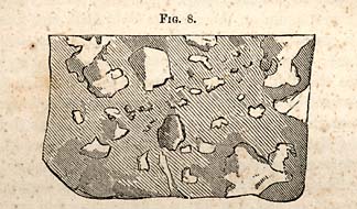
FIG. 8. [Brecciated Conglomerate]
Fig. 8 shows the character of one variety of this rock, which is composed mostly of angular fragments of quartz. This rock is associated in some places with mountain slate, an instance of which occurs about two-and-a-half miles northwestward from Mrs. Kirk's ferry.
* 73. The series by which this mass is reached, is through the thin bedded clay slate, which passes into thicker beds with conglomerates, imperfect chloritic sandstones, and which pass upwards into the superior rock. This rock is frequently porphyrized; or is traversed by porphyry more frequently, I believe, than the inferior beds. The quartz of this rock is rarely granular, and it still more rarely occurs under the form of a friable sandstone, though varieties not unfrequently occur, which possess the grauwacke character of the parallel beds in Renselaer county, New York.
The brecciated rock may be examined at flat swamp mountain, and at Brinkley's ferry; it extends to Gold Hill, or
Page 68
passes east of this place from one-and-a-half to two miles. At Milledgeville, one mile south of Stokes' ferry, the rock contains the large fragments of chert already referred to; so also the same rock is crossed twice in traveling from Mrs. Kirk's ferry to Gold Hill. The first time it is crossed, is two-and-a-half miles from Mrs. Kirk's. The rock at the ferry is the common clay slate, which passes by gradation into the thicker bedded slate or flaggs; then into chlorite sandstone, and finally into the brecciated mass, two-and-a half miles northwestward, where the rocks are vertical, having previously dipped to the northwest. The clay slates reappear to the northwest again on the road to Gold Hill, and finally the breccia is repeated, or reappears about two miles east of the latter place; from this point it continues to Brinckley's ferry, and forms the flat swamp mountain; from whence we pass northeastward to the Three Hat mountain, beyond which the rock disappears or sinks down, and is lost beneath the soil.
* 74. Quartz Veins.--The clay slates and breccia, with their intermediate beds, are traversed by veins of milky quartz. They are sometimes auriferous, and in some districts eminently so. They coincide in dip and direction very nearly with the beds of the rock in which they occur. In certain districts the veins are rarely auriferous; or if they contain gold at all, it is only in small quantities. Thus, the numerous veins between Troy and Montgomery county and Gold Hill are very poor in gold, and I believe are barren in the neighborhood of the narrows and falls of the Yadkin. The district of Gold Hill is, however, rich in gold.
The most barren veins of milky quartz, are those which form the low rounded hills, which are very numerous in parts of Chatham and Randolph counties. They seem to be formed by an immense mass of milky quartz which lies mainly upon or near the surface, and only ramifies into the slate in narrow strings, which are soon lost or run out. The surfaces of these rounded eminences is a mass of angular fragments of milky quartz, intermixed with a small amount of soil, sufficient only to sustain a scanty growth of blackjack. As the ores seem to be gathered into districts in which veins
Page 69
are numerous, so it appears that a district may be barren and unproductive in the ores and metals, though to the eye the proper repositories may be very numerous.
CHAPTER XIII.
On the Quartzite of North-Carolina--Varieties, Geological Relations, etc.
* 75. The quartzite is so peculiar that it merits a distinct notice in this report. Its name implies that it is closely related to common quartz, which is known to all who trouble themselves about the names of minerals. It is an uncrystalized kind of quartz, resembling as closely as possible common gun flint. Hence its common name, flint, which it bears in all the districts of the State where it is found. It is also called hornstone, and the English miners call much the same substance chert; and hence the adjective cherty, which is frequently used in the description of rocks.
Quartzite, however, is a name which includes the many varieties of silicious substances which have a close or compact structure, and is always amorphous or uncrystallized, and more or less translucent. It is designed to embrace, however, the darker varieties of the substance, which have rather a coarse texture when compared with chalcedony, opal or cacholong. The deep red and very fine and compact silicious minerals are generally called jaspers. It is the stone employed by the Indians for arrow heads. Quartzite may be regarded as a rock, inasmuch as it is very extensive in the south, and is by no means absent from the formations of the same age in the north. Its characteristics may be included in the following description:--Color, blueish black passing in
Page 70
to purple, grayish, white and green of several shades, and sometimes banded; texture, fine when compared with the finest sandstones; translucent on the edges; fracture, flatconchoidal and frequently brittle, or it may be tough in the mass, but small pieces easily chip off with a light blow. It passes on the one hand into a fine grit, and on the other, into the compact slate and a condition like flint. The tough varieties are usually coarse, and not homogeneous. When struck with a hammer, it is sonorous like cast iron. It is rarely if ever a simple substance like limpid quartz, as it usually weathers and loses thereby its homogeniety; besides, it is often porphyritic or porphyrized, and frequently the fresh fracture is dotted with small limpid crystals of quartz, which crystallized out from the mass when it was in a semi-fluid state. The development of other crystals or crystalline grains receive a ready solution, on the ground of the chemical solution of the silica.
An interesting instance of an analogous kind was observed by E. Emmons, Jr., in the development of small crystals of quartz in choysocolla, or the silicate of copper of the Gardner mine.
Crystallizations of this kind is imitated in the porcelain paste, when the fine material is allowed to stand in the vats. If the mass is left at rest for a few days, or perhaps for a few hours only, spicula or crystals begin to form in little clusters, and the material is spoiled. Talc appears sometimes sprinkled over its surface; among the most common foreign minerals disseminated through it, sulphuret of iron is rarely absent.
In weathering, the surface is usually of a drab color; and the rock will not be suspected to be a quartzite until it is broken.
As a rock, it never forms ledges of jointed masses like sandstones or limestones, but its outcrop takes the form of a military hat, the outcropping mass being sharp edged, rounded, separate and hatchet shaped. These hatchet shaped masses sometimes occur in clusters and groups, and stand thickly over the ground.
Page 71
As a rock, the strike of the singular outcropping masses is N. 10° E.; while the rock is N. from 20° to 40° E. Showing, that in weathering, they stand obliquely to the general direction of the rock. Their dip is northwest, with an angle of 80° to 85°. This rock, though hard and apparently composed of materials which can resist atmospheric influences, yet, some varieties disintegrate and form a light drab colored compact soil. It is too silicious to be fertile and easily cultivated. In the counties of Chatham, Randolph and Davidson, the quartzite usually alternates with the greenish slates; the latter decompose, and form a red productive soil. Hence, the rock beneath may be usually known by the color of the soil.
* 76. The ridges of these counties are frequently quartzite and valleys slate; a fact which indicates that the valleys have been deepened, in the course of time, by the more rapid disintegration of the soft clay slates.
Quartzite passes into a coarse porphyry and a silicious jointed slate, which is often used for hones.
The most perfect example of quartzite occurs on the plankroad leading from Asheborough to Fayetteville, where it passes along this rock for about twenty miles.
* 77. The varieties of quartzite are numerous, if color and texture are made grounds of distinction:
- 1. Light gray and compact, or very finely granular.
- 2. Smoke gray, with grains of hyaline quartz disseminated in the mass.
- 3. Texture fine granular, with a drab color.
- 4. Porphyrized quartzite.
- 5. Light green quartzite.
- 6. Greenish, and full of cavities, and frequently epidotic.
- 7. Banded quartzite, or coarsely agatized.
* 78. These forms of quartzite are not confined to rocks of a particular age, or to a given series. They seem to be distributed through formations of all ages and epochs. Thus, they are common to both divisions of the Taconic system; occur in the Silurian, Devonian and Carboniferous, and as late too as the Eocene; that is, if those cherty beds may be brought under the denominations I have adopted for this mineral or
Page 72
rock of North-Carolina. Indeed, in cabinet specimens, it is impossible to distinguish the quartzites of these formations from each other, unless fossils happen to be present.
* 79. The quartzites do not appear to occur in any regular order, or to form a succession of beds. The beds, too, are distributed with little regularity in the rock; for sometimes rounded hillocks of hornstone occur in the slates. In other instances beds occur which are parallel with the beds of clay slate.
* 80. Origin of Quartzites.--The rock or mineral, when associated with the older sediments, has been, and is regarded as a metamorphic mass; or one which was originally in some other state, as that of a clay slate. If however, we combine all the facts respecting the formations in which this substance is found, we shall probably reject the metamorphic theory of its origin. As it occurs in the different limestones of the Silurian system, it seems far more rational to infer, that the silica of which quartzite is formed was held in chemical solution, and the material is a chemical product. We cannot know of course, all the facts which were connected with its formation, and perhaps cannot now conceive how so much silica could have been held in that state of combination. But though we are unable to comprehend every thing relating to it, yet the chemical view seems more rational, after all, than the metamorphic. There is no evidence that heat was related to it as a cause of change subsequent to its deposition and consolidation. Frequently perfect fossils are made up of the material. Some of the most delicate organic structures are preserved in flint or quartzite. No one suspects the flint of the chalk formation to have been the result of vitrification by heat. Animal matter, however, has an attraction for silica. In conclusion, then, though it is difficult to comprehend the mode in which the quartzites were formed, yet I think that we may adopt the chemical theory in preference to the metamorphic, even in those cases where the rock is porphyritic. There is only one variety which occasions much doubt; it is the epidotic variety, which seems, by far, more likely to have been subjected to heat, than either of the others.
Page 73
CHAPTER XIV.
Origin of Vein Fissures, Dykes, etc.--General considerations relating to them--Kinds of Vein Stone or Gangue--Their relations to heat, etc.--Metallic Veins--Sulphurets--Oxides.
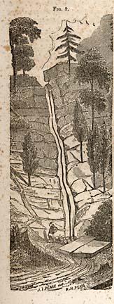
FIG. 9. [Vein Fissure]
* 81. Veins and dykes require to be treated of under two heads, or the subject requires to be separated so as to keep in distinct parts that which relates to the formation of the fissure, and that which relates to the mode in which they are filled. The matters are entirely separate; that force which forms the fissure is different in kind from that which subsequently fills it.
Vein Fissures.--Fissures, though due to the same general causes, nevertheless differ in various respects. There are fissures which appear to be deep, or penetrating to unknown depths; others are simply cracks, which we know terminate in the rock, and are distinctly defined.
Fissures are due to those causes, both of which may be said to be general. The first is due to the cooling of the earth's crust; and the second, to desiccation, and the third, to the mechanical force of pressure. The first operates
Page 74
externally; the second and third internally; but all are due to one cause, the high temperature of its crust and internal parts. This view of the matter, supposes a former incandescent state, and the earth placed in a cooler medium; and hence has lost its heat by radiating into space. The effect of cooling in all bodies is to contract them; and hence the process subjects the surface to a tension, which, in time, overcomes the cohesion of the strata, and the continuity of parts is severed, and a fissure is produced. The depth of a fissure must be variable, and the character of the strata must influence the result.
Desiccation must also produce a kind of fissure. The deep seated sediments must be exposed to the action of the residual heat; the result must be the same as when mud is exposed to the drying influence of the sun. Fissures thus produced, are frequently filled with granite.
The proof of a heated state of the interior rests on well determined experiments and observations. The temperature increases one degree for every fifty-six or fifty-eight feet descent, from about ninety-five feet below the surface- So incandescent matter issues from volcanic mountains. But I need not dwell on facts of this kind, as they are incorporated into the common stock of knowledge.
The origin of fissures are due, therefore, to general causes; but it should be noted, that the activity of these causes must have been far greater in ancient, than in modern times. The force must diminish, in the direct proportion to cooling of the earth's crust. The present state, or that which is accessible to observation, must be to all visible effects stationary; or have reached that point of temperature which no longer creates a tension. Fissures, then, are not produced in our day, except in the immediate vicinity of active volcanoes.
From the foregoing, it follows, that fissures must be more common in the ancient rocks. Observation proves the truth of the inference. Hence, the primary rocks stand first in the order of vein bearing rocks, the oldest sediments stand next--and in fine, when the whole series of sediments are examined,
Page 75
it will be found that the palæozoic are much more frequently traversed by vein fissures than the mesozoic. This statement, however, is not fully borne out when dyke fissures are examined. But it is also true, that for causes not well understood, that fissures are the products of periods or epochs more or less well defined; one of which I will cite in this place, viz., the new red sandstone period, which seems to have been one, during which they were formed, the world over. But these fissures are filled with stony matter; metallic veins of this epoch are extremely rare, and when they occur, are usually ill defined.
* 82. I am now prepared to speak of the modes by which fissures may be filled, and by which they become veins or dykes. The first inquiry which requires attention is, what are the forces which effect this result; for there are certain forces in existence which must be regarded either as remote or proximate causes in the filling of the fissures, and of the formation of veins. To the former belong, as I believe, the high temperature of the inferior part of the earth's crust. This high temperature sets in motion or brings into activity the properties of matter in such a way as to produce the results indicated.
Liquefaction and vaporization are two constants which flow from this high temperature. Matter is brought into a state by which it can enter and fill the fissures already made.
High temperature of the inferior part of the crust, sets in motion also electrical currents. This occurs from the well known influence temperature has when bodies are unequally heated, the equilibrium of the electro-magnetic force being disturbed. Currents thus set in motion, or if set in motion by any other cause, possess the faculty of carrying soluble matter from certain points, and depositing it at others, in obedience to an inherent law.
* 83. But again, fissures may be formed under circumstances which makes them closed or sealed cavities. These cavities, which are usually in the form of fissures, cannot exist long in a state of vacuity. If at great depths, liquids holding in solution soluble matter, must penetrate and fill them. This,
Page 76
then, is another force which should not be forgotten, Pressure, simply, does not indicate to us all that belongs to it; it requires the cooperation of the properties of matter, to secure the ultimate result.
To the foregoing must be added the pressure of elastic vapours or gasses generated at great depths in and beneath the earth's crust upon the molten matter with which it is in contact, or upon which it operates. Their existence is proved by their escape from craters and fissures in volcanic districts.
* 84. I may, with propriety, observe that the foregoing forces are connected with the earliest arrangements in the structure and formation of the earth's crust. They are ancient arrangements by which the metals are made accessible to us; and they are, it would seem, the necessary result of the constitution of the globe. They are by no means to be regarded as accidents arising from conditions which might have been otherwise. They are also general results, and are not confined to diminutive parts of the earth's crust; and so simple is the machinery by which the grand results are produced, that it would have required special instrumentalities to have prevented them.
The formation of veins, therefore, are the results of the operation of law, and hence certain constants may be looked for or expected; and upon which the practical miner may rely.
We have no occasion to go farther back in the series of causes, as that, for example, which caused the high temperature of the interior of the earth; it is sufficient for us to know the fact, and its adaptation to the production of results; the fact itself being attested in the phenomena of volcanoes, and sustained by observations in all parts of the earth.
* 85. The veins which appear under the simplest aspect, and which possess a great degree of homogeneity, are usually called dykes. They are fissures filled with homogeneous stony matter; or, if heterogeneous, it is the result of crystalization of parts of the mass; as the development of crystals in a paste of stony matter. The rock itself is complex when
Page 77
its elements are considered, but homogeneous when semifluid, and when it enters the fissure.
If the force which filled such fissures is considered, we are ready to admit that elastic gasses or vapors, pressing upon a liquid mass, may have been the instrument most immediately active in the result. First, there is the evidence of high temperature of a mass which has changed the walls of the adjacent rock. The results in these cases are consistent with what we witness in analogous cases. We must admit that the filling was in mass, and while it was in a semi-fluid state. We are not confined to this single cause; the force of elastic gasses, the force of pressure, may be produced by the strata alone acting upon a moveable fluid.
In the consideration of this kind of vein, we may satisfy ourselves that the other causes are not adapted to the production of such a result. We cannot rationally infer that vaporization meets the case, or thermo-electrical currents. They truly come under what is usually known as igneous injections, an expression not very definite or strictly correct. It is, however, important for us to know, that certain fissures are filled with incandescent matter, and in mass; but such a mode being possible, we should not, therefore, infer that all fissures are consequently filled in this way.
There can be no doubt respecting the mode in which granitic veins are filled, they must belong to the same class as the trap dykes. Besides, when they traverse chalk, or any of the limestones, the phenomena indicate that they must have been in a state of fusion.
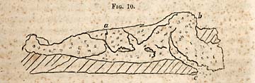
FIG. 10. [Granite vein]
Fig. 10 illustrates the common mode in which granite veins traverse the adjacent rock. The figure is designed to show
Page 78
also that the granites belong to different epochs, and that these epochs are determined by the order in which the different veins enter the rock.
Other veins may, in their respective phenomena, possess characters which are not explainable in this way. The statics of a vein fissure may entirely discredit the dynamics of dyke veins, or the contrary.
Leaving the latter for the present, and considering that we admit the fact that there are injections of melted rock from beneath, by the pressure conveyed to it in some way not susceptible of being determined in a given case, I may proceed to speak of heterogeneous veins or fissures filled with a mixture of metals in some state of combination and with the different earths.
* 86. In this kind of vein the dynamics require a special consideration of the statics. If it should be found that the substances are disorderly intermixed, there would be no objection to the adoption of the theory already stated, and which I believe is universally adopted. We must, however, study the statics of the heterogeneous filling. Now in showing in the general the distribution of these matters, I will refer to fig. 9. This figure is an accurate drawing of the Rossie lead vein, in gneiss. It will be seen that an irregular thick black line traverses the middle of the fissure. This is the lead, or the metal nearly unmixed with gangue. The parts on each side, and which are white, are belts of crystalline calcareous spar, intermixed with galena. The middle is unequal in width, sometimes it is eighteen inches wide; in others only six or ten. Now it is clear that this kind of vein differs from dyke veins, and we may doubt the justness of the same theory being applicable alike to the two kinds of veins, unless it admits of certain modifications. But why is this vein unlike the dyke vein? This question can only be answered, it appears to me, by inferring that the materials immediately below, and in proximity with the fissure, contained galena, as well as carbonate of lime. This inference may not possess much force, inasmuch as some maintain that the materials of the vein are derived from the rock adjacent
Page 79
to the fissures. This assumption, though it may not be groundless, does not, in my mind, contain as much probability as the first. It is advanced to meet certain difficulties which stand up against the igneous injection theory, which does not explain the phenomena when applied as it is to dyke veins. But we want more facts respecting the statics of veins, the metal is not so regularly distributed in all cases. It is often entirely mixed with the gangue, being less, however, in the gangue at the upper part. The metal may come in only at great depths in the fissure, all the upper part being entirely stony, or mixed with a few scattering particles of the sulphurets.
* 87. In treating of the mode and mannner by which fissures are filled, it is important that the properties of the vein stone or gangue, and the accompanying metal, should be well understood. The vein stones are not numerous; but their properties are quite different.
The known vein stones are as follows: carb of lime, sulphate of baryta and strontian, fluor spar, quartz, talc, silicate of manganese, carbonate of iron, carbonate of lime and magnesia, or dolomite and epidote.
The enquiry respecting these bodies is, can they be carried up into open fissures by vaporization, per se, or through the medium of water, in the form of vapor; or shall their presence in veins be ascribed to igneous injections?
Sulphate of baryta and strontian, fluor spar and quartz are soluble in water under certain circumstances.
The two first occur in cavities in a decomposing granite in St. Lawrence county. They line the inside, and are stalactical, as shown in my Geological Report of New York. So also they occur in Schoharie, in the Silurian rocks, in beds. Fluor spar and quartz often line cavities also, and hence are soluble when the needful conditions are supplied.
* 88. The salts of lime and magnesia and iron are more soluble than either of the foregoing. Epidote, which is the vein stone of the sulp. of copper and iron, is an igneous product, and is one of the most common metamorphic minerals known.
Page 80
But most of the foregoing minerals are also found in mineral and thermal waters, and being soluble in the vapor of water, may rise from the interior through fissures to the surface. Hence they may be deposited upon the walls which bound those fissures, and ultimately fill them. In North-Carolina, however, quartz and felspar veins, associated with trap dykes, are very common in the granite belt; and it is not uncommon to observe that a granite vein is composed of quartz, with only a very small proportion of mica and felspar. At least, nine-tenths is quartz, and as such veins must be regarded as igneous injections, it sustains the view that quartz veins may also belong to the same class of products.
The quartz and felspar veins, which traverse the sienitic granites of North-Carolina, seem also to have been formed in the same manner as the trap dykes, which are associated with them. The igneous origin of quartz veins, however, is not fully sustained by the phenomena which accompany them. Of hundreds of veins of this kind, I have never observed that the walls exhibit marks of igneous action. The same fact, however, exists in the felspar, and many of the dyke veins of the Taconic system. We have to remark, in regard to the want of igneous action, that we must consider the composition of the rock. Limestones, for example, are excellent rocks for the preservation of phenomena which are due to the action of heat; whereas the mica and talcose slates are far less changed by the same degree of heat. If mica and talcose slates are heated to redness, their appearance is very little changed. When used for hearth stones in furnaces, for a few months, they then become columnar and often vitreous. We may therefore infer that a single exposure to intense heat may result only in a slight change of texture or structure, which in the end may disappear by the absorption of water.
From the foregoing facts, it appears that veins, whose vein stone is quartz, or sulphate of barytes or fluor spar, may be filled by these minerals in a state of fusion, or through the instrumentality of mineral waters. In the latter case, fissures become galleries of sublimation, penetrated by vapor,
Page 81
holding in suspension and solution the minerals in question, which condenses upon the cooled walls. Whether we adopt the first or second view, it is necessary to maintain also that the fissures extend to those parts whose temperature is highly elevated. It establishes the position that vein fissures penetrate deeply into the interior of the earth.
* 89. In reasoning upon the phenomena of veins, it is not necessary to restrict the solubilities of the vein stuff to the limits which it may possess at the surface. Pressure and temperature, we know, modify the solubility of bodies; and carbonate of lime, which is almost infusible at the surface, but under pressure, retains its carbonic acid and fuses. It is therefore a fact consistent with the phenomena, which have been frequently observed in northern New York, with respect to the veins of limestone which resemble so perfectly granitic veins. No one who takes a consistent view of these veins, can doubt their igneous origin. Hence, too, there is nothing inconsistent with the view, that the vein stone, when a limestone, may be of igneous origin also.
It is, however, better to adopt that view of the mode in which a fissure is filled, which best comports with the phenomena revealed in any given case. A fissure may have been a gallery of sublimation, open for the reception of metallic vapors; or, as in the case of granite veins and trap dykes, it may be filled by fused matters, in which are mingled mineral substances of diverse kinds.
Page 82
CHAPTER XV.
Characters of a Vein Fissure--Distribution of Metal in a Fissure--Influence of Walls on the arrangement of the inclosed Ore and Rock, its parallel arrangement--Considerations respecting Iron.
* 90. The receptacles of ores, though they possess certain general characteristics quite similar, still a careful examination will detect certain important differences. A vein, for example, which may be relied upon, must be bounded literally by walls. If walls are absent, the receptacle is not a vein. Walls are the only criteria which distinguish a vein from a seam, a desiccation crack, or seggregation. The walls are produced by a rent oblique or vertical, and indicative of, or giving evidence that they have rubbed against each other, by which their asperities are smoothed off or removed. In consequence of these and other movements, the surfaces of the walls are well defined; they moreover show that the receptacle is a vein fissure, and not a desiccation crack. It sometimes happens that only one side is well defined; if so, it does not destroy the confidence of the miner with respect to the nature of the fissure. It still has a selvage on one side which proves it to be a true vein.
But if the receptacle of the ore is wanting in boundaries or selvages, or such boundaries as are not indicative of vertical movements of one side or the other, it cannot be regarded as a vein fissure, and cannot be relied upon as a permanent fund of metallic matter.
I would confine the characteristics of a vein fissure, therefore, to the existence of one or both walls; and a receptacle which cannot furnish the proper walls defined more or less clearly, should not, in my opinion, be regarded as a vein at all. I am disposed to insist upon this distinction, and pay no regard to the terms regular and irregular veins.
Page 83
Metallic Veins.--Metallic veins differ from dyke veins in being heterogeneous in their composition. A metallic vein is a mixture of metal and rock, or vein stone; the latter predominates, or, in other words, the vein stone is usually in great excess over the metallic substances intermixed with it.
The most common combinations of the metal as a mineralizer, is sulphur, forming a class of bodies universally known as sulphurets. In chemical language, they are sulphurets of lead, copper, iron, zinc and silver. All these substances possess peculiar relations to heat. They may be fused without being decomposed, or they may be volatilized, and condensed without change.
Hence, in regard to the mode by which they are introduced into vein fissures, it will not be inconsistent with any known fact, or with their properties, to infer that they may be introduced into fissures in vapor, or in a state of fusion; and it will hold good in either case, as has been stated respecting the vein stones, that their origin must be in the deep seated parts of the crust. So far then as the question respecting ultimate exhaustion is concerned, these facts indicate, that though the metal may vary in quantity at different depths, that a vein is not liable to be exhausted, or to be penetrated to its bottom.
Closed fissures may be filled, and no doubt are always filled by water, carying minerals in solution; very few substances can resist the solvent action of water under pressure and high temperature. Closed fissures are usually filled with earths, the carbonate of lime, sulp. of baryta, strontian and silica, or quartz; the latter is the most common in slate rocks, where it takes the form of seams or oval masses. Cracks in the argillaceous limestones and nodules, as septaria, are penetrated by solution, and are ultimately filled, when they present stellated seams. As these fissures or cracks are limited and closed, they can be filled only by latteral transfusions.
Metallic Oxides.--Several metals occur in veins which are in combination with oxygen. Of the oxides, iron is the most important. In northern New York, it occurs in veins and beds. In the latter form, it is equivalent to that of a rock.
Page 84
It is impossible to conceive that its origin can differ from the rock with which it is associated in the western part of Essex county. Here, hypersthene rock and labradorite encloses it in immense beds. The rock itself, like other varieties of granite, is very clearly of an igneous origin, and the iron rock shows from its relations to it, that it was cotemporaneous with it. In the eastern part of Essex, and also in Clinton county, the oxide of iron is mostly in veins. There are no serious objections to the foregoing views, and I should deem it unnecessary to refer to these instances, were it not that a certain writer has presented another view which is untenable, and which is not sustained by a single fact.
In North-Carolina, the oxides of iron occur only in veins, excepting where the mass has undergone certain changes.
The mode in which ferruginous veins have been filled, is clearly that which is assigned to trap or granite. Iron, however, in combination with chlorine is volatile, and is vaporized, and finally deposited in the condition of a peroxide or specular oxide. Examples of this mode occurs in volcanic vents. Lava, projecting into the funnel of a crater, is often incrusted with crystals of specular iron.
In St. Lawrence county, New York, specular iron occurs in isolated masses in limestone, or it has been impossible to discover a connection with a vein fissure. It is also disseminated in quartz crystals.
In this region specular iron occurs in true veins. Its characters, however, are concealed by the change in texture which it has undergone. In North Carolina, a specular iron is also found in veins in many places, some of which are highly important.
* 91. Those writers who attempt to make a distinction between regular and irregular veins, have hitherto failed; both kinds are productive according to their statements; the regular vein being supposed to be more so, or more permanent than the irregular. But the regular vein has its irregularities; it widens out, and it is pinched out and nipped; it is irregular in the amount of metal it carries, the irregular distribution
Page 85
of it being notorious in the best of veins, or in parts of them.
Good walls, however, do not prove that a given vein must pay a profit; or that it warrants exploration; it may be too narrow, it may be too wide; that is, the metal is distributed through a large quantity of vein stuff. But an exposure of ore being made in a receptacle, the important question of its being a vein, is the first thing to be determined; for, as I believe, the question of permanence of the receptacle, turns on the answer the phenomena gives us; if no walls, we have no ground to expect a permanent fund of metal; if walls are present, it is a fissure which extends deeply into the interior; so much may be regarded as settled, there will be depth at least. But if there are no walls, the boundaries of the receptacle will close like a desiccation crack or a seam in slates; and we should not be warranted in the expectation of a permanent fund of metal, as before remarked. To these remarks I am inclined to except the auriferous beds, in certain cases, in the Taconic system.
The veins termed regular and irregular, are worked with advantage, and sometimes those which are irregular have yielded the largest profits. The terms regular and irregular deposits scarcely admit of distinctions in practice, and hence, should not be employed. Still more objectionable is the term unstratified deposits. A deposit, in its true meaning, must be stratified; and it is especially erroneous when it is applied to igneous products. It would be just as proper to call a granitic vein a deposit, as a metallic lode. The term deposit is restricted to sediments.
* 92. The distribution of the metal and vein stone contains characteristics of a true vein fissure. There is a regularity in the parts which show that the process of filling was not always confined to one operation. The accumulation is supposed to be by successive layers or lamina which are deposited against the walls. Such an accumulation gives the comby structure, to use a miner's term, and as the lamina are crystalline, the points or apices are directed towards the
Page 86
middle of the fissure. The arrangement of the metal is also in accordance with the vein stone; it is distributed in belts parallel with the lamina, sometimes in continuous sheets, in others, in interrupted ones. The regular distribution which has been observed in some of the best characterised veins of metal in Europe, has been ascribed to successive additions of new matter to the vein. To this view there seems to be no objection, inasmuch as the force which produced the fissure may be regarded as operative through long periods. Every time the fissure is widened, it would receive fresh accessions of mineral matter. Another view of this subject may be presented, however, which is worthy of a moment's consideration. The arrangement of materials, or their special disposition in a fissure, may be influenced by a molecular force. Wherever there is space for particles to move, and a sufficient degree of fluidity to allow the particles to arrange themselves, the order in which the distribution is made will be regular, but the precise order will be very much controlled by the form or shape of the enclosing space. In fissures, the parallel walls will exercise a controlling influence, the subordinate parts of the enclosed metal and vein stone, will be arranged parallel with the master planes, formed by the walls. Seams of calc spar furnish, very frequently, instances of this kind of arrangement, the back of the seam of spar being implanted against the sides bounding the space; but the inward faces of the plate of spar will be covered with crystals directed to the middle of the seam. We may say, to make the idea plain, that the master planes condense the liquid holding mineral substances in solution. Now the term condense may not be the best, but its use here is analogous to that, which is employed in other cases. Stones in the soil condense water, plates of metal condense moisture, platina foil is wet by quicksilver, and platina sponge condenses hydrogen; flattened particles of gold condenses the air of the liquid in which it is immersed when it floats. In veins, the walls therefore may be said to condense the enclosed matter; it may be in vapor or in a liquid state, and the process having
Page 87
once begun in parallel planes, will afterwards continue to be thus arranged. In dykes the space is too much crowded to give the free movement of particles. In many cases, however, the columnar structure is developed, and as it is always transverse, it shows the influence of the walls upon the arrangement; though that influence may be due simply to the mode or direction in which the heat escapes.
* 93. The walls of a vein may be conceived to control the order of arrangement of the inclosed matter, giving it the laminated or comby structure. When limestone is associated with laminated rocks, its structure partakes of that of the rock which encloses it. So general is the effect of surfaces or planes of matter to produce parallelism, that we may witness their influence in numberless cases.
The effect of the walls in giving direction to the parts of the vein stone and its metal, does not disprove the view of geologists already stated. Veins may be widened at different times, as maintained, and yet the walls may control the disposition of the subordinate parts, and impart to them that parallel arrangement so frequently noticed in the most perfect examples of veins. The master planes in a vein therefore, are its parallel walls--the more perfect the walls, the more perfect the arrangement of its parts. If the foot wall is the most perfect, the parallelism will be the most perfect adjacent to that wall.
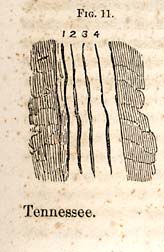
FIG. 11. [Parallel ore and vein stone]
Fig. 11 illustrates the parallel arrangement of the masses of ore and vein stone, 1 2 3 4, as described in the foregoing paragraphs. Parrallel arrangements occur when the vein decomposes in mass, under circumstances which differ from those which attend the filling of the vein originally. Remarkable instances have been noticed in Carrol county, Virginia; in Ashe county, North-Carolina; and in Polk county, Tennessee.
Page 88
* 94. These veins contain the sulphurets of copper and iron, with traces of arsenic. Near the surface the sulphurets are decomposed. Now, the separated elements, instead of intermingling, seperate; the oxide of copper, which is one product of decomposition, forms a stratum by itself, and the oxide of iron by itself. Thus, in Fig. 12, 4 represents the position of the oxide of copper, and 2 oxide of iron, and 3 a stratum of undecomposed bell metal ore. These beds lie in parallel position--a position which is secondary; as, originally, nothing of the kind appeared. Gravity, in this case, may have aided in disposing the materials as they were found in opening the vein; but similar arrangements take place where gravity had little or no influence. Water, no doubt, plays an important part in arranging the materials in the new condition in which they are placed.
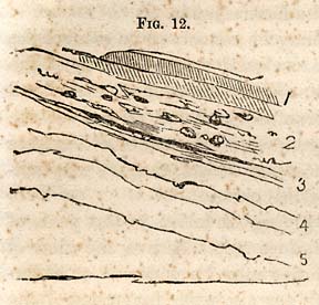
FIG. 12. [Ore and vein stone]
* 95. A variety known as the pipe vein, brings to light a very curious modification of a vein fissure. Instead of a simple fissure, whose walls are nearly parallel, they are twitched in, so as to form a kind of tubular repository. This tubular form of the vein plunges deep into the rock; but it forms a series of enlargements or contractions, similar to what occurs in ordinary fissures, none of which have walls perfectly regular and parallel. Fig. 13 shows the form of pipe vein in Georgia, near Ducktown, Tennessee.
Page 89

FIG. 13. [Pipe vein]
In this vein, notwithstanding its irregular form or rather deviation from the ordinary vein fissure, the masses of vein stuff have a parallel arrangement, as in other cases. For 25 feet of the top, the fissure is nearly closed. A streak of gossan or hydrous oxide of iron, served as a guide to the wide tubular expansion below, which plunges obliquely into the rock, in the direction of the lamina.
* 96. It is important, however, to guard against misapprehension respecting the arrangement of the contents of a vein. If it is expected that the same phenomena attend the arrangement of vein stuff, it will sometimes lead to disappointment. The aggregation of the materials admits of considerable variety. But these varieties throw light upon the mode by which the vein was filled, or at least indicate some of the conditions. A vein is sometimes occupied through its whole breadth by one substance. Thus the Cathey copper vein was filled with a mass of copper pyrites. Passages in the North-Carolina mine are filled with quartz and carbonate of iron, each occupying separate zones, to which succeed fine belts of copper pyrites in its vein stone of quartz.
The most usual condition in which the vein is found filled, is that where the metal is interspersed through the veinstone; though the favorable arrangement of the metal will be that of elongated parallel masses, taking nearly the direction of the vein fissure.
The position of the metal is sometimes in the middle of the vein, as in Fig. 9. In others it is upon the foot wall, as was the case at the North-Carolina mine. Where this vein carries both carb, of iron and copper pyrites, the latter occupied
Page 90
the foot-wall, while the former occupied the hanging wall, with copper pyrites interspersed through it. Even in nests of ore, as well as in regular veins, the ore takes a regular position in the mass usually near one of the walls.
The parallelism of structure is very remarkable in a few instances, in the mines of the old world. Thus, the Drei Prinzen Spat vein, near Freiberg, a section of which shows twenty-one parallel lamina, consisting of four kinds of minerals, blende, quartz, fluor spar, blende, heavy spar, sulphuret of iron, heavy spar fluor spar, sulphuret of iron calcareous spar. These occupy the upper side of the vein; the lower consists of precisely the same substances in the same order, two parallel bands of calc spar occupying the middle of the fissure, and each on one side has its corresponding lamina, or comb, on the other.
* 97. Forms of the metal bearing spaces in lodes.--Those who have formed their ideas of a lode from books, will probably perceive, on actual examination, that they have much to learn. A lode rarely extends continuously downward, without certain interruptions or alternations which are rather uniform and of a peculiar kind. It is true, in some instances, as stated, the continuity is unbroken; and the threatened break amounts only to a contraction, as the Rossie lead mine, (Fig. 9,) shows. But the most frequent form of the metal bearing spaces in the lodes of North-Carolina, are tolerably distinct from each other, and are arranged in lenticular segments. The segments lie nearly parallel in the slates to the planes of bedding; each segment also has its own investment of partings around it, which separates it imperfectly from those adjacent to it. The lower edge of the segment overlaps or extends beyond the next succeeding one beneath, and from which it is separated by a thin parting of slate. The succeeding one, therefore, so far as its upper edge is concerned, lies behind the former, and against the foot-wall. If the entire series of segments are examined, they are found to lie in echellon; and sometimes where the lode dips at as high an angle as 80°, for example, the fissure is vertical, and the shaft in descending cuts all the segments from top to bottom.
Page 91
Each segment makes an offset against the foot-wall, but lies obliquely across the fissure, so that its upper and lower edges touch or lie against each wall.
In most veins, an arrangement of this kind is more or less distinct. In the Gold Hill vein is a perfect example of the kind I have described.
The length of the segments are variable, sometimes ten or twelve feet; and their thickness is of course dependent upon that of the vein fissure. In some instances the segments are so distinct that on being removed the lode seems to have run out, but on working back to the foot-wall, another segment is encountered of the same form. The Pioneer mine, in Cabarrus county, which is in syenitic granite, is another fine exhibition of this arrangement. It does not therefore appear to belong, or to be produced, by the character of the rock in which the lode is formed.
* 98. The lenticular masses described in the foregoing paragraphs, are frequently called bunches by miners. These bunches are, however, frequently subordinate to still larger segments of the lode, through which the riches are distributed. The larger segments form bands or belts extending from the top to the great depths below; and which, taken as a whole, are quite uniform in their productiveness. These rich belts, or as they are usually called, pockets, alternate wtth poor ones. So the lode, therefore, taken as a whole, has first its greater divisions of rich and poor belts or pockets alternating, which is illustrated in the Gold Hill vein; and then these belts, whether rich or poor, are formed by lenticular masses lying obliquely across the vein fissure. To the eye, the poor belts furnish no characteristics by which they can be distinguished, with certainty, from the rich ones. Experiments only bring to light the fact. The foregoing presents features in a lode which should not be lost sight of, either in the first explorations or in subsequent workings of it. The theory which we may adopt respecting the mode in which a vein is filled, must also take in this feature of it, inasmuch as it may be regarded as a law in the distribution of the vein stuff. It is not simply that the metal lies in bunches,
Page 92
but the form of these subordinate masses must be taken into the account, and it not only affects the bunches of metal, but the vein stone also.
CHAPTER XVI.
Geological ranges of the Ores or Metals,--Are certain Metals confined to any certain Rocks?
* 99. Although the formations in North-Carolina are quite limited when geological epochs are counted, and though this subject may not be as important as it would if the range of rocks were greater, still its principles find many illustrations in the mining districts of the State. It cannot fail to be useful when our knowledge of the range is derived from foreign lands which have long been explored for the metals.
I have occasion to speak of only a few of the metals in this connexion, those, for example, which are economically or commercially important; and the order in which they require to be noticed is determined mainly by the geological relations they hold to each other.
* 100. Tin.--This metal is spoken of here for the opportunity it gives me for saying that there is no probability of its being found in North-Carolina. It belongs geologically to the oldest quartz or granites, and the oldest slates or killas, as they are called by Cornish miners. It is associated with copper; and many of the Cornish lodes contain tin at the surface and copper below. The stanniferous rocks of Cornwall, consist of quartzose granites, hornblende slate and clay slate, all of which are traversed by granitic veins which are mostly quartz and greenstone dykes, which are called elvans by the miners. They therefore make no distinction between slates which differ so much in composition as the hornblende and
Page 93
clay slates. The granites of Cornwall contain much schorl and mineral, which is rather rare in the granites of North-Carolina. The relation, however, of the granite to clay slate, and killas and quartz scams, is much the same as in Cornwall. But in the latter country the tin ore is and was scattered over the surface very much, as our gold ores are here. There was no difficulty in discovering the tin of Cornwall, and there has been no impediment to the discovery of gold here; and after much search for tin and its indications, it seems there is little prospect of its discovery.
The ores of copper take a much wider range than tin, although they are almost constantly associated in certain rocks. Copper is, however, most frequently found in the oldest rocks. It is in granite and the adjoining slates in the Carolinas and Virginia. It is in a native or metallic state in the Potsdam sandstone and igneous rocks of lake Superior.
Mr. Murchison observed veins of copper in the Devonian series in Russia. The Triassic or New Red sandstone contains copper also, which seems to be the most recent formation, which furnishes it in workable quantities.
* 101. The language used respecting the occurrence of metal in different rocks, seems to be somewhat loose and unintelligible. Thus, Sir H. De LaBeche remarks, with respect to tin and copper, that where granite and elvan are near these metals or their ores, they so abound that they may be worked, and produce good mines. Hence, he again remarks, we might infer that granite or elvan had considerable influence in promoting the presence of tin or copper ores, which either occur in them or in other rocks in their vicinity; while the granite influence was not essential to the accumulation of the ores of lead, antimony, manganese, zinc or iron, as the case may be, in quantities to be profitably worked. There are so many exceptions to the influence which is here spoken of, that it is questionable whether we should continue to regard it of much consequence, although it is backed by high authority. There is, however, this; workable veins of ore are usually in a disturbed district, as I have observed in another place, or in a district in which elvan and granite dikes
Page 94
abound. The rock of the country may be granite, or slate or limestone; and each may, or may not be metaliferous; where it is disturbed by igneous rocks, the probabilities are much increased thereby; if they are absent, the probabilities are much diminished.
* 102. The ores of iron and manganese have by far the widest distribution, both geologically and geographically. The magnetic and specular ores are widely distributed in the granitic series, in gneiss, mica and talcose slates, and primary limestone. Proceeding upwards in the geologic scale, they appear in workable quantities in the Taconic system, as in North-Carolina and in the Lake Superior district. In the upper Silurian, in the carboniferous and new red or Triassic system. Hematites, accompanied with manganese, occur in the drift, and the bog ores are also widely distributed. Similar deposits seem to belong to all ages. They are frequently the products of mineral springs which now cease to flow; but which have left thin deposits among the tertiaries and most recent formations. The silicate of manganese occurs in the oldest slates in veins.
Antimony ores, according to De LaBeche, are chiefly obtained in fair abundance in those portions of the granitic districts, which are much associated with trappean rocks. Oxide of manganese occurs also in the same rocks contiguous to the traps just spoken of.
* 103. The sulphuret of zinc is associated with both tin and copper, but more frequently with the latter. In the mining districts of Cornwall, zinc is very widely distributed. The red oxide of Sussex county, New Jersey, is connected with the primary limestone, its epoch is not determined. The sulphuret of zinc in North-Carolina, belongs to the Taconic rocks, and is only found in considerable quantities at the Washington mine. Carbonate of zinc or calamine, is confined in England to the carboniferous formation, and is probably in this country referred to the same or nearly the same epoch. Galena or sulphuret of lead has a wide distribution. It is found in veins in gneiss and granite in this country, and from these ancient rocks it ranges up to the carboniferous
Page 95
series. Galena, zinc, silver, gold and copper are associated in the Washington mine, in Davidson county. Antimony and galena occur in the gold region of Georgia, in certain parts of the Gum-log mine.
* 104. Gold is the associate of the sulphurets of copper and iron. The sulphuret of iron alone and quartz, may be regarded as the true associates of this metal, and it may be with gold as with silver; the latter though occurring in the same vein with sulphuret of zinc and lead, yet is rather attached to the latter than the former; and so it may be conjectured that gold, when it occurs in the same vein with sulphuret of copper and iron, is mixed with the latter rather than with the former. Gold veins traverse gneiss and hornblende, mica and talcose slates. These are the oldest slate rocks, and belong to the Blue Ridge. Another set or group of auriferous veins belong to the Taconic system. Previously to 1855, I had inferred that the auriferous veins of the two series belonged to the same epoch. But this position appears to be untenable now, in consequence of the discovery that auriferous beds also occur in the Taconic system. The gold of these sedimentary beds must, of course, have been derived from the preexisting lodes of the hornblende, mica and talcose slates. So far as this country is concerned, no discoveries of gold in veins have been made in rocks of a later date than those of the Taconic system.
* 105. Cobalt is found in a hornblendic gness at Chatham, Connecticut; it is associated with iron pyrites; it is called copper nickel, being a compound of cobalt nickel and arsenic. Silver is associated with lead, but it is in this relation in the older rocks. Small quantities of sulphuret of silver occur in Montgomery county, in the slates. Cobalt, silver and arsenic are found in some of the latest formations in Europe. These substances occur in the veins of Joachimsthal of the epoch of the Tertiary. They are probably the latest veins, whose age is determinable by the age of the formations through which they pass. In this instance, the geographical relation of the veins to igneous or eruptive rocks is quite manifest, and it may be regarded as due to this influences,
Page 96
that the vein fissures became charged with the ores of the metals in question. There are no instances known in England or France of vein fissures occurring in the lias, oolite, or any of the later formations. The Atlantic slope from New Jersey to Alabama, is in part overlaid with Cretaceous, New Red sandstone and Tertiary; but there are no repositories of the ores in that distance, which are connected with these later formations, excepting that of copper in the New Red sandstone. Mercury is said to occur in gneiss and older slate rocks. In Idria, it is associated with coal shales in the condition of a sulphuret.
* 106. The results to which observation tends are, 1st, That the original repositories of the ores are to be sought for in the primary and Palæozoic rocks; 2d, That it is in the region of the primary that they may be expected; 3d, That it is in the vicinity of eruptive rocks, granite, trap and porphyry, that the probabilities of their existence is greatly increased. Still, many districts where irruptive rocks are extensive, furnish only traces of a metaliferous region, as a part of New England proves. In these rmarks, iron may be regarded as an exception, inasmuch as it is common alike to many districts, while lead, zinc, copper, gold, etc., are more generally restricted to certain tolerably well defined districts.
* 107. Are veins of any of the metals confined to certain rocks?--Whether any of the ores of the metals are confined to certain rocks, is not to be expected in a restricted sense. Some are confined, probably, to a limited series, as the primary schists; and some others seem to be associated more frequently with a given rock, as chromate of iron with serpentine.
Several chemical combinations of the metals pass through a wide range of formations. No mineral substance is more common than iron pyrites. It is disseminated in most rocks; and it occurs, also, in veins. It is found in sandstone, all the limestones and slates, of all ages, and in the tertiary; it is a mineralizer of wood in volcanic and sedimentary rocks.
* 108. Copper pyrites, though widely disseminated, is much less so than iron pyrites; and its quantity is usually
Page 97
less where the two occupy the same lode. Copper is restricted rather to the older rocks, but is not confined to a limestone, sandstone or slate.
Manganese is also widely diffused; but when it is found in the more recent formations, it is derived, as in the case of the oxide of iron, from pre-existing repositories. Gold is restricted in its range, but not confined to one rock. Tin is confined to the oldest rocks, but not restricted to one. Mercury, which is restricted to a few districts, is not confined to one rock. Platina and its associates are referred to the serpentines.
It appears, therefore, that though certain ores have a restricted range, yet they do not appear to be confined absolutely to one rock. Gold is rarely found in limestone and serpentine, but in North-Carolina it is sometimes found in both of these rocks.
CHAPTER XVII.
Circumstances which favor the accumulation of Ore in Masses--State of the adjacent Rock, (sometimes called the country,) which appears to favor the accumulation of Ore in a Vein--Vicinity of Elvans--Passage of a Vein from one Rock to another--Condition of the Walls of a Vein.
* 109. The contents of a vein is often found to have accumulated at certain points. Miners as well as geologists have ascribed these enlargements to certain causes. When, for example, two veins cross each other, the ore at the point of intersection is twice as great as in either of the intersecting veins. This fact is so common, that when two veins are inclined to each other, and if prolonged will intersect, it is confidently expected that it will yield a much larger amount
Page 98
of ore. This is one of the most frequent and constant facts in mining which can be relied upon, or which, if it occurs, may be relied upon for increasing the product of the lode. This expectation is carried still farther; when, for instance, two bunches or pockets of ore in the same vein are approaching each other, at the place of meeting it is expected the ore will be increased.
* 110. The same result takes place when a vein crosses an elvan or dyke. De LaBeche remarks upon this subject, that the connexion between bunches of ore in fissure, where they traverse the elvans, is well understood by the practical miners of Cornwall. One of the most remarkable examples given in illustration of the fact is, that of the Wheal Alfred, near Guinear. The elvan crossed by the vein is about three hundred feet thick; the vein crosses it at an angle of about 25°. The elvan dips N. W. at an angle of 45°. The intersecting lode dips at an angle of 72°. The lode was in slate, and produced some ore while in it; but upon entering the elvan it became much richer and increasing in value, when it finally yielded an amount of ore which was sufficient to give a profit of £140,000 sterling to the adventurers. After quitting the elvan, and again entering the slate below, the lode became poor, and eventually was abandoned on this account.
* 111. Sometimes a lode in crossing an elvan is split in strings, and though the amount of ore may not be diminished, it will increase the expense of mining considerably, in consequence of the large amount of rock which may be necessary to raise and dress. The cases belonging to the kind under consideration as a whole, furnish a large per cent in favor of the increase of ore in the dykes, or while the vein is crossing them. When the vein passes between the elvan and the rock, prior to its intersection, the bunch of ore is also increased.
* 112. Veins are supposed also to be more promising in the vicinity of elvans and other eruptive rocks. All these facts seem to point to the influence which igneous matter has upon fissures, probably in opening passages from beneath
Page 99
upwards. The foregoing is in accordance with the prevailing opinions of the captains of mines in Cornwall, where it is said that the greatest quantities of copper ores are found in the neighborhood of large elvan courses. This view it is important to examine; for, in the mining districts of North-Carolina, large dykes or elvan courses form one of the interesting features of the country, as I shall have an opportunity for showing in the progress of this report.
* 113. There are many points of interest connected with the intersection of lodes one with another, or with dykes, which are not by any means sufficiently elucidated or established. Thus, at what angle is the most favorable for an increase of metal, or is the angle of intersection only a secondary point? Is there any connection between the increase of metal in the lode and the texture of the dyke which is intersected? or is there any connection between the increase of metal and the kind of elvan lithologically considered? The foregoing, together with many other inquiries important in mining, can only be satisfactorily answered by records duly made by intelligent agents or captains of mines, who feel sufficient interest in the matter to note all the facts pertaining to the subject at the time when they come under observation.
* 114. The condition of the adjacent rock is also supposed to influence the production of the vein; or, as the miner would say, the richness of the vein is dependent upon the country. Thus in certain Corn wall tin and copper mines, the lodes were rich where the clay slates were of a blueish white color, and poor where they were black. In another mine it was productive while in moderately hard killas; but when it entered a stratum of hard killas, the riches were cut out. Other instances are given where the same unfortunate change occurred on passing from softer to harder slates. So in cases of granite, where it was soft, the lode was rich; but on entering into a hard part of it, it became poor. These cases, however, do not seem to be perfectly satisfactory, other causes may have operated to have induced the change observed; or, inasmuch as veins change even when the rock preserves a
Page 100
uniform texture, the change may have been only one of those alternations met with in every day mining experience. So, also, the passage of a lode from one rock to another is usually attended with a change in its value, increasing in some cases, diminishing in others. Sometimes a lode is rich in the slate, and becomes poor on passing into granite; in others, it is poor in granite, but becomes rich in slate. So it would appear that the rock itself does not control its mineral wealth; or, if the position is too broad, it may be said with truth that it does not exclusively control it. The value of the lode in either case may be increased by an elvan course, which exists in one instance and not in another. The facts are too meagre, the observations too limited, to enable us to predict, with certainty, respecting the nature of the change which is to be expected in any given case, or whether a change will take place at all; though it is pretty well established that a change of ground produces a change of metals. In one or two instances in North-Carolina, a lode, in passing from slate into granite, continued to be equally rich in the latter, as in the former rock.
* 116. The condition of the walls of a vein are also supposed to influence the richness as well as the quantity of ore in it. A firm, hard, well defined wall, is regarded as the most favorable condition; if the walls on the contrary are soft, they do not hold the metal. So the presence of flukan is a favorable omen, according to Cornish miners. Walls, however, may have been originally firm, but in consequence of the decomposition of the sulphurets, may be softened and broken down. Their present state then, does not necessarily decide what influence they have exerted upon the lode, as in the cases respecting the influence of the rock on its lodes; so it may be said that the influence of the walls on the contents between them is not well understood. It is difficult to distinguish between accidental circumstances and necessary results or causes; the relation between antecedents and consequents. It is not possible to decide what influence a distant centre of force has, or can have, in the production of certain phenomena. There are, for instance, a complication
Page 101
of forces; a subterranean force in which heat may play its part, and electrical forces which circulate in the earth's crust, which play their part also. Observations require to be multiplied before some of the common and prevalent notions of miners can be received as decisive judgments. Observations which are conducted properly, and those tabulated, will lead to judgments which will be useful in a new mining region, and probably in all mining countries.
* 117. I have treated of vein fissures and other repositories of the ores and metals in the preceding chapter at some length, but it remains to classify and arrange them according to the characters which belong respectively to each kind. Now the forces which act upon the rocks within the sphere of observation, and which break the continuity of strata, are by no means numerous; and it so happens, that though the forces may differ, still the results are quite similar in certain respects; thus the cooling of the earth's crust opens deep fissures or rents, and so also the desiccation of rocks must produce cracks by shrinkage. In igneous rocks, and those forming a greater part of the earth's surface in the era when vein fissures must have been the most frequent occurrence, the fissures were the effect of cooling. In the era of sediments on the contrary, especially those which are calcareous and argillaceous, desiccation cracks must have been the most frequent. Desiccation cracks, however, differ from fissures produced by cooling, in the depth. By simple drying, fissures may be confined to a single rock; and it probably will be also checked with numerous cracks. In fissures from cooling of the crust, we may recognize a general force; in desiccation, a local one. In the former, too, it is probable that fissures would be accompanied with the shifting of the position of rocks, which would operate to extend them. There is still one more mode by which the earth's crust may be, and is fissured, as well as dislocated, viz., the action by the elastic vapours and gasses, which no doubt become pent up and confined, until, by accumulation, the force breaks the continuity of the strata. Sometimes, in the movements produced,
Page 102
the strata subside; at other times they are elevated or shifted, as represented in fig. 14.

FIG. 14. [Elevated or shifted fissure]
The most important forces by which the earth or its upper rocks are fissured, rent or separated, may be reduced to three: 1. Fissures by secular refrigeration; 2. Drying and desiccation of sediments; and 3. The action of elastic gasseous bodies disengaged in the interior of the earth.
* 118. Notwithstanding the foregoing statement respecting the nature of the forces which produce fractures and fissures in the earth's crust, still they do not furnish the necessary characteristics for distinguishing the different repositories of the metals from each other. Indeed these repositories scarcely admit of a scientific classification. We may enumerate, however, certain kinds of repositories which seem to be distinct from the others, and which it is useful to notice.
(A.) THOSE REPOSITORIES WHICH ARE COTEMPORANEOUS WITH THE ROCK.
1. The first includes those repositories where the ores are disseminated in the rock in grains, and small and large masses, as chrome ore in serpentine; magnetic iron ore in the hypersthene rock of the Adirondacks in northern New York; the specular ore, in some instances, in pyrocrystalline limestone.
2. The second, seggregated seams, which present a welted appearance upon the surface of the rock. Particles and small masses of metal are arranged in lines along such seams, but they are usually stony, and are cotemporaneous with the rock, so far as the materials are concerned, which form the seggregations. They rarely contain sufficient metal to pay the expense of extraction.
3. The third, beds or deposits of metal which are formed during the period when the rock was forming or being deposited. Some of the gold repositories of North-Carolina belong to this kind, and all the iron ores which are stratified in
Page 103
the sediments. They belong to all the systems which have been recognized; the oolite ore of the upper Silurian in New York and Virginia, the iron balls and stratified deposits of the carboniferous system, etc., are among the most important.
(B.) VEIN FISSURES WHICH HAVE BEEN PRODUCED AFTER THE CONSOLIDATION OF THE ROCK, AND SUBSEQUENTLY FILLED.
1. The first contains the granitic and trappean veins or dykes. They are true veins which were filled with stony matter, immediately after the fissure was formed.
2. The second, fissures which remain open and are slowly filled with stony and metallic matter in aggregations quite variable in their arrangements and relations, To this kind belong the veins of workable ores, sulphurets, etc.
3. The third, desiccation cracks, they are sometimes filled in part with the ores, but generally with sparry limestone, sulphate of barytes, etc. Cracks in septaria, in clay slate, in limestone and other rocks, with lenticular shaped fissures belong to this kind, provided they begin and end in the rock.
* 119. Repositories of ores occur, of which it is difficult to offer a satisfactory explanation of their production, or of the mode in which they were filled; among which I am disposed to place the copper ore of the New Red sandstone, and the lead ores of Missouri in Silurian limestone. The former, however, Prof. Rogers is disposed to regard as irregular repositories, and perhaps filled by cupreous emanations from beneath; and so it is not improbable that the repositories of galena in the western limestones may be regarded as irregular vein fissures, which were sufficiently extensive and deep to form connexion with the pyrocrystalline or eruptive rocks.
The assumption may appear unwarrantable; but when we see so many illustrations of the fact, that fissures are in proximity to eruptive rocks, and very uncommon in those at a distance, the assumption appears less hazardous. It is sustained also by established principles, and appears more rational than the theory which ascribes their formation to materials in the rock, and subsequent to consolidation, were secreted into the open fissures. It is true, that in support of
Page 104
the latter there is no question respecting the filling of seams by spar, and sometimes it is intermingled with the sulphurets.
The facts show that it is in accordance with known phenomena, and deserves consideration before it is rejected. Those which are most important in North-Carolina, are the contemporaneous beds, as the gold deposits. The disseminated ores, as the chrome ore and the vein fissure.
* 120. Numerous examples of the occurrence of the oxides in such relations as to indicate the contemporaneous origin of the rock and ore, are furnished in the instance of chrome in serpentine. Franklin county in North-Carolina, and Franklin and Hampshire in Massachusetts, furnish many instances of chrome ore imbeded in the rock. Serpentine is a rock which is now admitted as of igneous origin; hence it may be inferred from the relation of chrome to the rock, that it is also an igneous product, contemporaneous with the rock.
Serpentine, in northern New York, contains primary limestone; and large blocks of serpentine frequently occur in limestone. Sometimes they form a rock composed of equal parts of each. These may be supposed to have been accidental; or, that they have been developed in a magnesian paste by metamorphic action. This view is inconsistent with the facts revealed in St. Lawrence county, New York, and western counties of North-Carolina. In New York, the limestone is beneath the Potsdam sandstone, and is an unstratified rock, and has, in several instances, changed the Potsdam sandstone by contact. It is with this unstratified limestone that the serpentine is associated, and it is also in this limestone that the specular oxide of iron is imbedded; it is as it were entangled with it, and became so when in a pasty condition. If the views of geologists are true respecting the connexion of chrome ore with serpentine, analogy may well lead us to apply the same view to the origin of the specular ore in the primary limestone. This view, however, must be restricted to certain cases, for it unquestionably occurs in regular veins. These may be obscured at the surface by the disintegration of the ore which may be spread out widely over
Page 105
the surface in an earthy state, and appear like an ordinary bed of hematite.
* 121. The fact just stated respecting the occurrence of iron ore in beds requires a farther notice in this place. Only two of the oxides of the metals occur in the soil, or in the modern deposits, viz., iron and manganese. It is scarcely necessary to remark that these oxides are widely distributed, and it happens that wherever a rock is undergoing decomposition, we find one or both of these oxides as products of the change. In many accumulations of debris, we can discover iron and manganese disseminated through the porous mass; it may give it a deep red stain, or red and purple stain, which indicates the presence of both oxides; or these oxides may form black concretions in the soil. But what is of the most importance, is the accumulation of both in large and extensive beds. Most of the hematites and black oxide of manganese belong to deposits of this kind. They are products of decomposition. The manganese, though widely diffused, is far less abundant than iron. Manganese is evidently soluble in water by the aid of carbonic acid. Infiltrations of manganese and its deposition on the surfaces of sandstones, porphyries, etc., in dendritic forms, are instances of solution. But its occurrence upon the surfaces of the natural joints of rocks seems to be due to another cause.
Iron, in a state of hydrous per oxide, is not confined to the soil of the present; it is a deposit in beds in most of the systems of rocks, the Silurian, Devonian, Carboniferous and Permian. The same causes, therefore, have been operative in the distribution of iron in the mode I have indicated, throughout the sedimentary period. Its source cannot always be told. One of the most common is the sulphuret of iron, which is confined to no rock or epoch.
* 122. From the foregoing facts, it appears that most of the vein stone and metalic combinations possess volatility in the presence of water and sulphur. Possessing therefore this property, sometimes in an eminent degree, it is clear that it is possible that they may be introduced into the cracks and fissures of the earth's crust in a state of vapor. In this state,
Page 106
they are in a condition to penetrate all the narrow and thread like seams, as well as the wider and more important vein fissures. In this condition, too, the materials become as it were incorporated, to a certain extent, with the rock through the medium of its pores and open structure. These vapours possess a decomposing activity upon the surfaces of rocks with which they come in contact; though it may not be possible to determine now, in the decomposed vein stuff, and the inclosed walls, what is due to the contact of vapours, or the active elements which are subsequently disengaged by the decomposition of the sulphurets.
It is not inconsistent with known facts and phenomena to infer too, that veins may be filled in part by igneous injection, and in part by vaporization. Phenomena seem to indicate that fissures have been enlarged or widened after they have been filled; or that the vein stone has been moved upon itself, or has been shoved upwards against the walls. The evidence of movements exists in the striated surfaces of the wall and matter filling the vein. These striations are known by the name of slickensides. The same force which produce slickensides may also widen the fissure, and give thereby access to the vapour generated beneath, and at great depths.
Mineral veins are both complex and compound in their structure Complexity may therefore be expected to have ensued in the details of their filling. That these are not always to be ascribed to one cause is evident, and the recognition of those forces, of which we have the clearest evidence, are developed through the instrumentality of a high temperature beneath the earth's crust, will go far to explain many phenomena which a single force leaves in the dark.
* 123. Native metals, in the form of deposits in the consolidated sediment, similar to the oxide of iron, are somewhat rare. In North-Carolina, however, native gold must be regarded as a sediment. The deposits in which it occurs want the essential characteristics of veins; that of walls showing that receptacles of the metal were never fissures. The width of these depositories vary from a few inches to
Page 107
sixty or seventy feet. The line of demarkation between the gold bearing stratum and the unproductive rock is rarely distinct, and is usually determined by trial; but to the eye it is extremely difficult to determine this line.
* 124. The depositories which belong to this class, are the Jones & Lauflin mines in Davidson, the Howie mine in Union, and the mine near Zion, in Montgomery county. These deposits I had suspected for a long time to have been cotemporaneous with the rock; but the evidence that gold was truly a sediment, might not be fully sustained by the facts I had to present. But the occurrence of fossils at the last locality in the midst of the gold, and with the debris of the rock containing gold, and often visible in it, showing that it is not derived from an intruded decomposed dyke or porphyry, sets the matter at rest. More than $100,000 have been taken from this deposit. These beds containing gold are quite numerous and important in North Carolina. These deposits are usually in the talcose slates, which are impregnated with the oxide of iron, derived from the decomposed sulphuret of iron. The deposit at Zion is in quartz, which overlies a brecciated conglomerate.
I am unable to learn that this fact respecting gold, under the circumstances I have now communicated, had been suspected. A moments reflection, however, will satisfy any one that this mode of occurrence presents nothing very remarkable. Other metals occur in this mode in the form of oxides, while gold being unoxidable, occurs in its metalic state.
Page 108
CHAPTER XVIII.
Direction of the axis of disturbance or the lines of faults and of Dyke Fissures--Direction of Vein Fissures--General conclusions, etc.
* 125. The geological map of North-Carolina, now in progress, will show that there are certain lines or axis which are constantly directed to certain points of the compass, or which do not deviate materially from those points. These indicate the axis of disturbance which may have occurred in any given mineral district.
Taking the direction of the trap dykes, we shall find that their line of bearing approaches nearly north east and south west. There is, however, a variation amounting to many degrees, so that the limits being given, the result would show that they run from N. 10° E. to N. 35° E. Of twenty dykes which occur in the width of twenty rods, the direction is about 20° E. A group of dykes occurs between Greensborough and Lexington, about fourteen miles east of the latter place, upon a remarkable trappean belt between the slates of the Taconic system and the Greensborough and Salisbury granite, a sienitic granite, which is remarkably metaliferous. This belt, wherever exposed, exhibits a cluster of dykes and veins, which are frequently interlaced with each. The veins of felspar are intersected by the trap in a few instances, showing that the former are the oldest.
The vein fissures, though they too are intersected by dykes, pursue a course approaching to parallelism with each other, and their range of direction N. 10° W. and N. 70° E., by far the greater number are about N. 30° E.
The ranges of hills are usually parallel with the Blue Ridge. In no instance is the direction of the out crop of a rock or its strike coincident with the ridges, they always cross them obliquely, while, however, if the strike of the series of knobs and ridges are taken together, there is a close correspondence
Page 109
between the strike of the rock and that of the ridges; but when each is taken by itself, they never coincide.
The axis of disturbance, therefore, and the bearing of veins and dykes which show the direction of fissures, are parallel, or nearly so; though if the subordinate segments only are taken into the reckoning, as a separate and distinct ridge, there would be a decided deviation from parallelism.
* 126. The relation of dykes and veins to ridges, or the the more elevated parts of the country.--The mining district of North-Carolina, and indeed of the southern States, occupies the second belt of table land. Throughout this belt, the vein fissures more frequently occupy those positions which are only moderately elevated. The highest hills of Davidson, Randolph, Cabarrus, Mecklenburg, Rowan, etc., are rarely if ever traversed by vein fissures. The Gold Hill vein runs nearly parallel to a ridge along its crest. Other examples of productive veins are as common in valleys as upon ridges. The highest ridges of Randolph and Davidson are formed of exceedingly hard quartzite, and though veins sometimes occupy some of the highest points, yet, I do not know of a productive vein upon those points or ridges. The country may be regarded as low where the vein fissures are the most numerous, as near the Pioneer mine in Cabarrus county. There is, however, no necessary relation between the height of the country and the frequency or infrequency of veins or elvans.
* 127. The prevailing dip of the rock is to the north west, which continues to the liue of junction with the gneiss and mica slate of the flanks of the Blue Ridge. The north west dips are an exception to the prevalent dips of the Blue Ridge. I am unable to determine the age of the fissures and elvan courses by their direction. There is no doubt respecting the fact, however, that the vein fissures belong at least to two epochs, as I have elsewhere remarked; but the lodes or veins are so nearly coincident, that it is impossible to determine the fact from the direction of the fissure, seeing they belong to adjacent districts.
Page 110
1. General conclusions respecting the distribution of veins, etc.--Although the dynamics of vein fissures are not as yet sufficiently elucidated to enable geologists to explain all the phenomena attending them, still there are certain facts which throw much light upon the forces which have been active in their production. Thus it is true in the general, that vein fissures are near the centres of disturbance, and in the vicinity of eruptive rocks; when they traverse the newer formations, it is proof conclusive that these eruptive rocks are connected, in some way, with their production. This view is sustained. by facts of a negative kind, that where eruptive centres are unknown, vein fissures are extremely rare.
The foregoing conclusion is consented to by the most distinguished writers and observers, and observations in North-Carolina sustain the position. In the region where eruptive rocks occur, there the most productive mines have been found; yet there are tracts or districts where the country is riddled with trap dykes, which are not known to be rich in veins of metal. In parts of New England granite veins are very numerous, yet veins of the metals are scarcely known. Still the rich districts abound in trap dykes and elvans.
2. Minerals are distributed in districts.--It is extremely rare that a single vein is alone, and has no companions. In North-Carolina the districts are elongated, or lie in belts. The slate formation to which Gold Hill belongs stretches nearly across the State. Parallel with the slate, and close to its borders on the west, lies the granite belt, which is rich in metals, and is equally extensive.
Another mineral belt or district extends from King's mountain through Lincoln county to the Catawba, in the direction of Sherril's ford.
These examples of mineral districts are so distinct, that the facts have been recognized by many competent observers.
3. As productive veins are related geographically as well as geologically to eruptive rocks, they must be regarded as proximately connected with their filling by the metals. That they may be instrumental in the dry way of producing this
Page 111
effect by opening passages to the Zones of incandescent matter, or of converting fissures into galleries of sublimation, seems highly probable. M. Neekar, I believe, was the first who proposed this theory.
4. I have made no allusion to the electrical theory of Mr. Fox, a theory which many seem to favor and even adopt. But it has always been objectionable, on the ground that the consequent is put for the antecedent. The fact that electrical currents circulate in fissures, is no proof that they were the efficient cause which was instrumental in filling them. The parts of a fissure, considered as a whole, may be regarded as an apparatus sufficiently complete to develop currents, or to disturb the electric equilibrium. In this view, it may arrange the materials already in the vein, but not collect them from a distance. The currents are created, or set in motion, after the apparatus is put together, but they had no part in its creation. It is by no means strange that electrical currents are developed under the circumstances, when, in fact, every chemical change is attended with the excitation of electricity. The water of the mine is often charged with the sulphates and other salts, a condition favorable for electrical disturbance, as well as farther chemical decompositions.
Page 112
CHAPTER XIX.
Repositories of the metals in the midland counties of North-Carolina--They belong to both divisions of the rocks, the primary or pyrocrystalline, and the sediments.--In the former, they are always in veins, or else in beds of the same epoch with the rock; in the latter, in veins, and in the condition of sediments.--Of the ores of iron.
* 128. Our knowledge of the repositories of the ores and metals has been progressive. The establishment of the fact that gold occurs as a sediment, was not known prior to the commencement of the geological survey of this State. The occurrence of the magnetic and specular oxides of iron in veins in the oldest sediment of North-Carolina, has also been established during its progress.
The pyrocrystalline rocks are traversed by veins carrying iron, copper and gold. The sediments of the Taconic system are not only traversed by similar veins of a later epoch than the former, but contain strata also richly charged with metal. In North-Carolina there are no masses of iron ore contemporaneous with the rock inclosing it, as in the northern part of New York, where the hypersthene contains masses five or six hundred feet across, and which are evidently of the same age as the rock. The iron here is mostly in veins, whether in the primary rocks or in the Taconic system. Where the iron occurs as in New York, the rock is an eruptive one, in the molten mass of which, the iron it contains, becomes intermingled while in a state of fusion.
* 129. Of the iron ores of the midland counties.--As I have already remarked, the iron ores occur mostly in veins. It is true that the hæmatites or brown ores and bog ores form beds in the soil; and near the surface, and to a very limited extent also, particles of magnetic iron are disseminated in the consolidated sediment. The black sand, so common by the road side, has been detached very frequently from the stratified
Page 113
rocks or the sediment. But I know of no strata in any of the sediments, rich enough in black sand or magnetic iron to be of any value. But its occurrence very frequently gives us some information respecting the origin of the rocks in which it is found, or from which it has been detached. It is an interesting fact, that where a vein of the oxide of iron is found, it is always in proximity to one or more trap dykes.
As an illustration of this statement, I have inserted fig. 15. It is merely intended as a general illustration of the fact; and is taken from one of actual occurrence.
a A vein of magnetic iron; d d d d four parallel trap dykes; b, coarse pyrocrystalline limestone; c, quartz vein.
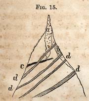
FIG. 15. [Trap dyke]
In this diagram the masses all belong to the eruptive rocks; but it will be observed, that the trap dykes were formed subsequently to the vein of iron, because one of them intersects it. The quartz vein is also cut by the dyke. But I have exhibited this diagram for the purpose of illustrating the general fact referred to; that the veins of the metals are accompanied with trap, which is eminently an eruptive rock; but they are never contemporaneous, and the trap is the intersecting rock, and of course runs in a different direction from the metallic veins.
Trap dykes, although troublesome neighbors to the miner, yet their indications are favorable; they are indicative of a mining district--especially when numerous.
The midland counties are traversed by three parallel belts of magnetic ore, or, in some places, the ore is changed to a variety called specular ore.
Beginning at the western part of the midland counties, the first belt to be described, passes from six to seven miles east of Lincolnton. It is the prolongation of the King's mountain ore, in Gaston county. The geological position of this belt is given on plate 14, section 1. It immediately adjoins or belongs to the belt of sediments which has been described
Page 114
as passing near Lincolnton. At Lincolnton, the rock is mostly a coarse light gray micaceous granite. Beds of slate, limestone and quartzite, succeed it on the east; but between this and the gneiss, a little farther east, are the veins of magnetic ore. The position of the narrow belt of talcose slate in which the ore occurs, is below or behind the heavy masses of granular quartz. These masses of quartz, as they are continuous from the South-Carolina line to the Catawba, are land marks for the position of the ore. There is no ore above the quartz, and I do not know that there is any in the gneiss represented as below the veins of iron in the section referred to. The careful consideration therefore of such relations, are of great importance; they furnish the clue to the actual position of the veins.
The rocks and ore taken in masses stand in this order, beginning our reckoning on the west:
- 1. Slate.
- 2. Limestone.
- 3. Fire Stone.
- 4. Quartzite.
- 5. Slate.
- 6. Magnetic Ore.
- 7. Feruginous Slate.
- 8. Gneiss.
- 9. Granite.
The quartz being a rock easily distinguished, becomes a guide to the position of the ore.
These ore beds or veins of which I am speaking, are situated six or seven miles eastward of Lincolnton, and upon the north side of the plank road. The limestone is a mile west of the belt of ore.
The ore is usually near the crest of a ridge, and here it traverses the parallel ridges, which, however, it crosses very obliquely. There is no instance in which the vein runs precisely parallel with a ridge, or follows it; it makes, in this instance, to the east. This fact should not be lost sight of in tracing the veins; they may be exactly upon the crest in one instance, but in the prolongation northward they will be found to have made to the eastward of the same prolonged ridge.
Page 115
The direction of bearing, as determined by the harder masses of rock, is N. 20° E.--and what is said respecting the bearing of the ore beds to the east, is true also of the rock and strata in which they occur.
* 130. Certain peculiarities respecting the veins of magnetic ore of Lincoln county require a notice in this place:
1. They are of a flattened oval form, that is, a vein is divided into sections, each of which partake of this form; the thin edge, perhaps, not making an outcrop at all, but is inclosed between strata and slate, which come together at the surface. This thin edge of ore, with its oval mass, lies obliquely in the slate, widening as it descends, until it reaches its maximum width, where it narrows below to its in inferior edge. The thickness of the upper mass may be less than twelve inches. This laps on to the west side of another flattened oval mass, which lies behind the first; but in its descent widens to a greater width than the first.
Some of the veins increase in width in this way, where, at the depth of sixty feet, they are six to eight feet wide. In working these veins, it is important to notice this arrangement, and especially the setting back of each oval mass; it invariably begins behind the upper, and against the foot wall. An arrangement of this kind is represented in Plate 10, in a transverse section of the auriferous vein at Gold Hill. It is not, therefore, peculiar or confined to the magnetic ore veins, but seems to be common to many kinds of veins of ores.
* 131. The ore of the veins under consideration is usually fine grained, or very rarely coarse; it belongs to the variety which is termed soft; that is, it breaks readily, and may be crushed in the hand. This softness arises partly from the mixture of talcose slate, by which the grains are separated from each other, and their coherence diminished. This fact exerts a favorable influence in smelting, as by it the ore is readily reduced to a size for the fire, and the fluxes to act readily upon it. It is also very strongly magnetic. The upper part of the veins have generally undergone disintegration, and the mass of ore is frequently in the condition of a slightly coherent red mass, which readily passes into the condition
Page 116
of a powder. On the outside especially this change has taken place, while the interior of a mass may be still occupied by a black unchanged ore, in the condition of grains. These changes are confined to the upper part of the vein, and only extend to that point where it is constantly wet.
These veins of ore in Lincoln county have been worked for a long period, and they have been and still are celebrated for the good quality of the iron which they furnish, especially when reduced with proper care. The iron has been famous for its toughness and great strength, and the facility with which it is made into blooms.
Messrs. Brevard and Johnson, are the principal owners of the depositories of ore in this belt. Being in the interior of the State, the only market which this iron finds is a home market; smiths generally obtaining the necessary supply from them. A much wider range of sale may be anticipated, provided Lincoln county becomes connected with Wilmington and the Seaboard, by means of a railway. The ore being inexhaustible, water power to move machinery being abundant, and more than all, a sufficiency of fuel for charcoal, makes the production of iron cheap. By aid of railways to take it to market, there is no question the iron may compete successfully with northern iron in a northern market. Charcoal iron must always have a preference over all others; and, for special purposes, no other can be used. For all uses where machinery is exposed to great strains, no other will do; especially, in those parts of a vehicle which are liable to break, as the axles of locomotives, etc.
* 132. The prolongation of the Lincoln county ore appears in the next place not far from the High Shoals of the Little Catawba.
It preserves the same relations to the slate, quartz and limestone, as those veins which have been already described. The character of the ore, however, in certain places, has changed. Near the High Shoals, or upon the property known by this name, there are three locations called banks, from which the ore has been obtained. The first is known as the Ferguson bank. At this place the ore is brown; it has
Page 117
become peroxidated, and has the color of snuff. The unchanged ore is largely intermixed with sulphuret of iron. It is unfit for bar iron, but may be employed for casting along with better ores; in small quantities it makes a smoother casting than the purer ores. When the Ferguson ore is entirely decomposed, it makes a very good iron in the forge.
The Ellis ore bank, is about three miles from the site of Fullenwider's old furnace. It lies in the direction of King's mountain. It is a black ore, and the vein is eighteen feet wide. Its direction is N. 20° E. It makes good iron, and is inexhaustible.
The Carson ore bank is the most easterly of the three. It is the common black magnetic ore, but is remarkably jointed, and hence breaks into distinct angular pieces. This property, or the High Shoal property, is well provided with the means for manufacturing iron; the water power, the ore and fuel for coal is abundant on the premises. It contains 14,000 acres of land, and the south east part of which is valuable for tillage.
The belt of ore with the same series of rocks continues to King's mountain, in the vicinity of which iron has been made for more than half a century. One of the principal veins is forty feet thick. The business is carried on by Mr. Briggs, who supplies the country with iron of an excellent quality. The general character of the belt is preserved still farther south. It passes into South-Carolina, extending to the Limestone Springs, in the Spartanburg district; or to the Broad river, where iron works have been erected.
In addition to the seams of magnetic ore which belong to this very extensive belt, there are beds of hæmatite near the top of King's mountain.
Crowder's mountain also furnishes the peroxide or specular ore near the top, and is said to constitute a vein six or seven feet wide. This I have not visited. It is evident, from the foregoing statements, that this important ore is widely distributed in Catawba, Lincoln and Gaston counties. There is no probability, however, that the ore has been discovered at all the accessible points. There is but little doubt, that upon
Page 118
this long belt, extending from the Catawba at Sherrill's ford to the Broad river in South-Carolina, at the Limestone Springs, other points not yet found will come to light, which will greatly add to the amount already known to exist. There seems, however, to be so much which is now accessible, that the inducements for finding more are not very imperative, even with those who are engaged in its manufacture; besides, the impossibility of taking it to a distant market, or one much beyond what may be called the home circle of trade, must remain for the present a drawback upon this branch of industry.
* 133. I have stated in what relation the foregoing belt of iron ore is found; that it is in close proximity to a narrow belt of sediments. I am not satisfied, however, respecting a question which might be raised, viz., whether it belongs strictly to this belt, and to the same epoch. I am inclined to regard it as an inferior series; but geologically belonging to the system of sediments which overlie those slates. But it is a question which is open for discussion; one which may be debated, or which is by no means satisfactorily settled.
* 134. The second belt of iron ore in the midland counties. It may be regarded as beginning in Montgomery county. It passes through Randolph county near Franklinville, thence into Guilford county, and appears again ten miles west of Greensborough, beyond which I have not traced it; and indeed do not know that on this immediate line of direction iron ore veins are known.
The ore is upon the land of Mr. DeBerri, and I believe is six or seven miles in a south west direction from Troy. The country about it is uncultivated, and covered in the immediate vicinity with the long leafed pine.
The relations of the ore to the surrounding rocks, is as follows:
- 1. Gold or Talcose Slate.
- 2. Quartzite.
- 3. Iron Ore.
- 4. Agalmatolite.
- 5. Talcose Slate.
Page 119
The beds are traversed by a narrow bed of hornblende, which, however, is not in a parallel position.
The mass of ore is about fifty feet wide. It occupies a heavy knoll or hill of a moderate height. How far the ore extends in the direction of its strike, I did not determine. It may be traced a quarter-of-a-mile, but being concealed by debris, its extent could not be determined without excavations.
At the surface it is silicious; but subordinate seams of pure heavy ore attest to the purity of the mass, as it will be found below.
This ore is a peroxide at the surface. Its strike is N. 30° E., and dip N. W. at a step angle. It is jointed, and breaks into angular pieces. The ore has never been noticed, and of course no trials have been made respecting the mode in which it will work, or the kind of iron it will make; but being free from sulphuret of iron, it is probable that the quality of iron will be such as to recommend it to the favor of iron masters.
About four miles in a northerly direction from Troy, and in a range with the ore just described, another series of veins are known, and which lie in the neighborhood of the Carter gold mine.
This ore is the magnetic variety, and much of it is in minute octahedral crystals. It is very friable, but is intermixed with talcose slate and grains of quartz, which contributes very much to its softness. The beds of ore differ in composition, but still it is no objection to the view which I have taken of them, viz., that they belong to the same epoch. It sometimes happens that a vein of specular ore lies by the side of a magnetic vein, being separated only a few feet.
In this belt or range the iron ore of Davie and Stokes counties should probably be placed. At rather distant points the ore of this belt appears in a range so direct, that there is no doubt of its passing entirely across the State. It lies parallel with the limestones and slates; but I am unable to trace these rocks across Catawba and Davie counties. We lose, after crossing the Catawba, the guides which I have spoken
Page 120
of. There is some doubt too, respecting the age of the limestone at Germanton; that is, it seems to be different from the King's mountain limestone, and still, if the iron ore is regarded as an eruptive rock, there will be no objection to combining the Davie and Stokes belts with the King's mountain belt, which passes through Lincoln county. The continuity of the belt is preserved better in the south than in Davie and Stokes. The ore of Davie presents great advantages for working, in consequence of the water power of the South Yadkin; and as most of the iron used in this and the neighboring counties is brought from Tennessee, it seems that even a home market is an inducement sufficiently great for the establishment of iron works upon the South Yadkin.
* 135. About three or four miles south west from Franklinville, in an uncultivated part of the country, I found heavy black massive magnetic ore in abundance, lying in loose blocks upon the surface. These masses I found in immediate proximity to a vein of magnetic iron, which appears to be of a superior quality. This vein, though not in an exact geological relation with those of Montgomery county, is still removed only a short distance from the quartzite. Its extent has not been determined, and cannot be, without the sinking of pits or uncovering the ore. I feel satisfied that it is extensive; and as it is near Deep river, its importance is enhanced by this circumstance.
Specular ore was discovered near Trogden mountain many years ago. The seam, however, is too inconsiderable to command attention. A shaft was sunk upon it before the present inhabitants settled this part of the country. The brightness of the ore probably deceived some discoverer, who mistook the ore for silver. Old crucibles and furnaces still attest to the unprofitable industry of some expectant of a fortune in the splendid lustre of this specular oxide of iron.
* 136. Ten miles west of Greensborough, in Guilford county, on a tract of land formerly owned by Mr. Coffin, two or more veins of magnetic iron of great purity were discovered several years ago It is black and middling coarse, and has all the external characteristics of a most valuable
Page 121
ore. It is unmixed with any substance which injures the quality of iron, and at the same time sufficiently soft to work easily, and make a tough iron. In New York, in the mineral districts where the magnetic ores prevail, it is regarded as an evidence, and in fact a proof, that an ore which crumbles in the hand, or is easily broken, will make a soft iron: while the hard tough ores, with a bright and shining lustre, will invariably make a hard iron with less toughness or tenacity, besides it is not reduced so kindly. The dull looking ores are always regarded as the best; those especially which become red upon the surface.
The ore which I am describing is a dull looking ore, but very heavy and free from rock.
The veins to which the surface ore belongs have never been uncovered or exposed. The distribution upon the surface indicates at least two distinct parallel veins. The surface masses become what is known as loadstone. They are not only thoroughly magnetic, but have two or more poles, and of course repel or attract the poles of a common surveyor's needle, according as the poles are north or south; north and south poles attracting, and north poles repelling. I may state in this connection, that a successful method of discovering veins of magnetic iron, is by means of a needle mounted like a dipping needle, but with one pole only. It is therefore made one-half of a thin bar of steel, and the other half of brass. On passing over a concealed vein of ore the needle is attracted; and when immediately over the ore, it points downwards. Its course of direction may be traced by the same instrument.
The ore upon the plantation of Mr. Coffin is between Brush creek and Reedy Fork. It extends north, and appears on the plantation of Mr. Joseph Harris, and onward to Rockingham county to the Troublesome, upon the plantations of John S. Morehead, Esq., where it is in great force; and south, it crops out on the plantations of Mr. Joel Chipman and John Unthanks. Thus it appears to form either another belt distinct from those I have mentioned, or a subordinate one. I mention it here as a subordinate one. The ore of Mr.
Page 122
Coffin's mine, even taken from the surface, worked easily, and made an excellent iron, which is remarkable, for surface ore.
* 137. The eastern or Chatham belt of iron ore is the least regular, as it now appears from my present information. Four or five miles from the Gulf, on the plankroad leading north, or towards Graham, the specular iron ore crops out on a ridge, on land owned in part by Mr. Evans. It is widely and profusely scattered over the surface, but it also appears in a heavy vein of rich ore some six or eight feet wide. This vein is in a talcose slate, and in connection also with a rock which is regarded as soapstone, but which is by no means magnesian; it is properly the figure stone or agalmatolite, and is known at many other places, in connexion with the iron ores. This vein I have traced three-fourths of a mile. It has a compact structure and a fine lively grain when freshly broken, and is entirely free from sulphuret of iron.
It will be seen from the foregoing brief statement, that this vein is an important and valuable one, being within a short distance of the Gulf, upon Deep river. The ground is descending to the river, a short distance only over the sandstone can be regarded as hilly. The raising of the ore too, will be attended with less cost than usual, inasmuch as the excavations may be drained for a long time, and will therefore save the expense of pumping by steam power.
Another seam or vein exists in this vicinity on lands owned by Mr. Glass. It is the crystallized specular ore, but I have seen it only upon the surface. Not far distant is the famous locality of hæmatite, usually known as ore hill. It occupies a knob some two or three hundred feet above the surrounding country. The ore lies in belts, which traverse the hill in an easterly and westerly direction. Quartzite forms the pinnacle of the hill, and as usual, is associated with talcose slate. The ore is more immediately associated with the latter rock.
It is from this place that the ore was procured mainly in the time of the revolution. The old excavations are partially filled. The ore is in large concretions or masses, which, in their general arrangement, lie across the hill. It is not, I believe, in one body, as has been supposed by many. The
Page 123
quantity I am unable to estimate; but appearances go to show that it must be large.
Some of the first ores of this neighborhood I found upon the plantation of Mr. Heading. It is magnetic, and resembles very closely the kind I have already spoken of in Guilford county, on the plantation of the late Mr. Coffin. I have not, however, seen the vein from which the remarkably fine specimens were derived.
Magnetic ore of a fine quality exists also on the plantation of Mr. Temple Unthanks. It is two or three miles beyond Mr. Evans' vein, and about three-fourths of a mile from the plankroad. The vein varies in width from one to three feet. From the foregoing statement, it will be perceived that in this part of Chatham county there is a valuable mineral district; furnishing three species of iron ore, the hoematite, magnetic, and specular. These are the principal ores from which iron is obtained. These repositories also contain ore of great purity, differing from each other, however, in richness and other qualities; a fact of considerable importance in the manufacture of iron. It is by a combination of different ores, possessing different qualities, that the manufacture of this metal is facilitated, and by which one possessing the most desirable qualities is obtained. I shall have occasion, however, farther on, to add two kinds of ore to the foregoing list; that of the hydrated oxide, mixed with carbonate and the celebrated ore called the black band, which belongs to the coal formation of Deep river. It is this first from which Pennsylvania manufactures her iron principally, though not entirely. Her iron masters also use the magnetic ores. The two kinds are mixed. Experience proves the value of the method. But who would suppose that iron masters, in order to obtain the results they seek for, could afford to transport the magnetic ore from Essex county, in northern New York, to Pittsburg? and yet thousands of tons are annually sent there for this purpose.
Chatham county, however, can furnish within the radius of seven or eight miles, five kinds of ore in abundance. It appears that the ore of this coal field, though less in extent
Page 124
than that of the true carboniferous in Pennsylvania; yet, there has been deposited in this formation, iron ores on as large a scale as in the true carboniferous. Many are slow to believe it, but I do not see any way to avoid the conclusion, seeing that an outcrop of it may be traced thirty miles. These beds, too, have been cut in the great shaft at Egypt, a thousand feet or more within the outcrop. But this is not the place to enter into a statement of details concerning this great deposit of iron ore. I shall give all the facts respecting it, when this formation comes up in its proper place for consideration.
But, one word more respecting facilities for the manufacture of iron upon Deep river. It has been supposed that Pennsylvania must enjoy a monopoly in the manufacture of this indispensable metal, in consequence of the extent of her possessions, and the vast amount of anthracite which she can employ. Of the extent of her resources in this respect no one can doubt. She can make iron cheaply by her anthracite, but no cheaper than it can be made on Deep river by bituminous coal or coke; and coke-made iron will be as good as that made by charcoal, in consequence of the purity of the bituminous coal on Deep river. And in the manufacture of coke, I believe products of distillation may be obtained which will more than pay the cost of making the coke. But this is a matter to be tried, and does not properly come in for consideration now. What I wish to say is, that in the coal of Deep river, the manufacturer has all the material he can want for this purpose; and if a better article of iron can be made from coke than by anthracite, then, in a district of equal extent, North-Carolina has advantages over Pennsylvania, for the manufacture of iron. In proof of this, I repeat that she has, 1st. The peculiar ore of the coal fields; 2d. The magnetic, specular and hæmatitic ores of the primary and palæozoic rocks in immediate proximity; 3d. The use of coke by which to make the iron; 4th. A fine agricultural region for the cereals, and 5th. A milder climate and rivers both for moving machinery and transportation, which is unobstructed in the winter. The cost of living, and the means
Page 125
for conducting the business, will be much cheaper. These advantages are too obvious to require comment or farther explanation.
* 138. Iron ore may exist in districts where it can be of little value only; there may be a destitution of fuel, or a want of water-power, though, with respect to the latter, it can be dispensed with when there is an abundance of the former.
In the first belt described, that which belongs to the King's Mountain belt, there is yet timber and wood for a supply for many years, I know not how many. The country is yet thinly settled, although it was cultivated before the day of the famous battle of King's Mountain. Oaks, chestnut, pine and hickory yet cover the ridges and plane-grounds of the Great and Little Catawbas. The water-courses furnish all the power required for moving machinery. It is strictly a district created for manufacturing purposes, supplying in itself all that is wanted to conduct the various manipulations required in creating what may be termed the raw materials for the arts.
The second belt, that which begins in Montgomery county, and passes through Randolph and onwards in a northeastwardly direction, is also supplied with timber, and wood and water-power. The forests of the long-leaved pine, still untouched by the boxing-axe and scraper of the turpentine merchant, are certainly the finest in this or any other State. The hills of Randolph are still clothed with trees.
The third belt, that which belongs to Chatham county, but which also passes into Orange in the direction of Red mountain, to which the belt of iron ore is prolonged, has its forests of long-leaved pine, as well as its oaks, ash and hickory timbers. Rocky river, Deep river, Haw and New Hope, furnish all the mechanical power required for moving machinery.
It is evident, therefore, after a careful examination of the premises in each belt, or district, that there is not lacking any thing, which is necessary for the successful prosecution of the iron business--except capital. The great highways
Page 126
are being opened to market, and I see no reason why capitalists may not now step in and reap the harvests.
There are still subordinate deposits of iron ore which have not been mentioned. In Johnston county, four miles west of Smithfield, there is a large deposit of hæmatite. It is connected with the quartzite of the locality. It is in the geological position in which it is common to find large accumulations of ore. It is in this respect situated like those of Berkshire county, Massachusetts, and Cherokee and Lincoln counties, North-Carolina.
Seven or eight miles south-west from Raleigh, in Wake county, the rock is an argillaceous slate and chloritic slate. Near Mr. Whitaker's, a bluff of hæmatite, in the hydrous peroxide of iron, is displayed very prominently. The whole formation is similar to the locality already described, near Smithfield, Johnston county. A thin seam of copper pyrites has been noticed in the same formation, in a vein stone of quartz eight inches wide, but it is of no account. The argillaceous slate resembles that of Davidson county.
Two miles south-west from Licolnton, Lincoln county, there is a fine bed of hæmatite which was not noticed in its proper place.
In Orange county, also in the range of Red mountain, extensive ore beds have been discovered, as I am informed by Mr. Gillis, of Granville county, who made explorations for me in this part of the State, and which I state on his authority.
In conclusion of this branch of the report, I have no hesitation in assuming the responsibility of assuring the citizens of North-Carolina, that the quantity of iron ore in the mid-land counties is enough to warrant the establishment of furnaces or forges, for its manufacture in all the districts which I have named. It is not so much, however, a question of quantity or quality as of expediency, at the present time. The time for moving in enterprizes of this kind, must be left to the judgment of parties. The great drawback, as all know, in this business has been the expense of carrying the manufactured article to market. This bar to the enterprize it
Page 127
is hoped and believed is about to be removed--is removed in some of the districts referred to.
Carbonate of Iron, or Steel Ore.--The localities of this mineral are rather numerous in North-Carolina. It is not yet determined, however, whether they possess any value as iron ore, for the production of iron. That it is frequently valuable as a flux for smelting copper is conceded, or has been proved by trial. The drawback upon this species of ore, for the production of iron or steel, lies in the presence of copper pyrites. It is not in beds, but an associate of other metals or ores, and is their vein stone, and hence is more or less intermixed with them. But in parts of several mines, as the North-Carolina copper mine, the copper is absent, and it is only intermixed with quartz.
In the vicinity of Gen. Gray's, upon the head waters of the Uwharrie, carbonate of iron is a very common substance. Upon the plantation of Mr. Johnson, a vein composed mainly of this substance has been exposed, by sinking two or three shafts, for the purpose of testing it for gold. This vein is pure enough for making iron. It carries gold in its quartz, but the quantity of the sulphurets is inconsiderable. I observed it at several places in this district. It is not however expected that this ore will be used by itself in the manufacture of iron. But where it exists in the vicinity of other ores, it will form an excellent addition as a flux, while it will also control the quantity of reduced iron, in the ultimate result.
Recapitulation of the leading facts respecting the Ores of Iron.--1. The ores of iron, although they do not make an extraordinary show upon the surface, yet, it will be seen from the foregoing statements, that they constitute an important source of wealth.
2. These ores embrace those which are known to be the most important ones for the production of iron, and embrace the brown oxides, or hæmatites, the specular and magnetic, or black oxide of iron.
3. They are distributed in the midland counties in belts, and though it cannot be shown that they form continuous
Page 128
masses or veins, still they lie in certain ranges, through which they may be traced, and upon which they appear at the surface at intervals.
4. They belong to both series of rocks, the pyrocrystalline and sedimentary; in both they occur in veins, which of course proves that they belong to a later period than that to which the rock itself belongs.
5. Those veins which belong to the sediments appear to hold a fixed relation to the quartzite or sandstone near the base of the Taconic system, being, so far as yet known, behind or beneath it, in slates which may be termed the bottom rocks of the sediments.
6. The hæmatites accompany, in several instances at least, the quartz rock already referred to; and they bear the marks of having been derived from pre-existing ores.
7. Experience has proved that the magnetic ores make a superior iron. The specular has not been tested in the furnace or forge, but their purity is a sufficient guarantee of their value.
CHAPTER XX.
Repositories of the Metals continued.--Gold and its position, relatons, etc.
* 139. The gold of North-Carolina belongs to four different geological positions: 1. The loose quartz grits beneath the surface soil; 2. In stratified layers, which are cotemporaneous with the rock; 3. In connection with seams and joints of the rocks, and probably also diffused in the mass; 4. In regular veins associated with quartz, and the sulphurets of iron and copper.
Page 129
The quartz grits form loose beds, in which, as the name implies, quartz is the characteristie mineral. It is both angular and rounded, and is invariably made up of broken down quartz veins, which were auriferous. This grit rests usually on the rocky bed below, it may be granite, slate or hornblende, or almost any rock.
The origin of this grit and the gold it contains, belongs to the present epoch; and the formation of it is due to the action, in part at least, of existing forces.
In every region of the State where gold is known, this formation is known; it is coextensive with the auriferous formations. It is, however, variable in thickness, depth and richness.
We do not, however, know when or how long ago the disintegration of the gold rocks of this State began. The rocks themselves are the oldest, and as they have not received upon them other deposits than those which are derived from themselves, it is clear that the process of disintegration may have been going on from the remotest periods; and hence, the oldest of the quartz grits containing gold may be contemporaneous with the Silurian system. What I have said in a foregoing paragraph respecting the age of the auriferous grits, means merely that the process is going on now.
A large proportion of the gold which has been obtained in all periods, has been obtained from this formation. Most of the gold from California and Australia is taken from it. All the large pieces come from it. A fact of curious import. Very few instances have occurred of lumps weighing several pounds which were still imbedded in the vein, though vein stone is usually attached to those which are found in the soil. In Catawba county, at the Cansler and Shuford mine, pieces weighing over a pound have been taken from the rock near the surface. It does not appear necessary to dwell upon these deposits of gold. They are well understood in this State. It may be useful to state that in forming an opinion of the richness of a vein, or of the rock which forms the deposit, it is necessary to make a great allowance; it is not safe to infer from a rich washing that the vein must be
Page 130
rich also. The gold has been accumulating, it may be, for a long period; and a large quantity of vein or rock has contributed to the amount of gold obtained. A sauce pan full of debris gives a grain or two of gold perhaps, but it may be, that originally, this gold was distributed through twice the quantity of material taken for the experiment; or, to take another case, it often happens that the gold is unequally distributed in the rock or vein, a very rich spot may be hit upon, which was derived from a single spot in the vein. This result would give no criterion by which to judge of the richness of the whole vein. It is hardly necessary to say that many experimental tests should be made, before a conclusion is formed of the richness of the rock from which the gold came.
* 140. The second geological position in which I find gold, is in layers or beds in the rock with which it is contemporaneous. If this view is correct, gold is a sedment; and belongs, as I shall show, to the palæozoic period. I do not know that we could infer this from its occurrence in the quartz grits which have been spoken of, though we might probably be satisfied that this formation belonged to a distant epoch.
These ancient auriferous deposits may be distinguished from veins by the absence of walls; there is really no line of demarkation between the auriferous layers and the adjacent ones. They can be determined only by testing, except by miners, who have become perfectly familiar with the bed or layer; even those are not aware of a change, except by the absence of gold, or until it is proved by panning. A slide, for example, has taken place, the auriferous layer is shifted; yet the miner works along the plane of dip, and only discovers the absence of gold in the mode I have stated. These facts go to prove most conclusively that a fissure never was formed, and that the layer has become auriferous by the deposition of gold, in company with the sedimentary matter which forms the layer.
I am not able, at this time, to state how widely gold is disseminated in the palæozoic rocks; but from indications derived
Page 131
from a few facts, it appears probable that it may be widely diffused or contained in most of the rocks in North-Carolina which belong to the Taconic system. Thus, in Randolph county, small quantites of gold may be obtained from every ravine, and frequently from the surface soil in which there is not a particle of quartz grits; it seems therefore to have been derived at large from the rock, and not from broken down veins. But it should be understood that the strata in which the quantity is sufficient to pay a profit, are rare.
* 141. The first deposit to which I shall call the attention of the reader, is known as the Jones mine. It is situated in Davidson county, about three miles east of Spencer's post office. It is near the line of Randolph and Davidson counties, and about three-quarters of a mile from the main road, and near the dwelling of Mr. Arnold. At this mine, the gold is disseminated through a mass of soft reddish talcose slate, sixty feet wide. The auriferous part of the rock may be, perhaps, more deeply tinged with brown than the rest of it, but it scarcely differs from it. The auriferous particles are evidently a decomposed sulphuret of iron, and probably of fine particles of quartz; for in the richest part of the mass, the fine quartz is more abundant than the talc. The whole has the softness of the talcose slates or a magnesian rock; a microscope proves that the fine quartz is the most abundant material.
The breast of ore as now exposed is sixty feet wide, and from twenty-five to thirty feet high. This part of the rock may be broken up by the hand, and when it is undermined, large masses fall of their own weight into the pit. Hence, it is easily quarried, the mining consisting mainly of cutting out large slices of the rock by picks, wedges, etc. The main mass yields from ten to twenty-five cents per bushel of ore. Fifteen cents is an average, I believe, for the whole breast of sixty feet. The abundance of ore, the softness of the rock which enables the owner to work a large quantity per day, places this mine among the valuable and paying ones in the State, notwitstanding the small per centage it yields in the mass. Ore of this description pays more than the evpenses
Page 132
of mining and separation of the gold, provided it yields only ten cents per bushel. This statement will be confirmed, when it is proven by experiment that six and seven hundred bushels may be worked per day, in consequence of the condition the ore is in, and the facility with which it is mined; hence mines of this description, if properly worked with the few laborers which are required, may become the most profitable as well as the most valuable of the class.
Although I have classed this mine with the sediments, it is still important to inform the reader, that immediately adjacent to the auriferous mass on the south and south-west, there is a heavy bed of porphyrized rock. Its presence suggests the inquiry, whether the agent which changed this mass had any thing to do with charging the rock with gold? That fissures are charged with metallic matters by emanations, seems to be proved. The case, however, under consideration presents itself under different circumstances; and though I would not deny the possibility of charging a mass of rock with gold in combination with the volatilizable sulphurets, still I cannot but regard the idea of its accumulating as a sediment, as the most simple and probable.
* 142. Within a mile of the Jones mine, two other mines of this class have been worked--the Lafflin and Delft mines. The first yields thirty cents per bushel of ore. The material is similar to an impure porcelain clay, or it is a pasty mass, forty feet deep, and mostly contains gold--especially those parts which contain black sand. It is a decomposed talcose slate.
It would be superfluous to repeat what has been already said respecting the Jones mine. Less is known of the Delft, however, than of the Lafflin mine, which is now proving itself the best of the three. They are supposed to belong to the same series of beds. In neither of these mines is it possible to discover walls which in any sense bound the auriferous mass.
* 143. Another in Randolph county, which is similar to the foregoing, is the Robbins mine, which is near the plankroad between Asheborough and Hunt's store, but is in an
Page 133
obscure part of this section of the county. The thickness of the auriferous mass seldom exceeds two feet. It is, however, rich only through the thickness of a few inches. It has been worked sixty feet in depth, but at this point the auriferous mass is much harder than above; the sulphuret of iron is undecomposed, and the consequence may be foreseen, that the expenses of mining having become greatly increased, while the gold obtained is less. The slate, which is brown, reddish and soft above, is blue and hard below; and the sulphuret of iron which carries the gold, is visible and unchanged. Portions of the layers of this mixture yielded a dollar per bushel; but its average is about fifty cents in the mass.
* 144. The well known Sawyer mine in the same county may be regarded as belonging to the sedimentary class. At one time it was worked with great success and profit. Circumstances not connected immediately with the value of this mine, led to its abandonment several years ago. The bed ranges N. 50° E., and dips at an angle of 75°-80°. The material is a fine grained talcose slate, and disintegrates and forms a fine white sand. Its beds, therefore, are siliceous. This mine has five or six parallel beds which are worked in a single tunnel or gallery. It has yielded six to ten dollars per bushel of ore, taken from certain parts of the beds. But narrow films of ore of reddish color sometimes gave ten times as much. Overlying these beds, is a porous black rock, highly charged with sulphuret of iron. Although rich in sulphuret of iron, which in this district is the principal vein stone, yet it contains no gold. This mine has always been worked with profit; but the person who leased it during the last five years died, and no record of its monthly or annual profits are accessible.
* 145. The Howie and Lawson Gold mine in Union county. This mine is situated in the hills of Union county, adjacent to the State line, dividing North from South Carolina. This is probably the most elevated part of the country. The rock of the county is mostly a clay slate; but the hills about the Howie mine are harder, and seem to be intermediate between a fine talcose and a clay slate. The bearing of the
Page 134
slates is N. 55° E., and the dip nearly vertical. Three distinct parallel beds have been worked, all of which being deposits, are of course parallel with the direction of the bearing of the rock.
The auriferous beds differ from the common slate beds in their hardness, which arises from a larger proportion of quartz, which is either disseminated or in seams, or intermingled with them irregularly. The quartz is fine, white, and granular; but on its surface of contact with slate it is mottled or speckled with brown oxide of iron. It is upon a surface bearing this peculiar aspect that the gold becomes visible. Small cavities, partly in the quartz and slate, show numerous particles of gold; and some surfaces in the richest parts of the beds are covered sufficiently to be polished, upon which the gold forms a perfect film, as if covered with gold leaf. The beds are variable in width, but the same seam is not uniform in this respect. The thinest is six and the greatest thirty inches. When the seam or bed is only six inches, it is difficult to follow it in depth, in consequence in part of the slight difference between the auriferous and nonauriferous beds; and besides, a slight displacement increases the difficulty. The thin beds, however, have been followed in one or two instances to the depth of eighty feet. The amount of gold yielded per bushel has been variable. Probably the average amount, when worked by the owners, was three dollars per bushel. But the statements gave more than this. The uniform testimony of those who were concerned in working it was, that there were places where they obtained one dollar and a half per bushel. I obtained from specimens I procured during my examination at the rate of eleven dollars per bushel, a bushel weiging one hundred pounds. The beds are nearly vertical. They have been traced three-fourths of a mile. An auriferous vein of quartz intersects these beds, its bearing is N. 70° E. Some portions yield two dollars per bushel, but the gold is distributed unequally through it. At this locality, therefore, we have two kinds of repositories of gold, each preserving its own characteristics.
The Howie and Lawson mine belongs to two estates. No
Page 135
one fact probably goes farther to prove the estimated value of these deposits of ore, than the practice of keeping a plumb line suspended over the exact boundaries, the object of which was to prevent an encroachment upon their respective premises. The miserable system prevailed of leasing the mine in small parcels; and hence, they were worked without system, and by excavating an open trench. These parties were usually men without means; and hence, when their trenches extended to water they were abandoned and another place sought, where the same plan was pursued. The result which followed was the abandonment or suspension of the operations. These valuable mines are, however, now in the hands of one*
* Commodore Stockton.
who will pursue them with scientific skill.
* 146. One of the most interesting instances of the occurrence of gold in the consolidated sediments, is at a place called Zion, twelve miles from Troy, in Montgomery county. It is both interesting and important, because here the fact that gold is a sediment, is attested by the presence of fossils. This locality has been already described; and the geological position of the rocks stated. The series consist of sandstones and chert, which rest upon a thick mass of brecciated conglomerate, which in its turn overlies talcose slates.
Those parts of the rock which contain gold are brown and of a loose texture from the presence of the oxide of iron, which undoubtedly originated from the sulphuret of iron which is sometimes visible in the rock.
The gold which has been obtained was derived from the debris of the rock, but the rock itself sometimes shows particles of gold. The position which seems to have furnished the most gold is near the bottom of a hollow, or near the head of a ravine towards which the rock slopes on all sides. The drainage of these slopes begins in the granular quartz, and the small stream which originates upon these slopes does not pass over an eruptive rock of any kind. There is, therefore, no doubt respecting the beds from which the gold is derived.*
* The geological position of these beds is illustrated in Plate 14, section 2.
Page 136
No other locality except this furnishes fossils. With respect to other localities geologists might probably differ as to the question of the sedimentary origin of the gold, though there seems to be sufficient evidence, that in those cases already described, they belong to the same mass. I have already stated that other localities furnish the fossils in which the rocks of Zion abound, but I am not aware that they furnish gold also. It is doubtful whether they have been tried. Notwithstanding the evidence there is of the sedimentary origin of the gold, it is a curious and interesting fact that it is visible in seams*
* These seams are seggregations of quartz which sometimes pass through a fossil; they have no connexion with distinct and regular veins.
which traverse the rock. Its relation in these cases shows, however, that its position has changed since it was deposited. If the rock was not proved to be a sediment, its position and relations might be explained by some geologists by aid of the igneous injection. But this application of the igneous theory cannot be applied in this case. There is one fact respecting the distribution of the gold in these sandstones in which it differs from that of the slate, it is more generally distributed in the rock, though it is more abundant in certain localities than in others. The gold in the slate is frequently confined to a single bed and only a few inches thick, and the line of demarkation between the auriferous and non-auriferous parts is indistinctly defined.
As a mine, the Zion locality has never been regarded of sufficient consequence to be named, and it is unknown out of the neighborhood in which it is situated; yet I was informed that over one hundred thousand dollars had been obtained from it.
Page 137
CHAPTER XXI.
Repositories of the Metals continued--Gold associated with Quartzite and Slate, and frequently in irregular veins--Seams and natural Joints.
* 147. This class of deposits partakes of the characters which belong to the sediments proper, described in the preceding chapter, and those in which the metal is distributed in regular veins.
The Ward mine, in Davidson county, belongs to this division or class; and its description and the accompanying illustration will show what characteristics distinguish it from those to which it is allied.
The gold of the Ward mine is connected immediately with quartz seams or irregular veins; those which do not extend continuously through the rock but terminate in it, and which do not pursue the usual direction. There is no direction which they can be said to pursue in the main. The quartz is subordinate to slate; but I am not aware that the latter contains gold, except when it is in contact with the former, or is distributed in the natural joints, which usually contain a film of quartz. The distribution of the metal too is irregular, and is found in pockets or bunches, some of which are very productive; hence, there is more uncertainty in the results, and the mining operations cannot be conducted in a manner so systematic as when distributed in regular veins.
The quartz at the Ward mine occupies the crest of a knoll, and it is so massive, I think, that it is rather one of the principal rocks of the formation than a vein. Indeed, it is dissimilar to the quartz which usually fills a vein fissure; it is a mass of quartzite in a drab colored slate; subordinate also to the main mass, but separated from it by slate. In fact, the knoll is made up of reticulations of heavy beds and thin seams, which intersect the slate in many directions.
Page 138

FIG. 16. [Quartz vein]
Figure 16 illustrates the character of many of the intersections which occurs, 1, 1, is a vein of quartz two to three feet thick, 2, 2, seams passing out from it. Now the main mass of quartz is too poor in gold to be worked, and it is probable that it is rather confined to its junction with the slate; but the small seams 2, 2, are frequently rich. The large vein runs about east and west, and dips to the north at a steep angle. But the large mass of quartz upon the summit of the knoll appears to take the usual direction of the beds of this system, that is north east and south west. The mining has been confined to the south of this great mass of quartz, and hence, as it is not exposed by cuts, it is still uncertain in what light to regard it. It resembles, in a few of its characters, the fossiliferous quartz of Zion, Montgomery county, and the silicious slates contain almond shaped concretions.

FIG. 17.
The gold of this mine is crystallized. The crystallizations, however, take the skeleton form, in which the faces of the octohedron are represented by lines and not by smooth faces, as in the annexed figure. The crystalline pieces occur in the form of arrow heads, spears, angular plates, etc. A very large proportion of the gold is crystalline. The pockets containing crystals usually lie in a red siliceous clay, which has been derived from the rock in contact with a seam of quartz. Some of the pockets have furnished five or six hundred dollars of crystallized gold.
The greatest quantity of gold, however, has been obtained by washing the soil, and hence it comes under the usual denomination branch mine. Several acres have been tested by
Page 139
panning, and the results obtained show that gold is widely distributed in the immediate vicinity where the principal workings have been carried on. The value of this mine is not yet determined, as it is only very recently that the work has been conducted with system, and a proper attention to the peculiarities of the repository.
* 148. The Hoover Hill gold mine, of Randolph county, may be classed with the foregoing, as the metal is distributed in irregular branching seams which spring from a heavy mass of tough quartzite.
The rock is traversed by two systems of joints, and which may have been developed by a porphyrized dyke, whose direction is N. 20° E.
The Hill is intersected by many cuts running in different directions, which pursue the seams of quartz or the joints by which it is divided. These joints have frequently given a rich return, but too frequently the dishonest miner has filled his bucket with the rich auriferous dust, and appropriated it to his own use. If reports are correct, no mine has suffered so much from the pilfering system as this.
The great drawback to a successful prosecution of mining is the hardness of the rock which has to be encountered in driving upon a vein of ore. The system of leasing it in parts too has injured the owners of the property, all of which has finally resulted virtually in its abandonment, until the obnoxious leases shall have expired.
* 149. Cansler and Shuford gold mine, in Catawba county. This mine is sixteen miles north easterly from Lincolnton, and about six miles south from the ford. Both the soil above the rock and the soft reddish rock itself yields the metal, but the most productive parts of the rock are the natural joints and quartz seams. A large quantity of gold has been obtained, and pieces in proximity to the natural joints have been found, which weighed a pound. These have an entirely different form from most of the native gold. They are made up of slightly coherent plates separated by slate or talc, but the whole so adherent as to require the tearing or rending of the gold, in order to effect a separation. Small lumps of
Page 140
gold of this structure have been quite common. I shall not attempt to account for this peculiarity in the form of the gold, when found in the connexion stated. When gold has been separated from its mechanical combination as it exists in pyrites, it is cast down on the quartz in the form of a plate, or lamina. The force employed in the separation and final deposition upon the quartz, or upon a seam, or in a natural joint, may have been electro-magnetic. Practically, it is important to be informed respecting the position in which it is to be found in repositories of this kind.
The Cansler and Shuford mine has been worked profitably from its first opening. The want of water is the greatest obstacle to a still more profitable result than has yet been obtained.
* 150. The Portis mine, in Franklin county, (if descriptions can be relied upon,) may be referred to this class. It belongs to the Taconic slates, and is therefore in the same geological position. No vein has ever been discovered; and hence, it is probable that the seams of quartz and seams in the slate have been broken down, and their contents mingled in the soil. It has been remarkable for the quantity of gold which has been found in lumps.
* 151. The Parker mine of Stanly county I believe should be ranked in this class, inasmuch as no vein has been discovered which carries gold. The rock is a decomposed mass, rather tenacious; but the gold is distributed in scams. Some deep excavations have been made. Two hundred thousand dollars in gold have been obtained from this material, which it is needless to say differs from the auriferous quartz grits of the branch mines. Several masses weighing four and five pounds were taken from the surface. The whole area, composing three or four acres, seems to be a decomposed slate through which the metal is distributed.
The Beaver Dam mine, in Montgomery county, may be classed also with the Portis and others, in which no distinct or main vein has been, or is likely to be found; and it is a matter of considerable importance to know that mines of this character have the gold attached, or in connexion with, their
Page 141
seams or strings as they are frequently called; for large expenditures have been made, and are likely still to be made, in attempting to discover a vein which does not probably exist. Therefore, it appears to me, that when the gold occurs in the mode I have represented, it will be a waste of money to cut deep trenches, or resort to other measures to discover the vein. At the Ward mine quartz is not wanting, but the largest masses are not auriferous.
The Beaver Dam mine has been very productive, if the accounts I have heard of it can be relied upon. It is the testimony of men worthy of confidence; and it is interesting to know that all of the mines which I have placed in this class of repositories have yielded large profits, and none of them have been abandoned. The Hoover Hill mine has not been worked very vigorously of late, and I believe has paid only moderate profits. They have all furnished, especially those which are slaty and traversed with strings of quartz, many large lumps of gold. Of this number is the Beaver Dam, the Ward mine, Cansler and Shuford, and the Portis mine. This has been rather a common occurrence at the latter.
CHAPTER XXII.
Repositories of the Metals continued.--Veins belonging to the Slates.--True Veins.--Arrangements of the materials filling the Fissures.--Right running Veins, or cross courses.--Conrad Hill Gold Mine.--Description of its Veins--their Characteristics.
* 152. Veins are the most productive, as well as the most permanent repositories of the metals. These I have defined as fissures in a rock which have been filled with the metals,
Page 142
their oxides, sulphurets and other chemical combinations, together with the stony mass with which they are associated, which is called gangue or vein stone.
The metals or their combination with sulphur and oxygen are scattered through the vein stone in masses of different sizes, and when about to take the form of a vein, become elongated or wedge form in planes parallel with the walls. Veins pursue a certain uniform direction in every mineral district. In North-Carolina this direction is usually east of north; and it coincides very nearly with the strike of the beds. But while this direction coincides nearly with the strike of the rock, and hence some geologists maintain that they are merely beds; it is rarely, if ever, that they coincide with the beds as they descend into the rock. This want of conformity to the layers or strata, places these repositories in the class which are properly termed veins. It is doubtful too, whether there is a coincidence in their strike with the planes of bedding, or their coincidence can be claimed only for short distances.
The metal in a promising vein, in addition to its distribution through the gangue in masses, is also accumulated upon the foot wall; it may change its position, but its usual place is there or in the middle of the vein stone, and rarely against the roof or hanging wall. The most promising plane, as I have remarked, is its accumulation in a belt or zone against the foot wall. But this is more obvious in the case of the sulphurets than in gold veins, in which the gangue is quartz. If the gangue is sulphuret of iron and quartz, more gold will be found adjacent to the foot wall than against the hanging wall.
It sometimes happens that more than one set of veins crop out and form another series, which run nearly a parallel course among themselves, or they may be divergent from each other. In determining which should be regarded as the right running veins, it is necessary to inquire what is the usual direction which the veins of a country or district pursue. In North-Carolina, this direction, as I have stated, is east of north, though a few instances occur in which the direction is
Page 143
a few degrees west of north. The variation in the extreme is from N. 10° W. to N. 70° E.; but usually only N. 45° E. Veins, therefore, which run within the limits I have stated, may be called the right running or normal veins. Those on the contrary which clearly intersect these, should be regarded as cross courses or cross veins. Instances of cross courses, however, are not numerous in the mining districts of this State.
* 153. The mining property, known as the Conrad Hill, is situated in the north part of Davidson county, and about six miles east of Lexington, its shiretown. It is favorably located, and its reputation as a mining property has stood high. It has been worked only for gold, though, as I shall show, it is highly probable that it will be hereafter more profitable for its copper ore. It has been impossible to ascertain how much gold this mine has yielded, as it has been in the hands of several persons since it was discovered.
The surrounding country is interesting, from the character of the rocks and the number of metallic veins which are known to exist, and many of which have been profitably worked. The Three Hat mountain is upon the south, which rises probably a thousand feet above the surrounding country. Its rock is quartzite, and a large portion of its surface is covered with a slaty chert, exceedingly hard. Between the mountain and Conrad Hill there is a deep valley, and upon the ascent towards the hill there is a trapdike running about north east which is one hundred yards thick. The veins cross the highest part of the eminence already spoken of, and in passing onwards in the direction of their strike, cross a valley about five hundred feet wide; after which, they reappear on another eminence called Dodge Hill.
Conrad Hill is elevated only eighty-eight feet above the plain just south of it, and through a part of which the heavy eruptive rock passes. It is rounded, and slopes in all directions; but the greater slopes are upon the south and south west sides. The property is divided into two parts by a north and south line. The east side is Conrad Hill proper. The veins all crop out on the east side of the division line; but as
Page 144
they dip north westerly, those near the line pass beyond the limits of the Conrad Hill property. This line, however, has no connexion with the formation, and hence requires no farther notice.
The repository of the gold is quartz, which carries the metal intermixed both in the quarts, carbonate of iron, and in the sulphurets; the latter of which are decomposed, and the only remaining element, iron, is in the condition of a hydrous brown oxide as usual.
* 154. The metal of this hill is collected in quartz veins. While the quartz carries gold by itself, we find it also in the sulphurets which the quartz contains, and probably these sulphurets are the true auriferous compounds. To a superficial observer, or to one who is not fully informed of the facts respecting gold bearing rocks, they would be led to believe that the quartz, and a brownish or ferruginous substance constituted the only matrices for gold. But here, as elsewhere, the undecomposed sulphurets are rich in this metal, although it is difficult to obtain it from them. When, however, these sulphurets are decomposed by atmospheric agency, the gold is disengaged from its combination, and hence, is obtained by the simplest processes imaginable.
* 155. The veins of this hill have been worked only to the depth of one hundred feet, and in but few places to that depth. Hence, I am led to believe that large quantities of ore still remain accessible, and may be raised at a profit by its proprietors. Shafts have been sunk to the depths of ninety-eight feet, and in one case to one hundred and seventeen feet below the surface of the hill. The deepest shaft, is that sunk upon the west slope of the hill. The veins which have been explored at all, have been worked to about the same extent as to depth and length; probably the depth will average eighty feet, and in length one hundred feet, the maximum length, I believe, will not exceed one hundred and fifty-five feet.
* 156. The structure of Conrad Hill is interesting and instructing both to the geologist and practical miner. It furnishes those phenomena which are of a decided character

Pl. 13. [Plan of the veins of the Conrad Hill mine, Davidson county.]
Page 145
The veins are bold and strong, and yet free from disturbances and shifts, which so frequently perplex the miner, and occasion solicitude and expense to the proprietors; and which also sometimes thwart the skill of the most experienced workman. Notwithstanding the veins are all bold and strong, yet differences of opinion exist as to their number as well as to their relations. This, however, does not arise so much from the existence of an intricacy in their relation as from a want of a few suitable cross-cuts at the surface. In describing these veins, I shall express the views which I have obtained from a personal examination, though they may differ somewhat from those who have been employed for years in this group of veins.
According, then, to my own examination, I am disposed to maintain that upon Conrad Hill six distinct veins may be pointed out, viz., three normal or right running and nearly parallel veins, and three cross veins. The first class lie directly behind each other, but do not crop out at equal distances apart. Their parallelism is confined to their strike, and they differ in their angles of dip. The three cross veins do not appear to be parallel with themselves, or with the normal veins, either in strike or in dip. But it is somewhat remarkable that five of them are gold bearing; but the sixth, which has not been worked by the proprietors on either side of the dividing line is supposed to be barren. The cross vein which has not been worked, was pointed out to me by Mr. Camman. If the characteristics are those which he stated, it is to be numbered among the veins of the Hill. Those characteristics are direction and dip, the further consideration of which I leave for the present. The sixth vein which I have reckoned as distinct, and entitled to a place in this group, does not appear at the surface--and could have been cut only at a depth of sixty-five or seventy feet; yet, as its course and direction is well defined, and as it is an important vein, I am strongly inclined to believe that my views are correct respecting it, and that it should be treated as a distinct, and not as a subordinate mass.
* 157. The order and relations in which they stand to each
Page 146
other are as follows, (see plate 13): 1. Those regular or right running veins standing behind each other, viz., the front, middle and back veins, or 1st, 2d and 3d veins, reckoning from west to east; 2d and 3d cross veins, cutting the formation in three different directions, not having among themselves, or with the others, the slightest parallelism. The relations of these two groups are exhibited in pl. 13. The diagram referred to is in the lower left corner of pl. 13, and the veins are numbered 1, 2, 3, from west to east; but another vein, in front of No. 1, and not numbered, is supposed to be cut in a shaft represented in the margin, at the depth of one hundred and seventeen feet.
(1st.) Front Vein.--This vein crops out upon the dividing line, traversing the hill in a north and south direction; but as it makes in easting, and is not strictly parallel with this line, it makes from it, in the direction of its strike. The strike is N. 10° E. It will be observed that this vein, as it lies so close to the dividing line, has no value upon that part of the property which is known as the Conrad Hill. It appears however upon the Dodge Hill, five hundred feet to the north, or east of north. This vein dips in the ratio of one to three, or moves westward one foot for every three feet perpendicular descent. It is from eighteen inches to two feet thick near its outcrop. Considering the position of the 1st vein, I deem it unnecessary to dwell longer upon its characteristics, than to state in brief, that it has been worked out to the levels of seventy and eighty feet at the south end, and that it has been productive in gold.
* 158. (2d.) The next vein in order is the first cross vein unnumbered in the diagram. It was pointed out to me by Mr. Camman, the superintendent of the works just put in operation by a Company of New York capitalists. Its direction is north east and south west, with a dip exceeding the other veins by at least 15°, according to the statement of the gentleman referred to. (If he is correct,) there can be no doubt that the vein is really distinct, and not a portion of one of the others which has been shifted from its place. It is supposed to be cut at the bottom of the engine shaft; the
Page 147
position, direction and distance may be seen in diagram referred to. Its wide deflection from a north and south line, will carry it rather east of the Dodge Hill, or across its eastern slope, and through the low grounds south west of Conrad Hill. The cutting of this vein, or the front vein, gave rise to a powerful discharge of water, which finally resulted in draining all the veins to a level with the bottom shaft. This fact proves that the veins have communications by water courses: even the tunnel cut many years since at the base of the southern slope drained both Conrad and Dodge Hill to its level; the water fell at the time, in Dodge Hill, fifteen feet. This vein has not been worked by any of the parties who have leased this property. It may prove a highly important vein. The other cross veins are rich in gold. The reason why this vein has remained untouched is, that it has been mistaken for the 1st vein No. 1; and as all the shafts but one have been sunk behind it, it could not be cut by them.
* 159. (3d.) The middle vein appears at the surface, fifty feet eastward of the front vein, on the dividing line. This vein runs parallel with the first. I am inclined to believe that it is parallel, or nearly so, both in its strike and dip. It has been worked with profit on both sides of the dividing line, which has been already referred to. Pursuing the course downwards and northwards, it will not fail to strike the observer, that upon the south side of Conrad Hill, as well as upon its crowning part, it dips beneath the dividing line It is cut in the shaft at the depth of about eighty-two feet This shaft is fifteen feet west of the dividing line. In the north strike of this vein, it recedes to the eastward; so that if it has not been worked out, there probably remains a quantity of ore before it reaches Dodge's Hill, where it may be readily traced, and I believe already exposed by a shaft. It will appear, therefore, that so far as Conrad Hill is concerned, this vein is of but little moment, but remains a good vein on the west. I was informed that good ore still remained standing in this vein in the direction I have indicated and as very slight changes of dip may produce an important change in the relations of certain fixed lines and points, it is
Page 148
proper to observe in this place, that the dip of this and its associated veins is influenced, to a certain extent, by the form and slopes of the hill; thus, on the north slope, this and the other veins have a dip nearly north-west. The effect of this change in the dip is to give to the east side a greater extent of vein. The same change occurs also upon the south slope; so that the normal dip to the west is changed to the south-west. This change of dip is local, but it is not without its benefits. The west dip, if there is a true west dip, is confined to the crowning part of the Hill.
It would seem from the foregoing facts, that this part of the veins of the hill was pushed forward to the west at the time and moment when it was raised above the surrounding plains by a force which may have been applied beneath. As far as the front property is concerned, it receives the veins upon the top of the hill at a level less deep, and upon the sides at a deeper level.
* 160. The next vein which I shall speak of, is the 2d cross vein. Its strike is N. 75° E. and S. 75° W. It may vary from this statement 5°. Seventy degrees eastward is not an uncommon direction. Its dip is about S. 25° E. or S. 20° E.; the outcrop is limited, and hence I was unable to determine those facts with precision.
This vein has been worked out on its western range to the depth of ninety feet, and upon its eastern prolongation, about eighty feet. The linear extent is about one hundred feet. Its average width is about two feet. Next to the Back vein, this has probably been the richest in gold. In its north-eastward prolongation, it passes far to the south of Dodge's Hill, where it has not been pursued. It should appear in this valley north-east of Conrad Hill.
* 161. The Back vein, or 3d vein, is the most remarkable of the veins of Conrad Hill. This is true, both as it respects the amount of gold it carries and has carried, as well as its thickness and amount and kind of matter which composes it. Its outcrop is 209 feet east of the dividing line, or 159 feet east of the middle vein. Its angle of dip is less than that of the veins already spoken of. It is cut in the Morehead shaft
Page 149
at the depth of about eighty feet, and this shaft is about fifty feet east of the dividing line. At the depth of eighty feet, where it is cut by this shaft, the middle vein is at least sixty-five feet in advance, where, as I have already stated, it is cut by the New York Company's shaft, fifteen feet west of the dividing line and at the depth of about eighty-two feet.
* 162. At the depth of about sixty feet it sends off a diverging branch which has been regarded as the middle vein, and it is supposed that at this depth the middle and back veins come together. I have illustrated my own views of the question by diagram referred to. It is evident that the middle vein crops out fifty feet in rear of the front vein, and that it is quite flat at the surface; and farther, that it moves to the west in the ratio I have already stated. This fact, therefore, proves that the vein which appears to join the back vein at the depth of about sixty or sixty-five feet, cannot be the middle vein. I therefore regard the so called middle vein, as a branch of the third. Its junction is still fifty or sixty feet east of the line, and the middle vein has passed (at the depth of eighty-two feet,) fifteen feet west of the same line. This branch has been worked out to about the same extent as the front veins.
At its outcrop, the back vein is about fifteen inches thick; as it descends, it soon becomes thicker, and at the depth of forty or fifty feet is about five feet thick. The thickness is not however uniform, still it continues to give an increased amount of matter; and when at the depth of between sixty and seventy feet, it is from ten to eighteen feet thick. The vein is quartz above, but at fifty feet carbonate of iron--carrying sulphuret of copper and iron, comes in, and finally, at the ninety foot level, as it is called, it exists in great force, being at least four feet thick next to the foot wall, which carries gold. This part of the vein has always been rich in gold but being overlaid with so thick a mass of quartz, which is intermixed also with crushed slates, it is more expensive to mine it at this depth, and on this account, than above and nearer the outcrop. The part of the vein next the hanging
Page 150
wall, consisting of layers of quartz and crushed slates, contains gold; but is poor, though rich pockets are found.
The rich part of this vein is separated from the poorer by a line of demarkation, and at certain points, appears almost as distinct as if it were a vein separated from the overlying mass. This part is four feet thick. Its matrix is quartz and carbonate of iron, interspersed with sulphuret of copper and iron, the former of which is far the most abundant.
Between that which is called the ninety-foot level and the dividing line of the two properties, the depth of ore which remains in situ, is variable. At the commencement of the south tunnel in the sloping shaft, the mass is some twenty-five feet deeper than at any point farther south. Here it is over one hundred feet. At the extreme south end of the gallery of the ninety-foot level, it approaches this line, both from the direction of the workings and the direction of the vein; still, at this point, it is twenty feet to the line, measured horizontally; for, on measuring from the hole which was pointed out as under the line, and measuring along a tunnel above, which terminates in the shaft fifteen feet on the west side of the line, I found it to be thirty-five feet, which makes this hole about twenty-six feet east of the dividing line. This prism of ore, therefore, is an important part of the mining property situated upon the east side of the dividing line. To understand the facts relating to the question, it is important to consider that the vein dips considerably, and recedes from the dividing line northwardly. So, as the dip north on the line of strike, turns northward, or becomes nearly north-west, it will not pass this line so soon as it would, provided its dip was due west. Now a shaft sunk upon the line opposite or west of the sloping shaft, would not cut this vein at a lower level than 150 feet. There remains, then, probably a prism of ore 100 feet deep at this point, and 55 or 60 feet near the southern termination of the tunnel of the ninety-foot level. This vein, or that portion of it which is rich, is four feet thick. Consisting as it does of carbonate of iron, the blasts which are designed to remove ore are not so effective as in quartz alone, but it is drilled with less labor. Being
Page 151
jointed, it splits off from the mass with greater ease, or it blows out, as the miners call the effect in such cases. The whole width of the vein at the ninety-foot level, is at least eighteen feet, and carries some gold throughout the mass. Pockets of rich places are interspersed through it. This great mass of ore still pursues its way downward, and at the deep shaft, fifteen feet west of the line, it will probably be cut at the depth of 130 feet.
* 163. The last vein which remains to be noticed in this report, comes in at or near the sixty-foot level. I could not, however, determine the exact point where it was first observed. Different views might probably be entertained respecting this vein. Taking all the facts into consideration, I am disposed to regard it as a cross vein entirely distinct from any of the preceding. It has been regarded as one already described by some, and which turns back upon its former course; but this is probably an incorrect view; for the cross vein with which it is compared dips directly south, or in a contrary direction. It seems, therefore, to be of itself a vein derived from some prolific source, which gave origin to the veins traversing Conrad Hill. This vein was cut in the tunnel shown in the diagram in the right corner of plate 13. a. a. represents the course it would take if prolonged upwards. The vein, however, is in the lower corner of the tunnel, and does not appear to be of any account above it; it is a vein which does not make an outcrop upon the surface.
* 164. I should remark here that this vein does not dip towards the dividing line. It however swings around slightly westward in that direction. Its strike is nearly east and west, its dip south, and its width about four feet. Eastward, it passes under props which are placed to support the roof where the back vein has been removed. Upon this line, extending from near the hole, as it is called, but to the east of it, I measured forty-two feet to the point where it passes beneath the props. It extends some twenty feet farther west, beyond the west point where I measured. Its present accessible portion is about sixty-two feet. But if we may judge from analogy, the vein is prolonged both eastward and westward.
Page 152
This vein is probably the richest vein which has been hitherto explored upon Conrad Hill. This fact I was able to test and prove from the ore which I took from the vein. I did not determine the amount of gold which it yields per bushel, but the results obtained by panning, and the fact that visible grains of gold are common in the mass, was, to me, satisfactory evidence of its richness.
The foregoing statements comprise the most important facts in my pssession relative to the mining property of Conrad Hill proper. I have but little information respecting the Dodge Hill, in the immediate vicinity of Conrad Hill. The veins, or at least a part of them, appear there, and carry gold. The opinion is that they are not so rich as Conrad Hill; and still it would be rather an anomaly in mining, if veins which are so rich should become too poor to work in so short a distance. The fact is common in North-Carolina, that veins continue frequently a mile, and carry sufficient metal to pay for working the whole distance. It will appear from the foregoing facts that the two front veins have been worked by the owners and leasers of the property situated upon the west side of the dividing line; and that the middle and back veins have been worked upon the Morehead or Conrad Hill side, together with all the cross veins except the first, which has not been worked by either party. The back vein has not been reached by the shafts upon the west side of the dividing line.
* 165. The main rock of Conrad Hill is Talcose slate. The rocks which are trappean, and which are commonly known as negro heads, do not appear in either of the hills; but I believe that both upon east and west sides, the country is traversed by wide belts of trap. The lamina of the slate are not-parallel with the dip and strike of the veins. The intersecting quartz bands are therefore to be regarded as true veins. The plan upon which I would recommend the working of Conrad Hill, is to arrange the means for taking the ore efficiently out of the deep cross vein, and to work out also the rich four foot stratum of the back vein which lies in proximity to the cross vein. These two veins are capable of furnishing a large
Page 153
amount of ore. In addition to this, I would recommend the sinking of a deep shaft about two hundred feet to the north west, which must necessarily cut the three regular veins. This shaft should be between Conrad and Dodge's Hill. It will not be difficult to find the several cross veins also, which crop out upon the surface. They have proved rich, I believe, without exception.
Plate 13 shows the relations of those veins which appear at the surface; the three long parallel veins dip westward and north westward; 1, 2, 3, are the right running veins, and 4 and 5 cross veins; a rich cross vein which does not reach the surface, is exposed and cut by a tunnel driven east and west at the depth of sixty feet; it was made for the purpose of exposing more effectually the veins b. b. The right running veins extend across Dodge Hill, about five hundred feet to the north east of the base of Conrad Hill.
The number of veins which cross Conrad Hill is worthy of note. The unfortunate ownership being in two properties, interferes with the most profitable pursuit of these rich veins. As far as the veins have been taken out, there are no indications that they are poorer than they were near the surface. The yield of the lowest portion of the vein, No. 1, was one dollar per bushel, but the variations in the product have occurred at different depths, and different parts of the same lode. There remains, unquestionably, a large quantity of metal below, for it is to be recollected that a very small quantity only of ore has been taken out below one hundred feet. At this depth the veins become more cupriferous, and the probability is, that in the future, instead of being worked for gold, the westerly and deepest veins will be worked for copper; but still, above the points where the copper pyrites begin to come, there are large prisms of auriferous veins standing; and some of the veins do not, at the depths explored, contain any pyrites, the vein stone being quartz intermixed with some carbonate of iron. This is the case with the cross vein exposed by the tunnel. It is probable, therefore, that a part of the veins will continue to carry gold, while a part, especially the front veins, will ultimately carry
Page 154
copper pyrites. The veins which belong to Conrad Hill proper, have not been worked out extensively to the north east, or in the direction of Dodge Hill. There remains, therefore, belonging to this property, ample space for the prosecution of the most productive veins.
I have spoken of this mine rather as a property than as a combination of geological facts of great interest. We find, in a very limited space, six distinct veins; and one of them branching or forking about sixty feet below the surface, and another rich vein, three-and-a-half feet wide, coming in at the same depth, which does not reach the surface. This vein shows gold at many points where it is exposed. The quartz is opaque, and stained brown, and is intermixed with decomposed and decomposing sulphuret of iron. The vein stone of all the depositories is shattered and angular, and often in rather small wedge form pieces.
CHAPTER XXIII.
Repositories of the Metals continued.--Auriferous Veins.--Gold Hill Gold Mine.
* 166. The history of the Gold Hill gold mine, if it could be gathered up and compiled from the recollections of the many individuals who have been interested in its development, would show the importance of perseverance under discouraging prospects--sufficiently so, it is believed, to have induced many operators to have abandoned the mine at an early day. But owing to the persevering efforts of Messrs. Holmes and the Messrs. Mauney, and the late Captain Peters, it has proved one of the rich mines of the State, and it is believed it
Page 155
is an established mine and fully proved by its depth and the length of vein along which the workings have been carried.
* 167. It is only fourteen years since mining began at Gold Hill. In the progress of the operations required in the business, and in consequence of the direction of the attention of the operators to the character of the country, many new discoveries have been made since the first surface-mine was worked on the land of Andrew Troutman, in 1842. The first veins discovered were upon the land of John Troutman. By this discovery, $400,000 were obtained, the deepest shaft reaching only to the depth of 100 feet.
The Honeycut vein was discovered in the same year. This mine yielded $101,665.
The next year, (1854), the mine known as the Barnhardt was discovered on the land of George Heilick. Its relations are shown upon plate 9, eastern vein, upon which the shafts, old shaft Barnhardt and Louder & Co.; it is the east vein.
The most productive vein remained to be discovered--that of the Earnhardt vein--which took place in one month after that of the Barnhardt. It is noted on the map by the Earnhardt and Randolph shafts, etc., which show its relative position.
Between the Barnhardt and the Earnhardt, there is still another, called the middle vein, which has never been regarded as a rich vein.
The numerous veins of Gold Hill are an illustration of the fact, that veins and mineral repositories occur in districts, and that it would be rather an anomaly to find one vein by itself--it would be an exception to a common rule. The veins of Gold Hill have not all proved remunerative, but the aggregate production of gold from all the veins up to the present time, 1856, has been $2,000,000.*
* I am indebted to Mr. Ephraim Mauney and Mr. Moses Holmes for much valuable information in relation to this mine.
* 168. Gold Hill is on the southern border of Rowan county, adjoining Cabarrus county. It is fourteen miles south from Salisbury. It is situated upon a narrow ridge, prolonged in a north-eastwardly and south-westwardly direction. It is only one mile east of the granite belt upon which Salisbury
Page 156
is situated. The formation is slate, dipping rather westerly, and with a strike of N. 30° E. The angle of dip is about 80°. The strata are not disturbed by eruptive or intrusive rocks. It is therefore in a measure free from accidents arising from faults and dislocations. The principal veins of the hill pursue a direct course, scarcely deviating at any point from their general direction. There is, too, a regularity in the descent, by which the miner may strike the vein at those points which he desires with great certainty. The principal variation is that of thickness, a variation which is, however, met with in all veins; another which may be alluded to, and which will be more particularly described hereafter, is that of richness, which is somewhat regular in its variations.
* 169. The veins of Gold Hill belong exclusively to a slate which has usually been regarded as a Talcose slate. Deep in the shafts it is uniformly blue, while at the surface it is changed into a soft reddish earthy mass, except that which bounds the Earnhardt vein. This is blue, rather fine, and maintains its integrity much longer when exposed to the weather than most of it upon the hill.
All the slate however should be considered as clay slate, differing scarcely, if at all, from the clay slate towards the Yadkin, or which is so common in Stanly county. It occupies, I believe, the same position, and is the same geologically.
At Gold Hill the strike is N. 30° E., and the dip north west at an angle of 80°. To the south eastward, or toward the Yadkin, it changes to a south east dip; but in about two miles in this direction, the breciated conglomerate is encountered; after which, the rock which succeeds is clay slate again.
The veins which carry gold are composed of quartz and quartziferous slate, and the sulphurets of iron and copper. Of these vein stones, the sulphuret of iron is the richest; the gold attaches itself to this mineral more freely than to the sulphuret of copper. It is an illustration of a fact which has not been sufficiently attended to in other cases. For example, in a mixture of galena, blende and the pyrites, the silver will be found in combination with the first, perhaps not
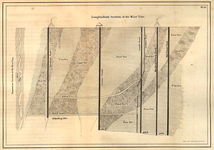
Pl. 10. Plan showing the arrangement of the pockets, as they are called, in the Gold Hill mine, and on the left the regular off sets of the vein as it descends.
Page 157
exclusively, but mainly; the blende will carry the least, and probably not any.
The vein which represents the series belonging to Gold Hill, is the Earnhardt. It is the only one which is now worked, or has been worked since the survey began, and hence the only one which I have been able to examine. The vein stone is principally a combination of iron and copper pyrites intermixed with seams and masses of quartz. In these minerals gold is mechanically mixed; and it is so fine, that even when rich, it requires great care and attention in grinding and panning to find it. But surfaces sometimes show gold, when they have been rubbed in the mine against each other. The vein may be said to be worked to about four hundred and ten feet in depth. Its thickness varies from six inches to four feet, and in one part of the vein it is 7 feet.
* 170 Having stated very generally some of the leading facts relative to this vein, it is important to notice the manner in which the mineral matter, particularly the gold, is distributed.
As a vein, or considered in mass, it may be divided into sections which are arranged rather obliquely with respect to the walls. The vein does not form a single sheet which rests uniformly against, or between the walls, but is divided into many lenticular segments, which, as it were, overlap each other at their thin edges; the lower segment has its upper edge behind and against the wall, and its lower edge over the edge of the next segment beneath. Plate 10, diagram on the left, shows a transverse section of the vein, though the lenticular masses are not so distinctly connected as here represented. An arrangement of this kind prevails in most of the good mines of this State.
* 171. I have stated the general arrangement of the subordinate masses composed of segments as they are arranged; it now remains to show the distribution of the gold, without reference to these subordinate segments.
For the purpose of illustrating this part of the subject, I have prepared plate 10. It is derived from the examination conducted by the survey, and also from the captains of the
Page 158
mines, who have been for many years engaged in directing the underground operations. The plate, without explanation, shows the principal facts. The shafts in the order in which they have been sunk, begin upon the right, and have been sunk the deepest. In order to understand the diagram, the reader must suppose himself placed upon the west or east side of a sheet of ore, with the wall removed, and as he looks, he will see the vein before him in the direction of its strike; it presents, therefore, a longitudinal vein with the vein restored, and the good and poor parts standing in the order in which they were found when the vein was stoped out, or taken down. Beginning on the right, there is represented a belt of good ore extending obliquely to the right, and connecting itself with another good belt towards the bottom, and which extends to the depth of three hundred and ninety feet; and between each, and in the fork, there is a triangular mass of poor ore. It is proper to state here, that the poor and good ores are relative terms; the gold of course is not absent, but much less, and in some of the belts thus marked, after the expenses of mining and extraction of metal were paid, the profits remaining were very small. The lines of demarkation, however, are very clearly defined, and can be. determined at once by the miner; the transition from good to poor is rather abrupt than gradual. The miner's phrase with respect to these rich and poor belts, is rich and poor pockets.
Towards the north east the vein seems to be all poor, it continues north east, but, for some reason, it has not been thoroughly tested; but the explorations which have been made are supposed to indicate a poor vein throughout in this direction.
Towards the southwest, however, the shoots, belts or pockets of good ore are decided, and the best pocket ever opened is the Randolph, which is penetrated by the Randolph shaft farthest to the south west. This pocket is now being taken out. It expands downwards, and at the three hundred and thirty feet level it is extending both ways, and will, it is supposed, become connected with the adjacent pocket on the
Page 159
right. The ore which was used in 1854-'55 was regarded as poor ore. All of the sheet of ore represented and marked as good and poor ore has been taken out, on the right to the depth of four hundred and ten feet, and on the left in the Randolph pocket, to the depth only of three hundred and thirty feet. There is, therefore, a sheet of ore standing, from which the water is drained, of about eighty feet in depth and two hundred and fifty in length. The diagram is made on a scale of eighty feet to the inch; and the part exposed and represented as worked out, includes all the stoping and exploration which have been made in this vein since it was first discovered. In length, this extends about five hundred and sixty feet. This is but a limited extent compared with other veins in this vicinity, or in the slate district. In the prolongation of the pockets downwards, this expansion is indicative of a union of all of them at no great depth. It is useless to speculate upon the probability of an increased richness should a union take place. How far, too, the vein may be expected to continue is not determinable; and hence, useless also to express an opinion; only, a vein so well defined and regular is usually prolonged much farther.
Different opinions prevail upon the question of the continuance of metal below; especially with respect to the diminution of or increase of gold. This vein has been exposed to a greater depth than any other mine in the State; but its workings are shallow, compared with many mines in other countries. There is, however, no diminution in the amount of gold obtained as yet at the bottom, compared with the more superficial parts. When the lithological characters of the poor and rich pockets are compared, the differences are scarcely perceptible. The mineral is in each case a sulphuret, and intermixed in the same proportion with flint or quartz. To the eye therefore, if only inspected in the general, no difference of structure or composition will be observed. This appears difficult to account for on the common views which are entertained with respect to the mode in which vein fissures are filled. If we adopt the view that they may have been filled by gasseous emanations, the difficulties
Page 160
in the way of understanding the mode seem to be less than if it is supposed the fissure was filled by the eruptive mode, and in a mass, and in a state of incandesceuce. There are apparent objections to the latter theory: there is, for instance, no appearance of a change upon the walls denoting an ignition of the vein materials. How much weight should be given to a negative, is impossible to say.
* 172. The machinery employed at Gold Hill for separating gold, consists, first, of the Chilian mill for crushing and grinding after being broken by hammers, the Tyrolese bowls, the Burke rockers, and the Drag mill. Amalgamation is always resorted to, though it has been frequently suggested that the ore is sufficiently rich to be reduced in the furnace.
The work for a Chilian mill of this ore is seventy bushels per day; and our mills run for twenty-four hours, with one or two short interruptions. They are all moved by steam power, and all the water used in the mills is pumped from the mine. The Burke rocker is the principal and best saving machine employed. The Drag mill is also a good machine, is cheap, and easily kept in repair. On inspecting these operations when going on, it is impossible to resist the conclusion that much of the gold is wasted along with the mercury. I believe this is admitted by the proprietors, and yet it is allowed to go on day after day, and still they show some good sense; the amount of gold which is obtained by the methods now in use is very respectable; and if not wholly satisfactory as to method, the determination seems to be to keep the wheels in motion and save what they can, instead of stopping and changing, for the purpose of trying all the new proposed methods which are continually thrust upon their notice by New York machinists, who know nothing practically about the matter. I say there is a fund of good and practical common sense in the methods now in use; they do well by their use, and hence they have succeeded in making money, when many of their neighbors, by changing their apparatus and adopting the untried or cheating concerns, which were hatched by mere mechanics, have lost money.
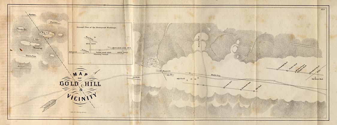
Pl. 9. Plan of the veins at Gold Hill, showing their relations and directions.
* 173. The only change for the better which can be adopted at Gold Hill, for the separation of gold, is by smelting. The Chilian mill has a sliding or slipping motion as it turns on its short axle, which flattens the particles of gold. A machine which will divide without flattening, is the desideratum in all mechanical methods. The consequence of the thin condition of a particle of gold, is to give it buoyancy in the liquid, which is of course charged more or less with earth or clay. But flat gold, where it approaches gold leaf, condenses upon its surface the air diffused in the liquid; and hence, although the heaviest of substances is often found absolutely floating, especially where there is a gyratory motion, or much motion of any kind in the liquid. For example, it is difficult in a tub furnished with stirrers, and which of course impart a circular motion to the water, to move them slow enough to prevent the passing off of the gold, and at the same time keep the dirt from caking at the bottom. If the latter is kept evenly diffused through the liquid, the gold will pass off; if the motion is slower, it will subside at the bottom, and the gold will have no opportunity to come in contact with the mercury. So with respect to the Chilian mill; a certain rapidity of motion must be obtained. If the stones make two many revolutions in a minute, the gold floats away and does not come in contact with the mercury in the channel. The movement for all kinds of ore is within a limited range; they should make from seven to ten turns in a minute; some ores require seven, others nine, and it is very rare that ten can be made without a loss both of gold and mercury.
* 174. The force employed at Gold Hill, for working the Earnhart vein, consists of sixty-six miners paid by the month, and thirty-nine negroes hired by the year. The day of twenty-four hours is divided into three shifts of eight hours each, for underground work. The expenses per month for the whole year amount to four thousand and thirty-eight dollars and forty-five cents, ($4,038 45.) In the expenses for the year (1854), five hundred and ninety-two dollars were for construction. The average mining expenses, leaving out the
Page 162
item for construction, amount to three thousand four hundred and forty-five dollars and seventy cents, ($3,445 70.) Hence, for the year, the mining expenses amount to about forty-one thousand three hundred and forty-eight dollars and forty cents, ($41,348 40.) This includes the negro hire for the year, which amounted to four thousand one hundred and twenty-four dollars and thirty cents, ($4,124 30.)
* 175. The amount of gold obtained in 1854, in the following months, as derived from the books of the company, was as follows:
| December and January, | $ 16,697 66 |
| February and March, | 13,514 75 |
| April and May, | 13,379 23 |
| June and July, | 11,014 95 |
| August, | 7,000 00 |
| September and October, | 7,615 05 |
| November and December, | 9,881 96 |
| 1955. January, | 10,625 16 |
| February, | 3,336 75 |
| March, | 11,280 92 |
| April, | 13,696 81 |
| May, | 11,642 61 |
| June, | 7,051 08 |
| Gold obtained in 13 months, | $136,636 76 |
| Expenses, | 60,331 07 |
| $ 76,305 69 |
Expenses for the following months in 1854-'55:
| 1854. October, | $ 2,857 16 |
| November, | 4,356 07 |
| December, | 4,406 90 |
| 1855, January, | 4,692 26 |
| February, | 4,076 77 |
| March, | 4,245 83 |
| April, | 6,734 00 |
| May, | 4,384 01 |
| June, | 3,430 13 |
| July, | 2,576 76 |
| August, | 4,736 54 |
| September, | 3,653 61 |
| October, | 2,269 69 |
| November, | 2,145 04 |
| December, | 3,778 30 |
| Expedses in 15 months, | $ 60,351 07 |
Page 163
By adding to the foregoing the expenses of four months, $16,084, the amount which would be expended in nineteen months would be $76,429. Total expenses incurred for nineteen months, thus:
| Gold obtained, | $ 136,636 76 |
| Expenses incurred, | 76,429 00 |
| Remaining over and above expenses, | $ 60,207 76 |
* 176. But it should be stated that during the time which includes the foregoing record, only the ore taken from the poor pockets was worked; and it is only since January last, (1856,) that the ore has been taken from the rich Randolph pocket. To ascertain what the rich ores would yield, the mills were put in order, and they were allowed to nse the richest ores for one day; which gave fifteen hundred dollars for the time. But specimens were taken out of the office and ground up and turned into gold, a mercantile transaction, and worthy of the President. It results in the loss of very fine specimens for exhibition. I have entered into a more specific statement of the mine and the affairs of this Company, because it is not known in the State what profits are reaped from this mine. It is generally known that it is rich, and pays; but how much, I never have met with the person who could tell me, except those who managed its affairs. I have entered into these particulars also, because the credit of the North-Carolina mines has suffered from mismanagement, and have obtained an unfortunate notoriety in Wall Street; that of being almost worthless. There are sufficient and good reasons why this has happened: 1st. The capital stock is too large; 2d. Attempts to speculate in them, and of course the double game is played by the Bulls and Bears; and 3d. The cross purposes of the knowing stockholders to oust out the more ignorant, and get possession of the prize. But there has been no substantial reason why the Gold Hill stock should have declined at all. It has been reaping a harvest of gold during the whole time of its depression in the stock market; and when it was said of it in
Page 164
the mining journals when its stock came down to "cypher," "the last rose of summer is gone;" it was still one of the most productive and paying mines of this country.
* 177. In working the ore of this mine, certain difficulties are encountered. The greatest appears to be the fineness of the gold, and its mechanical mixture with the heavy sulphurets. In consequence of this state, the ore must be ground extremely fine, or the gold cannot be separated; and the consequence of grinding fine, subdivides the mercury to an injurious extent. But even when ground finely, only the largest part of the gold is obtained. Hence, it is now customary to save the sand and work it over after it has been exposed ten or twelve months. In the course of this time the sulphurets are decomposed, and liberate the metal.
These difficulties met the first miners. It was the inexperience in this kind of ore which led to losses, and which might have resulted in its abandonment, had not the gentleman whom I have named possessed a large degree of skill and enterprize. The ore of the Barnhardt vein, while it was worked at the time the Earnhart was less prosperous, was in a state of disintegration to a considerable depth; and hence, its metal was separated with less difficulty. Experience in the ores has been gradually acquired, and now the desideratum is a method by which to extract all the metal at a single operation; a desideratum which will be found only by dispensing with mercury and resorting to the furnace.
* 178. The middle vein of Gold Hill is eighty-three yards east of the Earnhart vein, and runs nearly parallel with it. It has been explored by three or four shallow shafts sunk on the vein; very little is therefore known of it, though it is regarded as too poor to work. The ore which has been tested gave twenty-five cents to the bushel of ore. It passes immediately by the road side.
* 179. The Barnhardt vein has been productive, but I was not able to ascertain why it has been abandoned. Its vein stuff is decomposed to a great depth, and the material raised becomes in a short time a reddish earth. Its ore and its slate brought from one hundred and fifty feet, is rather coarser
Page 165
than the Earnhart, but in other respects it resembles it. The most important difference consists in the greater amount of sulphuret of copper and less gold. The copper and iron pyrites is from eighteen inches to four feet wide at the bottom of the deepest shafts. The ore yielded eight per cent. of copper. If as abundant as represented, the per centage would give a profit, if worked for copper, provided it was smelted on the ground.
This vein at the south end is divided in strings which penetrate the rock extensively in the old field south east of the village, where the surface is perforated by many shafts and tunnels. Of the three veins which occupy the crest of the verge on which the works are built two have been rich, but the middle one is poor. It sometimes occurs in parallel veins, that when one is poor in places, the other is rich in the same relative position, and vice versa, an interchange apparently of metal occurring in each respectively.
The Honeycutt vein was worked at the south west extremity of the village, where the old shafts are still visible. It appears to be a prolongation of the middle vein, or perhaps of the Earnhart. This vein is from fifteen inches to two feet wide. It was profitahly worked by A. Honeycutt, Culps & Co. It yielded one hundred and one thousand, six hundred and sixty-five dollars, (101,665.) A shaft was sunk to the depth of one hundred and eighty-five feet. This mine is disturbed by a cross course, or as it is usually called, a mud slide.
* 180. Miners frequently meet with unexpected changes in the character of the vein; it may become very rich and productive, or it may become suddenly poor. An instance occurred of a sudden change in the Icyhour vein, on the the west side of Buffalo, and two miles from Gold Hill. In prosecuting the usual mining operations the vein changed from poor to rich, that is, it ordinarily yielded from fifteen to twenty cents per bushel of ore. A longitudinal pocket was struck which yielded one dollar and a half per bushel. This rich segment of the vein was extended some seventy or eighty feet in length, but was entirely taken out; and it was found that it had no connection by strings with the mass below, but was
Page 166
perfectly isolated in the midst of ore, yielding the amount very uniformly, as I have stated. The vein stone is slaty, but contains fine quartz, and is a regular vein, but free, in a great measure, from the sulphurets. It is difficult to account for isolated masses of rich ore situated in the midst of poor, and marked out by lines so distinct.
* 181. Reed mine is in Cabarrus county, and was brought to the notice of the public in consequence of the large pieces which have been found upon the plantation. The weight and dates when these remarkable specimens of gold were found, are taken from Wheeler's history of North-Carolina, p. 64. The following is a copy of the statement referred to:
| 1803, | 28 lbs. |
| 1804, | 9 lbs. |
| 1804, | 7 lbs. |
| 1804, | 3 lbs. |
| 1804, | 2 lbs. |
| 1804, | 1¼ lbs. |
| 1826, | 16 lbs. |
| 1826, | 9½ lbs. |
| 1826, | 8 lbs. |
| 1835, | 13¾ lbs. |
| 1835, | 4½ lbs. |
| 1835, | 5 lbs. |
| 1835, | 1 lbs. |
| 1835, | 8 lbs. |
| 115¼ lbs. steelyard weight. |
One large piece had been found in 1799, that must have weighed three or four pounds, which was sold in Fayetteville for three dollars and a half. I believe this is the earliest record of the discovery of gold in North-Carolina.
The vein is in the slate near the dividing line between the slate and granite. The direction is east of north. A shaft has been sunk upon the vein to the depth of ninety feet. At this depth, the vein was followed ninety feet; and is represented to have yielded one dollar and fifteen cents per bushel. A cross vein intersects it, whose direction is N. 40° E.
I have been unable to obtain any information respecting this mine from personal examination of its interior. If testimony
Page 167
may be relied upon, it cannot but be regarded as a valuable mine. Operations were suspended at this mine at the instance of Mr. Reed, who procured an injunction against the lessees for an alleged fraud in their returns.
Upon this property a lead vein (galena) has been discovered, whose strike is N. 25° E., and dips slightly to the north. It is eight or ten inches wide. A shaft sunk upon the vein a short distance shows that it is broken into vertical segments, but the explorations are too superficial to furnish much information respecting its character.
* 182. The Phifer, Davis and the Pewter mines form a cluster in a soft, reddish and purplish slate in Union county, on or near five mile creek. The first was a rich mine, and was sometimes called the mint, and the second paid very handsome dividends, and the third, the metal obtained from it was an alloy of silver and gold. It contained from forty to seventy per cent. of silver; its white, and rather dull white color, gave the name Pewter mine. They have all been abandoned; it may be temporarily. The Davis vein was divided at the depth of ninety feet by a dyke or horse, became poor, and was afterwards abandoned.
The Hearne gold mine, in Stanly county, is two-and-a-half miles west from Albemarle. It is on high ground, and associated with hard iron colored trappean rock. But the rock of the country is clay slate. It is a strong vein. It is three feet wide, and has been traced a mile. The vein stone is quartz. As an evidence of its richness eight quarts of selected ore yielded eighty dollars. The mine is now worked successfully.
* 183. Long Creek mine, upon the High Shoal property, has been very extensively worked in former years under leases, which, when they expired, the explorations were discontinued until the property passed into the hands of a New York Company. It traverses slate in a direction N. 20° E. It dips westerly. It is from four to ten feet wide. The vein stone is quartz, containing bunches of iron pyrites often finely crystalized. The vein has been taken out usually four feet in width,; when ten feet, it is too poor to take the whole
Page 168
vein; or, if taken out, it should be selected; the richest part contains the most pyrites. The vein has frequently yielded three dollars per bushel; the poorest about fifty cents. The average yield has been one dollar per bushel. When it is worked down below fifty feet, arsenical pyrites is intermixed with the iron pyrites. When these sulphurets coexist in the ore, or form it, the mercury is excessively divided, which leads to a loss of the metals. This explanation has been given to account for losses which the Company has sustained in working the mine. The vein fissure is wide, and carries a great quantity of good ore near the surface, and hence, has been trenched at many places for nearly a mile.
It frequently happens that the mercury is divided minutely in the process of amalgamation, and so much so, that it appears like foam or froth; in cases where it is divided to this extent, it is extremely difficult, if not impossible, to collect it; and hence it is lost, together with the gold which has been taken up. To effect a re-union of the minute globules of mercury, soda ash may be added in small quantities. It is the most effective means which can be devised for this purpose.
* 184. Reynolds' gold mine is about six miles north east of Troy, in Montgomery county. It is in slate, which is back of or below the quartz and porphyritic beds in which those remarkable fossils occur, the palæotrochis, major and minor.
The slate is rusty, not bright, and is traversed by seams of quartz; and it is also stained with manganese. It rarely yields over fifty cents per bushel of ore, but as the slate is comparatively soft, it gives, at the present time, a moderate profit. Nests of the sulphuret of copper and sulphuret of silver came in at the depth of sixty feet. This vein furnishes occasionally the telluret of gold. The vein is rather obscure, and it is unsafe to form an opinion respecting its value. I have been informed since I left Montgomery county, that the vein is increasing in width, and has yielded, very readily, fifty cents per bushel of ore.
* 185. The King's mountain gold mine is west of the range
Page 169
of that name. It is widely known, having been worked successfully for many years by Mr. Briggs.
The vein is from six to eight feet wide, its direction north west, and its dip north east. It differs from most mines by an intermixture of limestone with the quartz at the depth of ninety feet. But the vein above this level was found to be a porous brown quartz; the gold in it being frequently coarse and visible. But the upper part originally did not differ from the lower; the limestone above the ninety feet level having been dissolved out, left the quartz in this porous condition. From the ninety foot level where the engine shaft was sunk, the undecomposed part rises towards the surface and towards the north west. In the undecomposed part, seams of quartz are not uncommon; the surfaces when separated are spotted with galena and sulphuret of copper, and small crystals of carbonate of lime. The limestone in this vein is not unlike that of Carter mine, in Montgomery county, which frequently contained that rare mineral, the telluret of gold. I did not succeed in finding it at King's mountain mine, but was informed that it was present in the ore. The rock which supports the vein is the Talcose slate, which lies below the brown sandstones and limestones of the Taconic system, and is in the same formation as the heavy veins of magnetic iron ore of this region. It is from six to seven feet wide, and is capable of furnishing a large amount of ore. The vein stuff is rather hard, and would require for working it powerful machinery. It is believed that the vein has not materially changed in the quantity of gold diffused through it.
Page 170
CHAPTER XXIV.
Repositories of the Ores continued--Gold Veins in the Syenitic Granite of the Salisbury and Greensborough belt--McCullock Gold Mine--Pioneer Mine--Fisher Hill Gold Mine, etc.
* 186. The success which attended the working of the McCulloch mine when under the direction of Mr. James Sloan, gave it a high reputation. But it unfortunately fell into the hands of men who cannot be safely followed in matters pertaining to this business. It is sufficient to say that the mine has been mismanaged. It was loaded with debt and with unnecessary apparatus, and it passed from a paying to a non-paying mine in the course of eighteen months after the New York owners came into possession of it, and after having given them seventy-two thousand dollars in one year.
The vein fissure pursues a north east course, but is curved in the middle. It dips S. 80° E., and at one place south east. The vein is composed of a column of brown ore resting on the foot wall, which extends from the outcrop to one hundred and thirty feet in depth. Upon this rests the disintegrated ore, containing eight inches of beautiful copper pyrites; and then against the hanging wall, quartz rather poor in gold and frequently eight feet thick. The vein at the surface is about two feet wide; at sixty feet, it is four; at ninety, ten; and at one hundred and thirty twenty-four feet six inches. It dips at an angle of forty-five degrees. At the one hundred and thirty foot level, it swells out into a rather lenticular form, and is twenty-four feet wide in the thickest part. Here the ore is concretionary; on the foot wall the brown ore is six inches thick only, then copper pyrites, then a belt of brown ore containing nodules or concretions of pyrites more er less changed, the middle of which is rich in gold. Upon the hanging wall is the principal mass of porous quartz, which, though it sometimes shows thin films of gold, yet is generally
Page 171
poor. The brown ore is soft and easily crushed. It is intermixed with fine quartz, and spongy masses of it, which are rich in gold. The average yield is from one-and-a-half to two dollars per bushel. It sometimes exceeds five. At the south west the vein runs into the Lindsay property. Towards the north there is a ravine into which the water of the mine at the sixty foot level flows through an adit. Beyond the ravine in this direction, and about one-third of a mile from the engine shaft, is Jack's Hill, a little higher than the McCulloch's Hill. A shaft sunk in the top of this hill cut the vein at the depth of seventy-seven feet, where it is seventeen feet thick. There is exposed at the bottom of the vein a base of three thousand feet, in the limits of which is stored a vast quantity of valuable ore.
The copper is the purest sulphuret, yielding by analysis thirty per cent. of copper. It decomposes rapidly even at the depth of one hundred and thirty feet. The walls are often colored blue by the sulphate of copper by the decomposition of the pyrites.
I have been unable to ascertain how much gold the mine has yielded, excepting for a single year--the last eighteen months the matter pertaining to have been in an unsettled state. That it is a paying mine, and may be worked with profit, is probably true; but when a mine is frequently advertised for sale, every one suspects that it has run out, or else certain schemes are in progress which are intended to benefit only a small part of the stockholders. At this mine the sulphate of iron and copper, oxide of copper, limonite, cacoxenite, specular oxide of iron, earthy oxide of manganese, and occasionally crystals of limpid quartz are found. The gold and copper mines rarely contain fine minerals, excepting those of common occurrence.
The McCulloch vein carries its gold in combination with the sulphurets. When, therefore, the veinstone is made up of quartz, gold will not be found in it; and when, on the contrary, pyrites reappears, after having been absent perhaps for a hundred feet, the gold reappears. It is a mass of quartz which is under foot at the present time; for the time being,
Page 172
therefore, it is too poor to pay the expenses of mining. But it will probably return to its former value. A mine so well developed and maintaining its width of vein, extending, including the Lindsay vein, not less than a mile in length, may be expected to continue to yield in the future as much gold as during the past.
As quartz in this mine is unproductive, it is in vain to work this material. The course which may be regarded then as the most likely to be a successful one, is to sink the Colby shaft to the depth of 300 feet, where it is expected to intersect the vein, and then drive each way, if necessary, for the rich ore. That unproductive spaces are encountered, is not rare in the experience of miners, and a change of this kind should not deter the capitalist from pursuing the vein, for there can scarcely arise a doubt of a final successful termination of the project proposed.
In making the foregoing remarks I wish it to be distinctly understood, that I do not mean to back the doctrine that the McCulloch mine may be expected to pay the interest upon its capital stock; for although it has done so for a short period, yet this fact does not warrant an investment in its stocks, even at par value. All mines have their periods of adversity, and to meet the expenses which accrue during those periods, there should be a surplus capital. The earnings of the mine during the period of its prosperity should be laid by in part for use when required.
* 187. Fisher Hill Gold Mine.--This vein has peculiarities which require a passing notice. It lies very flat, its dip is between fifteen and twenty degrees; and its vein stone quartz, in which a white sulphuret of iron is mixed irregularly through it. I have not observed a trace of copper. To the eye, before it is burnt, the ore appears poor; but this is a deception.
In consequence of its perfect freedom from copper pyrites, it may be burnt to great advantage. If this vein should not change, it must be regarded one of the first class of mines. Its thickness is from two to four feet near the surface. The quartz is brittle, and when burnt is easily pulverized.
Page 173
The yield of gold to the bushel averages three dollars, and it is worth ninety-nine cents to the pennyweight. The north west end of this mine the ore is worth only eighty-six cents to the bushel. It has changed its dip at this point, and has become very steep.
In consequence of the slight dip, the vein lying just beneath the soil, it has been frequently perforated by shafts by the lessees; it is therefore much exposed to surface water, which, in some locations, would be detrimental to the future prosecution of mining. It is known for rather more than a mile in the direction of its strike, and to be equally rich in its south western prolongation.
If the mining was prosecuted vigorously, this vein might furnish per day from fifty to seventy dollars over and above the expense of attending its working. The metal is attached both to the sulphuret of iron and the quartz; and by being heated to redness it breaks and grinds without difficulty in a drag mill.
* 188. In the vicinity of the Fisher Hill is the abandoned Hodge's Hill mine, which I believe never gave results which were perfectly satisfactory. The gold is distributed unequally through a heavy vein, whose width varies from six inches to twelve feet. Not having been able to examine the workings, I can say but little respecting it. It furnishes many famous quartz crystals. Its gold is distributed through quartz and copper pyrites; the latter is pure and handsome, and may furnish an inducement to some capitalist to reopen the mine.
The minerals taken out of the vein are peroxide of manganese, limonite, carbonate of iron, hornstone, very large quartz crystals, carbonate of copper, and its earthy red oxide.
* 189. The Lindsay mine is supposed to be a continuation of McCulloch; it is less rich, was formerly worked with success, but was badly excavated, according to reports. It is reopened, and I am informed with fair prospects.
It has been said that the McCulloch vein is split into strings. If the two forms one continuous vein, then the branches unite and form a consolidated lode which, in the Lindsay mine, is
Page 174
from eighteen to ten feet wide. It is distant from the McCulloch engine shaft about one hundred rods.
* 190. The veins in the mining district of Jamestown are quite numerous, all of which are worked only for gold when first discovered. The McCulloch, which has been noticed, the Lindsey, the Beason, the Harlan and Gardner mines, and the Beard mine. The four last are not worked. Gold having been the only metal sought, they were pursued down to water, where their characters were materially changed by the sulphurets of copper and iron, and the easy method of extracting the gold no longer existing, they were mostly abandoned. They are all true veins in the sienitic granite, and it will be an important question to determine whether they may be reopened with a fair prospect of success. In the mean time a few mines are being pursued, which probably have in their time presented equal obstacles to a successful result, and indeed have, in their turn, been abandoned also; but which on farther prosecution, with better means and more experience, are likely to become lasting sources of wealth.
* 191. Among the mines of this cluster, near Jamestown, in Guilford county, is one known as the Gardner mine, and I propose to make at least the usual statements respecting its character; and besides, there are certain interesting facts worthy of note, which require this brief notice. It is in the sienitic granite. It is a true vein, whose direction is N. 20° E., and with a westerly dip. It was worked for gold, and the lessees, who paid one quarter of the gold obtained as toll, made a profitable undertaking, as their books show. One hundred thousand dollars have been taken from the lode and surface mine. The gangue is quartz intermixed with brown ore which lies against the foot wall, and is from six to twelve inches thick. It rarely yields over one dollar per bushel, but the quartz is frequently richer, and hence has paid large profits. The lode is bounded by slate or killas; but the adjacent granite on the lower or foot wall is extremely tough and hard, while that on the upper side is soft. The arrangement of the vein stone is shown in figure 18.
Page 175
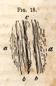
FIG. 18. [Vein from Gardener mine]
a. a. the granite inclosing the vein fissure. b. b. killas or slate. c. vein. The vein fissure is rarely more than three feet wide near the top, and in a part of the lode at the depth of eighty feet is only eight inches, where the ore is poor.
* 192. The vein stone is quartz as is commonly the case in granite, but upon each side it is bounded by slate, which of course fills in part the fissure. In this slate I find fine micaceous oxide of iron, and frequently it exists in connexion with the quartz where most of it has passed into the brown hydrous oxide of iron. Now the most valuable ore of this mine is a brown oxide, and to the eye it cannot be distinguished from that produced from the micaceous oxide; but the gold bearing oxide is derived from the copper and iron pyrites. It was noticed in working the ore of this mine that a part of it was rich, and another part was worthless. I found, on examination, that the worthless was derived from the micaceous oxide. It seems, therefore, that gold attaches itself, as usual, to the sulphurets; and it becomes necessary in examining the ores of a gold mine to determine their origin, for the micaceous oxide is not a rare mineral in veins carrying gold. In this mine we find the killas which have been alluded to. It seems that under the circumstances in which they occur in veins, it is difficult to determine how they were formed. At the Rudersill mine near Charlotte, and at the Dunn mine they are very thick, while at the Gardner mine they are thin; but in each of these cases they must have been produced in the same way; and what is perplexing is, they are similar to the slates of the country; and where thick, as near Charlotte, they have quartz veins which are like those of the sediments, and have no gold or metal in them. I have in another place spoken of the laminated dykes or slaty dykes; these killas of the veins, except when quite wide, resemble them.
The Gardner mine, at the depth of one hundred and ten feet, yields, under careful management, about one dollar per bushel; the poorest about fifty cents. The ore contains a
Page 176
handsome quantity of rich sulphuret of iron and copper; it yields about thirty per cent of copper; it is not largely intermixed with iron pyrites at any part of the vein. There are probably three veins upon the Gardner property; but I have been unable to determine their relations, two visits having been made to the mine when it was impossible to examine the exposed lodes underground.
* 193. Rudersill gold mine is near Charlotte, Mecklenburg county, and was at one time regarded as the most productive mine in the State. In this, as in many other instances, a rich and productive deposit of gold did not save the property from sale under execution. An infatuation seemed to have seized the managers, and extravagance was increased in a greater ratio than the returns of the mine, which indeed were known to have been very remarkable. This mine was reopened about two years ago, under the management and superintendence of an able, as well as prudent engineer. The present prospects warrant a favorable conclusion to the enterprise. The rock both above and below the two veins which constitute the mine is the syenitic granite of the Salisbury and Greensborough belt; but the veins are immediately in killas or slate, or mass which cannot be distinguished from the slates which predominate in the slate belt; and there are other points where the slate is in granite, and not less than one hundred feet thick, which is traversed with veins of quartz. It is difficult to determine whether the slate thus situated is to be regarded as the killas of a vein, or as masses of the slate system isolated by an eruptive rock.
Thus the Rudersill veins are between masses of an eruptive rock, and the lower is regarded as the elvan of the Cornish miners. The vein fissure is fifty feet thick, occupied mostly by talcose slate, which is overlaid by white granite and underlaid by elvan or a darker trappean rock. In this fifty feet of slate lie the two principal veins, which, instead of pursuing a direct course, are frequently curved or rather turned out of their regular course as represented in Plate 12, at the one hundred foot level of both the front and back veins.
A vertical section, Plate 12, shows the position of two veins

Pl. 12. [The underground workings of the Rudersill mine at Charlotte, Mecklenburgh county.]
The front vein yields, in some parts of it, for sixty continuous feet, one dollar per bushel, and the back vein only fifty cents. Carbonate of iron is one of the common minerals of the vein, though not so abundant as in many copper mines. An important advantage which this mine enjoys, is the amount of ore which can be commanded. It may be regarded as one of those repositories which, if prudently managed, will continue to give a very respectable profit at all times. One or the other of its veins may be depended upon, and it may turn out that when the one that now gives one dollar per bushel should be less productive, the loss will be made up by an increased productiveness of the other, and so vice versa. The arrangement of ore in the lode is usually in rich bunches, which are connected by strings. The quartz is brittle, and hence is readily crushed. The whole work of fitting and pulverizing the ore is by steam power.
* 194. The Dunn mine is inclosed in a heavy mass of slate also. It is seven miles from Charlotte, on the plank road; but the principal rock is granite. It has been worked for gold. It is remarkable for the large quantity of limonite which has been produced from iron pyrites. Imbedded in masses of limonite, fine and beautiful scales and plates of specular iron are common. It is of no account as a gold mine.
Phoenix mine in Cabarrus county furnished good ore in the quartz, intermixed with the sulphuret of iron. It was proved to be rich to the depth of one hundred and forty feet. At this level a white quartz and sulphate of barytes replaced the brown ore, and it immediately became poor, and yielded only twenty-five cents to the bushel. It yielded from one to three dollars per bushel above the one hundred and
Page 178
forty foot level. No company has as yet had sufficient courage to undertake to cut through the barytic part, and determine whether the vein stone changes and becomes rich again or not.
The Phoenix mine is about fourteen miles south east of Concord, and its general direction is north east. It belongs to the sienitic belt of rocks, and at the depth of one hundred and eighty feet is one foot wide. It is nearly vertical. This vein prolonged about one-and-a-quarter miles, takes the name of Vanderburgh mine, where the vein stone is sulphate of barytes and quartz. Its contents differ from those of the Phoenix mine. Copper pyrites prevails to that extent, that it has been in market as a copper mine.
One-and-a-quarter miles south west of the old Phoenix mine it has taken the name of Barrier mine, which is represented as a productive gold mine.
The Orchard mine is one-fourth of a mile east of the Phoenix, and runs parallel with it; it carries copper pyrites, but is not supposed to be rich enough to work.
Between the Vanderburgh and Phoenix locations a heavy trap dyke intersects the vein. This fact may throw some light upon the change of material which has taken place north of it.
The Barnhardt gold mine of Cabarrus county is in granite, and pursues a northeasterly direction. It is a well developed mine; its gangue of quartz, taken near the surface, contains coarse gold. It is without doubt a rich mine, and well worthy the attention of capitalists.
Pioneer gold mine is in a cluster of interesting, and which I believe will turn out to be valuable mines. This is the only one in the district which is worked at present. It is twelve miles east of Concord, and situated upon the eastern border of the sienitic granite, and in a belt upon which there are numerous veins carrying both gold and copper. The vein fissure in the granite is between sixteen and seventeen feet wide. Its direction is N. 70° E. The true vein stone is quartz from eight to thirty inches thick, both sides of which is bounded by the killas.
Page 179
The vein stone is usually stained with carbonate of copper; it is brittle and not difficult to pulverize, and the gold is contained both in the pure quartz and the sulphurets, intermingled with it.
The following items will show how the mine yields. There is only one pair of Chilian mill-stones in operation, whose movements were not graduated to the proper speed which the ore requires. The revolutions were too many for this ore, making, I believe, eleven in a minute. The defects of the machinery were too obvious to escape notice; but with these defects, the mine was proving itself a valuable one. I state the results according to the amount of ore used. Thirty to forty bushels of ore ground per day with the aid of a single mill. Thus:
| BUSHELS. | YIELDED IN GOLD. |
| 147 | $ 364 |
| 92 | 123 |
| 118 | 361 |
| 103 | 408 |
| 127 | 570 |
| 131 | 496 |
| 38 | 201 |
| 143 | 618 |
| 121 | 456 |
| 138 | 301 |
| 139 | 352 |
| 134 | 417 |
| 154 | 447 |
| 92 | 560 |
| Bushels, 1677 | $ 5,674 |
The yield, therefore, for the whole amount, is three dollars and thirty cents a bushel.
The labor is performed in, and at the mine by from fifteen to twenty hands, working from eighteen to twenty days in the month; and the whole cost amounts to four hundred dollars ($400) per month. Now under a certain plan of management the mine did not pay expenses, and became in debt in various ways, and would have been sold by the company, but the present agent, by proper attention to the management of the machinery, and particularly by using mercury
Page 180
in the Chilian mill, made the handsome profits shown above, by the use of the same kind of ore which before did not pay the expenses of mining. It is impossible to make money by working a gold mine without the closest attention; every leakage must be found and stopped; the revolutions of the Chilian mills must be timed to suit the character of the ore. If the ore of the Pioneer mine yielded only twenty-five cents per bushel with proper attention and economy, and the use of sufficient machinery to grind one hundred bushels per day, it would give a handsome profit.
Very few persons have been economical in working gold mines, and fewer still have thought of timing the movements of the machinery to suit the character of the ore; if this is not done, the gold and mercury is lost; for of all things yet discovered, gold is the most difficult to catch, and the easiest to slip away.
The vein stone is arranged in the fissure much as it is in the Gold Hill mine, viz., in lenticular segments; which overlap at the lower edge, and set back against the foot wall at the upper. The great quantity of ore at this mine, and the ease with which it is obtained, confers great advantages upon it.
I have observed that the Pioneer mine is in the immediate vicinity of several other mines; thus, upon the Morrison plantation there are four veins, all of which carry gold. The first is one mile south west of the Pioneer mine. Around an old shaft the refuse ore I found rich in gold. The vein stone is quartz, interspersed with the sulphurets. The second is one mile east. It resembles the first. In the third, the gold is in combination with copper pyrites. The fourth is a quartz vein, situated at the north east part of the plantation; it is composed of quartz and iron pyrites. The general direction of these veins is north east. In addition to the foregoing, there is a valuable vein carrying quartz and copper pyrites upon the plantation of Dr. Cosby. The part of the vein which has been tested is rich in gold, but the indication favors the expectation that it will prove rather a copper than a gold bearing vein.
Page 181
The Long mine is two miles north west from the Pioneer. It is nearly vertical, is two feet wide, and carries less copper than the Pioneer, and contains a larger amount of decomposed ore. The vein fissure is from eight to ten feet wide, and bears N. 10° W. It has been explored to the depth of fifty feet, the ore steadily improving in quality. It was regarded as rich as the Pioneer mine, and in certain respects, as having advantages which the latter does not possess.
A vein of quartz passes also through the plantation upon which the Pioneer mine is situated, which will intersect it, if both are prolonged a few hundred yards beyond the present workings. In itself, it is of no consequence; its presence shows the extent to which this small mineral district has been fissured. Its direction is N. 10° W.
Rymer gold mine is six miles east of Salisbury, Rowan county, and one mile to the left of the road loading to Gold Hill. Direction north east, and nearly vertical. The vein stone is seven feet wide. It is a prominent mass of brittle quartz. The immediate repository is a pale colored sulphuret of iron, which lies mostly against the foot wall. The ore is three feet wide. The sulphuret is sometimes crystallized in cubes. There is no copper pyrites intermixed with it. It resembles the Fisher Hill gold mine. As it contains no copper, the ore admits of roasting, which favors the discharge of the gold from the sulphuret, and the pulverization of the gangue. It is subordinate to granite. It has been opened but a short time, and the returns of gold have not been obtained. It is spoken well of by persons who have information upon the subject.
RECAPITULATION OF SOME OF THE LEADING FACTS RESPECTING THE
GOLD ORES.
1. I have shown that gold belongs both to the pyrocrystalline and sedimentary rocks. In the former it is always in veins; in the latter, in both veins and beds.
2. The gold repositories, therefore, belong to two geological periods. The first and oldest must be assigned to those
Page 182
which belong to the pyrocrystalline rocks, gneiss, mica and talcose slates, etc.
3. From the debris of the auriferous veins of these rocks the beds are formed which have been already described, and which belong to the oldest palæozoic rocks.
4. I have also shown that auriferous veins exist in the palæozoic rocks as well as beds. There are, therefore, two periods to which the auriferous veins of this slate must be as signed; the first prior to the creation of organic beings, and the second one bears a subsequent date, or comes within the palæozoic era.
5. As yet no veins are known of a later date than those which have been described as belonging to the Taconic system; that is, we have no auriferous veins belonging to the Silurian, which succeeds the Taconic system.
6. Gold is associated with quartz and the sulphurets of copper and iron--but sulphuret of iron appears to be the substance with which gold is more immediately associated.
7. Gold, like other substances, has been subjected to molecular movements, by which it has been transferred from the interior of a mass to its surface planes. Thus, in the slates it is more abundant upon the planes, or between two parallel planes, than in the lamina of the slate. So it often occurs in seams which were formed perhaps during the slow consolidation of the rock.
8. Gold is mechanically mixed with the quartz and the sulphurets, and rarely occurs in any chemical combination, except with tellurium. Its separation is therefore effected mechanically.
9. The amount of gold which can be obtained depends very much upon the means employed. All the machinery for the separation of gold is defective. The Chilian mill, which is probably the most effective, flattens the gold too much; the consequence of this is, that the surfaces condense air, which aid in buoying it up in the pasty fluid in which it is immersed, and hence it floats off with the escaping fluid. If the process were conducted in a heated fluid, less air would be condensed and more gold saved. A mill which operates
Page 183
like the flouring mill may be more successful than the Chilian, or like the eccentric plates of the Bogardus mill. Whatever form of apparatus is selected, it should be with reference to the preservation of the rounded form in which the coarse gold exists. In some cases and indeed in many it is already flat, and approaches the condition of gold leaf; it is therefore difficult to save. Much gold is lost by the haste in which the different processes are conducted, and the slight attention which is paid to the movements of the machinery; for it is to this point that the attention should be especially directed. The condition of the gold should be ascertained, whether it is fine or coarse, as those points must be determined before the movements of the machinery can be properly adjusted.
CHAPTER XXV.
Repositories of Metals continued--Silver; Washington Silver mine; its prolongation, etc,--Character of the Veins at different depths, etc.
* 195. This metal is much rarer in the United States than gold. Silver is combined, it is true, with the galena of many of the repositories of this metal; but it is not often that its per centage will warrant the expense of its extraction. The Washington silver mine has passed through the usual vicissitudes which attend all mining operations. It has had its day of partial success, when it seemed that its owners were just upon the point of realizing their hopes, when some unfortunate occurrence took place which set them afloat upon a tide of uncertainty. Various methods were resorted to to separate the silver and gold from the sulphurets by different assayists, but the results more frequently proved so near a failure, that they amounted in the end to the same thing; for
Page 184
more money was expended by the company than was received, though the returns came within a thousand or two dollars per annum of the expenditures, so that the company lived, because it was wealthy. It would happen that the amount of metals received was about eighteen thousand dollars, but it had to expend twenty thousand to get it; and the consequence was, that the operations at the Washington mine were suspended for several years; still it was established that a much larger per centage of silver and gold existed in the mineral than was ever obtained by any furnace operations. It was therefore a question of skill, whether the mine should be abandoned or not. There was ore enough, it was rich enough, but all who had been employed to smelt the ores succeeded only partially. Money, it is true, was made, while certain surface ores continued; but when they gave out, and greater skill was required, then the failure became too plain to be denied. It was precisely like working the surface of a gold mine which consists of brown ore, where the sulphurets were thoroughly decomposed. Any person with only ordinary skill could perform the work successfully, but when the undecomposed sulphurets were to be dealt with, it was another thing, and required skill and knowledge combined, in order to be successful with them, and as both were frequently defective or totally wanting, most of the gold mines of the State were abandoned. The ore of the Washington mine is a mixture of the sulphurets of lead, zinc, copper and iron, in which there is gold and the sulphuret of silver. The sulphurets of lead and zinc predominate, the sulphuret of iron stands next, and the sulphuret of copper and iron is the least. Zinc predominates over the lead. In some pieces they seem to be in nearly equal proportions. But almost all the lumps of much size contain the four sulphurets, with the gold and silver besides. There are, therefore, five metals to which the attention must be directed, and all of them should be saved; the gold, silver, lead, copper and zinc. The ore it will be seen is very complex, and it is no wonder that success did not crown the efforts of the owners until and after several years of trial and the expenditure of a large capital, especially
Page 185
when one of those metals which formed nearly half of the mass is one of the most refractory metals to deal with. In the first attempt to separate the metals composing this complicated ore, the silver and gold were of course the principal objects sought for. The lead in the ore was one of the agents or means by which this result was obtained, and the company I believe were enabled to save small bars as long as the carbonates of lead were abundant; but when this gave out, then litharage was purchased to aid the process of separation, and much of the lead added to the ores for this purpose was dissipated and lost. The difficulty encountered arose from the presence of so much zinc, which, in attempting to volatilize, dissipated the lead also, and which no doubt carried in its vapours some of the silver and gold with it. But I have dwelt perhaps too long upon this branch of the subject.
The rock of the country is a clay slate, reddish, striped and greenish, totally or partially changed into a hard rock. It often contains beds of extremely fine silex suitable for hones, and also masses which are porphyrized. Beds also of breccia and brecciated conglomerates are common. The formation belongs to the sedimentary series, and to that system which I have denominated the Taconic system. The evidence which I have been able to gather respecting the age of the vein fissures of this mine is, that it is of the same period as the auriferous veins in the same formation. There is a parallelism and a general resemblance in the characteristics of all these repositories; and there has not as yet come to light any fact which discredits the foregoing conclusion. For these reasons, therefore, I have been disposed to look upon the auriferous veins of the slate, and those which carry the complex combinations, as all belonging to one epoch. Upon the east side of Silver Hill, or the Washington mine, the heavy bed or porphyrized breccia passes on to the north east; it is the same mass which is so perfectly developed near the Narrows upon the Yadkin, and passes within two miles of Gold Hill and forms the Flat Swamp mountain, and from thence passes Silver Hill, leaving the mine upon the West. Four-and-a-half miles farther north easterly the same rock passes
Page 186
through the plantation of David Beck, near the Headrick copper mine, and from thence passing in the same direction, forms the Three Hat mountain south of Courad Hill. This persistent porphyrized rock would be expected to preserve the same relations to the mines or veins upon its west side, but this does not occur; for at the distance of about six miles north easterly, I found the Washington silver lead mines to reappear upon the east side of this singular belt, in which I have rarely found productive mineral veins, though quartz veins are very common. So also I may notice the fact in this place, that the Headrick copper mine is a slate which cannot be distinguished from that of Gold Hill, and the mineral matter of the vein resembles so closely that of the Barnhardt vein, that they cannot be distinguished. It appears, therefore, that these veins reappear on the east side of this breccia, but never appear in it--or they come up to the surface from six to twenty miles from the most important points where they are now worked. These facts are well illustrated in the Washington mine, near the residence of Mr. A. J. Moore, on the fork of the Salisbury and Lexington roads. The zinc, lead and copper were struck in a shaft designed to be sunk upon a gold bearing vein, and accompanied with the peculiar slates and minerals of the Washington veins, so perfect that no one would have suspected that they were taken at a point six miles to the north east.
The veins of the Washington mine traverse the crest of a low rounded hill, from fifty to seventy-five feet above the adjacent valley. The veins were exposed by the plough, or in the cultivation of this field, and their outcrop was scarcely observable; they presented nothing prominent or striking, and were accompanied with the usual quartz veins. Upon the west side of the yein, the rock is also rather thick bedded and hard, but not porphyrized. The slates adjacent to the vein are soft, and of various colors. The immediate rocks of the mine, or those which may be said to invest it, are uniformly hard rocks. The mine consists of two heavy veins, pursuing in depth a nearly parallel course; and the smaller
Page 187
veins less perfectly developed, and which have been discovered by the underground workings.
As this mine is one of the most important and valuable in North-Carolina, and as it is geologically important, I shall state with as much minuteness as possible the numerous changes which it undergoes or has undergone during the time it has been worked. These changes do not, however, differ in character from those which have been observed in other mines, and as they indeed correspond, the idea is sustained that all these repositories are more or less regular in their structure, and conform to certain rules.
The two principal veins are explored by three perpendicular shafts. They are sunk in the rock of the country, and hence furnish information respecting the rock adjacent to the lointersected formation. It begins upon the outcrop of the east vein, and hence passes down behind it. At the depth of forty feet a cross cut was made to the west which interesected both lodes at this depth. This cross cut extends to the west side of the west vein, and is thirty-eight feet long; from this it appears that the veins had made to the west twenty feet in forty. The shaft passes through soft rock, or that which is disintegrated, and it is not until the sixty feet level is attained that the rock becomes hard and firm. The distance between the two veins is twenty-eight feet. The underlie or dip is sixty-eight feet, and to the west.
The next shaft is sunk twenty-eight feet to the west of the west lode. It intersects the west vein at one hundred feet, (100.) The appearance of the lodes in the upper part is that of yellowish white or frequently silvery substance, both soft and friable, in which the mineral matter is not very distinct. The vein stone is a talcose slate more or less disintegrated, which envelops or conceals the metal, though its weight is perceptibly greater than that of common stone or rock. It was however in this material that silver was first recognized;
Page 188
it was found both in the native state, and in combination with galena. It was also in this level, or near it, (60 feet) that gold was first detected in both veins. In a state of purity the quantity has not been exceeded. The east vein has carried more silver than the west, and the difference in this respect between them has been so perceptible, that the east has been called the silver, and the west the lead vein. The space between is occupied for one hundred feet by soft slate, but traces of mineral matter pervade this mass, though somewhat disguised by the soft and pasty talcose slate. The spaces between the hanging wall of the west vein, and the foot wall of the east, is twenty-eight feet in both the forty and sixty feet levels. The ground becomes gradually firmer as the shafts descend.
The working of the vein along the sixty foot level, disclosed an interesting geological fact; the approximation and indeed coalescence of the two lodes, which gave a width of twenty feet. This conjunction sustains the common belief, that where two lodes come together their richness is increased; it was so in this instance. The lodes, however, though they come together do not cross, they soon separate, and then resume very nearly the same relations and distance they had prior to their junction. But at the junction the silver was in part transferred to the west lode; it became richer for the time than the east lode. At this point also manganese appears in the space between the veins, and the beautiful carbonates and phosphates of lead were also abundant here. These were associated with the silicates and carbonates of copper, and foliated native silver.
At the depth of one hundred feet, the volume of the lodes and the included metals has perceptibly increased. The walls of the veins and the rock have become firmer and harder. The lodes assume a more permanent character. Besides these indications of a favorable kind, another vein is disclosed, which contains also silver in connection with lead, accompanied as usual with zinc, twelve feet to the east of the east vein; it first appears at about the depth of eighty feet. It is not parallel with the two larger veins, but may be regarded
Page 189
as a cross course which will intersect them. Another small vein also was disclosed by the workings upon the one hundred feet level containing the usual metals of the main repositories on the west side of the west vein, it was intersected by the cross cut from the engine shaft in the west vein; it dips to the eastward. It is called the little west vein.
Levels have been driven at the sixty foot levels two hundred and forty-seven feet on the east, and three hundred feet upon the west vein.
The west vein between the sixty and one hundred foot levels expanded and yielded also rich silver ores, and below the one hundred foot level, the working results were uncommonly favorable, owing to the presence of the massive carbonates which yielded thirty per cent. of lead comprising the silver. So also the vein stuff of the west lode from sixty to two hundred feet level changed from the light and rather earthy looking mass, and small specific gravity, to the heavy and crystalized carbonates and phosphates, and to a black porous argentiferous galena native silver and blende. The lead was, however, much less than the smelter of the ore desired. This admixture was unequal. The lode in this neighborhood has become from ten to fifteen feet thick; but the expanded portions are not so well defined as the narrow parts, and the cavities in the walls become what the miners term "vugs," in which, however, there are valuable accumulations of metals.
At the one hundred and sixty foot level, it is perceived that the dip of the vein has changed, having become steeper; its underlie is now 63° from the horizon; and this underlie continues to increase in its descent, and both veins preserve their relations, that is, both become steeper, though they are now thirty two feet apart. A change of dip of this kind has been regarded as favorable to the increase of metal in the lodes; and such is the fact in this instance. The lodes at this level expand also into vugs, which are occupied with black steel grained zinc ore, with galena interspersed with arborescent foliated and filiform native silver, as well as that which is still in combination with the lead. The black ore of this
Page 190
level contains from forty-nine to fifty-two per cent. of silver-lead; which yields from fifty to one hundred and eighty ounces of silver to the ton of metal. A variety still richer, called the blue ore, and which is interspersed with the other ore unequally, gave Prof. Booth,
Of Lead, 38.
Of Silver, 2.875 per cent.
This astonishing result, it must be recollected, cannot be obtained from the great mass of ore, it is obtained only from comparatively small masses, unequally distributed through the vein at certain places.
The most important facts disclosed in these lower levels are, that the lodes have become more decisive in their tone and character, or in their general features. They are wider, the mineral matter heavier and more solid, or less intermixed with gangue. The mineral matter has increased, and the precious metals, gold and silver, have by no means diminished in quantity, but have rather increased in the same ratio with that of the lead and zinc and copper.
At one hundred and sixty feet, the east lode has regained, as it were, its predominance in silver. Arborescent silver is frequently obtained, and the south end of the lode contained better silver-lead than had been seen in the upper levels. The east lode is now ten feet wide, but at one point it is split into two parts by intervening hard rock. This disappears before it reaches the two hundred foot level. It is singular that the west lode is also split at this level in the same manner, and disappears at about the same time. In the west lode, the mineral contents consist of an admixture of zinc and argentiferous lead ores. The vein fissure has expanded about seven feet more. The lower parts of both fissures is filled with hard blende mixed with lead and silver. The minerals are also contorted and twisted.
The east lode at two hundred feet has increased in argentiferous galena, and the ore consists of from
40-50 per cent. of Zinc,
15-20 per cent. of Lead,
25 per cent. of Sulphur,
20 per cent. of Iron Silica and Alumina.
Page 191
The east vein has maintained its character for greater richness in silver between the one hundred and sixty and two hundred foot levels. Next to the foot wall the zinc and silver-lead is hard, and more abundant there, but at the same time both are distributed through the vein.
The west lode at two hundred feet is from ten to sixteen feet thick, and it is said that the amount of silver and galena has increased, or is increasing, as the last ten feet yielded better results than had been obtained before from this lode. Both veins, it appears, are becoming steeper at the lowest points at which they have been explored, being at the depth of one hundred to one hundred and sixty feet--as one to two in inclination; an indication which, as has been already stated, is to be taken as a favorable omen.
It appears from the foregoing statements that it sometimes happens, when two lodes are in such close proximity, that one is rich and the other poor alternately; but in this case, both seem to go on increasing slowly in richness at the same time, for the eastern vein between the hundred and seventy foot level and the two hundred contained the most silver; and a pocket, as it is called, was found at this depth which had a breadth in the vein of two feet, which gave more silver than any part which had been before met with.
The Symonds vein as it is called, which was struck twelve feet to the east of the east vein, scarcely differs from the preceding one in its general characteristics. It contains specimens which show that it has undergone the same changes--the transformation of galena into carbonate and phosphate of lead, where the needful conditions existed; as at the more superficial parts of the vein. Both galena and carbonate of lead exist together in the same specimen. Although its capacity is less than the old veins, it is still competent to supply a large quantity. It is supposed by some geologists, that in the existence of vugs, or cavities, a black color and a porous slaggy slate denotes the action of fire. These conditions, however, are often the results of decomposition which has slowly taken place, and water frequently produce changes which similate those of fire or heat.
Page 192
I alluded in the beginning of this chapter to the imperfect results which were obtained in the smelting of the complex ores of the Washington mine. In order to illustrate this important matter, I shall quote a paragraph from a report made to the stockholders of this mine by H. Schoonmaker, Esq., Chairman of the Board of Trustees. It shows the loss which the first company were obliged to sustain in attempting to separate the silver and gold; and so common was the result, that the public lost confidence in the enterprise, and regarded this valuable mine as another failure in this branch of business.
It appears that on the 4th of August, 1851, the furnaces were charged with 9,600 lbs. of roasted ore, equal to 20 per cent., or 1,920 lbs. lead; and 900 lbs. litharage--93, or 837 lbs.: and the production of the week was 513 lbs., or by the operations, a loss had been sustained of 324 lbs. of lead less than the litharage which had been put in the furnace, and also the 1,920 lbs. contained in the ore, making in the aggregate a loss of 3,244 lbs. of lead in one week's operation, in addition to the bullion that accompanied it. On the 8th of Sept., there was put into the furnace 9,750 lbs. of roasted ore equaling 20 per cent., or 6,950 lbs. of lead and 975 lbs. of litharage, equaling 93 per cent. or 905 lbs., amounting to 2,855 lbs. The production was only 513 lbs., from which a loss was sustained of 2,342 lbs., with its bullion.
The effect of these losses required the labor of 60 men, a steam engine of 60 horse power, 5 horses, the consumption of 14 cords of wood, and 400 bushels of charcoal per day. The foregoing are perhaps extreme examples, but with much less loss, the influence would be at once ruinous, had it not been for the extreme richness of the ore, which gave in the 513 lbs. of lead a large quantity of silver. It was known long ago that zinc and lead could not be smelted together, as one requires only the heat of fusion, while the other, zinc, requires that of volatilization. It follows, therefore, that it is indispensable that the lead and zinc should be separated before they are put into the furnace, and it is a fortunate fact
Page 193
that the precious metals in the mixture are not attached to the zinc.
The present mode of operating at the Washington mine gives much better results than those I have just alluded to. The favorable returns obtained at present depend upon a mechanical separation of the zinc from the silver, prior to its introduction into the smelting furnace. This is effected by Bradford's Separators, which, after the pulverization of the sulphurets, is detached from the galena by a simple shaking movement of a plate of copper, aided by water, over which the metals are passing. The separation is possible, in consequence of the slight difference in the specific gravity of the compounds. When the zinc is separated, the process of reduction in the furnace resolves itself into an easy and certain operation. The old process attempted the entire volatilization of zinc by heat, which of course was lost, and which, too, carried off the bullion as well as the lead. By the new method, the zinc is saved by a much cheaper process than that of volatilization, while at the same time the other metals are not wasted. The blende which is saved, can be converted into a white paint.
As the processes are now only in their incipient stage, I do not propose to give in full the results which have been obtained. It is, however, estimated, that the expenses for mining, the engine work, including the use of six cords of wood per day, two engineers, the roasting of ores, breaking and pulverizing, etc., will amount to seventy dollars per day.
As the ore is abundant, and as the means now at hand will enable the proprietors to smelt three tons of the silver-lead ore per day, which is worth one hundred dollars per ton, containing also bullion amounting to one hundred ounces to each ton of lead, and which is worth ten dollars per ounce, it is evident that very handsome profits must be realized from the Washington silver mine.
* 196. The north-eastern extremity of the Washington Silver mine.--Three miles west of Spencer's Postoffice, and near the residence of A. J. Moore, Esq., a vein of metal, identical in appearance with that of the Washington mine, was exposed
Page 194
in sinking a shaft for the recovery of a gold-bearing vein, by the late John Ward, Esq. It does not appear at the surface; the slate is closed above, and hence there was no appearance of a vein, until the shaft had penetrated into the rock six feet. Its discovery was therefore accidental; but may be regarded as a fact interesting in itself, independent of the economical value of the discovery. The ore is the silver-lead ore, of a fine grain and texture, intermixed with blende. The vein stone appears to be talc, or a soft white earthy substance, in which scaly talc abounds.
The ore, so far as it is known, scarcely differs in composition from that of the Washington mine. Even a porous lava looking vein stone, which is often seen at the Washington mine, is also present at this locality. Indeed there is the same singular mixture of blende, galena, copper and iron pyrites, carrying gold, as at the mine already referred to; the similarity extending to the numerous varieties of minerals which also occur at the Washington mine.
The vein fissure is distinct and well developed in the rock, and contains a large amount of metal, arranged in lamina, in which talc is frequently the most prominent substance. The vein is from three to six feet wide; but as the shaft is shallow, it is impossible to gain the information required to form an opinion respecting its value.
McMackin silver mine is one mile and a half south west of Gold Hill, and in the same formations. The minerals however which accompany the metals are quite different. The vein consists of sulphuret of lead and zinc intermixed in the same manners as in the Washington mine at Gold Hill. The grain of each is fine and sparkling. The pieces lying about the mine contain more zinc than lead. How, or in what proportions they are distributed in the mine I was unable to learn--the old shafts having fallen in. The rock is talcose slate; the vein stone a massive dolomite, colored with manganese, and often of a delicate rose color. The manganese changes the appearance of the rock after having been exposed to the atmosphere a few years: it becomes brown, and often black. Silvery talc is disseminated throughout the vein, and often divides
Page 195
the sulphurets into laminated masses. It appears that the vein was earthy at its outcrop, the metals having been removed, or their place occupied by earthy substances.
At the depth of sixty feet in the shaft sunk upon the vein the sulpherates are said to form a solid mass two feet thick in the middle of a six foot vein, the sides being occupied by the manganesian dolomite. The information respecting the ore in the shaft was derived from Mr. Idler, a mining engineer of note residing at Gold Hill.
The amount of the sulphurets upon the surface corroborates his statement. Some of the pieces were mostly a silver lead, resembling that of the Washington mine. Others were mixtures of galena and blende, resembling also that of the locality referred to.
The probability therefore is, that this mine is a very valuable one; and as success attends the operations at the Washington mine, an ore like this, it is hoped that it may be tested in a large way. The phosphates and carbonates of lead, together with sulphate of barytes occur at this mine, though not as beautiful as those of the Washington mine. Among the earthy minerals I observed stealite, and a fine variety of it equal to French chalk for marking, and fine green talc; a fine variety of columnar flesh colored dolomite, and the earthy black oxide of manganese. The dolomite is upon the walls of the vein, and is concretionary, or in the form of ovoid tough masses coated with tale, which is also disseminated in the interior.
No attempts have been made to smelt this ore, but the indications are so promising that it is desirable that the proprietor of the mine should undertake the task, seeing that the zinc which accompanies the metals may be separated from them mechanically, and at trifling expense.
Page 196
CHAPTER XXVI.
Repositories of the Metals continued--Veins belonging to Granite--Copper considered as one of the Metals accompanying Gold--Copper Veins of the granitic formation--North-Carolina and other Copper Mines of the granitic districts.
* 197. The establishment of the fact that copper ores may be profitably worked in North-Carolina, formed a new era in the mining enterprises of this State. It is scarcely second to that of gold. The sulphuret of copper and iron, or copper pyrites, or which is the same thing, the yellow sulphuret of copper, had been encountered in many of the mines which were worked for gold; but it was always an unwelcome attendant of the gold ores, and when it formed a considerable proportion of the lode, it led to its abandonment. The separation of the gold became more difficult and expensive, and indeed, the process pursued for the separation of gold, as it was usually or frequently conducted, only a small part was obtained; and if any process was resorted to to aid the operation, as heating or roasting, some of the pyrites was reduced to a metalic state, and an alloy of gold and copper was obtained, which might or might not pay the expense of separation.
The first attempt at working a mine for its copper was the Fentress, or the North Carolina copper mine, Guilford county. It was recommended as a test mine to determine the question whether this ore could be profitably worked by the persons having charge of the geological survey. Much anxiety was felt upon the subject, for it was supposed that its success would operate favorably upon this branch of industry, and if it failed, it was expected that it would put it back, and retard for a time this most important branch of mining. The fear expressed, however, did not arise from a want of confidence in the resources of the mine, but in the mode in which it
Page 197
might be conducted; and it turned out that the feeling was not groundless. The beginning of the enterprise seemed to be highly successful; it was indeed too successful in one sense, for it raised expectations which could not be realized. It fell into the hands of persons who knew how to make for themselves the most of a good thing. The success, however, seemed to forsake the mine after six or eight months, and the consequence was, that its stock went down to a mere nominal sum; and yet there was no time when confidence in its resources should have been lost; that is, it possessed those characteristics which were sufficient to sustain it--not at the high and extravagant value which had been set upon it, but to sustain it at the price which was paid for it. For a time it did not furnish copper, but there could not be entertained a doubt but that it would be struck again. But to a stockholder, one who had paid twice as much for it as it was worth, it was disastrous; he must submit to a loss; and so it ever will be under similar circumstances. Those who first issue stock at an enormous price, reap the benefits as far as they can sell; and those who buy, in expectation of making money by the earnings of the mine, must lose--not because the mine has no resources--not because it is worthless--but because it is only half as valuable as it is represented by interested persons.
* 198. The North-Carolina Copper mine has been traced at least three miles, by the remarkable show of quartz which range in the direction of its strike. The parties which have been interested in this property have sunk upon the vein six shafts. The two extremes are about three-fourths of a mile apart. The south-western is called the Worth shaft, the northeastern was sunk under the direction or superintendence of Mr. Fentress. At each of those points where the vein is cut, it may be known by its common characteristics. The direction it pursues appears to be N. 25° 30′ E. The vein is rather flat, but its dip is variable at different levels, having an underlie of 38°, 45°, 50° and 60°. So also the strike is known to be variable, and to be governed apparently by the slope of the country above. Thus as it passes from the south-west-ward
Page 198
to the north-eastward beneath a sloping surface, it takes the curve of the hill. This surface influence is not uncommon in the veins of North-Carolina, especially where the veins are flat. An example of this kind of curve, influenced by, or rather I should say coinciding with the surface slopes, exists in one of the veins of Conrad Hill. In all flat veins a departure from a straight or direct course is more perceptible than it can be in veins nearly vertical. Flat veins, it may be said in this place, are not regarded with so much favor as the steep veins. The miner uses this language respecting them, "they are lazy veins," or, in other words, they are not so well filled with metals as the steeper ones; and when one of this character becomes steep, it is found to become richer than when it was flat.
It must be well known by the dear results of experience in cases of this kind, that the fall in nominal value cannot be arrested at the true point of value; but it must go as much below, as it was above, its value. This forms the basis of Wall street operations; and it is to be hoped the stock of this mine never will go above its par value. The mining interests require that the profits should be made out of the mine, from legitimate earnings; and this mode of making money by copper or any other metal, is perfectly incompatible with that of stock jobbing. The mining interests of this State suffered from the mismanagement of this and two or three others; but it had one good effect, it drove out of the State for the time the mere speculator. It only requires the return of sufficient confidence in its mines to place this interest on a good footing, a better footing than if no disasters had occurred.
* 199. The North-Carolina copper mine is upon the eastern verge of the sienitic granite. It is, therefore, on a geological parallel with several others which have been opened in a south-westerly direction. This granite, however, does not pursue a direct or straight line. As it approaches Guilford county from the south west, it bends to the east; still it occupies the same relative position as several mines in Davidson, Rowan and Cabarrus. All these mines seem to have been formed in the thin edge of the granite. It is along the thinest
Page 199
parts of the rock, that trap dykes are the most numerous, as well as other eruptive rocks; and very few vein fissures are known in the central and thicker part of it. I state this as a fact; leaving it to be accounted for by those who are better acquainted with the efficient causes which have been instrumental in prodacing geological phenomina. The width of the vein in the different levels and at different shafts is expected to be variable. In this mine the following statement of these variations may be interesting:
At the Worth shaft, at the extreme south west, the vein is from three to four feet thick, at the depth of forty feet. At the extreme north east, it is three feet thick, at the depth of fifty-five feet. At the Colby shaft it is about one foot thick at forty feet. It is nearer the out crop than the preceding.
In the lowest level, three hundred and ten feet, the fissure between the walls is from seven to eight feet, and in parts of the level expands to twelve and thirteen feet. There is, however, no improvement in the vein when it is thus expanded; it carries about the same quantity of copper as the vein of seven and eight feet, and it has this disadvantage, that it is more scattered through the gangue--more vein than requires removal; and hence the expense of stoping is increased. The vein shows no tendency to close in at either of the levels; it rather, thus far, widens in its descent, and it is compactly filled with vein stone throughout, though, unfortunately, it is often but vein stone poor in copper. As in most cases of mining in this State, there is a timidity in prosecuting the work. It is well known that copper is not a surface metal. In an instance where a vein is so well developed, there can be but one successful plan of working, that of sinking shafts to the proper depth, or to that point where experience has proved in other mining districts that this metal is generally found. While it is notorious in this mine that the fissure is compactly filled, it is quite singular that the lode of copper shifts its position. It lies, for example, upon the foot wall for thirty or forty feet, when suddenly it curves upward, and follows for a distance of twenty or thirty feet again, the hanging
Page 200
wall; or without a curve, it suddenly leaves one wall and takes to the other.
The foregoing statement applies to the shiftings of a solid shoot of ore. In addition to these shoots, the copper is distributed in masses through the vein stone, which has been at times very equable; in others, less so; occasionally it is in nests or solid insulated masses eighteen or twenty inches long, and seven or eight inches thick.
* 200. The vein stone consists of two substances, quartz and carbonate of iron. Or it may be, that the carbonate of iron should be regarded not as a vein stone or gangue proper, but one of the metallic substances carried. But the copper is intermixed in it, or often distributed through it, as in other vein stones. Spaces have been filled with quartz and carbonate of iron, which contained only traces of copper pyrites. These intervals which are marked by the total absence of metal are rare, but in one instance it extended sixty feet in length. In those spaces where the copper is absent, the quartz may be regarded as the vein stone, and the carbonate of iron as the metal. These spaces seem to alternate; for in the lowest level the quartz carries the metal, and the carbonate of iron is absent.
* 201. The foregoing statements respecting the North-Carolina copper mine presents the most important peculiarities which I have been able to observe, as well as those which are common to the veins which traverse the granitic formation. I say granitic formation, for I conceive there are striking differences existing between those which belong to the granite and those of the slate formation; for although quartz is a vein stone common to each, yet there are associations of other minerals which seem to be peculiar to each. Thus carbonate of iron is at least a more constant associate of copper in the copper veins in the granitic district, than with those in the slate. Conrad Hill, which is really in a slate district, contains, it is true, carbonate of iron; but its presence seems to be due to an enormous mass of eruptive rock, which traverses the southeastern side of the hill. This mine is, therefore,
Page 201
placed in a position which makes it quite analogous to those belonging to the belt of granite.
* 202. Considering the time during which the North-Carolina mine has been worked, the metal which it has produced cannot be regarded as very extraordinary; at the same time, when the circumstances which have attended the working of the mine are considered, it is at least worthy of note, and probably as great as could be expected. The whole amount in barrels which have been sent to market is three thousand and five hundred. The aggregate weight is between fourteen and fifteen hundred tons (1,400 and 1,500 tons.) The per centage of copper has never exceeded twenty-three per cent., and none has been shipped which yielded less than fourteen per cent. of copper.
The cost of transporting a ton of copper to Boston by way of Wilmington is thirteen dollars, ($13,00.) The twenty per cent. ore is worth, at the present time, in Boston, four dollars and seventy-five cents per cent. per ton, or ninty-five dollars per ton. The mine, therefore, seems to have yielded one hundred and thirty-three thousand dollars, ($133,000,) save expenses of mining, transportation, &c. But it should be recollected that a fifteen per cent. ore must be included in the aggregate quantity which has been shipped; and hence the amount of cash received for ore will be considerably diminished. The estimate, however, is hard on the present value of ore; its value has been greater than it is now. We cannot, therefore, state the exact sum which has been realized from the sale of ore; but it would seem that the mine should have made something, notwithstanding its early bad management.
The present shoot of ore in the three hundred and ten foot level is between eighty and ninety feet long, mostly of solid copper; its thickest part is about thirty-four inches. The mass lies upon the foot wall. To reach the shoot of ore, between sixty and seventy feet of barren vein had to be penetrated. This shoot came in in October last, and it still holds out, giving to the proprietors a very fair prospect of remunerating returns.
Page 202
As this mine is still regarded as a test mine for North-Carolina, its affairs are watched with a good deal of interest. Other veins which resemble this may be opened on the eastern border of the granite formation. If it should prove a paying mine, adventurers will not be wanting to try their fortunes in several which are already known in Guilford, Davidson and Cabarrus counties. The encouragement for penetrating this lode still farther is found in the regularity of its formation, in which respect, it is as perfect as Wall Street itself. The fissure is well developed, and is wide enough to satisfy the oldest and most experienced miner. The ore comes in at intervals in great force, and the quantity is increasing in each shoot. The drawback or the discouraging features of the mine lie in the long intervals of barren vein stone between the productive shoots. These varieties, however, are by no means uncommon. They are not indicative of a failure of the mine. Indeed, there has been no mine but has precisely this kind of irregularity, and therefore its occurrence here should not be disheartening. Should this mine fail to give fair returns to its proprietors, it would be an extraordinary occurrence in the annals of mining. But stoping ground should be prepared in anticipation or beforehand, to meet the probable barren spots, which may be expected to occur at intervals. A shaft should reach a six hundred feet level at an early a day as possible, and if at this level it is not productive, it should be abandoned.
* 203. Upon the western border of the sienite in Cabarrus county, and about eleven or twelve miles from Gold Hill, there are three promising veins, carrying the yellow sulphuret of copper, viz., the Ludowick, Boger and Hill mine. The Boger vein intersects the Concord road near the crossing of the Mount Pleasant road, at a distance of about eight miles from Concord. Upon the Ludowick property there are two veins traversing a hard sienite. Direction N. 70° E., gangue quartz, and from twelve to eighteen in width.
The Boger vein runs N. 20° W., and is nearly vertical; angle of dip 80°; gangue quartz; the yellow sulphuret presents a fine appearance.
Page 203
The yellow sulphuret on the Hill property is contained in a vein from eighteen inches to two feet at the outcrop. The seam of copper is about four inches thick in the middle of a quartz gangue, in which carbonate of iron is disseminated and intermixed also with copper. This mine is one mile south west of the Boger vein; its strike N. 40° W.; angle of dip 80°, and to the west. These veins have not been tested; their characters at the surface are as promising as, if not more so than, those of the North Carolina copper mine; indeed the ore with the vein stone clearly resembles it.
These veins were not particularly noticed until the copper mines of North-Carolina were below par in market; and hence, there was no attempt to expose them at a proper depth.
The indications at all of these mines belonging to one neighborhood are, that they will prove to be good mines, being traceable from one-half of a mile to a mile by their vein stones, and showing handsome ore at their outcrops; and which is arranged apparently in continuous sheets. The yellow sulphuret is solid, and is unaccompanied with iron pyrites.
* 204. The Twin mine is six miles south west from Greensborough. Its name came into use from the circumstance that two parallel veins are exposed in one tunnel. Their direction is N. 40° E., with a southeasterly dip. The slate between the veins is four feet thick, and the veins about eighteen inches, consisting of quartz thickly interspersed with yellow sulphuret of copper, at the depth of sixty feet. At this depth the sulphuret assumes the form of a vein, the masses being connected together by strings.
The rock and walls are hard and firm, and at the depth of forty feet the rock required to be excavated is tough. Still the vein, at the depth of sixty feet, contains considerable stamp ore, and is not intermixed with iron pyrites.
This mine is in the vicinity of three veins running nearly parallel with this, upon which attempts were made to open and expose their contents. These veins traverse the Guilford granite, and may be traced over a mile. Indeed, the Twin mine is a continuation of one of these, which is known in the
Page 204
neighborhood as the Raleigh mine. These mines are situated upon the highest point of land in the vicinity.
Should farther developments put a favorable aspect upon these veins, which, by themselves, constitute a mineral district in Guilford county, their position near the Central Railroad would give them important advantages so far as conveyance to market is concerned.
* 205. Veins of Copper Pyrites belonging to the Slate formation.--Headrick copper mine belongs to this formation; its color is dark blue, and might be denominated chloritis slate. Those who are acquainted with the slates of Gold Hill would recognize it at once. I am satisfied that these dark slates are merely varieties of clay slate, which may be colored by chlorite.
This mine was opened for a gold mine, but the persons to whom it belonged were imperfectly prepared for conducting the business, and failed to obtain remunerating returns. They obtained about thirty-seven cents per bushel. Considered as a gold vein, the vein stone is quartz and copper and iron pyrites. The gold, however, is distributed principally through the sulphurets.
The direction of the vein is N. 21° E. and S. 21° W. Its course scarcely varies for one mile. The dip is N. 21° W., and makes westward seven feet in seventeen in its descent. The metal is a mixture of copper and iron pyrites. The vein was six inches wide at its outcrop, and consisted of quartz intermixed with brown ore, some of which was worth one dollar per bushel. At the depth of twenty feet the lode of copper pyrites was thirty inches thick, and furnished several tons of copper pyrites, which gave fifteen per cent. of copper. The solid ore diminishes below this point, and is only about six inches thick, but is still scattered through the slate for two feet. The vein fissure does not appear to be confined to this space, inasmuch as two thin veins and a sheet of slate carrying gold and quartz are closely connected together.
Page 205
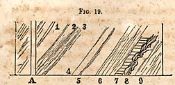
FIG. 19. [Hedrick copper mine]
The diagram will serve to explain the arrangement of the masses composing the vein. 1, Lode consisting of copper pyrites adjacent to the foot wall eighteen inches to two feet thick; 2, blue slate; 3, mucky quartz, with some pyrites; 4, slate; 5, slate which weathers brown, and contains gold three feet thick; 6, contorted slate; 7, vein of copper pyrites and quartz, between three and four inches thick; 8, slate; 9, vein of copper pyrites and iron three to four inches thick--terminating in slate.
Twelve hundred feet northeasterly, or N. 21° E., a shaft of sixty feet cuts the vein where it is six inches wide in a solid mass, but distributed through the quartz and slate two feet wide. Southerly twelve hundred feet the same vein has copper very much the same character as in the other shafts. The vein has been traced more than a mile in length continuously. Although this lode has not been fully developed by shafts sunk to a proper depth to secure that end, still there is very little doubt but it will prove a valuable mine. Its length and regularity, the two strings of four inches, which are intersected at the two principal shafts, distant from each other twelve hundred feet, are favorable indications, and go far to sustain the view I have taken of the Headrick copper mine.
* 206. The Barnhardt vein of Gold Hill, at the depth of between one hundred and seventy and two hundred feet, or at the level at which the lessees suspended their operations, contains considerable copper. The lode is equal to eight or ten inches, but is intermixed with iron pyrites. It yields, by trial, eight per cent. of copper; but as the expenses of mining and transportation on waggons are too great to warrant an attempt to work it for copper, nothing has been done farther than to test it for the per centage of copper. Still, provided there were smelting works upon the ground, this percentage of copper would give a fair profit.
Page 206
I have hopes that the time is not far distant when all the ores (gold and copper) will be smelted, and the use of mercury dispensed with. A large amount of copper is annually lost at Gold Hill, and it will probably turn out that the losses in various ways will pay the cost of smelting, were proper works erected.
* 207. Remarks similar or in keeping with the foregoing may be made with respect to the copper lodes of Conrad Hill. The regular front veins of this mine change their character, and at the depth of one hundred and seventeen feet copper pyrites take the place of the brown ore. These veins are remarkable for their regularity, width or strength, and it is by no means to be supposed that the fissures will be found closed, or cease to carry mineral matter.
A vein of pyrites of some promise exists on the lands of Leonard and Young. At its outcrop it is five feet thick, mostly quartz; but upon the foot wall there is from three to four inches of copper and iron pyrites. The vein dips at an angle of from twelve to fifteen degrees westward, and hence, is very flat, but it soon becomes steeper. It has been traced more than half a mile, and was formerly worked for gold.
* 208. Spencer Copper Mine, in Randolph county.--It is upon the upper branches of the Caraway, near the south boundary of Guilford county. It is from four to six feet wide, and nearly vertical. Its direction is N. 20° W. The vein stone is quartz, through which the yellow sulphuret is dissemmated. I have seen very handsome ore from this mine, but have not examined it in place. The sulphuret is interspersed through the quartz near the outcrop, but at sixty feet is collected in masses nearer the foot wall.
* 209. Standard property near Gold Hill.--This property at one time was regarded as very valuable. As the mineral now appears, I should esteem it more important for copper than gold. It is traversed by a net work of veins, or by several veins, whose direction is N. 20° E. The mineral at the surface is gossan, or the hydrous oxide of iron, and resembles the cap which covers some of the copper mines at Ducktown, Tenn. The veins which appear below this mass of gossan
Page 207
are more or less siliceous, and show the carbonates of copper and small masses of the black oxide. A place known as the big cut exhibits the vein to the best advantage. It is in a small cluster of veins, the relative position of which is shown on Plate 9, upon the left. Six or seven veins traverse the slate of this district, some of which are, no doubt, the prolongation of the veins which are worked at the village of Gold Hill.
* 210. The Townsend vein is supposed to be upon the range of the Barnhardt mine. But the slate is rather coarser and harder, and somewhat concretionary.
Upon the surface and in the rubbish from this abandoned mine, I found a mixture of copper pyrites, or the sulphuret of iron and copper. The vein is one foot wide, and has regular walls. Although it yielded gold when worked several years ago, it is evident that if pursued at all it should be for copper. The same remark is applicable to the Standard and Idler veins, which, at the time they were worked, the presence of copper pyrites was disregarded, or considered rather as an injurious mineral.
* 211. The Conrad Hill. The front veins at the depth of one hundred and ten feet carry the yellow sulphuret of copper. The upper part of the veins have been worked profitably for gold, but at the lowest levels which have been explored, copper forms the most important metal. But as no attempts to raise this ore have as yet been made, I do not propose to speak farther of its value.
In this vicinity several other auriferous veins are known to carry copper at between forty and fifty feet. They remain however untried, and their shafts are fallen in or filled with water.
Page 208
CHAPTER XXVII.
Repositories of the metals continued--Lead and its Combinations; its Geological Relations and Associations.
* 212. Galena or lead, cannot be said to abound in North-Carolina; yet, at three localities it may be regarded as an important metal, viz., at the Washington silver mine, which has been already described--the McMackin silver mine in the vicinity of Gold Hill, in Cabarrus county, and near the residence of A. J. Moore, Esq., in Davidson county.
The rock in which lead is most frequently found is the argillaceous slate of the Taconic system. The localities already noticed belong to the slate formation. Others are also known which bear the same relations; for example, the Hoover and Boss lead mines in the neighborhood of the Headrick copper mine in Davidson county. Lead is not known in connection with the copper mines of the granitic districts; at least the quantity in connection with the copper or gold mines in this formation is too small to merit even a passing notice. What may be discovered in the copper and gold veins at deeper levels cannot of course be predicted. In the North-Carolina copper mine, carbonate of lime has made its appearance in the vein stone, and indeed forms, in one of the levels, a constituent part of it. This fact is in itself an indication that galena or a silver lead may come in also, an occurrence which would be injurious, rather than beneficial to the mine.
The Boss lead mine, in Davidson county, is scarcely entitled to a notice as a mine. It has furnished handsome cabinet specimens of galena, which were taken from a very distinct vein of quarts. The mineral is associated with copper pyrites. The metal is scattered through a very tough vein stone, but has been exposed only near the outcrop. The most favorable fact which this depository presents, is the development of a very distinct vein fissure, which, at several places, carries metal in small quantities both of copper and lead near
Page 209
the outcrop; but these metals appear in different parts of the vein, and are not mixed together.
The vein is from four to six feet wide, and takes the course of the majority of the metallic depositories of the country.
The Hoover lead mine is two miles south from the Boss mine; and was formerly owned by a Mr. Williams, on whose plantation it was discovered. The galena is coarser and more crystalline than that of the Washington mine. The vein is promising at its outcrop, but at the depth of ten feet dwindles to mere string in its calcareous vein stone. It furnished two or three tons of metal which seemed to form a pocket or bunch merely, in its gangue.
This place, however, offers one inducement to pursue the metal in the direction of the vein; it is the calcareous gangue of the lead which bids fair to pay, in part, the expenses of testing the depository more thoroughly than has as yet been done. Limestone is extremely scarce in this part of the State, and as it is six or seven feet wide, enough would be obtained to be employed for a flux in smelting the ores of the Washington silver mine, or other metals of this mineral district, while the vein itself would be sufficiently tested to determine its value.
The only important depositories depositories of lead of the midland counties which may be regarded as important, are those already referred to, and which are associated in each instance with blende. They are all silver lead ores, and their value as mines is only beginning to be appreciated. Their value has been evolved by the discovery that the blende with which the lead is associated may be separated by a mechanical process, after which, the whole of the silver and lead may be obtained by the usual process of smelting and cuppellation. The lead becomes valuable in these cases as an instrument, or an agent in the process of reduction.
It is an interesting geological fact that the silver lead ores all belong to the Gold Hill belt, and the different localities lie in a range with each other. The extreme points of the belt, at which these interesting combinations of metal have been discovered is about thirty miles. The most southwestern
Page 210
point is the McMackin silver mine, and the most northeasterly one is that near the residence of Mr. Moore, in Davidson county.
The enquiry will no doubt be raised whether the same vein of metal may not be found between these extreme points. This expectation may, perhaps, be realized; but the intervening country is crossed by an overlying brecciated conglomerate, into which this vein of metal does not probably penetrate. The Gold Hill part of this belt is on the west side of the conglomerate, and the Davidson extremity is upon the eastern side of it. The facts respecting the relation of these silver lead veins, induces me to adopt the opinion that they would rather pass beneath the conglomerate than through it. We have no evidence, it is true, that the veins of silver lead are continuous, only they are upon one line of strike, and the ores resemble each other externally, as well as in their chemical constitution. Admitting, however, their continuity, which is hardly credible, the overlying brecciated conglomerates will conceal them throughout most of the distance between the points which I have named. As it regards the galena or lead of the Washington mine, the McMackin and the Davidson mine, enough has been said under each respective head; inasmuch as the two last require farther exploration to establish their true value.
CHAPTER XXVIII.
Repositories of the metals continued--Zinc, its ores, geological relations and associations.
* 213. So far as the investigations have been made, it appears that zinc is found in this State only in combination with
Page 211
sulphur. I have already noticed it as a mixture with galena and copper at the Washington mine in Davidson, and at the McMackin mine in Cabarrus counties. At both of these mines it is found in masses which consist almost exclusively of blende. Its color is brown, and its texture fine grained, and often quite compact. At the McMackin mine it is yellowish, and always of a lighter color than at the Washington mine, and at this place also it is often distinct from the galena. At the Davidson zinc and lead mine, near the residence of Mr. Moore, it resembles that of the Washington mine. With respect to this metal, it is important to recollect that neither gold nor silver may be expected to be found in it, either in a state of mechanical mixture or chemical combination, notwithstanding it is in contact with lead and pyrites, in which both silver and gold are intermixed. Perhaps it is going too far to assert that neither of these may exist in the blende in very minute proportions. In all the trials which have been made, it has not been detected in sufficient quantities to make them objects worthy of future search, with a view to secure economical results.
An interesting locality of the sulphuret of zinc exists at the Jacob Troutman gold mine, one mile south east of Gold Hill. The ore is of an ash gray color, with a low metallic lustre. It is fine grained, and rings like cast iron when struck with a hammer. It is also quite hard. It becomes coated with a yellowish powder when heated to bright redness, and exhales the odor of sulphur, the latter of which is readily discharged, or volatilized in a capsule over the flame of an alcoholic lamp.
It is uncombined with lead, bismuth, cadmium, copper, gold, antimony or arsenic; as it appears when fused with nitre or carbonate of soda, and afterwards dissolved in muriatic acid, which leavcs silica in a gelatinous state. The acid solution, tested with sulphurated hydrogen, gave no precipitate which indicates, as I have remarked already, the absence of the foregoing metals, some of which were suspected, especially antimony and arsenic.
The principal metal present in this gray compound was
Page 212
proved to be zinc, by passing again sulphuretted hydrogen through a neutral solution, and to which caustic soda was added, which gave a white precipitate; this was also easily soluble in muriatic acid.
A small quantity of iron is also present, which exists, diffused sparingly through the mineral in small grains. This form of sulphuret of zinc first appears in the Troutman vein, at the depth of one hundred feet, where it is only two inches thick. At the one hundred and fifty foot level it is six inches thick, and exists in a solid mass. It is attached to the quartz of the vein, which, at a higher level was very porous and carried gold, yielding, near the outcrop, at the rate of fifty dollars per bushel; gave at the one hundred feet level only one dollar per bushel. After the shaft had been sunk one hundred and fifty feet, the vein was regarded as too poor to work, and was abandoned. The zinc which had come in at this depth was disregarded, and indeed the nature of the metal was not suspected; it yielded neither gold nor silver, and the operators were unable to extract lead from it; and hence it appeared to be worthless. The readiness with which this variety of sulphuret of zinc is decomposed, proves that it may be converted into a valuable white paint, provided the quantity of metal should be sufficient for this purpose. This is the most easterly of the veins belonging to the Gold Hill mineral district; its course is east of north. It appears to be a strong, well defined vein, and belongs to the slate formation; but in its progress north-eastward will pass beneath the brecciated conglomerate. It is known only at the Troutman plantation.
Page 213
CHAPTER XXIX.
Repositories of the metals continued--Manganese, its ores, their geological position and relations.
* 214. Manganese is widely diffused in the rocks of North-Carolina, and next to iron it is the most common of the metals. The surface is frequently nearly covered in certain places with black nodules or concretions about the size of a pea; these are composed of the black oxide of manganese and iron--their dark color is due to the presence of the former. The natural joints of the slate rocks are generally covered with a film of manganese which has escaped from the interior of the rock to the surface. The only ore of this metal which has a commercial value, is the black, or peroxide of manganese. It is usually associated in this country with the limonites or brown hæmatite, and occurs in beds, or as a deposit in the soil. I have not, however, been so fortunate as to discover this species of ore in the connexion I have named, in the midland counties, in sufficient quanty, and at any place, to be regarded as possessing a commercial value. The use to which it is put, is to form in the chloride of lime which is employed in bleaching.
The species of manganese which has fallen under my notice is the silicate of the metal. Of this there are three veins, each of which may be traced a half a mile or more upon the surface; and which are from five to seven feet wide.
A vein of this mineral is referred to in Prof. Olmsted's report, and which was regarded by him as the black oxide. It forms a superficial layer of the black oxide, but the quantity of it in this condition is too small to possess a commercial value. The vein I have reference to is about three-fourths of a mile south-west from Gold Hill. It is four or five feet wide, and is mixed at the surface with the oxide of iron.
Another vein crosses the plankroad about ten miles east of Lincolnton. It forms a conspicuous black stripe by the road
Page 214
side. The first impression is, that it is produced by the presence of coal. It is black upon the surface in consequence of oxidation; it is traversed by seams of a reddish substance, and by seams of quartz.
The third vein of this substance crosses the road at Mr. Briggs' iron works, in Gaston county.
This mineral has not been applied to any useful purpose. But manganese is frequently associated with silver ores, and hence, the veins should be examined for the purpose of ascertaining if there exists any valuable metal in connexion with it.
At the McMackin silver lead mine manganese enters into the constitution of the vein and forms in part the vein stone, or perhaps may be regarded as one of its metals.
CHAPTER XXX.
Earthy Minerals and Rocks which possess a value in the Arts.--Steatite--Agalmatolite--Pseudo Burrhstone--Roofing Slate--Fire-stone--Fire-clay--Porcelain-clay--Building Stone--Porphyry--Antifriction Rocks, or Rocks which may be employed for the bearings of heavy wheels.
* 215. Steatite or Soapstone.--This important material is common in several of the midland counties. In Wake county it occurs on the plantation of Mr. Lewis Nippers; it is rather coarse, and contains upon the surface too much quartz. It is associated with slates containing veins of quartz carrying the specular ore of iron, which seems to be a very common association in this State. Two miles north-east from this place, and probably also at intermediate points, soapstone exists in large beds or mountain masses, which, though rather
Page 215
coarse, is of a very good quality, and is suitable for hearths, jambs and other purposes. Its color is green, and the mass is rather crystalline. It may be sawn into blocks of any required size. It is in inexhaustible quantities. Where soapstone is to be employed in the construction of hearths, backs or jambs for fire-places, too much caution cannot be observed in exposing the stone to heat for the first time. It often happens that water is inclosed in the rock, and if heated rapidly, it is converted into steam and explodes; and the breaking of the stone might be followed with fatal consequences. Hence, the rock should be dried in the first place, and all its water expelled slowly, which saves the stone from flaking off subsequently.
Soapstone occurs three miles west of Ashborough, and five or six miles north-west of Franklinville, in Randolph county.
The use of soapstone is generally known. Its valuable qualities are dependent upon its softness and refractory powers. It enables the mechanic to give it form and shape at a very trifling expense. It is true it is not handsome in itself, as it is not susceptible of a polish; still, when planed and varnished, it makes a very handsome mantle-piece. The varnish brings out lively light green tints which give the surface the appearance of a variegated marble.
The most valuable soapstones are free from flint and hornblende spar, and other foreign minerals. When present, they diminish more or less its value. The most important use of soapstone is as a lining for stoves, and its employment in the formation of registers in houses heated with hot air. The fine compact varieties are selected for these purposes. In quarrying soapstone, gunpowder should not be used--indeed its use is not attended with much success--and when it breaks out a mass, it produces shakes or invisible cracks which greatly damage the stone, and which open, on exposure to heat and frost. The only safe method of quarrying, is to cut out rectangular masses by means of suitable tools.
Soapstone, as a rock, belongs to the pyrocrystalline series, and never occurs as a sediment; it is associated with serpentine,
Page 216
hornblende and talcose slate. It frequently contains, in isolated crystalline masses, dolomite, or magnesian carbonate of lime, sparry iron, or carbonate of iron--brown spar, asbestos, etc. In Massachusetts it passes gradually into serpentine. I have never seen it passing directly into serpentine in North-Carolina.
Agalmatolite belongs to the sedimentary class of rocks. As such, it may be regarded as a white variety of argillaceous slate. The most remarkable locality of this rock is near Hancock's mills, in Chatham county. It is also associated with the massive specular ores of iron, both in Montgomery and Chatham counties. It is also in immediate connexion with quartz rock in Montgomery county. It is often useless, from the presence of fine granular quartz, or from disseminated grains of magnetic iron.
In foreign countries this stone is cut into pagodas or images, and hence, has been called figure stone.
As its grain is very fine, and its texture compact and at the same time soft, it is adapted to a variety of useful or ornamental purposes, as ink-stands, paper-weights, etc. When exposed to heat, it does not become as hard as soapstone. It however receives something of a polish which may be heightened by varnish; and hence, may become rather handsome for mantle-pieces. This use of it is important in North-Carolina, as marbles are extremely scarce. The soapstones and figure stones are important also, in consequence of their combined strength, softness, and their ability to stand the weather; the latter property enabling the artist to quarry and shape them readily, and when placed in a building, they are more durable than granite.
* 216. Marble.--There is probably no material so scarce in North-Carolina as limestone, when its actual quantity is compared with other States of the Union. Limestone, however, forms an interrupted belt across the State. At one or two localities in Catawba county it has a fine, even, granular structure, combined with a lively lustre, which equals in beauty any of the Italian marbles. But these qualities are too limited at the surface to be of any use. The question is, is it probable that beds possessing these fine properties may
Page 217
be obtained by deeper explorations. It is not at all improbable.
Agalmatolite.--This rock has been already noticed. It resembles steatite, and so much so, that it has always been confounded with it. It is, however, quite different in composition, though it has the soft soapy feel, and the light greenish white colors. In North-Carolina it is much finer and whiter than its soapstones, and hence, it has been regarded as a better kind of this rock. In the arts and as a fire-stone it is not as valuable, as it is more likely to split and flake off when exposed to the fire. If carefully dried, this defect may be partly overcome; but when used as a fire-stone, it should be exposed endways to the flame or fire. It splits like an argillaceous slate; indeed it is a white variety of this rock. In addition to its use as a fire-stone, it is supposed to be employed, when ground, for adulterating white paint or white lead; but for this purpose it is not adapted. When mixed with oil it becomes translucent, or loses its opacity; and hence, in common language, it has no body. But the use to which the powdered rock is employed, is to adulterate hard soap; that is, I suppose adulteration is the right word, inasmuch as it is designed to increase its weight. It has, however, other properties which may justify, in part, its employment; it is retentive of odors, and hence, in fancy soaps, it may serve a useful purpose; besides, it no doubt assists in absorbing grease, and in cleansing surfaces. It may not be, therefore, an absolute cheat in soap, as it has certain useful qualities. Large quantities have been ground the last year in Chatham county for the New York market. It is necessary that it should be free from grit. When pure, it is suitable for antifriction powder, and may also be used as a cosmetic, in place of chalk, lead, etc., without injuring the skin.
The composition of this variety of Agalmatolite is as follows:--
| Silex, | 75.00 |
| Alumina, | 18.75 |
| Potash, | 2.00 |
| Water, | 3.50 |
| Traces of iron, | . . |
| 99.25 Jackson. |
Page 218
An analysis may give an excess of silex in consequence of its mechanical intermixture, as it is not unfrequently disseminated through the mass as a foreign mineral. It will make, according to Dr. Jackson, a very refractory material for potter's stone-ware and crucibles. The oxide of iron is an accidental mixture, varying very much in quantity at different localities. Sometimes octahedral iron abounds in certain layers in thick and heavy beds; it is apparently absent, and becomes snow white in the furnace.
Burrhstone or Pseudo-burrhstone.--This rock, upon its exterior, is exceedingly rough and ragged, and as it is an extremely tough siliceous rock, it may probably possess the same valuable properties as the Paris burrhstone. But I do not speak confidently; for the fact can be known only by applying a stone suitably prepared to this use, that of a millstone. The material of the rock is in the required condition at the surface. It consists of a porous chert; or, originally, it was a porphyrized chert, the felspar having disintegrated, leaves rough cavities bounded by a tough sharp edged material, similar to that of the Paris burrhstone. One difficulty may materially interfere with the introduction of this stone for the purpose proposed, viz., the expense of cutting it, in consequence of the toughness of the material; and besides, the stone has not weathered deeply, except when detached from the parent bed. But the formation is extensive, and the varieties or kinds are quite numerous; and hence, it is expected that localities will occur suitable for the purpose I have proposed.
The most extensive beds of the Pseudo-burrhstone occur in Montgomery county, near Troy. It is the fossilliferous mass which is intimately connected with the granular quartz. A rock possessing characters quite similar to the foregoing exists in large masses at the Flat Swamp mountain, in a part of Stanly and Davidson counties. So far as they have fallen under my observation, they are not so good as those of Montgomery county. The whole range too, from a point near Gold Hill to the Flat Swamp mountain is traversed by a siliceous
Page 219
porous rock, which possesses many of the characters required for a good millstone.
* 217. Roofing Slate.--In the slates of Chatham county there are beds which are firm, hard and strong, which may be employed for roofing. The colors are blue and purple. Of the former, the most important beds are near Rocky river. The purple beds were observed on the plantation of Mr. Headen. The best were brought up in sinking a well. The slates extend, I believe, across the State--but the debris of rocks conceal so frequently the outcrops, that they cannot be traced continuously. The only drawback which seems to exist respecting the roofing slates, is the depth of the beds, or the want of a sufficient extent of outcrop. It is not so accesible as in the more elevated parts of this country. Quarries of slate require an elevation above the general level of the country in order to obtain depth, and at the same time space above ground, so as not to be obliged to incur much expense in draining.
Fire-stone, and Stone for Furnace-hearths.--The sandstone of the Taconic system furnishes fire-stones which may be relied upon; also, for the hearths of furnaces. It is a white and rather friable rock, with some mica. Specimens of it would be called arenaceous quartz. There are two ranges of this rock, one passes through Wake county, and runs parallel with the veins of graphite--the other through Lincoln and Catawba counties. The latter have been proved by experience to be valuable for the purpose I stated--those of Wake do not differ from them, and hence may be regarded as equally valuable.
* 218. Fire-clay for Fire-brick--Pipe-clay.--Clay for firebrick is abundant in Gaston county. It is free, I believe, entirely from lime and the alkalies, potash and soda. It extends through the county. It is inexhaustible in the vicinity of King's mountain, and appears at numerous places between the iron-works and Dallas, as well as at numerous places in and about the latter place.
Pipe-clay occurs in Forsyth county, and is employed extensively for the bowls of pipes. In Davidson county, also,
Page 220
this variety of clay exists in the depressions of the surface. particularly in the vicinity of Spencer's Post Office. When exposed to high heat, the bowls lose the whiteness of the clay, and change to a drab. These clays are also suitable for jugs, pans and other vessels for domestic use. These clays, however, are employed only to a very limited extent.
* 219. Porcelain-clay.--This substance exists at numerous localities. In Lincoln county, at Lincolnton, it appears to be abundant, and of good quality. In Davidson it is also said to exist, but it is probably a pipe-clay. White clays are abundant; but whether they will retain their whiteness when heated intensely, has not been determined by myself, except in a few instances. A large tract of country, forming part of the plantation of Mr. Bryant, at Jones' Falls, is underlaid by a white clay.
* 220. Building Stone.--The granites of North-Carolina are frequently in a disintegrated condition. But the quarries near Raleigh furnish a very good granite for construction. The micaceous sandstone of Wake also furnishes a good material for building, which is easily quarried. There is, however, no want of building material in any part of the State. The best, however, is the freestone of Deep and Dan rivers, of which I shall have occasion to speak hereafter.
* 221. Porphyry.--There is a belt of porphyry extending from Jones' Falls, some seven or eight miles north-east. Its base is black, purple and green of different shades--some of it is equal in beauty to the porphyry of the ancients. There is, however, little probability that it will be brought into use as an ornamental stone, though it is susceptible of a high and beautiful polish. It is also well adapted for mortars, being very hard and tough.
The porphyry passes by insensible shades into hornstone, which frequently is very fine-grained or compact. It is green, gray, blue, purple and green, and purple in stripe, and sometimes spotted. The compact varieties are highly valued for the bearing of gudgeons and axles of wheels. Years elapse before it can be seen that they are worn in the least. For all heavy wheels, therefore, they are as important in diminishing
Page 221
friction as the diamond and other gems in the wheel work of time keepers.
These admirable antifriction stones abound in Chatham, Randolph, Davidson and Montgomery counties. They may be selected from the finest varieties of hornstones and porphyries, which are frequently found in extensive beds in the clay slates of these counties.
CHAPTER XXXI.
Graphite--Its relations, extent, quality and uses.
* 222. The occurrence of this substance in North-Carolina has been known for more than a quarter of a century. Notwithstanding the length of time it has been known, its true value has not been determined. The works, however, which are now in operation will probably settle the question respecting its value. The best known locality is in Wake county; it is a few miles west of Raleigh, and it crosses all the roads running south-west, west, or north-west. It is much more distinct in the gullies or the road side on a wet day, than when it is dry. On the Hillsborough road there are two belts rather less than half a mile apart.
The whole formation consists of three or perhaps more parallel veins; they are apparently variable however in number at different points of exposure.
The feature which this mineral presents, most worthy of notice, is its great persistency; for there are, I believe, no mines on record, whose extent can be compared with the graphite of Wake. It is known to occur fifteen miles south-west of Raleigh, on Black creek, in a hill by the road side discoloring the soil forty feet in width; and it is explored
Page 222
seven miles north-west of Raleigh; and from these distant points it shows no signs of giving out. Its veins, therefore, extend eighteen or twenty miles, though I do not assume that they are absolutely continuous, yet I have little doubt that they may be traced upon the surface throughout this entire range. Enough is not known of the exact relations of these depositories of graphite to enable us to speak with certainty of their relation to the enclosing rock. With the facts which are now in my possession, I am disposed to regard them as veins and not as beds. Their strike is a few degrees (about 10) east of north. The general range of the slates is N. 25° 30′ E.; and besides, the graphite has a veinstone of quartz, or is accompanied with quartz; hence, from facts of this kind, I look upon or regard them as deserving the name of vein, as much as any of the auriferous depositories of this State.
The dip is north-westerly at an angle of 65° to 70°. Shafts have been sunk upon them to the depth of one hundred feet, and a single vein has been stoped out to the depth of seventy feet. The distance of the continuous stoping is about one thousand feet. This ground furnishes the most reliable information respecting the character of these repositories of graphite. The level of the tunnel or drift referred to, shows a vein varying in width from six to eighteen inches, with regular walls, showing friction and triac, or slickensides, proving thereby the existence of a vein fissure. Intermixed with the graphite we frequently find lenticular masses of quartz, besides the quartz in fine grains more immediately disseminated in the metal itself. It rarely contains sulphuret of iron. The graphite, though confined mostly to the seam, yet spreads more widely in the rock, and stains it black for several feet, and hence the vein appears wider than it actually is. The adjacent parts which are colored resemble the common plumbaginous slates of which there are many examples in the Talcose slates of New England.
The following beds accompany the veins, and they lie in the following order:
Page 223
- 9. Talcose Slate.
- 8. Micaceous Sandstone, two hundred feet thick.
- 7. Talcose Slate.
- 6. 2d Graphite Vein.
- 5, Dark colored Slate, twenty feet.
- 4. Plumbaginous Slate, from one to two feet.
- 3. Graphite from four to eighteen inches thick.
- 2. Yellowish & white joined Slate, two feet.
- 1. Drab colored Slates.
The graphite, wherever it occurs in North-Carolina, is not far beneath the sandstone referred to. Hence the veins of graphite occupy a position quite similar to the iron ore veins of Lincoln county. This sandstone is near the base of the Taconic system in some places, indeed in most it is underlaid by a conglomerate and a few beds of slate.
The graphite belongs to the primary slates; it is a mineral which differs in its origin from coal, that is, there is no evidence that it has been in the condition of organic matter.
* 223. This question respecting its origin is one of the most interesting in geology. Coal, without doubt, is of vegetable origin. In composition it will be perceived that it is not greatly dissimilar to anthracite, by a reference to their respective constituents; but anthracite, however near it approaches in composition to graphite, is derived from organic matter. We cannot, however, under the circumstances in which the graphite of Wake county occurs, assign its origin to the same source. We are necessarily driven, therefore, to account for its occurrence on other grounds. To do this satisfactorily, we must ascertain whether there are any phenomena in nature or art which are illustrative of those chemical changes, which may throw light upon its formation. Upon this ground we may confidently refer to the production of artificial graphite in iron furnaces, which, when working well, and under the full and advantageous application of heat, invariably produce graphite both in the metal and in the slag. The artificial graphites contain, I believe invariably, a small per centage of iron; and in its formation it involves the process of a combination of the vapor of the two elements. When, therefore, it is an established fact that graphite is formed under favorable circumstances from any substance
Page 224
which contains carbon, it does not appear difficult to account for it as it occurs in the veins of Wake and Lincoln. All we have to assume, is the existence of the carbonates in the interior of the earth. These, when exposed to heat, being susceptible of decomposition, undergo the needful changes for the production of this carbonaceous substance. It undoubtedly rises in vapor, and is condensed in the fissures in the form in which it is now found. We have no occasion to call to our aid the metamorphism so frequently alluded to, and so frequently employed in accounting for phenomena of a kindred character. That carbon of a coal seam is susceptible of being converted into graphite may be admitted; but whenever carbon occurs in rocks of a sedimentary origin, it is accompanied with other phenomena which form a conclusive argument respecting its origin. Here, in Wake, we have a rock distinctly primary in its character, showing no traces of sedimentary origin, or at least of having been deposited within the organic era; and as graphite is formed artificially under the needful conditions, it cannot be regarded as an unwarrantable assumption that it may also be formed directly in the interior of the earth, and independent of any preexisting organic matter.
Its occurrence in veins or fissures is also accordant with facts which are established in the case of metallic bodies. Any substance which can be vaporized may be found in and filling the preexisting fissures.
Graphite is a very important substance; it has become an indispensable article of commerce--but it very rarely occurs in that state of purity which is required for the purposes for which it is employed. Silex or quartz in fine grains is the most common impurity, and the most difficult to separate. When crystalized and pure it still requires the aid of art to bring it to a state in which it can be employed. In its pure laminated state the mechanical condition produces singular changes in its molecules, or rather particles; it is almost impossible to pulverize it and impart to them that form which seems essential for its employment in the arts. These, when mechanically separated, are split almost ad infinitum, or in a
Page 225
mode similar to talc and mica, and become thereby light as down, and difficult to recombine. The variety known in Wake has a rounded form; and hence, it is susceptible of a mechanical division, and of assuming readily the state required in the arts. The impurity of this variety is silex in a state of minute subdivision; and before it can be applied for certain purposes, this must be separated from it by mechanical means. It cannot be used for pencils, or as an antifriction agent in its natural state. It is, however, not so objectionable when it is employed upon wood, as wagon axles, &c.; but where iron is employed, it wears the surfaces rapidly--hence it is common for farmers to employ it in its native state upon their wooden axles, mixed with grease, with good effects.
The experiments which are being made by Mr. Miller, at Raleigh works, will probably test most thoroughly the question respecting its value and uses for various purposes.
It should however be stated, that for certain purposes, as for paint and its application for stoves there can be no doubt of value, with only an imperfect separation of silex. For the presence of fine silex cannot be injurious when used for a paint for roofs; its presence is rather beneficial, as it thereby becomes less combustible, and renders the wood in a measure fire-proof; it is far more valuable for paint than any of the stone paints in use, having, when in combination with fine silex, all the incombustible properties which they are supposed to possess. It is not only with respect to the use of graphite as a paint for roofs, but also in an equal degree as a paint for ships. I believe, for these purposes, the separation of silex is not required; it should be as fine as possible, free from slate, and contain simply graphite and silex. Graphite, notwithstanding its lightness, has a body unequalled for strength, by any substance. A minute quantity indeed is sufficient to give color to a large quantity of fluid, and cover a large surface of wood. Graphite must also protect wood in a certain degree from decay. Old roofs, for example, where it has been employed, have, as it were, been renewed by its use, and rendered durable for years, when, without, they would
Page 226
have been useless. It protects most thoroughly from the air, and when of a good quality is adherent. It is, therefore, one of the most valuable of paints; but it has not been sufficiently common in market to supply the demands; but it appears to me that the depositories of Wake, when brought properly before the public, and the great value of the article becomes known, can supply an immense amount of material; indeed, it is only in this country that graphite is sufficiently abundant to meet the wants of the public, and it is singular that so little should have been done up to this time in introducing graphite into the commercial world as one of the most valuable paints for roofs and shipping. The value of graphite for crucibles is well known; but as it regards the adoption of it in its partially pure state, I am not well informed enough to speak with confidence; but inasmuch as in the manufacture, clay of a fine quality is required to form the body of the utensil, it seems that it may be all that is wanted.
In addition to the remarkable depositories in Wake county, the old county of Lincoln also furnishes, or will furnish those, which are probably equally pure; but they are not so extensive. The formation is the same, and the mode of occurrence the same; that is, it is in veins in a talcose slate, whose dip and direction closely conform to that of the rock. It is, however, proper to observe, that the graphite of Lincoln, (or it may be within the limits of Catawba) county, has not been explored except superficially, but the surface indications are favorable both as to quantity and quality.
Although the graphite of Wake county is beneath the micaceous sandstone, it does not necessarily follow that it will always occupy that position in North-Carolina. We can see no reason for limiting it to any of the older rocks, including the palæozoic slates and sandstones. In most cases, whether in the palæozoic or hypozoic strata, the direction or course of the depositories may be expected to pursue the usual course which prevails in the formations of the slates.
In New York the graphite is connected with the primary limestone in which it occurs in irregular veins or disconnected masses. It is always, however, crystalline, and in many
Page 227
instances perfectly pure; but as in the case of other substances which occur as ores, it is uncertain in its continuance. In North-Carolina, however, the depositories appear to be permanent or persistent in depth, and the great desideratum is to free it from silica. The partial failures seem to have arisen from not having employed more extended vats, and the use of too little water, for the amount of fine graphite which had to pass through them.
CHAPTER XXXII.
Deep River Coal Field--Masses which compose the formation--Considerations respecting its age.
* 224. No formation has excited more attention than that of Deep river. In Connecticut and new Jersey it has been known under the name of New Red Sandstone, and has been carefully examined by Dr. Dean of Greenfield, and President Hitchcock of Amhurst College, Mr. Redfield of New York, and Prof. Rodgers of Boston. The most remarkable discoveries which have been made in connexion with this formation, are the foot prints of birds; and probably their discovery has given as much celebrity to North American geology as any which have been made. The age however of this series had not been determined to the satisfaction of all parties, prior to the commencement of the Geological Survey of North-Carolina. The difficulties which beset this question are uncommonly great. Resting as it does in the northern and southern States, upon granite or pyrocrystalline rocks, its geological relations gave no clue to the epoch of its deposit; and then, to add to the obscurity, most of the fossils which had been discovered, were equivocal in their meaning. So
Page 228
that, neither its position in the series could be deciphered by its relations, nor indicated with certainty by its organic remains. During the progress of the survey of North-Carolina, evidence has been gradually accumulating respecting its age; but it is only during the last two years, or since the publication of my report in 1852, that the evidence has taken a more positive form. It is true that I had in my possession fossils which pointed to the Permian system as its equivalent; but this evidence became neutralized in part by the occurrence of fossils which belong to the Triassic type; or may be regarded by other geologists as Triassic. I was led, in view of all the facts known to me at the time of the publication of the report referred to, to express the opinion that the Deep river coal series belonged to the Triassic, or New Red Sandstone epoch. The reader will see in the sequel what changes this opinion has undergone since that time. Waving the geological question for the present, I shall proceed to describe the series as it is developed upon Deep river.
* 225. A natural division seems to exist when we take into account the physical characters of the formation only; and indeed it would be disregarding important features, were these to be passed by unnoticed. According then to these features, the series should be divided into three great deposits, the lower red standstone and its conglomerate; the coal measures including slates, shales and drab colored sandstones, with their subordinates; and lastly, the upper red sandstones and marls.
These three parts of an apparent unbroken series, so far as succession is concerned, seem to be continuous deposits without breaks or unconformability, with one exception; but when their organic remains are taken into the account, we cannot avoid doubting the correctness of the foregoing view. The lower sandstone has nothing in common with the upper, excepting its lithological characters; but there is a gradual transition of the lower into drab colored sandstones, and the obscure fossils belonging to the vegetable kingdom extend from one to the other, though there is a want of certainty in the exact determination of those forms. When, however, the
Page 229
upper red sandstone is examined, its fossils are found to be entirely different from those below; and hence the necessity, as will be seen in the sequel, of separating it from all the inferior masses, notwithstanding its apparent conformability.
I have said the series is conformable and without breaks excepting in one instance. I here refer to a conglomerate lying between the upper drab colored sandstones and the upper red sandstones and marls. It is not clear that there is a decided unconformability, but I am inclined to adopt the opinion that there is.
* 226. The lower sandstone is red or purplish red, often deep red, or the color of a well burnt brick. It is made up of grains of quartz, which are rarely coarse; its texture is even, and many beds are firm, free from marly layers, and constitute an excellent free stone.
The lower beds are made up of pebbles of quartz strongly compacted together, without the intervention of a cement. So firm are these beds of conglomerate that they make an excellent corn stone, which, when broken from the quarry, split across the pebbles without removing them from their beds. The pebbles are derived from the adjacent and inferior Taconic slates, or the auriferous slates, with their series of imbedded minerals.
The most conspicuous part of the conglomerate is quartz, which is rounded by attrition, and has often assumed a flattened or oval form.
The origin of these pebbles is, without doubt, from the slates; particularly the veins which traverse them. The slate itself is largely intermixed with distingrated matter, which sets free the undecomposable milky quartz, and hence, when exposed to the action of water upon a sea beach, they are rounded by the attrition to which they are subjected. It requires afterwards that they should be consolidated by pressure, when they form a solid mass of conglomerate.
The thickness of the beds varies from six inches to two feet. These solid beds are parted by soft or marly matter, which gives an opportunity to split them horizontally from the planes upon which they were deposited.
Page 230
The color of the conglomerate is usually gray; but when the pebbles diminish, and the marly matter increases, they are red. These are perishable masses, and hence are not suited for millstones. The lower conglomerate is full sixty feet thick, and rests, as has been already observed, upon slates and other beds of the Taconic system; but as the rock extends north-east and south-west, or obliquely across the slate, it reposes upon certain pyrocrystalline rocks, and has its conglomerates made up, in part, from them. Hence we may find pebbles from the quartz veins of the slates which carry gold, as well as from the gneiss, hornblende and granite. The two systems, it is scarcely necessary to say, are strictly unconformable--the slates having been tilted up prior to the deposition of the sandstone with its conglomerate. Hence, the formation rests upon the upturned edges of the inferior and older rocks. The conglomerates, though instructive, require no farther descriptive details, except, it is proper to say here, that they are destitute of fossils, excepting the occasional occurrence of lignite, and perhaps near their junction with sandstone, that of silicified trunks of trees, as at Gernanton, in Forsythe county. I have not been able as yet to detect a leaf of a cycad, or a fern; though the silicified trunks of a conifer are very common. This fact is of considerable importance; for, at the beginning of another stage, those remarkable vegetables are very common. I cannot, however, say that they will not be found; but only mean to assert, that after many diligent examinations, they have not as yet been discovered.
The statements which have been made relate to the quarries of Moore county, which furnish the millstones. It is not present everwhere beneath the sandstone in so much force; unless it is concealed by soil. Thus, at or near the junction of the sandstones with the slate, at the Gulf, I have not observed the conglomerate in place; it is there, but in thinner beds.
* 227. The lower red sandstone which succeeds the conglomerate, is made up of both angular and rounded grains of quartz, which are always coated with peroxide of iron. This
Page 231
coating may be washed off when the grains resume their common color and lustre. The upper part of this mass, however, is frequently of a drab color, and has fine grains. The hyaline quartz, with its red coating, is absent. The point where these drab colored beds may be observed, is on the north side of Deep river, at Egypt. So also near the Gulf; but this mass is variable in thickness, and it is common for the red sandstone to continue, until it is replaced by coal shales; but the coal shales are invariably succeeded by the drab colored sandstones, where they become an important mass.
The lower sandstones, as they exist, extending from Evans Mills to the slates bordering the sandstone on the north, consist of,
- 1. An inferior conglomerate too much concealed by the soil to admit of measurement.
- 2. A hard dark brown freestone.
- 3. A softer thick bedded brown sandstone.
- 4. Gray sandstone.
- 5. Hard red sandstone.
- 6. Soft red sandstone, frequently passing into a marly sandstone.
- 7. Gray and olive green sandstone.
The foregoing description of rocks or strata which succeed the conglomerate, and lie beneath the coal slates, will apply to this part of the formation. Some of the strata are soft, others hard, and a few occupying the upper part are gray and drab. Red sandstones predominate over the rest; and besides, they are generally hard and durable.
* 228. The dip of the sandstones is somewhat variable in direction as well as in amount. In direction it is about S. 25° W. The amount of dip varies from 10 to 22 degrees. It is frequently steeper near the bottom beds than near the slates. The thickness of the lower red sandstones at the Gulf and Egypt is at least fifteen hundred feet, (1500,) and probably is nearer two thousand, (2000.) West of Carthage, in Moore county, it is greater. But as the rock approaches Jones' Falls, in Chatham county, it evidently becomes thinner, and, as I believe, nearly thins out. If my observations are correct with respect to this change, important consequences
Page 232
must flow from them; for in that case it is the upper sandstone which is prolonged north-eastward into Granville county, and that which is connected with the coal, or beneath it, thins out. At Jones' Falls there is less than forty feet of sandstone and conglomerates, which is probably the lower part of the sandstone. Following, however, these lower beds from Jones' Falls northwardly, it appears that the lower masses become thicker, and about six or seven miles east of Chapel Hill the black slate of the coal measures reappears. There seems to be a deep depression upon the strike of the lower beds, in which the inferior rocks come in again, which may also contain seams of coal as at Farmville and Egypt. But still farther north or north-eastward the black slate disappears, or is concealed by an overlying red sandstone. I have said all that appears to me can be useful to the student respecting the lower mass, so far as it is required when its composition only is to be considered. That which relates to its organic contents will be noticed farther on.
* 229. The coal measures consist of two principal rocks; the drab and gray sandstone, and the coal slates or shales. The sandstones are rather fine sediments, and rarely if ever very coarse. They are even and rather thin bedded rocks, and some of them are suitable for grindstones. Frequently they are defective from excess of clay, and when exposed to the air crumble and fall to pieces.
The sea in which they were deposited was probably shallower than when the lower red or upper red sandstones were deposited. Ripple marks which are rare in the latter are common in the former, the drab colored beds; so also their surfaces are marked with marine plants, which grow in the shallow water. The dip of this middle mass corresponds to the lower red sandstone. The thickness of this part of the series at Mr. McIvers' plantation, near Egypt, is twelve hundred feet, (1200.) This measurement excludes the black and green slates and the drab colored beds beneath them; or, in other words, it embraces the series of the continuous beds of this color up to the conglomerates of the upper red sandstone.
Page 233
It is worthy of notice that the surfaces of these rocks, when exposed to the atmosphere, become covered with an efflorescent salt during the dry weather of summer, which consists of chloride of sodium, or common salt; and the water at many places, which is obtained by sinking wells, is brackish. No wells, however, are sunk more than 30 or 35 feet. They are therefore shallow, and do not give us the necessary information respecting the quantity of native matter with which the formation is charged. It is evident that there is a change in this respect, for in the deep shaft of Egypt, (460 feet,) the water is entirely free from foreign matters, and is an excellent water for domestic use. There are no brine springs worthy of note issuing from this formation--which is contrary to what might be expected considering the constancy of the salt which appears upon the surface rock.
* 230. The coal measures of Deep river form a distinct belt of rocks between the two red sandstones. The drab colored beds of the middle series has been described; the slate, which is an important member, will come up for consideration in this place. Of the belt which is occupied by slate, it may be said that it is extremely variable in the character of its beds; yet is by far the thickest mass, or most important in quantity. The great shaft of Egypt passes through slates and calcareous shales, 423 feet, while there is also a heavy bed of slate above the shaft, or where it begins, probably amounting to 150 or 200 feet; but below the 423 feet level the red strata are numerous.
The first 233 feet of shaft is black slate and calcareous shale of a greenish color, which is always more or less crusted. There are seven (7) alternations of these beds; and what is worthy of particular attention, is the constant occurrence of fossils in the former, while the latter are entirely destitute of them. The cypris, which is so common in the black slate, never appears in the greenish calcareous shales. The principal interruption to the continuance of the slates is the interposition of the beds of argillaceous oxide of iron, which are not far from 223 feet from the surface, or 200 feet above the first coal seam. The beds of iron balls and layers are about
Page 234
six feet thick; beneath, slates and shales continue, with only a few important interruptions, until the coal seam is reached at the depth of 423 feet. The shaft is sunk about 1,000 feet from its outcrop. The first thirty feet is soil. The last two feet is made up of coarse gravel, large rounded rocks, trap, and pieces of coal, all of which rested upon the black slate. The overlying soil is, evidently, at this point, made up of transported materials; though at a greater distance from the river the debris of the rocks remains in place. Below the first coal seam, the black slates reappear; but the principal bed is a gray sandstone which partakes of the character of a fire-clay, which is some fifteen feet thick. At the depth of thirty feet below the first coal seam another thin seam of coal comes in from twelve to fifteen inches thick, accompanied with black band. The slates still continue, and probably two hundred feet deeper. The body of slate at Egypt is probably thicker than at any other place in the coal field. At Evans' mills it is scarcely greater than six hundred feet thick. Four miles farther east from Egypt the slate is divided into four distinct beds by drab and gray sandstone, which are frequently covered with ripple marks.
There is, therefore, considerable diversity in the formation of the slate and shales with which the coal seams are immediately connected.
The slates are more or less charged with sulphuret of iron when near the coal; and hence, on exposure to the air, disintegrate or decompose, and become covered with saline efflorescence, which consists of the sulphates of iron and alumina. The black slates are highly bituminous, and take fire readily, and burn with a white flame. The greenish calcareous shales are destitute of bitumen, although they are equally, if not more fragile than the black slates. As a whole, these slates, on an exposure of a few months to the air, fall to pieces and decompose, and become an incoherent heap of fine slate, intermixed with a grayish ash or earth. The dip of the slate in the shaft of Egypt, at the depth of three hundred feet, is nineteen degrees. This angle is very constant from near the top to the bottom of the shaft. There is a slight change,
Page 235
which indicates that the dip will become less towards the middle of the trough, inasmuch as at the outcrop of the coal seam at the Taylor plantation the dip is twenty-two degrees.
* 231. The number of seams of coal which have been recognized are five. The first or upper is the most important. Its width is six-and-a-half feet. It consists of two seams, seperated by a seam of black band similar to the celebrated Scotch black band, which is celebrated for its valuable properties in the manufacture of iron. This variety of iron ore I observed at Farmville, soon after the slope had extended one hundred feet. At the surface or outcrop it is indistinct, and would pass for the common black slate; but it becomes heavy and perceptibly rich in iron when it is beyond the reach of atmospheric influences. The black band I believe accompanies all the coal seams, and as the connexion of this mass is such that it may be raised with the coal, it becomes a valuable addition to the resources of the coalfield.
* 232. The fire-clays, though they are not found at the bottom of every seam, still are quite common in the slates. They are traversed by organic remains vertically; but contain an entirely different series of vegetable from those of the older coalfields. Stems of sigellaria or stigmaria are unknown. Those plants which do occur, are so closely interlaced and matted together, that it is extremely difficult to determine their forms. We find, therefore, the slates and the coal measures to be made up of beds which are perfectly analogous to those of the coalfields of Pennsylvania and Ohio. This fact is quite interesting, as it furnishes a refutation of a geological dogma, that all the valuable coals belong to the carboniferous period. 1. We find the black bituminous slates so highly charged as to burn readily. 2. The coal seams which in the aggregate are nearly seven feet thick. 3. The black band, an ore supposed to be peculiar to the carboniferous epoch. 4. Bands of argillaceous iron ore both in balls and beds. 5. Fire-clays abounding in vegetable fibres and stones, the former of which appear to be roots; one bed of fire-clay is fifteen feet thick; and beds occur which are not accompanied with a coal seam. We find, therefore, all the
Page 236
concomitants of a coal series which belong to the carboniferous epoch. The seams of coal which have been exposed to the greatest extent are bituminous; but semi-bituminous seams are known, which are separated from the former several hundred feet. For example, there is a seam of anthracite near the junction of the slate with the upper red sandstone at the Gulf. Its extent is unknown. Another is known as the Wilcox seam. The latter is one mile south of the Murchison seam, and I have at times entertained the opinion that it is near the inferior sandstone, but still have doubts respecting its position, and should not be disappointed if it turned out that it holds a position above the bituminous seams. It is probably a local change, although I have not observed any local cause which is competent to dissipate the bituminous matter. At the Gulf, and also at Evans' mills, the semi-bituminous seams are near a heavy trap dyke, which apparently accounts for the condition of the coal.
* 233. The upper red sandstone differs slightly in aspect from the lower. It is more marly; and although hard beds occur frequently, yet by far the greater part of the rock is soft and perishable. Its color is the same; and a geologist might pass from the lower to the upper sandstone without being aware of the fact. Still, an inspection of the fossils which have been obtained from each respectively, demonstrates clearly the importance of regarding them as two distinct sandstones, belonging to two distinct epochs.
The upper may be characterized by saying that it consists of hard brown beds, alternating brown, or red, and mottled marls or clays, or those which are variegated. The spots are green or greenish, and usually distinctly circumscribed. The beds are frequently marked by cavities of an irregular form, which are evidently caused by the former presence of some salt, as the chloride of sodium, which is invariably dissolved out. The lower part of this sandstone is pebbly; indeed it may be regarded as beginning in a conglomerate, which is another fact which goes to prove that it is separated from the lower by a change in the physical condition of the country. The beds of conglomerate rest upon a gray or drab-colored
Page 237
sandstone. The conglomerates are below the greenish shales, which are some ten feet thick, and in which I have found cycads, ferns and certain forms of conifera belonging principally to sycopodiacca. Above this plant bed, the rock is a sandstone of a reddish color, with a very few beds which are gray.
We may, therefore, enumerate the beds which form the upper series, as follows, beginning with the inferior beds:
- 1. Gray or drab-colored sandstones, which probably belong to the coal measures.
- 2. Beds of conglomerate, from ten to fifteen feet thick.
- 3. Green and dark colored slates, with plants, consisting of cycads, ferns, &c.
- 4. Red and gray sandstones and marls, more or less mottled with green, greenish and white, some of which contain the posidonia.
The most important localities for examination of the conglomerates are: 1. Mr. House's quarries, upon Haw river, at Haywood; 2. Jones' Falls; and 3. A locality about six miles south-west from Jones' Falls, on the plantation of Mr. Ellington.
The conglomerates which crop out at the two first localities, have been mistaken for those at the base of the lower sandstone; for at Jones' Falls it is evident that the whole thickness of rock belonging to the sandstone series is less than thirty feet. It is not so distinct at House's quarry, upon the Haw river. At Mr. Ellington's, however, the same conglomerates are far above the bottom rocks of the series. The thickness of the sandstones beneath, at this place, cannot be less than eight hundred feet.
The identity of these beds of conglomerate is proved by the presence of the plant bed, which occupies the same relative position to the conglomerate, and furnishes the same species of plants.
I have been particular in stating these facts, for they change the whole aspect of the question respecting the age of this formation. If it were true, as most of the geologists who have visited Jones' Falls on Deep river have asserted, that the conglomerates there were at the base of the lower red sandstone, it would be necessary to group in one system the whole formation whose age or epoch would be that of the
Page 238
new red sandstone, being determined by the vegetables contained in the plant bed; but, when the facts are presented as in the foregoing paragrahps, we are satisfied that the plants belong to the upper beds, and it is to this age and epoch only that they belong. They have nothing to do with the age of the lower, being separated from it by the coal measures, and also by beds of conglomerates. It will be seen from the foregoing, also, why I have taken the position that it is the lower sandstone and coal measures which thin out as the series passes from McIver's to Jones' Falls. For at Jones's Falls, the beds below the plant bed cannot exceed forty feet; while at Ellington's, only six miles from Jones', the thickness of the rocks beneath it is at least eight hundred. This fact, of itself, proves that the conglomerate at Jones' Falls is not the conglomerate of the lower red, from which the millstones are taken, six miles from Carthage, and which I have stated are about sixty feet thick. These lower beds of conglomerate sometimes enclose lignite, or stems of wood which are carbonized; but I have not been able to discover in connexion with them beds of slate or shale equivalent to those I have already described. I have carefully sought for them near Egypt and the Gulf, without success. Beds of conglomerate, occupying about the same horizon as those of Jones' and Ellingtons', traverse, I believe, the whole length of the formation. They may be observed at Benjamin Wickers, and near the saw-mill of Mr. McIver, from which place they may be traced to Egypt. The plant bed has not been observed west of Ellington's; but the rocks pass mostly through a forest, where the debris of the sandstone conceals a large part of the formation, and hence, it is highly probable it may be covered up.
I have now stated those facts relative to the sandstone series of Deep river, which are necessary for a correct understanding of the divisions which have been proposed, and which may be recapitulated in a brief form at this place.
- 1. Lower red sandstone with its conglomerate.
Page 239 - 2. Coal measures, consisting of drab colored sandstones, bituminous slates and calcareous shale, coal seams, fire-clay, and bands of iron stone.
- 3. Upper red sandstone, with mottled sandstones and marls, together with its conglomerates at the base, green shales with plats belonging to the order cycadacea, ferns and sycopodiacea, etc.
In a country which is only slightly disturbed, and where so much of the rock is concealed beneath its own debris, it is extremely difficult to obtain certain facts which bear upon the conformalities of the series. There seems to be a slight unconformability of the upper red sandstone and marls with the lower; but it is slight, and a geologist might honestly question the accuracy of the opinion. If the coming in of the upper conglomerate marks the position of an unconformability, that, together with the fossils of the plant bed, would indicate the commencement of the series which, in Germany, is known under the name of the Keuper sandstone, which usually succeeds the Muschelkalk. But in Shuringia the Keuper rests upon a plant bed which consists of slates containing cycads, ferns, etc., not unlike those of Deep river, and which stand apparently in the same relation as those belonging to the foreign locality already referred to.
CHAPTER XXXIII.
Geographical extent of the Coal Measures, together with the under and overlying Sandstones.
* 234. It is evidently important to determine the area over which a coal series extends. Their importance or value rests upon such a determination when their value to the public at large is to be decided, and especially when large expenditures are required to convey it to market. It has been maintained that this coalfield is of little value to the immediate country in which it is situated. This view is undoubtedly erroneous, though the fact upon which it is founded may be
Page 240
true. For the warming of houses, for example, it may not be necessary, in consequence of the forests which still remain, and the rapidity with which they are renewed, when removed for tillage; yet, coal is important in the arts, it is important as a fuel everywhere in conducting most branches of manufacturing industry. It is so, because it is cheaper and better adapted to many pursuits than wood or charcoal. The coal, therefore, is important in the immediate neighborhood where it is found, inasmuch as it is the best or cheapest fuel which can be employed in the manufacture of iron. It is taken for granted, that the people require additional means for getting their produce to market. The time has come when the ordinary means of transportation of the produce of the plantation must be superseded by those which are more rapid and certain, and which can be relied upon for quantity; so also, those which cheapen taansportation must be constructed, if the country wishes to prosper. The manufacture of iron, therefore, by means of coal, does not presuppose that new and expensive means of transportation to market for its own accommodation. It comes in, however, in aid of those means which the planter and farmer require, whether manufacturing projects are devised and carried into execution or not.
The coal of Deep river will be useful at home, and may be explored for domestic manufacturing with profit, although the country in its immediate neighborhood is well wooded. When this view is taken in connexion with the fact that it may also be transported to market with the ordinary profits of this business, the value of the coalfield begins to assume its importance.
* 235. The first statement respecting the geographical extent of this series with which the coal stands connected, is that relating to the sandstones, which occupy a much larger area than that part of the series which contains the coal, or which has been called the coal measures.
The rocks occupy a deep depression in the oldest sedimentary slates. In whatever direction the series is approached, this fact becomes perceptible; the outer border is always below
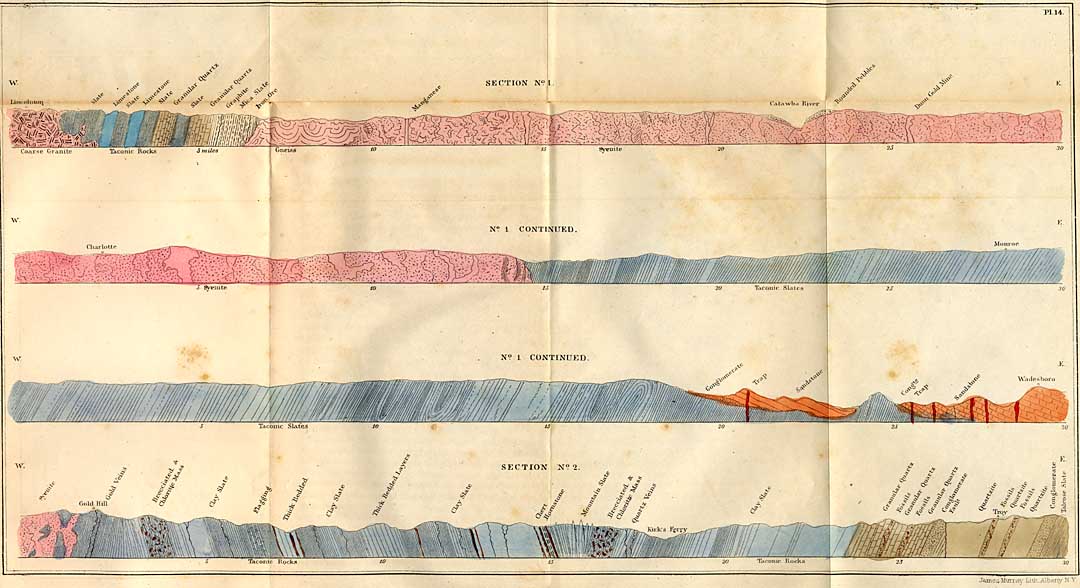
Pl. 14. [Sec. 1. Extending from Lincolnton to Wadesboro', running nearly east and west, showing the position of the Taconic system near Lincolnton, and the relations of the Trias, near Wadesboro, Anson County. The numbers below indicate the distance in miles.
Sec. 2. Showing the relation of the rocks from Gold Hill to Troy, Montgomery county, and the position in which fossils occur in the older rocks at the latter place.]
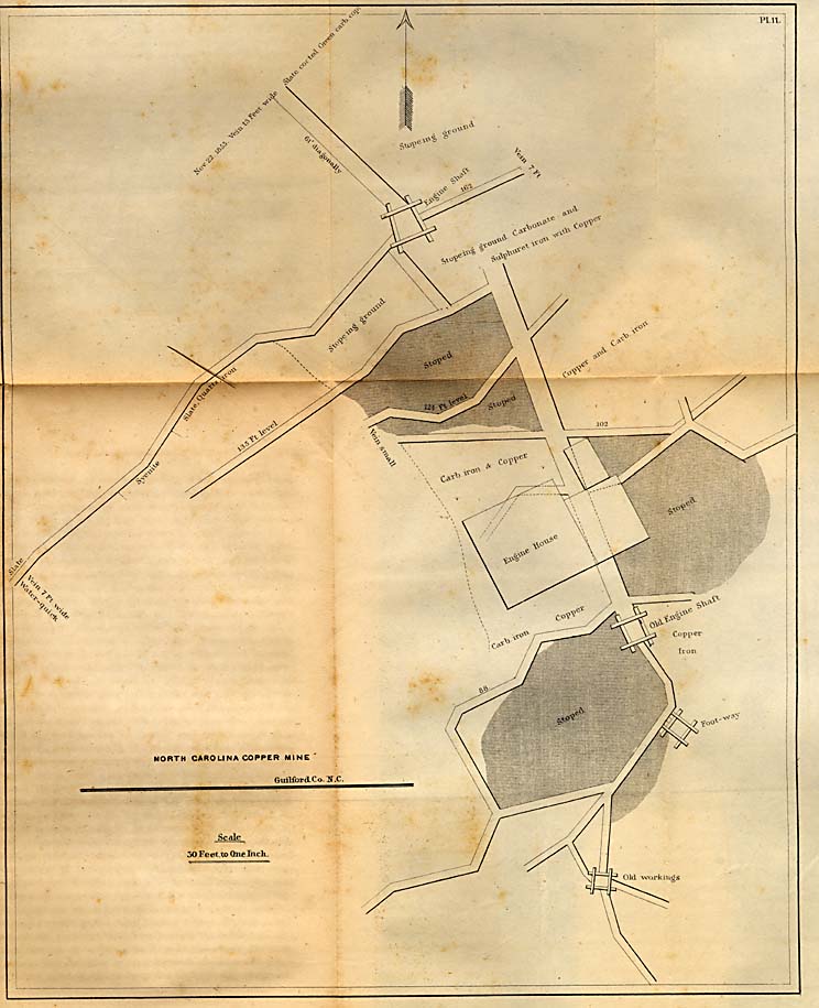
Pl. 11. [Exhibits a plan of the working of the North Carolina copper mine of Guilford county.]
Page 241
the surrounding country; and to reach the sandstones, there is a descent both on the north-western and south-eastern sides. This long valley, prior to the deposition of the rocks which now occupy it, must have been very deep. This is evident, from the fact that the series is very thick.
This valley is now isolated or cut off from those in which similar formations are known to exist. It is therefore an independent one, so far as the Dan river or the Richmond series are concerned. The long axis of this valley is parallel, approximately at least with both, though it has no connexion with either. I have traced this valley, with its sandstones, from a point about six miles from Oxford, in Granville county, across the State in a south-westerly direction. It passes into South-Carolina, about six or seven miles, where it terminates. Within the State its length is about one hundred and twenty miles. Its breadth is variable. Where it terminates near Oxford, in Granville county, it is very narrow, or indeed runs to a point. The widest part is between Raleigh and Chapel Hill, on the line of which it is eighteen miles wide. On the Neuse it is twelve. On the Cape Fear, between Jones' Falls and the Buckhorn, it scarcely exceeds six miles. This is one of the narrowest places of the series, it widens rapidly in a north-easterly and south-westerly direction, till, towards Chapel Hill, or rather eastward of that place, it becomes eighteen miles, as stated, from which it soon diminishes in breadth. From Capt. E. Bryan's, at Jones' Falls, the direction of the western margin, for about six miles, is about south-west. Soon afterward its course is more westerly, and even sweeps around and takes a northerly course; but afterwards resumes a south-west course into South-Carolina, after crossing the corner of Union county. The auriferous slates may be observed at numerous places on the north-western border. The exceptions which have fallen under my notice show the series in a metamorphic condition. At Capt. Bryan's, a belt of chert and porphyry rises from beneath the sandstones, and extends seven or eight miles in a north-easterly direction. A similar belt also rises up from beneath the same series one-and-a-half miles northerly from the Gulf, on the plankroad,
Page 242
and pursues a course parallel with the former. This is probably a repetition of the series at Jones' Falls. But the unchanged slates emerge in an unconformable position at numerous places in Chatham and Moore counties, among which I may mention the millstone quarries on the waters of Richland creek, the tributaries of Indian creek within one mile of Evans' bridge, and on the road leading to Salem, and again about a mile above the mouth of Line creek, which enters Deep river not far above the same bridge. An important point which exhibits the junction of the series is about one-and-a-half miles from Farmersville, on the Pittsborough road, where a deep ravine divides the lower conglomerate and red sandstone from the slates of the Taconic system. The slates, as usual, dip nearly to the north-west at a high angle, while the sandstones dip from them, or southerly, at a very moderate inclination. An interesting exposure of the inferior beds of these sediments, resting upon the slates, occurs at the quarry of Mr. Seawells, where the conglomerate or millstone has been entirely removed, by which an intervening stratum of clay which rests upon the edges of the slate is exposed. The conglomerate or millstone grit is about forty feet thick. It dips at an angle of seventeen or eighteen degrees, and to the south-east. On the north-west side it appears, from observation, to repose upon the gold slates, especially all of it south of Orange county; or upon rocks of the same series, and which have been changed, or have been porphyritic. The width of the lower sandstone on the north-west side, beyond its junction with the bituminous slates, varies at different places; it is from three-fourths of a mile to three miles. Small fields are still farther removed, but they are usually isolated, and cut off by projecting ridges of the older slates. The largest field which is thus isolated, is in Anson county.
* 236. The south-east margin is concealed through all that part which lies south-west of Cape Fear river but at several points near the margin where the auriferous slates make their appearance. In Anson county, one mile-and-a-half sout-east of Wadesborough, the red sandstones dip gently to the west. But the characters which these rocks exhibit indicate
Page 243
that it is the upper sandstone which is thus prolonged. It resembles that of Brassfield's, sixteen miles from Raleigh, on the Hillsborough road, where the sandstones become calcareous and somewhat nodular. But neither place furnishes fossils, and hence the criteria by which to judge of their identity are indecisive. I would not make the statement respecting this question without reservation. Yet, those calcareous concretions seem to belong to the upper mass at Brassfields, and those near Wadesborough closely resemble them. The south-east side, from its crossing of the Cape Fear to the Pedee, is usually covered with the tertiary sands. We are unable, therefore, to learn the character of this margin, whether it is horizontal, or dips away or towards the axis of the formation. There is no exposure by which the position of the coal measures can be determined; this part of the series does not appear on this side; there is no positive fact from which we can judge of its existence at all; and this becomes still more obscure, in consequence of the facts which have been already stated, which have led me to believe that it is the upper sandstone which is prolonged, and forms the extreme points of the formation. Hence, it is not improbable that the upper sandstone extends beyond the coal measures, and conceals them from observation. If so, there are no inducements of sufficient value which would warrant the expenditure of capital in attempting to obtain them upon the south-east side. North of the Cape Fear, as the formation passes onward through Orange into Granville county, the south-east side is equally unpromising for coal; while on the north-west side, about six miles from Chapel Hill, in the neighborhood of Mr. Mooring's, in Chatham county, there is an exposure of black slate, containing the common fossils of this part of the coal measures. But this exposure is limited; and from this locality the indications of the presence of coal cannot be discovered, or they are merely lignite beds, which are the products of a single coniferous tree. It is not difficult to distinguish these appearances from those which accompany the coal seams. In the former, its speedy removal from its bed should be sufficient to satisfy every reasonable mind,
Page 244
though many still persist in seeing a coal seam in a flattened stem of an ancient tree, provided it is fully carbonized.
We find the coal measures confined mostly to the central part of the sandstones, where they traverse the counties of Chatham and Moore. The formation pursues a westerly course, parallel with the general direction of Deep river. The outcrop crosses the river between Evander McIver's and the Hornville property, thence by Farmersville, it crosses the river obliquely at Egypt, and soon recrosses it again near the fish-trap, and passes into the Taylor plantation. It continues on the north side of the river until it passes the plantation of Mr. Murchison, from which it crosses it again for the last time into the plantation of Mr. Fooshee, where the coal series is well developed, three or four seams of good coal having been exposed by several excavations directly over the outcrop of the seams. The direction of the outcrop of the coal seams from Murchison's to Fooshee's is S. 54° W., which may be taken as the direction which the north-western margin pursues for the next eight or ten miles; after which the direction is about S. 45° W. The extent of the coal seams in this direction is not determined. The features of the formation are still favorable for their continuance. The coal seams upon the plantation of Mr. Fooshee are equal in thickness, and possess qualities of the same nature as those of Egypt. There is, therefore, grounds for the expectation of its continuance still farther in this direction. But the outcrop of the series is concealed, and requires the expenditure of capital to test the correctness of this expectation.
The whole length of the outcrop, following its windings, is about thirty miles. The extreme point beyond Evander McIver's, where the coal seams have been discovered, is at Martin Dyer's, where a boring cut a seam near the outcrop ten inches thick. The locality still farther north-eastward in this direction, known as the Rhiney Wicker's property, but owned by Mr. Ellington, does not belong to the same series as the Egypt and other seams, whose value has been tested. The Ellington seam is in connexion with the plant bed I have spoken of, and undoubtedly belongs to the upper sandstone. It is less
Page 245
than three inches thick, and therefore of no importance. I have spoken of this locality in former reports, but had not visited it. When, however, I had an opportunity to examine the character of the beds in which it occurs, I was satisfied it was wholly unconnected with the true coal measures of the lower series. The existence of coal seams has, therefore, been determined by the auger, and by excavations from Martin Dyer's to Mr. Fooshee's, on the south side of the Deep river, in Moore county. The coal slates are known to be prolonged in each direction from these points; and though the existence of the coal seams in the prolonged slate may be questioned, still, there are no reasons for their immediate discontinuance. It should, however, be stated here, that the slates beyond Martin Dyer's are known only for about two miles, where they are accompanied with fine beds of argillaceous oxide of iron. But they extend much farther to the south-west, and nearly to the Great Pedee. But their thickness is diminished at Drowning Creek, and there are no exposures of iron ore. Beyond the Great Pedee, in Anson county, the black slates, if they occur at all, are feeble or thin; though this plat of the formation may be concealed by the deep soil of the valley, still the prospects for finding coal are not encouraging. My opinion with respect to the extent of the coal is, that it will be prolonged about ten miles; that it will turn out that the continuous outcrop will be, ultimately, about forty miles; that it will be extended farther in a south-west than in a north-east direction is rendered probable, from the fact, that in the latter direction I am unable to perceive that the seams show any signs of giving out; and it is in this direction that the black slate is extended much farther than in the others I have referred to.
I do not deem it necessary to enter upon a discussion respecting the probable extent of the coal seams in the direction of their dip. Circumstances have changed since the publication of the first report, in which I made certain conditional statements of the probable quantity of coal in the Deep river formation. At that time doubts were entertained, and freely expressed, whether Chatham and Moore contained a
Page 246
coalfield at all. Believing, as I had a right, that those were erroneous views, and calculated to injure the interests of the State, I felt bound to make those statements which would place in its true light the value of this coalfield; for, if those interests were abandoned at that time, the prospect for improving this property would be delayed necessarily for a long time. I believed that the most important interests of the State were centered upon Deep river. Those interests were not confined to a single product, nor a single enterprise. There were two great interests at stake, that which related to the production of coal, and that which related to the production of iron. Here were the raw materials. Here were the elements which, if properly used and employed, would increase the wealth of this section of country more than fourfold. But more than this, I saw in it a stimulus to enterprise and mental activity. Industry would be promoted in every branch of pursuit which the products of this section of the State could foster. It did not confine itself to coal and iron, but extended to agriculture and home manufactures. The stimulus arising from success would pervade the whole community, and put a new aspect on society.
CHAPTER XXXIV.
Quantity and quality of the Deep river Coal--Composition, etc.
* 237. I have stated that it seems unnecessary to express, at the present time, an opinion respecting the quantity of accessible coal in the Deep river district. I believe the developments are now sufficient to establish its character, and that the deep shaft at Egypt contains what we had a right to expect, or were justified in expecting. It has established this
Page 247
position, that the known quantity demanded the construction of means to carry it to market; and these means are now so far completed, that there is no danger the public will take a retrograde course. Times have been, when there was danger that all the works for developing the resources of this coalfield would stop, and the public are indebted, in a great measure, to the exertions of Mr. McLane, for the completion of an enterprise which imparts confidence where it was wanting, and at the same time infuses new energy in the few who were always confident of ultimate success.
* 238. The quality of the coal is of a high order; it is true it is not equal to the Breckinridge coal for its volatile matters, but it equals it in its combustible products. For the purpose of giving a greater publicity to the excellent character of this coal, I shall make use of the analyses which have been made of it, together with others which are well known, and which will serve as standards for comparison. No one had pursued a plan so thorough as the late Prof. Johnson, whose experience in this line of investigation was equal, if not greater, than any of whom we could boast. They are characterized by thoroughness, which gives confidence in their accuracy. I shall, therefore, deem it proper to put in circulation again the analyses which were issued in a report, the circulation of which has been extremely limited, and which it is now difficult to procure.
The first analysis of this order was made of the coal of the lower seam, at Farmersville, and recently mined. The composition was found to be as follows:
| Volatile matter, | 30.91 |
| Fixed carbon, | 50.70 |
| Earthy matter, | 18.32 |
| 99.93 |
The specific gravity of the specimen 1.416. The coke of this coal is light and puffy, ashes purplish gray.
A second specimen gave--
Page 248
| Volatile matter, | 28.47 |
| Fixed carbon, | 64.70 |
| Earthy matter, | 6.83 |
| 100.00 |
Specific gravity 1.497. Coked very slowly. Ashes brownish red.
A third specimen from the lower seam, gave,
| Volatile matter, | 30.85 |
| Fixed carbon, | 63.90 |
| Earthy matter, | 5.25 |
| 100.00 |
Specific gravity 1.415. Ashes white and very light.
The fourth specimen gave,
| Volatile matter, | 81.30 |
| Fixed carbon, | 64.40 |
| Earthy matter, | 4.30 |
| 100.00 |
Specific gravity 1.308. Coked slowly. Ashes nearly white.
The foregoing analyses were made of coal taken only a few feet from the surface. They are designed to show, in part, the effect of meteoric influences which had necessarily diminished the amount of volatile, and increased relatively the earthy matters, as well as to increase also the quantity of hygrometric water. This coal at greater depths is found to sustain this view, as will be seen by analyses of coal taken from greater depths, and farther removed from atmospheric influence.
Coal taken from the deep pit at Egypt, and analyzed for me by Dr. Jackson, gave,
| Fixed carbon, | 63.6 |
| Carb. Hydrogen gas, | 34.8 |
| Ashes, | 1.6 |
| 99.0 |
Color of the ashes reddish brown.
Page 249
This coal, it is true, was not taken from the same place as those whose analyses have been given in the preceding paragraphs; but the Egypt and the Farmersville coal cannot be distinguished from each other, when taken from about the same depth. The analysis of the Egypt coal shows a better quality and an increase of volatile matter, and less earth or ash; probably no analysis shows a better composition for all the purposes for which coal is employed. Another mode of testing the value of coals, is to determine the amount of steam which a given quantity of coal will generate. Thus Johnson found, by experiment, that the steam producing or evaporating power of this coal, was equivalent to 8.1; or that one pound of coal would convert 8.1 pounds of water into steam; and also, that one part, by weight, of dried coal, will reduce twenty-six and ninety-seven hundredths times its weight of lead.
The following table of comparison is quoted from Prof. Johnson's report, showing the evaporative and lead producing power of coals taken from the different pits of the Richmond basin, and certain foreign bituminous coals, which hold about the same rank as to reducing and steam producing power. In an economical point of view, this comparison is interesting; showing that the coals of the Richmond and Deep river basins do not differ materially from each other, or from those of the carboniferous period:
| Lead reduced | Steam generated by one | ||
| Names of Coal. | by one part | ||
| of Coal. | part of Coal. | ||
| 1 | Chesterfield mining Co. Va., | 25.78 | 8.99 |
| 2 | New Castle, Eng., | 26.78 | 8.65 |
| 3 | Clover Hill, Va., | 26.96 | 7.67 |
| 4 | Liverpool, Va., | 27.07 | 7.84 |
| 5 | Picton, N. Scotia, | 27.24 | 8.41 |
| 6 | Midlothian, Va., (screened,) | 27.28 | 8.94 |
| 7 | Midlothian, (average,) | 27.34 | 8.29 |
| 8 | Pittsburg, Pa., | 27.54 | 8.20 |
| 9 | Farmersville, N. C., | 26.97 | 8.10 |
Other foreign, and particularly British coals, produce similar results; the reductive and evaporative powers do not exceed those of Deep river. Thus, according to the results obtained by the British Commissioners on coals, the following
Page 250
kinds yield the following numbers, expressive of their power, as in the foregoing table:
| Names of Coal. | Lead reduced. | Stem generated. | |
| 1 | Broomhill coal, | 25.32 | 8.85 |
| 2 | Coleshill, | 26.14 | 8.00 |
| 3 | Dalkeith Jewel seam, | 27.42 | 7.08 |
| 4 | Three-quarter rock vein, | 26.62 | 8.84 |
| 5 | Ponty-Pool, | 27.46 | 7.47 |
| 6 | Bedwas, | 28.20 | 9.97 |
| 7 | Cwm Frood rock vein, | 28.30 | 8.70 |
| 8 | Grangemouth, | 28.45 | 7.40 |
| Averages, | 27.11 | 8.09 |
The composition of the Farmersville coal, in a raw state, as determined by organic analysis, is as follows, the water being determined by a separate process, and, as equal to 1.71 per cent.:
| Sulphur, | 3.30 |
| Carbon, | 68.41 |
| Hydrogen, | 4.64 |
| Oxygen, | 8.37 |
| Earthy matter, | 13.60 |
| Water, | 1.71 |
| 100.00 |
The excess of hydrogen which the foregoing analysis exhibits, over and above that which is necessary to form water, is equivalent to 3.57 per cent.
The earthy matter in the better specimens of the Farmersville coal, though taken near the surface, where it is less exposed to meteoric influences, is only 3.81 per cent., instead of 13.60, where it is still more exposed; and an analysis of this coal gave Johnson:
| Moisture, | 2.35 per cent. |
| Sulphur, | 0.22 per cent. |
| Carbon, | 80.20 per cent. |
| Hydrogen, | 5.45 per cent. |
| Oxygen and other vol. matter, | 7.97 per cent. |
| Earthy matter, | 3.81 per cent. |
| 100.00 | |
| Hydrogen in excess, | 4.46 |
Page 251
The fixed carbon of this variety, when coked slowly, is 64.57 per cent. The volatile carbon of the 80.20 per cent. is 15.63 per cent.; which leaves the 64.57 as the fixed carbon of the specimen. Three thirty-seven hundredths per cent. more passes off in vapor when the coal is coked rapidly.
The question respecting the presence of injurious matter in this coal, is also determined by the foregoing analyses. Thus, sulphur is injurious in various ways. If present in a large quantity when burnt in grates, its odor is extremely offensive, and it blackens the several articles of furniture which are often used. Twenty-five grains triated for sulphur gave 3.3 per cent. Another analysis gave 3.20 sulphur. It is evident, both from experiment and observation, that the sulphur diminishes as the depth increases; or as other foreign matter diminishes, the sulphur also becomes less. The sulphur in all the pits appears disseminated, and sometimes in lumps, in the slate, while I have observed it in the coal seam, only in one or two instances, in a visible mass in the coal. The impure coals, those which contain slate, contain the most sulphur. When the coal is therefore pure and free from the foreign intermixture of slate, coprolites, animal and vegetable matter only partially changed, then the sulphur is in excess.
* 239. The combustion of this coal, and the case with which it can be ignited, are important qualities. It burns briskly with a brilliant and free combustion. It therefore gives a pleasant and agreeable fire in parlor grates. In this respect, I believe it is not excelled by any coal now in market. This brilliant combustion is attended with a swelling of the whole mass, by which a good hollow fire is maintained, agglutinating as the combustion proceeds, and ending in the production of a light porous coke. It is for these qualities, that it is so well adapted to the use of smiths; and it is invariably remarked by them, that they wish for no better coal. In market it sells to Blacksmiths for forty cents per bushel. The amount of sulphur in the iron of the coal produces injurious effects in iron which is heated and welded by it. It is stated by Johnson, that the sulphur will not injure it on shipboard or on shore.
Page 252
Sometimes in a rapid combustion of the coal in a grate, it melts partially, and exhibits a tendency to flow. This fact shows that its volatile matter or bitumen is in large proportions. This tendency, however, does not exhibit itself in slow combustion.
The Breckinridge coal melts and flows when ignited. This, however, contains nearly twice as much bitumen or volatile matter as the Farmville coal. The Breckinridge has about 61 per cent. of volatile matter, while that from the Egypt pit has only 34.8, or nearly 35 per cent. Whether the Deep river coal can be profitably employed for the production of coal oil and other matters for light, has yet to be determined by a series of well conducted experiments. It is desirable that its value for light should be determined, but it is probable that it cannot compete with several richer coals now in market.
The value of the bituminous coal for the common furnaces, seems to be well established; there can be no doubt of its value for warming parlors, or for grates, for smith's work of all kinds, being both cheaper and more economical than charcoal; that is, at forty cents per bushel, it is more economical than charcoal at five cents. The value of the semi-bituminous coals is not so well determined. From several analyses by Johnson, its composition near the outcrop has been determined. Thus the per centage of volatile and fixed matters gave, in
| No. 1, | Fixed carbon, | 83.12 |
| Volatile matter, | 8.28 | |
| Earthy, | 8.60 | |
| 100.00 |
The ash is purplish gray. This specimen had been long exposed to atmospheric influences; its specific gravity 1.45.
| No. 2, | Fixed carbon, | 83.76 |
| Volatile matter, | 6.64 | |
| Earthy, | 9.60 | |
| 100.00 |
Ashes reddish gray. Specific gravity 1.54.
Page 253
| No. 3, | Fixed carbon, | 87.18 |
| Volatile matter, | 7.35 | |
| Earthy matter, | 5.47 | |
| 100.00 |
Specific gravity 1.47. Ash reddish gray. Obtained from a fresh opening, and taken from the 2½ foot seam.
In this semi-bituminous coal of Geo. Wilcox's seams, it adpears that the votatile matter is less than one-fourth of that which belongs to the Farmville or Egypt coal. The value of this variety has not yet been determined; it is doubtful whether the semi-bituminous coals can be carried to market, where they will have to compete with the Anthracite of Pennsylvania. They have their place, however, and will be employed for warming apartments in the large villages and cities of the State, both in grates and coal stoves. These coals would be well adapted for the Raleigh and Wilmington markets, or for home consumption; and it is probable, may be employed economically in the manufacture of iron. But the question is not yet settled whether these semi-bituminous seams are permanent, or may not prove to be locally anthracite or nearly so; but which may become bituminous at greater depths upon the dip of the seams, and perhaps even at comparatively small depths, the semi-bituminous seam may become a bituminous one. As the value of the latter is greater, such a result is to be hoped for. If the loss of bitumen was to be attributed solely to the local action of trap dykes, such a result appears highly probable; but as a general disturbance of the coal strata seems to be connected as a cause with the loss of bitumen, a change can scarcely be expected where this disturbance is excessive at the surface. The escape of steam through fissures in the broken coal strata no doubt carries off bitumen, while the dry heat of a melted rock would operate only through a limited extent. This result arises from low conducting power of rocks. It frequently happens that a rock, in immediate contact with trap, is vitrified only a few inches; while on the other hand, where rocks are broken up and twisted, or their layers bent, the
Page 254
metamorphism is very extensive, though trap is nowhere visible in the altered series. Hence it is, that miners are rarely alarmed when they see trap dykes passing through a coalfield; provided the strata are not much disturbed. They know that the heat of a trap dyke, at the time of its injection, cannot alter or change the coal extensively. They look more, therefore, to the changes which the strata have undergone, and become alarmed only, when they see they have passed from a continuous plane into interrupted ones, in consequence of faults. It is doubtful whether dykes have much effect in deranging the condition of rocks. It is to be attributed rather to a force which acted in a stage prior to the one by which the dyke fissure is filled. But this view does not affect the reasoning of the miner. With him it is a question how much the strata are disturbed, without reference to the agent, act, or time.
CHAPTER XXXV.
The Dan River Coalfield--Division of the Beds Composing It.--Conglomerates and Breccias.--Lower Sandstones.--Coal Shales.--Upper Sandstones.--Conglomerates--and Brecciated Conglomerates.
* 240. The counties of Rockingham and Stokes contain within their respective areas a series of deposits, which do not differ materially from those of Deep river. They contain coal, but the seams are less known; and, judging from the depths of the works which have exposed them, they seem to be less promising than those of Deep river. While all the beds which are connected in this formation, or which stand together, are much the same as those of Chatham and Moore,
Page 255
the coal seam is mostly semi-bituminous, or similar to the George Wilcox seam which has been described.
There are certain peculiarities, however, worthy of notice, which do not exist in the Deep river formation. Those peculiarities will be recognised in the following division of the Dan river series:
- 1. And at the bottom, conglomerates and breccias.
- 2. Lower sandstones, including the soft and hard.
- 3. Gray sandstones, with bituminous shales, fire-clays, &c
- 4. Upper sandstones and marls.
- 5. Brecciated conglomerates.
These parts are all distinct and separate at Leaksville, where the system is probably more perfect than elsewhere. They lie in a trough in the primary series, or in the laminated pyrocrystalline rocks, whose direction is about north-east and south-west. The axis of the trough runs parallel with a line which connects Leaksville with Germanton. The system dips to the north-west; the angle of dip is variable, and ranges between 15° and 40°, it is usually greater than 20°.
The whole extent or range of the Dan river series is about forty miles, thirty of which is comprised within the bounds of North-Carolina. The north-east extremity extends into Virginia, about ten miles. The breadth of the series is not less than four, and not greater than seven miles.
It has no connection with the Richmond coalfield, though it is prolonged in that direction; neither is it connected or continuous with another small coalfield in Halifax county in Virginia. These several troughs are, all of them, isolated depressions in the primary series. Those geologists who are familiar with the northern parts of our country, may infer that these troughs were once connected, and that diluvial action has removed intermediate parts of the series. This view does not, however, seem to be sustained. There is no evidence of diluvial action at all; there is no drift proper in North-Carolina. But all of these isolated troughs were connected at a comparative recent period with the ocean. We are notified of an approach to these troughs by the pebbly
Page 256
beds which border them, which overlie the series, and which appear to bound them. These beds of pebbles, while they surround the coal series, are still distributed along the line of drainage towards the ocean.
If a correct geological map of the United States is consulted, and the positions of the coal fields to which reference has been made is noted, we cannot fail to notice the singular fact that there are four small troughs formed in the primary rocks, or slates, all of which lie with their axes directed to the southwest and north-east--a direction which, in this region, is nearly parallel with the present coast line. These troughs, as I have already said, are disconnected; and an examination of the series, their outcrops, &c., goes to show that each was formed in a trough by itself, and entirely separate and independent; each series of sediments was deposited in its own deep sea, or arm of the sea: and furthermore, considering the limited area of each, the depth of these seas or estuaries was very great. These areas have been only slightly disturbed, though they are traversed by many dykes. The Richmond trough has been disturbed the most, the inclination or dip of the beds often exceeding forty degrees.
The lowest mass of the Dan river series is conglomerate; but it is badly developed. It is not exposed at Leaksville, the north-east extremity; but at Germanton these beds consist of angular fragments of granite and gneiss, intermixed with a few imperfectly formed pebbles. This mass might be mistaken for granite, were it not that it contains here and there the pebbles referred to; or it may be fragments of silicified wood. In this mass I have also found the roots of the silicified trunks penetrating and branching into it, showing that the trees grew upon the spot where they are now found. Above the conglomerate, or brecciated conglomerate, the silicified trunks of coniferous trees are sufficiently numerous to be regarded as an ancient forest. The roots are sometimes changed into lignite. What appears to be trunks are always silicified. These, sometimes, exceed two feet in diameter: segments of which stand out from the sandstones at an angle of 45°; but they are usually prostrate. It is remarkable.
Page 257
that at this locality, the trunks and roots only remain. All the tender and leafy parts are destroyed. The beds containing the silicified trunks extend half a mile. In immediate connexion with the soft sandstones which contain the vegetable products already referred to, I found a concretionary clay. Large concentric circles mark the boundaries of the concretions, some of which are four feet in diameter. Above the argillaceous concretionary mass, we find the regular bedded red sandstones, consisting of variegated strata in part--but mostly red sandstones, of various degrees of coarseness. These terminate in the black and green shales and slates, which contain the seams of coal.
At Leaksville, where the series is the best exposed, they consist of the following strata:
- 1. Shale or black bituminous slate below the coal; thickness undetermined.
- 2. Slaty micaceous sandstones two feet.
- 3. Shaly coal at the outcrop eighteen inches.
- 4. Micaceous shale two feet.
- 5. Semi-bituminous coal from two to three feet at the outcrop.
- 6. Shale one hundred feet.
- 7. Strata of a semi-concretionary limestone more or less silicious, from four to six feet. This is probably an equivalent of the argillaceous iron ore.
- 8. Soft green, blueish and black shales with posidonias, sixty feet.
The shales, however, still continue; but being covered with soil, their thickness remains to be determined. The calcareous strata are above the coal seams; as no others are known, and as they extend through the coalfield, they become way boards for the discovery of the seams of coal beneath them. These layers are well preserved at Madison, and contain septaria.
The dip of the slates at Leaksville is N. 35° W.; angle of dip 25°.
A section of rocks between Eagle bridge and Gov. Morehead's factory, consists of the following strata:
- 1. Sandstones and conglomerate, mostly concealed, at the bridge.
- 2. Flinty black slates, two hundred feet thick.
- 3. Coal slates, consisting of green and black slates, with posidonia and cypris in great abundance.
- 4. Red and gray sandstones.
Page 258 - 5. Conglomerates.
- 6. Shaly and green variegated sandstones.
- 7. Conglomerates and brecciated conglomerates at least three hundred feet thick.
They contain many angular fragments, some of which are very large.
The upper part, which may be observed at Morehead's factory, presents the following strata, which I state more in detail, and in the ascending order:
- 1. Greenish brecciated trappean mass.
- 2. Coarse, brecciated mass, intermixed with pebbles only partially rounded, eighty to one hundred feet thick.
- 3. Greenish slate and shale.
- 4. Greenish slaty sandstone.
- 5. Coarse decomposing sandstone, one hundred feet thick.
The first, or No. 1. of this upper part of the series is made up of various rocks, as talcose slates, granite, and masses of feldspar and trap. The size of these angular fragments is from seven to eight inches long, and four to five thick. It is a decomposing mass.
The coarse brecciated mass immediately above this, is a tough, durable, building stone, of a gray color, and looks like granite at a distance. It contains a large amount of quartz, and the ground or paste in which it is imbedded, is less disposed to disintegrate. The dip of this series is N. 30° W.
The upper part of the Dan river sandstone is unlike that of Deep river, unless it is parallel with the rocks at Jones' Falls, which I am disposed to regard as probable, and as the inferior beds of the New Red sandstone. There is evidently a change in the deposits indicative of a more important one, connected with a change of the organic remains. This remains to be determined.
The series of sandstones again, which are exposed on Factory creek, four miles from Madison, on the road to Martin's lime-kilns, are interesting, as they are exposed by the denudation of the stream. They are enumerated in the ascending order, and probably begin near the coal shales:
Page 259
- 1. Soft greenish slates.
- 2. Coarse sandstone, with pebbles.
- 3. Red and brown sandstones.
- 4. Porous red sandstones, or sandstone with angular cavities, similar to those of Deep river, which may have contained a soluble salt.
- 5. Green and gray hard sandstones.
- 6. Coarse sandstones, with pebbles.
- 7. Conglomerates resembling those at Morehead's factory.
- 8. Marls, reddish and mottled, beneath which are the primary slates in an unconformable position.
The dip in this series is very regular; the angle of dip is twenty degrees, and the distance across them is about half a mile, and every stratum being exposed, there is no danger of committing an error in the succession, or being misled by repetitions. This series is probably equivalent to that which begins at Jones' Falls, upon Deep river; or, in other words, is the upper part of the Triassic system. At the time the examination was made, I noted the succession only, omitting even the approximate thickness of the strata composing the series. Obscure fucoids were observed, but not obtained.
The Thecodont saurian remains were obtained far below this series; and hence, though we find apparent differences in the groups, we may be confident, I think, that the upper and lower parts of the formations upon Deep and Dan rivers, are the equivalents of each other.
At Madison, the series below the coal slates, as exposed on the east side of Dan river, is made up of the following strata. They rest upon gneiss:
- 1. Soft variegated micaceous sandstones, two hundred feet thick.
- 2. Green, shaly and drab colored sandstones, about five hundred feet thick.
- 3. Red sandstones, with small angular cavities.
- 4. Green and dark colored coal shales, the latter bituminous.
At Madison, the fossils of the slate are the same as those at Evans' Mills, on Deep river. The conglomerate, which is so conspicuous a member of this formation on Deep river, is very imperfectly developed upon the Dan.
At Germanton, at the extreme south-western extremity of the formation, coal has been obtained. The series is not well exposed, but the relations of the beds are as follows:
Page 260
- 1. Slate below.
- 2. Fire-clay.
- 3. Coal eighteen inches.
- 4. Slate, one foot.
- 5. Coal, eighteen inches.
- 6. Black bituminous slate, five feet.
- 7. Sandstone and slate.
Semi-bituminous coal was first obtained about four miles from Germanton. Subsequently, only two miles. This coal is not pure at the outcrop. Coal is known at several places between Leaksville and Germanton; but no new discoveries have been made since my report was published. The Leaksville seam has been explored deeper; the slope has been sunk about one hundred feet. The seam had increased; the thickness now being from three-and-a-half to four feet. But, as yet, the investigations of these coal seams have not been sufficiently extended to allow us to express a positive opinion of their value. The coal itself is less valuable than upon the Deep river, inasmuch as it ranks only with the anthracite coals. But the exploration on the plantation of Mr. Wade, at or near Leaksville, becomes more favorable; the coal seam having increased in thickness and improved in quality. But as the means for transporting the article to market were insufficient and defective, no decidedly favorable results could have been anticipated.
* 241. When the lower sandstones and conglomerates of the two rivers are compared, it is evident that the beds below the coal series are less important upon Dan than upon Deep river. In the latter, the lower sandstones, with their conglomerates, are remarkably thick; and we have seen that the conglomerate is very feebly developed upon the Dan at Germanton, and wanting at Madison; and it appears that in Virginia, the lower sandstones, with their conglomerates, are entirely wanting.
The slates of the coal measures of the two districts are probably equal in thickness; but it appears from facts thus far developed, that the coal, and the argillaceous iron ores, are less in quantity in the Dan river district.
The series above the coal slates, however, are either better
Page 261
exposed, or else are actually thicker. There is no locality where the upper rocks are so well exposed as upon Factory creek. Of the identity of the two series there can be no doubt. The fossils of the Dan, differ in no respect from those of Deep river. I have obtained a much larger number from the latter than the former. I found it necessary to confine my explorations for the time being to Deep river. It must be understood, that while explorations are in progress, is the best time to obtain the evidence of the age and epoch of the formation. It has happened that this evidence was frequently lost to myself, in consequence of the decomposition of the materials which were taken out of the shafts which were being sunk, as well as dispersed by the hands of visitors, who were frequently present. Hence, it has required much time to obtain a class of facts essential and necessary to decide certain geological questions of real importance.
CHAPTER XXXVI.
Economical Products of the Coal Fields, and of the Red Sandstones.
* 242. Industry never lacks materials upon which to expend its exergy. It is not cupidity which always seeks the useful, in the rough quarries of nature. The occurrence of one valuable product is but a step towards the discovery of another; and we are frequently surprised at the numerous wants which are supplied in a single series of sediments. In addition to the coal, which is the first object of pursuit, and the discovery of which has opened the way for others, and which probably would be useless, were there no coal, iron ore, free stones, grindstone grits, and fire-clays, may be enumerated.
Page 262
The iron ores belong to two or three distinct kinds:
1. The ordinary hydrous peroxides, with arggillaceous matter, which are undoubtedly the altered products derived from the argillaceous carbonate.
2. The same kind in appearance, but which is magnetic.
3. The black band of the Scotch miners, and which is regarded by a gentleman well acquainted with this ore, as the Blackbest of the Scottish miners.
All these kinds appear to be abundant, or to be coextensive with the coal slates. I am not able to speak of the extent of the brown magnetic ore which occurs upon the plantation of Mr. Tyson. It is an interesting anomaly in the way of iron ores, to find the brown ores, with their ordinary aspect, strongly magnetic. I suspect this kind may be confined to the surface, inasmuch, as under the action of light, and perhaps certain atmospheric influences, the black ores of the older rocks become very strong magnets.
The argillaceous carbonate, when exposed to meteoroic influence, the hydrous peroxide, with argillaceous matter, occurs at the depth of about two hundred and thirty feet in the shaft at Egypt. It is frequently found outcropping above the coal seams, in nodular masses of different forms and sizes, and may be employed as a clue to the position of the coal seams; inasmuch, as there are no known bituminous seams above the iron ore beds. The principal seams are below; but inasmuch as there is another outcropping of iron below the seams, about thirty-four yards distant, it is necessary to be on guard, so as not to be led astray by the inferior beds of iron. These outcropping beds of iron ore at the Gulf, are undoubtedly the seams of black band, belonging to the next seam of coal below the main seam, which at Egypt is thirty feet below in the shaft. But this ore, though traces of its outcropping may be seen at several places, is not always to be found upon the surface. It is rarely as strong at any place, as at the Gulf.
The argillaceous carbonate occurs in balls, and in continuous beds. They are adjacent to each other. The color of the ore is gray or drab; it effervesces with acids, and is somewhat
Page 263
silicious; and certain parts of the seams of ore are tough. It differs in no respect from the argillaceous carbonate of the carboniferous series. It contains about thirty-three per cent. of metallic iron. The surface ores being altered, the carbonates contain fifty per cent. of metallic iron. This is not too large a per centage to be estimated for the magnetic ores of the Tyson plantation. Of the quantity of these carbonates there can be no doubt; since they occur along the entire outcrop of the slates of the coal series. A very beautiful and rich kind is found at Benjamin Wicker's, beyond the known limits of the coal seam; so, at the other extreme, at Murchison's, it is still in place, and holding the same relations as at the Gulf, at Egypt, or McIver's.
I am unable to distinguish the black band from the argillaceous carbonate, where it has been subjected to meteoric influences. I have, heretofore, maintained and expressed the opinion, that there were two bands of the ore under consideration; one above, and the other below, the main coal seam; but the shaft at Egypt proves the existence of the black band accompanying the little coal seam; and hence, it is probable that what appears to be argillaceous carbonate, is the black band, changed by exposure to the air. There is, probably, only two bands of the argillaceous carbonate--the continuous band or seam, and the band of iron balls in proximity with each other.
This is mined with great ease and facility. Although hard and difficult to penetrate with the augur, yet, when the slate beneath the band is taken out, tons of it fall into the pit at once. The expense therefore of mining, is trifling under the circumstances; and hence, there is no reason for doubting the feasibility of making iron from it at a profit.
The black band invariably accompanies the coal seams. There are now known three seams of it; one between the main coal seams, another immediately below, and a third, equally important, accompanying the little coal seam thirty feet below the former, and from which it is separated by slates and gritty fire-clay, fifteen feet thick.
The black band owes its high value as an ore, to the facility
Page 264
with which it is converted into pig, and the quality of the pig produced from it. The ore itself is black and somewhat massive, as a slate; fracture compact and even, or only slightly conchoidal. It would be mistaken for a heavy massive slate.
This ore was first discovered at Farmersville; but it was not suspected to be the Scotch black band; but that it would prove available ore there could be no doubt. Mr. Paton, a gentleman of great experience in iron making, first suggested to Mr. McLane the character of the ore. Examination proved the correctness of the gentleman's opinion already referred to. When roasted it is strongly magnetic, and probably the brown magnetic ore of Tyson's, is only an altered black band, as it occurs also in layers, or in the form of a fissile ferruginous slate.
The composition of the black band was determined for me by my friend Dr. Jackson. It is composed of,
| Carbon, | 31.30 |
| Peroxide of iron, | 47.50 |
| Silex, | 9.00 |
| Bitumen and water, | 8.81 |
| Sulphur, | 3.39 |
| 100.00 |
The roasted ore yields only 0.89 per cent. of sulphur. Sulphur, as in the case of the slate, seems to attach itself to the slaty parts of the mass; but I should have expected also a small per centage of phosphoric acid, seeing that coprolites are very common in the black band. The fossils of the black band too, are more abundant than in the slate; it is at the junction of this ore with the coal, that the saurian teeth occur in the greatest abundance, especially in that stratum which intervenes between the coal seams.
This ore becomes important, in consequence of the facility of its conversion into pig. I am not able to say whether the 89 hundredths per cent. of sulphur in the roasted ore is sufficient to exert much influence in the furnace product; probably not. In the progress of mining, the black band is so
Page 265
closely connected with the coal, that it will necessarily be raised; and hence, a valuable ore will be obtained at the surface, with only a trifling additional cost, over that which attends the mining and raising of the coal only.
From the occurrence of this ore, the mineral resources or the wealth of the coalfield is very much increased. We may, therefore, congratulate the friends of the Deep river improvement, and those of the mining interest of the country, of this accession of valuable products; which must secure for this region important establishments for the manufacture of iron.
* 243. In connexion with the subject of iron ores, I may very properly introduce those which are denominated materials for construction, such as free stones and fire-clays. The red and purple sandstones abound, in the lower red sandstone, with beds suitable for building stone. The color of these beds, whatever it may be, is lively and inviting. Indeed, no difference can be discovered between those of Deep river and those of the Hudson river, or the Connecticut river sandstone. As these beds are extensive, they furnish, at many points, stone of a suitable quality for any purpose which may be required. No quarry has been, as yet, opened extensively enough to prove the value of the material. These remarks are made without reference to the state of the people, and their present wants or means to get the material to market. In the event that the improvements upon Deep river turn out as the friends of improvement expect and hope, the free stone will be in demand. It should have its value as in other parts of our country where means of intercommunication are provided, which lead to the cultivation of a good taste in building, and hold out inducements to construct durable structures. Where, on the contrary, the temptations to change place and emigrate for bettering their condition, no improvements in construction are made. But the opening of the navigation of Deep river, the commencement of manufactures, etc., will put a new phase on society, and lead ultimately to the construction of durable residences.
* 244. The fire-clays, though they are not found beneath every coal seam, still are common in connexion with the
Page 266
coal, and between the main and little seams. It is well known that they are important for fire-brick and other kindred purposes, where a refractory article is required. When exposed to atmospheric influence at the outcrop, they have all the characters of an argillaceous stratum. When deep in the interior, and removed from atmospheric influence, they appear like a fragile sandstone. When taken up with other materials and exposed, they soon disintegrate, become soft, and pass into another form. Vegetable fibre penetrates the mass, vertically as well as horizontally. These singular beds are regarded as the soil upon which the coal-producing plants grew. Whether this view be true or not, the fact is well acoounted for by this theory. The vegetable matter, however, of these beds, is not all of it the remains of roots. Prostrate stems of calamites, and the foliage of vegetables are easily detected in the network, or mesh of roots. There are no stems of sigilloaria or stigmaria in these fire-clays, as in all the beds which belong to the carboniferous system. Their absence proves the epoch of the series not to belong to that referred to. It proves, however, that coal can be, and is produced from a vegetation quite different from that which prevailed in the epoch of the true coal. It proves too, that geologists have been too hasty in claiming from the so named coal period, the only one which has produced coal in sufficient quantity to make its exploration for a distant market a business from which profits, and even wealth, are likely to flow. We find not only coal, but also fire-clay, bands of iron both nodular and in continuous beds, but even the rarer ore, the black band, which is found only in the coal measures of Europe.
* 245. Millstones.--Beneath the red sandstone, the conglomerate is so perfectly consolidated that it forms a valuable millstone. This is made up almost entirely of compacted quartz pebbles, which are so firmly imbedded that their fracture is often directly across the axis of the pebble, where it would be expected to break out. These pebbles are derived from the quartz veins of the Taconic system, and hence, consist of milky quartz.
Page 267
The beds vary in thickness from six inches to eighteen, or even two feet.
The stone is adapted to the grinding of indian corn. They are said to be better cornstones than the French Burrhstone; for grinding wheat, the latter have been always preferred, as they are far less liable to heat the flour. Several quarries are opened in Moore county, and from them the country is principally supplied. The conglomerate at or near the base of the upper sandstone is less consolidated, and is not so well adapted to the formation of millstones. The thickness of the beds is from forty to sixty feet; but it is a mass which thins out, and hence its thickness at several points is extremely variable. The lower sandstone, with its conglomerates, is better developed in the south-west part of Moore county than elsewhere. We find, even at the Gulf, the conglomerate ceases to be an important stratum,
As a whole, the mass is made up of rounded pebbles in beds of variable thickness, which are separated from each other by finer and softer varieties. The conglomerates rest almost immediately and unconformably upon the slates of the Taconic system. A circumstance worthy of note, is the fact that the pebbles are auriferous; hence, the opinion expressed by distinguished geologists, that gold is a recent product, probably of the Tertiary period, is erroneous. It must have existed at the time of the laying down of the bottom rocks of this coalfield; indeed, long before. So that instead of its being a recent metal, it is one of the oldest, being certainly coeval with copper and iron pyrites.
* 246. Grindstone Grits.--In the midst of the gray stone beds, more particularly those which occupy a place between the two red sandstones, I have frequently observed valuable grits, which are suitable both for coarse and fine grindstones. Grindstones have, however, been frequently made from the reddish bed as well as the drab and gray grits. These stones have been made to supply the wants of the citizens in a neighborhood far removed from the means of transporting heavy materials. No systematic efforts have been directed steadily towards the business of preparing these stones for
Page 268
market. It is only when manufactures are established, that a demand will arise out of the interests and wants of the community, that these lesser products of industry will take their place in the regular trade of the country.
* 247. Bituminous Slate.--The slates of the coal series, especially where they are very near the coal seams, are highly bituminous. They are known to contain 28.6 per cent. of volatile matter, and 19.55 per cent. of fixed carbon. Slates are employed for illumination in Europe, when they are near a large population. It would seem, therefore, that the slates of Deep river may, under favorable circumstances, be employed for this purpose. It is evident that they cannot be transported far for any purpose. They ignite readily in the fire and in a candle, blaze and burn with a good flame, emitting a white light. The question may be entertained, whether it is not possible to obtain the bitumen or volatile matter in a portable slate. The importance of light and fuel certainly warrant trials for this purpose. Even the slate far removed from the coal seams is combustible, and highly so. It is doubtful whether such a mass or bituminous slates exists even in the carboniferous series. It is impossible to estimate the amount of combustible matter locked up in them, and which it is possible may be turned to some account.
CHAPTER XXXVII.
The Advantages of Deep River for the Manufacture of Iron, etc.
* 248. It is the centralization of materials which creates an important manufacturing locality when combined especially with a power to move machinery, and an aggricultural capacity to sustain a large population. These give importance
Page 269
to any location for establishing a manufacturing interest upon a large scale.
Assuming the doctrine as true, we may proceed to ascertain whether there is such a centralization of means upon Deep river, sufficient to build up the interests alluded to. First, it has already been proved that the products of the coalfield make good the assumption. The hydrous peroxide of iron, the black band and coal, need not be spoken of again. The fuel and the material productions are abundant for any projects in this line of operations.
But the additional means in other ores in striking distance, add to and greatly increase the means for the purposes in view. Thus, the inexhaustible specular ore, four miles from the Gulf, the magnetic ore a few miles farther, the hematite of ore will make an addition of three kinds of ore to those already known in so much abundance in the coalfield. There is, then, the water power, if it is wished to employ it for moving machinery; or what is better, the employment of steam may be substituted for it; and still this power should not be lost.
The next important material is timber. The timber of Deep river and vicinity furnishes a variety not excelled in the State, or any State. First and foremost is the long leaf pine, of which forests line its banks. The growth is large, the wood mature, and is unimpaired by age or by the wood man's axe. The next most important timbers are the oaks and hickories. The manufacturing interests have been scarcely encouraged hitherto; all the materials in the line of woodwork remain as in a new country
The next article of importance is stone for construction. These have been spoken of already. The free stone is not only well adapted to the construction of durable or imperishable buildings, but it is adapted to the construction of elegant ones. Whether strength, durability or beauty, or all of these characteristics are combined, there is ample room for obtaining all that can be wished.
The last essential qualification for manufactures, is an agricultural country; one whose soil is adapted to the production
Page 270
of the cereals; for if these can be grown, every other necessary is provided for. The adaptation of Chatham county to the growth of the cereals cannot be doubted; past experience may be cited in proof, or rather the testimony of the whole community confirms the position.
But climate should not be overlooked. There is a temperature suited to the constitution, which, while it favors longevity, favors also the sustenance of life at the lowest expense; while it preserves the strength, and does not weaken the body by a high summer range. Such, I believe, is the favorable climate of North-Carolina. The moderate range of the thermometer, the freedom from long and excessive heats, or long continued cold, favors the cheap sustenance of laborers, both as to food and clothing, and adds several numbers to the per centage of advantages over a climate which is subjected to either extreme of temperature. But an accessible market is indispensable to prosperity. We do not, and cannot rely upon what has hitherto been done; it is what may be, or what improvements the country admits of. The outlet for trade is not restricted to one direction. It is not Raleigh, nor Norfolk, Fayetteville or Wilmington, but it is in all these directions; and so also a route may be opened to Charleston and the West. The position of Deep river is central. If the manufacturing interest is fostered, intercommucation with distant towns follows of necessity. A town will grow up with greater rapidity on Deep river than at Beaufort. Here are the elements which always draw together an active and intelligent community. These elements have ever created wealthy and flourishing towns. If, then, we require a concentration of means and interests to build up large towns, I do not know where a greater number of the requisite elements can be found in the interior of any State.
Page 271
CHAPTER XXXVIII.
History of the opinions respecting the age of the Deep and Dan River Formations.--Division of the Series with remarks sustaining it.
* 249. I have spoken of the formations under consideration in general terms. It is now necessary to place before the reader those details in which I find those facts which go to establish the views which have been forced upon me respecting the age of the Deep river coal measures, and the sandstone upon which they repose. I shall, however, give, in the first place, a brief statement of the opinions which have been expressed by several eminent and distinguished geologists, who have investigated the question at issue.
Maclure, in his geology of the United States, referred this series to the old red sandstone; being misled by the close resemblance of the two formations in their lithological aspects.
Regarding the sandstones of the Connecticut valley as equivalents in part of the North-Carolina series, Prof. Hithcock, in his earlier reports, adopted the opinion of Maclure. Leaving out of view, however, these distant equivalents, I shall limit my statements to those formations which belong to North-Carolina and Virginia. Of the latter, those which are known as red and gray sandstones of the Atlantic slope, and particularly those which belong to the Richmond coal basin, the late Richard C. Taylor expressed the opinion, in his first examinations, that they belonged to the regular coal measures. This opinion was founded upon an error, to which Mr. Taylor was not a party.
Previously, Mr. Nuttal had discovered Zamias, or Zamites, which have since been regarded as evidence that the Richmond series were cotemporaneous with the Oolites of Brora. Mr. Nuttall, however, was not the author of this deduction, he was the first to discover this order of vegetables. This deduction was not, at this time, thought of; but it was
Page 272
left to the sagacity of Prof. Wm. B. Rodgers, who, after obtaining additional information, communicated a memoir to the American Association, in 1843, in which he addressed a body of evidence bearing upon, and sustaining this view, which has been regarded by most geologists as satisfactory in its evidence, that the Richmond series was cotemporary with that of Brora in Scotland, and on a parallel also with that of Whitby in Yorkshire, England. This opinion was ably sustained by its author, and has been approved by some of the most distinguished men of this country.
But, after all, it does not appear to be fully established; and Prof. Bunbury, who has examined critically a series of fossils from this formation, leans but slightly to that side maintained by Prof. Rodgers; regarding the evidence almost as conclusive, that it is cotemporary with the Trias, as with the Oolite. These remarks I regard as appropriate; inasmuch as the Richmond basin, that especially which contains the coal seams, is supposed to be cotemporaneous with that of Deep river. It is this bearing of the question which makes it necessary to establish the age of the Richmond basin first. I have maintained this position myself, having seen, as I supposed, sufficient evidence that the two belonged to the same epoch. This view is now also sustained by Prof. Wm. B. Rodgers. But in the course of my later examinations of the Deep river coal series, certain facts have come to light which diminish my confidence in my former opinion.
Other geologists place these formations at the base of the Liassic series. Prof. Agassiz, relying on the testimony of the remains of fish, supports this view. In this conflict of opinion, it is plain the question is not yet at rest; it is not settled; the evidence which bears directly upon it is conflicting, because the facts themselves are too few and too meagre to support an opinion. As far as they go, they may be indicative, but other facts more direct may set them aside.
In 1853, I expressed the opinion that the Deep and Dan river series were cotemporaneous with the Trias. I have, however, often spoken of the Permian rocks of North-Carolina, without communicating the ground upon which this
Page 273
opinion rested, or the facts which seemed to warrant such a deduction. Having stated thus much respecting the views of others at different times, as well as my own, I shall proceed to state the divisions which I now propose, and which are drawn from a careful examination of facts. In doing this, I shall exhibit a concise view of the epoch to which the parts of this series belong; and in thus condensing as it were the whole subject with their subordinate parts in the simple division I propose, certain conflicting facts will be at once reconciled. It will be perceived why and how certain opinions have been derived, which have caused their authors, some to lean to the side of the Lias or Oolite, and others to the Trias.
According then to my present view, the Deep and Dan river series admits of the following divisions:
| Names. | Foreign Equivalents. | |
| TRIAS. | 1. Red sandstones, marls, etc., | Keuper sandstone & marls, coal shale, group of the Thuringerwald. Muschelkalk absent. |
| TRIAS. | 2. Black or blue slate, with plants and a coal seam, | Keuper sandstone & marls, coal shale, group of the Thuringerwald. Muschelkalk absent. |
| TRIAS. | 3. Conglomerate. | Keuper sandstone & marls, coal shale, group of the Thuringerwald. Muschelkalk absent. |
| PERMIAN. | Drab colored sandstones, | Permian. Rothe todte liegendse. |
| PERMIAN. | Calcareous and bituminous shales, | Permian. Rothe todte liegendse. |
| PERMIAN. | Coal, fire-clay, argil, oxide of iron, | Permian. Rothe todte liegendse. |
| PERMIAN. | Red sandstone, semetimes gray and drab, | Permian. Rothe todte liegendse. |
| PERMIAN. | Conglomerate. | Permian. Rothe todte liegendse. |
In the foregoing schedule I have placed the beds in the order they stand, or according to the order of superposition.
As a physical group, their true relations are represented in the foregoing scheme. But it remains to be seen whether it is what some call a natural history grouping; whether its natural history characters will conflict with the arrangement of the masses as they stand and are named, or whether it can be sustained by the evidence of fossils at all, which geologists regard as the test, and the only one by which to try physical groups. But, it should be said that we must first make out these groups; fossils cannot, and should not, override the testimony of superposition. Having made out the arrangement, having determined the order of superposition, we are then prepared to see what we have got in the line of fossils, and having seen that, we may then look abroad, and see what series the great masses, as well as the component
Page 274
parts, are cotemporaneous with. This I conceive to be the use of fossils.
Admitting, however, that the testimony of fossils will be required to sustain the division and the names I have affixed to those divisions, it should certainly be recollected that we are drawing a parallel between a series of rocks and their fossil contents, which are separated from each other three thousand miles; and that it cannot be expected that systems so wide asunder should admit of that direct evidence which those do which are nearer to each other, and upon the same continent. We cannot reasonably expect that many species will be common to two groups so widely separated.
Our conclusions, too, will probably stand some chance of being embarrassed by the presence of new species, or new genera, which, in themselves, unless they are analogous to those of supposed cotemporaneous strata, cannot help us in making up the results. It may occur, too, that certain species which in one country are confined to certain distinct well determined bands, will, in another, pass beyond the limits in which they are supposed to be confined, especially at distant localities. When the number of embarrassments are likely to be multiplied, it is wise to avail ourselves of all the lights which may shine from any source; and hence; we should not entirely neglect lithological characters; we may give them weight when taken in connexion with others of more importance, and to which they should be subordinate. We should allow generic relations their share in the evidence; indeed, it is unreasonable to expect full specific evidence, by which I mean, that which arises from the presence of many identical species. It should be recollected, too, that this formation comes in at the close of the Palæozoic period, and that specific affiliations are diminishing, and have diminished materially since tho beginning of the Silurian epoch.
In the formations under consideration, many species have been found, which are at present unknown in the same parallels in Europe; but, provided their analogies are known, or, in other words, their generic affiliations can be made out, we should be satisfied. Mr. Agassiz's determination of the age
Page 275
of the Richmond coalfield rests on the remains of fish which are only generically related to those which in Europe belong to the Liassic group; they are not identical species. Hence, if we find the Thecodont saurians in the Deep river coal measures, we are justified in adopting the opinion that it is of the age, or nearly parallel with, the Bristol conglomerate. We find the analogies of the Bristol conglomerate, and not the identical species. It would be evidence sufficient to determine us to place it in the Permian rather than the Triassic, where another order, the Batracian reptiles are found, or in rather parallel planes with the Lias, where Ichthyosaurs and Pleisiosaurs constitute the most striking part of its saurian fauna. Labyrinthodonts belong to the Triassic, and Thecodonts to the Permian epoch.
In order to substantiate the correctness of the preceding division, as well as to sustain the views which I have expressed, I propose to place before the reader the palæontological evidence in my possession, and upon which the whole is based. In the first place, I shall succeed better in presenting the palæontological evidence in an intelligible form, by stating certain facts which have a direct bearing upon the right or wrong of the proposed division.
The division proposed, I acknowledge, grew out of palæontology. I had observed the constant occurrence of certain fossil vegetables in certain relations, which seemed incompatible with the true geological position these fossils were supposed to occupy. This observation led to an investigation of the facts pertaining to their supposed position, when it was found that this position, or the supposed position and relation, was erroneous. This investigation finally led to the correct determination of the position this plant bed occupies. The plant bed in question is the one I have placed in a parallel position with Lettenkohle group of the Thuringerwald.
1. The earliest discovery which led me to entertain the opinion that the lower sandstone and Deep river coal measures were cotemporaneous with the Permian system in part, was the existence therein of a class of saurians which Prof. Owen, of London, has denominated THECODONTS, from the
Page 276
mode in which their teeth are connected with the jaw. The teeth of these saurians were found on my first visit to the coalfield. By sections, I have been able to determine that these canine looking teeth did not belong to Sauroid fishes, neither were they the teeth of the Labyrinthodonts, frog like saurians which belong to the New Red sandstone. I have found also, that they do not occur much above or much below the rocks which immediately invest the coal seams.
2. At Ellington's, which is usually known as the Rhiney Wicker place, and so named upon the map, I found a peculiar plant bed formed of dark blue slates, in which there is a seam of fine bituminous coal about two inches thich. These blue slates or shales rest upon a coarse conglomerate. This plant bed I afterwards traced to Jones' Falls or Lockville, where it also rests upon a conglomerate, which, to all appearance, is equivalent to the conglomerate below the lowest red sandstone; and which, in Moore county, is used for millstones. To determine the question whether it is or is not this lower conglomerate, I have examined the lower part of the red sandstone at the Gulf and elsewhere, but have never discovered this plant bed in the position it occupies at Jones' Falls. It is only forty feet above the porphyries of the Taconic system at this place; but when traced to the Ellington plantation, six miles south-west, the sandstones below the conglomerate have come in in great force, and their aggregate thickness is not less than eight hundred feet. Here, then, we have proof that the plant bed which is connected with a conglomerate cannot be that conglomerate which belongs to the base of the lower red sandstone. When traced still farther south-west, I found that it rises apparently in the series; and we find it in the next place overriding the whole of the carboniferous series.
3. This blue slate containing plants is again exposed about three miles north-east of Jones' Falls, on the plantation of Mr. House, on the banks of Haw river.
This plant bed, then, may be traced nearly ten miles. It is always accompanied by the conglomerate, which is thirty
Page 277
or forty feet thick, if we embrace all the beds; some of which are interlaminated with drab colored sandstones.
To the south-west, after leaving Ellington's, most of the rocks are concealed by the debris; and where the conglomerate appears at Evander McIver's mill, I have been unable, as yet, to find the blue slates. To the north-east again, after leaving House's quarry upon the Haw river, the lower sandstones increase in thickness again; and in the neighborhood of Mooring's, six miles from Chapel Hill, the black bituminous shales or slates make their appearance. At this place, there is probably another deep depression in the primary rocks, where it is possible we may discover a limited coalfield. But in attempting to trace the outcrop of these lower rocks farther north-eastward, we find it is soon lost, and they are entirely discontinued or concealed beneath the npper red sandstone. We soon find ourselves in the red and greenish marls, which we suppose may be the Triassic of English writers; or more correctly, it may be regarded as the Keuper of the German. The plant bed lies beneath the Keuper, and its plants are certainly analogous to those which are found in the Lettenkoble group of the Thuringerwalds. I can see no objection to regard the blue slates as its equivalent. This bed contains no fish scales, or any animal forms; and I believe there is no plants in it which belong to the bituminous shales of the coal seams. These are certainly strong facts, and they go to establish the doctrine, that these beds and their overlying red and green marls should be separated from the bituminous beds of the coal series. If this plant bed was beneath the coal measures, it would establish the doctrine, that the whole series belong to the Triassic period.
But as this plant bed occurs high up in the series, and after the deposition of a conglomerate, it only effects the age of the series above it. Now as the conglomerate at Jones' Falls rests on the porphyries and porphyritic slates of the Taconic system, it is evident that there is wanting at this place a vast series of rocks, consisting of the lower red sandstone, and the whole of the coal measures, as they are developed at Egypt and elsewhere. Their absence is a fact, and that fact
Page 278
proves that all of their seams thins out in this direction, and that the sandstones about Haywood and onward towards Granville county, are no less and no more than the upper sandstone which I have ventured to regard as equivalent to the Keuper of European writers. The lower sandstone, if the foregoing views are correct, is the Rotheliegendes, the lowest mass of the Permian system, while the middle is identified as Permian, by its Thecodont saurians.
It is, I think, evident, from an inspection of the rocks, disregarding the evidence of fossils, that they should be divided. The two red sandstones are widely separated by intervening rocks; and I am inclined to believe that there is a slight unconformability between them. Their fossils, too, are dissimilar. It will be found that the upper is fossilferous, while the lower is extremely poor in organic bodies. In whatever light, then, we view the members of this series, we are forced to come to the conclusion that it consists of members belonging to two different stages, and that we cannot consistently, with known geological principles, place the whole series under one head, with one name and denomination. We cannot call the lower sandstone Triassic or Liassic, because it has none of their characters; but in the upper sandstone there are Triassic fossils, and the beds which contain them are separated from those beneath by conglomerates, as well as by thick masses of other sediments. The foregoing facts place in a strong light the danger of hasty generalizations where the series of sediments are complicated, and where their position and relations are obscure from the absence of the necessary terms, for a correct and immediate comparison; especially, those generalizations which are founded or drawn from one or two organic facts.
It is with considerable diffidence that I have proposed the separation of the upper sandstone from the sediments beneath, and it is only after a careful examination, and mature deliberation, that I have ventured to adopt the plan, and publish it under the circumstances I am placed in, knowing very well that it is not in accordance to the published opinions of our most learned geologists. I find, however, that the phenomena
Page 279
do not admit of any other interpretation, in the light of facts now known. It may turn out, it is true, that other discoveries will put upon the questions at issue a different geological aspect; but until other facts with other bearings are brought to light, I shall adhere to what I now publish, believing it is more consistent with the received geological principles of the day, than those views and opinions which have heretofore been promulgated.
In forming or making up a judgment respecting the epoch of the deep and Dan river formations, it is necessary to determine, if possible, what weight each class of fossils should of right possess in the balance. It is clear, in the first place, that we are obliged to rely upon the testimony of fossils which belong to analogous formations in Europe, their systems having been established both on the ground of superposition and the presence of certain organic bodies, before our formations had received that attention which is necessary to determine the exact period in the world's history, which they represent. In this respect, we are obliged to follow the lead of European geologists. We are obliged to determine at what period some of our formations were laid down, by the assistance of European tests. We cannot now take an independent course. Yet we are bound to make out a stratigraphical series correctly, when possible; but where a formation is deposited upon the rocks of the primary or Taconic series as is the fact with the Deep river coal series, we have no stratigraphical clue to base our opinions upon; and hence, we are left to grope our way slowly by the aid of fossils; and it cannot be expected that in a formation so peculiar, so barren in these products the world over, that we can at once
NOTE.--The Bristol conglomerate, Eng., which contains the teeth and bones of the Thecodont saurians, is supposed by Prof. Phillips to belong to the lower part of the Trias. Should his view prevail, it will change also the position I have taken; for it is the presence of these saurians in the Deep and Dan river formations which induces me to place a part of this series in the Permian system. I have been sustained in this view, by the fact that these saurian remains are found upon the continent in the undisputed Permian beds. I think I am warranted in this course by the opinions of all other European geologists, who have invariably regarded the presence of this order of saurians as the best test of age; and besides, Prof. Phillips stands alone in locating the Bristol conglomerate in the Triassfc system.
Page 280
make those comparisons with European standards which will give us results upon which we may rely. The comparisons which had been made prior to my investigation of this series of sediments, it had been settled that they were formed in a period subsequent to that of the true carboniferous, as develed in Pensylvania and Ohio.
The series which succeed the latter is known in Europe by the name of Permian, a system which has been separated from the New Red, with which it had been grouped. This was done only recently. Then, in going up to the next beds of the upper part of the messozoic series, we find the green sand. Now, it was well settled that the Deep river and Richmond coal basins, together with the red sandstones of New Jersey and Connecticut valley, were deposited at some period between the close of the carboniferous period and the green sand. The known European rocks which are interposed between these perods, are, the Permian, Triassic, Liassic and Oolite, with certain other limited or local formations, which it is unnecessary to notice in this place.
But it does not satisfy the requirements of geology to determine simply and only that our formations may lie somewhere in this wide interval. This wide interval is filled with stirring events, it is not a blank; but we find in it the closing up of the palæozoic account, and the entry upon a new book, the messozoic; and among the first entries, we have to note the foot marks of warm blooded animals; the animals which had lived before were all cold blooded. This is one of the first entries upon the messozoic book; and here we find the feathered biped, whose footmarks are seen in all countries where the New Red sandstone or Trias is known. The next page in the messozoic book is the record of the creation of the mamiferous types, which then is another important stage recorded in oolites of Solenhoffen.
We see, therefore, if we would bring up our geological dates with those of Europe, we must localize our formations more closely; we must draw the parallels in lines which shall be nearly coincident. Prof. William B. Rodgers, in carrying out the objects which I have thus designated, has recently
Page 281
drawn certain parallels by which he makes the formations under consideration coincident with the Liassic of Europe. This conclusion rests on a few fossils only, and those which are equivalent in their nature. Thus, the Equisetum Columnare is a fossil, which is eminently characteristic of the Keuper sandstones and marls of the Trias. The Cypridæ referred to, of themselves, possess but little weight; they exist before this period, and would go equally as far to identify the Deep river series with older formations, as with the Liassic or the Jura. At most, there are but two species yet known in the Deep river rocks, though one of them is very common. The Lycopodites is, manifestly, quite a different species from the L. Williamsonis. None of the Zamites have been identified with species of the Jurassic age. But the conclusion that certain parts of the formations under consideration belong to one age, and certain to another, there remains scarcely a doubt; a view which I had adopted several years ago. I have already stated the facts upon which I rely for establishing the Permian age of the lower members of this series, and more evidence remains to be brought forward respecting the identity of the upper members with the Keuper sandstone and marls. But I may, for the benefit of the general reader, dwell a little longer upon the saurians I have referred to. I do this, not so much for the sake of argument or the bearing the facts may have upon the settlement of the question at issue, as for the sake of the history they furnish; but in passing, I have one remark upon another point, it is this, that the higher grade of fossils should have more weight in deciding a doubtful question than the lower; that an animal should have more weight than a vegetable; that a Palæosaur should be regarded as more important than a Pecopteris, a cypris, or posidonia; and a vertebrated animal should have more weight than an invertebrate. This, I believe, is the doctrine of Prof. Agassiz.
The Thecodont saurians of the Bristol conglomerate, together with those of this type in other Permian strata upon the Continent, were Lacertian reptiles provided with four members for locomotion, and which were adapted for swimming
Page 282
as well as progression upon land. They would rank in the same grade as the highest reptiles of the present, the reptilian characters being developed in full, unless indeed the ichthyic type remained recognizable in the biconcave form of the vertebra. With the double headed rib, we see the reptilian heart and circulation taking precedence over that of the fish, and with this advancement in rank we find, most probably, the most perfect representation of this mode of circulation to which any order of animals had attained in this early period. Reptiles, then, of the highest rank, are the representatives of the Permian epoch; and without doubt should be placed in the front rank of its characteristic fossils. If to this, however, is added the subsequent introduction of Triassic fossils, and the discontinuance of those belonging to the beds in which these peculiar saurians occur, it seems to me the evidence is as complete as possible, that in the lower members of the Deep river series we may claim the existence of the Permian system. Should this conclusion be sustained, it will add to our sedimentary systems an important member, which most, if not all geologists of this country, have hitherto supposed was wanting. It fills up an important gap in our series, and supplies in this country a continuous chain of the history of our planet; and if the discoveries of Prof. Marcou in the far west are also confirmed respecting the existence of the Jurassic series, it will probably turn out that geologic time is as fully represented in the American as in the European systems. It will then be confirmatory of the great doctrine which has been taught, that there has been an uniformity the world over, in the operation of nature, in both the organic and inorganic worlds.
Thus, in Europe, the Sauroid fish appear in the Devonian system; then a class of saurians in the Carboniferous; then the Thecodonts in Permian, followed by the Labyrinthodonts or frog like saurians of the Trias, and the Ichthyosaurs and Pleisiosaurs in the Lias or Jura. In the latter, however, we have something to do to complete the analogies. But in the upper messozoic we have, as in Europe, the Mossosaurus; and finally, in the Pre Adamic period, a parallel in the mamalian
Page 283
fauna, especially in the general distribution of the the family of Elephants and Mastodons.
CHAPTER XXXIX.
Description of the Organic Remains of the lower series of Deposits of Deep river, which have been denominated the Permian system.
* 250. The fossils will be described in the order in which they occur in the beds, beginning with the inferior ones. These fossils consist of plants and animals. In the older or lower red sandstone, but few fossils of any kind exist. Those which have been found are marine vegetables, whose characters are obscure; yet they are so well preserved, that it is not difficult to recognize them. No animal remains have been discovered in the lower red sandstone.
1. Remains of vegetables in the lower sandstone, or Rotheliegendes.--The most important vegetable remains are the silicified trunks of trees belonging to the order of conifera or cone bearing trees. The fragments of the stems are well known as petrified wood. These stems and trunks occur of various dimensions, and seem to be found at, or to belong to, the inferior part of this rock. They are usually brown, sometimes black, as if penetrated by manganese. The bark is always absent, unless in certain obscure parts, which appear like roots when the outside surface is charred. The texture of the wood is usually vissible, and the structure peculiar to coniferous trees can be made out with a good lens.
The stems are always broken, but some of the pieces are five or six feet long. The place of a branch is often visible by the growth around the part. Of the silicified trees, the
Page 284
locality, where they exist in the greatest numbers, is in Germanton, in Stokes county. They are so numerous as to have received the name petrified forest. They are not confined to this place, but are found strewed upon the surface of the ground at Haywood, in Chatham county; near Wadesborough, in Anson; and also some fifteen miles south-west of Troy, in Montgomery. At Jones' Falls, I found a rolled fragment of one in the conglomerate of that place. Fragments have also been transported to the east, when they are found in Wayne county, in the alluvial covering of the Meiocene.
As it regards the precise period to which these silicified stems belong, I believe it is not yet satisfactorily determined. Stems of this description are found along the edge or borders of the upper sandstone; but I have not found any which I could say belonged to the rock. I can see no difference, externally, between those bordering the upper sandstone, and those which are inclosed in the lower. The rolled fragment in the conglomerate is older, of course, than the beds of which it formed a part; and as these beds underlie the upper sandstone, it is evident they do not form a part of its organic remains. And those which lie upon the surface, on the borders of the upper, may have been transported there by streams which have ceased to flow. From the foregoing facts and reasoning, I am disposed to regard these stems of coniferous plants as having grown during the deposition of the Rothe todthe Liegendes. It appears from circumstances, however, that these trunks have been subjected to violence; and though we find some standing upon end, yet it is to be proved that they grew in the position which they now occupy.
* 251. Vegetables which are sometimes known under the name of fucoids.--As in most countries, so in North-Carolina, the lower sandstone and conglomerates which represent the beds known in Germany as the Rothe todthe liegendes, are quite barren of fossils. The conglomerate contains lignite in a bad state of preservation; but the plants which grew while the rock was being deposited, were certain marine plants; and the most common one which I have observed in the
Page 285
sandstone, and which is distributed through it, generally belongs to the genus CHONDRITES. It penetrates the rock vertically, is somewhat branching; but what is quite peculiar, is, that its main frond*
* The term frond applies to that part of the plant which would usually be regarded as the stem, or main support; but it also applies to the whole of the plant, as it is destitute of leaves, or the common forms of floral organs.
is double, or appears so, and these stems are usually twisted or winding. It enlarges and contracts irregularly, but is never inflated or much swollen. It has no foilage, of course, but it sends off subdivisions of the main frond, which alternate with each other. The sub-divisions go off nearly at right angles to the branches from which they proceed.
It is impossible to trace this fucoid far enough to determine its length. I have observed some parts of the plant which are four inches long. I believe it is confined to the lower red sandstone, and is the most abundant in its middle part. The name which I propose for this plant is CHONDRITES, duplicatus.
It should be observed that it is probable this rock will be found richer in fossils than I have represented. As yet there are no quarries opened, and as it is generally concealed beneath its own debris, few opportunities are furnished for testing or determining its organic wealth. No animal remains have been observed in this rock.
This sandstone has the texture of the red and purplish freestones of Pennsylvania, New Jersey and Connecticut; and much of it is well adapted to construction. It however contains marly beds, which are undergoing disintegration. Pebbly beds are not unfrequent; bat it has no important bed of conglomerate except that upon which it rests. Hence, it appears to have been deposited in waters which were comparatively quiet and undisturbed by violent currents. Hence, too, we cannot attribute its paucity of organic remains to this cause; but must probably look to the presence of the oxide of iron which gave a turbid slate to its waters, and which ultimately invested the grains of quartz of which it is mainly
Page 286
composed. These may be washed and freed from its coating when they become either white or hyaline.
* 252. (2.) Fossils of the Coal Measures, including the drab colored sandstones.--A. VEGETABLE REMAINS.--As there is no distinct line of demarkation between the shales or bituminous slates and the drab colored sandstones. I shall describe the fossils of each as if they formed one rock. They, however alternate, and finally the slates give way, and the sandstones predominate. These are often marked by the waving ridges and furrows which are known under the name of ripple marks, proving, as is supposed, that the sandstones were deposited in shallow water. The annexed figure illustrates the phenomenon I have described.

FIG. 20. [Ripple Marks]
The gray or drab colored beds begin or appear in some places below the slates, and perhaps the red always disappears before the thin lighter colored rocks appear in the series. Indeed, there are drab colored beds intermixed with the lower red at various places.
The coal measures are made up, therefore, of gray and drab colored sandstones, black bituminous shales and greenish calcareous shales, which also contain bitumen, but no fossils, argillaceous oxide of iron, black band, fire-clay and coal seams. There are no less than seven alternations of these nonfossilferous beds with the bituminous beds, which are loaded with cypris and many posidonia, fish scales, etc. The coal slates and shales proper, which do not alternate with
Page 287
beds of sandstone, are about eight hundred feet thick at Egypt, embracing a few beds of drab colored sandstone below the slate. The drab colored sandstones above the coal slates are about twelve hundred feet thick at Evander McIver's plantation. The whole series then which I have denominated for the sake of convenience, coal measures, (perhaps improperly,) is nearly two thousand feet thick. These upper beds of gray or drab colored sandstones, are often partially covered with an efflorescence in summer which consists mostly of common salt, hence this part of the series has been denoted as the salines in one of my sections; and probably it will be found necessary to make a wider distinction between the upper gray mass and the beds below it than I have hitherto made. This upper drab colored mass ends with conglomerates below the Keuper sandstone and marls, the upper member of the Triassic system.
The chemical composition of the calcareous shales is as follows:
| Carbonate of lime, | 35.50 |
| Carb. of magnesia, | 9.25 |
| Alumina and protoxide of iron, | 15.70 |
| Hygrometric water, | 2.59 |
| Insoluble, | 36.38 |
| 99.42 |
The shale is traversed by soft gray seams half an inch wide, which are richer in lime, probably, than the more shaly part. The examination proves that these beds contain magnesia, which is a fact common to these localities. The beds are, no doubt, variable; but probably magnesia is a constant constituent.
SUB KINGDOM, CRYPTOGMIA.
The plants belonging to this sub-kingdom form two classes, which are known under the names, Thallogens and Acrogens. They are characterized thus: structure cellular, stems and leaves undistinguishable.--LINDLEY.
Page 288
The Thallogens contains the Algales, Fungales and Linchenales of Lindley.
SUB CLASS ALGALES.--LINDLEY.
The fossil vegetables belonging to this division of the vegetable Kingdom, are generally known under the name of Fucoids, or plants like the present sea weeds.
GENUS, CHONDRITES.--STERNBERG.
CHONDRITES INTERRUPTUS.--E. n. s.
Frond smooth, irregularly interrupted, branching, dichotomous; angle acute. Smaller branches constricted where they leave the main frond, generally short and acute, rather thick in the middle, clustered together at the upper extremity, prostrate.
The fronds are never twisted nor double, as in the one in the lower sandstone already described. Large surfaces of the thin bedded drab colored sandstone, interlaminated with the black bituminous slate, are often covered with this fucoid. The beds alternate a few times with a fragile slate which abounds in a minute Posidonia. This fossil is found upon the plantation of Evander McIver, Esq., about four miles east of Egypt, beneath the coal seams; bnt being upon or near a line of disturbance, it is uncertain at what depth below the coal seams these fucoid beds occur.
CHONDRITES GRACILIS.--E. n. s.
Plate 2, Fig. 4.
Frond slender and smooth, gently tapering, and apparently branching, branches distant.
This fucoid forms a coiled mesh of delicate cordlike fronds upon the drab colored sandstones. They appear at first sight like a matted mass of roots, but on close inspection they turn out to be the fronds of a marine plant. It is sometimes larger than I have represented in the figure; but it is found under a lens, to be interwoven with many delicate threads. These, no doubt, are the extremities of the branches. The
Page 289
numerous crossings of these threads and cordlike fronds obscures the characters of the plant, and especially the mode in which it branches. It occurs upon the plantation of Mr. Forshee, about two miles west of Egypt, where the sandstones have suffered a dislocation, and rise up from Deep river in a high bluff, about opposite the Taylor plantation. This fossil is in the drab sandstones above the bituminous slates. At the place where they occur, the fracture is more prominent than at any other point upon Deep river. The displacement is, at least, five hundred feet.
CHONDRITES RAMOSUS.--E. n. s.
Stem or frond interruptedly ridged, or coarsely striate, tapering branches alternate.
The ridges of the stem or frond may have become so by pressure, though, to all appearance, the ridged surface, together with the interruptions, is due to the natural growth of the plant. It is flattened and prostrate. Its appearance is indicative of its having been a land plant; but its minute branches are destitute of foliage, and it is evident that it is not a fern. This plant is briefly noticed, as it is quite common at Egypt, in intimate relation to the coal seams. This specimen was taken from that part of the shaft which lies between the six foot and the little seam thirty feet below. It is associated with an Equisetum and a Cheilanthites.
GENUS, GYMNOCAULUS, n. g.--E.
Plate I. Fig. 4.
Frond tapering and branching, branchlets dichotom Yous, the main branches forming with each other, or with the main stem, an angle of 70°.
GYMNOCALUS, ALTERNATUS.
Stem or frond apparently smooth, tapering; branches alternate, naked, dichotomous.
The figure referred to gives all the information respecting this plant of which I am in possession. The structure is shown in the main stem, where it appears rather coarsely
Page 290
cellular. The condition of the plant is similar to half decayed vegetable; and hence, is not silicified, or in any way mineralized. The largest of the stems are half an inch in diameter. It has some resemblance to the Cryptomeritus, but is, notwithstanding, a different plant.
It is found in the black bituminous slates of the Dan river, at Madison, Stokes county, and on the Deep river at Evans' bridge. It is very common in some places, the most so of any fossil except the cypris of the shales.
CLASS, CRYPTOGAMIA, CONTINUED.
SUB CLASS II.--ACROGENS--MUSCALES.
NAT. ORDER EQUISETACEA OF HORSETAILS;
EQUISETUM COLUMNAROIDES.--E. n. s.
Plate 2, Fig. 3.
Cuticular surface very finely striate reticulate; articulations indistinct, uniform, obscurely marked and linear ribs, composed of two alternating kinds, the ligulate and acutely tapering; the latter, grooved in the middle, sometimes the groove is obsolete.
The articulations are from one-and-a-half to two inches distant from each other. In the specimen from which the description is drawn, which is nine inches long, there are four joints, and half of another; and there are twelve or thirteen ribs in a width of two inches.
This specimen of Equisetum occurs at Egypt, and is quite abundant in the materials taken from the deep shaft, especially in that part of it between the six foot and one foot seam. It is mostly in a gray sandy fire-clay, which disintegrates rapidly by exposure to the air.
The specimen from which the figure was drawn occurred in the black bituminous shales, upon the plantation of Mr. McIver, and was taken from the mass above the coal seam.
It therefore probably ranges through this series; but does not occur in the drab colored sandstones, above these slates.
Page 291
It resembles, in certain points, the Equisetum columnare, for which it might possibly be mistaken; but the points are twice the distance apart, at least, and at uniform or nearly uniform intervals, though in the columnare they are more distant toward the middle of the stem than at the base; but it more especially differs from the Equisetum columnare of Brogn. in the linear form of the points, and the absence of teeth or pointed terminations of the ribs at each of the joints.
Remarks.--The specimen from which the figure was taken was perfectly flattened, and resembles a leaf rather than a stem; but it appears to be sufficiently exact to lead the collectors aright; it was figured before the better specimens of the plant were brought to light at Egypt.
I have not yet observed, in the coal slates of Deep river, specimens of the Equisetum columnare described by Prof. William B. Rodgers, and which is regarded as one of the characteristic fossils of the Richmond series. In a specimen which I obtained from this series, the tuberculations at the joints are quite distinct, and hence I have no doubt respecting the accuracy of the observations of M. Brogniardt respecting his plant from the Richmond coal field; but it is not as distinct in its tuberculations as some specimens of the C. Suckowi.
LYCOPODALES.--LINDLEY.
NAT. ORDER, , OR CLUBB MOSSES.
Plate 3, Fig. 3.
* 253. Plants belonging to the Lycopodiaceæ occur in the bituminous slate and gray sandstone of the coal measure. All the specimens which have fallen under my notice are too obscure to be successfully compared with Fig. 2, of the same plate. The specimen figure was taken from the most perfect I have seen. It appears to be a smaller plant, and with a stem supporting fewer branches; indeed, I have not seen one which branched at all; whereas, the other by its side, is profuse in giving off branches.
FILICALES.--LINDLEY.
POLIPODIACEÆ, OR FERNS.
Page 292
The ferns of this country are always small plants, with under ground stems, while in warmer climates they are provided with ærial stems which rise to the height of fifty or sixty feet. They are then called tree ferns. Of this description were many of the ferns of the carboniferous system, a fact which is indicative of a moister and warmer climate, and one in which an extreme cold was probably unknown. The leaves of these plants are termed fronds, and the organs which are necessary to reproduce the plant, and which are analogous in these functions to seeds, grow upon the back of the leaflets of the frond, either upon the small veins or upon the margin. The organs are microscopic, though in mass distinctly visible. The spores or the reproductive organs, when mature, become visible where the plant is agitated, or shaken, in the form of a darkish cloud. This appearance is produced by the detachment of millions of spores or reproductive grains, which in mass have received the name of Sori. The grains resemble more than anything else the pollen of plants. Some plants bear no organs of fructification, and hence are termed barren.
Upon Plate 4, Fig. 9, I have figured a fertile fossil teru, which shows the Sori in the form of dots arranged in lines upon the back of the pinnules. This arrangement, together with the organs themselves, is a perfect exhibition of the fructification which may be frequently seen during the summer and autumn, in many recent ferns. Indeed, the original type of this beautiful class of plants is perfectly preserved; and may be seen in all the geological stages at present known, since ferns became the inhabitants of earth.
CHEILANTHITES.--GOEPPERT.
Frond bi-pinnate; pinnæ oblique, sessile lobed; lobes, acute, rather than rounded, proximate alternate.
This plant is poorly preserved except in its firmer parts, as the stem and midribs of the leafets, which may be distinctly traced; but the parenchyma is obscurely defined, and it was difficult to obtain an exact outline of it.
Page 293
This plant occurs abundantly in the deep shaft at Egypt, associated with the Equisetum, in the fragile gritty fire-clay between the coal seams. It is a large fern, the stem of which is sometimes half an inch in diameter.
FAMILY UNDETERMINED.
DYCTUOCAULUS STRIATUS, n. g.--E.
Plate 1, Fig. 3.
Frond, or stem thick, tapering below, somewhat triangular. lobed; lobes striate, from the base or divergent from it--growth often parasitic.
The stem appears to have been succulent, and to have resembled some of the varieties of plants commonly known under the name of prickly pear. This plant was at one time very common in the coal at Farmville, indeed it is always in the form of a soft bituminous coal which preserve the stems in a state in which it was possible to detach them from the mass. They always exhibited two or three tiers of growth, each stem starting out from the summit of an older one; as represented in the figure. This plant apparently throws some light upon the kind of vegetation from which the coal itself originated; but a soft succulent stem, when subjected to the pressure which a coal seam has to sustain, must be generally obliterated, or crushed into one homogeneous mass.
CHAPTER XL.
Of the Animal Remains of the Coal Measures of Deep and Dan rivers.--Notice of tde Vertebral Remains of the Bristol Conglomerate, etc.
* 254. The organic remains which I have discovered in the
Page 294
formations under consideration, in the course of the geological survey, and which are confined to the coal measures proper, belong to three classes, the vertebrata molusca and articulata. All are important, although there are only a few species under each class. In the molusca only one or two species are known, and the same may be said of the articulata. Of the vertebrata, which really contain the most interesting and important of the discoveries, there are probably four species or kinds. They belong to a peculiar order of saurians, of which but few only are known to have existed, or of which at least, but a few discoveries have been made in any part of the world. They belong to that order of reptiles which have received, for certain reasons, the name of THECODONTS, which were supposed to have inhabited seas or estuaries; but at the same time, to have been provided with extremities suitable for walking, or for progression upon land. They ranked higher in the scale of organization than others of the same order which lived nearer our own times; and hence, seem to break up that regularity in progressive rank or development which is claimed by many geological writers. As I propose to describe the vertebrate animals first, I may here state in this place that they belong to two great families; the reptiles and fish. Of these the former are the most important, as the discoveries now stand, inasmuch as their characters are preserved better, and their presence furnishes the most decisive test of the age of the rocks which contain them.
The common reader who has not turned his attention particularly to natural history, may form a tolerably correct idea of the reptiles which are to form the subject of the following remarks, by reference to the Aligator of the Southern rivers, as in their form as well as in their habit they resemble these extinct or lost saurians of the Deep and Dan river rocks. They were not, at any rate, very unlike each other in these respects. In the smaller details of the construction of their bodies they differ; but still, when their general forms are compared, they were probably as much alike as the Aligator of our Southern rivers and the Gavial of the east.
The first discoveries of the remains of these extinct reptiles
Page 295
of the order termed Thecodonts, and which are so closely related to those of the Deep and Dan river formations, was made by Messrs. Ryley & Scutchburg in a rock known in England, under the name of the Bristol conglomerate, whose age is supposed to be the same as the inferior part of the Permian system, to which allusion has been frequently made. This fact seems to require that I should state in detail, some of the characters which belong to these remains, in order that the reader may be put in possession of the facts which will enable him to form his own conclusions respecting the inferences which I propose to draw from the facts themselves; for their truth, or correctness of the inferences respecting the age of the Deep and Dan river coal measures, turns mainly upon the affinities which belong to the fossil remains of the Bristol conglomerate, and those I have discovered in the rocks just referred to. If the affinities are as intimate and close as I suppose, then my inferences respecting the age of the rocks under consideration will be regarded as nearly parallel with those of the Bristol conglomerate, and my deductions respecting their contemporariety, will be regarded with favor. We may not, however, expect that the reptiles of the rocks of Deep and Dan rivers will possess a nearer resemblance than to furnish strong analogies, that is, it cannot be expected that separated as the formations are, a distance of three thousand miles, that these reptiles will form one species. It will be sufficient to sustain my deductions, provided I can establish a close analogy between them, or that there is a close family resemblance.
The reptiles of the Bristol conglomerate, (Eng.,) belong to two distinct genera, the THECODONTOSAURUS and the Palæosaurus. These genera were founded by their discoverers upon the characters of their teeth, and the mode of their insertion or attachment to the jaw, and being very peculiar, and differing from any which had been at that time discovered, they became important representatives of the time or epoch of their creation. I therefore extract from various publications, an account of these remains, in order, as I have already said, of putting in possession of the reader those facts which
Page 296
will enable him to make the proper comparisons between the fossils in question.
The first genus, then, and which was called THECODONTOSAURUS, was founded upon the structure and implantation of their teeth in the jaw in distinct alveoli, or sockets. Prior to the discovery of this peculiar mode of attachment, all reptiles had their teeth soldered to a plate or parapet of the outer face of the jaw, like that which prevailed in fishes. But in this extinct genus, the inner parapet of the lower jaw is nearly as high as the outer one, and the teeth are arranged in a close set series, slightly decreasing in size towards the posterior part of the jaw. Each ramus of the jaw is supposed to have been furnished with twenty-one conical slender teeth, which were compressed, acutely pointed, and finely serrated with the serratures directed towards the apex of the tooth.
In the latter respect, it resembled the genus RHOPALODON of G. Fisher. The outer surface was more convex than the inner, and the apex was slightly recurved, making the anterior edge more curved than the posterior. The base of the crown was contracted, and the fang at this point became rounded, or sub-cylindrical. The pulp cavity remained open in the base of the crown. The body of the tooth consists of compact dentine, in which the calcigerous tubes diverge from an open pulp cavity at nearly a right angle, to the surface of the tooth. They form a slight curve at their origin with the concavity directed towards the base of the tooth, then proceed straight, and at the periphery bend upward in a contrary direction. The crown of the tooth is invested with a thin coat of enamel.
Only one species of the foregoing described genus is known, the T antiquus. The most important parts of its remains consist of a ramus of the lower jaw three-and-a-quarter inches long, and one-and-a-half in the greatest depth, consisting of the dental bone containing twenty-one teeth, with the subangular and complimentary bones. The teeth resemble a surgeon's abscess lancet, being acutely pointed and flattened; the middle are the largest, rising above the alveoli only about one-fourth of an inch.
Page 297
The other genus, the PALÆOSAURUS, has a different tooth being carinated, lateraly and finely serrated, but with the serratures at right angles to the axis of the tooth, instead of being directed towards the apex, as in the former genus. They are curved and slightly compressed, and were inserted into the jaw in distinct alveoli, or sockets. The breadth, as compared with the height or length of the tooth, is much greater than in the Thecodontosaurus.
To the foregoing account I propose to add an extract from the Report of Prof. Owen, at the eleventh meeting of the British Association, which contains some additional matters respecting both genera, which is both interesting as well as necessary, for a full understanding of the characters of these reptiles:--"Their vertebræ are biconcave, with the bodies more constricted than their articular ends, and deeper than the TELEOSAURUS; but they are chiefly remarkable for the depth of the spinal canal, at the middle of each vertebrae where it sinks into the centrum; thus, the canal is wider vertically at the middle than at the two ends; an analogous structure prevails in another saurian, the RHYNCHOSAURUS of the New Red sandstone, but is less marked. Besides deviating from existing lizzards in the Thecodont dentition, and biconcave vertebra, the ancient saurians of the Bristol conglomerate also differed in having some of their ribs articulated by a head and tubercle to two surfaces of the vertebra, as at the anterior part of the chest in Crocodiles and Dinosaurs. The shaft of the ribs were traversed, as in the Ichthyosaur and Rhyncosaur, by a deep longitudinal groove for the protection of the blood-vessels. Some fragments of bone indicate obscurely that the pectoral arch deviated from the Croccodilian and approached the Lacertian type in the presence of a clavicle, and in the breadth and complicated form of the Coracoid bone. The humerus appears to have been but little more than half the length of the femur, and to have been like that of the Rhyncosaurs unusually expanded at the two extremities. The tibia, fibula and metatarsal bones manifest, like the femur, the fitness of the Thecodont saurians for progression on land. The ungual phalanges
Page 298
are sub-compressed and curved downwards, pointed and impressed on each side with the usual curved canals."
The most important facts communicated in the foregoing extract on the peculiar characters of the vertebræ, which are represented to have been biconcave, the double articulation of the ribs, the groove beneath, the presence of a clavicle, and a probable complicated coracoid, and particularly the implantion of the teeth in distinct sockets. These are important points to be recollected when we come to compare with them the fossil bones of Deep river.
The first discovery which was made in this country of analagous saurian remains, was by our distinguished countryman and naturalist, Mr. Isaac Lea, of Philadelphia. Several fragments of vertebræ and teeth having been brought to light in cutting a road through beds of conglomerate in the town of Upper Milford, Pa. Mr. Lea undertook this investigation, which resulted in the discovery, that they were Thecodont saurians with biconcave vertebræ, such as have been described, and which were strictly analogous to those of the Bristol conglomerate. But those of Milford, Pa., seem to differ from them genericaly; and hence, Mr. Lea instead of referring them to the Palæosaurus, found it necessary to construct a new genus which he has named CLEPSISAURUS, in allusion to the hour glass form of the vertebræ. This genus will hereafter be found to bear the type of one or more of our Deep river species. I propose merely to allude to this discovery in this place. I shall have occasion to make frequent reference to it hereafter; but in the mean time, I shall take up my own discoveries, and lay before the reader figures and descriptions of these reptile remains, beginning with the teeth.
Page 299
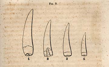
FIG. B. [CLEPSISAURUS teeth]
The first series of teeth belong, I believe, to the CLEPSISAURUS, of Lea, figure B., 1, 2, 3, 4; the largest of which, is one inch and thirteen-sixteenths of an inch long, and three-eighths of an inch wide at base. It projected from the jaw about one inch and a half. The base contracted when it entered the socket, and where it is usually compressed as if it were pinched off; showing, that it was hollow, at this part of the tooth. The largest tooth is bicarinate, as shown in the annexed transverse section E., Fig. the carina dividing the tooth into two unequal parts: Towards the tip, the carina or ridges become serrate with the serratures standing at right angles to the axis of the tooth, as seen in Plate 5, Fig. 3. The surface of the compact dentine is covered with a thin enamel which is prone to seale off and leave the dentine smooth and bare. The enamel is marked by fine, rather oblique wrinkles, which are not impressed upon the dentine. No. 2. of this series, Fig. B. has the same characters, but for a fuller illustration,
Page 300
I annex Fig. 22, as they show the peculiar wrinkles of those adjacent to the sharp lateral ridges or carina of the tooth. There is a fine feathery arrangement here which seems to be characteristic of this kind of tooth. No. 2, also of the series of which there are four, shows the character of the dentition in the existence of a point of a young tooth entering the pulp cavity of an old one. No. 3 and 4 belong evidently to the same series, being smaller, but exhibiting the same markings as well as forms. The carinæ, however, are less distinct than in the larger ones, and while the sharp ridge may be present, the serratures towards the base become obsolete, but are more distinct towards the apex of the tooth, or upon the upper half of the crown. These teeth are beautiful and glossy on the outside, when not in contact with a rock containing sulphuret of iron. This substance frequently destroys the tooth, especially when it enters into its texture. In this case it is impossible to preserve them by external applications, and in the end they split, and are perfectly destroyed. Others seem to be perfectly carbonized, and though perfect to the eye, yet are so brittle, that a slight blow breaks them transversely, and it is impossible to polish them down sufficiently thin to obtain a knowledge of their structure.

FIG. 21. [Tooth]
The teeth represented in Fig. B. appear to have belonged to but one species, and probably to the one described by Mr. Lea under the name of CLEPSISAURUS PENNSYLVANIUS. This opinion is founded upon the form and markings of the teeth and their insertion into the jaw. The jaw in both cases was not grooved for the reception of the teeth, but provided with distinct alveoli or sockets. The proof of this fact is derived from the distinct markings near the base of the crown, which show the depth to which the tooth was implanted in the jaw. This mode of dentition goes to show, that this saurian approximated the alligator as has been suggested; for in this reptile we find the teeth implanted in separate sockets, and the young tooth to displace the old one by entering into its pulp
Page 301
cavity represented in Fig. 2, or else into its side where its pressure creates an absorption, and the final formation of a round or oval hole, through which it passes into the pulp cavity. It is also probable that inasmuch as the teeth differ in size, the place of insertion of the jaw of the Clepsisaurus, had the same irregularity as that we now perceive exists in the Alligator. The first and largest of the teeth in the series B. was found at Farmville, in the black bituminous slate. It is the largest I have seen, and it differs somewhat from the smaller in its bicarination. All the pits along the whole out-crop of the bituminous shale, furnish teeth, but few bones. They are common at Egypt and Farmville, the Taylor plantation and the Gulf. They are more common at the junction of the black band with the coal seam. I have also found them in the Dan river coal field, but I have not as yet in the calcareous shales between the bituminous beds, above or below the coal seams. These teeth remains, seem therefore, restricted to this part of the formation; but of this, I can only speak of the discoveries which have been made up to this time. Certain bones of saurians have been found in the drab colored sandstones which lie in proximity with the carboniferous shales, but as they have not been accompanied with teeth, a direct comparison cannot be instituted between those of the sandstones and those of the black slates. Bones too, as will be seen in the sequel, have been obtained in the upper marls and sandstones, but these differ in form and size from those of the coal series, and must belong to saurians quite different; and which may probably turn out to be Labyrinthodonts; but these too are unaccompanied with teeth.
I am unable with certainty to connect the teeth described in the foregoing paragraphs with the bones of the skeleton; but as these teeth seem to be identical withhose found in connection with the vertebra at Milford--Mr. Lea's Clepsisaurus Pennsylvanius--it may be regarded as highly probable that this series of four teeth belonged also to a skeleton whose vertibroe were biconcave and constricted in the middle, or had the form of an hour glass. In consequence, however, of the scarcity of information upon this point, I prefer regarding
Page 302
these of Deep river provisionally as the same as Mr. Lea's found at Milford. Its name, will therefore, be the same as that conferred by this distinguished naturalist.
* 255. The saurian remains which I shall next describe, are so far perfect, that I am able to show the relation of the teeth to the skeleton, or to certain parts of it, particularly the vertebra. They will be found, as the reader will see, to be different from the preceding, not so much in the actual form of the tooth, as in the peculiar plaits of the enamel as well as of the dentine itself. From these important differences, I am disposed to regard the animal to which they belonged, as differing generically from the Clepsisaurus, and as the teeth occurred in connexion with the vertebræ, and as these differ considerably in details from this genus, I am strengthened in my belief that it should be regarded as a different genus. In accordance with this belief, therefore, I propose for it a name which is expressive of the peculiar external appearance of the teeth and their plaited or slightly grooved surface. The name proposed provisionally is, RUTIODON, from Rutis, plaits, and odous, tooth.
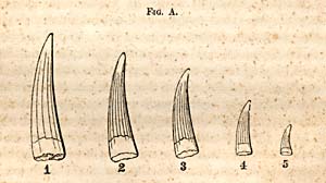
FIG. A. [RUTIODON teeth]
These teeth are represented in the series A., 1, 2, 3, 4, 5, which show the form and relative size. No plaited tooth has been found as large as the largest in the first series.
NOTE.--An account of these reptiles of the Deep river formation was read before the Albany Institute in March, 1856; but, I had on many occasions previously communicated my views to several individuals both orally and in writing.
Page 303
Of the latter, the largest is one inch and three-eighths long, and five-sixteenths of an inch in diameter at the base. The external characters, as I have said, differ from the former in having plaits or flutings upon their surface which extend to the dentine beneath. The enamel is superficially wrinkled as in the first series, but more so. Laterally the tooth is marked on one side with a sharp ridge or carina, and in the larger, faintly on the other side, but the serrations are wanting. The ridges when present divide the tooth into two unequal parts. The flutings never extend to the apex: only about two-fifths of the crown is thus ornamented; the rest is nearly smooth. The smallest tooth of the series is five-eighths of an inch in length and one-eighth in diameter. Like those composing the series B., they are slightly compressed, some more, and others less. At the base of the crown, they become more rounded, but flattened in that part which is inserted into the jaw, in consequence of the tooth having been hollow. When the two series are compared, it will be admitted that there are important differences between them, which however, appears in a more striking light when the individuals are placed side by side, than when veiled through the medium of figures and descriptions. They never pass into each other; the patterns always remain distinct.
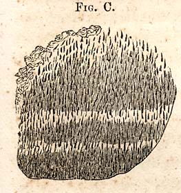
FIG. C. [Rutiodon tooth structure]
The structure of the fluted teeth is shown in Fig. C. The calcigerous tubes as seen under the microscope start from the pulp cavity, rise a little upward then pass to the outside nearly at right, angles to the axis of the tooth, turning a little upwards as they approach the enameled covering. There is seen, also, light belts crossing the section, as represented in the accompanying figure; but there is no arrangement approaching that which has been so frequently illustrated as existing in the Labyrinthodonts of the New Red sandstone. This conclusion is also borne out by the structure or outward form of the vertebra, with which the teeth are associated.
Page 304
Reference having been made to the form of the accompanying vertebra, I propose in the next place to furnish a description of them, annexing also a figure of one of the most distinct in my possession.

FIG. 22. [Thecodont vertebra]
This vertebra is slightly compressed obliquely from its articular surfaces; its proportions, however, are preserved. It is biconcave and its concavities rather deep, and bordered by a broad rounded ridge. The centrum or body is compressed or constricted, which gives it the hour glass form of the Clepsisaurus and Thecodontosaurus of the Bristol conglomerate. Its diameter through the centrum from side to side, is only seveneighths of an inch, and one inch and five-eighths from the upper to the lower edge.
The longest, or the vertical diameter of the anterior or articular surface, is one inch and a half; the transverse, one inch and two-eighths of an inch. Its form, (articular surface,) is orate, as represented in Plate 7, Fig. 4, the widest part being the lower half.
The vertical, or greatest diameter of the anterior articular surface is one inch and seven-eights, (1 in. ⅞). The transverse diameter through the middle is one inch and five-eighths, (1 in. ⅝). The difference is owing in part to the protuberances seen in the figure towards the lower side of the centrum. Length of the vertebra one inch and five-eighths, (1 in. ⅝). In this vertebra the spinous process is evidently broken off; but in a mode which has left the surfaces comparatively smooth. Its form, particularly its constriction in the middle, its excavation between the articular ends in the line of the spinal marrow, giving to the latter a monilliform
Page 305
shape, its biconcave structure and its teeth places the animal among the Thecodonts, and its microscopic structure shows that it could not have been a Labyrinthodont. But while its type is saurian it cannot escape our notice that it also departs but slightly in certain respects from the ichthyic type, as all fish have vertebra which are strictly biconcave, and the junction of the processes to the body of the vertebra seem to be less firm than in others related to this family, the suture remaining distinct; in consequence of which the processes may be separated, as in the young of the mammiferous class.
The neural arch being broken in this case, the groove protecting the spinal marrow is brought to view. It consists simply of two sharp ridges of bone which begin at about half an inch from the articulating border, and the canal widening towards the posterior extremity, it becomes about one-fourth of an inch wide, and about one-fifth of an inch deep.
From the anterior lower half of the centrum there rises a ridge of bone which terminates on the edge of the articulate border, in a rounded protuberance against which the head of a rib rested. Beneath the compressed body or centrum it has another sharp ridge extending from one articular surface to the other.
The other vertebræ which belonged to the same skeleton have preserved essentially the same characters. In some of these there is exhibited a peculiar, broad, expanded form of the aicular surfaces, which may be described as bell-form only the concavities are too shallow to admit strictly of the comparison. (See plate vi, fig. 8.) The processes of these vertebræ, as usual, are broken, having been imbedded in a yielding or compressible bed of bituminous coal. The two vertebræ which are represented here in juxtaposition are four inches and one-eighth of an inch long, (4⅛ in.;) greatest diameter, two inches and one-eighth, (2⅛ in.) The figure shows also, besides the vertebræ, several ribs which are more or less crushed, but some of which preserve the grooves for the transmission of blood vessels. At the lower edge of the figure there projects the end of a spinal process, which shows itself on the inferior side about two inches. It is one inch and three
Page 306
quarters wide, and half an inch thick at its exposed extremity. Six vertebræ were found in two or three clusters, imbedded in the lower seam of coal at Farmville. The cluster contained vertebræ, ribs, and portions of the sternal arch, and several teeth, whose surfaces were plaited. It may therefore be inferred that the teeth belonged to this skeleton, along which they were found, inasmuch, too, as no other kind than these were found along with it, though they were common in other connections.
Some of the ribs show that they were doubly articulated, and one in particular, whose inferior surface was exposed, shows a wide, shallow groove for the protection of blood vessels and nerves.
Among these clusters of bones I found in one mass a portion of a cranium, which I have referred to the frontal bone. There are no curious sculptures or markings, as is sometimes the case in cranial bones of saurians and sauroid fishes, but simple striæ, as represented in plate v, fig. 5. The striations referred to seem to be common to all the bones of the skeleton, especially the ribs, and even on the articular surfaces of the vertebræ they may be seen.
* 256. The questions which may be properly discussed at this stage of our examination of these remains, would probably be, are they known to the scientific world--or have they been described, and is there any doubt respecting the family to which they belong? I have already had occasion more than once to refer to the discovery of Mr. Lea and to his Clepsisaurus. It is stated that this genus has bi-concave vertebræ and a constricted centrum, and a carinated tooth much resembling the first described series, and a double-headed rib. There is, therefore, as will be seen by reference again to my descriptions, a close relationship between those of Deep river, Milford, Pa., and Bristol, in England. They form one family, or a group, in which there is a strong family resemblance. They all belong to the order Lacertilia, of Owen, which have teeth implanted in distinct sockets, forms of vertebræ and ribs alike. When we compare the minor details of structure and of form, we find certain dissimilarities which
Page 307
go to show that they may belong to different genera, as is the case with the THECODONTOSAURUS and PALæOSAURUS, though found together in the same bed. The teeth, for example, in the Rutiodon, are always smaller, but more especially should it be observed that they are plaited, while those described by Mr. Lea, as well as those of the Bristol conglomerate, are smooth.
In Mr. Lea's saurian the diameter of the articulating surfaces of the vertebræ is only one inch and six-tenths, (1 6-10 inches.) In the Deep river saurian, last described, it is rather over two inches. In the smallest of the vertebræ, however, the diameter is about the same, but the vertical diameter through the middle of the centrum is one inch and seven-tenths, (1 7-10 in.,) while in Mr. Lea's it is only one inch and one-tenth, (1 1-10 in.) Although we are not able in this case to compare homologous parts, yet I think there can remain but little doubt that the genera are different, as has been laid down. But though there may remain an amount of uncertainty, still I believe I am justified in regarding the RUTIODON as distinct, and hence should receive also its specific name, and hence I propose Carolinensis, which will be a suitable name to distinguish it farther from Mr. Lea's Clepsisaurus Pennsylvanicus. There can be no objection in making a provisional distinction by name, seeing the fossils belong to similar formations in different States. It enables us to speak of them without circumlocution, and should it prove that the denomination has been hasty, the synonims are not likely to
NOTE,--Since the foregoing was written, fragments of the skull of a saurian, with beautifully sculptured surface, have been found at Egypt. As the simply striated skull bone must have belonged to the Rutiodon, it is possible that the sculptured one may have belonged to an Archegosaurus; it cannot be a Palæosaurus. I have to add, also, that since the foregoing was written, Mr. Lea has communicated to me the fact that he had discovered a tooth in the red sandstone formation of New Jersey, the locality of which is not recollected, and which, on its being shown me, I recognized as one which belongs to the last series of five, the plaited-teeth of Deep river. He had given the name of CENTEMODON, from Kentema, awl, and odous, tooth, with the specific name, sulcatus. This discovery proves the existence at the North of the two genera which have been described. Mr. L. has communicated his discovery to the Society of Natural History of Philadelphia.
* 257. The nearest living representative in our country of the genera Clepsisaurns and Rutiodon, is the Alligator, so well known in the southern part of North-Carolina. But the Alligator has a different form of vertebræ. The articulating surfaces are concave before and convex behind; or, in the technical phrase often employed, the ancient Saurians were Amphicoelian, and the Alligators are procoelian; their vertebræ being, really, ball and socket joints.
In comparing the size of these genera, and taking the skeleton of the Alligator as the standard, one which is eleven feet long, I find the Rutiodon must have been both longer and larger. Thus the vertical diameter of a dorsal vertebra of this Alligator is only one inch and an eighth of an inch, (1 in. ⅛,) and the length one inch and five-eighths, (1 in. ⅝). The Rutiodon it will be seen, on referring to the measurements already stated, must have been more than two, probably three feet longer than the full grown Alligator of our rivers, though probably the Alligator may acquire a length of fourteen or fifteen feet. We have, however, no positive data as it respects the length of the tail and of the neck, as no vertebræ belonging to either of these parts have been found. The relative form of the vertebræ of these two reptiles was evidently somewhat different; thus, the transverse diameter of the vertebræ of the Aligator is greater than the vertical, while in the Rutiodon the vertical diameter is the greatest. This fact seems to indicate a greater height in proportion to the length and breadth. In the size of the teeth, the Alligator is a match for the Rutiodon, and, like the former, the size is as variable, while generally in the ancient saurians the size or length of the teeth is more uniform.
From the foregoing facts, we may infer that the soil of
Page 309
North-Carolina has been trod, and its waters have swarmed with reptiles from the remotest ages. They are common to all the formations, from the Deep river coal measures down to the tertiary beds, and they are still the formidable inhabitants of its waters. Those which I have from the tertiary are considerably larger than those from any former epoch, or those which belong to the present.
While engaged in the examination of the formations upon the Dan river, I discovered the vertebral remains of another saurian, closely allied to those already described. They were imbedded in the black slate near Leaksville, at a point near the bridge over Smith's river. This part of the formation, it is now well known, is between the red sandstones, and is very near the coal seams. These remains are more perfect in some respects than those which have been discovered upon Deep river, at Farmville. Three of these vertebræ are delineated upon plate 8, Fig. 1. It will be observed that these are also biconcave, or belong to the Amphicoelian type, and have the hourglass form of vertebræ; that they have two articulating surfaces for a double headed rib, that their processes are united to the body by suture. In the union of the process by suture, and in the existence of two articulating surfaces for a double headed rib, Plate 8, Fig. 3, we see the same arrangements as now exist in the Alligator. As these vetebræ have lost only a part of their spinous processes, they are proper parts for comparison and measurement. I obtained the following dimensions of the vertibræ under consideration:
| Vertical diameter of the posterior articulating surface, | 1 inch and ½ of an inch. |
| Transverse diameter, | 1 inch and ⅜ of an inch. |
| Length of body, | 1 inch and ⅝ of an inch. |
| Height of body and spinous process, | 4 inch and ¾ of an inch. |
| Width of spinous process, | ⅞ of an inch. |
| Distance of the articulating surface of the head of the rib to the upper part of the articulating surface of the oblique process, | 2 inch and ½ of an inch. |
The body of each vertebræ is traversed longitudinally by three ridges, two lateral and one inferior: concave surfaces bound these ridges, or they may be regarded as longitudinal
Page 310
depressions. These vertebræ are strong and rough, and the spinous processes wide and high, more so relatively than the homologous parts of the Alligator. To the eye, there is the same disproportion between the articular ends, as in the vertebræ of the Rutiodon. The anterior articulating surface is the smallest. In the fine specimens figured, the rock will not permit the measurement of bone so as to verify what is apparent to the eye.

FIG. M. [Dorsal vertebra]
Page 311
Another dorsal vertebra of this series, Fig. M., the spinous process of which is nearly perfect, has the following dimensions:
| Vertical diameter of the anterior articulating surface, | 1 inch and ⅞ of an inch. |
| Transverse, | 1 inch and ¼ of an inch. |
| Vertical diameter of the concavity, | 1 inch and 1-16 of an inch. |
| Transverse, | ⅞ of an inch. |
| Distance from the lower edge of the vertebræ to the end of the spinal process, | 4 inch and ½ of an inch. |
| Width of the spinal process near its base, | 1 inch and 00 of an inch. |
| Width at the top, | ⅞ of an inch. |
| Depth of the concavity, | 6-16 of an inch. |
The anterior edge of the spinal process of this vertebræ is grooved, and the posterior edge is provided with a sharp ridge.
| Another dorsal vertebra of this series, measures from the upper edge of the articulating surface of the centrum to the top of the spinal process, | 3 inch. and ⅝ of an inch. |
| From the end of the transverse process to the top of the spinal process, | 3 inch. and ½ of an inch. |
| Length of the transverse process, | 1 inch. and ⅛ of an inch. |
| From the inside of the ridge surrounding the concavity to the outer articulating surface of the oblique process, | 1 inch. and 5-16 of an inch. |
This vertebra is anterior in the spine to those referred to in Plate 8, Fig. 1; but its exact position, or its number, I am unable to determine.
The Leaksville series contain fourteen pieces, more or less perfect; and all appear to be dorsal.
Among these vertebræ are fragments of ribs, one of which, minus the head and neck, is six inches long. It is rounded at the proximal extremity, and flattened at the distal end, where it is 1⅛ of an inch wide. The inner edge is grooved. From being nearly round at the proximal end, it first becomes somewhat triangular, and then flat and expanded, sending off on one side near its extremity an oblique flattened branch, which joins its fellow rib below, something like the plan which prevails in birds. The whole length of the rib was probably 7½ inches. This rib is about half an inch thick at the proximal extremity.
Page 312
The question which it is important for us to determine is, whether the Leaksville Saurian is identical with one or the other of those which have been already described. While it is true that we are yet deficient in information respecting certain parts of the skeleton to enable us to satisfy the demands of the question, still we may avail ourselves of all the facts within our reach; and probably this course may give us something which will be a clue to a correct determination which we require, and enable us to form at least a rational conjecture. For this, I propose to compare the parts of each species with one another, and, in the first place, I will take the Clepsisaurus for comparison with the Leaksville specimen. The measurements of Clepsisaurus which bear immediately upon the question, are the distance from the centrum to the top of the vertebral spine, etc.:
| 1. The measurement is, | 2 inch. and 1-5 of an inch. |
| 2. Length of vertebræ, | 2 inch. and 1-10 of an inch. |
| 3. Vertical diameter of the constricted part, | 1 00 |
| 4. Transverse, | 3-10 of an inch. |
| 5. Length of the transverse process, | 2 00 |
In the Leaksville saurian,
| 1. The height from the centrum to the top of the spinal process is, | 3 inch. and ¼ of an inch. |
| 2. Length of vertebræ, | 1 inch. and ⅞ of an inch. |
These measurements differ; and of the fourteen vertebræ from Leaksville, none of their measurements agree with those of the Clepsisaurus.
The length of one transverse process, is one and an eighth of an inch. The length of this process in the C. Pennsylvanicus, as will be seen, is two inches; but this is variable, and we cannot affirm that we are measuring homologous parts. There being however, considerable difference in the relative proportions of parts, it must appear probable that the Leaksville and Milford saurians are different, or belong to different species, admitting that the individuals were adults; and admitting that one of them was an immature individual, we should
Page 313
have a right to expect that the proportions would tally more closely. The probability is, when the character of the bones are considered, we need entertain scarcely the shadow of a doubt but that both individuals were mature, especially when the teeth are taken into the account; that is, when the teeth and bones of the C. Pennsylvanicus are brought together, there can remain scarcely a doubt that this belonged to an adult individual; and as this is the smallest of the two, little doubt should be entertained respecting the Leaksville specimen. The difference in the proportions of these species is considerable; and as proportions are the most reliable characters for the determination of questions of this kind, I shall regard them as belonging at least to different species. It seems probable from the proportions which have been obtained by measurement, that the Leaksville saurian was higher than the Milford, the latter was also lower and broader of the two.
We may now compare the Leaksville with the Deep river saurian.
The only points of comparison which lie within our reach, must be drawn mainly from the vertebræ and its appendages. As to the height of the spine, the Leaksville is the highest, and the vertebræ comparatively more slender. The teeth which have been found in the Dan river slates, resemble those of the Clepsisaurus, but no teeth occurred in connection with the bones: we are left in ignorance respecting these important organs. Upon the whole, I am disposed to regard it as differing only specifically from the Clepsisaurus: I propose for the Leaksville saurian the specific name, LEAI, out of respect for the high standing of the discoverer of the first of the Thecodont saurians in this country.
We may before we leave this subject, sum up the characters upon which each of the foregoing species and genus now stand. In the first of the discovered genera, the Clepsisaurus, the characteristics were derived from the teeth. They differed both from the Thecodontosaurus and Palæosaurus of Riley and Scutchbury, while it resembles them in the biconcave form of the vertebræ. The Clepsisaurus could not harmonize
Page 314
with the genera which had been established; hence the necessity of founding a new one for the reception of the one discovered in this country. In subsequent discoveries of similar types in our formations, it becomes necessary to make the comparisons with all the genera which have been established. In comparing, therefore, the Rutiodon with known genera, it is found that the outward form and structure also of the teeth, differed from any which had been previously described. It was in consequence of these differences, that I have ventured to propose the genus referred to. The facts respecting the Leaksville saurian, it is evident, do not wholly clear up the question as to genus; though it is quite plain from its proportions, that it cannot agree specifically with the CLEPSISAURUS or RUTIODON; but to which of these genera it actually belongs, cannot be decided before we obtain more information respecting its teeth. I have supposed it more probable that it is a Clepsisaurus, as teeth belonging to this genus have been found in the slates of Dan river, and none which belong to the Rutiodon.
* 258. If the foregoing statements and conclusions are founded in principles of Natural History, we have three species of Thecodont saurians existing cotemporaneously, whose remains were entombed in the slates of the coal measures of Deep and Dan rivers. It will be seen that they are found in a well-defined geological horizon; hence their remains become available for the purpose I have used them--that of defining the age of this series of deposits. The remains of the Clepsisaurus Pennsylvanicus seems to be farther removed from this horizon than either of the three species belonging to North Carolina. The epoch of the conglomerate in which they are embedded, may be near the beginning of the Permian system, or later; the deposits at and near Milford, Pa., are not so clearly defined as those of North Carolina. In view of all the facts presented, it seems I am justified in expressing the opinion that the older sandstone and coal measures are correctly located in the Permian system. I have, however, still more testimony which supports this opinion, and I shall now proceed to lay before the reader this testimony
Page 315
which is contained in another discovery of saurian remains approximating closely to the PALÆOSAURUS PLATYODON, found in the Bristol conglomerate, and which has been already referred to. These remains are better known by the teeth, which are compressed and serrate, with the seratures standing at right angles to the axis of the tooth. Now the teeth are the only organs which I have found, but these agree so well with the figures of those of the Palæosaurus that no one can doubt of their being generically related. The annexed three figures, showing the tooth in different positions, will convey a correct idea of the form of the Palæosaurus tooth. Fig. 1, side view, but too narrow at base; No. 2 is an edge view, showing that though apparently quite flat when its broad planes are seen, that it has considerable thickness; fig. 3, enlarged, shows the serratures of the edge.
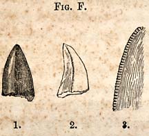
FIG. F. [Palaeosaurus teeth]

FIG. G. [Palaeosaurus teeth]
A corrected outline of the shape of this tooth is given in Fig. G. No. 1 is an exact outline of its form. No. 2 represents its transverse section at its junction with the jaw. It is bicarinate; serrate on both sides from its base to the apex. The tooth is lancet-shaped, being compressed, but the crown becomes thicker towards the base, especially on one side, whence its transverse section is obliquely gibbous. The serratures are not simply notches in the edge, like those of a saw, but impressions which extend beyond the edge into the margin of the enamel. The outer face of the tooth is more convex than the inner, and the anterior edge also the most convex of the two. Below the enamel the tooth is slightly constricted, perhaps only apparently so by the discontinuance of the enamel, which is rather thick and strong, and adheres firmly to the dentine, and at the place where the tooth enters the socket it is nearly cylindrical. The calcigerous tubes, as seen under the microscope, ascend a little from the pulp cavity, and then pass off at right angles to
Page 316
the axis of the tooth. Fig. H. represents the appearance of the calcigerous tubes under the magnifying power of 350 diameters. The following dimensions of the tooth will convey a more accurate idea of its form and characters than can be obtained by description alone:
| Length, | ½ inch. |
| Width at base, | 5-16 inch. |
| Thickness at base, | ¼ inch. |

FIG. H. [Palaeosaurus tooth]
The inner face, adjacent to the edge, has a flat groove, or rather the tooth becomes flattened, or is brought to an edge rapidly, and which is rather thin, as if an edge was made by scooping out a piece longitudinally from a cylinder by a small gouge. The tooth appears quite flat when imbedded in slate, and in this relation it has the exact form of the Palæosaurus tooth figured by Sir Charles Lyell, in his Elements. P. 306, fig. 348.

FIG. I. [Palaeosaurus tooth]
A small tooth belonging to the genus Palæosaurus has the following proportions and dimensions: (Fig. I.) No. 1.
Length, 5-16 of an inch; breadth at base, nearly ¼ of an inch; thickness, 3-16 of an inch.
NOTE.--The tooth No. 3, fig. I, belongs to the Rutiodon. It is one of the smaller fluted teeth, but is a good figure of this kind, showing very clearly, the difference between the Clepsisaurus and the Rutiodon.
No. 2 shows the serratures as they appear on both edges of the tooth enlarged. The smallest tooth which has fallen under my notice, is one-fourth of an inch long; it preserves in its measurements the proportions of those which have been already given. There is, therefore, no doubt, but that these flattened, bi-carinate teeth, belong to one species of saurian, though they differ in size. From the foregoing figures and descriptions, it will no doubt be admitted, that the genus represented by them, differs generically from the RUTIODON
Page 317
and Clepsisaurus. The form, and especially the structure of the teeth is very different. They have no resembance to the Labyrinthodonts of the New Red sandstones. The other genus, the THECODONTOSAURUS, with compressed teeth, the serratures point to the apex of the teeth.
When these compressed teeth, therefore, are compared with those of the PALÆOSAURUS, a genus established by Riley and Scutchbury, it is difficult to resist the conviction, that our Saurian is closely related to it. The figures of the teeth, however, do not give all the information respecting them, which is necessary for an exact determination; but as far as they go, they sustain the opinion I have expressed of their generic affinity. I should infer from the figures of the Palæosaurian teeth that they were thinner than ours, while the latter must be shorter and stouter; those of the Bristol conglomerate being nine lines long and five wide. These proportions do not differ from those of Deep river.
From the foregoing facts, I am disposed to regard the teeth under consideration, as belonging to the Palæosaur, but differing specifically from that of the Bristol conglomerate. I propose naming it PALÆOSAURIUS CAROLINENSIS, as North-Carolina is the only State in which these remains are found. Of its vertebræ we are yet ignorant; but I am disposed to believe that the fragments of its cranium may yet be found at Egypt.
* 259. There is still another kind of tooth which I am unable to refer to any species which has been described.
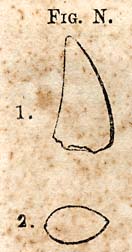
FIG. N. [Palaeosaurus Sulcatus tooth]
Its form reminds one at once of the Palæosaur, but an attentive examination of its character will convince any one that it differs from the foregoing species. Fig. N. are outline figures; No. 1 shows the curvature of the tooth, and 2 the form of the transverse section near the base of the crown.
Page 318

FIG. No. 3. FIG. No. 4. [Palaeosaurus Sulcatus tooth]
Fig. (No. 3,) shows the convex fluted surface; the flutings however, are somewhat irregular, but are not to be regarded as accidental. Fig. No. 4, shows the serratures of one edge; those of the opposite edge are obsolete, and exist only faintly towards the apex of the tooth. The figures are of the natural size.
The following measurements show the relative proportions between their length and breadth:
| Length rather greater than | ½ of an inch. |
| Breadth at base | 5-16 of an inch. |
| Thickness, rather exceeds | ⅛ of an inch. |
The foregoing description and figures of teeth, prove that the length and breadth differ from the P. Carolinensis, and that their proportions also differ; 2. that the transverse section is different, and 3, that the serratures exist principally on one edge; that though the transverse section is gibbous, yet it is not obliquely so. It is therefore specifically different from that, or appears to be. The texture of teeth, and the character of the enamel also appears different; it is less compact and the enamel is thinner; and hence, so far as my discoveries go, they appear to warrant the establishment of a species, and I therefore, propose the specific name, Sulcatus, from the furrows upon the convex face of the tooth, when it will stand, PALÆOSAURUS SULCATUS.
From the foregoing determinations, (which may be regarded as provisional,) it cannot fail to strike the person who is conversant with the discoveries in palæontology, that this period was rich in the Thecodont saurians, and that they characterize the Permian as clearly as the Ichthysaurus and Pleisiosaurs do the Liassic epoch; and so far as discoveries now warrant, our conclusions are sustained that they are probably confined to the Permian epoch.
* 260. Of the Bones found in the Gray Sandstone.--In Germanton, I found a cluster of bones belonging to a saurian in close proximity to the coal slates, but beneath them. Those which I regard as the most important, consist of a
Page 319
femur and tibia; both, however, imperfect. There were many small bones more or less mutilated, and hence, too imperfect for determination; but what was quite as unfortunate for the bones and my discovery, was that the rock itself had become concretionary, and was quite refractory in breaking, being both tough and massive. The large bones referred to, are represented on Plate 7, Fig 1, 2. These bones, though not properly mineralized, yet they seem to have undergone a change in structure. Parts of the more compact bones are crystalline and brittle, and hence the difficulty of exposing them in their matrix is increased. The tissue of the bones is fine and close; color black, except where they have been long exposed to the weather.
The femur, Plate 7, Fig. 1, is broken towards the proximal extremity; but the outline of the head is imprinted in the rock, and portions of the bone remain in situ. The distal extremity is removed just above the condyles.
The tibia has two gentle curves, but its extremities are marred, and a large notch is broken out of the front of the condyles. A side view presents somewhat the shape of letter S.
The preserved portions have furnished me with the following measurements:
| Femur. Length preserved, | 7 00 inches. |
| Distance across the proximal end, including a part of the head, | 3 inch. and ¼ of an inch. |
| Diameter of the bone four inches from the head, | 1 inch. and ¾ of an inch. |
| Thickness rather greater than, | ¾ of an inch. |
The form of the cylinder of bone, or its transverse section, is represented on Plate 7, Fig. 5. This flattening or compression appears to have been natural, and not due to mechanical pressure in the rock. At the point where it is broken, it begins to widen; the fracture, therefore, is just above the condyles. It was probably nine or ten inches long when perfect.
The tibia is more broken, though the general form appears to be preserved. It is thick through the condyles, and begins
Page 320
to form a curve as it passes down towards the middle of the bone; and the curve exists at the distal extremity.
I have the following dimensions;
| Length of the tibia, | 10 inch. and ½ of an inch. |
| Breadth across the condyles, | 2 inch. and ¼ of an inch. |
| Diameter below the condyles, | 1 inch. and ¾ of an inch. |
A metatarsal bone? is figured, Plate 6, Fig. 3. Several detached ones were found in the rock, its surface is striated.
All the small bones are black and crystalline, and extremely brittle. I was unable to discover in this mass of bones any teeth or vertebræ, and hence it is impossible to determine whether they belong to the Thecodont Saurians, with biconcave vertebræ, or not. The size of these bones belong evidently to a larger individual than any which I have described. None of the bones are provided with medulary cavities; or those cavities are wanting where the bones are broken.
A remarkable cluster containing sixteen curved bones, five inches long, and from one-fourth to one-half of an inch thick, was found in this group in the sandstone. They are black, compact, and disposed to break into oblique prisms. The first impression they convey is, that they are short ribs. They taper towards both extremities, and are neither provided with tubercles or heads, or any process. They are flattened on one side, and rounded and striated longitudinally on the others.
I speak of them in this place, more for the purpose of directing the attention of geologists to these singular bones, than for the purpose of describing them in detail; in hopes thereby that some one more fortunate than myself may yet discover other facts which will throw some light upon their position in the skeleton.
The metatarsal bones, I should remark before leaving the subject, is nearly straight.
Several other bones were discovered at this place, but as they are imperfect, I omit for the present a farther notice of them.
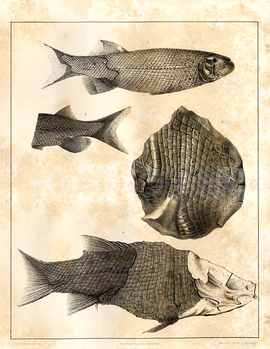
Plate 9. [Figs. 1 and 2. Dictyopyge from the Richmond coal formation.
Fig. 3. Tetragonolepis, from the same.
Fig. 4. Genus Ischypterus, Sunderland, Mass.]
Page 321
CLASS PISCES, OR FISH.
The remains of fish are numerous in the black bituminous slates. They consist entirely or almost so of small shining rhombic scales, and belong to the ganoid order. A few parts of the fins rarely occur. Bones also of the head, and in one case, a temporal bone, about four inches long, was taken from the Egypt shaft. When I found the mass of slate to which it was attached, it had so far disintegrated that on lifting it, though carefully, it fell into many pieces, and the relict was destroyed. The fish, which seemed to have swarmed in those days, after dying, were completely broken up by decay, leaving nothing except the harder bones and the scales. The fish scales appear in the upper beds of slate, but I have never observed any in the sandstones below or above.
FIG. P. [Defensive bone]
The next most common remains to the fish-scale is a defensive bone, probably belonging to that kind usually called Ichthyodolerite. The annexed figure P shows its size and form. Like the scale, it is confined apparently to the bituminous slate.
It belongs to the front part of the dorsal fin of the genus catopterus, Redfield, or Ischypterus of Sir P. G. Edgerton. But as it has not been discovered in connection with the fin, I am under the necessity of expressing myself doubtfully respecting the genus to which it should be referred. In the genus Ischypterus I have not been able to discover in the fin itself a line of demarcation through which the front part could be detached and leave it as perfect and distinct as it is usually found.
There are evidently two kinds of fish teeth in the Deep river slat; one slender and terete like the point of a needle, and slightly flattened at the larger end. It is rather more than one-eighth of an inch long, and scarcely ever exceeds one-fourth.
The other is a small, short, conical tooth, with a comparatively large base, and seems to have been set directly upon the jaw.
Page 322
I am aware that the foregoing very brief statement respecting the fish of this formation is too meagre and too indefinite to be of much service in determining the age of this formation. I prefer to wait the result of discoveries before attempting to make use of the present knowledge, which is evidently too scanty upon which to form a geological opinion.
It is now well known to geologists that two genera of fish have been found in the slates of the Richmond coal basin--the Tetragonolepis, Agassiz, whose scales are rather large, (pl. 9, fig. 3;) the other is a slender fish, with scales more resembling those in the rocks of Deep river, (pl. 9, fig. 1.) But none of the large scales indicative of the existence of the Tetragonolepis have been found with those smaller rhombic scales in the formations of Deep or Dan river. It may be questioned then whether the fish may not be different in the two localities, the scales of the Deep river being much smaller and more acutely rhombic.
The most common body which is connected with animal remains are coprolites, the excrement of fish and saurians. They are common and abundant in all the bituminous schists. Their forms are variable, as well as their size. The one most frequently met with is about one and a half inches long, and half an inch in diameter; this kind is never spiral. But another, not differing materially in size, shows a spiral arrangement of parts, (plate 6, figs. 6, 7 and 9, of which No. 7 is the most abundant.
After having examined critically a large number of beds in the Deep and Dan rivers coal fields, I am confident the fish remains thus far differ from those of the Richmond basin. The Tetragonolepis, which is a liassic genus, has not yet been found in North Carolina, and I am confident, too, that the scales, fins and fish bones, found on the deep river, do no tbelong to either species of DIOTYOPYGE of the Richmond coal-field. (See proceedings of the Geological Society of London, vol. 3, pp. 280, from which the figures were copied.)
CLASS MOLUSCA--BIVALVE SHELLS.
The genus Posidonia is the only animal of this class which
Page 323
has been observed. It is a small, thin, bivalve shell, concentrically marked with lines or furrows. It is pressed perfectly flat in the black bituminous slates. It is often abundant, but it is also frequently absent. It is associated with a cypris, and the fossils which have already been noticed. The shell is as thin as paper, and we rarely find one perfect, though a large surface may be covered with them.
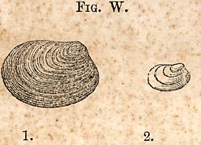
FIG. W. [Posidonia ovalis]
The posidonia of the black slates appears to be a different species from those which occur in the upper red sandstone. Figs. W are accurate outlines of the shell--the Posidonia ovalis. The smallest, No. 1, is the natural size, and 2 is enlarged.
CLASS ARTICULATA.--ORDER, CRUSTACEA.
Family Cypridoe.--This singular fossil, the cypris, composes entire strata among the bituminous slates. It is a very small fossil, the largest individual scarcely exceeding one-thirtieth of an inch in length. Their form is much like that of bean, though infinitely smaller. In the midst of this multitude of small carapaces of this family, it is usual to find two sizes, one about half the length of the largest, but the small ones scarcely differ in form from the larger; both are smooth, and the only marking which they exhibit is an oblique groove, which may be due to pressure. The great interest which attaches itself to these curious fossils, is their abundance. In the shaft of Egypt it was very singular also to observe their sudden disappearance from the green calcareous shale, and their sudden return again on the reappearance of the black bituminous slate. Prof. Rogers speaks of one species with a granulated carapace, which I have not seen.
NOTE.--Scales of the Tetragonolepis have been found since the foregoing was written.
Page 324
CHAPTER XLI.
Fossils of the Argillaceous Blue Slates.--Equivalent to the Coal Shale group of the Thuringerwald, with remarks and descriptions.
* 261. The plant bed reposing upon the conglomerate at Jones' Falls or Lockville, as the place has recently been called, is one of the most remarkable, as well as the most characteristic bed in the whole series upon Deep river.
After the deposition of the conglomerate the beds were quietly formed. The accumulation began in dark blue slates or shale, perhaps not more than ten feet thick, to which succeeded a soft gray sandstone, which is probably equally rich in plants as the slates themselves; but the latter has not been examined with much care, and an examination which was continued for half an hour, gave several new plants, is all that has been done. These beds have furnished only plants, consisting of ferns and cicadeous ones, which seem to be quite abundant. The importance of these beds in a geological point of view, consists in giving us a clear and well defined boundary to the Keuper sandstones and marls, which overlie the beds in question. The Muschelkalk were it present, would occupy a position immediately below the plant bed.
It may be well to recur in this place, to the chain of evidence which supports the view which I have presented.
1. The lithological characters of the lower sandstone, agree in these respects with the formation in other parts of the world.
2. The series next above it, are shown to belong to the Permian system, by the existence of Thecodont saurian remains.
3. The Trias succeeds the Permian, and as we have found several plants which in their localities represent the system, there can remain scarcely a doubt that the view I have presented,
Page 325
is supported by a class of facts, which in other cases, would be regarded as decisive. The upper part of the series which I have placed with the Permian, the drab colored sandstone beneath the conglomerate, may be found hereafter to be Triassic. I have placed them in the upper Permian, because I have yet seen no line of demarkation separating the lower, from the upper, until we reach the conglomerate referred to. But the series which is composed of drab colored sandstones, is so much concealed, that a clear line of this kind may exist, and may have escaped detection. The Muschelkalk is wanting; that central limestone so rich in fossils in Germany, and which is a well defined fingerboard in the geological horizon; but the Keuper-scheifer of the Germans may be represented by our calcareous shales and bituminous coal shale bands.
Our evidence is not confined to the existence of certain saurian remains; it is also found in the succeeding beds, whose fossils I shall now proceed to describe.
FILICITES OR FERNS.
ORDFR, PECOPTERIDES.--GOEPP.
Frond, simple, pinnate, bi or tripinnate, or bitripinnatified; pinnules, equal or dilated at base, midrib or main nerve, strong and not evanescent towards the apex; secondary nerves dichotmous and sometimes twice or thrice forked, or anastomosing with each other.
STRANGERITES,
TÆNIOPTERIS.
Frond, many nerved, middle nerve thick, side nerves parallel, dichotomous.--Borneman.
STRANGERITES OBLIQUUS.--E. n. s.
The nerves or side veins go off at first at an acute angle, when they soon become nearly at right angles with the margin of the frond. Some of the side veins divide near the mid rib; others do not fork until they nearly reach the margin.
Page 326
Those which bifurcate low down or near the mid rib, usually fork twice. This fern occurs at Ellingtons, but is rare.
Another species also belongs to this locality. It is much longer, and not so wide, and is a much more delicate plant; the mid rib is less robust, or more slender.
ACROSTICHITES OBLONGUS.--GOEP. n. s.
PECOPTERIS WHITBYENSIS.
Plate 4, Figs. 8 and 6.
Frond bi-pinnate, primary pinnæ going off nearly at right angles, prolonged and tapering; leafets; oblong, obtuse; closely placed, but not united; adherent by the whole base, and slightly widened; edges nearly parallel; midribs rather faint, especially near the apex; side veins making rather an acute angle, anastomosing, but frequently fork towards the margin, primary rachis, thick strait, as in Fig. 6, Plate 4.
The fern just described, I had supposed was the P Whitbyensis, described by Prof. Wm. B. Rogers, in the Transactions of the American Association. A critical examination of the side veins of the leafets, seems to throw considerable doubt upon the correctness of my first impression. I was moreover confirmed in that view for a time, by a remark of this gentleman on seeing the plant, that it was the one I referred to; but Prof. R. saw it at a distance, and is not responsible for an opinion expressed under the circumstances. It differs from the Whitbyensis as stated in the peculiar distribution of its side veins, and being anastomising, throws it into GOEPERTS genus ACROSTICHITES. The leafets of the P. Whitbyensis are falcate and acute. It is true the general appearance of the plant, thick rachis is much like Brogniarts figure, but differs from it essentially in the details. It agrees much less with Lindley's and Hutton's figure of this fern. In their figure, the rachis is slender, and the leafets decidedly acute and falcate.
This fern, so far as my examination has extended, is undescribed; and hence, I have proposed the name oblongus, from the form of the leafets. If it should prove that this is the plant which has been taken for the Whitbyensis, it will change somewhat the evidence which has been adduced in
Page 327
support of the views that the Richmond coalfield is of the age of than of Whitby, in England.
That the distribution of the side veins may have been over-looked, appears possible from the fact that Prof. Bunbury, who alludes to it, speaks of the obscurity of the side viens; indeed, in most specimens the midrib becomes very obscure toward the apex of the leafet and the lower leafets, the midrib is so evanescent that it might pass for a neuropteris, to which genus it undoubtedly has a close affinity. This fern occurs at Ellingtons in the blue slate, associated with other species of Pecopteris, Equisetum Calamites, &c. It does not appear to be very common.
PECOPTERIS FALCATUS. E. n. s.
Plate 4. Fig. 9.
Frond pinnate, or bi-pinnate; secondary rachis smooth, channeled; leafets long, rather distant than approximate; obtuse, somewhat falciform, slightly protracted at base, and adherent their whole width; midrib distinct to the apex; side viens go off at an acute angle, fork once, and also twice; sori round, in two rows, with from twelve to seventeen in a row. The standing of the leaves vary as to closeness. They are approximate on parts of the frond. I have never seen an entire frond. It is evidently as large, or nearly so, as the P. insignis.
It is rather common at Ellington's in the blue slate; I have also seen a poor specimen at Lockville in the same kind of slate; and also in a decomposing, light-colored slate at House's quarries on the Haw river.
Fig. 5, of the same plate, seems to be closely allied to the preceding. It may be a barren frond, or the leafets may be variable in length, towards the base of the rachis. It is peculiar in the variable form of the leafets. It is more common at Ellington's than any which I have noticed at that locality.
PECOPTERIS CAROLINENSIS, E., n. s.
Pl. 4., Fig. 1, 2.
Frond pinnate, or bi-pinnate, leafets long, tapering when
Page 328
beyond their middle, sub-acute, close, apices only, seem to be free; slightly dilated at base; midrib perceptible near the apex; side veins going off at an acute angle, dividing once or twice. Fructification spots, arranged singly and in a row, on each side of the midrib; large, round, scolloped, elevated it the middle, and radiate.
The leafets of this fern are rather more than an inch long; they are thin and delicate, and taper from near the middle to an obtuse point. Fragments only of this large fern have been found, some six or seven inches long. It might be mistaken for the preceding; the sori, however, are quite unlike those of the falcatus, resembling those of the Phlebopteris, but the side veins are not reticulated as in that genus. It occurs at Ellington's, in the blue slate.
PECOPTERIS (ASPIDITES) BULLATUS.--BUNBURY.
Plate. 2, Fig. 8.
Frond bi-pinnate; leafets contiguous, widening at base, obtuse, nearly entire; veins, oblique; sori, sunk in round pits, and thickly implanted, or approximate, and in one series on each side of the midrib.
The stem is smooth, and the primary pinnæ go off at right angles. The leafets are very nearly perpendicular to the partial rachis, closely placed, but not united at their bases, and about three-tenths of an inch long, more or less obtuse, and their margins apparently entire; the midrib scarcely reaches the extremity of the leafet; side veins obscure, but when distinguishable, oblique and pinnated, with three or more alternate branches. The peculiar distinctive character of the species consists in the round pits in which the sori are placed. Bunbury. This species belongs to the Richmond coalfield."*
* From proceedings of the Geological Society, London, p. 282.
Frond bi-pinnate, pinnæ, sub-opposite alternate, sessile contiguous, sub-imbricate, orbicular, entire sub-convex; veins dichotomous, flexuous, diverging from the base of the leafet. Primary pinnæ, nearly opposite, long, narrow, nearly linear; leafets numerous, opposite or alternate, or placed closely to each other so as to touch; slightly cordate, one-quarter of an inch in length; no distinct midrib; veins rather strongly marked, numerous, and radiate from the bases of the leafet, and repeatedly forked; surface of the leafets granulated between the veins--considered as intermediate between the Neuropteris and Odontopteris. Bunbury. It belongs to the Richmond coalfield."* * Proceedings Geological Society, London, vol. iii, p. 281. Frond sub-orbicular; sessile, veins three or four times divided, flexuous. The imperfection in the outline of this fern renders it impossible to give the general form. The veins or nerves are strong and radiate from the base. There are some indications that what appear to be nerves and described as such, may be thread-like bodies, as some of them appear to cross the others; so, also, there are round dots like sori between the veins, consisting of impressions which are nearly obliterated; but these are too doubtful to allow a change of name. It occurs in the blue slates at Ellingtons; only two specimens were obtained. This fern being obscure and not presenting to the eye any strong marks by which it is easily recognized, may be quite common at this locality and yet escape detection. I have met with only two specimens of it.
Pinnate, petiole strong, striate, leaves opposite elongate, many nerved, parallel, at right angles to the petiole, obtuse. There is no doubt that the position of the leaves upon the petiole, as in the figure, represents the mode in which they were attached; but as there is no opportunity for determining their length, and whether obtuse or acute, the description must remain defective. The probability is they are obtuse, and hence I have placed it in this genus. It occurs at Ellingtons in the blue slate, and appears to be rare. Petiole, strong and striate; leaves thick, narrow, supplied with a single thick nerve in the middle of the leaf, rigid, acute; margins revolute; leaves about two inches long and standing nearly at right angles to the petiole. This is no doubt a true cycas. It occurs in the dark slates of Lockville or Jones' Falls. Stem or petiole, channeled; leaves opposite, thick, acute, and apparently supplied with a single mid rib; margins revolute, or thickened; leaves standing at an acute angle with the petiole. Frond was probably fourteen or fifteen inches, if not two feet long; leaves about three inches long. The specimen adheres by the back side of the frond. The upper shows a channel in the middle, which indicates a mid rib, but no side veins can be discovered. It occurs at Lockville. Fragments of the leaves are not uncommon. Frond pinnate, midrib, rather coarsely striate; leaves opposite,
long, narrow, acute, slightly constricted at base, many nerved, parallel. The figure represents the leaves as not constricted at base; better specimens show that they are slightly constricted. This grass like Zamites differs from the gramineus proposed by Prof. Bunbury in the length of the leaves, they are shorter and not as wide. The longest are about an inch and a quarter, and they are supplied with about six nerves, one of them becoming more prominent than the rest. A species agreeing with the obtusifolius as described by Prof. Rogers, is found in the blue slates at Ellingtons. Stem or midrib, strong, striate; leaves nearly opposite, or rather alternating; lanceolate, contracted at base; nerves many, parallel, converging towards the apex. The detached leaves of this plant are very common in the blue slate at Ellingtons; some are half an inch wide. Leaves linear, lanceolate, acute, constricted immediately at the base; nerves, fine parallel, converging towards the apex. The P. longifolius differs from the former in the proportion of the leaves; they are narrower in proportion to their length than the lanceolatus; the base is wider and constricted less, and the nerves are not so strong and distinct. The frond is seven inches wide, and was probably two feet long. It occurs at Lockville in the blue slates; it is a more robust plant than the former. At Ellingtons, in the blue slate, I have found an apparently singular fruit disk, which I believe is entirely new. I supposed at first, it might be the fruit of a cycadeous plant; but it is quite evident, that it differs in toto from the fruit of this family, as it is usually represented; besides, there are certain facts connected with the specimens which go to show, that it
is in itself a complete plant. I have called this singular production, Lepacyclotes, from its being composed of a circle of scales, having a distant resemblance to the scales of a cone of a pine. It is one of the most common plants at this locality, the detached scales occurring throughout the slate. (Natural order Undetermined.) Disk circular or elliptic and formed of numerous scales arranged in a circle or in that of an ellipse; scales terminating outwardly, in triangular points, which form a border outside of a circular ridge. Disk circular and formed of numerous triangular pointed scales, which radiate apparently from a centre. This species appeared to be furnished with a thin fleshy disk, most of which broke in detaching it from the rock. A portion however, still remains as represented in the figure. Disk elliptic, scales inserted or standing around an eliptical area, which is marked by an elevated line; scales with a ridge upon the back, bounded by two shallow furrows or depressions. The thin triangular expansions outside the ridge, are variable in length. This species is by far the most common, and it furnishes some anomalous forms which it is difficult to understand on the assumption that it is a coniferous fruit. Thus, I have one specimen less than half an inch in its longest diameter, and another, if complete, more than eight inches, and formed of three concentric circles, as if it were an entire plant; one circle growing upon another. When I first observed this species, I supposed its elliptic form was due to pressure; but
I am persuaded the form is constant, whether the disk is small or large. I believe too, that its form marks a specific difference. The latter, L. ellipticus, is sometimes furnished with a stem which traverses the disk in the direction of its long diameter, or its longest axis. At first, it appeared to me, that it was an accidental accompaniment; but having seen it already, three or four times, and always lying in this direction, I believe it should be regarded as a stem, or support of the disk, and that it is a part of the plant. Both species occur at Ellingtons; the ellipticus is by far the most common. Stem and branches thickly covered with small recurved lanceolate leaves, clasping at base; larger upon the main stem than branches; branches numerous, and irregular often elongated, leafy. This species is quite abundant at Ellington's, in the blue slate. It does not occur in the carboniferous slates at all. There is one in this lower formation, however, which is only seen in fragments, but which I believe is quste different. It has been referred to. Leaves pointed or acute, beginning to taper about one-third their length from the base; clasping and decurrent; main stem large, leafy, and supplied apparently with simple branches. The leaves are three times as long as those of the W. diffusus, and their length is very uniform. This species occurs at Lockville, in the blue slate. The stems are sometimes half an inch in diameter. Another species occurs at Lockville with slender elongated branches, with leaves about the length of those of the W. diffusus,
but more pointed. It may be a variety of the former. The W. longefolius resembles very closely the Voltzia acutifolius. Joints distant, ribs distant with the surface between, marked with fine parallel lines. The outside resembles that of the C. Moutgeottii, and may belong to that species; but I have never observed the internal stem which is like the C. arenaceus. The dark cuticle is without markings; beneath, finely ribbed; specimens occur in which the joints are enlarged. Number of ribs in an inch about forty. This is the most common calamites at Lockville and Ellington's. A specimen from the Richmond coal basin. It has not been discovered as yet in connection with the series upon Deep river. * 262. Leaves short, wedge form; or sub-triangular, marked with striae radiating from the centre, arranged in twos or fours around the stem or support. I have seen specimens with two opposite leaves in place. In the one from which the figure was taken there are three, and one is restored.
Leaves with divergent margins, and marked with unequal divergent lines. Stem quadrangular? The softness of the stone and the slight abrasion it has suffered at the centre, renders it uncertain respecting the shape of the stem. This fossil plant occurs in the soft reddish marls near Haywood. It is associated with Fig. 1, on Plate 2. Mr. Lea of Philadelphia, has a similar plant from Turner's Falls, Mass., a locality which has furnished so many fine foot prints of birds and saurians. This plant which occurs in the Keuper sandstone near Haywood, Chatham county, is too indistinct for the determination of the genus to which it belongs. The outline of the frond, with its leafets, are easily made out, but the more important characters are too much obliterated. The specimen is not altered or changed in its composition, but is still bone, and bears a resemblance to a grave-yard bone; hence, its texture or structure is visible to the eye, and is seen to be coarsely cellular throughout, with broken cylinders or canals traversing it in an oblique direction. The texture appears as coarse and open as any bone belonging to the mammiferous order. In this respect it is in contrast with the bones figured on plate No. 7. NOTE.--I have several other plants from the Keuper, which are too imperfect for determination; among them is a large Zamites or cycadeous plant.
The bone is very thick at the proximal extremity, or at its articulation with the thigh bone. Its articulating surface is well preserved. It is divided into two unequal parts by an elevation which fits to the space between the condyles of the femur. This surface is very oblique, the greater has a width of two and a half inches; the lesser of one inch, measured transversely. At the distance of about seven inches from the proximal extremity it has a strong curve, or such as represented in the figure. The upper part is obliquely quadrangular. The anterior surface of this part has a deep broad groove, which extends nearly to the curvature, but becomes flattened or shallow near this part of the bone. The outside is narrower than the inside. The inside surface is broad, slightly convex. The posterior side shows the deep longitudinal depression between the condyles for the transmission of its vessels and nerves. The inferior part, which is seven inches long, is straight from the curvature; just at the bend it is oval in a transverse section, but as it proceeds towards the lower extremity, it is flattened; the anterior edge is only about half as wide as the posterior. It is broken at this end, and there is probably a loss of two inches in length. It continues to widen to the broken extremity, and its surface is injured; none of the natural unbroken surface remains, but the form is preserved. Dimensions of the bone, etc.: This bone has a small medullary cavity, which is brought to view by a fracture near its curvature. The bone is stained throughout with a reddish tint, which was derived from the rock inclosing it, which, when ground
down, is white, and its structure is as easily brought out as the recent bone. Another bone from the same sandstone as represented upon plate 5, fig. 2, was found near the locality of the former. It is a fragment of a cervical vertebra. If a vertebra, its spinous process must have been very long, as the piece remaining is still four and a half inches. It is flattened, and its transverse section oval, and is provided with sharp ridges on each edge for the attachment of muscles. It is three-quarters of an inch wide, three-eighths of an inch thick. The portion of the centrum remaining has two large articulating surfaces, the one above fig. 2 is more than one inch across and runs parallel with the flattened faces of the bone; it must have been two inches long. The other is oblique, and is concealed in the figure under the triangular process, and the broken one on the right. There is also a deep groove running in the direction of the spine, but which terminates in a sharp ridge. The bones were discovered by Mr. Leadbetter, of Anson Co., N. C. The position is near the upper part of the red sandstone. I visited the place and know from personal examination that it belongs geologically to this formation. I regarded the bone as a remarkable one, and hence was cautious not to leave the question of place in uncertainty, although for myself I put perfect confidence in the observation of the gentleman who found it. * 264. The posidonias of the sandstone and marl are very abundant at a locality six or seven miles south from Mr. McIvers. There seem to be two species. One represented by Figure X., upon which the ribs are fine and numerous, amounting to twenty, having the external form of an Edmondia, with a nearly straight hinge line, which I have named P. multicostata. The other has fewer but stronger ribs and a more triangular form; the representation indicates a thick shell like an astarte, but it is thin;
FIG. X. [Posidonia multicostata]
the ribs are strong, but the erroneous impression arises from the enlargement of the figure. FIG. V. [Posidonia triangularis]
Page 329NEUROPTERIDES.
NEUROPTERIS LINN ÆFOLIA.--BUNBURY.
Plate 2. Fig. 6.
CYCLOPTERIS.
Plate 4. Fig. 10.
Page 330CYCADEACEÆ, OR CYCADS.
PTEROZAMITES DECUSSATUS.--E. n. s.
Plate 3, Fig. 1.CYCADITES ACUTUS.--E. n. s.
CYCADITES LONGIFOLIUS.--E. n. s.
ZAMITES GRAMINIOIDES.--E. n. s.
Plate 4, Fig. 11.
Page 331ZAMITES OBTUSIFOLIUS.--ROGERS.
PODOZAMITES LANCEOLATUS.--E. n. s.
Plate 3. Fig. 7.PODOZAMITES LONGIFOLIUS.--E. n. s.
Page 332LEPACYCLOTES.--n. g.
LEPACYCLOTES CIRCULARIS.--E. n. s.
Plate 3, Fig. 4.LEPACYCLOTES, ELLIPTICUS.--E. n. s.
Plate 3, Fig. 6.
Page 333LYCOPODIACEÆ.
WALCHIA DIFFUSUS.--E. n. s.
Plate 3, Fig. 2.WALCHIA LONGIFOLIUS.--E. n. s.
Page 334EQUISETACEÆ.
CALAMITES DISJUNCTUS.--E. n. s.
Plate 4, Fig. 7.CALAMITES ARENACEUS.
EQUISETUM COLUMNARE.
Plate 2, Fig. 9.FOSSIL PLANTS OF THE KEUPER SANDSTONE AND MARLS.
(Natural order undetermined.)
SPHENOGLOSSUM.--E. n. g.
Page 335SPHENOGLOSSUM QUADRIFOLIUM.--E. n. s.
Plate 1, Fig. 2.PECOPTERIDES.
PECOPTERIS?
Plate 2, Fig. 1.ANIMAL REMAINS OF THE KEUPER SANDSTONE AND MARLS.
DESCRIPTION OF A TIBIA OF A SAURIAN.
Plate 5, Fig. 1, one-half natural size.
Page 336
The whole length measured over the curvature to the articulating surface
13 inch. and ½ of an inch.
Thickness of the condyles from side to side
3 inch. and ¼ of an inch.
Circumference of the condyle
10 inch.
Thickness through the inner condyle
3 inch.
Thickness through the bend
1 inch. and 3/4 of an inch.
Thickness through the flattened extremity from the anterior to the posterior
2 inch. and 3/4 of an inch.
Thickness from side to side
1 inch. and ½ of an inch.
Page 337POSIDONIA.

Page 338
This form of the shell suggests the name triangularis, should it prove to be a new species. They are associated with a calamites, the characteristics of which are rather obscure, Plate 1, Fig. 1.
The stem appears as if it was angular, but as neither the equisetum or calamites are angular, it is probably due to pressure.
A species of cypris also occurs in the red shales, in Anson county. They were discovered by my friend Mr. Leadbetter, who also discovered the fossil bones of the red rocks which have been described.
CHAPTER XLII.
The Coalfields of Deep river and of Richmond, compared, 1st, as to their lithological characters, 2d, their paloeontological contents, and 3d, the indications of their comparative age.
* 365. The rocks which stand connected immediately with the coal seams, lie between two red rocks or masses; the Rothertodthe liegendes below, and certain beds of the New Red sandstone above, which I suppose may be cotemporaneous with the Keuper sandstones and marls. The coal seams themselves are connected with, or embraced in a black bituminous slate, the whole thickness of which at Egypt, I have estimated at eight hundred feet. Immediately succeeding the slates, we find drab colored sandstones, then beds of conglomerate,
Page 339
followed by a thin plant bed, composed of blue slates whose flora is peculiar; and finally, the upper red sandstone already alluded to. Such is briefly the character of the Deep river rocks.
The Richmond coal formation, it will be seen, is quite different. In the first place, the inferior red sandstone is absent. In the second place, the mass of beds are mostly grits and gray sandstones, with only intercalated beds of slates and the coal seams, and near the bottom of the series, and in some instances repose almost immediately upon syenitic granite. We perceive then, at once, that as physical groups, they are unlike each other, which will become more striking by stating somewhat in detail the nature of the rocks which overlie the coal seams. Thus we have the following series of beds:
| FEET. | INCHES. | |
| Sandstone with shale | 570 | 00 |
| Slate with calamites | 8 | 01 |
| Sandstone and shale | 43 | 00 |
| Sandstone with calamites | 8 | 10 |
| Sandstone with shale | 48 | 08 |
| Slate with long vegetable stems | 2 | 06 |
| Sandstone | 6 | 06 |
| Slate with many calamites | 5 | 06 |
| Sandstone | 14 | 00 |
| Carbonaceous rock | 13 | 00 |
| Slate | 5 | 00 |
| Main Coal Seam | 36 | 00 |
| Sandstone | 5 | 00 |
| Slate | 4 | 00 |
| Coal | 1 | 00 |
| Slate | 3 | 00 |
| Sandstone and grit | 7 | 00 |
| Granite | 00 | 00 |
| 773 | 10 |
* Copied from Mr. Lyell's paper, read before the Geological Society of London, entitled "Structure and probable age of the coal of James river near Richmond, Va."
Here we perceive the coal seam is within ten feet of granite, and the main seam within twenty. In other shafts the coal is found resting upon an uneven mass of granite. There
Page 340
are others where the coal is thirty or forty feet above the granite. There is, however, no red sandstone interposed between the granite and the coal. It is certain the lower sandstones of Deep river, and the foregoing slates and grits, are not cotemporaneous beds, inasmuch as the fossils are totally different, and indicate a different epoch. We have, therefore, a period represented by the rocks of Deep river, which are older than the coal seams of the Richmond trough, and which are not represented at all in this series.
But this fact alone would not prove that the rocks which represent the two systems which inclose the respective seams, differ in age. It is proved only that long before the rocks near Richmond had begun to be deposited, the country where Deep river now flows had been for a long time beneath the waters of the ocean, in which there had accumulated by the slow accessions of matter, an immense thickness of sandstone.
But then the fact that subsequently coal seams were formed, does not prove that they must necessarily be cotemporaneous. I have shown that the coal seams of Deep river belong probably to rocks of the Permian epoch. But those inclosing the coal seams of Richmond may belong to the Triassic, Liassic, or Oolitic epochs. The exact epoch must be determined by the fossils which have been or may yet be discovered in the rocks of this district.
The determination of the age of the Deep river formation may aid us in determining the age of the Richmond basin.
In fixing upon the age of the former we have a base from which to start. We have reason to believe that the formation of these rocks went on continuously. But it is also proved that during the time they were forming, very important changes took place in the races of organic beings which lived during that time. Thus, the fossils of the coal shale group at Lockville and Ellington's, are totally different from any below the group, or prior to it in time. There is not the slightest resemblance between the fossils of the beds connected with the coal seams and those of the beds at Lockville and Ellingtons. There is not a species in common.
Having ascertained thus much relative to the series of
Page 341
rocks on Deep river, we can hardly avoid the enquiry, whether we find anything in common in the coal shale group and sandstones above the carboniferous beds and the Richmond basin. I can answer, that there is a very close generic resemblance at least, and to a limited extent, a specific resemblance also. Thus, the Tæniopteris magnifolins, Zamites obtusifolius and the Calamites arenaceus, are identical from these two localities. If fossils are to be relied upon as tests of age, the Richmond coalfield is formed of rocks which were deposited cotemporaneously with the upper series on Deep river, beginning with the upper conglomerate; or, in other words, the Richmond coalfield is Triassic, and the Deep river, Permian. The latter represents, it is supposed, the last of the Paloeozoic period, the former, one of the first stages of the Mesozoic period. This generalization may appear to be too bold in the minds of some Geologists, to be true. But the idea, that the Richmond coalfield may be Triassic, has been suggested before; for Prof. Bunbury, after examining critically a series of fossils collected by Mr. Lyell, remarks, "that there is about as much evidence of its being Triassic, as Oolitic."
It appears that most of the fossils relied upon by Prof. Rogers for his determinations, are found in the Triassic group, and some of them are eminently Triassic fossils, as the Calamites arenaceus, and there is but one among them which could be claimed as exclusively Oolitic, viz: the Pecopteris Whitbyensis. Of the correct determination of this plant, I believe we should entertain strong doubts. If therefore, the plants of the Richmond coal series are mostly Triassic, I cannot see that we need object to the view presented, sustained as it is by a comparison with the Deep river fossils, which belong to rocks above the middle conglomerate or the one immediately below the coal shale group at Ellingtons.
It is interesting to find that there is so much probability or proof existing, which sustains certain general conclusions respecting the carboniferous eras or formations in this country. The carboniferous epoch proper, has been regarded as the only one which we could rely upon for coal. The coalfield
Page 342
of Richmond was looked upon as an anomaly after it had been determined to belong to a more recent epoch than the former. But if our conclusions respecting the epoch of the Deep river series are sustained, we have in this country the true carboniferous; and in the next stage, the Permian comes in with its coal, and then the New Red sandstone in the next stage with workable coal seams, so that it is probable we have coal seams occurring in three consecutive stages. As coal originates from vegetables, it is also interesting to note, that these three consecutive stages, are characterized by peculiar vegetations; that each stage differs in its coal plants, or the plants from which the coal is produced. So also, it is probably true, that the Oolitic coal of Brora, Scotland, had its peculiar vegetation, or its peculiar plants from which the coal was derived. But the physical phenomena attending the carboniferous epochs, must have been quite similar in each; they must have been accompanied with subsidences, and other necessary changes and conditions, in order to have secured results so similar in each respective epoch.
NOTE.--The Paloeotrochis of Montgomery county, is closely allied to the Oldhamia of Ireland, the oldest known fossil of the British Dominions; both are Zoophites of the same order.
Page 343
APPENDIX.
I WISH to supply in this appendix some omissions without a special division into chapters and sections, which I have made in the body of the report.
* 1. The first omissions relate to the water power of the Roanoke at and near Weldon.
This power occupies an important position in consequence of the intersection of rail ways at this place, making it an accessible point from the north, north-west, south and south-west. It is also in the midst of fertile and productive lands.
I have not attempted to estimate the amount of this power at or near this place; but it will be seen, that it is very great. Let any one examine the locations along the canal for five or six miles, and he will be surprised that a power so vast, so convenient, so controllable, is still unoccupied by mills. If the canal itself should take the place of a mill race, and there can be no objection to this position, it furnishes sites for manufactories for five or six miles, with the whole power of the Roanoke to support them. Weldon should become a large manufacturing town; at least, I can see no reason why it should not.
* 2. Jones' Fall or Lockville.--The alterations which have been made in the locks and canal at this place, will greatly improve it as a manufacturing site. The whole river will be controlled and commanded. The site itself is convenient and free from danger during high water. On the south-west side, one mile and a qarter above the Falls, there is another valuable water power owned by Capt. Bryant; the amount of fall and its advantages I am not able to state.
These water powers are near the deposits of coal and iron, or near the centre of an important and growing district. It is connected with Pittsborough by a Plankroad, and will undoubtedly be connected with Raleigh by a Railway; and
Page 344
being upon the river, it is connected with Fayetteville and Wilmington and the ocean, by navigable waters; hence this point is one of great importance. The village of Haywood near by, though now dilapidated, is built upon a pleasant and healthy site in the forks of Deep and Haw river; its position is beautiful and furnishes eligible sites for country residences, scarcely equalled by any in the State.
There are many locations in this State, with advantages for manufacturing, which recommend themselves to Northern companies who require more power than they can command at home. Of these, Weldon, Jones' Falls, the Horseshoe Bend of the Catawba, the South Yadkin, are among the best unoccupied sites. Weldon is the place for the manufacture of cotton; Jones' Falls is adapted to cotton and iron; the Horseshoe Bend and the South Yadkin for iron.
GILLIS COPPER MINE.
* 3. This mine is near the east line of Person separating it from Granville county. It is in the north-east corner of Person, and only about five miles from the Virginia line. The country is rather elevated, being probably eight or nine hundred feet above Henderson.
The rock immediately investing the mine is an altered slate belonging to the Taconic system. About a mile east, the conglomerates form a very prominent part of the series; but they are beyond the influence of the forces which changed the slates referred to.
On the west, slates which I have usually regarded as talcose, but which I now believe are argillaceous, succeeded the metamorphic ones; but another altered belt is encountered in about five miles to the west, in which there are also veins which carry the ores of copper. I refer to the belt which traverses the land of William Gillis. The altered belt in which the Gillis mine occurs, pursues a direction nearly north and south, or nearly, if not exactly on the parallel of the line dividing the two counties; but the strike of the vein is N.10° E., with a steep easterly dip, amounting to about 70°. It is however, slightly variable at different depths in the shaft.
Page 345
The metal which the vein carries, is known as the vitreous copper ore, which yields when properly dressed, about sixty per cent. of copper. Two shafts have been sunk upon the vein, both of which have been carried to the depth of eighty feet. The lode continues all the way down, but is variable in width. At the present time, at the depth of eighty feet, it is eighteen inches in the south shaft, and about five feet in the north. The vein stone is a porous quartz, stained and impregnated with the green carbonate of copper. In the north shaft, calcspar has accompanied the quartz, though it is mostly in bunches.
The vein carries in addition to the vitreous copper, silicate of copper, green carbonate, red and black oxides of copper, the latter rare; and the red oxide first appeared in the eighty foot level, where the vitreous ore is in a continuous belt running across the shaft. The width is from two to four inches nearly pure vitreous copper. On each side the quartz, gossan, etc, is impregnated with the carbonate intermixed with chrysocolla.
This vein was examined about eighteen months ago. I expressed a favorable opinion of it which was based partly upon the ground, that it carried a rich metal in a continuous depository, which extended according to my own examination, at that time, almost a mile. It is now known to extend about five miles. The vein I found well formed and regular. Subsequently a contract was made by a party who proposed to work it. This party, however, reported after a brief trial, that the vein had disappeared, and that it was entirely worthless. This unexpected report was scarcely credible, but being unable at that time to make a farther exploration, I could not say that the report was untrue. I omitted, therefore, a reference to it in the proper place; but fortunately, the owners having employed a gentleman of intelligence and capacity, to open the mine properly, it turns out a rich and valuable depository of metal. Encouragement has followed the sinking of the shafts referred to, and I now feel confident that it will prove better than I was led to expect on my first examination.
Page 346
It now bids fair to become one of the rich mines of the State.
It was expected when Gillis' mine was first opened, the vitrous copper would change, or be replaced by the poorer, the yellow sulphuret, but as yet there are no indications of change, very few particles of the yellow ore having been observed.
The indications which the rocks furnish, taken in connection with the fact that there are other veins than the one described in this neighborhood are that this part of Person and Granville will prove a mineral district of considerable importance.
* 4. One remark which may be properly made in this place respects the chemical composition of the copper ores: it is this, that they cannot be regarded as definite chemical compounds, but mixtures which may have the following range: 2 C2u. S., Fe. S., but are generally represented by C2u. S., Fe. S. or 3 C2u. S. F2e. S3. There are ores or sulphides (sulphurets) which are definite in composition, or uniform in their proportions of sulphur and metallic elements, especially when crystalized, or crystaline, but there is more which is promiscuously commingled, and which consists of several sulphides in various and indeterminable proportions, and those which are richest in gold have an excess of sulphur. Selenium sometimes occurs also in some varieties of sulphides.
* 5. Iron ore of a fine quality is another product which is worthy of note, but this ore is more abundant in the region of Mount Tirza and Red Mountain.
This series of sediments continues westward from fifteen to twenty miles. Upon Hyco, about five miles north of Roxboro, I found its northern termination in a mass of felsparthic quartz rock at Marlow Mountain, on a ridge of hills showing some very bold features where they are traversed. Two prominent naked pinnacles crown the summits of this mountain. They are highly picturesque objects, and well worthy of a visit by the curious and by geologists. They seem to be metamorphic, and consist of a compound of albite and quartz,
Page 347
or else of the prismatic felspar. Associated with those singular pinnacles are beds of argillaceous slate, aglamatolite or argillaceous soapstone, silicious slate, approaching a sandstone. Some of the beds are highly charged with magnetic iron ore, in imperfect crystals, and it is highly probable that it will be found in beds of considerable magnitude.
This formation in Person County is identical with that of Montgomery County, not far from Troy. It is there accompanied with veins of iron ore. The stellated talc of Cotton Stone Mountain occurs in a similar formation. It may prove that this mineral is not magnesian, and may be one of the forms or varieties of Agalmatolite. These rocks rest upon the primary schists, hornblende slate, talcose slate, etc., with felspathic veins, some of which are white and pure.
* 6. Labyrinthodont of the Deep River Coal Measures.--Allusion has been already made to this fossil under the name of Archegosaurus. The first saurians of this type were found in the coal of Saarbruck, in Germany. The cranial bones of this singular lizard are beautifully sculptured, and ornamented with pits. It is readily distinguished from the Thecodont saurians by these characteristics. It occupies the same position, being imbedded in the coal of the lower part of the six foot seam.
In conclusion, I find it necessary to say that the animal remains which have been described in the foregoing pages have been submitted to the examination of Joseph Leidy, Prof. of Anatomy in the University of Pennsylvania. Prof. L. is one of the ablest comparative anatomist in this country, and it was expected that he would have been able to have furnished a descriptive catalogue of the interesting fossils of deep and Dan rivers in season to have been inserted in this report. But in this expectation I am disappointed, and have occasion to regret it, because, if I have fallen into errors, those errors would have been corrected in this volume.
FIG. E. [Clepsisaurus Pennsylvanicus tooth]
* 7. OMISSION.--The figure of the transverse section of the large tooth of the Clepsisaurus Pennsylvanicus was omitted. It is now placed in the margin. It is bicarinate near the base and unequally convex.
Page 349
DESCRIPTION OF THE PLATES.
PLATE I.
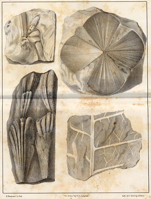
Fig. 1. Supposed to be an Equisetum. Its stem, however, appears to be angular, and if so it belongs probably to an undescribed genus. It belongs to the upper Sandstone of Deep river.
Fig. 2. Sphenoglossum quadrifolium. Upper sandstone.
Fig. 3. Dyctuocaulus striatus.
Fig. 4. Gymnocaulus alternatus.
PLATE II.

Fig. 1. Supposed to be a Pecopteris.
Fig. 2. Neuropteris. (?)
Fig. 3. Equisetum columnaroides.
Fig. 4. Chondrites gracilis.
Fig. 5. Leafet of an undescribed plant.
Fig. 6. Neuropteris linæfolia.
Fig. 7. Diaphragm of the Equisetum columnare.
Fig. 8. Pecopteris bullatus.
Fig. 9. Equisetum columnare.--Richmond coal basin.
PLATE III.
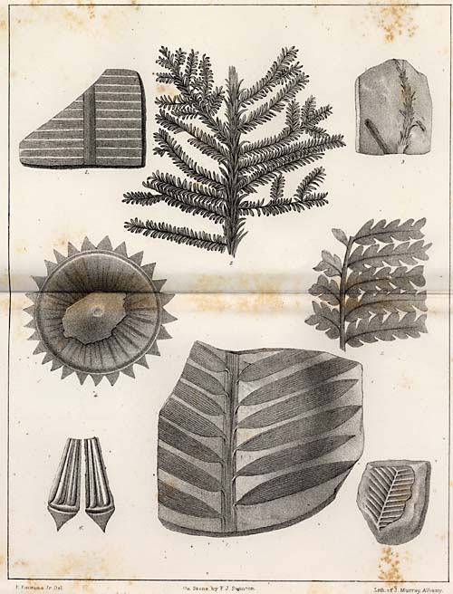
Fig. 1. Pterozamites decussatus.
Fig. 2. Walchia diffusus.
Fig. 3. Lycopodites.
Fig. 4. Lepacyclotes circularis.
Fig. 5. Undetermined, in consequence of the obscurity of the side veins.
Fig. 6. Lepacyclotes ellipticus.
Fig. 7. Podozamites lanceolatus.
Fig. 8. Pterozamites of the upper sandstone.
PLATE IV.
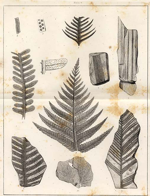
Fig. 1. Pecopteris Carolinensis, showing its sori, nat. size.
Fig. 2. Sori enlarged.
Fig. 3. Pecopteris?
Fig. 4. Calamites disjunctus.
Fig. 5. Pecopteris falcatus.? Barren frond.?
Fig. 8. Acrostichites oblongus.
Fig. 6. Enlarged view, showing the reticulated side veins and their distribution.
Fig. 7. Calamites.
Fig. 9. Pecopteris falcatus.
Fig. 10. Cyclopteris.
Fig. 11. Dionites graminoides.
Page 350
PLATE V.
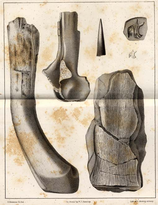
Fig. 1. Tibia of a saurian found in the upper sandstone, or the Keuper sandstone.
Fig. 2. Fragment of a cervical verteba.?
Fig. 3. Tooth of the Clepsisaurus Pennsylvanicus.
Fig. 4. Fish scale enlarged; natural size below.
Fig. 5. Portion of the frontal bone of the Rutiodon Carolinensis.
PLATE VI.
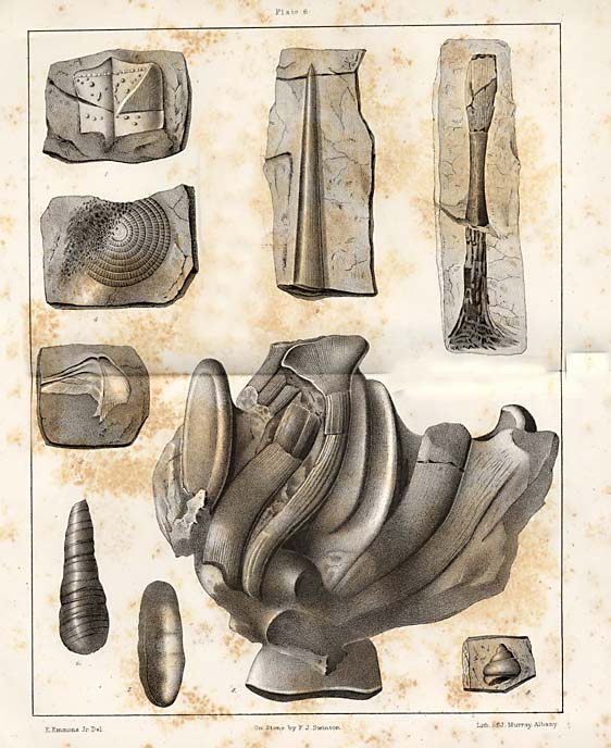
Fig. 1. Fish scale, natural size.
Fig. 2. Supposed ichthyodolerite.
Fig. 3. Metatarsal bone, or it may be a short rib. Taken from the sandstone at Germantown.
Fig. 4. Undetermined. Found in the bituminous shale at Farmersville.
Fig. 5. Undetermined. From the black bituminous shale of Farmersville.
Figs. 6, 7 and 9. Coprolites from the bituminous shale, Farmersville.
Fig. 8. Two lumbar vertebræ, in position and natural size, with the crushed ribs, and beneath showing a portion of the spinous process. From the bituminous shale, Farmersville.
PLATE VII.
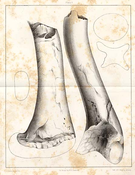
Fig. 1. Femur of a saurian from the gray sandstone, Germanton.
Fig. 2. Tibia in juxtaposition with the former.
Fig. 3. Showing the form of a transverse section near the distal extremity.
Fig. 4. Form or shape of the articular extremity of the vertebra of the Rutiodon.
Fig. 5. Longitudinal section of the same vertebra, showing its concavities and constricted centrum.
PLATE VIII.
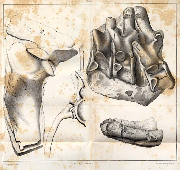
Fig. 1. Three consecutive dorsal vertebræ, showing the articulation of the ribs.
Fig. 2. The form and relation of the rib to the vertebra.
Fig. 3. Coracoid bone.
Fig. 4. Supposed to be a part of the humerus.
PLATE IX.
Figs. 1 and 2. Dictyopyge from the Richmond coal formation.
Fig. 3. Tetragonolepis, from the same.
Fig. 4. Genus Ischypterus, Sunderland, Mass.
PLATE 9. (Map.)
Plan of the veins at Gold Hill, showing their relations and directions.
Page 351
PLATE X.
Plan showing the arrangement of the pockets, as they are called, in the Gold Hill mine, and on the left the regular off sets of the vein as it descends.
PLATE XI.
Exhibits a plan of the working of the North Carolina copper mine of Guilford county.
PLATE XII.
The underground workings of the Rudersill mine at Charlotte, Mecklenburgh county.
PLATE XIII.
Plan of the veins of the Conrad Hill mine, Davidson county.
PLATE XIV.--Sections.
Sec. 1. Extending from Lincolnton to Wadesboro', running nearly east and west, showing the position of the Taconic system near Lincolnton, and the relations of the Trias, near Wadesboro, Anson County. The numbers below indicate the distance in miles.
Sec. 2. Showing the relation of the rocks from Gold Hill to Troy, Montgomery county, and the position in which fossils occur in the older rocks at the latter place.
PLATE.----(Sections.)
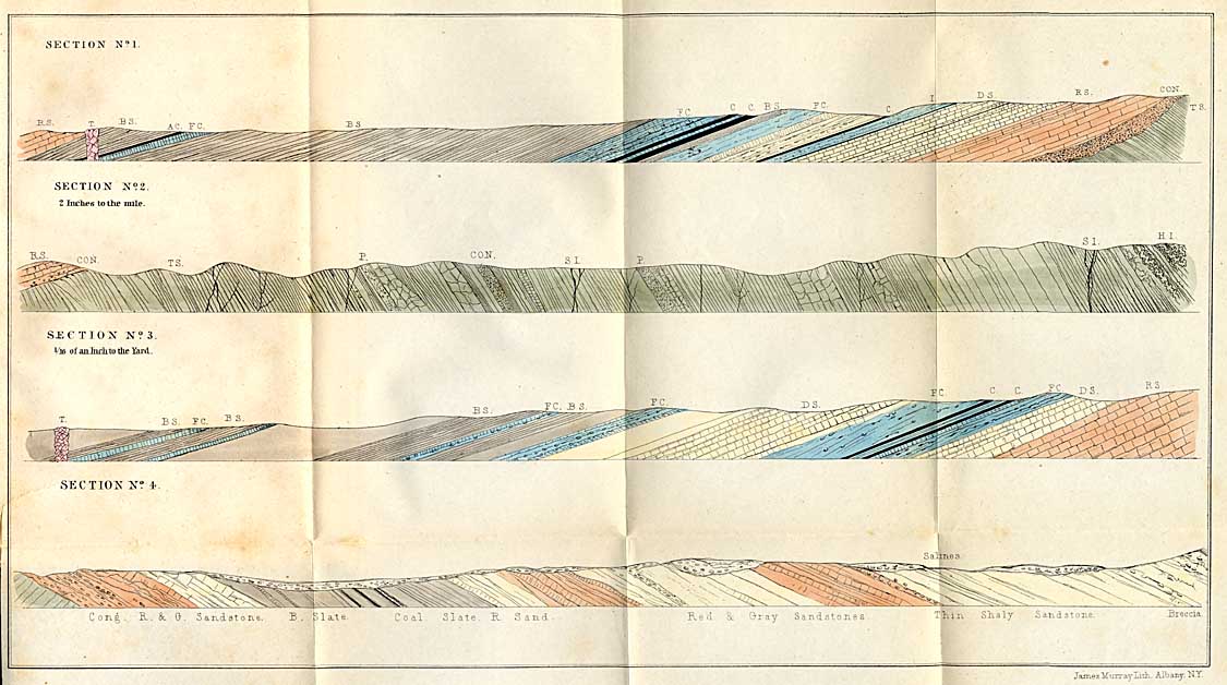
Sec. 1. Showing the series of sandstones and slates with the coal seams at the Gulf.
Sec. 2. The same section prolonged north-west, showing the relations and position of the veins of iron ore in the Taconic series, together with the position of the brecciated conglomerates. S. I., specular iron. H. I., hæmatitic iron at ore knob. Con., conglomerate. T. S., Taconic slates.
Sec. 3, extends across the coal series at Murchisons, Moore county. F. C., fire clay.
Sec. 4, extends across the coal series at Evander McIver's. The Salines consist of drab colored sandstanes, which, in dry weather, are coated with salt. The Breccia marks the boundary here between the Keuper sandstone and the coal measures, though the term breccia would be more properly replaced by the term conglomerate.
Page 352
ERRATA.
Page XV., 6th line from top for "fine" read "fire."
Page XVI, 16th line from top, for "projenitors" read "progenitors."
Page 20, 12th line from the top, for "chrystalline" read "crystalline."
Page 21, 4th line from the bottom, for "plains" read "planes."
Page 96, middle of the page, for "irruptive" read "eruptive."
Page 154, 2nd line from the bottom, for "Maury" read "Mooney."
Page 216, 4th line from the top, for "Asbestos" read "Asbestus."
Page 219, 7th line from the top for "Headen" read "Heading."
Page 201, 14th line from the bottom, for "hard" read "based."
Page 205, 9th line from the top, for "murkey" read "milkey."
Page 228, for "Triassic" read "Liassic."
Page 291, for "Clubb" read "Club."
Page 295, for "Ryley and Schutchburq" read "Riley and Scutchbury."
Page 292, for "Polipodiacea" read "Polypodiacea."
Page 233, 8th line from the top, for "Native" read "Saline."
Page 233, 10th line from the bottom, for "crusted" read "crushed."
Page 235, 17th line from the bottom, for "Sigellaria" read "Sigillaria."
Page 235, 3d line from the bottom, for "Stone" read "Stems."
Page 269, 14th line from the top, for "hemalite" read "haematite."
Page 239, 2nd line from the top, for "plats" read "plants."
Page 239, 3d line, for "Sycopodiacea" read "Lycopodiacea."
Page 233, 15th line from the top, for "Suringia" read "Thuringia."
Page 244 and 245, for "Fooshee" read "Forshee," and for "Dyers" read "Dye's."
Page 251, 11th line from the top, for "triated" read "tested," and for "case" read "ease."
Page 290, 4th line from the top, for "Cryptomeritus" read "Cryptomerites."
Page 300, 11th line from the bottom for "Pennsylvanius" read "Pennsylvanicus."
Page 337, for "Syco podiacea" read "Lycopodiacea."
Change Zamites, Plate 4, fig. 11, to Dionites.
Map of the Deep River Coal Field.
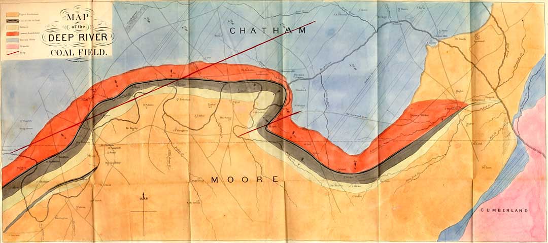
Map of the Deep River Coal Field.
Return to Menu Page for Geological Report of the Midland Counties of North Carolina by Ebenezer Emmons
Return to The North Carolina Experience Home Page
Return to Documenting the American South Home Page