North Carolina and its Resources:
Electronic Edition.
North Carolina. Board of Agriculture.
Funding from the Institute for Museum and Library Services supported the electronic publication of this title.
Text transcribed by
Apex Data Services, Inc.
Images scanned by
Tampathia Evans
Text encoded by
Apex Data Services, Inc. Lee Ann Morawski, and Jill Kuhn Sexton
First edition, 2001
ca. 1.4M
Academic Affairs Library, UNC-CH
University of North Carolina at Chapel Hill,
2001.

Source Description:
(title page) North Carolina and its Resources.
State Board of Agriculture
xv, 413 p., ill.
Winston
M. I. & J. C. Stewart, Public Printers and Binders
1896
Call number C917 N87a (North Carolina Collection, University of North Carolina at Chapel Hill)
The electronic edition is a part of the UNC-CH
digitization project, Documenting the American South.
The text has been entered using double-keying and verified against the original.
The text has been encoded using the
recommendations for Level 4 of the TEI in Libraries Guidelines.
Original grammar, punctuation, and spelling have been preserved. Encountered
typographical errors have been preserved, and appear in red type.
All footnotes are inserted at the point of reference within paragraphs.
Any hyphens occurring in line breaks have been
removed, and the trailing part of a word has been joined to
the preceding line.
All quotation marks, em dashes, and ampersand have been transcribed as
entity references.
All double right and left quotation marks are encoded as " and "
respectively.
All single right and left quotation marks are encoded as ' and ' respectively.
All em dashes are encoded as --
Indentation in lines has not been preserved.
Running titles have not been preserved.
Spell-check and verification made against printed text using Author/Editor (SoftQuad) and Microsoft Word spell check programs.
Library of Congress Subject Headings, 21st edition, 1998
Languages Used:
- English
LC Subject Headings:
- North Carolina -- Description and travel.
- Agriculture -- North Carolina.
- Industries -- North Carolina.
- Mines and mineral resources -- North Carolina.
- Natural resources -- North Carolina.
- North Carolina -- History.
- North Carolina -- Handbooks, manuals, etc.
- North Carolina -- Geography.
- Public institutions -- North Carolina.
Revision History:
- 2002-04-24,
Celine Noel and Wanda Gunther
revised TEIHeader and created catalog record for the electronic edition.
-
2001-06-28,
Jill Kuhn Sexton
finished TEI-conformant encoding and final proofing.
-
2001-05-03,
Lee Ann Morawski
finished TEI/SGML encoding
- 2001-04-24,
Apex Data Services, Inc.
finished transcribing the text.

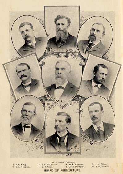
1. W. F. Green, Chairman.
2. H. E. King. 3. J. R. McLelland. 4. W. R. Capehart. 5. J. H. Gilmer.
6. D. A. Tompkins. 7. E. A. Aiken. 8. Cyrus Thompson. 9. R. H. Wharton.
BOARD OF AGRICULTURE.
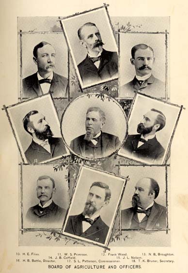
10. H. E. Fries. 11. W. S. Primrose. 12. Frank Wood. 13. N. B. Broughton.
14. J. B. Cottfield. 15. J. L. Nelson.
16. H. B. Battle, Director. 17. S. L. Patterson, Commissioner. 18. T. K. Bruner, Secretary.
BOARD OF AGRICULTURE AND OFFICERS.
NORTH CAROLINA
AND ITS
RESOURCES.
ILLUSTRATED.
STATE BOARD OF AGRICULTURE.
RALEIGH.
WINSTON.
M. I. & J. C. STEWART, PUBLIC PRINTERS AND BINDERS.
1896.
Page III
TABLE OF CONTENTS.
- HISTORICAL . . . . . 1
- GENERAL SKETCH . . . . . 16
- CLIMATE . . . . . 31
- FORESTS . . . . . 36
- FLORA . . . . . 56
- FAUNA . . . . . 63
- GEOLOGY . . . . . 68
- ECONOMIC MINERALS . . . . . 98
- Corundum . . . . . 98
- Mica . . . . . 100
- Talc and Agalmatolite . . . . . 100
- Monazite . . . . . 101
- Marls and Phosphates . . . . . 102
- Coal . . . . . 103
Page IV - GEMS AND GEM STONES . . . . . 107
- Diamond . . . . . 108
- Hiddenite . . . . . 108
- Emerald . . . . . 109
- Aquamarine . . . . . 110
- Ruby . . . . . 110
- Sapphire . . . . . 110
- Cyanite . . . . . 111
- Garnet . . . . . 111
- Quartz . . . . . 111
- Citrine Topaz . . . . . 112
- Smoky Topaz . . . . . 112
- Amethyst . . . . . 112
- Other Gem Stones . . . . . 112
- BUILDING STONES . . . . . 113
- PUBLIC ROADS . . . . . 117
- Road Materials . . . . . 121
- WATERS AND WATER WAYS . . . . . 122
- COMMERCIAL FISHERIES . . . . . 141
- SHELLFISH . . . . . 151
- AGRICULTURE . . . . . 155
- Cotton . . . . . 158
- Tobacco . . . . . 159
- Rice . . . . . 162
- Peanuts . . . . . 163
- Other Important Crops . . . . . 164
- Model Farms . . . . . 165
- Glenoe Stock Farm . . . . . 165
- Occoneechee Farm . . . . . 165
- Duke Farm . . . . . 165
- Rockwell Farm . . . . . 165
- Biltmore Farms . . . . . 166
- State Agricultural Society . . . . . 168
- HORTICULTURE . . . . . 169
Page V - VINEYARDS . . . . . 178
- NURSERIES . . . . . 180
- MANUFACTURING . . . . . 187
- TOBACCO MANUFACTURING . . . . . 197
- List of Tobacco Factories . . . . . 198
- MISCELLANEOUS INDUSTRIES . . . . . 202
- RAILROADS AND STEAMBOATS . . . . . 213
- NEWSPAPERS . . . . . 216
- POPULATION . . . . . 220
- RELIGION . . . . . 225
- GOVERNMENT AND TAXATION . . . . . 226
- STATE DEBT . . . . . 230
- GEOLOGICAL SURVEY . . . . . 231
- AGRICULTURAL DEPARTMENT . . . . . 232
- STATE MUSEUM . . . . . 233
- AGRICULTURAL EXPERIMENT STATION . . . . . 234
- RAILROAD COMMISSION . . . . . 236
- BUREAU OF LABOR STATISTICS . . . . . 237
- PUBLIC CHARITIES . . . . . 238
- The Insane Asylum . . . . . 239
- State Hospital . . . . . 239
- Eastern Hospital . . . . . 240
- Other Provision for the Insane . . . . . 240
- Institute for the Blind . . . . . 241
- Institute for the Colored Deaf, Dumb and Blind . . . . . 241
- School for Deaf and Dumb . . . . . 241
Page VI - ORPHANAGES AND HOSPITALS . . . . . 244
- Thomasville Orphanage . . . . . 244
- The Thompson Orphanage . . . . . 244
- The Orphans' Home . . . . . 244
- Odd Fellows' Orphans' Home . . . . . 245
- The Friends' Orphanage . . . . . 245
- The Children's Home . . . . . 245
- The Mission Hospital . . . . . 245
- Wilmington City Hospital . . . . . 245
- St. Peter's Hospital . . . . . 245
- The Good Samaritan Hospital . . . . . 246
- The Watts Hospital . . . . . 246
- Rex Hospital . . . . . 246
- PUBLIC BUILDINGS . . . . . 246
- EDUCATION . . . . . 247
- Free Public Schools . . . . . 249
- University of North Carolina . . . . . 251
- College of Agriculture and Mechanic Arts . . . . . 252
- State Normal and Industrial School . . . . . 254
- Davidson College . . . . . 255
- Trinity College . . . . . 256
- Wake Forest College . . . . . 257
- Elon College . . . . . 259
- Guilford College . . . . . 259
- Bingham School . . . . . 260
- The Horner School . . . . . 260
- Davis Military School . . . . . 261
- Salem Female Academy . . . . . 261
- Peace Institute . . . . . 262
- St. Mary's . . . . . 262
- Baptist Female University . . . . . 263
- Chowan Baptist Female Institute . . . . . 263
- Oxford Female Seminary . . . . . 264
- Greensboro Female College . . . . . 264
- Asheville Female College . . . . . 264
- Lutheran College for Women . . . . . 265
- Private Schools and Colleges . . . . . 265
- Schools for the Colored Race . . . . . 267
- Agricultural College for the Colored Race . . . . . 267
- Shaw University . . . . . 268
- St. Augustine Normal School . . . . . 269
- Slater Industrial Academy . . . . . 270
- Livingston College . . . . . 270
- Biddle University . . . . . 271
- Scotia Seminary . . . . . 272
Page VII - HEALTH . . . . . 273
- Mineral Springs . . . . . 275
- Hot Springs . . . . . 275
- Haywood White Sulphur Springs . . . . . 276
- Glen Alpine Springs . . . . . 276
- Connelly Springs . . . . . 276
- Sparkling Catawba Springs . . . . . 277
- Barium Springs . . . . . 277
- Moore Spring . . . . . 277
- Piedmont Springs . . . . . 278
- Bromine and Arsenic Spring . . . . . 278
- Cleveland Springs . . . . . 278
- Lincoln Lithia Springs . . . . . 278
- Ellerbee Springs . . . . . 279
- Jackson Springs . . . . . 279
- Red Springs . . . . . 279
- Panacea Springs . . . . . 280
- The Seven Springs . . . . . 280
- SEASIDE RESORTS . . . . . 281
- PINY-WOODS RESORTS . . . . . 284
- MOUNTAIN RESORTS . . . . . 287
- Hickory . . . . . 288
- Lenoir . . . . . 289
- Blowing Rock . . . . . 289
- Green Park Hotel . . . . . 290
- Blowing Rock Hotel . . . . . 291
- Watauga Hotel . . . . . 291
- Boon . . . . . 291
- Eseeola Inn . . . . . 292
- Cloudland Hotel . . . . . 292
- Highlands . . . . . 293
- Asheville . . . . . 293
- Battery Park . . . . . 293
- Swannanoa Hotel . . . . . 294
- Berkly Hotel . . . . . 294
- Oakland Heights . . . . . 294
- Kenilworth Inn . . . . . 294
- Arden Park . . . . . 294
- Hendersonville . . . . . 294
Page VIII - WITH GUN AND ROD . . . . . 296
- DESCRIPTION OF COUNTIES . . . . . 301
- Alamance . . . . . 301
- Alexander . . . . . 302
- Alleghany . . . . . 303
- Anson . . . . . 303
- Ashe . . . . . 305
- Beaufort . . . . . 305
- Bertie . . . . . 307
- Bladen . . . . . 308
- Brunswick . . . . . 309
- Buncombe . . . . . 310
- Burke . . . . . 312
- Cabarrus . . . . . 313
- Caldwell . . . . . 314
- Camden . . . . . 315
- Carteret . . . . . 315
- Caswell . . . . . 317
- Catawba . . . . . 317
- Chatham . . . . . 319
- Cherokee . . . . . 320
- Chowan . . . . . 321
- Clay . . . . . 322
- Cleveland . . . . . 323
- Columbus . . . . . 324
- Craven . . . . . 325
- Cumberland . . . . . 327
- Currituck . . . . . 328
- Dare . . . . . 329
- Davidson . . . . . 330
- Davie . . . . . 332
- Duplin . . . . . 333
- Durham . . . . . 333
- Edgecombe . . . . . 335
- Forsyth . . . . . 336
- Franklin . . . . . 338
- Gaston . . . . . 340
- Gates . . . . . 341
- Graham . . . . . 342
- Granville . . . . . 342
- Greene . . . . . 343
- Guilford . . . . . 344
- Halifax . . . . . 346
- Harnett . . . . . 348
- Haywood . . . . . 349
- Henderson . . . . . 350
Page IX- Hertford . . . . . 351
- Hyde . . . . . 352
- Iredell . . . . . 353
- Jackson . . . . . 354
- Johnston . . . . . 355
- Jones . . . . . 356
- Lenoir . . . . . 357
- Lincoln . . . . . 359
- McDowell . . . . . 360
- Macon . . . . . 362
- Madison . . . . . 363
- Martin . . . . . 364
- Mecklenburg . . . . . 365
- Mitchell . . . . . 367
- Montgomery . . . . . 368
- Moore . . . . . 369
- Nash . . . . . 371
- New Hanover . . . . . 372
- Northampton . . . . . 375
- Onslow . . . . . 376
- Orange . . . . . 377
- Pamlico . . . . . 378
- Pasquotank . . . . . 379
- Pender . . . . . 380
- Perquimans . . . . . 382
- Person . . . . . 382
- Pitt . . . . . 384
- Polk . . . . . 385
- Randolph . . . . . 386
- Richmond . . . . . 388
- Robeson . . . . . 389
- Rockingham . . . . . 390
- Rowan . . . . . 391
- Rutherford . . . . . 393
- Sampson . . . . . 394
- Stanly . . . . . 395
- Stokes . . . . . 396
- Surry . . . . . 397
- Swain . . . . . 399
- Transylvania . . . . . 400
- Tyrrell . . . . . 401
- Union . . . . . 402
- Vance . . . . . 403
- Wake . . . . . 404
- Warren . . . . . 405
- Washington . . . . . 406
- Watauga . . . . . 407
- Wayne . . . . . 408
- Wilkes . . . . . 410
Page X - STATE MAP . . . . . Inside last Cover.
Page XI
ILLUSTRATIONS.
- A Forsyth County Farm OPPOSITE PAGE . . . . . 155
- Blowing Rock . . . . . 287
- Geological Map . . . . . 68
- Hickorynut Gap . . . . . 1
- On the Yonahlossee Road . . . . . 291
- Some Indigenous Flowers . . . . . 56
- Some Native Fruits . . . . . 169
- Some Native Gems . . . . . 108
- State Map . . . . . Inside last Cover
LIST OF COLORED PLATES:
- A Corner in the State Museum . . . . . 233
- Ascent of the Blue Ridge . . . . . 17
- Barnard Farm . . . . . 362
- Beach at Nag's Head . . . . . 281
- Bean Field . . . . . 28
- Board of Agriculture Frontispiece
- Board of Agriculture and Officers Frontispiece
- Catawba Falls . . . . . 63
- Cherokees--Indian Reservation . . . . . 355
- College of Agriculture and Mechanic Arts . . . . . 252
- Cotton Mills . . . . . 190
- Craggy Chain . . . . . 20
- Cranberry Iron Mine . . . . . 96
- Cumnock Coal Mines . . . . . 104
- Experiment Station . . . . . 234
- Falls of Queen's Creek Rapids . . . . . 294
- Glenoe Stock Farm . . . . . 165
- Great Falls and Bulkhead . . . . . 187
- Harvest in the Catawba Valley . . . . . 156
- Herd of Holsteins . . . . . 162
- Macadam Roads and Bridges . . . . . 120
- Macadamized Country Roads . . . . . 117
- Mt. Airy Granite Quarry . . . . . 113
- Narrows of the Yadkin . . . . . 136
- Norfolk and Southern Railway . . . . . 214
- Normal and Industrial School . . . . . 254
- Occoneechee Farm . . . . . 166
LIST OF ILLUSTRATIONS:
Page XII
- On Linville River . . . . . 126
- On Picturesque Trout Streams . . . . . 298
- On Roanoke River . . . . . 125
- On the French Broad River . . . . . 122
- Piny-woods Inn . . . . . 284
- Placer Gold Mining . . . . . 84
- Roan Mountain . . . . . 292
- Rockingham--Carolina Central Railway . . . . . 202
- Sand-hill Lands . . . . . 171
- Scenes near Fayetteville . . . . . 26
- Shell Road . . . . . 119
- Some Native Game Birds . . . . . 296
- State Capitol . . . . . 246
- State Hospital . . . . . 239
- State School for Deaf and Dumb . . . . . 242
- Steam Seine Fishing . . . . . 147
- Stone Mountain . . . . . 115
- Strawberry Farm . . . . . 177
- Tar River . . . . . 138
- The Nantahala Mountains . . . . . 288
- Tobacco Field . . . . . 160
- Trucking around New Bern . . . . . 184
- Trucking Scenes . . . . . 181
- University . . . . . 251
- Vanderbilt Estate . . . . . 52
- Views at Morehead and Beaufort . . . . . 12
- Views around Hot Springs . . . . . 275
- Wilmington, New Bern and Norfolk Railway . . . . . 132
- Wrightsville Beach and Sound . . . . . 283
Page XIII
PREFACE.
At the December (1895) meeting of the State Board of Agriculture it was agreed that a new edition of the Hand Book was a necessity, and the Secretary to the Board was charged with its preparation. This involved a complete revision of the former publication, the selection of suitable illustrations, the preparation of much new data, and the issuing during this year of a volume illustrative of the vast resources of North Carolina. All of this with the view of pointing out progress already made, and the possibilities presented for future development. The work has proved more exacting than at the time was contemplated, in that the changes necessary frequently required the rewriting of such portions of the former volume as were still considered in part available, and to make more complete the presentation whole chapters have been introduced presenting matter hitherto entirely omitted or to which but slight allusion was made.
The remarkable development in all branches of industry, with corresponding increase in the volume of business, together with the varied and ever-widening conditions favorable to the avocation of the farmer, the trucker, the fruit grower, the lumberman, the miner and the fisherman, have all combined to induce the publication of this volume by the Board of Agriculture. The Board, always in the lead, is ever found promoting the best interests of the people of the State, lending encouragement to the development of her rich resource of forest, of mine, of soil and of sea. The State Constitution provides for an Agricultural Department, and its earlier reports date back to 1825. The present organization of the Board was effected under an act of the General Assembly in 1877. From the day of its organization it began the discharge of the duties assigned it with an earnest determination to foster and stimulate agriculture in all its branches, and to promote every legitimate attempt to develop the State's resources. It has aided in almost every movement in this direction, being in a certain sense a pioneer, by directing attention to the possibilities offered. It was first among the States to increase the catch of fish by means of fish hatcheries; it explored the phosphate beds of the eastern
Page XIV
counties; it surveyed the coal fields; it exhibited the ores of gold, silver, copper and of iron in great expositions, and in the same way advertised the forests; it surveyed the oyster grounds, and it promoted the development of the sand-hill region. By its assiduous and systematic effort North Carolina is becoming known as the most resourceful of all the Southern States.
This is the fifth publication of its kind emanating from the Board; the first appearing in 1879, which was followed by an improved edition in 1883; this was exhausted by distribution at the Boston and New Orleans expositions, so that in 1886 a new and still better book was issued and did good service until the approach of the great Columbian Exposition, when it was determined to offer a more exhaustive treatment of the conditions presented in North Carolina for the profitable investment of capital. This volume was a departure from the ordinary Hand Book type, and proved a most acceptable résumé of the varied conditions so happily distributed in the State by the munificent hand of nature. So useful a volume was soon brought to the attention of the public, and so persistent was the demand that the edition of ten thousand had dwindled to as many hundred, when the Board took the action referred to above.
It is most gratifying to note the advance made all along the lines of enterprise since 1893. The extent of progress in the industries and the manufactures; the extension of agriculture and horticulture; the widening of remunerative truck fields; the adaptability of hitherto worthless sand-hills and flat lands to the profitable production of peaches, grapes, berries and bulbs, and the expansion of the facilities for all forms of education--these all tell of the solid progress of our people and point with unerring conviction to North Carolina as the most progressive, most desirable and most healthful of all the South Atlantic States as a place of residence. Her homogeneous, hospitable population, conservative laws, light taxation, salubrious and temperate climate, and the great possibilities of her natural and improved conditions also present inviting fields to the investor or to the home-seeker.
The subjects brought to view in this volume are presented with rigid regard to fact; they are under-drawn rather than otherwise, and described from a sober business point of view without exaggeration or untruthful illusion. The facts about North Carolina are sufficient in themselves; no coloring is needed. These facts are but imperfectly presented in the pages to follow; there are doubtless omissions and many under-drawn descriptions, but the work has been performed while in the discharge of regular official duties. The
Page XV
compiler has sought out facts in regard to all the State's resources obtainable by research, enquiry and from personal observation, and, subjecting all to careful examination, has arranged them in as succinct and coherent an order as the subjects will allow. A considerable portion of the facts are from official records and statistics, and the remainder from the most accurate and competent authority attainable.
It is fitting here to give credit and make due acknowledgment to those who have so generously contributed in the preparation of the matter for the work. Much has been drawn from the very excellent and accurate work of Col. John D. Cameron, in the Hand Book of 1893. He has written much that is enduring, and from it the most liberal quotations have been made. For information relating to the ores, building stones, minerals, waterpowers and roads, I am indebted to Professor Joseph A. Holmes, State Geologist; for information in regard to taxation and the State debt, to Hon. R. M. Furman, State Auditor; for articles on Agriculture, to Hon. S. L. Patterson, Commissioner of Agriculture; for information prepared on horticulture, to Prof. W. F. Massey; for information relating to flora and the climate, to Dr. H. B. Battle, Director of the North Carolina Experiment Station, and to Professor Gerald McCarthy, Botanist, and Mr. C. F. von Herrmann, Meteorologist, of the Experiment Station staff, and to the following for information on the subjects annexed to their names:
- Dr. Kemp P. Battle, University of North Carolina--History.
- D. A. Tompkins, Charlotte--Manufacturing.
- Dr. R. H. Lewis, Raleigh, Sec. State Board of Health--Health.
- Col. C. A. Cilley, Hickory--Mountain Resorts.
- Dr. G. H. Sadelson, Southern Pines--Piny-woods Resorts.
- Col. F. A. Olds, Raleigh--Seaside Resorts.
- W. W. Ashe, Raleigh--Forests.
- H. H. Brimley, Raleigh--Fauna and Game.
- Capt. C. B. Denson, Raleigh--Charities and Orphanages.
- Mr. Charles McNamee, Biltmore--The Biltmore Estate.
- Morganton Land and Improvement Company--several illustrations, and to the gentlemen in the several counties who so generously corrected the sketches of their counties.
To all I beg to give assurance of hearty appreciation and the full credit for assistance rendered.
T. K. BRUNER,
Secretary.

HICKORYNUT GAP.
Page 1
HISTORICAL.
EARLY HISTORY.
THE LANDING OF SIR WALTER RALEIGH'S COLONY.
"They were the first that ever burst
Into that silent sea."--Coleridge.
On the 4th of July, 1584, two English ships hove in sight of the coast of North Carolina, somewhere about Cape Fear. They were the vessels of Sir Walter Raleigh, and were on a voyage of discovery, to take possession of some portion of the new world in the name of the crown of England. The day on which they first beheld the shores of our country has since become the great political holiday of the age, and is now distinguished as the anniversary, not of the origin, but of the downfall of the authority of England over the United States. The commanders of these two ships were Philip Amadas and Arthur Barlowe; and the ceremony which they performed upon the coast of North Carolina, and which I am now about to celebrate, is perhaps one of the most memorable events in the history of mankind. The fortunate results of the dominion of England over the territory of our Union are as innumerable as are the stars; and the free Anglo-American, in whatever forests he may be found, will turn reverently to the spot consecrated as its birthplace. The two adventurers loitered along the coast of North Carolina, in full view of the shore as it sweeps in a curve from Cape Lookout to Cape Fear. There was scarcely wind enough to ruffle the plumage of the two ships as they lay their gentle course, and the mild land-breeze was so fragrant, that the voyagers exclaimed that they seemed to be in the midst of some delicate garden, abounding with all kinds of odoriferous flowers. Thus making their liquid way, on the 13th of July, 1584, we find the two ships at anchor in the roads of Ocracock Inlet, within a few hundred yards of the island which lies to the south, and which the Indians called Wokokon. And this is the spot, of all the fair lands of our wide-spread country, which was first occupied by old mother England.
NOTE.--Extracts from "Memorials of North Carolina" by Joseph Seawell Jones.
Page 2
About midday on the 13th, when there was not a film of a cloud in the heavens, nor a breath of air to break the sea; when the tides were still, and the sunshine danced along the glittering sandbanks from Hatteras to Lookout; when the whole scene was so intensely tranquil, that those ships looked like "painted ships," and that ocean a "painted ocean;" when the crew stood about the decks in silent wonderment at the vast and solitary world before them--no scudding skiff, no rising smoke, no distant sound; at this hour, when solitude was most awful and most sublime, the sound of prayer broke the enchantment, and the first words of Christian suffrage were uttered in returning thanks to God that the lion flag of old England was about to be planted upon the coast of the new world. The boats were then manned, and the two captains, attended by the most noble gentlemen of the expedition, were pulled toward the shore; and as the boats grated upon the sand, they sprang upon the beach, and Captain Amadas shouted in a loud voice:
"We take possession of this land in the right of the queene's most excellent majestie, as rightfull queene and princesse of the same, to be delivered over to the use of Sir Walter Raleigh, according to her Majestie's grant and letters patent, under her highnesse's great seale."
This, then, was the birthday, and here, then, was the birthplace, of our great Anglo-American empire. And how fortunate was it for the cause of civil and religious freedom all over the world that England, and not Spain, France, or Portugal, colonized our splendid domain. Look to the South American States, already in the decrepitude of old age; their moral, intellectual, and physical condition alike unimproved; their governments unsteady and tyrannical; their private estates insecure; and the very liberty which, but a few years ago, they so proudly achieved, already degraded into popular despotism. Spanish blood corrupted the new world. The seeds of civil and religious despotism were sown, broadcast, from the City of Mexico to Cape Horn; and after a revolution of three hundred years, Spanish America can boast of but little that is either grand or sublime, in all her history, excepting the monuments of Montezuma's magnificence and the victories of Bolivar.
But how different has been the career of the Anglo-American race. The seed which was planted on Wokokon Island has given birth to a new genus of men. Another and a hardier race than even the Anglo-Saxon has sprung into existence, and are now bearing onward to the Pacific, as they leap from the Alleghany to the Rocky Mountains, the language and the liberty of their forefathers. The
Page 3
general principles of human government have been simplified; the liberty of the people and their right to self-government, immovably established; a free, happy and powerful Republic, under the constitution and laws of which the rights of individuals are as inviolably sustained as is the glory of the national faith, now covers the fairest portions of the new world; and what is the proudest result of all, this new-born nation, in the purity of its government and in the happiness of its people, is now sending back across the sea, to regenerate and to reform the old world, the sublime lessons of her own experience. Happy proud Anglo-America. She has given to the world the great principle of a free government. She has extended the provinces of liberty, civilization, and of law. "The lightning of the heavens could not resist her philosophy, nor the temptation of a throne seduce her patriotism."
Let us now return to the voyagers. As soon as they had performed the ceremony of occupation, the company penetrated a few miles into the interior, and, on reaching the summit of an eminence, they discovered that they were on an island, and not on the continent, "They behelde the sea both sides of them to the north and to the south, having no end any of both ways." They were on an island clad with vines, which reeled so full of grapes, "as that the very beating and surge of the sea had overflowed them, of which we found such plentie as well there as in all places else, both on the sand as on the green soil, on the hills as in the plains, as well as on every little shrub as also climing towardes the tops of high cedars, that I thinke in all the worlde the like abundance is not to be found." From the eminence which they had gained, they beheld the valleys replenished with goodly cedar trees, and having discharged their harque-buz shot, a flock of cranes (the most part white) arose under them, with such a cry, redoubled by many echoes, as if an army of men had shouted all together." The island is again described as having "many goodly woods, full of deer, conies, hares, and fowle, even in the midst of summer, in incredible abundance. The woods are not such as you find in Bohemia, Moscovia or Hercynia--barren and fruitless, but the highest and reddest cedars in the world, far better than the cedars of the Azores, of the Indies, or of Lybanus."
The extracts which I have made are taken from the report of the two captains, Amadas and Barlowe, made to Sir Walter Raleigh on their return to England. The description is not too highly wrought, for we must remember that the ravages of man and of the ocean have, for more than two centuries, desolated and changed Wokokon Island. The beautiful name of Virginia was first applied to the islands of
Page 4
North Carolina, and I have seen, in the earliest maps and charts of the State at present bearing that name, Roanoke and Wokokon Islands laid off to the south under the somewhat boasted title of "Old Virginia." This, at least, was the Virginia of Sir Walter Raleigh, and of the Fairy Queen of England. His name is identified with no other section of our Union, and the name of the capital of North Carolina best betokens her proud remembrance of the character of her founder.
The two captains, after having surveyed Wokokon Island, returned to their ships and there remained for two days before they encountered the natives. It is not my design in this number to follow them in their adventures among the savages; I would rather ask the reader to come with me to the consecrated spot, and see how it now looks after a revolution of two hundred and fifty years.
I have myself stood upon such an eminence on Wokokon Island as that described by the voyagers, but I sought a more poetical hour than midday, and I had, too, the benefit of a blustering March wind, which threw the waters all into a rage, and brought down the waves of the Pamlico all the way from Roanoke Island, as heavy as if they had been born in the Gulf Stream. It was a clear, cold day; and with the history of these voyages fresh in my memory, I had wandered about the island, and at sunset I placed myself as near as possible on the very eminence on which they had stood centuries ago. The view before me was indeed wild and startling. The glorious sunset gilded the crested waves of the Pamlico, as they broke in boundless succession afar to the west and to the north, and the narrow island that curves around to the northeast from Ocracock to Hatteras, all covered as it was with the mellow tints of the sun, resembled a rainbow resting on the face of the sea. The opposite towns of Portsmouth and Ocracock, and the old shell castle, stood before me amid the noisy waves, as if they had arisen to earth from the convulsive throes of the excited sea, and then there was the narrow island, with its naked woods and vines, and the waves bursting and thundering upon its shores, combing their foam higher and higher on each return, as if in the wantonness of their strength they would clap their hand over the very spot on which I stood. To me there is something especially fascinating in the scenery about Ocracock Inlet. I love it for its very bleakness; and historical association, too, hallows it in my memory. It is indeed a place of storms, for nature has there provided everything which can give fury to the winds, and, come from what quarter they will, they bring noise and strife. An easterly wind arouses the whole Atlantic, and the waves
Page 5
dash through the narrow straits, retreating from the fury of the storm; and then a westerly wind arises and, sweeping over the Pamlico, sends them all back to their ocean mother. A northeast gale will bring down from the banks of Hatteras sand enough to create an island; and oftentimes a ship, riding at her anchorage, is enveloped in a whirlpool of sand, and lifted high and dry out of the sea; but then a northern storm will send its ministers to the rescue, and the briny waves will soon ply their strength, undermine it, and sweep the ship away.
* * *
"The gentle children of an isle,
Who knew but to worship and to love."--Russell.
For two days our adventurous voyagers saw no signs of man. The vine-clad and flowery isle before them seemed to have bloomed away its existence unenjoyed by man, and their minds were filled with the sublime thought--that in this virgin world the clamor of war had never been heard, nor the silence of its shores ever violated, save by the thunders of the waves and of the clouds of heaven. On the third day, however, this dream was broken. A solitary boat with three savages turned the northern part of Wokokon, and, gliding into an indenture in the shore, one of the party sprang upon the beach, and coming directly opposite the anchorage of the ships, he walked up and down along the water's edge, seemingly in wonder at what he saw. When Captain Amadas and three other gentlemen approached him in a boat, he made them a speech of much length, in his own barbarous tongue, and then firmly stepping into their boat, he manifested by signs his desire to visit their ships. How brave is innocence. It goes wheresoever it will, and triumphs where guilt would fall. It has survived the fiery furnace, and once walked upon the stormy sea, as upon the plains of the earth.
The name of this Indian was Manteo; and the whole domestic history of England cannot boast a more perfect character. He was alike the firm friend of the English and the stern patriot and defender of his tribe; and whenever a strife arose among them, he held out the olive branch, and made peace upon the principles of justice. His savage birth and life were indeed but additional embellishments of his character; and while he restrained the inhuman vices of his tribe, he checked the not less odious avarice of his new and more civilized associates. . . . On reaching the ships, Manteo wandered about the decks, examining every part of them with the curiosity of ignorance; and having tasted of their meat and of their wine, and received a present of a hat and some other trifles, he departed again
Page 6
to his own boat and attendants. He then put off into the water and "fell to fishing, and in less than half an hour he had laden his boat as deep as it could swim;" and then he came back to the shore, divided his fish between the two ships, and departed.
The next day Granganameo, the king's brother, with a fleet of canoes, entered Ocracock Inlet; and leaving his boats, as Manteo had done, in a small cove, he came down to the water's edge near the ships. He was attended by forty or fifty men, "very handsome and goodly people, and in their behavior as mannerly and civil as any of Europe;" and they spread down upon the shore a long mat or carpet, upon which Granganameo was seated, and "at the other end of this matte four others of his company did the like--the rest stood about him somewhat afar off."
He showed no signs of fear or mistrust as the English, dressed in full array of armor, approached; but he sat perfectly unmoved, and bade them, by signs, to be seated near him, and then he made them "all figures of joy and welcome--striking on his breast and on his head, and afterwards on ours, to show we were all one--smiling and making shewe the best he could, of all love and familiaritie." After this welcome, Granganameo made them a long set speech, to which Captain Amadas replied by presenting him with divers things, which he joyfully received; and during the whole ceremony none of the company of attendants spoke a word audibly, but each in the other's ear very softly.
During this visit the voyagers learned that the country was called Wingandaceo, and that the king was named Wingina, and that his majesty had recently had a fight, in "which he was shot in two places through the body, and once clear through the thigh, by reason whereof, and for that he lay at the chief town of the country, which was five days journey off, they saw him not at all." Thus, by the illness of the king, Granganameo was in authority, and when the captain went around making presents to the company of attendants, he rose from his seat and took them all away, and indicated to the voyagers that all things should be given to him, and that the men around were but his servants and his followers.
In a few days the voyagers commenced trading with the savages for skins, and such other commodities as they possessed; and on showing all their merchandise, the article that most took the fancy of Granganameo was a large, bright tin dish, which he seized and "clapt it before his breast, and after made a hole in the brim thereof and hung it about his neck, making signs that it would defend him against his enemies' arrows; for these people maintain a deadly and
Page 7
terrible war with the people and king adjoining. They exchanged the tin dish for twenty skins, worth twenty crowns, and a copper kettle for fifty skins, worth fifty crowns."
A few days after this, the captains gave a collation on board the ships, and Granganameo came with all his retinue, and they drank wine and ate of their meat and of their bread, and were exceedingly pleased; and in a few days more he brought his wife, his daughter and two or three children on board the ships. His wife is represented as having been a most beautiful and modest woman. She wore a long black cloak of leather, with the fur side next to her skin; her forehead was surmounted with a band of white coral, and from her ears swung, even down to her waist, bracelets of precious pearl. Her raven hair was streaming down from her coral crown, and intertwisting itself with her earrings of pearl, flowed gracefully back over her jetty robe in wild and unshorn luxuriance. Granganameo, too, on this occasion was dressed in state . . . . The civility and kindness of the voyagers were well appreciated by Granganameo and his wife; and they spread around the country such reports of their good will, that "a great store of people" came down to Wokokon to see the strangers, and to trade away skins, pearls, coral and dyes. During all this intercourse nothing occurred to give dissatisfaction on either side, and in a few days we find Captain Barlowe, with seven comrades, at Roanoke Island on a visit to Granganameo. The particulars of this visit deserve to be specially detailed, to illustrate not more the manners and customs than the hospitality of the uncorrupted American savage.
On the north point of Roanoke Island there stood an Indian village of nine houses. Several were very large and commodious dwellings, being built of the best cedar, and containing as many as five rooms. The town was fortified by a circle of pickets, and the entrance through this, into the interior of the village, was over a turnpike path, which wound around from the water's edge, and entered the fortification through an avenue of these picketed trees. This was the town of Granganameo; and as Captain Barlowe and his company approached it in their boats, the wife of the good savage, being in the entrance near the water's edge, saw and welcomed them cheerfully and friendly.
Granganameo not being at home, the civilities of the tribe devolved upon his wife, and generously did she acquit herself. She ordered a number of men to draw the boats out of the water, others she appointed to carry the voyagers on their backs, and when they were brought in the outer room, she gave them seats around a large
Page 8
fire. Their outer garments, which had been wet in a rain, were taken off, quickly washed and dried, and the women of the village came and brought warm water and bathed their feet. My reader, I have drawn this picture not from my imagination but from history, nor have I purloined from classic annals a description of the Golden age, and thrown it amid the scenery of Roanoke Island; but this good Indian woman deserves to live renowned in the history of North Carolina as a good Samaritan, who ministered to the sorrows of the weary and distressed.
But Granganameo's wife was not satisfied even with these cordial attentions. She had prepared, in the words of Captain Barlowe, "a solemn banquet" wherewithal to refresh them, and as soon as they had dried themselves and reassumed their outer garments, they were ushered into an inner room to enjoy the feast. The tables were set all around against the walls of the house, and on them were placed "some wheate like furmentie, venison, sodden and roasted, fish sodden, boiled and roasted, melons raw and sodden, roots of divers kinds, and divers fruites." Their drink was wine made of the grapes of the island, and ginger-cinnamon and sassafras water. Captain Barlowe exclaims, "We were entertained with all love and kindness, and with as much bounty after their manner as they could possibly devise. We found the people most gentle, loving and faithful, and such as live after the manner of the golden age."
The house of Granganameo comprised five rooms--the hall in which the voyagers first entered, the banquet room, and then came two sleeping chambers, and in the rear of them all was the sanctum in which they kept an idol to bend before and to worship, and "of whom they spoke incredible things." The feast went off gloriously. The voyagers gave many signs of their pleasure and gratification, and the good woman implored them to tarry for the night; but the prudent Captain Barlowe preferred lounging in an open boat near the shore during a rainy night, lest there might be some miscarriage. She, however, sent them mats to cover with, and brought down to the boat, with her own hands, some supper put in pots; and Captain Barlowe concludes his account of the feast by declaring that a more kind or loving people cannot be found in the world.
Let us now see what information, as to the geography of the country, these voyagers acquired. The Indian name of the Albemarle Sound was Occam, and into it flowed a river named Nomopana, and near the mouth of this river was a town called Chowanook, and the name of the king thereof was Pooneno. The Pamlico shores of the County of Carteret were called Secotan, and those of Craven,
Page 9
Pomonick. Secotan was under the king of Wingandaceo, and Pomonick under an independent king named Piamacum. In the interior, towards the setting sun, the country was called Newisk, and through it coursed the river Neus. The king of this country was in alliance with Piamacum, and had aided him in a war against the Secotans. The journal of Captain Barlowe speaks too of a river called Cipo, which flowed into the ocean, in which were found "great store of muscles" producing pearls, and constant allusion is made to a great town called Shicock, which was said to be five days' journey from the banks of the Occam.
There was a tradition about Secotan, that some years before the arrival of the voyagers a ship had been wrecked on the coast, and the unfortunate strangers had been preserved by the savages. They remained ten days on the Southern Cape of Wokokon Island, and afterwards put to sea in a rudely constructed craft and were seen no more. Some weeks afterwards their boat was found wrecked on a contiguous island, and these were the only people "well apparelled and of white color" of whom the Indians had ever heard.
I will here conclude my notices of the voyage of Captains Amadas and Barlowe. The report which they made to Sir Walter Raleigh gave a powerful impulse to the adventurous spirit of the whole British nation, and was distinguished at that day as the very beginning of the authority of England over the present territory of the United States. A rich bracelet of pearl was carried home and worn by Sir Walter as an emblem of his new dominions; and Manteo and Wauchese, two of the native savages, were passengers back to England, where they became the companions of the noble Lord Proprietor of Virginia.
ROANOKE ISLAND.*
* NOTE.--Extract from the "Picturesque History of North Carolina."
"Such is the aspect of this shore,
`Tis Greece, but living Greece no more;
So coldly sweet, so deadly fair,
We start, for soul is wanting there."
I have never wandered over the Island of Roanoke without a feeling of melancholy, as intense as that of Byron whilst contemplating the fallen greatness of Greece. The days of her glory are over, and gone with those beyond the flood; but still she is to me an island of the heart, for her shores are the graves of the warlike and the wise. The native Indian built his Machicomack on her hills; and there, too, stood the City of Raleigh, the birthplace of the Anglo-American; and
Page 10
thus was Roanoke known long before the beach of Jamestown was settled or the rock of Plymouth consecrated. She is the classic land of all English America, and will live in the future story of our Republic as the mother-earth of American liberty. The illustrious names of Raleigh, of Cavendish, of Grenville and of Drake--the heroes of the reign of Elizabeth--are a part and portion of her history. Hariot, the mathematician and philosopher of the age, for the space of a whole year studied its natural resources and Indian History; and nearly two hundred and fifty years since gave to the world a book unequalled for the accuracy and the interest of its details. It would seem, indeed, as if the chivalry and learning of that age had contributed this splendid representation, to give a dazzling brilliancy to the early history of that State on whose shores the flag of England was first unfurled, and in whose valleys, and over whose hills, the mountain Goddess Liberty first shouted the cry of American independence. Bear witness, Mecklenburg, on the 20th of May, 1775.
But it is not historic association alone which makes sacred the shores and the vine-clad forests of Roanoke. Nature seems to have exerted herself to adorn it as the Eden of the New World. The richest garniture of flowers, and the sweetest minstrelsy of birds, are there. In traversing the northern section of the island, in the spring time of the year, flowers and sweet-scented herbs, in the wildest luxuriance, are strewn along your winding way, welcoming you with their fragrance to their cherished isle. The wild rose bush, which at times springs up into nurseries of one hundred yards in extent, "blooms blushing" to the song of the thousand birds that are basking in her bowers. The mocking-bird, too, whatever ornithologists may say of its "chimney habits," makes this his favorite haunt; and I myself have seen him pillowed on the highest cluster of roses, and swinging with his weight the slender tree, as he warbled out his most exquisite song. It may be, however, that Roanoke is the very spot where, in imitation of the Eastern queen of song, the mocking-bird fell in love with the rose.
There are stately pine forests extending along the centre of the island; but the most beautiful of its trees are what are commonly called dogwood, the laurel, and a delicate species of the white oak. I have seen a forest composed of these trees, the branches and limbs of which were literally intertwisted and knitted together by the embraces of the Roanoke vine, which here, in its native garden, grows with extraordinary exuberance.
Within the deep shades of these reclining vintages, the spirit of solitude at times reigns in undisturbed majesty. At midday, when
Page 11
the heat of the summer's sun is too glowing for exertion, there is not the chirp of a bird to break the solemnity of the spot. The long and slender vine snake, which at other hours is seen industriously threading his way through the mazes of the vintage, has now suspended himself on a twig, and hangs as idle and as still as a black silk cord. If you hear the tread of footsteps, it is not of man, but the stealthy retreat of an unsuspecting fawn, which hath slept too long, and which now, like a woodland nymph, hies away on the approach of man. But in the morning and in the evening this scene of quiet and of repose is all changed. It is then the granary of the island, and the birds have all assembled and are warbling in bacchanal confusion their morning or evening hymn. The scenery of Roanoke is neither grand nor sublime. There are no Alpine summits to mingle with clouds, but a series of gentle undulations, and a few abrupt hills, in the valleys of which the richly dressed scenery I have described may be found. If it should ever be the lot of the reader to stroll under the vintage shades of Roanoke--made impervious to the rays of the sun by the rich foliage and clustering grapes above him--he will not venture to discredit the highly wrought sketches of Hariot, nor mock the humbler enthusiasm of the volume now before him. I remember once to have stood upon the loftiest eminence of the island, and to have watched the progress of a sunset. It was on a summer's eve which had been made peculiarly clear by a violent thunder squall the preceding night, and not a film of a cloud or a vapor was to be seen about the horizon or in the blue vault of heaven. There was not a breath of air to stir the slender leaf of the few lofty pines that straggled around me, and even the mocking-bird seemed to have hushed his capricious song, to enjoy the intense feeling of the moment. To the westward of the island, the waters of the Albemarle crept sluggishly along; and in the winding current of the Swash several vessels stood, with outspread but motionless wings. Away down to the south, the Pamlico spread itself out, like an ocean of molten gold, gleaming along the banks of the Chikamacomico and Hatteras; and, contrasted with this, were the dark waters which separate Roanoke from the sea-beach, and which were now shaded from the tints of the sunset by the whole extent of the island.
A sea of glory streamed along the narrow ridge--dividing the inland waters from the ocean; and beyond this the boundless Atlantic heaved her chafed bosom of sapphire and of gold against the base of yon stormy cape. I enjoyed and lived in that sunset and twilight hour. I thought of the glorious destiny of the land on which I trod--as glorious as the waters and the earth then around me. I thought of
Page 12
the genius and the death of Raleigh--of the heroic devotedness of Grenville--of the gallantry of Cavendish and Drake--of the learning of Hariot--of the nobleness of Manteo, the Lord of Roanoke--of the adventurous expedition of Sir Ralph Lane up the river Moratock--of the savage array of the bloodthirsty Wingina--of the melancholy fate of the last of the Raleigh colonies--of Virginia Dare, the first Anglo-American--of the agony of her mother--and I then thought of those exquisite lines of Byron,
"Shrine of the mighty, can it be
That this is all remains of thee?"
ROANOKE COLONY MEMORIAL ASSOCIATION.
The Roanoke Colony Memorial Association was organized in the Spring of 1894. The chief agents in its organization were Prof. Edward Graham Daves, of Baltimore; Dr. S. Weir Mitchell and Mr. Talcott Williams, of Philadelphia. Earlier than this Prof. Daves, who was a North Carolinian by birth, had made a tour in North Carolina, lecturing for the benefit of the scheme.
At the first meeting, which was held in May, 1894, Prof. Daves was elected president; Mr. W. D. Pruden of Edenton, vice president; and Dr. J. S. Bassett of Trinity College, secretary and treasurer. In the succeeding July Prof. Daves died, and the vacancy thus made was filled by the election of his brother, Maj. Graham Daves, of Newbern, N. C.
The Company has bought the site of the Raleigh Fort on Roanoke Island, which it has marked clearly, and it intends to preserve the site as it stands, and to erect permanent memorials of the Lost Colony.
VIRGINIA DARE MEMORIAL ASSOCIATION.
An organization under the above title has been effected in North Carolina. The object of the Association is to erect a permanent memorial to the memory of Virginia Dare. Mrs. Florence P. Tucker, of Raleigh, is president, and Mrs. Sallie S. Cotten, of Falkland, is secretary.
Virginia Dare was the first white child born in North America, of English-speaking parents. It is also significant that the first Christian sacrament in America was the baptism of Manteo, an Indian, and Virginia Dare, infant native white American, which occurred on Roanoke Island. North Carolina, in August, 1587.

VIEWS AT MOREHEAD AND BEAUFORT.
Page 13
THE REVOLUTION.
North Carolina was most forward in resisting the arbitrary aggressions of the British Government. The first pitched battle against governmental tyranny was at Alamance, May 12, 1771. The first legislative body in defiance of the Royal Governor was at Newbern, Aug. 25, 1774. The General Assembly had placed on its seal May 20, 1775, as the date of the first declaration of independence.
[The skirmish at Lexington on April 19, 1775, although insignificant in itself, fired the American heart; the news of the encounter reached Charlotte, in Mecklenburg county, on the 19th of May following, and on the next day, May 20, the patriots of Mecklenburg met in convention and declared the independence of the colonies. The cause of Massachusetts and of New England was theirs also, and a blow struck there in furtherance of British aggression must ultimately be repeated in North Carolina; hence this bold and patriotic action.]
In the winter of 1775-76, North Carolina troops under Howe helped drive Lord Dunmore from Virginia. In February, 1776, the Tory Highlanders were crushed at Moore's Creek bridge. On April 25, 1776, North Carolina, first of all the colonies, empowered her delegates to the Continental Congress to vote for independence. In the next month her troops assisted to repel the British fleet at Charleston. In the same Summer her militia under Rutherford, marching over trackless mountains, effectively humbled the hostile Cherokees. Her troops fought gallantly under Washington at Brandywine, German-town and Monmouth and were among the picked men to storm Stony Point under Wayne. By their stubborn endurance and pluck her people thwarted Cornwallis' attempt to subjugate the Carolinas and Virginia. They furnished troops and leaders for capturing Ferguson at King's Mountain. They aided Green in crippling Cornwallis at Guilford Court House, and the virtual victory of Eutaw Springs.
By the patriotism of Ex-Judge David Schenck, the battlefield of Guilford Court House has been purchased, and converted into a beautiful park, with appropriate monuments to the gallant heroes of the action.
AFTER THE REVOLUTION.
After the Revolution the State steadily increased in population and wealth, albeit hindered by two causes. In the first place, as she then had no good accessible harbors within her limits, she was denied the striking evidences of prosperity which attend the building of great
Page 14
cities. The handling of her products enriched the merchants of Charleston, Norfolk, Richmond, Baltimore and New York. Then the opening for purchase at government rates of immense areas of fertile lands in the West and Southwest carried off many of her citizens with all their substance to build up Indiana, Tennessee, Georgia, Alabama, Mississippi and other States.
The following table taken from the census books shows that there was no backward step:
| YEAR. . . . . . | POPULATION. |
| 1790 . . . . . | 393,751 |
| 1800 . . . . . | 478,103 |
| 1810 . . . . . | 555,500 |
| 1820 . . . . . | 638,829 |
| 1830 . . . . . | 737,987 |
| 1840 . . . . . | 753,419 |
| 1850 . . . . . | 869,038 |
| 1860 . . . . . | 992,622 |
| 1870 . . . . . | 1,071,361 |
| 1880 . . . . . | 1,399,750 |
| 1890 . . . . . | 1,617,947 |
This population is of a singularly homogeneous character. The immigrants in early days, Virginians (mainly English), Pennsylvanians (mainly Scotch-Irish and German), Scotch-Irish, Scotch Highlanders and Lowlanders, Swiss, French, Huguenots, Germans from the Rhine and elsewhere, have fused by inter-marriages or business or social communication into a homogeneous people of steady, orderly and friendly habits. The relations between masters and slaves were singularly free from cruelty on the one side and insolent spirit of rebellion on the other. And after emancipation there was little friction in the adjustment of the new relation of employer and employee.
PROPRIETARY AND ROYAL GOVERNMENT.
The attempts of Sir Walter Raleigh having signally failed, no further attempts at colonization were made for three-quarters of a century. In 1629, a charter was granted by Charles I. of England to Sir Robert Heath of the Southern part of Virginia, Latitudes 31° to 36°, under the name, in honor of that king, of Carolina. As Heath did nothing under it, a renewal was granted in 1663 to eight Lords Proprietors, and an enlargement to 36° 30′ and 29°, two years afterwards. The first permanent settlement in the limits of North Carolina was called the County of Albemarle. The Lords Proprietors appointed Governors of Albemarle, and then Governors, or Deputy
Page 15
Governors, of North Carolina until 1728. Seven of them then sold their interests to the Crown, Lord Carteret, afterwards Earl Granville, yielding the right of government, but retaining his one-eight interest in the land of all Carolina. In 1744 he obtained a grant in severalty of about one-half of North Carolina, next to the Virginia line. The colony was therefore under the crown from 1728 to the Revolution.
The colonists have been charged by some historians as of a turbulent character, but it seems certain that their civil commotions were on account of real grievances, and were not more frequent nor violent than in Massachusetts and Rhode Island, Virginia and South Carolina. They had the wisdom to discern attacks on their rights and bravery to resent them.
The Tuscarora war of 1711 brought terrible losses of life and property to the young colony. By the aid of troops from South Carolina the uprising was quickly suppressed. Afterwards in the Yemassee Indian war, North Carolina repaid her neighbor by sending prompt and efficient succor under Col. Maurice Moore. She likewise sent troops to aid the unsuccessful attempt on Carthagena, and to Virginia and New York to fight against the French and Indians.
THE CIVIL WAR.
North Carolina was not forward in adopting secession. The people by a small majority in February, 1861, voted down the proposal to call a convention to consider Federal relations. But when coercion by the United States Government was resolved upon, a convention was called, and, on May 20, 1861, an ordinance of secession was passed by unanimous vote, and it was supported by large levies of money and troops. It was not the policy of the Confederacy to defend seriously the North Carolina coast, and by the Spring of 1862 the whole of the country from Beaufort to the Virginia line was in the hands of the Federals. Plymouth was, however, recaptured with nearly two thousand prisoners by the Confederates under General Hoke, but in a few months it was lost again, the Confederates having previously been ordered to Virginia. Fort Fisher at the mouth of the Cape Fear was defended with conspicuous courage for many months, thus enabling Confederate vessels to evade the blockade and introduce large supplies of necessaries, such as cloth, blankets, shoes, medicine, &c., for the use of our soldiers. And this was brought about by the efforts of Governor Zebulon B. Vance, seconded by the votes of the Legislature in authorizing large increase of bonds and treasury notes. A sharp but indecisive battle was fought at Bentonsville near the close of the struggle, but the valor and the sacrifices of the soldiers
Page 16
of North Carolina were chiefly in the great campaigns of Virginia, Maryland and Pennsylvania, and to a less extent in Tennessee and South Carolina.
The records of the War Department at Washington, comprising forty-nine volumes of about one thousand pages each, furnish a statistical history of the war. The result is impartial and represents the combined labors of five Federal and two Confederate officers. The casualties on both sides are recorded. The tables of dead and wounded show that on the Confederate side North Carolina lost more soldiers killed than any other Southern State, as follows: 14,522; and that she headed the list in the number that died of wounds, and that 20,602 of her soldiers perished of disease. Her military population in 1861 was 115,369, yet she furnished 125,000 to the Confederate cause.
GENERAL SKETCH.
The State of North Carolina is bounded on the north by Virginia, east by the Atlantic Ocean, south by South Carolina and Georgia and west by Tennessee. It is included nearly between the parallels 34° and 36½° north latitude, and between the meridians 75½° and 84½° west longitude.
The extreme length of the State from east to west is 503¼ miles; its average breath is 100 miles; its extreme breadth is 187½ miles. Its area embraces 52,286 square miles, of which 48,666 is land, and 3,620 is water.
Its topography may be best conceived by picturing to the mind's eye the surface of the State as a vast declivity, sloping down from the summits of the Smoky Mountains, an altitude of nearly 7,000 feet, to the level of the Atlantic Ocean. The Smoky Mountains constitute a part of the great Appalachian chain, which here attains its greatest height; the greatest, indeed, in the United States, east of the Rocky Mountains. This slope is made up of three wide extended terraces--if that term may be allowed; the first a high mountain plateau--distinguished as the Western or Mountain Section; the second, a sub-montane plateau, distinguished as the Middle Section, or the Piedmont Plateau region; the third, the Atlantic plain, distinguished as the Low Country or the Coastal Plain region, and that part from the head of the tides downward as the Tide-water Section. From the first to the second section there is a sharp descent through a few
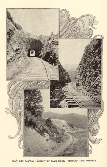
SOUTHERN RAILWAY--ASCENT OF BLUE RIDGE--THROUGH TWO TUNNELS.
Page 17
miles only of not less than 1,500 feet; from the middle to the low country a descent of about 200 feet; through the two latter, however, there is a constant downward grade.
THE MOUNTAIN REGION.
This is so sharply and distinctly defined, and embraces so large a portion of the territory of North Carolina, as to merit a somewhat extended reference to its magnitude, its elevation and its characteristics. Broadly considered it may be treated as a high plateau, bounded on the east by the irregular chain known as the Blue Ridge, extending across the State in a general direction from northeast to southwest, until, reaching the southeastern border of Henderson county, it turns to the west and forms for a long distance part of the southern boundary of the State, passing at length by a southwest projection into the State of Georgia, and again reuniting with the chain of the Smoky Mountains, to which it had made near approach on its entry into North Carolina in the counties of Ashe and Watauga.
The average elevation of the Blue Ridge is nearly 4,000 feet, though on the southern and northern extremities it drops to 3,000 feet, its lower gaps being a little above 2,000 feet over the main level of the Piedmont country. Seen from the east, the chain presents the aspect of a steep and rugged escarpment springing suddenly from the Piedmont plateau to an altitude of from 2,000 to 3,000 feet above it. From the west the appearance is that of a low and ill-defined ridge, in some places, as in parts of Henderson and Macon Counties, presenting almost a smooth, unbroken horizontal line; again uplifting itself in bold prominence, attaining the height of nearly 6,000 feet, as in the Grandfather, and the Pinnacle, the conspicuous summits so attractively visible near Round Knob, on the Western North Carolina Railroad.
The western boundary of this division is that long chain known under the various names of the Iron, the Smoky, and the Unaka Mountains, and forming the dividing line between North Carolina and Tennessee, and enclosing with marked definiteness the plateau of Western North Carolina. The area of this division approximates 6,000 square miles. The plateau is the culminating region of the Appalachian system, and contains not only its largest masses, but also its highest summits. It is divided by a number of cross ridges, and consequently into a number of smaller plateaus or basins, each bounded on all sides by high mountains and having its own independent system of rivers or drainage. It is this connection or interlacing of the outside bounding chains by the agency of the numerous cross chains
Page 18
that gives Western North Carolina its marked mountain character, its alternation of high mountain ranges with corresponding valleys and their attendant rivers, and the numerous lateral spurs, penetrated also by their valleys and their mountain torrents, and all arranged with an order and a symmetry as rare as it is beautiful, and also presenting facilities for communication from the opposite sides of these chains of inestimable value in the construction of works of internal improvement not often possessed by mountain countries.
The chief of these in exceptional elevation is known as the Black Mountains, consisting of a single short ridge extending in a northly direction from the point where it leaves the Blue Ridge. Its total length is only about fifteen miles, but within this short distance there are a dozen peaks that rise to an elevation of more than 6,000 feet above the sea, and one of these--Mitchell's Peak--the highest mountain on the eastern half of the continent, has an altitude of 6,711 feet. Between the French Broad and the Pigeon rivers stretches the long ridges of the Pisgah and the New Found mountains, interrupted by the valley of Hominy creek, the opening of which offers convenient passway to the next parallel ridge, the Balsam mountains, which extends in unbroken continuity from the South Carolina line on the south to the Smoky Mountains on the Tennessee border on the north. This range has a mean elevation of about 5,500 feet, with fifteen summits exceeding 6,000 feet; and across the range are only two pass-ways or gaps suitable to the passage of wheeled vehicles, one of which, traversed by the Western North Carolina railroad, is 3,357 feet above sea-level; the other, Soco Gap, being 4,341 feet high. Then comes the Cowee mountains, extending nearly across the State, and separated from the Great Smokies by the narrow valley of the Tuckasegee river. The mean height of this ridge is about 4,800 feet, the highest summit, at the southern end, being Yellow mountain, 5,133 feet. Then succeeds the massive and very bold double chain of the Nantahala and Valley River mountains, with a mean height of 5,000 feet, the two branches of which lie in close parallelism from the Georgia State line on the south as far as the Red Marble Gap on the north, where they separate, one branch directed westward and known as the Long Ridge, and uniting itself with the Smoky mountains in Cherokee county; the other extending to the northeast, under the name of the Cheowah mountains, and ending without definite connection in undefinable ridges or isolated peaks.
On the east side of the Blue Ridge and extending into the Piedmont region are a series of short and irregular ridges or spurs. Among these are the Saluda, Green River, Tryon and Hungry
Page 19
mountain masses, which are more or less separated from the Blue Ridge by the deep valleys or gorges carved by the river torrents which have cut through them and thus unite with the waters flowing toward the Atlantic; the waters on the west of the Blue Ridge, on the contrary, all directing their courses toward the Mississippi or its tributaries. Two other and more prominent ridges extend into this Piedmont plateau for considerable distances. The South mountains, commencing as foot hills of the Blue Ridge in western McDowell, extend in a general easterly direction, south of the Catawba river to western Catawba county, a distance of some fifty miles. They reach their maximum development near the junction of Burke, McDowell and Rutherford counties, where several knobs have an elevation of near 3,000 feet. The other of these two ridges, the Brushy mountains, cut off from the Blue Ridge at the west by several tributaries of the Catawba assumes definite proportions in eastern Caldwell county and extends northeast more or less parallel to the Yadkin valley and Blue Ridge on the north, as far as the Sauratown mountains in Stokes county, a distance of some eighty miles. In Yadkin and Surry counties these mountains nearly disappear, but they reappear in Pilot, Eaton and Moor's Knobs to the northeast.
The Linville mountains, though a distinct spur from the Blue Ridge, are so coincident with it in perspective and in general characteristics as to need no mention as a distinct ridge.
The above embrace the whole mountain system of North Carolina, and in the western section unmistakably present the culmination of the great Appalachian system, as illustrated by the highest summits lifted up in all the territory of the United States east of the Rocky Mountains, and also as the source from which many large rivers radiate to flow towards the opposite directions of the Atlantic Ocean, the Gulf of Mexico, and the Mississippi river and its tributaries.
Along the Blue Ridge, along the Smoky mountain range, and along the cross chains are found the following summits which exceed 6,000 feet in elevation:
IN THE SMOKY MOUNTAINS--Mount Buckley, 6,599; Clingman's Dome, 6,660; Mount Love, 6,443; Mount Collins, 6,188; Mount Alexander, 6,447; Mount Henry, 6,373; Mount Guyot, 6,636; Tricorne Knob, 6,188; Raven's Knob, 6,230; Thermometer Knob, 6,157; Luftee Knob, 6,232; Cataloochee, 6,159; Roan (High Knob,) 6,313; Roan (High Bluff,) 6,287; Grassy Ridge, (Bald), 6,220; Cold Spring, 6,015.
IN THE BALSAM MOUNTAINS--Enos Plotts' Balsam, 6,090; Jones' Balsam, 6,224; Rockstand Knob, 6,002; Brother Plott, 6,246;
Page 20
Amos Plott's Balsam, 6,278; Rocky Face, 6,031; Double Spring Mountain, 6,380; Richland Balsam, 6,370; Chimney Peak, 6,234; Spruce Ridge Top, 6,076; Reinhardt Mountain, 6,106; Devil's Court House, 6,049; Sam's Knob, 6,001.
IN THE BLACK MOUNTAINS--Blackstock's Knob, 6,378; Potato Top, 6,393; Black Dome, 6,502; Mount Gibbs, 6,591; Mount Hallback, (or Sugar loaf,) 6,403; Mount Mitchell, 6,711; Balsam Cone, 6,671; Black Brother, 6,619; Cattail Peak, 6,611; Hairy Bear, 6,681; Deer Mountain, 6,233; Long Ridge, (middle point,) 6,259; Bowlen's Pyramid, 6,348.
IN THE CRAGGY RANGE--Big Craggy, 6,068.
In all forty-three peaks of 6,000 feet and upwards. And there are eighty-two mountains which exceed in height 5,000 feet, and closely approximate 6,000, and the number which exceed 4,000 and approximate 5,000 are innumerable.
The general contour of all these mountains is gentle, the summits generally presenting smooth rounded outlines, occasionally rising into sharp pointed peaks, and, except on the southern border, presenting but few precipitous slopes. There, some of the most stupendous cliffs or precipices east of the Rocky Mountains present themselves, such as Cæsar's Head and Whiteside Mountain, the latter presenting a sheer perpendicular front of naked rock eighteen hundred feet in height.
Otherwise the mountains are covered with deep rich soil, clothed with massive forests to their tops. To this general condition there is the remarkable exception presented by the locally named balds, natural meadows found on the rounded tops of many of the highest mountains. Their elevation is generally near, or above, 6,000 feet. The heavy forest growth of the valleys and lower slopes of the mountains is gradually dwarfed towards the bald summits, so that these are surrounded by a fringe of stunted, scrubby oaks, beeches, &c., the balds themselves being covered with a rich herbage of grass, pasturage to which large herds of domestic animals are annually driven to remain until the return of cold weather.
The great elevation of these mountain heights is indicated by the botanical features of the vegetation, which shows a predominance of firs, hemlocks, white pines, and other trees of high latitudes.
In respect to those timber trees found here, in common with the other sections, the Mountain region has the advantage of possessing an unbroken forest. In comparison with the extent of forest lands, the clearings here are mere patches.
There is little hazard in saying that there is nowhere in any of the States an equal area of land covered with timber trees of such

THE CRAGGY CHAIN--BIG CRAGGY.
Page 21
various kinds, and of such value. The walnut, tulip trees, (poplars), and oaks attain a size that would hardly be credited by one who had not seen them. The preservation of this magnificent forest is due to the fact that it has hitherto been inaccessible to transportation. Within the past few years much of it has been brought into connection with the markets of the world. One railroad line passes entirely through this section, and another branching off at Asheville and leading to the extreme southwest of the State, is now completed. Into the northwestern part of the State also a railroad has been completed and others projected.
The cultivated productions of this section are the same as those of the Piedmont Plateau region, cotton and rice excepted. Its garden vegetables are the same, but the cabbage and the Irish potato grow here to a degree of perfection that cannot be excelled anywhere. Among the fruits, its apples are noted for size and flavor. Peaches and grapes grow well generally; but, for their highest perfection, nature has made provisions by a suspension to some extent of her ordinary laws. Throughout the mountains, in certain localities and at certain elevations, there are horizontal belts where frost is seldom known. Such localities are found not only in this section, but in the South mountains and in the Brushy range.
The climate of this Mountain region differs less from that of the Piedmont Plateau region than would be inferred from its higher altitude. The difference is more perceptible in summer than in winter. In the former season, its cool and bracing air, together with its varied scenery, its mineral waters--sulphur, chalybeate and thermal--made this section one of the favorite resorts of the people of the South and Southwest when it could only be reached by private conveyances. Since it has been penetrated by railroads, the influx of health and pleasure-seekers has increased an hundred fold, and in future will add very largely to its resources.
The soils of the basins of the great rivers of this section, and its mountain valleys, are noted for their fertility. The capacity for the production of cereals and hay grasses is equal to that of any lands. As might be inferred from the heavy forest growth with which the entire surface is covered, the mountain sides are susceptible of profitable cultivation up to their summits.
Among the valleys most noted for their beauty and extent are the upper French Broad and Mills river valleys, of Henderson and Transylvania; the Swannanoa, in Buncombe; the Pigeon river, Richland and Jonathan's creek flat lands, in Haywood; those of the Valley
Page 22
river and Hiwasse, in Cherokee; and portions of the upper Linville, in Mitchell.
The entire transmontane country is well adapted to stock-raising. The cultivated grasses flourish everywhere with even ordinary care. But it is in the north-western counties--particularly in the counties of Ashe, Alleghany, Watauga, Mitchell, Yancey--that all the conditions are found necessary for its perfect success. The soil throughout these counties is a deep rich loam, up to the summits of the mountains. The whole country is covered with a dense vegetation, amongst which will be found some of the largest timber in the United States, and as yet the forests are comparatively unbroken, because they have been inaccessible to market. The clearing of the timber is a work of some difficulty, but when that is done the labor of the farmer is rewarded with the richest crops. After two or three crops are taken off, the land, if suffered to lie at rest, springs up spontaneously in timothy, herds grass, and other rich pasture grasses; and once established, the grass perpetuates itself upon the land. Nor is an entire clearing necessary to establish the land in grass. If the undergrowth is removed, the trees thinned out, and the surface stirred and sown in orchard grass (Cocks foot,) it flourishes luxuriantly even while the forest trees are left standing.
Its capacity as a grazing country has long been known. But formerly the cattle were left to the resources of nature, which indeed, in such a country were abundant and rich. "Horses and horned cattle," says General Clingman in one of his publications, "are usually driven out into the mountains about the first of April and brought back in November. Within six weeks after they have thus been put into the range, they become fat and sleek. There are, however, on the top and along the sides of the higher mountains ever-green and winter grasses on which horses and horned cattle live well through the entire winter. Such animals are often foaled and reared there until fit for market, without ever seeing a cultivated plantation." Of late, attention has been turned to the breeding of fine stock, and some herds of cattle and flocks of sheep are found there which will compare not unfavorably with those of any country. This country is already penetrated by one railroad, and others are in course of construction. When fairly laid open to railroad communication it will offer--besides its rich mining interests and timbers--one of the finest fields for cattle and sheep breeding and for dairy products that the Union presents.
Apart from its forests, nature has been prodigal to this section in shrubs and flowering plants. It has always been a favorite resort of
Page 23
the botanists. It is a field that has been assiduously cultivated by many of the most distinguished professors of that science. It was from these mountains that Bartram, the Michauxs--father and son--Fraser, Delile, Lyon, Nuttall, Von Schweinitz, Mitchell, Gray and Curtis, drew much of the material of their valuable contributions to botanical science. It was here that some of the most beautiful flowers that adorn the gardens of Europe and of this country were first discovered. It still yields rare flowers to the explorer, which though not conspicuous for their beauty, are deemed rare treasures by botanists.
This section has also been one of the chief sources of supply of medicinal herbs. Immense quantities are gathered and shipped to the northern cities and to Europe. In travelling through the mountains bales of these herbs may be seen collected about the country stores as bales of cotton are seen in the middle and eastern regions. Ginseng in great quantities is shipped to China. The trade in medicinal herbs has grown into a large business.
Corundum abounds in Macon, Clay and many other counties. Mica is abundant in Mitchell and Yancey, and those counties yield a large part of the world's supply. The largest and finest sheets of it seen at the World's Fair at Vienna were from the Ray Mine in Yancey.
This section is rich in iron ores of the best grade. That of Cranberry possesses such excellence for making iron for special purposes--steam boilers for example, and steel of the finest quality, such as is adapted to making surgical instruments and the like--that a railroad forty miles long and costing more than a million dollars has been constructed through one of the most rugged parts of the mountain territory to reach it. Copper also is prominent among the metals of this region. The most noted mine is that of Ore Knob, in Ashe.
The effect of these mining enterprises upon the prosperity of this section has been marked. Labor has found employment, a home market has been furnished to the farmer, and there has been some appreciation of property of every kind.
The past few years have been remarkable for the success with which the difficulties presented by the want of transportation in this State have been grappled with and overcome. These achievements at once great and beneficent, will make this period a memorable one in the history of the State. Railroads are now entering the northwestern part of the State in several directions. The completion and connection of these, and the opening up of this region, so rich in
Page 24
elements of undeveloped wealth, is now regarded as the first and most imperative duty of the statesmen of North Carolina.
PIEDMONT PLATEAU REGION.
The Piedmont Plateau region is intermediate between the Mountain region, already spoken of, and the Coastal Plain region, which extends to the ocean. It comprises nearly one-half the territory of the State. In passing into this region from either of the others, a marked change is at once observable in topography, in production, and largely in industrial pursuits. The tumultuous continuity of mountains subsides into gentle undulations, a succession of hills and dales, a variety and charm of landscape, alike different from the high, uplifted mountain elevations and the flat monotony of the plains or levels of the east. Every step brings to view some new charm, some new arrangement of the rounded hills, some new grouping of the tracts of forest which still cover so large a part of the country. The hills, indeed, in their gracefully curving outlines, present lines of beauty with which the eye of taste is never satiated. These are attractions which depend upon permanent features of the landscape, and which, though infinitely heightened in their effects by the verdure of spring and summer, are only brought into fuller relief by the nakedness of winter. The variations of surface, though less defined at first, become more marked towards the west, and towards the Blue Ridge the country assumes a bold and even rugged aspect.
The hand of improvement is more visible in this than in any section in this State. Almost the entire region is now dotted over with thriving villages and towns. The homes everywhere indicate a high degree of thrift and comfort. An unusual proportion are built in modern style, and tastefully painted. Nestled amidst yards and gardens, enclosed with neat painted palings, flanked with orchards of fruit trees, in which a space is generally allotted to choice grape vines, they give abundant proof of ease, plenty, and, in many instances, of no small degree of luxury.
It is in this section that the great water-power of the State--estimated by the late State Geologist, Prof. W. C. Kerr, at three million horse-power--finds its greatest development and employment. It is through this section that flow the upper waters of the Dan, the Roanoke, the Tar, the Neuse, the Cape Fear, the Yadkin, and the Catawba, and their numerous affluents. All of those have been partially utilized by the erection of corn, flouring and saw-mills in every neighborhood, and cotton and woolen mills on almost all of the rivers and their tributaries. Within the last few years the number of cotton-mills has
Page 25
largely increased. Those erected lately are spacious buildings, and equipped with the best machinery. Within the same period all or nearly all of the older ones have been enlarged and new machinery put in. The fact begins to be more and more recognized that within the cotton States there are advantages for the manufacture of that staple that cannot be found elsewhere. Here the cotton is at the door of the manufacturer, and the prime cost of the material is therefore less. Wages are less here than in the northern States, and a lower rate of wages here affords a more comfortable living than a higher rate there, for the necessaries of life are cheaper, and less of food, clothing and fuel are required. Less fuel, too, is required for heating the mill in winter. The laborer can make substantial additions to his means of subsistence from his garden, which is always allotted here to the head of the family. Here there is no obstruction to machinery from ice in winter, and no greater suspension of work from drought in summer, for our rivers are as long as those of New England and have as many tributaries. The original cost of the site and of the building here is very much less than the same cost there. The force of these reasons cannot be long resisted, and, indeed, the phenomenal growth of cotton milling now observed in the State fully asserts the truth of the claims set forth.
In subsequent chapters in this volume the water powers and manufacturing will be treated at more length.
The soil of this Piedmont Plateau presents a blending of the soils of the Eastern and Western regions, the tertiary formation of the first pushing itself sometimes far towards the west until it comes into proximity with the older formations of the Piedmont region, and often, in its extreme western extension, partaking of the character of the formations of the mountains. A soil so composed or diversified, in connection with favorable climatic conditions, offers great agricultural possibilities, and in this section we find the widest range of production. It is here that we find the largest area devoted to the cultivation of the most profitable varieties of tobacco, and it is here that the culture of cotton is largely extended and profitably pursued; and it is here also that all the cereals and all the grasses are cultivated in their highest perfection, enlisting the leading agricultural interest of the population. Here also the fruits of the temperate zone find congenial home--apples, peaches, pears, cherries, the small fruits and grapes being unexcelled in excellence, variety and abundance. In this section are also widely distributed the richest veins and deposits of the valuable ores and metals, including the precious metals, gold and silver, iron, copper and lead, and the only two coal
Page 26
formations found in North Carolina. These ores, and the mining operations connected with them, will be treated of in a chapter in this work. This region also abounds in varied and extensive forest wealth, which will be referred to in its proper place.
COASTAL PLAIN REGION.
The whole eastern portion of the State consists of a vast plain, stretching from the sea coast into the interior of the country, a distance of from one hundred to a hundred and fifty miles. Traversing this section from north to south are tracts of country which vary little from a perfect level. The Carolina Central Railroad has a stretch of one hundred miles where there is neither curve, excavation nor embankment. From east to west the surface rises by easy gradations at the rate of a little more than a foot to the mile. The rise, however, is not perceptible to the traveler. But though level in parts, it is in general relieved by slight undulations. Along its western border, as in the county of Moore, it attains an elevation of about five hundred feet.
The western boundary may be roughly defined by a line extending from the western part of Warren, through Franklin, Wake, Cumberland, Chatham, Moore, Montgomery and Anson. This line marks what, at an earlier period of the earth's history, was a line of sea-beach. Over this whole section the primitive rocks are covered with a deep stratum of earth, principally sand. Along the western border there is a broad belt of unequal width, but generally from thirty to forty miles across, where granite, slate and other rocks are sparingly distributed, mainly near water-courses, where the more recent formations have been removed by the erosian agencies. The belt of primitive rock here mentioned extends to the Wilmington and Weldon Railroad, from the Virginia line to Goldsboro, and from thence to a line drawn through Averysboro to the South Carolina line about where the Pee Dee enters that State. From the line there indicated to the sea coast not a stone of any size, except along the water-courses, and scarcely a pebble, except at a few points, is to be met with.
A bed of shell limestone underlies some portions of the region, cropping out at intervals. It forms a good limestone, sufficiently pure for all the common purposes of building, and in quantity large enough to supply a wide extent of country with quicklime. Examples of this are found nine miles below Waynesboro, in the north-west corner of Jones, in the northern part of Onslow, at Wilmington, and on the north-west branch of the Cape Fear to a distance of forty miles above.
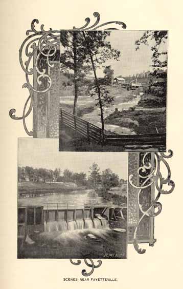
SCENES NEAR FAYETTEVILLE.
Page 27
This section is made up of beds of clay and sand, with vast quantities of shells imbedded in them. The soil varies in character to the extent that the one or the other predominates; and to the extent that the shells, when intermixed with it, have undergone decomposition. The upland soil is for the most part a sandy loam, easily accessible to the sun's rays, easily worked and very productive in the crops there cultivated. There are, however, extensive areas of country where sand predominates to such a degree that the surface to a considerable depth is a bed of white sand. Yet this kind of land is the favorite habitat of the long-leaf pine. When cleared, it yields good crops of corn and cotton for a few years without manure, and always with slight help from proper commercial fertilizers, and considerable areas, as in Moore county, have been found to be valuable for small fruits and orchards. There are other extensive areas where clay enters so largely into the soil as to form a clay loam. The counties on the north side of Albemarle Sound--a very fertile tract of country--are examples of this class. The alluval lands of this section--lands always in the highest degree productive from the fact that all the elements of fertility are intimately intermingled by having been once suspended in water--are of unusual extent and importance. The grain grown there supplies food not only for people of other parts of the State, but large populations in other States. There are also extensive areas when the marls of the tertiary formation come near the surface and increase the fertility of the soil. This is the case from the eastern part of Jones county to the Cape Fear river, and in portions of many other counties. Another class of lands in point of fertility equalling any in the world is that reclaimed from some of the swamp and lake areas in the extreme eastern portion of this region. These lands seem to be well nigh inexhaustible. The cultivation of three-quarters of a century has made no change in their productive capacity. To the lands reclaimed from the borders of marshes--so frequent near the shore--the same remark may be applied.
Another class of land remains to be mentioned which will be a resource of inestimable value in time, perhaps not distant. Bordering on the sea and sounds are extensive tracts of country designated as swamps. Though so-called, they differ widely in their characteristic features from an ordinary swamp. They are not alluvial tracts, neither are they subject to overflow. The land covered by many of them lies for the greater part quite low; but this remark seldom applies wholly to any of them--to some does not apply at all. On the contrary many of them occupy the divides or water sheds between the
Page 28
rivers and sounds, and are elevated many feet above the adjacent rivers of which they are the sources. These latter are susceptible of drainage, and when reclaimed some of them have every element of exuberant and lasting fertility. Bay River swamp, between Pamlico and Neuse rivers, and Green swamp, in Brunswick and Columbus counties, may be mentioned as examples. The elevation of the latter is forty feet above the sea level. The work of drainage is simple. From the border of the swamp, which is always the highest land, the bottom slopes in every direction gradually, almost imperceptibly, to the centre. A canal cut through this border into the swamp, and carried to some neighboring stream, lays bare an extensive belt along the entire border. The aggregate territory in the State known as swamp lands is between three and four thousand square miles. When drainage shall be properly carried out over this great territory--a work which on account of the slight difficulties to be encountered as compared with those which they encountered and overcame, would be deemed trifling by the laborious North German and the indefatigable Hollander--hundreds of square miles of land of surpassing fertility will be added to the area now in cultivation.
Throughout this entire section cotton, corn, oats, sorghum, peas, peanuts, potatoes, especially sweet potatoes, are the staple crops; the culture of tobacco has been lately introduced with success. Upon the rich alluvions and the reclaimed lake and swamp lands, corn, with peas planted in the intervals between the corn, forms the exclusive crop. Occasionally on the broad low-grounds of the Roanoke, wheat is grown to a considerable extent. In the counties on the north of Albemarle Sound it is one of the staple crops. On the low-grounds of the lower Cape Fear rice has long been the staple crop, and during recent years its culture has been extended northward along the low lying lands of the rivers and sounds. The upland variety of rice has been introduced within a few years past with entire success. This section is everywhere underlaid with marl--a mixture of carbonate of lime and clay formed by the decomposition of imbedded shells--sufficient in quantity, when raised and applied to the surface, to bring it to a high pitch of fertility and maintain it so.
In the counties of Duplin, Sampson and New Hanover valuable deposits of phosphates have been discovered, which are now being mined and ground for fertilizing purposes. They are known to exist in the adjoining counties, but to what extent has not been yet ascertained. From the similarity of the geological conditions throughout
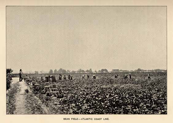
BEAN FIELD--ATLANTIC COAST LINE.
Page 29
the Eastern Section, there is little doubt that a systematic exploration there will lead to further extensive discoveries.
The use of marl, on account of its lower value in comparison with its bulk and consequent cost of transportation, must be mainly, if not wholly, confined to the section in which it is found. Phosphates, on the other hand, on account of their high fertilizing power, admit of transportation to any distance, and may be used anywhere.
Dr. Emmons remarks: "The swamp soils of North Carolina show a greater capacity for endurance than the prairie soils of Illinois, notwitstanding the annual crops are somewhat less per acre; and, on the score of location, we are unable to see that the Illinois soils have the preference. Nor, as regards health, are our swamp soils more subject to malaria than the country of the prairies." He refers to the remarkable fact that "persons live and labor in swamps with impunity or freedom from disease." This statement is fully sustained by the reports of our engineers who have had charge of the construction of railroads in that section, as well as by the general healthfulness of the inhabitants of the region, and especially so by those who use cistern water.
The swamps, in their natural state, afford abundant pasturage. They are covered in part by a dense growth of reeds, which supply excellent food for cattle, winter and summer.
That eminent agriculturist, Mr. Edmund Ruffin, of Virginia, who studied this section of the State with care, expressed a high appreciation of the tidewater region for the cultivation of grasses. He said: "There is no better country for grasses east of the mountains. In small lots I saw dry meadows of ochard grass and clover that would have been deemed good in the best grass districts." It is evident, from the humid character of the climate in that region, and from the fact that the heats of summer are tempered by sea-breezes, owing to the proximity of the ocean, that the conditions are such as to favor the growth of this family of plants.
Among the resources for future use along the seaboard country, peat is entitled to a prominent place. It exists over hundreds of square miles in area, and to the depth of many feet. At no distant day it will be extensively used, both as a fuel and fertilizer.
If the indications of nature are to be relied on, North Carolina was plainly marked out as the land for vineyards. In the sober narrative of the voyage of Amadas and Barlowe, made in 1584, to North Carolina, then an unbroken wilderness, the author tells us, in most graphic language of the abundance of grapes: "so full of grapes as the very beating and surge of the sea overflowed them."
Page 30
Upon the visit of the voyagers to the house of the Indian King, on Roanoke Island, wine was set before them by his wife. It is further mentioned that, "while the grape lasteth, they (the Indians) drink wine;" they had not learned the art of preserving it. Harriot, a distinguished man in an age of distinguished men, of whom it was justly said that he cultivated all sciences and excelled in all, visited the same coast in 1586, where he was struck with the abundance of grape vines, and he was impressed with the fact that wine might be made one of the future staples of the State. "Were they," he writes, "planted and husbanded as they ought, a principal commodity of wines might be raised." This State has proved to be far richer in this respect than it is probable even he suspected. Grape vines were found in equal profusion in the original forest throughout the State. They often interlaced the trees to such an extent that they were a serious impediment to the work of clearing away the forest, catching and suspending the trees as they were felled. At this day, if a tract of forest is enclosed, and cattle of every kind excluded, they spring up spontaneously and thickly over the land, Some of the finest wine grapes of the United States, the Scuppernong, the Isabella, the Catawba and the Lincoln, are native to this State. But it was long before the bounty of nature in this regard was improved. This was probably due to the fact that the State was settled almost wholly by emigrants from the British Isles, who knew nothing of the culture of the vine. It was planted here and there to yield grapes for table use; but it was not until within thirty years that a vineyard was known in the State. Within that period several of large and a great number of small extent have been planted. Grapes in season are abundantly supplied for domestic consumption, and shipped in hundreds of tons. The wines of the established vineyards are held in high and just repute. In a broad commercial sense, the possibilities of the Scuppernong, as a wine grape, is yet to be developed: North Carolina should supply the bulk of the wine used in this country.
All the cultivated fruits and berries grow here in great perfection with the exception of the apple. This, though by no means an inferior fruit, is yet not equal in size and flavor to that of the Piedmont Plateau and Mountain regions. Among the swamps the cranberry is found in profusion. The melons are of every variety and of peculiar excellence.
Page 31
CLIMATE.
It will be conceded without question that the influence of climate on human progress is supreme, because its happy or adverse conditions affect all that relates to comfort, health, energy and success in the occupations of life. Those regions most abounding in fertile soil and exuberant vegetation, which favor the growth of many valuable productions of nature, often have those treasures closed against the efforts of industry by unfavorable climatic conditions, an excess of heat and moisture, and an air poisoned with miasma, leading to loss of vigor, health, or of life itself. On the other hand the frigid regions of the north are equally unsuited for the permanent abode of man.
The greatest nations have all developed in the regions of the temperate zone, which possess the most variable climate. Variations of heat and cold, of moisture and dryness, within extremes not too great, are essential to the best development of vegetable as well as animal life. Man especially, requires the inspiration of the changing seasons, the summer, warm enough to assure the rewards of labor by the abundant yield of the fruits of the soil, the winter, with its bracing cold, giving a period of rest and renewal of vigor.
It is common to find the most extravagant claims made for the climate of favored localities. The splendid climate of North Carolina will be best described by presenting to the seeker for a new home a few facts in regard to the chief climatic features, which may be easily verified by reference to the excellent publications of the North Carolina State Weather Service, where more detailed information may be sought.
North Carolina lies on the same parallel of latitude as the central Mediterranean basin, that climatically most favored region of the globe. Though this position in the warm temperate zone determines the chief climatic features of the State, these are modified by various causes, most important of which are the proximity of the ocean in the east and the mountain system in the west. The State is naturally divided into three regions: the Coastal Plain, Piedmont Plateau and Mountain. The effect of the prolongation of the first into the Atlantic is to give the climate of that region a more insular or marine character, the effect of the presence of the sea being to lessen the changes in temperature both diurnal and seasonal and to increase the amount of precipitation. Contrary to the prevailing impression, the nearness of the Gulf Stream has a minimum effect on the climate in
Page 32
the east, both because the Gulf Stream is separated from the land by fifty miles of cold water, and because the prevailing winds are from the southwest or northeast and do not blow the moist air of the Gulf Stream over the land, as is so often stated. The annual mean temperature of Southport, situated in the southeast corner of the State, is 64 degrees. Here vegetation of semi-tropical origin, as the palmetto and magnolia flourishes and rice is cultivated. The decrease in annual mean temperature towards the north is only to 59 degrees at Coinjock and Weldon. The land is level and fertile, and the earlier and more rapid development of vegetation has led to one of the most important industries of the State, that of truck farming. The shipments of truck and strawberries to northern markets begins before the middle of April.
On the other hand in the Mountain region the influence of elevation predominates; the land rises in summits higher than any east of the Rocky Mountains; the summers are cooler, the winters more severe, but the dryness of the air renders the climate more salubrious. The highest point in the Blue Ridge, Mount Mitchell (elevation 6,711 feet) has probably a mean annual temperature of 38 degrees, but the annual mean at Asheville (elevation 2,250 feet) which is 54 degrees, is nearer the average for the district. The white pine and the spruce, whose natural habitat is lower Canada, are abundant in the forests of the Blue Ridge. There are many picturesque and charming valleys, looked down upon by lofty peaks, which have a climate as mild as the less elevated Piedmont region on the east of the range. In certain mountain localities occur the remarkable thermal or frostless belts, regions where the season is known to be a month earlier in spring and later in autumn than in the valley below them, and where, above and below, frost works its blighting effect, leaving in vivid contrast horizontal belts of untouched foilage and blooming flowers. The Blue Ridge acts also as a barrier to all except the most severe cold waves from the northwest, which frequently advance around the south end, affecting the Gulf States before they reach North Carolina.
Intermediate between these sections may be found all gradations in climate, as in soil, products and scenery, suited to every individual taste. The climatic conditions are favorable for the growth of a great variety of crops, as cotton, corn, tobacco, and small grains, which are the staple crops of North Carolina, as well as almost every kind of fruit and vegetable. Invalids also may find returning health at many of the now well known summer and winter resorts, while the pleasure seeker frequents the watering places along the east coast.
Page 33
TEMPERATURE.
From records extending over a period of twenty five years the mean annual temperature of the State has been determined to be 59 degrees Fahrenheit. The means for the three regions for the different seasons of the year are as follows:-
| Spring. | Summer. | Autumn. | Winter. | Year. | |
| Coastal Plain . . . . . | 58 . . . . . | 77 . . . . . | 62 . . . . . | 45 . . . . . | 61. |
| Piedmont Plateau . . . . . | 59 . . . . . | 77 . . . . . | 59 . . . . . | 43 . . . . . | 60. |
| Mountain . . . . . | 56 . . . . . | 72 . . . . . | 56 . . . . . | 40 . . . . . | 56. |
| For the State . . . . . | 58 . . . . . | 76 . . . . . | 60 . . . . . | 43 . . . . . | 59. |
For convenience of comparison the annual mean temperature at some of the most important places in the State is presented in the following table:
| Asheville . . . . . | 54. |
| Charlotte . . . . . | 60. |
| Chapel Hill . . . . . | 60. |
| Franklin . . . . . | 54. |
| Fayetteville . . . . . | 61. |
| Greenville . . . . . | 61. |
| Greensboro . . . . . | 59. |
| Goldsboro . . . . . | 62. |
| Hatteras . . . . . | 62. |
| Highlands . . . . . | 50. |
| Kitty Hawk . . . . . | 60. |
| Lenoir . . . . . | 56. |
| Murphy . . . . . | 56. |
| Morganton . . . . . | 58. |
| Newbern . . . . . | 62. |
| Portsmouth . . . . . | 62. |
| Raleigh . . . . . | 60. |
| Southport . . . . . | 64. |
| Tarboro . . . . . | 60. |
| Weldon . . . . . | 59. |
| Wilmington . . . . . | 63. |
In the summer months the southern portion of the Piedmont Plateau presents higher monthly means and greater extremes than either the Coastal or the Mountain regions, probably in part due to the sandy nature of the soil. The warmest month is July, and a few stations sometimes have for that month a mean of over 80 degrees; the coldest month is January, and in the mountains the mean for that month sometimes is as low as 30 degrees. The extremes in temperature for the State are considerable, but rarely does the temperature reach zero, except during such extraordinary cold periods as occurred in 1873, 1886 and 1893. During a normal winter the minimum temperature in the central portion of the State will sink to 10 or 12 degrees, but such cold is usually of very short duration. During a normal summer the temperature will perhaps on two or three days reach 100 degrees.
In respect to temperature Dr. Kerr stated:
"Middle and eastern North Carolina correspond to middle and Southern France, and Western North Carolina to Northern France and Belgium. All the climates of Italy from Palermo to Milan and Venice are represented."
Page 34
PRECIPITATION.
The normal average precipitation for North Carolina is 53.29 inches. The State therefore forms the northeastern limit of that region in the United States characterized by the largest amount of rainfall, the centre of which lies in the middle Gulf coast. Long records show a belt of minimum precipitation extending through the Piedmont Plateau; at the same time certain valleys west of the divide also have a small amount. On the east coast and over the southern portions of the Mountain region the annual precipitation becomes very large, over 70 inches. No station has a normal less than 40 inches.
The average for the different regions are as follows:
| Spring. | Summer. | Autumn. | Winter. | Year. | |
| Coastal Plain . . . . . | 12.85 . . . . . | 17.04 . . . . . | 13.10 . . . . . | 12.24 . . . . . | 55.23. |
| Piedmont Plateau . . . . . | 12.18 . . . . . | 13.99 . . . . . | 11.35 . . . . . | 12.28 . . . . . | 49.85. |
| Mountain . . . . . | 13.69 . . . . . | 14.95 . . . . . | 10.61 . . . . . | 14.07 . . . . . | 53.32. |
| For the State . . . . . | 12.94 . . . . . | 15.87 . . . . . | 11.71 . . . . . | 12.77 . . . . . | 53.29. |
One advantage must not pass unnoticed, namely that the rainfall is uniformly distributed throughout the year, and that during those months when growing crops require the most moisture, the amount is greatest. The largest amounts occur in July and August, when the averages for the State are respectively 5.44 and 6.09 inches; the least amounts occur in October and November (3.66 and 3.40 inches) during which the weather is especially favorable for the final work of the farmer, before the much needed rest of winter begins.
As illustrating extreme years with respect to total precipitation, it may be mentioned that the wettest year recorded occurred in 1877, with an average of 64.88 inches for the State. September, of that year, had the only average of over 10 inches for one month. During the year 1890, the total annual rainfall was 46.49 inches, and November of that year had an average of only 0.35 inch.
A few records of normal annual precipitation are presented below:
| LOCATION. | INCHES. |
| Asheville . . . . . | 42.77 |
| Franklin . . . . . | 57.11 |
| Hatteras . . . . . | 62.26 |
| Lenoir . . . . . | 51.64 |
| Mount Airy . . . . . | 48.95 |
| Raleigh . . . . . | 45.67 |
| Weldon . . . . . | 46.84 |
| Chapel Hill . . . . . | 46.11 |
| Greenville . . . . . | 50.66 |
| Highlands . . . . . | 76.29 |
| Murphy . . . . . | 64.05 |
| Newbern . . . . . | 59.29 |
| Southport . . . . . | 50.03 |
| Willeyton . . . . . | 52.90 |
| Charlotte . . . . . | 52.72 |
| Goldsboro . . . . . | 55.00 |
| Kitty Hawk . . . . . | 58.82 |
| Morganton . . . . . | 47,96 |
| Portsmouth . . . . . | 69.14 |
| Tarboro . . . . . | 53.65 |
| Wilmington . . . . . | 55.95 |
Page 35
SNOWFALL.
As a matter of comfort in winter, snowfall is of more importance than rainfall. The amount of precipitation occurring as snow is rarely sufficient to serve as a protection to small grain crops, the amount being both too small and remaining too short a time on the ground. The average snowfall for the State is about 5 inches. During severe winters much larger amounts occur, and may remain on the ground for a week or ten days, but during a normal season the ground will rarely remain white for more than two days at a time. Snows occur in the Piedmont and Coastal regions, most frequently with northeast or north winds, during the passage of storms up the coast.
FROST, ICE AND STORMS.
Considering Raleigh, the capital city, as representing the average with respect to the probability of the occurrence of frost, it may be stated that the average date for the last frost in spring is April 10th, though killing frost have occurred on rare occasions in May. In autumn, the first frost will generally occur about October 26th. Necessarily in the mountain region these dates are both much advanced, while in the east, the modifying effects of the many arms of the sea penetrating the land greatly diminishes the danger of killing frosts at the season when crops are growing.
The formation of ice to any thickness only occurs during exceptionally severe winters. Ice has formed, however, as far south as Wilmington, to a thickness of half an inch, and even Albemarle and Currituck Sounds have been frozen over. But the normal winter yields opportunities neither for sleighing nor skating, except for very brief periods.
There remains to be considered one special advantage possessed by the State, due to its position with reference to the prevailing course of cyclonic storms. The great path of these "weather breeders" is across the lake region and thence northeastward up the St. Lawrence Valley. North Carolina lies entirely out of this general path. Of the total number of storms charted from 1874 to 1890, only 16 per-cent. crossed North Carolina. There are, therefore, longer periods of pleasant weather than can be experienced in more northerly states. Of destructive tornadoes, North Carolina experiences not one in ten years.
On the other hand, the State does lie in the path of the so-called sub-tropical storms which move up from the coast of Florida. These storms occur most frequently during the months of August, September and October, and are usually accompanied by heavy rains and
Page 36
much wind. The damage to crops and property is generally small, but they give to Hatteras a deserved reputation for gales dangerous to the ships and lives of mariners.
FORESTS.
The forests of North Carolina have for many years been one of the chief resources of revenue to the people of the State, the value of their products, including domestic fuel, timber for construction and such forest by-products as turpentine and its derivatives, amounting in 1893 at least to $25,000,000, and probably much exceeding that amount in the year ending March 1st, 1896. The forests in their original distribution extended compact and unbroken throughout the length and breadth of the State, with the exception of unimportant savannas in the eastern section, covered with coarse grasses and sedges, and isolated mountain summits in the extreme western counties, which, bare of trees and shrubs, produced a close turf of vigorous and hardy but tender grasses; and at the present time, after the encroachment of field and pasture for over a century, nearly two-thirds of the area of the State is still under forest cover.
The forests, which extend from the sea level in the eastern and southeastern sections to altitudes of 6,600 feet along the State's western borders, where the Appalachian upheavals reach their culmination, are made up of more or less distinctly marked regions having different kinds of trees, the different growth being due to the changes of temperature as the elevation varies and to the succession of different soils. There are three of these regions most clearly marked: the Coastal Plain with upland forests chiefly of pines; the Piedmont Plateau with forests of pine mixed with hardwoods, or belts of hardwoods with pine, alternating with belts of hardwoods without pines; and the Mountain, the forests of which lying above 2,000 feet elevation are destitute of pine.
The coastal forest region, in extent nearly coincident with the Coastal Plain and embracing about three-eights of the area of the State, lies east of a line drawn from Weldon to Raleigh, and from Raleigh to Wadesboro, the line being nearly southwest in direction and almost parallel with the Atlantic Coast Line. Its surface is undulating along the seaboard where it is usually raised only slightly above high water mark, ten to forty feet, and where there are numerous and extensive swamps; but it becomes rolling and even hilly adjacent
Page 37
to the water course along its western limits, where altitudes of 500 to 600 feet are encountered. The upland soils of this region are sandy loams, rarely stiff, moderately fine and even grained. To the north of the Neuse river loams and loose loams are the more frequent upland soils and the growth is loblolly pine (North Carolina pine* * Lumbermen's name. * Local name.
), with a subordinate growth of small oaks; while to the south of this river the upland soils are more sandy and the forests are of long-leaf pine, often to the exclusion of almost every other tree, but near the streams and larger swamps there are belts of loams having for the chief growth loblolly pines, often of a large size (rosemary and slash pines*
). The lowlands, which are either narrow strips of alluvium contiguous to the streams or, in the vicinity of the coast, are large and poorly-drained basins, have soils that are silty and clayey and compact, or sandy and loose with a large percentage of organic constituents. Where the soil is mellow throughout the year the lowlands have forests of loblolly pine, which is the tree of chief commercial value, mixed with many kinds of hardwoods, particularly ash, maple and gums. If the soil is more compact, the growth is chiefly oaks-water, willow, Spanish, swamp, white and overcup oaks, with elms and some gums. Where the soil is wet through a large part of the year, the largest sweet and black gums are to be found, and where flooded for a considerable part of the year the finest cypress occur, in places to the exclusion of other large trees. On peaty soils or sandy soils underlaid with marl occur white cedar and various bays forming "cedar" or "juniper bays." The lowlands form a large part of the timber yielding lands of this section of the State.
The Piedmont forest region, which extends westward from the Coastal region to the foot of the Blue Ridge has a surface varying from gently rolling to rugged and broken near the larger streams, along most of which are narrow strips of alluvium. The upland soils vary from sandy and loose loams, superficially so at any rate, to stiff and rarely clayey loams, and are characterized by forests of hardwoods, particularly of oaks, hickories and dogwood, mixed with the short-leaf pine. There are occasional belts of hardwoods containing no pine, as the one which passes through Orange, Alamance, Granville and Person counties; the belt of magnificent oaks and hickories passing from Greensboro southwest to Charlotte; and the similar belts in the western parts of Lincoln and Catawba counties. In a few places, as in the southern parts of Union county and in parts of Durham county, there is much more pine than oak in the forest, the post oak,
Page 38
black-jack and Spanish oaks of the original growth forming a lower story beneath the pines.
The Mountain forest region has a topography that is broken and rugged, most of its area lying within the Appalachian plateau, the eastern boundary of which is the Blue Ridge. The valleys are generally narrow, circumscribed, and largely under cultivation. Most of the forest lands lie on the mountain slopes, where up to the present, but little land has been cleared for cultivation. The forests are largely of hardwoods; red, chestnut and white oaks, yellow poplar and chestnut all of which on the lower mountain slopes reach the largest size that these trees attain in the United States, and with these, particularly on the north slopes and at higher elevations, are lindens (the northern basswood or whitewood,) birches, hard and soft maples, beech, ash and wild cherry. On cold north slopes there are forests of hemlock, and on many of the mountains above an elevation of 4,000 feet compact forests of spruce and fir are found. On the lower hills of the river basins, and especially on those lying near the Blue Ridge, white pine is found which is now being utilized for shingles and building material and more largely for box boards. No yellow pine occurs on the mountains although, south of the French Broad river, it grows along the river hills and is used to a considerable extent for lumber and in construction.
The richness of the sylva of North Carolina, almost unequalled in the variety of hardwoods and conifers by that of any other region in temperate climates having an equal area, is unapproached by that of any other State or Territory. The great variety of soils and climate has brought together trees from all parts of eastern America so that 24 kinds of oaks are to be found in the State, which is three more than occur in any state to the north of this one, and two more than are to be found in any state to the south of this one; of the nine kinds of hickories known to occur in the United States, eight are to be found in North Carolina; here are all six maples of the eastern United States, all the lindens, all six of the American magnolias, three of the birches, eight pines out of eleven, both species of hemlock and balsam-fir, three elms out of five, six arborescent species of plumb and cherry and three of pyrus (apple).
In the eastern, and particularly in the sontheastern part of the State, at the mouth of the Cape Fear river, the warm air, seldom below freezing, enables numerous trees which extend farther south, to Florida, Texas and even Mexico, to here make their northern limits, or to extend but little farther to the northward. This is the case with the palmetto, prickly ash, American olive (devil wood),
Page 39
mock orange and live oak, trees which, in this State, occur only along and near the coast, but extend southward to Florida or to Texas. The bleak and exposed mountain summits, on the other hand, bear forests of trees which there find their southern limit, but extend northward through northern New York and New England to Canada. Such trees are the black spruce (he balsam), striped and spiked maples, mountain sumac, which is really an apple, balsam-fir and aspen, all, unless sheltered by other trees or by the slopes of the mountain above them, rugged and dwarfed from the cold and constant winds to which they are exposed.
Between these extremes, lie the commercial forests trees nurtured under no such adverse conditions. Some of these trees have wide distribution to the north of this State or to the south of it, or in both directions, and some of them are restricted in their distribution to North Carolina or to the region around the southern Appalachian mountains. In the coastal region, the pond pine, the great tupelo, barren willow oak, fork-leafed black-jack, over-cup and laurel oaks, are trees which extend farther to the south. The same is true of the long-leaf and loblolly (North Carolina) pines, the first of which trees can be worked for turpentine longer in this than any other State, and the later forms here more compact forests and reaches a larger size than elsewhere. The southwestern red oak and water bitter-nut hickory (rice field hickory), trees common in the lower Mississippi valley, occur sparingly in this State. The mossy cup, yellow and shingle oaks, white linden and big shag-bark hickory, prominent trees of the central states, extend as far to the southeast as central North Carolina; while trees of the north, like the hemlock, sugar or hard maple, northern red oak, cherry birch and white pine and of the northeast, like the pignut hickory, chestnut, northern pitch pine and balsam enter more or less largely into the composition of the forests of the western parts of the State.
Many trees of wide distribution, and among them some of the most valuable, extend from the State in all directions, the white, post, black, scarlet and Spanish oaks, the red and white maples, the white hickory and brown-heart and shag-bark hickories, short-leaf pine, yellow poplar, red cedar, black cherry and black walnut. The cypress, water and willow oaks, downy poplar, swamp-white oak (Q. Michauxii, Nutt.) southern elm, and planer tree are trees having a great range to the south and southwest. A few trees are found only in this State, or extend but a short distance beyond its boundaries, the yellow-wood, the large-leaved umbrella tree, the Carolina he lock, the clammy locust, the last being entirely confined to this State.
Page 40
But if nature has been lavish in the variety of forms it gave, it has been no less prodigal in material wherewith to build them, for an equitable climate and an abundant rainfall have vied in rearing trees no less magnificent in size than valuable for the quality of their timbers. No less than twenty trees reach in North Carolina the greatest size which they attain, among them some of the most important trees of the American forests, viz: the white and rock chestnut oaks, the cucumber, black cherry, yellow poplar, the hemlock and chestnut. All of these attain their greatest dimensions on the cool moist slopes of the mountains. One species the loblolly (North Carolina) pine, reaches its greatest size, and forms its most compact growth, along the lowlands or on the moist uplands of eastern North Carolina.
Altogether there are 153 kinds of woody plants, which form a simple upright stem and attaining arborescent proportions growing naturally within the State; and of these over seventy are trees of the first size, and fifty seven are trees of great economic value. Fourteen of these are known to attain in this State a height of over 100 feet, three of them a height of over 140 feet, sixteen of them reach in this State diameters of five feet or over; and five reach diameters of seven feet or over. The largest aud finest specimens of individual development are to be found in the extreme eastern and western regions in places where the soil is not only deep and fertile, but where during the greater part of the growing season it remains moist or at least mellow. Such conditions are furnished by the lower slopes of the higher mountains, particularly the northern slopes and by many of the swamps of the coastal region.
THE FOREST TREES.
Pinus palustris, Mill., the long-leaf pine, occurs commercially in the fifteen counties of the coastal region lying south of the Neuse river, where it is found on the driest and most sandy soils unmixed with other trees, or on better soils with a lower story beneath the pine of dogwood and small post and Spanish oaks, the oaks being suitable for cross ties. From this pine, by boxing it, that is removing a thin layer of the sap-wood so that the resin contained in the tree may exude and be caught in a hole or "box" cut in the trunk of the tree near its base, crude turpentine, as the resin is called, is obtained. By the distillation of the crude turpentine spirits of turpentine is gotten as the volatile part, while rosin is the residue left in the retort. This industry of tapping the pine for resin and the distillation
Page 41
of that, gives employment to several thousand men in this State, and the annual value of the resinous products sold from this State aggregate over $1,500,000, being, in fact, about one-third of the entire product of these commodities in the world. Tar is obtained from this tree by slow combustion in a closed kiln of pieces of its heartwood impregnated with resin; and from tar, pitch is made by boiling it with a fixed proportion of crude turpentine.
The long-leaf pine is a tall and slender tree, with a long clear stem, the trees frequently being 100 feet high, but rarely three feet in diameter. The wood is even grained and strong, stronger than that of any other American pine and nearly twice as strong as that of the white pine. It is exceptionally free from knots, wind-shakes, heart-cracks, red-heart and other timber defects, takes a good polish and is particularly suited for flooring, wainscotting and outside work; and on account of its resistance to decay, for tank plank, trestles and framing. The sap-wood is very thin.
Pinus taeda, L., the loblolly pine, occurs from the coast as far west as Granville and Anson counties. Although it makes its best development, reaching its largest size and forming its best wood, on the moist land bordering streams and swamps, mixed with hardwoods of various kinds, it nevertheless grows well on fresh uplands, particularly in old fields, where, unmixed with other trees it grows rapidly and forms a good timber. It is the largest of southern pines, reaching a height of 140 feet and a diameter of 4.5 to 5 feet above the swollen base and forming a long, clear, tapering trunk. The wood is coarser grained than that of the long-leaf pine and is especially suitable for panneling, wainscotting, and ceiling. It also makes excellent flooring when rift sawed as it does not sliver. For such uses the smaller and "sap trees" make the best lumber as the kiln dried sap-wood lumber takes paint better than the heart-wood. The large trees, which in a great part are heart-wood, are used for heavy framing and in naval construction. The lumber is marketed largely in eastern cities and chiefly as North Carolina pine, but the common field name for the tree in North Carolina is short-leaf or old-field pine, though swamp and slash pine are frequently applied and rosemary pine is the name given to the largest stocks with a small proportion of sap-wood. The sylvicultural possibilities of this tree make it one of the most important of eastern American trees as it has a strong and valuable wood, rapid growth, is liable to but few injuries, is readily reproduced, and grows well under divers conditions of treatment and on various soils. Young trees where they occur should be protected as they soon become large enough for use, and the
Page 42
growth should be kept as thick as possible that the lower limbs may be shaded of and clear stems formed. From 3,500 to 4,000 feet, board measure, per acre is considered an average yield for this pine.
Pinus echinata, Mill., the short-leaf pine or yellow pine, as it is usually called in this State, occurs throughout the Piedmont forestal region, and south of the French Broad river in the Mountain region. It is found as a forest tree, neither on the most fertile uplands nor on the lowlands, but occupies soils which are poor or of medium fertility. It reaches its largest size, however, on the better class of loamy soils, often being 80 to 90 feet high and 2.5 to 3 feet in diameter, where it is associated with the white oak and various black oaks, the red and white-heart hickories and dogwood, but it is far more abundant on close or shallower soils growing with the post and black-jack oaks, which often form a lower story beneath the open upper story of pines. The wood is yellow, soft, rather light, even grained and easy to work and is largely used as a building material where ever the tree occurs. It is sawn for shipment but not to so large an extent as either of the pines previously described. The timber of the regrowth of this tree in old fields and waste places is largely sap-wood, and when kiln-dried, makes a lumber in no way inferior to that of the loblolly pine. Although there are many places where this tree does not occur in the forests, yet its young growth is generally disseminated where ever fields have been abandoned or woods closely culled, so that the significance of the term "oak lands" no longer holds strictly true. These old-field sap pines, when allowed to grow and reach a large size, form a heartwood as large and equally as good as that of the original growth of pine in the forest. Although this pine makes a fair growth when growing alone, unmixed with other trees, its most rapid growth and the largest stocks, freest from knots and limbs and with the greatest yield of timber from each tree, are secured when the tree is associated with the white and black oaks and the hickories. When associated with these trees the crown rapidly pushes upward to get to the light, leaving behind a slender, clear stem, which, when suitable light conditions are assured, rapidly enlarges. When growing unmixed with other trees the trunks are apt to be knotty and limby.
Four other yellow pines occur in North Carolina; one in the Coastal region, Pinus serotina, Mx., the savanna pine, and three in the Piedmont and Mountain regions, Pinus Virginiana, Mill., the cedar or scrub pine, P. rigida, the northern pitch pine, and P. pungens, Michx. f., the Table Mountain pine. These are sometimes sawn into lumber, but the trees are small or not common, so the wood is little used.
Page 43
Pinus strobus, L., the white pine, occurs along and near the Blue Ridge and over local areas to the west of it. It is locally used for building and especially for making shingles and box lumber.
Taxedium distichum, Rich., the cypress, is one of the largest trees of Eastern America. It grows along the margins of streams or in swamps, with the sweet gum and black gums, but reaches its largest size in swamps along and near the coast, too deep for these trees to reach their largest dimensions. Trees are often cut which are five or seven feet through above the swollen base. The wood is dark brown in color and only slightly resinous. It stands exposure remarkably well and shrinks and swells but little when subject to alternations of temperature or of moisture and dryness. Such characteristics make the timber peculiarly suitable for shingles, doors, sashes and exterior trimming, and a large amount is manufactured in this State for such purposes. Much is also sawn for boat and tank plank, buckets, tubs, etc. On account of its durability in contact with the soil, it is adapted for telegraph and telephone poles, ties, posts and similar uses. Taxodium distichum imbricaria, (Nutt.,) Ashe,* * Cupressus disticha var. imbricaria, Nutt. Gen. ii, 224.
is a smaller tree growing in ponds which dry up during summer. Its timber is rarely used, where better can be secured.
Juniperus Virginiana, L., the red cedar, is frequent throughout the State except in the higher mountains. It is most abundant on and near the coast and there reaches its largest size sometimes being fifty feet high and three feet through, generally, however, it is far smaller. The wood, in contact with the soil, or when exposed, resists decay a long time and for this reason is largely used for buckets, posts and ties. It is of slow growth, but reproduces itself abundantly and young trees are to be found where ever there are old ones.
Chamaecyparis thyoides, (L.) B. S. P., the white cedar or juniper, occurs in swamps in the Coastal region having a sandy or peaty soil in the eastern zone. It is not generally diffused, but where it does occur is quite abundant, often forming a great part of the growth, small bays and gums usually growing with it. The wood is light, soft, white, very durable, the sap-wood lasting nearly as long as the heartwood. It is largely used for woodenware, shingles, telegraph poles. It grows rapidly and is one of the most valuable of American trees, being put to many uses for which no other wood is so well suited. No where in the United States is it common and the supply of it is rapidly being exhausted. The young growth where found should be protected as it soon becomes large enough to be used.
Page 44
Tsuga Canadensis, (L.) Carr., the hemlock, is one of the largest trees in the State, being frequently over 100 feet high and sometimes as high as 140 feet. It is very common along the brinks of streams in the high mountains. The timber is of the same quality as that of the tree farther north, coarse grained and suitable only for framing and for coarser uses. The most valuable part of the tree is the bark, from which is obtained one of the best and most widely used tanning extracts. Except around Cranberry, in Mitchell county, but little timber has been cut in this State for this purpose. It is one of the most wasteful practices, as, after the bark is removed, no use is made of the rest of the stock.
Tsuga Caroliniana, Engel., the Carolina hemlock, is a much smaller tree than the preceding, and while resembling it some in general appearance, instead of having its light, graceful aspect, is stiffer and looks more like a spruce or fir. It is quite rare, being found at intervals along and near the Blue Ridge from Georgia to Virginia, growing on dry ridges and exposed cliffs. The bark has tanning properties similar to those of the true hemlock. Both of these trees are known under the local name of spruce pine.
Picca Mariana, (Mill.) P. S. B., the black spruce, or he balsam as it is called in the mountains of this State where it occurs, is found along many of the high mountains, forming on them dense sombre forests. The trees are as a general thing not large, though occasionally specimens may be three feet through and eighty or ninety feet high. It has been used to some extent in the mountains for a building material but it is too inaccessible for general use at the present time.
Abies Fraseri, Pursh, the Carolina balsam is found on many of the highest mountain summits. The wood of this tree has considerable resonant properties, and is eminently suitable for the manufacture of sounding boards to musical instruments. The balsam or fir resin is found in blisters in its bark. It is used medicinally and is gathered to some extent.
Nine white oaks occur in North Carolina; seven of these are large trees, one is a medium sized tree, and one is a shrub.
Quercus alba, L., the white oak is decidedly the most valuable oak which occurs in this State. It is found in every county but is most abundant in the Piedmont region, though it reaches its largest size on the lower slopes of the mountains, where however above an elevation of 3,000 feet, it seldom occurs. In the Coastal it is rare except on moist loamy soils, being altogether absent from the river and swamp lands and equally so from the loose
Page 45
sandy pine lands. But throughout the Piedmont region it is to be found on nearly all soils, either in company with other oaks and hickories, or with pine, and is very often the most prominent feature in the forest, particularly in second growth woods on a good soil. Trees four feet in diameter with clear stems of from forty to sixty feet are not infrequently cut. The qualities of its timber are well known: tough, compact and elastic, light brown in color, with a thin sap-wood. In contact with the soil it is one of the most durable woods and cross ties made from it last from seven to eight years. Some rims are made from it and a great many felloes and wagon spokes. Quarter-sawed to show the silver grain, it is used for furniture and office finishing. Its bark is considered one of the best for tanning and it is largely used for that. When the wood is to be bent or split young and vigorous trees are preferred as being tougher and more elastic, many barrel staves being split from it, for which purpose it is preferred to the other oaks. Its growth is rapid and it reproduces itself rapidly both from seed and stump-shoots.
Quercus monticola, Michx., the rock chestnut oak, is somewhat similar to the white oak in the qualities of its timber; but the wood is darker in color, harder and more difficult to work. This tree grows only in the upper districts, usually along dry ridges with various red oaks, and in such situations becomes only a medium sized tree; but along the foot hills of the higher mountains, on a more fertile soil, individual specimens are often found five feet in diameter. This tree is rarely unsound, and for this reason is preferred to all other of the inland oaks for ties and posts. The bark, which is gray, deeply furrowed and thick is better than that of all the other eastern oaks for tanning and there are several tanneries in the western part of North Carolina which are extensively using it. The supply in all of the higher mountain counties is large, as in none of these counties has bark ever been gathered. A great waste of timber goes on where ever trees are cut for their bark as the wood is rarely utilized. On dry and rocky soil the chestnut oak makes a shade tree scarcely surpassed, retaining the thickness of its foliage until the trees are old and have reached a large size.
Quercus Michauxii, Nutt., the swamp chestnut oak and Q. lyrata, Walt., the over-cup oak, are both found in the swamps of the Piedmont and Coastal regions. The swamp chestnut oak reaches a larger size than any other of the southern white oaks. On the alluvial lands of the Cape Fear river, specimens of this tree are to be seen 18 to 20 feet in circumference, breast high, with cylindrous or tapering trunks which are free from limbs for fifty or sixty feet. Although
Page 46
these trees look quite dissimilar in their bark, leaves and acorns, yet their wood has qualities that are alike, the wood of both being rather coarse grained, open and porous and liable to check and warp in drying, and inferior to that of the other white oaks. It is well suited however for furniture and paneling, and large numbers of white oak staves for the West Indias are made from it.
Quercus minor, (Marsh.) Sarg., the post oak, is very abundant on dry soil throughout the Piedmont region. In the Coastal, it is frequently found on loamy soils, especially to the north of the Neuse river, and in the mountainous region below an elevation of 2,000 feet. It is a small tree reaching a height which seldom exceeds 50 to 60 feet, with a diameter of 18 to 20 inches, although on fertile soils on the Piedmont plateau, it reaches a height of 90 feet and a diameter of 4 feet. It is especially suited for ties and posts on account of its small size and the durability of the wood in contact with the soil, where it will remain sound as long as that of the white oak. The post oak grows rapidly and its young growth is abundant wherever the mature trees occur.
Quercus prinoides, Willd., the chinquepin oak, is a frequent shrub in the Piedmont region. The three other arborescent white oaks, Quercus prinoides acuminata, (Michx),* * Q. Prinus var acnminata Michx. Hist. Chen. Am. 5, t. 8.
Ashe, the yellow oak; Q. macrocarpa, Michx., the mossy cup oak; and Q. platanoides, (Lam.) Sud., the swamp white oak, are infrequent trees occurring along streams in many parts of the State, but on account of their infrequence, are of little economic importance in North Carolina. Their timber, except that of the first, is inferior in quality to that of the other white oaks, being weaker and more porus.
There are nine kinds of red and black oaks found in North Carolina. Of these only seven can be classed as timber trees and only the first five of those mentioned below are of economic importance in this State.
Quercus rubra, L., the northern red oak, is common in the mountains along moist slopes or at a high elevation, even on dry ridges, and is found as far to the eastward as Wayne county, along streams and on rich, cool hillsides; but it becomes more infrequent to the eastward. In the mountains, it reaches its largest size, often being 100 to 120 feet high, with a circumference, breast high, of 15 to 22 feet, the tapering trunk free from limbs for two-thirds of its length. Between five thousand and six thousand feet of boards have been cut from a single tree in Jackson county. The wood which is brownish-red in
Page 47
color and coarse grained, is considered one of the best for furniture making, since it works easily and takes a good polish.
Quercus volutina, Lam., the black oak, is a large tree 2 to 3 feet in diameter and 50 to 80 feet in height, found in nearly every county in North Carolina, but infrequent in the southeastern counties and around the higher mountains. It is in the deep red and gray loam soils of the Piedmont region that it becomes most abundant and reaches its largest size. On these loams, associated with the white, Spanish and post oaks and red-heart hickory, it becomes the conspicuous feature in the forest. The wood is not so even grained as that of the northern red oak, which it much resembles, but it is more easily worked and furniture manufacturers in the towns in the middle part of the State find it well suited to their requirements.
Quercus velutina coccinea, (Wang.), Ashe,* * Q. coccinea Wang. Am. 44, t. 4, f. 9.
the scarlet oak, bears some resemblance to the black oak, but is a smaller tree in every way. In North Carolina it is usually called spotted oak, on account of its light gray bark with black stripes or spots on it near the base of the trunk. The wood is coarser grained and more brittle than that of the black oak and is not so highly valued. In many places, however, it is preferred for fellys and for clapboards, which when made from it are said "to never wear out."
Quercus digitata (Marsh.) Sud., the Spanish oak or southern red oak, is a large tree common in the Coastal region on loamy soils and in the Piedmont region, but not common in the mountainous. It has wood resembling that of the preceding red oaks, but it checks in drying and decays more rapidly on exposure. Most of the red oak staves made in the eastern part of the State are from the wood of this tree.
Quercus digitata pago daefolia, (Ell.), Ashe,* * Q. falcata var. pagodasfolia Ell. Bot. S. C. & Ga. ii, 230.
the swamp red oak, is a tree having a general resemblance to the Spanish oak, but it occurs only on the margins of streams in the Piedmont and Coastal regions. The wood is similar to that of the Spanish oak, and is put to the same uses.
Quercus Texana, Buckley, and Q. palustris, Duroi, are oaks found along streams in the Piedmont plateau region. They are red oaks, but are not frequent enough to have distinctive names given them in this State.
Quercus Catesbaei, Michx, the forked-leaf black-jack and Q. Marylandica, Muench, the black-jack oak are common on poor land
Page 48
in the Piedmont and Coastal regions of the State, the first being confined to sandy soil in the latter region.
There are four water and willow oaks in North Carolina. None of them are large trees and all have wood coarse grained and porous and liable to check in drying.
Quercus aquatica (Lam.) Walt., the water oak and Q. phellos, L., the willow oak, are found throughout the eastern half of the State along and near water courses. The wood of the willow oak is better than that of the water oak and is largely used for fellys. Both trees are abuudant, especially eastward and young trees are common where ever there are old trees. Their trunks are rarely over three feet in diameter, and 60 to 70 feet is about the average height of the trees.
Quercus laurifolia, Michx., the laurel-leaved oak, occurs only along and near the coast. Its foliage is evergreen, or nearly so. The wood is somewhat better than that of the water oak and the tree is usually larger than the water oak.
Quercus imbricaria, Michx., the shingle or turkey oak, is a medium-sized tree found on the banks of mountain streams; and Q. brevifolia, Michx., is a small tree which grows on the sandy lands in the eastern part of the State.
Quercus Virginiana, Mill., the live oak, is a large tree found only along the coast. It is short bodied, the trunk rarely being over ten feet long, but becomes four or five feet in diameter. The wood is very hard and is susceptible of a fine polish, but is difficult to work and is heavier than that of any other of the oaks of the eastern United States.
Castanea sativa Americana, W. and C., the chestnut, is one of the largest trees in North Carolina, reaching frequently a diameter of seven or eight feet. The wood is soft and splits easily and straight, and in contact with the soil or when exposed is extremely durable. Ties made from it last from eight to ten years. It takes a good polish and is suitable for cabinet work and interior finishing. On account of its durability it is largely used for ties, telegraph posts, and fence rails. It is one of the most abundant trees in the mountain region, but is rare to the east of the Blue Ridge. It sprouts freely from the stump and young growth is common near mature trees. The gathering of its sweet edible fruit is an industry of some importance in the mountain counties in the late autumn if it has been a fruitful season.
Fagus ferruginea, Ait., the beech, is a medium-sized tree occurring along streams or on wet hillsides throughout the State. The wood of the beech is compact, and difficult to split; in color it is
Page 49
nearly white. It is used for making shoe lasts and tool handles.
Betula lutea, Michx., the yellow birch, is very abundant in the cool, moist hollows of the higher mountains, where it reaches a diameter of four or five feet. Its white wood is frequently wavy grained or curly and is largely manufactured into veneering for pianos and furniture.
Betula lenta, L., the cherry birch, is more frequent in the mountains than the preceding tree. The wood, light red in color and susceptible of a fine polish, is sawn in many places on the mountains and used in furniture making, for which it is well suited. From the bark is distilled birch oil, used as a substitute for wintergreen in flavoring.
Betula nigra, L., the black birch, is a small tree, with a porous, coarse grained wood, very common along streams in most parts of the State. The wood is well suited for the manufacture of trucking barrels and crates.
The two most common ashes in the State are Fraxinus Americana, L., the white ash, and F. Pennsylvanica, Marsh., the green ash, the first being found along water courses in all parts of the State, and the latter in the Piedmont and Coastal regions. The wood of the white ash is better than that of the others, but there is not much difference. The wood is light, soft and elastic. F. Caroliniana Mill., the water ash, is a small tree growing in deep swamps in the eastern part of the State.
Robinia pseudacacia, L., the yellow locust, is, as a forest tree, confined to the mountains, where, on rich slopes, it becomes a tree 80 feet high and 3 feet in diameter. The firm wood, which is very durable, is largely used for pins, posts, treenails and in turnery. The locust has been planted and become naturalized all through the State.
Prunus serotina, Ehrh., the wild black cherry, is found throughout North Carolina, but it is only on the cool slopes of the higher mountains that it becomes large enough to be considered a timber tree. In such situations, however, it often forms a trunk four feet through and sixty feet long, and forms a considerable part of the forest. It attains its largest size in this State. The beautiful reddish wood is extensively used for making furniture.
Liquidambar styraciflua, L., the sweet gum, reaches a height of 100 and a diameter of five feet and ranks among the largest trees. The red or brownish wood takes a fine polish and is used to some extent in the making of furniture and for flooring. Its most serious defect is that it is liable to warp but this can be prevented by careful
Page 50
drying. In the form of veneer it is largely used for making packing boxes, crates and truck barrels. It is found only in swamps or near streams but in such situations is extremely common, except in the Mountain region.
Three elms occur in North Carolina, Ulmus Americana, L., the white elm; U. alata, Michx., the southern elm; and U. fulva, Michx., the slippery elm. The white elm is the largest and most abundant of these trees. It is found in swamps in the Piedmont and Coastal regions where it becomes a large sized tree. Except for making hubs and fruit crates the timber is put to but few uses. All of the elms are much used as shade trees. Celtis occidentalis, L., the hack berry, is a large tree growing along streams in most parts of the State, with foliage resembling that of the elm. The wood however is weak and heavy and is rarely used except for fencing.
Morus rubra, L., the mulberry, occurs in moist places in nearly every part of the State. Although the bright yellow wood takes a beautiful polish, it is little used.
Platanus occidentalis, L., the sycamore or buttonwood, is a large tree, becoming six feet through, found along streams in all parts of the State. The strong heavy wood is used for making boxes for plug tobacco, and quarter sawed, when it shows a beautifully marked grain, for panels for furniture and interior finish. When turned into veneer it shows handsome markings and in this form is used in house finishing.
Juglans cinerea, L., the butternut or white walnut, is not a very common tree even in the mountain counties where it occurs most frequently. The light brown wood is sometimes used for furniture making. It takes a polish nearly equal to that of the black walnut.
Juglans nigra, L., the black walnut, grows in all parts of the State along streams or, in the mountains, on rich, cool hillsides. In the Piedmont and Coastal regions there are few trees remaining except around dwellings and along fence rows, but a great many are yet standing in the mountain counties. Trees have been cut in the mountains four feet in diameter and seventy feet to the lowest limb, but the average diametor is not over two feet, with a clear stem of 40 or 50 feet. It is a tree of rapid growth and would well repay extensive planting.
Hicoria aquatica, (Michx. f.) Brit., the rice field hickory and H. minima, (Marsh.) Brit., the bitternut hickory, are found along watercourses or in moist places, the first only in the southeastern part of the State and the last throughout. Their wood is softer and more brittle and inferior to that of the other hickories. H. alba, (L.)
Page 51
Brit.,* * Carya tormentosa, Nutt.
the white-heart hickory is one of the most common kinds and although it does not become as large a tree as the others, has wood of a superior quality, being very elastic and tough. The wood of this species is largely white; of all the others brownish. It is preferred to the others, particularly for buggy spokes and rims, tool handles and hoops. The other kinds are, however, largely used for these purposes when the white-heart cannot be obtained. H. laciniosa, (Michx.) Sarg., the great shag-bark, is found at intervals through the middle part of the State.
Hicoria ovata, (Mill.) Brit.,* * Carya alba, Nutt.
the shag-bark hickory, is a large and valuable tree found along streams and on rich hillsides through the Piedmont region and to a less extent in the mountains. The brown wood splits exceedingly straight and easily and for this reason it is considered excellent for hoops. H. odorata, (Marsh.) Sarg., the red-heart hickory, is the common large upland hickory. The bark is sometimes scaly and for that reason, it is called scaly bark in the eastern part of the State. The wood is considered scarcely inferior to that of the white-heart hickory and is put to the same uses. It is very common, particularly on the deep red loams in the Piedmont region. H. glabra, (Mill.) Brit., the pignut hickory, is a smaller tree than the preceding, and grows generally on poorer or rockier soil. The wood is inferior to that of the red-heart hickory in elasticity and strength. It is common in parts of the State, but in other sections quite rare.
There are two species of Tilia or linden, whitewood or basswood of the north, which are abundant enough to be of economic importance. These are the linden and white linden, both abundant in the mountains. The wood of both is white and soft, and is used for ceiling, in furniture and buggy manufacture. It also makes good wood pulp. The southern linden, which is found along the coast is a small and rare tree. Aesculus octandra, Marsh., the buckeye, has soft wood suitable for ceiling and such uses. It reaches in the mountains a large size, four feet in diameter and eighty feet high, and is abundant there.
There are four large maples in North Carolina. The red maple, Acer rubrum, L., is the most frequently met and is the only one in any part of the Coastal region. The wood, nearly white, is softer than that of the other species, and is sawn for finishing the interior of cars.
Page 52
The Acer barbatum, Michx. the sugar or rock maple, is as abundant in the mountain counties as the red maple is in the eastern; it is found to some extent in the middle counties and sparingly in the eastern. It is the largest of the maples. The wood is light brown and hard. The bird's eye and curly forms of it are frequently met with. The black maple, Acer nigrum, Michx., is an infrequent tree confined to the mountains. Acer saccharinum L.,* * Acer dasycarpum, Ehrh.
the white maple, or hard maple as it is sometimes called, is a large tree with wood something like that of the sugar maple. It is confined to the western part of the State. There are three other arborescent maples in North Carolina, but their timber has no commercial value.
Liriodendron tulipifera, L., the yellow poplar, attains its largest dimensions in North Carolina, where in the mountain counties it grows to a height of 120 feet or over, with a diameter, breast high, of seven or eight feet. It is found, however, throughout the State and is largely used for building material, furniture, making packing boxes, crates and wood pulp. Magnolia acuminata, L., the cucumber tree, a large tree found frequently in the mountains, has wood similar to that of the yellow poplar and applicable to the same uses. There are five other species of Magnolia occurring in the State, but they are, from their infrequence or small size, of no economic importance here.
Hard-wood trees, like dog-wood, persimmon, iron wood and hornbeam are common in all parts of the State, and the same can be said of sassafras and black gums.
FORESTRY ON THE BILTMORE ESTATE.
Biltmore Estate was the first one in this country to establish a Department of Forestry and to manage its forests upon a practical forestry basis.
The United States is behind all other civilized nations in the manner for caring for its timber lands. The government lately has waked up to this fact, and realized that the only way to save our forests was to place them under forest management. On the Biltmore Estate, the endeavor has been to carry out only those principles of forestry which apply as well to the government forests, or those owned by a lumbering firm. Forestry that does not pay is no forestry at all; hence, many methods which are considered of first importance in the forests of France and Germany are denied to us, for the simple reason that forestry in this country is still in its infancy.
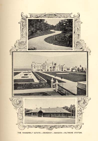
THE VANDERBILT ESTATE--DRIVEWAY--BILTMORE STATION.
Page 53
The Forest Department of the estate has under its charge about 110,000 acres of wood lands, a much larger tract than is usually assigned to any one forester. These wood lands are divided into two distinct parts; the first, containing 10,000 acres, lies in the valley of the French Broad river and is known as the Biltmore Forest; the second part, containing nearly 100,000 acres, lies almost entirely in the mountains, and is known as Pisgah Forest, so called from Mt. Pisgah which has an elevation of over 5,000 feet. These two forests cannot be treated upon the same system. In Biltmore Forest the main object has been to increase the value of the growing stock, to protect the more valuable from the faster growing species, and gradually to secure an even aged wood, which is important, as it facilitates the management of the forests in a great degree. Before Mr. Vanderbilt bought Biltmore Forest, most of the large timber trees had been cut down, so it was decided, as there was a good sale in fire wood in both Biltmore and Asheville, to grow only trees for fire wood. The forest was composed almost entirely of oak and pine. The pine is a much faster growing tree than the oak, and the oak is the more valuable of the two, hence something had to be done to help along the oaks. This was accomplished by either giving the oaks a start in their youth, by sowing them in distinct groups, or by cutting back the pines when threatening to over-top and kill the oaks. A sufficiently dense covering must be kept at all times, in order that the soil may not deteriorate.
Pisgah Forest has never been lumbered out. Here the timber has reached a large size, and the Forest Department is growing only timber trees, as it would not pay to bring fire wood from so great a distance.
Mr. Vanderbilt has bought a band saw mill at Asheville; splash dams will be built on the creeks in Pisgah Forest, and the logs will be splashed into the French Broad river and carried on down to the Mill. The amount of timber which shall be cut in Pisgah Forest each year, and the same holds good for the amount of fire wood in Biltmore Forest, is fixed by what is known as the "sanctioned annual yield." This is the amount of wood that is added to the tree each year, and from this we are able to find the amount of wood added to the whole forest each year. If we cut no more than this our forests will surely not be diminished.
Then too, there has been a great improvement over the usual methods of lumbering. Every tree that is to be cut is selected by the forester; no trees under a certain diameter are taken. The mother trees are left to seed the ground again, which they do most liberally
Page 54
in this climate, but most important of all, the undergrowth is especially looked after. Every tree is felled carefully, and the smallest possible amount of damage is done.
I have only stated here the simplest principles, but by these means the forests of the Estate are improving year, by year.
BILTMORE NURSERY AND ABORETUM.
A little more than six years ago a nursery was established on the alluvial deposits of the Swannanoa river, at Biltmore, for propagating large numbers of native and hardly exotic forest trees and shrubs, and, as this industry has developed into one of the largest and most complete and consistent establishments of its kind, an outline of the progress and results obtained, together with the future plans, may be of general interest.
Up to the time of the founding of the nursery very little was known regarding the capabilities of the soil and climate of the locality. Barring the tangible evidence of the indigenous species and a few foreign plants that were sparingly used about the homes of the residents, the plan of procedure was largely based upon the available meteorological data. That the scope of the undertaking might not be circumscribed by lines falling within the possibilities of the natural surroundings, considerable freedom was exercised in ordering the first consignments of stock plants. Orders were placed with the leading nurseries of the world for woody plants coming within the range of the definition above explained; in fact, everything of this nature that could be procured from the commercial nurseries and likely to thrive in the locality was included.
It will readily be admitted that the first season's work was one of experiment. Every precaution was taken to encourage the plants to produce a well balanced growth and thoroughly ripen the same before the time of killing frosts. Finally, the ground was placed in the best mechanical condition to withstand the effects of winter. With intense interest, every stage of development and effect being carefully recorded, the entire aggregation of plants was watched. The first winter, fortunately, was not severe, and although some losses were sustained, the majority of the species entered upon their second season with increased vigor. On the advent of the second winter the stock could not have been in better condition to withstand the hardships which followed. The winter was very severe, accompanied by several remarkable depressions of the thermometer. With such a test it is evident that the surviving plants will serve as an invaluable criterion to the planter in the mountain district.
Page 55
Having thus gained the key to success, the employees are kept busy propagating the desirable species and varieties, and a glance at the great range of glass, frames and land leads one to believe that the annual output might reach vast and astonishing numbers. Since the erection of the first propagating house, between three and four millions of forest trees and shrubs have been turned over to the planters. In addition to this, at the present writing, nearly two millions of plants are in course of development, and the annual output may now be estimated at something over two millions of plants.
Although the list of species and varieties in cultivation on the nursery is a large one, it is not complete. Many kinds of plants known to science have never been cultivated, and are, consequently, only procurable through the agency of collectors or botanical exchanges. Here again, the nursery, through its paid collectors and generous contributors, is constantly adding rare or little known plants to its collection. Among the extremely rare plants recently introduced into cultivation are two from the State of North Carolina, species which were but imperfectly known to botanical science, namely, the dwarf sumach (Rhus michauxi, Sargent) and the deciduous kalmia (Kalmia cuneata, Michaux).
A pertinent question might arise as to the intrinsic value of many of the plants thus neglected or not in cultivation. A direct answer could not be given at the present time, but their value in pleasing combinations of foliage or flower in landscape planting or home decoration is possible. To the student of certain branches of natural history they have an added charm, and when it is considered that the efforts of the nursery in this respect are preliminary steps towards the establishment of a vast museum of living trees and shrubs, to be called the Biltmore Arboretum, in which will be illustrated examples of every species and sub-species of woody vegetation that will thrive unprotected in the soil and climate of the locality, its future object will be better understood.
To facilitate the compilation of the list of plants to be represented, their identification and subsequent classification necessary for their distribution in the arboretum, a magnificent library and several herbaria (collections of dried plants) have been installed in the nursery buildings as a nucleus for the great undertaking. The library already contains a large number of the masterpieces in botanical literature, and additions will be made as rapidly as suitable works can be procured. Among the herbaria represented is the type collection of Dr. A. W. Chapman, upon which he based his work, the "Flora of the Southern United States." The botanical collectors are now engaged
Page 56
in preparing thousands of botanical specimens illustrating the flora of Western North Carolina, and it is expected to offer these specimens and many others from our vast country, either living or dried, in exchange for material not represented in the present collection.
Although no planting has yet been done on the arboretum, active work has been in progress for some time; the energy being expended in laying out the line and making the necessary clearings. In effect, the arboretum will appear as a line of road traversing the valleys and slopes for a total distance, including several loop roads, of about twelve miles. On either side, and extending back for two hundred feet or more, will be planted the trees and shrubs it is intended to exhibit, first, in isolated specimens, second, in small masses, and third, in bulk. To plant this vast area with suitable specimens and to provide a living blanket to protect and cover the intervening ground and space beneath the spread of the greater trees, it will require possibly more than ten million plants.
Beginning with the first species coming within the classification to be adopted, one may pass along the line and view the ligneous plants of many temperate countries in botanical sequence, at least so far as the peculiarities of soil and exposure will admit of such an arrangement. When the progress of the nursery and aboretum has sufficiently advanced and the proposed plantings have reached characteristic peculiarities, it is expected that the student and lover of plants may find ample field for study and recreation; the planter, the types of beauty appealing to his senses, and the artist, the shades and tints of Flora in her seasons.
FLORA.
The flora of any region includes all the indigenous or native plants, and such foreign species as have been introduced and show their ability to maintain themselves without cultivation. A flora includes flowering or phaenogamous plants as well as flowerless or cryptogamous plants, but only such as grow wild. The specific constitution of a flora depends firstly upon the climate, and secondly upon the geology of a district. A third modifying force is composed of numerous smaller factors of less importance than either of the above; but which in the aggregate amount to a very considerable influence. Among such factors we may enumerate the following:
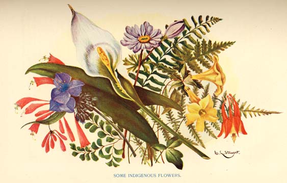
SOME INDIGENOUS FLOWERS.
Page 57
(1) Age and condition of civilization. (2) Density of population. (3) Methods of agriculture. (4) Presence or absence of railroads and navigable streams.
In a climate like ours virgin soils are usually covered by forest growth, which by its varying density shelters a greater number of species of low growing plants than unwooded land shows. As settlements grow older and population denser, the forest gives way to tilled fields and introduced crops which crowd out the native species of lesser economic value. Crops like cotton and corn which require clean cultivation are far more destructive to the native species than are meadows and pastures where native plants have a chance to compete with the introduced grasses. Railroads and navigable rivers help to introduce and spread foreign plants and in so far they are unfavorable to the native flora. The introduced species now in North Carolina come from Europe, Eastern Asia, South America and the Northern Middle States in about the order given.
To most non-scientific persons the general aspect or physiognomy of a flora are of more interest than its specific constitution.
A well watered and varied landscape covering hill and dale, with interspersed groves and green open spots is to all more agreeable than a monotonous stretch of woodland or plain.
The total number of distinct species growing within a circle of say twenty-five miles diameter, in a fertile and well varied district, is from 1000 to 1200, not including microscopic fungi.
The great naturalist, Humboldt, after a long life spent in studying nature in all parts of the globe, wrote: "The character of nature in different regions is most intimately associated with the history of the human race and its mental culture. Climatic relations have to a great extent influenced the character of nations and the degree of gloom or cheerfulness in the dispositions of men. Who does not feel differently affected beneath the shade of a beechen grove, on hills covered by pines, and in a flowering meadow where the breeze murmurs through the trembling foliage of the birch?"
The same author classifies vegetation as directly affecting landscape, and indirectly human character, into sixteen forms representing as many kinds of climate or geological formation. First there is the palm form characteristic of the moist hot climate of the tropics. Associated with this, we usually find the banana which furnishes the chief subsistence of the languid natives of torrid climes. The mallow form--most familiar to us in the swamp hibiscus, the garden, althea and holly-hock, and among economic plants, cotton and okra is characteristic of a warm, temperate, moist climate. The mimosa
Page 58
form--trees with light green, pinnate leaves like the black locust--is characteristic of a climate cooler and drier than that in which the mallow form luxuriates. The pine form, including all cone-bearing evergreens, is characteristic of a cold-temperate climate. The aerial orchid form is tropical as are also large leaved herbaceous plants such as the caladium and arum. The trailing form, or vines, is most common in the climate where the mallow form is at home. Ferns, sedges and grasses seem to possess greater powers of adaptation than any other plant families, but we find them most luxuriant in the torrid zone where grasses become tall, woody bamboos and ferns become trees.
A comprehensive study of nature teaches us that where geological causes do not interfere all forms of organic life, except only mental and moral endowment, increases in its abundance, vigor and perfection from the poles to the equator. In traversing this distance, we find, however, that each zone has its own peculiar beauties and forms of life. In each zone, too, we find a certain co-ordination between the vegetal and animal life, and where men exist their social condition or the state of civilization. In the frigid zone where the somber pine form characterizes vegetation savage and untamable beasts abound, and the mental development of mankind becomes stunted, rigid and gloomy. In the torrid zone where vegetation runs riot, and there are no seasons nor apparent changes of foliage during growth, we find subtle and treacherous wild beasts like the panther. Here humans seem to become cruel as the beasts and as ungovernable as the unreclaimable forests and jungles among which they live. In the temperate zone with its succession of seasons, its deciduous flora and flowery meadows, we find native the teachable animals and the most advanced nations of men.
In the temperate zone geological causes affect the composition of the native flora and the characters of the animals and men which inhabit therein much more powerfully than seems to be the case in either the frigid or torrid zones where climate is all powerful. In the temperate zone where ever we find an arid or barren soil there we find also the more puny animals and men with minds and characters as meagre as their lands.
The moral of all this is, that in seeking a new home, we should consider carefully the unmodifiable factors of climate, geology and locality as shown at least in part by the nature of the indigenous flora.
The State of North Carolina lies between the parallels 33° 50′ and 36° 33′ of north latitude. Its eastern side, 187¼ miles long, is washed by the Atlantic Ocean; its furtherest western extension is
Page 59
503¼ miles inland, the average elevation above the sea level is 640 feet. The highest point is Mitchell's Peak, 6,888 feet. The total area is 52,286 square miles, of which 3,620 square miles are water, and 48,666 square miles land. Climatically, about two-thirds of the State belongs to the northern or temperate type, and the remainder to the southern or sub-tropical type. The State is divided by geological causes into three well-marked districts each having a distinct and different flora. The Coastal Plain region consists of a low, sandy plain of about 150 miles in width, which in comparatively recent times, geologically speaking, has emerged from the sea. Extensive swamps fringe the coast along its whole extent.
The long leaf or southern pine,--Pinus Australis, Mx. is the predominant growth, with the loblolly pine,--Pinus taeda, Mx. and scrub oak Quercus Catesbaei as secondary factors. The herbaceous growth is chiefly wire grass,--Aristida sticta, Mx. and A. purpurea, Mx. Plants of the composite or aster family abound in their seasons, the most common genera being Chrysopsis, Silphium, Aster, Peterocaulon, Helianthus and Liatris. Leguminous plants, chiefly Lupinus, Tephrosia and Stylosanthes abound, but as a whole the drier portion of this region is very poor in species. Along streams, "branches" as they are called, we find a more luxuriant growth. Here, in addition to the above species, we find among trees and shrubs oaks of many species, Sour Gum, Nyssa aquatica L.; Sweet Bay, Gordonia Lasianthus, L; and its close relative Stuartia Virginiea, Cav.--both of which belong to the camellia and tea family. The "he-huckleberry," Cyrilla racemiflora, Walt. abounds and the great bay, Magnolia Grandiflora, L. comes almost to the Cape Fear river.
The palmettos, Sabal Palmetto, R. & S. and S. Adansonii, Guerns. come as far North as the Cape Fear river. Among under-shrubs, the most common genera are the blue-berries, Vaccinium and Gaylussacia; stagger bushes, Andromeda; sumachs and related genera; the spice bush, Clethra; button bush, Cephalanthus; yopon, Ilex; alder, Alnus; pepper bush, Itea, and Jersey tea, Ceanothus. Among the climbing vines, we find in profusion the grape Vitis, four species; Smilax, seven species; Clematis, two species; Virginia creeper, trumpet flower, Tecoma; cross vine, Bignonia; Carolina jessamine; wild ginger, Decumaria; and passion flower, Passiflora incaranta. L. The southern cane grasses, Arundinaria gig antea and A. tecta cover the banks of streams to the nearly complete exclusion of other species of this family.
In the swamps the prevailing trees are the bald cypress Taxodium distichum, Rich. and white cedar, Cupressus thyoides, L. Along
Page 60
the coast, live oak Quercus virens, L. occurs. All of these trees within the influence of tide water are apt to be covered by the abundant festoons of the southern long moss, Tillandsia usneoides, L. which is not a moss at all, but an epiphytic plant closely related to the pine apple and to the aerial orchids of the torrid zone. We find in wet and boggy situations Saggitaria, Aletris, Tofieldia, Zigadenus, Lachnanthes, Pleea, Xyris, and the very rare spoon-flower, Xanthosma saggitifolia, Schott. Here also we find quite a variety of interesting carnivorous plants. The most celebrated of these is the Venus fly-trap, Dioneae muscipula, Ellis. This does not occur north of the Neuse river nor much below the southern boundary of the State. It is most abundant around Wilmington, but the recent extensive development of truck farming in that neighborhood threatens the speedy annihilation of this plant. Besides Dioneae we find five species of carnivorous pitcher plants, viz. Sarracenia rubra, Walt.; S. variolaris, Mx.; S. flava, L.; S. purpurea, L.; and a doubtful species, S. Drommondii, Croom, near the South Carolina line. There are also four species of sundew, Drosera filiformis, Raf; D. longifolia, L.; D. rotundifolia L.; and D. brevifolia, Ph.; Pinguicula lutea, Walt; and P. elatior, Mx. together with the closely related bladderworts, Utricularia inflata, Walt; U. vulgaris, L; U. subulata, L. and U. cornuta. Mx. complete the list of carnivorous or insect eating plants found in this district. In like places we find a great abundance of bull-rushes, Juncus, 10 species; cat-tails, 2 species; sedges, including about 18 genera and 110 species. Of grasses, besides the canes, Paspalum, 10 species; Panicum, 25 to 27 species; Uniola, 3 species; Andropogon, 7 species; Erianthus, 2 species; Elymus, 2 species; Arisdidia, 5 to 6 species; Sporobolus, 3 species; Leersia, 4 species and Zizania, 2 species.
Of the flora of the Piedmont Plateau region we shall write more briefly. The region has been long settled and more thoroughly cultivated than either of the others, and the result is that the original indigenous growth has been here largely destroyed or supplanted by introduced species. This is now a country of rolling red clay uplands whereon all the common plants and crops of the middle states are at home. Cotton, tobacco, grasses and cereal grains are the chief staples. Oaks, hickories and elms are the predominating trees with short leaf pine--Pinus mitis Mx. on the ridges separating the water sheds of different streams. The flora is a mixture of the flora of the eastern and western districts with a very large per cent. of introduced species familiar to dwellers in the middle states and Europe.
The Mountain region of the State includes the foot hills and all the valleys and domes of the Blue Ridge and Smoky mountains.
Page 61
This region has been until comparatively recent date quite inaccessible, and hence the original growth is still everywhere to be seen, though the axe and fire of the lumberman is now only too frequently heard and seen in the land. The predominating forest growth is oaks, hickories, black-walnut, chestnut, cherry, white poplar (Liriodendron), magnolias--five species in the valleys; and white-pine, white spruce, hemlock spruce and balsam fir on the higher peaks. On the middle terraces birches, limes, elms, ashes, maples, and willows complete the very northern forest flora. In this case the high altitude gives us a climate equivalent to that which high latitude gives to more northern States, and the forest growth partakes of the same character. The undergrowth, both shrubby and herbaceous, is however, very different from the corresponding flora of northern climes. Here beneath a characteristically northern forest growth we find a typical southern undergrowth. Besides the gorgeous flowers of the semi-shrubby magnolias, we find in profusion the even more striking bloom of the rhododendrons, of which there are eight native species. Here is the original home of the Rhododendron catawbiense, Mx. the parent of our finest cultivated rhododendrons. Of kalmia or "calico bush" there are three species, and related genera of the Ericaceous family almost too numerous to mention.
Cranberry bogs are frequent and Stuartia pentagyna--a different and less showy species than that found in the coast district--abounds. Spireas of several species; hydrangea, two species, and Viburnum, eight species are very abundant. The service berry--Amelanchier, is much esteemed for its fruit, which is usually obtained by cutting down the tree which here grows 25 to 30 feet high. Among the climbers are grapes, three species; trumpet flower; Virginia creeper; honey-suckle, three species; smilax or green brier, three species; moon seed, (Menispermum); poison sumach; Decumaria barbata, L.; wild ginger or dutchman's pipe, Aristolochia sipho, L'Her, and Virgin's bower Clematis, two species.
The herbaceous growth is particularly rich in composite plants. Nearly all the northern and most of the southern species of aster and solidago, or golden rod, abound. In early summer travelers by railroad often pass for miles through lands thickly covered by the bright yellow flowers of Senecio aureus, L. var. tomentosus, Mx. supplanted later in the season by Bidens and Coreopsis. In cool moist spots violets abound in great profusion. Fifteen species are found, all of which grow to an unusual size. On rocky cliffs we find plants of the saxifrage family every where. The most common genera are
Page 62
Saxifriga, five species; Astilbe; Heuchera, five species; Tiarella and Mitella. The pink family is represented by Silene, five species; Alsine, three species; Spergula and Paronychia. The beautiful evergreen, and round leaved, Galax aphylla, L. is fairly common. The long lost and much sought for plant Shortia galacifolia, Gray, has been recently found in several places, but has now been nearly extirpated by the rapacity of collectors. Lily of the valley; terrestrial orchids, Lilium, three species; Trillium, five species; Acorus, Orontium, and Arisaema are all very common. The partridge berry, Mitchellia; and liver leaf, Hepatica with various grasses and ferns form the ground carpet.
At the cryptogamic flora of the State, we must only glance. Of ferns our flora numbers 38 to 40 species. Ground pine, (Lycopodium,) ten species; liver-worts, 70 to 75 species; mossess, about 200 species; lichens, about 220 species; algae and sea weeds, about 50 species; fungi, 2,500 species, of which nearly 100 species are edible mushrooms.
The total number of species of plants recorded from this State is about 5,500, but as the cryptogams have not been very exhaustively investigated, it is likely that the number of species will eventually reach over 6,000.
No State in the Union, nor any country of similar area anywhere, can show a more varied flora than North Carolina, nor one which contains a greater number of indigenous plants of high economic value. From early colonial days, North Carolina has been the chief scource of the yellow pine lumber and naval stores consumed in or exported from the United States. This business has now, however, passed to virgin fields further south, and where the axe of the woodman and hacker of turpentine gatherer erstwhile resounded, we now see the plow and the pruning knife of the fruit grower and truck farmer. Our swamp lands still yield largely of cedar, cypress, gum and similar valuable timbers. While our mountains contain vast quantities of the most valuable hard wood suitable for furniture and cabinet work. This State has for over twenty years furnished the main supply of the sweet chestnuts sold in the stores--the spontaneous product of our mountain slopes.
For decades, North Carolina has been the chief source of the national supply of crude vegetable drugs. This industry has now reached an extension and volume, the importance of which but few outside the medical and pharmaceutical professions appreciate. The number of distinct species of important medical plants found growing wild in this State is about seven hundred.
Page 63
We have already spoken of the influence of geological formation on the superimposed plant growth. A few words on the value of indigenous plants as indicators of the agricultural worth of the underlying soil will close this chapter. Plants, unlike animals, are unable to change their habitations and therefore in the course of time in accordance with the law of "survival of the fittest," each species becomes specially adapted to one kind of soil. The species which do not adapt themselves fail to hold their ground and are supplanted by the species which do. Hence the surviving and "fittest" species become trustworthy indicators of the nature of the soil--if we know on what kind of soil the species thrives best, or for which it is specially adapted.
White oaks, hickories and elms and our most common northern shade trees, thrive best on a rich, strong clay upland soil. Such soil is best adapted, agriculturally, for grasses and cereal grains. The red oaks indicate a rather lighter and drier and poorer soil, better adapted for fruit. Walnut, gum and tulip trees thrive best on a rich moist soil, such as river bottoms. The buckeye, especially the sweet species, (Aesculus Pavia) indicates a soil rich in lime or marl. The chestnut will not grow on soil containing much lime, but luxuriates in a potash rich soil. The dog-wood, black jack and scrub oak, indicate a very poor, stony or sandy soil of little agricultural value except for early truck farming and peach and grape growing for northern markets.
Among herbaceous plants, the cockle burs and Jamestown weed indicate rich moist soil, and the rag weed indicates a poor one. Asters indicate a thin, dry soil, whereas sun-flowers and most goldenrods abound only on fertile lands. Sedges and ferns grow only upon soil too wet for agricultural purposes. "Broom sedges," grasses, Andropogon, indicate a much worn soil lacking in potash, while the Aristidias, or wire grasses indicate one naturally deficient in all the elements of plant growth. The Malvas, Hibiscus and all plants of the mallow, or cotton, family indicate a moist soil.
FAUNA.
The native living things belonging to a given region are called its Fauna and Flora, the former including all animals and the latter all plants. It is the Fauna of North Carolina that will now be briefly considered.
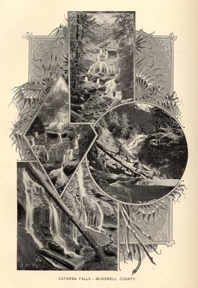
CATAWBA FALLS--MCDOWELL COUNTY.
Page 64
The distribution of North American land animals has been ably discussed by Dr. J. A. Allen, in the Bulletin, of the American Museum of Natural History, of New York, Vol. 4, 1892, and also by Dr. C. Hart Merriam, of the United States Department of Agriculture, in the publications of that department (see particularly, Year Book of the Department of Agriculture, 1894.)
The classification adopted by Dr. Allen, for faunal areas, is more elaborate than is necessary for use here, and therefore the division of the North American Continent into primary "life zones," by Dr. Merriam, will be the system employed. They are as follows:
The Artic Zone, lying north of the northern limit of tree growth, the land of the Polar Bear, Artic Fox and Reindeer and the Hudsonian Zone, the home of the great Moose and embracing within its limits the upper part of the vast spruce forests of Labrador and crossing the continent to Alaska, are not represented in this State.
The Canadian Zone takes in the northern part of New England, New Brunswick, Quebec and northern Ontario, the southern part of Newfoundland, and extends across the continent to the Valley of the Yukon, in Alaska and, in spite of our southern situation, the fauna of this zone occurs in North Carolina along the crests of the Blue Ridge and the Great Smoky Mountains. The boundaries of this division with us are, of course, determined by the altitude, the lower limit being about 4,500 feet, (see Brewster, on Birds of Western North Carolina, "Auk," Jan. 1886). Of animals belonging to this fauna and having a range to the far north but occurring in this State may be mentioned--the Canada Lynx (Lynx canadensis) and the Red Squirrel (Sciurus hudsonius), the "Boomer" of our mountains. Among the summer birds are the Carolina Snow bird (Junco hyemalis carolinensis), Mountain Solitary Vireo (Vireo solitarius alticola), Blackburnian Warbler (Dendroica blackburniae), Winter Wren (Troglodytes hiemalis), Redbreasted Nuthatch (Sitta canadensis), &c. It is a remarkable feature of North Carolina animal life that a stretch of country lying between the parallels 34° and 37°, as this State does, should possess among its native animals and birds species that belong naturally to a fauna characteristic of the great forests of Canada and that reaches on its northern border to beyond 60° of north latitude. But to this great degree does the altitude of our mountain peaks modify their southern position. This is the region of such northern trees as the firs and spruces, forests of which cap the towering peaks of these North Carolina mountain chains.
With its upper limit coincident with the lower limit of the Canadian, we come next to the transition zone--the Alleghanian Fauna
Page 65
of Dr. Allen. This seems to be a region in which a mingling of southern and northern forms of life is evident, although its characteristic life is sufficiently well defined to admit of its recognition as a faunal division. Among the notable animals belonging to this fauna was, in olden times, the Elk or Wapiti (Cervus canadensis), noble herds of which ranged the mountain sides and valleys of the western region of the old North State. But, alas, that was long ago, and unless reintroduced and afterwards protected, they will never range those mountain sides again. Here also we find that queer animal, the Star-nosed Mole, which is found even to the northern limit of the Canadian Zone. Among the summer birds are Wilson's Thrush (Turdus fuscescens), Yellow-throated Vireo (Vireo flavifrons), Rose-breasted Grosbeak (Habia ludoviciana). We also find such southern species of birds as Orioles, Catbird (Galeoscoptes carolinensis), Brown Thrasher (Harporhynchus rufus) and such animals as common Mole (Scalops aquaticus) and Cotton-tail Rabbit (Lepus sylvaticus) mingling with the above. The lower limit of this fauna Mr. Brewster places at about 2,500 feet, but it must be understood that the boundaries of none of these divisions are, or can be, very sharply defined, as there is necessarily a great overlapping of species from one to the other, and this overlapping and mixing of the life belonging to one zone into that of another varies very much with individual localities. That celebrated weather prophet, the Woodchuck or Ground Hog belongs here and is by no means uncommon in suitable localities in western North Carolina.
Next we come to the zone that covers a greater amount of the State's area than any other--namely, the Carolinian. This is not a projecting spur from more northerly zones running down into the State only by way of the mountain ranges, as were the two former, but is more especially a fauna of the Piedmont Plateau region and of the western border of the Coastal Plain region of the State. It is, as its name implies, distinctively Carolinian in its character. The Opossum (Didelphys virginianus), the Gray Fox (Urocyon cinereoargentatus), the Fox Squirrel (Sciurus niger), are animals characteristic of this division, and among the birds we find such well known southern forms as Carolina Wren (Thryothorus ludovicianus), Cardinal or Red-bird (Cardinalis cardinalis,) Gnatcatcher (Polioplila caerulea), Mocking bird (Mimus polyglottos). The Molly Cotton-tail (Lepus sylvaticus), is a common and inextinguishable characteristic feature here, and pretty much the same might be said of our chipper and lively little Bob White--our Partridge, in spite of what the "quail" hunters call him.
Page 66
Beginning near the coast at the extreme northeast corner of the State, running southward and westward and gradually widening on its way down as latitude modifies altitude we find a strip of country containing life features much more tropical in character than those previously considered. This is the northern corner of the Austro-riparian or Louisianian Zone. This zone includes the whole of the south Atlantic coast region, a wide expanse of country bordering the northern shores of the Gulf of Mexico and the whole of Florida with the exception of its extreme southern coast line. The Alligator (Alligator mississippiensis) now begins to show himself and is plentiful and attains a large size along the southern half of our tide-water region. Several species of the smaller rodents belong to this zone, notably the Cotton Rat, Rice-field Rat and Wood Rat, and the Marsh Rabbit (Lepus palustris) reaches the northern limit of his range on the coast marshes of North Carolina. The peculiar Big-eared Bat is found associated with the above, and the change in bird life is as noticeable as that in mammals. The Chuck-will's widow takes the place of the Whippoorwill and formerly this zone received added brilliance in North Carolina by the presence of the gaudy and noisy Carolina Parroquet (Conurus carolinensis), now, unfortunately, almost confined to southern Florida. The great and rare Ivory-billed Woodpecker was also a former example of this life division, found on our coast at least as far north as Beaufort Harbor, but his day has also, apparently, gone by. Those interesting creatures the Ground and Diamond Rattlesnakes also come in here, and the Cotton-mouth Water Moccason (Agkistrodon piscivorus) is their equal as an awe-inspiring Austro-riparian representative. Siren and Amphiuma are two water animals quite characteristic of this zone, and their bites, like those of hundreds of other and equally totally harmless creatures, are regarded as deadly poisonous. The great Brown Pelican and the swift and graceful Swallow-tailed Kite, are both features of this division of animal life, and the Black Vulture, that very useful but not beautiful bird that seems equally at home in the pure ether a thousand fathoms above the earth, or in the dark and odorous interior of a dead mule, is always with us.
It is a matter of interest, although having no bearing on present day fauna, that the huge Mastodon once roamed our fields and forests and the great prehistoric elephant (Elephas americanus,) nearly allied to the "mountainous Mammoth" of the Old World, was also a North Carolinian in days gone by. So, also were many other rare and interesting animals, now only known by their fossil remains. Loose bones of extinct whales, in some cases a good part of the entire
Page 67
skeleton, have been found in numerous localities, and in Halifax county some huge fragments of the skull were sufficiently entire to give a good idea of the size of the complete animal. This whale was identified by Professor Cope and by him named Mesoteras Kerrianus in honor of its discoverer, Professor W. C. Kerr, late State Geologist. Its length was estimated at 80 feet, the largest extinct baleen whale ever found. Another well known fossil whale lay across the bed of a creek in the same county and was used, during low water, as a footlog.
From the foregoing brief sketch it will be seen how widely varied is the character of the animal life belonging to North Carolina. As Dr. Merriam so truthfully says in his report as head of the Division of Ornithology and Mammalogy in the Year Book of the United States Department of Agriculture for 1894:
"An accurate knowledge of the areas which, by virtue of their climatic conditions, are fitted for the cultivation of particular crops is of such obvious importance to agriculture that the Division of Ornithology and Mammalogy was early led to make a special study of the geographic distribution of the land animals and plants of North America, for the boundaries inhabited by native species were believed to coincide with those suited to the production of particular kinds of fruit, grain and tubers, and for the rearing of particular breeds of domesticated animals.
"When the boundaries and life zones and areas are accurately mapped, the agriculturist need only ascertain the faunal area to which a particular crop or garden plant of limited range belongs in order to know beforehand just where it may be introduced with every prospect of success, soil and other local modifying influences being suitable; and in the case of weeds and of injurious and beneficial mammals, birds and insects, he would know what kinds were to be looked for in his immediate vicinity, and could prepare in advance for noxious species that from time to time suddenly extend their range. * * * * In short a knowledge of the natural life areas of the United States and of their distinctive species and crops, would enable our farmers and fruit growers to select the products best adapted to their localities, and would help them in their battle with harmful species."
Such being the case, where, indeed, is the limit to the agricultural possibilities of a State in which the native animal life includes such widely different forms as, say, the Canada Lynx, with a range almost reaching the Artic Sea, on the one hand, and on the other, the great Florida Alligator, whose center of abundance is well within the limits of tropical America, the land of the cocoanut, the lemon and the orange.
Page 68
GEOLOGY.
Even the casual observer who travels across the State of North Carolina from its eastern shores to its western boundary will see that when he has gone about half way he passes from a region which is very level or gently undulating, and the surface of which is covered with sand and loam soils from which hard rocks are entirely absent, to another, the surface of which becomes more and more hilly until it culminates in mountains in the western portion of the State, and the soil of which is more or less mingled with the hard granitic and slaty rocks from which they have been formed.
A little more traveling in this region will be sufficient to indicate that the geologic formations of the eastern half of the State, which has been designated as the Coastal Plain Region, are radically different and much younger than that of the western half, embracing the Piedmont Plateau and Mountain regions. The boundary line which separates these two great geologic divisions extends from near Weldon on the north by way of Raleigh to near Wadesboro on the southwest.
In age instead of being contiguous the areas are widely separated; the formation covering the Coastal Plain being one of the most recent, while those of the Piedmont Plateau (excepting the limited red sandstone or Trias areas) being among the oldest.
The accompanying sketch map indicates in a general way the limits of these two general areas, and the minor geologic groups of the Piedmont Plateau and Mountain regions. Formations of the Coastal Plain are shown as a unit for the reason that notwithstanding that they belong to at least five successive geologic periods, yet being spread one directly on top of the other it is impossible to indicate them individually on a map of this character.
The Coastal Plain region, as indicated above, along its eastern boarders contains the sounds, bays, the sand dunes and ridges, the swamps and marshes and other characteristics of a seashore region. Further inland it is generally level, and has more of the upland and less of the marsh. Toward its western boundary the swamps nearly or quite disappear, the upland predominates, the surface becomes more undulating and even hilly in places, and soils which further eastward were composed of fine sand and silt, along the western border of this region contains a larger proportion of coarse sand or gravel mingled with clay.
Along the banks of such rivers as the Cape Fear and Roanoke where these streams have cut down through the surface and left the
[ Link ]
MAP OF
NORTH CAROLINA
SHOWING DISTRIBUTION OF
PRINCIPAL GEOLOGICAL FORMATION.
Page 69
high steep bluffs the material composing half a dozen geologic formations are exposed to view, the oldest, the Potomac gravel, sands and clays, lying at the bottom on the irregular surface of granite and slates; cretaceous sands and clays; tertiary (eocene and miocene) marls and clays; the Lafayette yellow and brownish sands and loams; and the Columbia sands, gravels and clays, lying one successively above the other--the last of these, the youngest of all, being on top. Along the western border of these Coastal Plain formations occasional outcrops of hard granites and slates are exposed along the beds of streams where the once overlying sands and clays have been washed away, but besides these no large masses of hard rock are to be found in this region other than the limited beds of limestone which are exposed along the banks of the streams in a number of eastern counties, epecially in the southern portion of the state.
In these southeastern counties, the limestone is exposed at the surface along the banks of the streams in a large number of localities, and this rock may be used for the making of lime, macadamizing roads, and in some cases it will do for building purposes. In a few places, as in the neighborhood of Castle Haynes, New Hanover county, this limestone contains numerous phosphate pebbles and over considerable areas the limestone has dissolved away and left the phosphate pebble in form of phosphate gravel, which has been worked for a number of years, and can be worked with equal success on the adjoining Hermitage property. Other phosphate deposits have been found in Duplin, Pender, Onslow and Brunswick counties.
In the Piedmont Plateau region, the geology is much more complex. There are, however, two narrow belts of comparatively recent rocks; the triasic or red sandstone, the general outlines and location of which are best indicated on the accompanying map. The more eastern of these two belts, extending from Oxford, in Granville county, across the state through portions of Wake, Durham, Chatham, Moore, Montgomery, Richmond and Anson counties, has a maximum width of about 15 miles. In this formation are found the coal deposits of Moore and Chatham counties and the valuable beds of red, gray and brown sand-stone, which are described more fully under head coal and of building stone. The more western of these two belts is much more limited in area, extending from the Virginia line across portions of Rockingham and Stokes counties, and having a maximum width of four or five miles.
The older crystaline rocks, (granites, gneisses and slates), extend in belts of varying width and length obliquely across the state having a general northeast and southwest course. The most marked of these
Page 70
is the great slate belt which extends across from Virginia, through Person, Orange, Chatham, Randolph, Stanley, Union and adjoining counties. It has a maximum width of some forty miles; the rocks are everywhere folded or broken, and titled; and are penetrated by numerous dikes and veins; many of the latter being impregnated with gold bearing ores. And in the western part of this slate belt, especially in Davidson and Cabarrus counties, these gold ores have associated with them ores of silver, lead, zinc and copper. The region is one of hills and valleys and rapid streams, along which have been developed numerous excellent water powers. Just west of this slate belt, lies a belt of granite and other kindred rocks; extending across the state; having a width varying from ten to twenty miles. These rocks are also penetrated by numerous veins which carry gold bearing ores; and in some cases, especially in Guilford county, these are also highly impregnated with copper ores, and in some places this granite belt, as well as the slate belt, contains valuable deposits of iron ore. Lying west of this granite belt and extending from it to the foot hills of the Blue Ridge, is a large area, the rocks of which are of gneisses and granites, with here and there more limited belts of slate. The rocks are very old, belonging probably to the Archaen age. They are often deeply decayed, forming fertile loam soils. In some places, valuable and extensive beds of granite are to be found. At intervals throughout the entire region the rocks are penetrated by quartz veins which contain in many places gold bearing ores; the more noted gold bearing areas of this region being those in eastern Catawba; about the South Mountains in Burke, McDowell and Rutherford counties, and in the Western part of Caldwell county. There are also in this region valuable deposits of iron; notably those in Stokes, Gaston, Macon and Catawba counties. This region is exceedingly hilly, being penetrated by the Brushy mountains, south of the Yadkin, and the South mountains, south of the Catawba river.
The geology of the mountain region is perhaps fully as complicated as that of the Piedmont Plateau. Over the larger part of the region are to be found the older crystalline rocks, greatly folded and turned on their edges; and they contain at intervals valuable deposits of iron ore: notably magnetic iron ores in the region about Cranberry in Mitchell county; in Ashe and Madison counties and in a number of places these rocks are also penetrated by veins carrying gold, silver and copper bearing ores. Along the line of the Blue Ridge and again along the line of the Great Smoky mountains are narrower belts of rocks, belonging to what has been designated the Ocoee period.
Page 71
The age of these is not known, though it is certain that these rocks are much younger than the slates and gneisses which have just been described. These rocks of the Ocoee formation contain also in places deposits of minerals, especially the marbles and brown iron ores of Cherokee county. In this region, as in the Piedmont Plateau, the rocks are decayed to a considerable depth, thus producing deep soils which vary in character from sandy and gravelly loam to those containing a large proportion of clay in regions where the rock itself contains large proportion of hornblende. These soils are porous and fertile, and for the most part on the slopes of the mountains are still covered with virgin forests.
ALPHABETICAL LIST OF NATIVE MINERALS.
- 1 Actinolite.
- 2 Albite.
- 3 Allanite.
- 4 Altaite.
- 5 Alunogen.
- 6 Anatase.
- 7 Andesite.
- 8 Anglesite.
- 9 Anthophyllite.
- 10 Anthracite coal.
- 11 Antimony.
- 12 Apatite.
- 13 Arsenopyrite.
- 14 Arfvedsonite.
- 15 Argentite.
- 16 Asbestos.
- 17 Auerlite.
- 18 Augite.
- 19 Autunite.
- 20 Azurite.
- 21 Barite.
- 22 Barnhardtite.
- 23 Beryl.
- 24 Biotite.
- 25 Bismite.
- 26 Bismutite.
- 27 Bismuthinite.
- 28 Bitumenous coal.
- 29 Bornite.
- 30 Breunnerite.
- 31 Bronzite.
- 32 Brookite.
- 33 Calamine.
- 34 Calcite.
- 35 Cassiterite.
- 36 Cerusite.
- 37 Cerargyrite.
- 38 Cerolite.
- 39 Chalcopyrite.
- 40 Chalcocite.
- 41 Chrysocolla.
- 42 Chromite.
- 43 Chlorite.
- 44 Chloritoid.
- 45 Chrysolite.
- 46 Chalcanthite.
- 47 Chalcedony.
- 48 Columbite.
- 49 Copper.
- 50 Corundum.
- 51 Covellite.
- 52 Crocidolite.
- 53 Crocoite.
- 54 Cullasageeite.
- 55 Cuprite.
- 56 Cuprosheelite.
- 57 Cyanite.
- 58 Cyrtolite.
- 59 Deweylite.
- 60 Diamond.
Page 72 - 61 Diaspore.
- 62 Dolomite.
- 63 Dudleyite.
- 64 Dufrenite.
- 65 Enstatite.
- 66 Epidote.
- 67 Fergusonite.
- 68 Fibrolite.
- 69 Fluorite.
- 70 Garnet.
- 71 Galena.
- 72 Gahnite.
- 73 Genthite.
- 74 Glauconite.
- 75 Gold.
- 76 Goslarite.
- 77 Göthite.
- 78 Graphite.
- 79 Gummite.
- 80 Halite.
- 81 Halloysite.
- 82 Hatchettolite.
- 83 Hematite.
- 84 Hiddenite.
- 85 Hyalite.
- 86 Hydrofergusonite.
- 87 Ilmenite.
- 88 Iron. (meteoric)
- 89 Itacolumyte.
- 90 Jefferisite.
- 91 Kammererite (Var. penninite)
- 92 Kaolinite.
- 93 Kerrite.
- 94 Labradorite.
- 95 Lazulite.
- 96 Leucopyrite.
- 97 Limonite.
- 98 Lucasite.
- 99 Maconite.
- 100 Magnesite.
- 101 Magnetite.
- 102 Malachite.
- 103 Marcasite.
- 104 Margarite.
- 105 Marmolite.
- 106 Martite.
- 107 Melanterite.
- 108 Melaconite.
- 109 Molybdenite.
- 110 Molybdite.
- 111 Monazite.
- 112 Montanite.
- 113 Montmorillonite.
- 114 Muscovite.
- 115 Nagyagite.
- 116 Niter.
- 117 Octehedrite.
- 118 Oligoclase.
- 119 Olivenite.
- 120 Orthoclase.
- 121 Opal.
- 122 Penninite.
- 123 Phlogopite.
- 124 Phosphuranylite.
- 125 Picrolite.
- 126 Pleonaste.
- 127 Polycrase.
- 128 Prochlorite.
- 129 Psilomelane.
- 130 Pseudomalachite.
- 131 Pyrite.
- 132 Pyromorphite.
- 133 Pyrolusite.
- 134 Pyrophyllite.
- 135 Pyrrhotite.
- 136 Pyroxene.
- 137 Quartz.
- 138 Rhodochrosite.
- 139 Rogersite.
- 140 Rutherfordite.
- 141 Rutile.
- 142 Samarskite.
- 143 Saponite.
- 144 Scheelite.
- 145 Schreibersite.
- 146 Scorodite.
- 147 Serpentine.
- 148 Siderite.
- 149 Silver.
- 150 Sillimanite.
- 151 Smaragdite.
- 152 Sphalerite.
- 153 Sperrylite.
- 154 Spodumene.
- 155 Spinel.
- 156 Staurolite.
- 157 Steatite.
- 158 Stibnite.
- 159 Stilbite.
- 160 Stolzite.
- 161 Succinite (amber)
- 162 Sulphur.
- 163 Talc.
- 164 Tantalite.
- 165 Tetradymite.
- 166 Tetrahedrite.
- 167 Thorite.
- 168 Thulite.
- 169 Titanite.
- 170 Tourmaline.
- 171 Tremolite.
- 172 Troilite.
- 173 Uraninite.
- 174 Uranotil.
- 175 Vermiculite.
- 176 Vivianite.
- 177 Wad.
- 178 Wavellite.
- 179 Willcoxite.
- 180 Wolframite.
- 181 Xanthitane.
- 182 Xenotime.
- 183 Zircon.
- 184 Zoisite.
Page 73
GOLD, SILVER AND COPPER.
The total amount of the precious metals produced by the mines of North Carolina up to the end of 1894 is estimated at approximately $24,000,000.00. The production for the past ten years is ascertained to be $1,295,676. By far the greater proportion of this is gold, the amount of silver being insignificant.
The area of the productive gold region in the State embraces some 8,000 to 10,000 square miles of the middle and western counties. It may be divided into six obscurely defined belts:
- 1. The Eastern Belt.
- 2. The Slate Belt.
- 3. The Igneous Belt.
- 4. The Kings Mountain Belt.
- 5. The South Mountain Belt.
- 6. The Mines West of the Blue Ridge.
The gold occurs in placer deposits, in quartz fissure veins, and as impregnations in the country schists and slates.
The gold is not uniformly distributed in the ore bodies; both the veins and schists having "chimneys" or "shoots" in which the gold is concentrated, leaving the intermediate parts relatively poor. The shoots have a pitch of their own in the ore body.
(1). The Eastern Belt includes the counties of Warren, Halifax, Franklin and Nash. The present known area over which the mines are distributed is not less than 300 square miles. The country rocks are diorite, chloritic schists, and gneiss. The district is characterized by a great abundance of narrow quartz veinlets from a "line" to 1½ inches in thickness. The gold appears originally to have been in these narrow seems, which have been broken down in the process of weathering, the fragments being widely distributed through the soil, and generally most abundant on the bed rock, fifteen to twenty-five feet below the surface, or in favored sinks or channels.
Among the more noted veins of the district are: the Portis, located near Ransom's Bridge, in Franklin county. The operations consisted of surface sluicing and hydraulicking the surface soil to a depth of 5 to 30 feet. The upper decomposed rock layer is every-where auriferous to some extent. There are two main zones of ore, nearly at right angles, each about 9 feet in total width, consisting of reticulated quartz veins in diorite. Five miles southeast of the Portis is the Mann-Arrington mine. The ore body consists of quartz lenses up to 12 inches in thickness interlaminated in the schists. The depth of the shaft is 108 feet. Other mines in this belt are the Arrington, Thomas, Kearney, Taylor, Davis and Conyers.
Page 74
(2). The Slate Belt is an area of metamorphic slates and schists extending in a general southwesterly direction across the central part of the State, varying in width from 8 to 50 miles. The rocks are argillaceous, sericitic and chloritic, metamorphosed slates and schists, sedimentary pre Jura-trias slates, and ancient devitrified volcanic rocks.
The copper ores of Granville and Person counties, are at times auriferous, and, although the contents of the precious metals is insignificant, they may form an important item of profit in a well conducted metallurgical treatment of these ores for copper. Assays* * In all assays of this article gold and silver are calculated at their coining rates, usually gold, $20.67 and silver, $1.29, per Troy ounce.
show from $2.50 to $10.75 per ton in gold and silver, and from 20 to 48% of copper.
This copper belt is approximately ten miles in length. The ore is chiefly chalcocite and bornite in quartz, and occurs in lenticular veins, from a few inches to 14 feet in thickness. The principal veins are the Blue Wing, Holloway, Mastodon, Buckeye, Pool, Gillis, Copper World and Yancey.
The gold mines in Moore county are situated in the northern and western parts. At the Bell mine, eight miles northwest of Carthage, the mineralized country schists constitute the ore, which exists in several narrow belts containing siliceous seams from 1/8 to 4 inches in thickness. The entire vein matter averaging 4 feet, is estimated to run $12.00 per ton. The Burns mine is eleven miles west of Carthage. The silicified sericitic and chloritic schists are here filled with quartz stringers and lenticles, both the quartz and portions of the schists being auriferous. Mining is done in large open cuts, 20 to 100 feet wide, to a depth of about 50 feet. The average yield of the ore is said to be $2.50 to $3.00 per ton, in free gold. The Cagle and Clegg mines are near the Burns, and the nature and character of the ores are similar.
The Hoover Hill mine, in Randolph county, is seventeen miles south of High Point. The principal ore body is the so called "Briols" shoot; 12 feet wide and 70 feet long, entered by a shaft 350 feet deep. The ore is worth $8.00 to $10.00 per ton. At the Jones or Keystone mine, eighteen miles southeast of Thomasville, the ore bodies consist of belts of mineralized schists, two of these being 50 and 110 feet wide respectively. The mine is a series of open quarries; the average value of the working ore will not fall under $3.00 per ton, of which about $2.00 is extracted by milling. Other mines
Page 75
in Randolph, are the Loftin, Winningham, Slack, Davis Mountain, Sawyer, Winslow and Uwharie.
The Emmons mine is fifteen miles southeast of Lexington, in Davidson county. The ore body is from three to eight feet thick, and the ore is only slightly auriferous, and has been worked mainly for its copper contents. The main shaft is 416 feet deep on the incline. The Cid mine is 1¼ miles northeast of the Emmons, and has ore similar to it. The shaft is 100 feet deep on the incline. The Silver Hill mine is ten miles southeast from Lexington. The two principal veins are known as the "East" and the "West," are parallel and about 28 feet apart on the outcrop. The gasson was worked for gold. Below the water level, however, the ores become a complex mixture of silver bearing sulphurets, mainly galena and zinc blende. The mine has opened to a depth of 760 feet. Some assays of the ores show:
| CARBONATES | PYRITE | GALENA | |||||
| Gold, per ton . . . . . | $ 8.27 | $ 2.07 | $ 3.10 | $ 10.34 | $ 4.13 | $ 6.20 | $ 4.13 |
| Silver per ton . . . . . | 20.36 | 4.65 | 4.01 | 2.97 | 3.23 | 10.73 | 11.25 |
| $28.63 | $ 6.72 | $ 7.11 | $13.31 | $ 7.36 | $16.93 | $15.38 |
The galena bearing ores show from twelve per cent. to fifty-seven per cent. of lead, and from seven per cent. to thirty-five per cent. of zinc. The Silver Valley mine is five miles northeast of Silver Hill; the character of the ore is almost identical to that of the former. The vein is nearly twenty feet wide at the surface; below, the ore-shoot has a width of five to twelve feet, and consists of alternate bands of ore, slate and quartz, the ore seams being from three to eighteen inches thick. The mine has been opened to one hundred and twenty feet vertical depth. The galena and blende carry from $17.00 to $180.00 per ton of gold and silver, from fifteen per cent. to twenty-five per cent. of lead, and from eleven per cent. to thirty-two per cent. of zinc. These ores have been successfully smelted, using copper ores as a flux. The Welborn mine, two miles west of the Silver Hill, carries similar complex ores. The Conrad Hill mine is six miles east of Lexington. There are two systems of veins, carrying copper, pyrite and gold, in quartz and siderite. The mine has been opened to a maximum depth of four hundred feet, considerable bodies of ore, up to eighteen feet in maximum width, have been exploited and mined. The ore is essentially a copper ore, though it contains some gold.
The Russell mine in Montgomery county, is situated three miles north of Eldorado. The entire slate formation is gold bearing, but
Page 76
only certain belts are sufficiently rich to warrant mining. There are at least six of these belts within a distance of 2,000 feet across the strike. The ore bodies have been exploited and worked chiefly in large open cuts. It is stated that the average "run of mine" ore milled $3.00 per ton. There are streaks from four to five feet wide which went much higher. The Appalachian mine is situated near Eldorado. The ores are similar to those of the Russell. The depth of the last working was 160 feet. The Steel mine is two miles southeast of Eldorado. The ore body varies from nine to twelve feet in thickness, and occasionally rises to twenty feet. The most valuable part of the deposite consists of what is locally called "string veins," narrow seams of ore which run through the mass, more or less parallel to the slates. Some assays show from $20.00 to $100.00 per ton. The Sam Christian mine is twelve miles southwest of Troy. The gold is found in old channels, in gravel from one to three feet in thickness. It is generally in the shape of nuggets from five to one thousand penny weights. The aggregate yield of this mine in the past has been quite large, and may prove of value in the future.
Other mines in Montgomery county are the Beaver Dam, Reynolds, Carter, Bright, Ophir, Dry Hollow, Deep Flat, Bunnell Mountain, Worth, &c.
The Crawford mine in Stanly county is four miles northeast of Albemarle. It is a placer deposit of comparatively recent discovery. The gravel bed is from one-half to two feet in thickness, overlaid by two to four feet of soil. The width of the channel is about two hundred and fifty feet. During 1895 two notable nuggets were found here, weighing eight and a half and ten pounds respectively.
The Parker mine is situated at New London. Numberless auriferous quartz stringer veins, from one to eighteen inches wide, intersect the country rock in all directions. The principal yield of gold has been from the ancient gravel channels. The aggregate production is estimated at $200,000.00.
Other mines in Stanley county are the Crowell, Barringer, Haithcock, Hearne, Lowder, &c.
Rowan and Cabarrus counties may be treated together. The Gold Hill group of mines is situated about fourteen miles southeast of Salisbury. This is one of the most noted mining districts in the State. The group comprises a number of mines situated in a belt of auriferous schists, nearly one and a-half miles long and two-thirds mile wide, in the southeast corner of Rowan county, extending into Cabarrus on the south, and Stanly on the east. The character of the ore bodies is that common to the "Slate belt" elsewhere. The
Page 77
schists are impregnated, over certain widths, with auriferous sulphurets, accompanied by lenticuler stringers of quartz. There are at least ten well defined veins in the district. The Randolph, the most prominent of the ten veins under discussion, has been worked for a linear distance of one thousand five hundred feet, and to a depth of seven hundred and eighty feet. The width of the ore shoots is stated to be from six inches to seven feet. Some indication of the range of values is given in the following assays:
| Gold, per ton . . . . . | $25.84 | $4.14 | $5.68 |
| Silver per ton . . . . . | $ .49 | .71 | 2.26 |
| $26.33 | $4.85 | $7.94 | |
| Copper, per cent . . . . . | 0.85 | 2.59 | 5.96 |
The McMackin veins are rich in silver ores. Up to 1874 it is estimated that the total production of the Gold Hill mines was $3,000,000.00, which represents about twenty-three per cent. of the assay value of the ores.
The Rocky River mine is situated ten miles southeast of Concord, in Cabarrus county. A number of shafts have been sunk on several parallel lenticular quartz veins to a maximum depth of one hundred and thirty feet. The quartz assays from $3.00 to $6.00 per ton, and the enclosing schists themselves yield $3.00 per ton of gold. The ore contains also considerable galena and blende. Other veins in the slate belt of Cabarrus county are the Buffalo, Biggs, Furr, Widen-house, Isenhour, Mauney, Nugget, &c.
The Crowell Mine in Union county is fourteen miles north of Monroe. The vein matter is cellular quartz, carrying galena, pyrite, and chalcopyrite. There are three veins varying in thickness from one to four feet. Assays show from $6.00 to $13.00 per ton. The Long mine is near the Crowell and the ores are similar. The Moore mine is three miles southeast of the Long. The quartz vein is stated to be five feet in thickness, with a four inch pay streak of calcite following the hanging wall. The ore contains besides free gold, galena, blende, chalcopyrite and pyrite. The Stewart mine is one and a half miles southwest of the Moore. There are three parallel ore belts, from a few inches to five feet in width. In general, there are numerous narrow ore seams; the ore contains pyrite and galena. Assays show values from $6.00 per ton and upwards. Other mines in the vicinity are the Lemmonds, New South, Crump and Battle-field.
There are a number of mines in the neighborhood of Indian Trail, which are apparently located in two parallel series of veins
Page 78
about one half mile apart, comprising in the first or western group the Henry Phifer and Fox Hill mines; and in the second the Black, Smart, Secrest and Thomas Hemby. About two miles south of Indian Trail is situated a group of mines comprising the Moore Hill, Falger Hill, Davis, Phifer, Lewis, Hemby and Harkness. This zone of auriferous schists is about three miles in length and one-half mile in width. For a distance of two miles there is an almost unbroken line of pits and shallow shafts. The gold is not uniformly diffused, but is carried mostly in narrow parallel seams, rarely more than one or two inches in thickness. The ore bodies as a whole, are from one to six feet wide. Assays show from $3.00 to $16.00 per ton of gold and silver.
The Bonnie Bell Mine is one and a half miles north of Potter's Station. The general width of the ore bearing belt is stated to be fourteen feet, consisting of argillaceous schists intersected by small quartz veinlets.
The Howie Mine is about one mile west of the Bonnie Bell. The ore bearing formation extends over a width of four hundred feet. Within this belt are as many as eight so-called "veins" or ore seams, varying from eighteen inches to sixteen feet in width. The ore seams run through a wide range of values. The average yield in the mill at one time was $13.00 per ton.
(3). The Igneous belt lies on the west side of the Slate belt; the formation consists of massive igneous plutonic rocks, extending across the slate in a southwesterly direction, and having a width of from fifteen to thirty miles. It includes the greater portion of Guilford, Davidson, Rowan, Cabarrus and practically the whole of Mecklenburg counties. The area of the auriferous portion, however, is scarcely more than one thousand square miles.
The auriferous quartz veins, which are found in these rocks, are the fillings of undoubted fissures. The gold ores are often cupriferous and rarely contain lead or zinc.
The mines in Guilford county lie to the south and southwest of Greensboro. They carry highly cupriferous ores as a rule, and have been worked both for gold and copper.
The Hodges Hill mine is six miles southeast from Greensboro and has a vein from six inches to twelve feet in width. The gold is distributed unequally through quartz siderite and chalcopyrite, the ore assaying from $1.00 to $40.00 per ton. The Fisher Hill and Millis Hill mines are five to six miles south of Greensboro. Fifteen veins are reported on the property, one system running north and south, and a second northeast and southwest. The ore bodies vary from four inches to ten feet in thickness. The ores are cupriferous.
Page 79
The Fentress mine is nine miles south of Greensboro. The deepest shaft is four hundred feet deep. The ore body varies from one to thirteen feet in width. The ores are chiefly sulphurets and the veinstone is quartz and siderite. The Garden Hill mine, three miles east of Jamestown, has a vein some three feet in width, the gangue being quartz and brown ore. It has been worked for a distance of five thousand feet along its course the deepest shaft being two hundred and fifty-eight feet in vertical depth. Some of the ores carried as high as twenty-five per cent. copper, and ran $3.00 to $10.00 per ton in gold. The North State mine, two miles west of Jamestown, has a vein two to twenty feet wide, traced by its outcrop some three miles. Other mines in this county are the Lindsay, Deep River, Jack's Hill, Twin, Beason, Harland, Beard, Vickery, Lander, &c.
The Lalor mine in Davidson county is two miles southeast from Thomasville. There are three shafts, the deepest of which is one hundred and forty feet vertical. The vein carries iron and copper sulphurets. Other mines in the vicinity are the Eureka, Loflin and Black.
In Rowan county a group of mines is found to the southwest of Salisbury, from two to nine miles distant. Among the principal ones are the Hartman, Yadkin, Negus, Harrison Hill, Southern Belle, Goodman, Randleman and Roseman. The workings of these mines have been comparatively shallow, 160 feet being the deepest so far as records go.
Another and more important group of mines situated three to seven miles east and southeast of Salisbury, includes the four following: The New Discovery mine was worked to a depth of one hundred feet. The Dunn's Mt. mine has three veins. Work has been done to a depth of one hundred and ninety feet. The Reimer mine has been opened by three shafts, the deepest of which is one hundred and ninety-three feet. The average width of the fissure is three and one-half feet. The veinstone averaging this width, is quartz, and carries ten per cent. sulphurets, mainly pyrite. Ore probably averages $5.00 to $6.00 per ton, though some assays run very high. The Bullion mine is one and a half miles from the Reimer. A seven foot vein is reported at a depth of ninety feet, which runs from $7.00 to $16.00 per ton.
Another group of mines is situated eight to ten miles southeast of Salisbury. Among these are the Gold Knob, Dutch Creek, Atlas and Bame. There are about one hundred localities in Rowan known to be auriferous.
Page 80
The Phoenix mine in Cabarrus county, is seven miles southeast of Concord. There are three parallel veins, two hundred and one thousand feet apart. The main Phoenix vein, which has been traced for twenty-one hundred feet on the surface and sunk upon to a depth of four hundred and twenty-five feet, varies from one to three feet in width. The filling of the fissure is quartz, carrying from three to sixty per cent. of sulphurets accompanied by barite, calcite and siderite. The shaft extends to a depth of four hundred and twenty five feet. The mill yield of the ores was about $10.00 per ton, with about $7.50 in the sulphurets. The ores also contain one and a half per cent. to three per cent. of copper. The extraction of gold by chlorination was ninety to ninety-five per cent. of the whole. The Tucker mine is one mile south of the Phoenix. The vein averages eight inches, and the ore carries about $15.00 per ton. The main shaft was 175 feet deep. Other mines in the vicinity are the Barrier, Faggart, Furness, Gibb and Quaker City.
The Read mine is ten miles southeast of Concord. It is of special interest as being the site of the earliest recorded discovery of gold in North Carolina. The placer deposits have produced many famous and valuable nuggets. One nugget recently found there (April, 1896,) weighed twenty pounds, seven ounces and six dwts. The auriferous quartz veins are confined to a large greenstone dike and are from four inches to three feet in thickness.
Gold is probably as widely diffused in Mecklenburg as in any other county in the central part of the State. The productive area covers about six hundred square miles, within which are well nigh one hundred mines. About half a dozen of these are now worked, but only two or three with vigor. Among the many mines in Mecklenburg are the following: Davidson, Blake, Point Clarke, Parks, St. Catherine, Rudisil, Smith and Palmer, McDonald, F. Wilson, Howell, Trotter, Carson, Taylor, Isenhour and others.
The Rudisil mine is one mile south of Charlotte; has a vein fissure fifty feet wide, with two ore bodies or pay streaks, from two to six feet in thickness, one on either wall. Down to the water level the ores are rich and easily treated. Below that level they are refractory, containing iron and copper pyrites. The lowest level is at three hundred and fifty feet. Three ore shoots have been explored and worked from thirty to one hundred feet in length. Assays of the ores show:
| Gold per ton . . . . . | $24.80 | $29.97 | $36.18 | $45.47 | $72.35 |
| Silver . . . . . | trace | .19 | .13 | trace | trace. |
| $24.80 | $30.16 | $36.31 | $45.47 | $72.35. |
Page 81
The St. Catherine mine is in the northern extension of the Rudisil lode. It has been worked to a depth of four hundred and sixty feet. Below two hundred and fifty feet there are several large shoots of low grade ore. The occurrence may be briefly stated as a series of obscurely paralled seams of slate, with quarzose ore bodies two to six feet in thickness between them. Assays show:
| SULPHURETTED ORES. | |||
| Gold, per ton . . . . . | $35.14 | $52.19 | $72.41 |
| Silver . . . . . | 1.14 | .55 | .39 |
| $36.28 | $52.74 | $72.80 |
The Clark mine is two and a half miles west of Charlotte. There are two vein systems, the northeast and southwest running system was worked to a depth of seventy feet, for a distance of one thousand two hundred feet along the strike. The east and west running system was worked to a depth of seventy-eight feet. Assays show from $5.00 to $30.00 per ton.
A second group of mines is found five to ten miles west of Charlotte, embracing the Hays, McGee, Brawley, Frazer, Hipps, Campbell, Todd, Arlington, Capps, McGinn, Means, Bennett, Stephen, Wilson, Gibson, Neal, Troutman, Prim, Abernathy, Alexander, Dunn, Sloan, McCorkle Cathey and others.
At the Stephen Wilson mine there are ten well defined veins, but only two of these have been worked. Vein No. 2, is from two to three feet wide. The ores carry iron and copper pyrites. Assays show ores to range from $1.00 to $156 per ton.
The Capps mine has two convergent veins, the Capps and the Jane, each probably three thousand feet or more in length. The outcrop of the vein at many points, still shows a width of twenty to twenty-five feet. The greatest depth worked is one hundred and thirty feet, but drill holes penetrated to a depth of one hundred and forty feet where the vein is shown to be twenty feet diameter, assaying from $6.00 to $7.00 per ton. There are four well known ore bodies or Shoots. Assays of the good ore from the third ore shoot showed from $11.00 to as high as $130.00 per ton. The McGinn mine adjoin the Capps. It is situated on three veins, the Jane, the Copper and an unexplored vein. The Jane vein has been worked to a depth of one hundred and fifty feet, and the ore body was something like thirty-five feet wide, the ore ranging from $3.00 to $100.00 per ton. The copper vein has been worked for copper ores to a depth of about one hundred and ten feet. The ores range from $6.00 to $14.00 per ton.
Page 82
At the Dunn mine there are two shafts sixty and ninety feet deep, which have explored three or four bodies of ore composed of silicified slates, and having an aggregate thickness of about twelve feet. Assays show from $8.00 to $30.00 per ton.
A third group of mines is found five to seven miles north of Charlotte, including the Henderson, Ferris, Hunter and others. The Henderson mine has been worked to a longitudinal one hundred feet. Three bodies of ore were worked from it, varying from one and one-half to four feet in thickness. At the Ferris mine there are several veins, the Garris vein, two to five feet thick, being the principal one now worked, is entered by two shafts, ninety and one hundred and twenty feet deep respectively. The ore consists of quartz seams up to twelve inches in thickness in a slaty gangue.
A fourth group of mines located in Providence township, some five to ten miles southeast of Charlotte, embraces among others the Hunter, Fredinick and Ray mines. At the Ray mine there are five veins with an aggregate length of four miles. The Ray vein, six to eight inches thick, the best known, has been opened by six shafts, the deepest being two hundred and fifty feet. The ore consists of compact sulphurets.
The Pioneer Mills group of mines of Cabarrus county extends into the southeastern part of Mecklenburg county. The Johnson, Stinson, Rhea, Maxwell, Simpson and Black mines belong here. In Clear Creek township, ten to twelve miles southeast of Charlotte, is another group of mines, comprising the Brafford, Ellington and Surface Hill.
(4). Kings Mountain belt occupies an area of indefinite and imperfectly known boundaries, adjoining the Igneous belt on the west. The principal counties embraced here are Gaston, Lincoln, Catawba, Davie and Yadkin. The country rocks are chrystalline schists and gneisses, and isolated bodies of siliceous limestone.
The Kings Mountain mine in Gaston county, is one and a-half miles south of Kings Mountain village. The ore is a mixture of siliceous limestone and quartz, and exists in lenticular chimneys, five of which have been exploited thus far. In length they are about one hundred feet and width twenty feet. The deepest shaft is three hundred and twenty feet. The present average value of the ores is said to be from $4.00 to $6.00 per ton. The Caledonia mine is four miles east of the Kings Mountain. The ore bodies consist of masses of chloritic and sericitic schists, intermixed with pyrite and chalcopyrite. The width of the ore bearing ground is from eight to ten feet. The ores are low grade, running from $3.00 to $5.00 per ton. The
Page 83
Long Creek mine is six miles northwest of Dallas. There are three veins, the Asbury, Dixon and McCarter Hill. The Asbury, where worked, was from six to eight feet wide; opened to a depth of one hundred and forty feet. The Dixon has been worked by shallow pits, the thickness of the vein being a little over three feet. The McCarter Hill vein has been entered by three shafts, and sloped to a depth of one hundred and sixty feet in the ore shoot, which has a width of four to six feet. The assay value of the ore mined is stated at $8.00 per ton.
Other localities in Gaston county are the Rumfeldt, Duffie, Derr, Rhyne, Burrell, Wells, Oliver, Farrar and other mines.
In Lincoln the best known localities are the Burton, Hoke and Graham mines.
The Suford mine in Catawba county, is four and a-half miles southeast of Catawba village. Some twenty acres of ground here are covered with auriferous quartz, and the soil is also auriferous. The schists and gneisses are penetrated by seams of auriferous quartz, which run in every direction.
Other mines are the McCorkle, England, Rufty, Abernathy, &c.
In Davie county are the Butler, Callahan Mountain, Isaac Allen and other mines of minor importance.
In Yadkin county the only noteworthy locality is the Dixon mine, eight miles southeast of Yadkinville. The vein is quartz and shows a thickness of four feet on the outcrop; it pinches and swells spasmodically. The ore is supposed to run something like $7.00 per ton.
(5). The South Mountain belt proper comprises an area of about three hundred square miles, extending from Morganton to Rutherfordton, and covering portions of Burke, McDowell and Rutherford counties.
The auriferous quartz veins of this district are true fissure veins, and vary in thickness from a mere line to four feet, the majority are from less than one to three inches thick. These veins appear to be concentrated in aggregates along certain parallel belts or zones, of which there are five. (1). The Morganton belt passing through Morganton and along Little Silver creek to North Muddy creek. (2). The Huntsville belt, passing over the southern end of Huntsville Mountain. (3). The Pilot Mountain belt, passing over Hall's Knob, White's Knob, Pilot Mountain, Brackettown and Vein Mountain, to and beyond the Second Broad river. (4). The Golden Valley belt, passing across the upper end of Golden Valley, and crossing Cane and Camp creeks to the Second Broad river. (5). The Idler Mine belt, about three miles north of Rutherfordton.
Page 84
The maximum breadth in a north and south direction across the ore bearing formation as a whole is about seventeen miles. The great majority of these veins are, of course, too narrow to be profitably worked individually, on any regular mining scale. When the ground admits the whole formation, which is usually decomposed to considerable depths, may be undermined and washed down in sluices, and thence to the mill for battery treatment and amalgamation. Some of the large quartz veins have been opened by shafts and underground drifts, as at the Vein Mountain and Idler mines. However, no vein mining of any magnitude has been prosecuted in the district. If, as reported, there are regular bodies of ore here, ranging from one and a-half to three feet in width and running from $5.00 to $15.00 per ton, these should form the basis of profitable mining enterprises.
The placer deposits form by far the most important resources of the precious metals in this district. They are of three general classes: (1). The gravel beds of the streams and adjoining bottom lands. (2). The gulch and hillside deposits, or the accumulations due to secular disintegration and motion, and (3), the upper decomposed layer of the country rock itself, the rotton rock in place. In the first two classes the deposits are from a few inches to several feet in thickness. In the third class the thickness in the decomposed rock layer, carrying the small auriferous quartz veins, is very variable, from a few feet to as much as one hundred and fifty feet.
The distribution of the stream deposits is very general along the bottoms, highlands and ridges drained by the streams of the region, and the centers of operation are at Brindletown, Brackettown and Vein Mountain. At the larger mines, hydraulicking is employed, under a pressure of fifty to two hundred feet, with twelve inch mains and one and one-half inch nozzle. The hydraulic elevator has also been used successfully. The numerous mountain streams afford a fairly good and constant supply of water for mining purposes. There are several long ditch and flume levies in the region; one of these is over ten miles in length.
The Handcock mine, in Burke county, is a placer digging at the foot of Hall's Knob. The thickness of the gravel bed is one and one-half to two feet, and that of the overlay twenty-five feet. A rough estimate of one of the pits showed a yield of fourteen cents per cubic yard. The Carolina Queen mine is situated on the northeastern slope of White's Knob. A series of narrow quartz veins in the upper decomposed rock layer, has been sluiced over a width of some three hundred feet, and to a maximum depth of fifty feet. The J. C. Mills tract, at Brindletown, covers a very large territory, and is one of

PLACER GOLD MINING--BURKE COUNTY.
Page 85
the most famous localities in the South Mountain region, a large amount of gold having been obtained here since the first discovery in 1828. From Pilot Mountain and along its lower slopes, a number of gravel channels radiate in all directions. Some of these, as the White Bank and the Magazine mines have been worked as high as water could be obtained, but a large amount of virgin ground still remains that has not been worked. The total length of the several ditch lines on this property is about twenty miles. The head obtained at the mines is from sixty to two hundred feet.
The Marion Bullion and Improvement Company, in McDowell county, owns an extensive tract at Brackettown. The principal work of importance here has been placer mining. In a general way, the gulch and hill side deposits range in value from four to fifty cents per cubic yard, while the gravel of the bottom land will run as high as $1.00 per cubic yard. A number of narrow quartz veins have been explored on the property.
The Vein Mountain property comprises a large tract extending from Vein Mountain, on the second Broad river, in a northeasterly direction to Huntsville Mountain, a distance of four miles. The gulch deposits here have been hydraulicked to points as high as water could be obtained by the ditch lines. The value of the gravel ranges from five and one-half cents to $1.25 per cubic yard. A series of as many as thirty-three parallel auriferous veins, mostly quite small, crosses Vein Mountain in a belt not over one-fourth mile wide. These veins are mostly only a few inches thick, one of them "the Nichols," is in places three feet thick, and has been opened up to a depth of one hundred and seventeen feet. Below the water level the quartz is impregnated with pyrite, chalcopyrite, galena and blende. The average mill run of the ore is said to be $15.00 per ton.
The Idler mine, in Rutherford county, is situated five miles north of Rutherfordton. As many as thirteen parallel veins have been explored within a distance of half a mile across the strike. The four larger veins are known as the Monarch, Alta, Carson and Glendale. The last work was done on the Alta vein some three years ago at a depth of one hundred and five feet. The thickness of this vein is said to average about fifteen inches, and the ore is said to yield in mill tests for $10.00 to $30.00 per ton of free gold. The Elwood and Leeds mines are situated in the neighborhood.
The Polk county placer deposits, some 25 miles southwest of Rutherfordton, appear to be an extension of the South Mountain belt. The better known localities are the Pattie Abrams, Wetherbee, Red Springs, Tom Arms, Splawn, Ponder, Riding, L. A. Mills, Carpenter,
Page 86
Hamilton, Neal, MacIntire, Double Branch and Prince. These all had a good reputation in the past, while the deposits contiguous to water lasted, but at present none can be worked on a large scale without a larger supply of water than can be easily obtained.
The Miller, Scott Hill, Pax Hill and Baker mines in Caldwell county, are situated on the waters of Johns river, and might be considered as belonging to the South Mountain belt. They are quartz veins and have been developed in a small way, though now idle, with one or two exceptions. The principal veins are from twelve to twenty-four inches wide, and carry besides gold, sulphurets, pyrite, galenite, &c.
(6). The Gap River Creek mine is in the southern part of Ashe county on New river. There are three quartz veins of which only one, fourteen inches to three feet thick, has been worked to any extent. The one is complex; vitreous copper ore, malachite, chrysocolla, chalcopyrite and some pyrite, besides free gold. Assays show:
| Gold per ton . . . . . | $8.62 | $34.79 | $57.36 |
| Silver per ton . . . . . | 2.26 | 25.50 | 14.53 |
| $10.88 | $60.29 | $71.89 | |
| Copper per cent . . . . . | 23.83 |
The Boylston mine in Henderson county is situated twelve miles west of Hendersonville, on Forge Mountain. There are four principal auriferous quartz veins, which are parallel to each other, varying in thickness from one to four and a-half feet. The principal work has been done on vein No. 2, which has been exploited by shallow shafts, drifts and open cuts. The average value of the ore is estimated at about $4.00 per ton.
The gold obtained in Cherokee county is found: (I) in the gravel underlying the broad bottoms of Valley river and other streams; (2), in the schists and the included quartz stringers or veins of the more elevated country bordering these valleys; (3), in the iron ore beds which skirt Valley river along its whole length, and occur with several reduplications or foldings at intervals for several miles to the east; (4), in the limestone, which is usually closely associated with the iron ore beds, and contains gold in connection with galenite and possibly also in quartz veins, which traverse it.
The placer mines, now worked, are situated in the drift which covers the spurs and terminal ridges, especially where they project into the bottom lands.
The schists have not been largely prospected. The iron ore beds have not hitherto been regarded as gold bearing, but recent examinations
Page 87
point to the presumption that they frequently are. Assays of some of these brown hematite ores have shown from $1.80 to $10.00 per ton.* * Note.--For a more detailed description of the gold deposits and mines, see Bulletins 3 and 10, published by the North Carolina Geological Survey.
IRON.
The mineralogical character of the iron ores found in the State includes magnetite, red hematite, brown hematite (limonite), siderite (spathic ore), and black band ores. The first three of these, however, constitute the important economic ores in North Carolina.
In geographical distribution these ore deposits cover considerably over half the area of the State, being confined principally to the Piedmont Plateau and Mountain regions.
Geologically, the magnetites and red hematites are confined almost exclusively to the crystalline rocks. The limonites also occur here, as well as in the Ocoee rocks of Cherokee and Madison counties. Isolated deposits of porous brown hematite are found in the more recent formations of the Coastal Plain region. These are the so-called "bog ores." Siderite or spathic iron ore occurs as a gangue mineral in some of the gold quartz veins in the central part of the State, but owing to its limited quantity, it is of little economical importance for the manufacture of iron. The blackband ores are confined to the coal measures of the Triassic rocks in Chatham and Moore counties.
The magnetite, specular and brown hematite ores in the eastern part of the crystalline area, in the so-called Gaston ore beds, are situated on the Roanoke river, one mile east of Gaston, in Halifax county. The ore is red hematite containing some magnetite. There are two principal deposits, of which the lower one only has been opened, where the thickness exposed was from eighteen to twenty-four inches. It is stated that at low water a width of eight feet of ore is visible in the bed of Roanoke river.
Analyses of the better class of ore show:--
| Silica . . . . . | 9.10 to 10.12% |
| Metallic Iron . . . . . | 49.00 to 58.00% |
| Sulphur . . . . . | 0.03 to 0.08% |
| Phosphorus . . . . . | 0.005 to 0.050% |
In Granville county, fourteen miles northwest of Oxford, is a series of lenticular bodies of specular hematite, at times partially magnetic. Exploratory openings have exposed beds of ore measuring as much as twenty-one feet across, and the outcrop has been traced for several miles. Analyses of these ores show from 50 to 54 per
Page 88
cent. of iron, from a trace to 0.9 per cent, sulphur, and from 0.7 to 0.9 per cent. of phosphorus.
Small deposits of specular hematite have been found in Person and Durham counties, but the ores are rather low grade, being quite siliceous and in places high in phosphorus.
The Chapel Hill mine, in Orange county, is opened on a deposit of red hematite, containing a small proportion of magnetite. The deepest shaft is seventy-two feet. There are two veins crossing each other at an angle of about 60,° and standing nearly vertical. These veins are carried in a fine grained ferruginous quartzite, into which the ore appears to pass by insensible gradations. The widest portion of good ore observed is six to eight feet. Analyses of good ore show:
| Silica . . . . . | 43.04% |
| Metallic Iron . . . . . | 65.77% |
| Sulphur . . . . . | 0.153% |
| Phosphorus . . . . . | 0.170% |
The Ore Hill mines, in Chatham county, about forty miles southeast of Greensboro, on the Cape Fear and Yadkin Valley railroad, are deserving of special attention as being the repositories of considerable bodies of brown hematite. The mines were first opened over one hundred years ago, during the Revolutionary war, and iron was made here by the Sapona Iron Co., during the late civil war. The property is at present owned by the North Carolina Steel and Iron Co., of Greensboro.
The ore is brown hematite, and occurs in a number of veins, having more or less regular walls, dipping at steep angles and with variable strikes. The ore bodies have been opened by extensive pits and a number of shafts and tunnels. Analyses show the ore to vary from 39 to 60 per cent. metallic iron, and 0.038 to 0.833 per cent. phosphorus. The silica is uniformly low from 2 to 7 per cent. and the sulphur from 0.05 to 0.34 per cent. It is believed that ores running from 45 to 50 per cent. metallic iron, and 0.20 to 0.40 phosphorus can be mined here on a large scale for blast furnace use.
The Titaniferous magnetites in the crystalline rocks of Rockingham, Guilford and Davidson counties extend from the head waters of Abbott's creek in Davidson county, across Forsyth and Guilford counties, to the Haw river in Rockingham county, a distance of about thirty miles. It consists of two parallel belts, the "Tuscarora" and the "Shaw," lying some three miles apart. Beyond the Haw river they approach each other and are believed to unite in Rockingham county. The ore is granular, titaniferous magnetite. The gangue is gneiss. Some of the ores contain alumina in the form of corundum, becoming in places true emery ores.
Page 89
The ore deposits consist of lens-shaped masses, contracting and enlarging in thickness from a few inches to six and eight feet. The principal bodies which have been worked are estimated to average four to five feet in thickness. These ores were worked as early as the Revolutionary War in Catalan forges. Later the Tuscarora and Dannemora mines were operated by the North Carolina Centre Iron Company. A number of analyses of these ores show:
| Silica . . . . . | 1.31 | 12.86 | 4.71 | 12.75 | 1.39 |
| Metalic Iron . . . . . | 55.06 | 53.27 | 48.41 | 41.95 | 30.97 |
| Alumina . . . . . | 4.26 | . . . . . | 8.68 | 5.17 | 52.24 |
| Sulphur . . . . . | trace | trace | 0.089 | . . . . . | . . . . . |
| Phosphorus . . . . . | trace | trace | 0.023 | . . . . . | . . . . . |
| Titanic Acid . . . . . | 13.60 | 13.58 | 13.74 | 15.35 | 0.78 |
The magnetite and brown hematite ores in the central part of the crystalline area extend across the State in a southwesterly direction from Virginia to South Carolina; the principal deposits lie in Stokes, Surry, Yadkin, Davie, Catawba, Lincoln and Gaston counties.
In the Danbury region, Stokes county, the ores are chiefly magnetite, and have been mined and smelted as long as one hundred years ago. They occur in a series of parallel belts, occupying a width of about four and a half miles, the outcrops of which have been traced over an aggregate distance of twenty miles along the strike. The country rocks are talcose, micaceous and quartzitic schists and gneisses. The ores may be divided into three classes: (1), hard ore; (2), soapstone ore; (3), sand ore. The "hard ore" is a compact massive magnetite. The "soapstone ore" is composed of magnetite grains disseminated in a soft talcose matrix. This is the so-called "Catawbarite" of Lieber. The "sand ore" consists of granular magnetite in a friable sandy matrix.
Among the most important localities in this region are: the William Nelson mine, four and one-half miles northwest of Danbury. The ore was originally mined for the Clements forge built near here in 1790. The ore is of the hard variety, and the thickness of the body as now visible is three to eight feet. Analyses of select ores show:
| Silica . . . . . | 17.83% |
| Metallic Iron . . . . . | 53.24% |
| Sulphur . . . . . | 0.023% |
| Phosphorus . . . . . | 0.052% |
The Lee Nelson mine is three and one-half miles northwest of Danbury. The ore is of the soapstone class. The thickness of the deposit varies from three to nine feet. Analyses of good ore show:
| Silica . . . . . | 21.47% |
| Metallic Iron . . . . . | 47.23% |
| Sulphur . . . . . | 0.006% |
| Phosphorus . . . . . | 0.081% |
Page 90
The Rogers mine, two and one-half miles north of Danbury, was at one time the largest and best developed mine in the section. The main shaft is sixty feet in depth, and the ore in the bottom is stated to be eight feet in thickness. It is of the hard variety. The gangue is chloritic and micaceous. Analyses show:
| Silica . . . . . | 20.00 | 12.29 | 11.69 | 15.66 | 31.75 | 13.76 |
| Metallic Iron . . . . . | 52.86 | 58.26 | 63.71 | 57.13 | 49.03 | 61.74 |
| Sulphur . . . . . | 0.084 | 0.179 | 0.006 | . . . . . | . . . . . | . . . . . |
| Phosphorus . . . . . | 0.016 | 0.001 | 0.003 | . . . . . | . . . . . | . . . . . |
The Pepper mine is one and a half miles east of the Rogers. The ore is a hard, granular magnetite. An analysis shows 44 per cent. metallic iron and 0.033 per cent. phosphorus. The thickness of the ore body is stated to be six to eight feet.
The Isaac Fagg mine is four miles northwest of Danbury. The ore is of the sandy class, which occurs in seams of variable and irregular thickness, reaching four feet. Analyses show from 42 to 48 per cent. of iron, and from 0.079 to 0.117 per cent. of phosphorus.
Other mines in the vicinity are the Becky Nelson, Cherrytree, Carlin, Simmons, &c. All prospects point to the existence of large and important deposits of magnetite ore. The nearest railroad point to Danbury is Walnut Cove, eleven and a half miles distant, at the junction of the Norfolk and Western and the Cape Fear and Yadkin Valley railroads.
The magnetite ores of Surry and Yadkin counties consist of magnetite grains disseminated through mica schist and gneiss. The purer ores are almost free from the gneiss, and pass from that degree of concentration by intermediate gradation steps into gneiss containing very little magnetite. The economic value of such leaner ores will depend largely on the cost of magnetic separation. The rock is usually decomposed to considerable depths and is therefore well adapted to easy and cheap crushing. Among the more important localities are:
The Ferris mine, two miles north of Pilot Mountain P. O., two beds of ore, each about two feet thick, separated by one foot of mica schist, are reported here; containing from four to sixty-one per cent. of iron and 0.05 to 0.09 per cent. of phosphorus.
Hyatt's mine is seven miles west of Pilot Mountain P. O. Ore was formerly mined here for a distance of one thousand feet along the strike, to a maximum depth of twenty feet. The thickness of the bed is stated to be six to eight feet. An analysis of the ore after it had been washed for the forge, showed sixty-three per cent. of iron and 0.03 per cent. of phosphorus.
Page 91
The Williams mine is four miles northwest of Rockford. At the Stanley mine, ten miles from Elkin, the ore is limonite and red hematite, having a width of from four to fourteen feet and it contains fifty four per cent. of iron and only a trace of phosphorus.
The Hobsen ore beds in the northern part of Yadkin county, have yielded considerable amounts of magnetite ore for the old forges. Analysis show from forty to sixty-seven per cent. of iron, and from a trace to 0.04 per cent. of phosphorus.
To the north and south of Mocksville, Davie county, are several localities where magnetic ores are found, but nothing definite is known of the extent of the deposits, excepting some of them carry from eight to ten per cent. of titanic acid.
One of the most important belts of ore in this central part of the State extends from Iron station, in Lincoln county, in a northeasterly direction to the Catawba river, in Catawba county, a distance of some twenty miles. The ores are magnetite, and were at one time extensively mined and worked in the primitive Catawba forges and charcoal blast furnaces. The country rocks are micaceous and quartzitic schists, in which the ores occur in lenticular deposits.
The principal ores of the old ore banks were: The Big Ore bank, the Brevard, Stonewall and Robinson banks in Lincoln county; and the Morrison, Tillman, Deep Hollow, Mountain Creek, Abernathy, Little John and Powell banks in Catawba county.
The Big Ore bank is four miles north of Iron Station. The "Eugene" shaft, one hundred feet deep, here exposed three parallel ore bodies, by cross-cutting; respectively eighteen, twelve and eight feet in width; the intervening schists being from three to four feet thick. Analysis of these ores show from fifty-eight to sixty-eight per cent. of iron, from 0.06 to 0.09 per cent. of sulphur, and 0.01 to 0.08 of phosphorus. This bank supplied ore for the Rehaboth, Madison and Vesuvius furnaces situated close by.
The Powell bank is four and one-half miles southeast of Catawba station and the ores were smelted in the Catawba Valley forge. The main bed, opened to a depth of thirty feet, was three to four feet thick. An analysis shows metallic iron 64.21 per cent. and phosphorus 0.009 per cent.
A similar zone of ores, and of equal importance to the above, occurs in Gaston county. It consists of four parallel belts: (1). That on which the Ormond mine is situated. (2). Little Mountain. (3). Yellow Ridge. (4). Crowders and King's Mountain.
The Ormond mine, situated one mile west of Bessemer City, has probably been more extensively worked than any other iron mine
Page 92
(the Cranberry excepted) in the State. The character of the ore is varied, practically speaking there are four classes: (1). Hard block ore, with less than five per cent. water, and hence to be classified as turgite. (2). Bluish black powder ore. (3). Porous brown hematite or limonite, and (4). hard massive ore, slightly magnetic. All of these ores are slightly manganiferous at times.
The ores occur in lenticular bodies in the schistose and gneissic country rock. In length, the ore formation is continuous over twenty-four hundred feet; transversely to the strike, the ore bodies occupy a width varying from fifty to one hundred feet. As to the size of the separate lenses, they vary in thickness from less than three to more than twenty-eight feet. Some analyses show:
| Silica . . . . . | . . . . . | 9.72 | 2.48 | 4.27 | 1.55 |
| Metallic Iron . . . . . | 47.10 | 52.39 | 64.56 | 68.03 | 65.35 |
| Sulphur . . . . . | . . . . . | 0.048 | . . . . . | . . . . . | . . . . . |
| Phosphorus . . . . . | 0.057 | 0.079 | 0.004 | 0.036 | 0.007 |
The Little Mountain mine is situated three-fourths of a mile from the Ormond. The ore is brown hematite, occurring in a distinct vein structure between parallel walls of siliceous slate. The gangue is quartz. On the outcrop the ore is very lean, the quartz predominating; but at the bottom of the sixty-foot shaft the quartz has nearly disappeared. In thickness the vein varies from three to ten feet. Analyses show.
| Silica . . . . . | 6.67 | 7.90 | 11.96 |
| Metallic Iron . . . . . | 54.32 | 53.75 | 52.70 |
| Sulphur . . . . . | . . . . . | 0.011 | . . . . . |
| Phosphorus . . . . . | 0.017 | 0.045 | 0.022 |
In the Yellow Ridge belt are the Costner, Ellison, Ferguson, Frelenwider, and Yellow Ridge mines. These ores are magnetites somewhat similar in character to those of Lincoln and Catawba counties. At times they are rather high in sulphur contents. The mines were worked in former years to supply the local forges, and the maximum depth reached was probably one hundred and twenty feet. In thickness the ore bodies are stated to be usually five to seven feet. Analyses of the ores show: from twenty-seven to sixty-one per cent. of iron, from 0.007 to 0.07 per cent. of phosphorus, and from a trace to 1.5 per cent. of sulphur.
The ores of Crowder's Mountain are limonites and magnetites, which have been but superficially explored; so that very little satisfactory information can be given concerning the value of the deposits.
In the western part of Catawba and Lincoln, and in eastern Cleveland are several occurrences of magnetite ore, usually slightly
Page 93
titaniferous. Such are the Barringer and Forney mines in Catawba county.
Brown hematite ores occur in the cyanitic hydro-mica schists of eastern Caldwell and Burke, and western Catawba and Lincoln counties, but the deposits appear to be rather unimportant from an economical standpoint.
The magnetite and brown and red hematite ores of the Blue Ridge mountains and their eastern foot hills may be considered next.
Along the crests and slopes of the Blue Ridge in Watauga county, there is a zone of schistose red hematite of considerable purity. The ore is mineralogically martite schist, and the enclosing rocks are grayish, greenish and pinkish siliceous schists, of probable eruptive origin. The principal locality is at Bull Ruffin, seven miles southeast of Boon. The developments are insufficient to establish the true size and extent of the ore bodies, although in places the beds appear to reach five feet in thickness. Similar occurrences are found near Blowing Rock, and in a northeast direction to near the Virginia State line. Various analyses of this "martite" ore show from forty-four to sixty-eight per cent. of iron, and very low in both sulphur and phosphorus.
In the central and northern parts of Caldwell county are several occurrences of titaniferous magnetite, the most noteworthy one being on the Curtis farm, sixteen miles north of Lenoir, in Richlands cove, where the ore body attains an apparent thickness as great as forty-five feet, and the ore contains from twenty-eight to thirty-seven per cent. of iron, and from fifteen to thirty-six per cent. of titanic acid.
The magnetite specular and brown hematite ores in the crystalline area west of the Blue Ridge mountains, comprise an area of over 5,000 square miles which is the repository of some of the most important magnetic ore deposits in the State.
The so-called Little River belt crosses the State line from Grayson county, Virginia, into the northeastern part of Alleghany county, North Carolina, and continues southwest across that county. The ore consists of magnetite in a talcose gangue. It is often slightly titaniferous (2 per cent. to 5 per cent).
There are in Ashe county three main belts of magnetite ore; (1). the Ballou or River belt; (2). The Red Hill or Poison Branch belt. (3). The Titaniferous belt.
The Ballou or River belt is the most easterly and crops out along the North Fork of New river. There are two parallel outcrops about half a mile apart. A series of old forge diggings extends from Piney creek to New river. The thickness of the ore beds varies from
Page 94
thirty feet down. The more prominent localities are Weaver's, Halsey's, Lunceford's and Brown's ore beds. Many of these ores are soft, being in a micaceous gangue, and are hence susceptible of great improvement by washing, or better still, by magnetic concentration. Thus, some of this soft ore running 43.05 per cent. metallic iron, has been brought up to 67.35 per cent. by washing.
The Ballou ore bed is probably one of the most important in the county. It is situated on the North Fork near the mouth of Helton creek. The ore is a hard, fine granular magnetite, disseminated in a gangue of hornblende, epidote and quartz. So far as exposed the thickness of the bed is twelve feet, dipping 37° southeast. Analyses of this ore show:
| Silica . . . . . | 17.88 to 20.79 |
| Metallic Iron . . . . . | 50.68 to 45.50 |
| Sulphur . . . . . | 0.02 to 0.002 |
| Phosphorus . . . . . | 0.009 to 0.024 |
The Red Hill or Poison Branch belt crosses from the northwestern corner of Alleghany into the northeastern corner of Ashe county, and extends thence in a southwesterly direction a distance of some ten miles. Among the more important localities are: The Lee and John L. Pugh farms, on Ben's branch, where ore bodies from two to forty feet in thickness have been exposed. The ore is friable granular magnetite associated with hornblende schists. At times it is manganiferous. Analyses show from 43 to 45 per cent. of iron, from a trace to 4.6 per cent. of manganese, and is low in both sulphur and phosphorus.
The Black property is situated on the southwest slope of Helton Knob. The ore is very friable, and was on this account much prized by the forge people.
The Belvins Ore beds are situated on the western foot hills of Helton Knob. The ore is a hard magnetite in a gangue of hornblende and epidote. The thickness of the principal exposed bed is thirty-five feet, with three streaks of ore, aggregating fourteen feet in thickness, and containing thirty-two to thirty-six per cent. of iron and very small quantities of sulphur and phosphorus.
The Red Hill deposits are directly to the southwest from the above. A number of shallow openings here have uncovered a rather complex and widely distributed ore formation, consisting in places of mixed masses of soft ore, hard ore and gangue, of great width, and in others of narrow bodies--five feet, &c.--of hard ore; pyrite is present in considerable quantities at times. Analyses show the ore to contain from 20 to 51 per cent. of iron, from 0.07 to 1.6 of sulphur, and from 0.004 to 1.1 per cent. of phosphorus.
Page 95
The McClure's Knob deposits are on the opposite side of Helton creek from Reo Hill. A number of openings expose a series of parallel ore beds, distributed over a width of some two thousand feet northwest and southeast, across the strike. None of these, however, so far as developed show a thickness over three feet.
The Poison Branch ore bed is situated about one mile southwest from McClure's Knob. The thickness of the ore body is stated to be six feet. It is composed of hard magnetite ore in hornblende gangue, the ore containing from forty-five to sixty-one per cent. of iron, and being low in both sulphur and phosphorus.
The Piney Creek ore bed is situated on Piney creek, one and a half miles above its mouth. The ore is course granular magnetite in a matrix of brownish black manganese oxide. It is exceptionally pure and practically free from gangue matter. The thickness of the upper part of the bed is six and one-half feet, beneath which is about one foot of soft highly manganiferous ore. The bed is probably even thicker than this, its full extent not being uncovered. Analyses show from fifty to sixty-five per cent. of iron, from 0.6 to 9.6 per cent. of manganese, and being low in both sulphur and phosphorus. A very similar ore occurs at the Francis mine, a half mile southwest from the above. The greatest thickness of the bed is ten feet. The ores carry a considerable amount of hygroscopic water, as high as forty-two per cent.
The Graybeal ore beds, still further to the southwest, carry some similar ores to the Piney Creek, and Francis beds, the main bed, however, consists of hard, solid magnetite, some twenty feet in thickness, analyses of which show; fifty-five to sixty-three per cent. of iron and 0.005 to 0.009 per cent. of phosphorus.
The Horse Creek bed is one mile above the mouth of Horse creek, the ore is manganiferous magnetite, and the deposit is at least six feet in thickness. Analyses show from fifty-four to sixty-two per cent. of iron, three to seven per cent. of manganese and 0.006 to 0.02 per cent. of phosphorus.
The Wilcox ore bed is one-quarter mile northwest of Dredsen P. O. The ore is magnetite and epidote hornblende gangue. The width of the outcrop is twelve feet. Analysis shows the ore to contain fifty-three per cent. of iron, and 0.02 per cent. of phosphorus.
The Titaniferous ore belt is the most northwestern belt of importance in Ashe county. It starts near the Virginia line and extends southwesterly to Helton creek, a distance of two and one-half miles. The ores are titaniferous magnetites. The analyses show from forty-five to fifty-eight per cent. of iron, from five to nine per cent. of
Page 96
titanic acid, and very little phosphorus and sulphur. The important points are: The William Young farm, one-fourth mile south of the Virginia line, where an outcrop of ore is found covering a width of at least twenty-five feet. On the adjoining McCarter farm, a bed from nine to twelve feet in width has been opened; and a half mile nearly west, another bed three feet in thickness. The Banguess ore bed, one-half mile south of McCarter's, shows five feet of ore which has a red color and streak. The gangue is epidote, feldspar and quartz.
The Pennington property is about one mile slightly south of west from the Banguess. The ore bed is eight feet wide. On the Kirby place, near Sturgill P. O., a body of magnetite ore about fifteen feet in width has been uncovered, which is low in titanic acid, containing only a fractional per cent.
In the extreme eastern portion of Ashe county the gossan ores (brown hematite) of the Ore Knob copper lode, bear mention. The thickness of this lode is about ten feet, and the gossan extends to an average depth of forty-five feet.
The principal magnetite and specular ore deposits of Mitchell county are situated in the northern and northwestern parts on the slopes of Roan, Iron, Unaka and Pumpkin Patch mountains. Four belts may be recognized:
- (1). The Bald Mountain Specular belt.
- (2). The Cranberry Magnetite belt.
- (3). The Roan Mountain Titaniferous belt.
- (4). The Pumpkin Patch Titaniferous belt.
The Bald Mountain Specular belt consists of a heavy and extensive outcrop of specular red hematite on the head waters of Spring, Beans, Pigeon Roost and Hollow Poplar creeks, very near the Tennessee line. The ore is fine grained and compact; near the outcrop it is silicious, but becomes purer and almost free from gangue matter in depth. Its width is stated to be ten feet. The outcrop has been traced over a distance of seven miles. An analysis shows 52 per cent. of iron, and 0.09 per cent. of phosphorus.
The Cranberry Magnetite belt contains by far the most important deposits of ore in this entire region, and has been most extensively developed. The eastern extremity is at Cranberry in the northern part of Mitchell county; thence it extends north 34° west for two and a-half miles to the Tennessee line; crossing the same it passes through the southern portion of Carter county, Tenn., deflecting gradually westward and then southwestward, to the head waters of Tiger creek, recrossing into North Carolina, and continuing in a southwesterly direction to the Toe

THE CRANBERRY IRON MINE.
Page 97
river, a total distance of some twenty-two miles. The most important development in this belt, if not indeed in the State, is at the Cranberry mine, at the terminus of the East Tennessee and Western North Carolina railroad. The ore deposit is an immense lens of magnetite, associated with hornblende, pyroxene, epidote, quartz, feldspar, calcite, &c. The present workings of the Cranberry mine cover about eight acres on the slope of Cranberry ridge, and consists of two tunnel openings and four main open cuts in successive levels or benches. Altogether the ore body has been opened up and explored in these main workings about eight hundred and seventy-five feet in length, by three hundred feet in breadth, by one hundred and sixty-five feet in average depth, representing approximately 1,600,000 cubic yards. At a low estimate, this volume would contain 4,800,000 tons of ore material. The ore varies in character from very fine grained, dense, massive to soft coarse granular magnetite. Analyses show the ore to vary from forty-five per cent. iron (run of mine) to sixty-eight per cent. from selected masses of ore. It is well within the Bessemer limit as to both sulphur and phosphorus. The ores are smelted in a small coke furnace situated at the mine, and the pig iron is of a special Bessemer grade, averaging less than 1.00 per cent. silicon and 0.025 per cent. phosphorus. It has attained a wide reputation for the manufacture of steel. The annual production has varied from about four hundred tons to a maximum of three thousand two hundred tons. The possibilities of the Cranberry mine as an ore producer have never been fairly demonstrated. It is without exception the largest deposit of Bessemer ore in the South, and its importance and value in this respect are very great.
The Iron Mountain ore beds are situated in the western part of Mitchell county. Among the principal deposits is the Jenkins mine, on Greasy creek, where the ore body is stated to be 18 feet in maximum thickness. The general Cranberry belt has been traced from the Jenkins place to the Toe river, a distance of eight and a half miles.
The Roan Mountain Titaniferous belt lies from three to five miles south of the Cranberry belt, and generally parallel to it. The Titaniferous belt of Pumpkin Patch mountain, north of Bakersville in Mitchell county, shows similar ores.
There is only one locality of note in the magnetite ores of Madison county, namely, the Big Ivy or Heck mine, six miles north of Alexander, where an ore body some 50 feet in width has been exposed. The ore is very similar to that of the Cranberry mine.
Page 98
The Brown Hematite ores of Cherokee county are among the most important in the State. The ore beds of value occur in the calc schists immediately below the quartzites, and above the marble. The principal deposits extend in a northeasterly direction from Murphy along Valley river for a distance of some sixteen miles. The outcrop is a double one. (1). Extending in a sharp synclinal bed underlying the quartzite, in a direction N. 40° E, from the Hiwassee river to Mason creek. (2). And in a flat synclinal bed along the crest of the low ridge running slightly north of east from Vengeance creek to Valleytown. In the former the quantity of ore is naturally greater, as the members of the synclinal fold dip at steep angles, and in all probability the ore extends to considerable depth; its thickness is from 1 to 40 feet. In the latter the ore lies nearly flat, on or near the crest of the ridge, and is therefore contracted in its dimensions. Present explorations have shown a width of from 40 to 175 feet, and a thickness of from 8 to 38 feet.
The ore is everywhere well situated for mining, but most advantageously in the latter formation, where it can be mined almost exclusively by stripping and open work. Representative samples of these ores show:
| Silica . . . . . | 8.31% | 9.08% |
| Metallic Iron . . . . . | 54.94 | 50.02 |
| Sulphur . . . . . | 0.055 | 0.712 |
| Phosphorus . . . . . | 0.476 | 1.423 |
Similar ores occur in the western part of Madison county.* * NOTE--For more detailed descriptions of the iron ore deposits of the State, see Bulletin, No. 1, published by the State Geological Survey.
ECONOMIC MINERALS.
CORUNDUM.
In the production of corundum, North Carolina leads all the other States, and indeed, during 1895, nearly all the corundum mined in the United States, came from North Carolina. With a single exception (Acme mine in Iredell county) the mines in the State which have been operated during the past few years, are located in a narrow belt of crysolite rock, which extends from Virginia across this State into Georgia, between the Blue Ridge and the Great Smoky mountains. The more important of these mines which have been recently operated, are the following: Corundum Hill (Cullasaja) mine and Hosea Moses mine in Macon county; Sapphire (Hog Back) mine in
Page 99
Jackson county; Behr mine and Buck Creek (Cullakanee) mine in Clay county; Carter mine in Madison county, and the Acme mine in Iredell county.
The first of these, the Corundum Hill mine, seven miles southeast of Franklin, is not only the best known, but has been the longest and most successfully worked of any of these mines. Operations were begun here by Col. C. W. Jencks, in 1871; and since 1878, the annual output of this mine has been from two hundred to three hundred tons of clean corundum. Dr. H. S. Lucas is the present manager. The first mining here was chiefly for gems, and the work was done by hydraulic process, the soil and the decayed rock of the surface being washed through a series of sluice boxes inclined at a considerable angle. The lighter minerals naturally floated off, while the corundum and other heavy minerals remained in the box. The Hosea Moses mine, on Ellijay creek, a few miles north of Corundum Hill, was operated for several years by the same company that operated the Corundum Hill (Hampden Emery Corundum Co). The force employed at these two mines during the past few years has been somewhat variable, but is usually from thirty to forty men.
The Sapphire mines, near the Great Hog Back mountain in the southeastern corner of Jackson county, were operated on a considerable scale from 1892, to the latter part of 1893, from fifty to sixty men being constantly employed in mining and prospecting. The product in 1893 was over four hundred tons of material, one-fourth of which was said to have been nearly pure corundum crystal.
The Behr mine, five miles east of Hayesville, was opened in 1880. A steam cleaning plant was erected at the mine and considerable developments and prospecting work was done.
The Buck Creek mine is also located in the eastern part of Clay county. The inaccessibility of this mine has been one of the chief difficulties in the way of large mining operations at this point. Nearly all the corundum is in massive blocks associated with black hornblende, and this makes it difficult to work, but corundum occurs here in large quantities, and one may reasonably expect large mining operations here in the near future.
The Carter mine is located in the southern corner of Madison county. The corundum occurs here in considerable quantities associated with spinel, feldspar and other minerals.
The Acme mine, about three-fourths of a mile west of Statesville, was operated in 1893 to the extent of producing about 50 tons of clean corundum. Corundum was discovered here about 1875 by Mr. J. A. D. Stevenson, but active mining operations were not begun until 1893.
Page 100
During the past few years a considerable amount of prospecting has been done in the counties west of the Blue Ridge, especially in Jackson, Macon and Clay, and several new mines are being opened up at the present time. A few miles north of Franklin, on Cowee creek, hydraulic mining in search for gem corundum has been carried on during 1895-'96, on a considerable scale.
MICA.
Mica mining in North Carolina has been carried on to a greater or less extent during the past twenty-five years, mainly in the counties west of the Blue Ridge. The majority of the mines are located in Mitchell, Yancey, Jackson and Macon counties. During the past few years the low tariff rate has permitted the importation of large quantities of mica from India, and this has had a tendency to decrease the North Carolina product, but the yield of these mines during the past year (1895) has approximated 36,000 pounds cut mica. Since 1891, the industry has received something of a stimulus by the introduction of the mica mill for the grinding of scrap mica, which prior to that date had been regarded as waste product; the quantity of ground mica produced has increased considerably since that time.
The mica occurs usually in the form of large irregular crystals from one to three feet in length, and from a few inches to nearly two feet in diameter at its greatest width; these crystals are usually bedded in a matrix of quartz and feldspar in large irregular veins from a few inches to many feet in width, and sometimes traceable along the surface of the ground for a half mile or more. Generally in these veins, the quartz and feldspar predominate, and sometimes very little mica is present. In places, however, the crystals of mica occur in abundance, sometimes near the foot-wall, again near the hanging-wall and sometimes scattered irregularly through the central portion of the vein. The wall rock for these veins is usually either biotite mica schists or schistose gneiss.
Probably the total value of the mica product in North Carolina since the beginning of the industry (1868) has not been much short of $3,000,000.00, of which the mines of Mitchell and Yancey counties have contributed by far the larger part, and nearly all the remainder has been produced in Jackson and Macon
TALC AND AGALMATOLITE.
The mining of talc is confined largely to Swain and Cherokee counties. The principal deposits which have been worked in the last
Page 101
few years being those on the Nantahala river at Hewetts, Swain county; and those on the Valley river at Tomotla, eight or ten miles north of Murphy, and those on the Nottely river some five miles southwest of Murphy. At each of these places mining operations have been in progress during the past few years, and mills have been erected for the grinding of talc prior to shipment. Specimens of talc have been found in a number of other counties, and recently a deposit of this matter has been described as occurring in Chatham county.
Agalmatolite--pyrophyllite (silicate of alumina) sometimes erroneously classed with talc (which is a silicate of magnesia) is found in deposits of considerable magnitude in Chatham, Moore and Orange counties, where, indeed, it occurs as a white or greenish slate or schistose rock, which can be mined easily and cheaply.
MONAZITE.
A few years ago monazite was regarded as one of the rare minerals found at but few places in North Carolina and elsewhere, and of no special economic value; but since the discovery of the fact that the small percentage of thorium (1 to 10 per cent.) which it contains is the best material for use in the manufacture of the Welsbach incandescent gas lights, monazite has come to have a considerable economic value, and has been mined on a considerable scale in North Carolina. The production and value of monazite mined in the State during the past three years was about 1,500,000 pounds, valued at more than $100,000 at the mines.
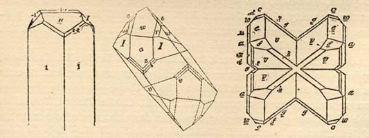
PRISMATIC AND TWINNED CRYSTALS OF MONAZITE--ALEXANDER CO.
The larger part of this monazite has been mined in Burke, Cleveland, Rutherford and McDowell counties. The best sands (highest in thoria) came from Burke and Cleveland counties, though some of special high grade has been reported from McDowell county. The price of monazite has varied from twenty-five cents per pound in 1893, to as low as three cents for the poorer grades and six to ten cents per pound for the better grades sold in 1894-'95.
Page 102
This monazite is found along the narrow valleys near the head waters of the small streams, mingled with the gravel and sand which lie directly upon the rock. In some places, however, the soil on the slopes of the adjacent hills is found to be quite rich in monazite. It is mined with the shovel and pick, the soil and underlying gravel containing the monazite being thrown upon a perforated iron pan at the head of a sluice box, and as this is washed down by a current of water the monazite, which is nearly twice as heavy as ordinary sand, quickly settles to the bottom and is easily separated from the latter. The separation is completed by a slight additional washing. The black grains of magnetic iron sand and some other impurities are removed by a strong magnet, and the dried monazite is then ready for shipment.
MARLS AND PHOSPHATES.
In the majority of the counties in the Coastal Plain region, shell marls are found sufficiently near the surface to render it possible for them to be mined and used for agricultural purposes, and for many years these marls were used extensively in this connection. They are composed largely of fossil shells, with more or less admixture of sand and clay. Analyses show many of them to contain from fifty to ninety per cent. of carbonate of lime, and where these are used for agricultural purposes they are usually scattered over the fields at a rate of from fifty to two hundred bushels per acre. During the past few years, however, the price of agricultural lime has been so low that the majority of the planters have considered it cheaper to purchase lime for spreading over their fields than to mine and haul the marls which they have on their farms.
Deposits of phosphate rock have been found in Duplin, Sampson, Pender, Onslow, Brunswick and New Hanover counties; but in only one of these counties (New Hanover) have these phosphate deposits been mined up to the present date. At Castle Hayne, ten miles north of Wilmington, phosphatic pebbles from the size of a pea to an inch in diameter are found mixed with sand and clay in beds from one to six feet in thickness at a depth of from three to ten feet below the surface of the ground. The phosphate pebbles in such cases usually make from ten to fifty per cent. of the aggregate mass of the material, the remainder being sand and clay. Associated with this phosphate gravel is usually found a lime rock in which is imbedded phosphate pebbles of the same size and character as those found in the sand, this being generally designated phosphate conglomerate.
The phosphate pebbles mined at Castle Hayne, are there washed
Page 103
and dried, and shipped to Wilmington, Norfolk and Baltimore, where they are manufactured into commercial fertilizer.
On the Hermitage plantation, adjoining the Castle Hayne tract, phosphates of similar character are found extending over a considerable area. The phosphate rock in Sampson and Duplin counties occurs in much larger blocks, from a few inches to two feet in diameter, highly water-worn and overlaid by from six to ten feet of sand. Thus far, the deposits of this rock discovered, have not been mined on any considerable scale.
COAL.
The coal fields of North Carolina are confined to two limited areas or belts of triassic sandstone. The smaller or Dan river belt having a width of from two to four miles, and a length of nearly thirty miles in northeast and southwest directions. The other, the Deep river sandstone belt, extends along a trough, narrow at each end and some fifteen miles wide at its central point, and extends from Oxford, in Granville county, southwestward across the State. In the former belt tracings of coal are found throughout almost its entire length, and at several places near Walnut Cove coal is exposed; the formation carrying merchantable coal, however, is limited to the region from the southern part of Chatham, ten or twelve miles into the northern part of Moore.
In the Dan river basin, the most promising outcrops for coal, are those along the line near the wagon road from Walnut Cove to Germanton. The coal bearing vein there is said to have a thickness of from two to seven feet. It is exceedingly friable and crumbles readily when exposed to the atmosphere, but like the Cumnock coal, it cokes readily and makes an excellent gas coal. In composition it is semibituminous. The outlook for occurrences here of workable seams of coal is fairly good.
The quality of the coal in the Deep river region resembles somewhat, but seems to be superior in character, to that in the Dan river region. In the Deep river basin, the coal with its shales, outcrops along the northern margin of the belt at various points for more than fifteen miles, and a number of shafts have been sunk to and through the main seam. In this basin, Emmons reports five seams of coal, separated by black shales and slates, black-band iron ore and fire clay; and estimates the area of this coal field at three hundred square miles. In this region a considerable amount of prospecting work has been done from time to time during the past few years, and the principal coal seam reaches from three to five feet
Page 104
in diameter; it also cokes well and is an excellent gas coal. The only mine operated on any considerable scale is the Cumnock, or old Egypt coal mine.
CUMNOCK COAL MINES.
The Cumnock mines in Chatham county are the only operating colleries in North Carolina. These mines, originally opened years since, were operated in a desultory and primitive manner prior to 1888, when Samuel A. Henszey, of Philadelphia, Pa., obtained possession, organized a company, and vigorously proceeded to re-open the mines upon an extensive scale, install a modern and efficient plant and introduce business methods, absence of which had accounted for previous indifferent success. Encountering many obstacles, the restoration and development proved slow and expensive, but by determined and persistent effort the property has been finally placed in a position that assures success. The underground works have been opened upon a large scale and in a most permanent manner for economical operation. The machine plant, both underground and on the surface, has been perfected with the most modern appliances for hoisting, pumping and ventilation, and every available safeguard for the protection of life and property has been introduced.
The colliery is operated by two perpendicular shafts--one for ventilation only, measuring 8 × 10 feet, tapping the vein in the "rise" workings at a depth of two hundred and twenty feet, and the main working shaft, 8 × 12 feet, four hundred and sixty-four feet in depth. The present plant has a capacity of one thousand tons per diem. Direct connection is had with the Cape Fear and Yadkin Valley railway at Cumnock and the Seaboard Air Line at Colon by means of the Raleigh and Western railway, an extension of which is well advanced toward a connection with the Southern railway system at or near Randleman, in Randolph county. The yield is a clean, shining bituminous coal, igniting easily, burning with a bright, clear combustion, leaving very little purplish, grey ash. It swells and agglutinizes, making a hollow fire.
The following analyses made at different times and from sampling of the mine at various points attest the uniformity of quality:
| Dr. Jackson. | G. C. Schaefer. | J. H. Cremer. | Dr. H. Endeman. | |
| Volatile matter . . . . . | 34.80 | 32.70 | 27.85 | 31.42 |
| Fixed Carbon . . . . . | 63.60 | 60.70 | 64.19 | 63.32 |
| Ash . . . . . | 1.60 | 5.30 | 4.24 | 4.12 |
| Moisture . . . . . | . . . . . | . . . . . | 1.95 | 1.14 |
| Sulphur . . . . . | . . . . . | 1.30 | 1.77 | 1.99 |
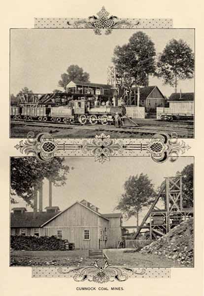
CUMNOCK COAL MINES.
Page 105
The Cumnock company owns four thousand three hundred acres. The workable veins aggregate six feet in thickness, lying in two benches of four feet and two feet respectively, separated by two feet of black band iron ore, the point of contact being plain and admitting of clean mining. The specific gravity of these coals as ascertained by Dr. H. B. Battle, Ph. D., is for the upper seam 1.31 and the lower 1.43. Using this basis, competent authorities estimate 11,000 tons to the acres, or 47,300,000 tons within the land owned by this one company. The coal is equally suitable for manufacture of gas, generation of steam, blacksmithing and domestic use. The Greensboro Gas Company in a recent letter says: "This coal made nine thousand seven hundred cubic feet of gas, eighteen and one-half candle power, and forty-nine bushels of good, clean, hard coke." For locomotive use, Mr. William Montcure, now Superintendent of the Central Division Seaboard Air Line, made an exhaustive test some time since and in submitting the result said: "I made a test of your coal as compared with Pocahontas, using the same engine, pulling the same trains with the same crew, with the following result for the same service:--Pocahontas 52,000, Cumnock 40,000 lbs. As a blacksmith coal it is now being shipped to local points on the Norfolk and Western railroad. As a grate coal it is without a superior, burning with a bright blaze, emitting no smoke and with entire absence of soot.
GRAPHITE.
This mineral, in small quantities, is quite widely distributed in North Carolina in the crystalline rocks, both slates and gneisses, and there are beds of a more or less impure slaty and earthy variety in several sections of the State, the principal of which are two: one in Gaston, Lincoln and Catawba, as a constant associate of the argillaceous and talcose slates and shales which belong to the Kings Mountain slates, and the other in Wake county.
The Wake county beds are the most extensive, as well as the best known, graphite beds in the State. They extend in a northeast and southwest direction for a distance of sixteen or eighteen miles, passing two and a half miles west of Raleigh. The thickness is two or three, and occasionally four feet. The eastern (and longitudinally the most extensive) bed is nearly vertical. It was opened at a number of points many years ago and has been worked on a small scale, at intervals, during the past few years. It is a bed of quartzitic and argillaceous slates, which are more or less graphitic, from about twenty to sixty per cent. graphite.
Page 106
KAOLIN AND CLAY.
At various places in the older rocks of middle and western North Carolina are to be found extensive veins or dikes composed largely of feldspathic material which has decayed from the action of atmospheric agencies, and which decayed material is generally designated as Kaolin. Generally in these dikes there is an admixture of feldspar, quartz and mica. In places the mica occurs in considerable quantity, and in crystals of sufficient size to permit of its being mined for commercial mica, and in such cases the deposit is designated as a mica vein. In other cases, quartz is the predominant material, and in still other cases, where the best kaolin is produced, the proportion of both quartz and mica are small, and the feldspar is the prevailing material. These dikes vary considerably in size, ranging from a few inches to several hundred feet in thickness, and up to several hundred yards in length. They are generally, though not always, parallel to the schistosity of the crystalline rocks.
The kaolin in these dikes, which occur in the Uaka or Smoky mountains, is said to have been mined by the Indians, "packed" across the country to the seaport and shipped to Europe during the early settlement of the country. From several of these dikes near Webster, in Jackson county, the kaolin is being mined at the present time, washed and dried, and shipped to Trenton, N. J., and other pottery centers. The most noted of these kaolin dikes in Jackson County, is that being mined near Webster, by the Harris Clay Company, which dike has a thickness of nearly two hundred feet, and has been traced for a distance of more than half a mile. The kaolin is mined from a depth of from sixty to one hundred and twenty feet, below which point, the original feldspar is not sufficiently softened by decay to permit of cheap mining operations.
Many similar, but far smaller feldspar and kaolin dikes are to be found in various counties of both the Mountain and Piedmont Plateau regions; but none of these have been worked to any considerable extent for either feldspar or kaolin.
There are also many deposits of clay, varying in shades of color, from white, like kaolin, to purplish, yellowish brown, resulting from the decay of granite, gneisses and crystals in schists in these regions. These clays, of course, vary in composition both with the character of the rocks from which they have been formed, and with the extent to which the materials of the original rocks have been separated by the sorting action of water in transporting materials from one place to another. They are frequently a reddish or yellowish color owing to the oxide of iron present, though at many places their colors are
Page 107
lighter. These clays are used on a small scale in almost every region where brick are needed for the construction of houses or chimneys, but only at a few places, such as Biltmore, (Buncombe county,) Pomona, (Guilford county,) and Goldsboro, (Wayne county,) have they been used extensively in the manufacture of tile, drain and sewer pipes.
Fire brick are also manufactured at Pomona; and the clay beds near Grover (Gaston county) are said to make fire brick and vitrified brick of excellent quality.
The most extensive beds of clay known in North Carolina are those found in the Coastal Plain region. In the Potomac (lower Cretaceous) formation, there are extensive beds of laminated, dark-colored clays, exposed along the banks of rivers crossing the Coastal Plain region, notably on the Cape Fear river for fifty miles below Fayetteville. These clays are usually dark in color owing to the vegetable matter which they contain; and, in some cases, they are highly lignitic.
Along the western border of the Coastal Plain region, especially in Moore and Harnett counties, there are limited exposures of silicious deposits (over-lying the Potomac series, and capping some of the sand-hills) which have recently been tested for fire brick with very satisfactory results. These deposits are from five to fifteen or more feet in thickness, and are overlaid by but a few feet of loose sand. In a few places the material has all the qualities of fullers earth.
Among the Miocene deposits, there are, in places along the river-bluffs in the Coastal Plain region, especially on the Roanoke and the Tar, somewhat extensive exposures of "blue marl," a calcareous clay which may prove to be of some value, but of which no practical tests have yet been made.
The Lafayette (Pliocene) materials, which are spread over so large a portion of the Coastal Plain region, are generally sandy in composition, with a large admixture of loam in many places. No extensive deposits of clay have been observed among the materials of this formation, though doubtless limited deposits of clay will be discovered as more extensive explorations are made.
GEMS AND GEM STONES.
Many of the varieties of precious stones or gems of commerce are found in this State, and have been searched for in spasmodic
Page 108
exploration for a number of years. The accidental discovery some fifteen years ago of emerald and hiddenite in Alexander county, where gem mining on a considerable scale was conducted for several years, may be considered the beginning of this industry. The indications rarely justify the expenditure of much capital, and the existing conditions barely justify the rating as an industry. Yet it is a source of revenue to a few persons who wash the gravel or gouge out the crystals from the mother rock.
The largest plant operated for gems exclusively was that in Alexander county, where emerald, hiddenite, beryl, rarely terminated rutile, and exquisite shades of garnets were found; and next to this should be mentioned Corundum Hill in Macon county, where rubies, sapphires, beryls and garnets are gathered incidentally in washing corundum for the markets. Again, garnets, beryls, rubies, sapphires, hyacinth, emerald, citrine topaz, amethyst and rare quartz gems are taken incidentally in McDowell county, on the property of the Marion Improvement Company, under the skillful management of Col. H. C. Demming, of Harrisburg, Pa. And in a desultory way, in Mitchell, Yancy, Macon, Buncombe, McDowell, Burke, Alexander, Iredell, Lincoln and other counties various gem stones are gathered and sold to local and foreign dealers.
DIAMOND.--There is recorded the finding of thirteen small diamonds in the State. Seven of these are credited to the auriferous gravel beds of Burke, McDowell and Rutherford counties centering about the Brindletown region. The largest one of these weighed four and one-third carats, and was found in McDowell county. The remaining six are credited to the following counties: Lincoln 1; Mecklenburg 2; Franklin 2; Richmond 1. There is but small indication that diamonds may be found with more frequency in the future, yet the forest clad hills may one day give to the diamond hunter rewards little dreamed of now.
HIDDENITE.--This is an emerald-green variety of spodumene, found only in Alexander county, when it occurs sparsely in the soil and gneissoid rock, along with emerald, monazite, rutile, allanite, dolomite and quartz crystals of generally smoky color and rare modifications. At one time a considerable amount of mining was done by the Emerald and Hiddenite Mining Company in search of these gems, and with gratifying success, as crystals of hiddenite and chrome-green beryl of exceptional size and conspicuous beauty were obtained.
Hiddenite was named after Mr. W. E. Hidden, of New Jersey (a mineralogist of note who has done much valuable work in this State), by Prof. J. Laurence Smith, who identified the mineral. To

1. EMERALD CRYSTAL.
2. SMOKY TOPAZ.
3. SAPPHIRE.
4. SAGENITE.
5.. PALE EMERALD.
6. AMETHYST.
7. MIDDENITE CRYSTAL.
8. ROSE GARNET.
9. CITRINE TOPAZ.
SOME NATIVE GEMS.
Page 109
the energy and enterprise of Mr. Hidden is due the introduction of hiddenite as a gem of rarity and with an established commercial

CRYSTALS OF HIDDENITE--SPODUMENE.
value of $100 or more per carat for richly colored specimens; but specimens of the natural crystal were exhibited in the cabinet of Mr. J. A. D. Stevenson, of Statesville, N. C., for several years prior to Mr. Hidden's exploitation. The gem is justly esteemed for its great beauty of color, its superiority over the emerald in the splendor of its fire, and in its being the rarest of the precious stones. (See colored plate; this crystal now in the Harvard Museum.)EMERALD.--Beryls of chrome-green color have been found in many localities in Mitchell, Yancey, Macon, McDowell, Burke, Iredell and notably in Alexander county. The most celebrated specimens are still uncut in the hands of collectors outside the State. One of the finest crystals ever found here was taken from the property of the Emerald and Hiddenite Mining Co., and is now in the private collection of Mr. C. S. Bement, of Philadelphia. It is eight and

MODIFIED BASAL TERMINATIONS--ALEXANDER COUNTY EMERALDS.
a-half inches in length and weighs nine ounces. (See colored plate.) There were other handsome crystals doubly terminated, and perhapsPage 110
of better color found, but somewhat inferior to this in size. Mr. J. A. D. Stevenson secured a crystal (fractured) a few years ago with an outside border or coating of rich chrome-green color, which weighed very nearly twenty-seven ounces. This specimen offered fine material for the lapidist, but its lack of symmetry and absence of terminations lessened its scientific value.
AQUAMARINE.--Pale bluish, bluish-green, pale green, greenish-yellow, yellow, golden yellow and limpid white beryls are found in the mica veins of Mitchell, and in feldspathic and micaceous rocks and in the soil in Yancey, Macon, McDowell, Burke, Alexander, Iredell and other counties. These tints are more abundant than the chrome-colored, and are sought after by those living in proximity to the localities and offered to collectors; eventually finding their way into cabinets or the show cases of gem dealers.
Many of these crystals are of great scientific interest because of the remarkable terminations, oftentimes rivalling the lapidist in the number and brilliancy of the facets presented. A few of these remarkable geometric figures are presented here, through the courtesy of the American Journal of Science.

BERYL-MODIFIED TERMINATION OF CRYSTAL.
Many fine crystals and fragments of various shades of coloring, and ranging in size from the minutest forms to those of more than two feet in length and as much as seven inches in diameter have been found at the mica mines, and some specimens from other localities. These immense crystals are opaque and generally bluish or greenish in color, and are of value only as specimens.

BERYL-BASAL VIEW OF TERMINATIONS.
RUBY.--The ruby is derived from the red crystals of corundum, and the finest specimens in the State so far discovered are from Macon county, and the majority from the Corundum Hill mines. A few are found in Clay, Jackson, Iredell and Gaston counties. There have been but few found of the coveted pigeon-blood color.
SAPPHIRE.--Like the ruby, sapphires come from crystals of corundum, and they are to be found at the same localities designated for ruby. Many nice gems have been found in the State. (See colored plate.) The term "oriental" is applied in commerce to ruby, sapphire, emerald and topaz, and in speaking of oriental sapphire, it is meant that it is a corundum sapphire, and so on through
Page 111
the list. Corundum is next to diamond in hardness, and gems from that source are more highly prized on that account.
CYANITE.--This mineral is not very rare in its occurrence in this State, and comes from practically the same localities designated above for corundum gems. It is of an exquisite deep-blue color much resembling sapphire, but of a softer substance, yet hard enough for gem purposes. The finest specimens are found at Yellow mountain, in Mitchell county.
GARNET.--This material is widely distributed in the State and is a constant constituent of many of the micaceous and other igneous rocks, and in flattened crystals in muscovite and biotite crystals as inclusions. It is found massive and in trapezohedron crystals weighing from six to eighteen pounds each, and through many intervening forms down to the small fractured masses in Kinzigite and in sands. In color it ranges from black into red, cherry, cinnamon, almandine, purple, rose and other pale tints. (See colored plate.) The most desirable shades for gems come from Macon and Alexander, but good gems are found in Mitchell, Yancey, McDowell, Burke, Caldwell, Catawba and other counties. Pyrope and massive garnet for conversion into abrasives is found in McDowell and Burke counties. Massive manganiferous garnet is found in Rutherford, Lincoln, Gaston, Rockingham, Stokes, Chatham and other localities.
QUARTZ.--The widest distribution characterizes this material. It is comparatively abundant in about one-third of the area of the State. Many rare and interesting forms are to be found, as well as some remarkably large crystals; in fact crystals approaching three hundred pounds in weight are credited to Ashe county. Caldwell county furnishes some beautiful and perfectly limpid specimens. Alexander county is a more prolific source and supplies specimens of many shades in color and of great scientific interest because of rarely modified terminations. Both Mr. J. A. D. Stevenson and Mr. W. E. Hidden have forwarded fine collections ranging in color from almost black through varying tints of brown and yellowish-brown to limpid white, to Germany at the request of an eminent crystallographer, the late G. von Rath, of Bonn, who carefully studied and figured them, announcing in his results many new forms or planes hitherto unknown to science.
Under the general head of quartz, reference may properly be had to several gems belonging to this classification.
Sagenite, Venus' hair, arrows of love and rutilated quartz, are the names usually applied to one of the most striking of the quartz
Page 112
gems. It occurs as a crystal or mass of quartz holding as inclusions scores of acicular crystals of rutile; these are brown, red and yellow in color and are meshed in confusing lines of fiery brightness which are very effective in artificial light. Iredell county has supplied many fine specimens; as have Alexander, Catawba and Burke counties. (See colored plate.)
Citrine topaz--yellow quartz--is also found in Burke and adjoining counties; but rarely in deep, rich color. It makes a striking gem when the coloring is good, and is much esteemed. The reproduction in the colored plate is from the collection of Mr. A. M. Field, at Asheville.
Smoky topaz--cairngorm--occurs in many shades of brown, from very deep--almost black--through varying rich tones and fading into limpid white. This gem, while of low price, is much admired in some of its richer colorings.
Amethyst--purple quartz--is widely distributed, almost as great in extent as quartz. It occurs in deep and pale shades of purple, and is too well known to demand extended notice. Catawba and Lincoln counties have produced handsome crystals in clusters.
Some few specimens of opalescent quartz have been found which under the lapidist's wheel have turned out fair results. Cabarrus county has supplied the best of this variety of quartz.
In addition to the above there have been found many quartz crystals with inclusions of various substances, which have presented when cut, attractive gems. Some of the prettiest of these came from the property of the Marion Improvement Company in McDowell county.
OTHER GEM STONES.--There are a number of gem bearing stones, which while affording occasional gems, are not sought like the foregoing. Among these may be mentioned zircon, which occurs in small crystals in many localities. Some limpid white gems (small) have been cut, but no large gems of any color have been discovered.
Agate also occurs in the State, and some material fit for cutting has been found in Cabarrus and Mecklenburg counties. Some specimens of moss agate are reported from Orange county.
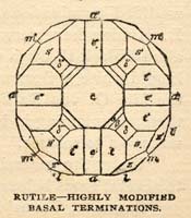
RUTILE-HIGHLY MODIFIED BASAL TERMINATIONS.
Rutile of fine texture has been cut into gems--much resembling black diamond in effect--but is not often found flawless enough for the purpose. Specimens of malachite, tourmaline, spinel, chrysolite,
Page 113
lazulite, carnelian and jasper have all been found, and occasionally acceptable gems result from these sources. Also from fresh water mussels in creeks and rivers are occasionally secured pearls of fair quality.
BUILDING STONES.
Building materials are quite widely distributed in middle and western North Carolina, though all the better grades of building stones are to be found in the middle counties, or the Piedmont Plateau region. Roughly speaking, the State may be divided into a series of geologic belts, extending in a general northeast and southwest direction. Three of these belts may be said to carry most of the stone of economic importance.
Sandstone belts, one of which includes the brown stone of Anson, Moore, Chatham, Wake, Durham and Orange counties; and the other includes the brownstones of Stokes and Rockingham.
The eastern granites and gneisses, including the gneiss of Vance and Wake counties, the granites of Franklin, Granville and Warren, and the smaller areas of granite in Wilson, Edgecombe, Richmond and Anson.
The Piedmont granite belt, which consists of the granitic and syenitic rocks of Person, Caswell, Alamance, Guilford, Forsyth, Davie, Davidson, Rowan, Iredell, Cabarrus, Mecklenburg and Gaston counties.
The gneisses and granites west of this Piedmont Granite belt, but still within the limits of the Piedmont Plateau region, are somewhat isolated. The ordinary rocks of the country are gneiss, which at intervals are sufficiently granitic in character to permit of their being used for building purposes, and at intervals throughout this area, as at Mt. Airy, considerable masses of typical granitic material are found. In the Mountain region, the rocks are generally gneissic in character, but in many places, as about Hendersonville, at Troy's quarries, this gneiss proves valuable for architectural purposes, and at a number of places, notably at Stone mountain, in Wilkes county; in the neighborhood of Hickory Nut Gap; and on the French Broad river below Asheville, there are masses of true granite surrounded by gneisses.
The browstones are largely limited to the eastern sandstone belt, which extends from Oxford, in Granville county, in a southwesterly
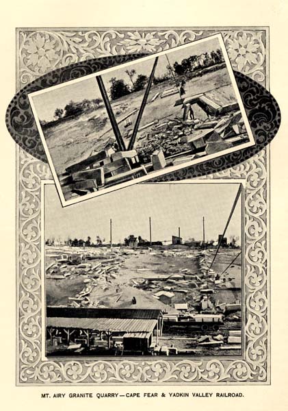
MT. AIRY GRANITE QUARRY--CAPE FEAR & YADKIN VALLEY RAILROAD.
Page 114
direction across the State, with a maximum width of about fifteen miles. The rocks of this belt are all of triassic age, belonging to the same geological formation, which with Connecticut, Pennsylvania and New Jersey, furnish the famous brownstone for northern and eastern cities. Within the limits of this belt are many exposures of a fine, compact, light and dark reddish brownstone, not at all inferior to the better grades of brownstones from the States just mentioned. Quarries have been opened up at a number of different places, the more important of which, are the following: The Frank Hammond quarry, two miles south of Wadesboro; the Linehan quarry, one mile north of Wadesboro; and the Wadesboro Brownstone quarry, about one mile northwest of Wadesboro. The stone from all three of these is homogeneous, fine grained and compact, varying in color from a reddish brown to a grayish brown.
Near Sanford, there are also several brownstone quarries; that of the Aldredge Brownstone Co., one mile south of Sanford, being the largest and most actively worked of the region. This quarry has a branch railroad connecting with the Cape Fear and Yadkin Valley and the Seaboard and Air Line railroads at Sanford, and is now quarrying, sawing and shipping brownstone of excellent quality to a number of States. Other quarries which have been operated to a greater or less extent in this region during the past few years, are the Goenella Bros. quarry, about one and one-fourth miles south of Sanford and near the Seaboard Air Line railroad; the Carolina Red and Brownstones Company's quarry, where a mill has been erected for sawing the stone, and the Carolina Brownstone Company's quarry, about one-fourth mile west of Sanford. There are also other places near Sanford where brownstone of good quality has been discovered and opened up to a limited extent.
Near Carthage, in Moore county, on the property of Messrs. Grimm, McNeal & Bros., are several outcrops of brownstone which promise to be of excellent quality.
Near Cumnock (Egypt) is a large exposure of a brownish red, compact sandstone, which is exposed along the banks of Deep river for a distance of half a mile. Also about one mile east of Guilford along the banks of Deep river, is a fine to medium grained sandstone; and in other places near by sandstones of color varying from olive to gray and buff, have been found in considerable quantities, and are being quarried by the Gulf Buff Stone Company.
Also along the line of the Raleigh and Western railroad, between Cumnock and Colon, medium fine grained brownstone of good quality has been quarried to a limited extent.
Page 115
At several points in the western part of Wake county, as, near Brassfield, and in Durham county, sandstone of good quality has been quarried to some extent. The Dukes' quarry is located about one mile east of Durham, and the Rogers quarry is located near the latter.
Concerning the granites, the following brief statement can mention only some of the more important quarries and places. In Wake county there are near the city of Raleigh important beds of granitic gneiss which were worked at the "Capitol Quarry" in the eastern edge of the city, from which the material was obtained for the construction of the Capitol. The penitentiary quarry, inside the enclosure of this institution, furnished the stone for the foundation and walls of the prison, and for a number of other purposes. On Dr. Lewis's farm, two miles northwest of Raleigh, is a hard, tough, fine grained, gray gneiss, which has been worked at intervals for many purposes. At Wyatt, on the Raleigh and Gaston railroad, is a pink granite; and near Rolesville, some fifteen miles northeast of Raleigh, are extensive deposits of gray biotite granite with pinkish feldspar.
In Franklin county there is a quarry at Louisburg; and extensive beds of gray biotite granite, medium grained, on the Freeman Mill place in Nash county, about twelve miles west of Springhope; this stone is of good quality, and would doubtless work in a satisfactory manner.
In Granville and Warren counties granite of good quality has been worked to a limited extent at a number of different places in the vicinity of Oxford; at Warrenton, and again about one mile north of Warren Plains. About two miles northwest of Warren Plains is another outcrop of gray granite, which has been used for making mill stones, and for other purposes.
In Wilson county, a few miles south of Wilson, on the Wilmington and Weldon railroad, and on Moccasin river, are considerable beds of coarse, red, feldspathic granite, which splits readily, takes a beautiful polish, and closely resembles the red Scotch granite. Granite deposits of quite similar character are to be found along the line of the Seaboard Air Line railroad in Anson and Richmond counties. In Wilson county, it should be mentioned also that on the Wilmington and Weldon railroad, two and a-half miles above Toisnot, a medium to coarse grained granite of dark gray color occurs in considerable quantities.
In the Piedmont Granite belt, building stone of excellent quality occurs in great variety, and is widely distributed. The two more important regions where active quarrying has been in progress during
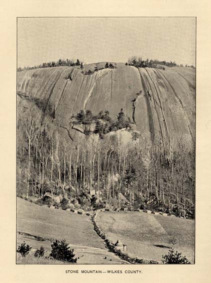
STONE MOUNTAIN--WILKES COUNTY.
Page 116
the past few years are in the Dunn's Mountain region, in Rowan county, and about Mooresville, in Iredell county. The more important granite quarries and deposits of Rowan county lie along the line of Dunn's mountain ridge, which extends in the northeast and southwest course for a distance of about twenty miles, in the eastern portion of the county and closely parallel to the main line of the Southern railway. The stone here outcrops in broad exposures of several acres extent and has been quarried in a dozen or more places, at all of which there are large outcrops capable of furnishing immense quantities of stone without stripping. With the exception of Dunn's mountain proper, all the stone of this great "boss" is of medium fine grain and light-gray speckled, with occasional small crystals of magnetite and pink feldspar, the latter in places becoming so abundant as to give a uniformly, warm pinkish tint, as at the Kirk mountain quarry, and Dunn's mountain proper. Stone from this latter place was used in building the Federal Post Office, at Raleigh. This is an exceedingly valuable and extensive granite area and is destined to be, in the near future, worked on a large scale.
The more important of the quarries of this region are those of the Pink Granite Company; the Hambley quarry; the Stone Mountain Granite Company's quarry, and the Kirk Mountain Granite Company's quarry, all four or five miles east of Salisbury and tapped by the Yadkin railroad. And the Wyatt quarry several miles southwest of this point.
In the neighborhood of Mooresville, three quarries have been opened up during the past two years, two for monumental stones, and one that has been worked to some extent for building material. The stone is fine grained biotite granite, for the most part containing little or no injurious material. Handsome monuments made from this stone are to be seen in the cemeteries at Raleigh, Charlotte and a number of other places. The three more important deposits are those at the quarry of the Charlotte Granite Co., about one mile south of Mooresville; the J. N. Breed quarry, one and a-half miles southwest of Mooresville, and the Biddell quarry, three miles east of Mooresville.
Excellent granite is also to be found in Davidson, Davie, Cabarrus and Alamance counties. In Davie county there is an exceedingly unique and beautiful stone which has been called "Orbicular granite" or Augite, occurring at Coolomee.
The Mt. Airy granite quarry in Surry county is the best known and the most extensively worked at the present time. The stone is nearly white granite of uniform grain and texture, and free from injurious
Page 117
material. It works easily in three tracks, and is so located as to be entirely free from quarry water. The stone is exposed over an area of more than forty acres, so that no stripping is necessary in quarrying operations. The quarry equipment is extensive and complete in every direction. Operations have been carried on during the past several years on a large scale by the Mt. Airy Granite Company.
Stone Mountain on the line of the Blue Ridge in the northern part of Wilkes county is an enormous mass of gray granite, which has recently been purchased by a new company, which purposes to construct a railroad to that point and quarry the stone on an extensive scale. The color and texture are quite uniform and the stone appears to be free from injurious materials, and will doubtless make an excellent material for architectural purposes.
PUBLIC ROADS.
The question of good roads has occupied the attention of the people of the State for about ten years, but has only recently taken sufficient hold upon the public mind as to show itself in good works. The question is of vital importance to the farmer and trucker, and indeed to every industry. Ample provision is now made by law, so that any county or township may begin the permanent improvement of its roads. In addition there are many special acts of the last few sessions of the Legislature for separate counties. These vary in their details, but in nearly every case they retain in part the requirement that able-bodied citizens shall be liable for labor on the public roads for a limited number of days, and with this they combine provision for a varying rate of taxation for road purposes. In a few of the counties the money necessary for the new road work is paid out of the general county fund. In a few cases the old labor system has been abolished entirely, and the roads are being worked by taxation alone. In nearly all of the counties convict labor is employed in the road improvement, and in the majority of cases a limited amount of improved machinery and implements have been purchased and are being used in the work. The construction of stone roads has been undertaken in Mecklenburg, Wake, Alamance, Cabarrus, and to a lesser extent in Forsyth, Rowan and Durham counties. Buncombe has purchased a complete outfit of machinery, and has begun to macadamize. The work in other counties has thus far been limited
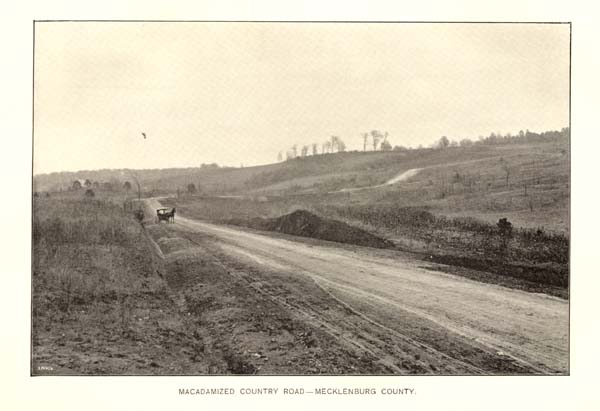
MACADAMIZED COUNTRY ROAD--MECKLENBURG COUNTY.
Page 118
largely to the improvement of earth roads by grading, draining, and in some cases changing the location of the old roads.
In Mecklenburg county the work has now been in progress for some years; during which time nearly forty miles of roads have been graded and drained, and nearly as many miles have been macadamized. The general plan adopted, and which has been adhered to, was to start at the city limits of the county-seat and to grade and macadamize all of the important public roads from this point out toward the township and the county limits. These roads have a width of forty feet for the first two miles from the city limits, and beyond this point a width of thirty-six feet. They have a maximum grade of four feet in one hundred. For cross drains sewer pipes are used in all cases where practicable, and strong wooden bridges with stone piers have been put in wherever needed. The average cost of these roads, including the macadamizing and grading, is about $2,000 per mile. The average number of convicts employed is about eighty, and the average cost of this labor per convict, including their food, clothes, medical attention and guarding, is from twenty to twenty-two cents per day. In charge of the work is one superintendent and one engineer (part of the time) and six guards. The rate of taxation in the county has been eighteen cents on the $100 worth of property, and the entire amount raised in this way for the support of the convict force in road-improvement work during the past year was about $18,000. In addition to this, each township levies a tax varying from seven to fifteen cents on each $100 worth of property.
In Wake county, Raleigh township has been working its roads by taxation and labor during the past six years. It has a steam-roller, road machine, crusher, spreading carts, and a complete list of smaller implements for road work. The number of convicts employed varies from fifty to sixty, and the average cost per convict per day, including food, clothes, medical attendance and guarding, is about twenty and one-half cents. All the county prisoners whose terms are less than ten years can be used in this work. Convicts do every kind of the work except the most difficult part of the bridge construction. Twenty-eight miles of road have been graded and eighteen miles have been macadamized, the work having been divided between the principal roads in the township, starting from Raleigh. By special law the work has been extended beyond the township boundary. Excellent truss bridges are being built across all the streams and culverts.
In Alamance, Cabarrus and Rowan counties a limited amount of macadamizing has been done, and many miles of earth roads have
Page 119
been greatly improved by grading and draining. These counties use their convicts in working their important roads.
Buncombe county, out of its general tax fund, maintained an average force of about sixty convicts at work on its more important public roads, for several years, at an average cost of about thirty-five cents per day per convict. For general road work, the old system still prevails. Many miles of earth roads have been regraded and drained and in places relocated. A complete outfit for macadamizing work has been purchased, and a limited amount of work has been done.
In the other counties mentioned above the question is now being agitated, and in the near future they will doubtless begin to construct stone roads. In all of them the earth roads have been improved, to a greater or less extent, by grading, draining and changes in the location of roads. These improvements are increasing the popularity of the movement. One of the most encouraging features of the movement has been its growth in several of the eastern counties during the past few years.
Several years ago the strongest opposition to the movement came from these eastern counties, where the surface of the country is level, and where the stone for macadamizing purposes is scarce or entirely absent; but during 1893, and years following, Wayne, Lenoir, Edgecombe and New Hanover counties, adopted plans for improving their earth roads and have pushed the work forward with vigor and success, accomplishing results of decided benefit at a small expenditure of money. This has resulted in arousing considerable interest in the subject in a number of adjoining counties.
In New Hanover, by the expenditure of a small sum annually, a limited amount of grading and draining is being accomplished, and the sandy road surface is being improved by the admixture of clay, and, it is believed that in the near future these roads will be still further improved by being covered either with crushed stone or with oyster shells from the adjoining sounds. A few years ago a shell road was constructed in this county for a distance of eight miles (from Wilmington to Wrightsville), which since that time has been maintained in excellent condition by the employment of one man, who, with a cart and horse, drops small quantities of oyster shells at such points as show indications of wear. This road now serves as an object lesson in showing the ease with which an excellent road can be constructed in this region and the small expenditure necessary for keeping it in repair.
In Edgecombe county, as is the case also in New Hanover, no convicts are at present employed on the public roads, but it is

SHELL ROAD--WILMINGTON.
Page 120
expected that they will be employed in both counties at an early date. A tax of forty-five cents on the poll is assessed for road purposes. Machinery is used, including a road machine, scrapers and plows, and a horse roller; ordinary labor is employed at a cost of about sixty-five cents per day. The policy adopted in this county has been to first improve the particularly bad places in the roads in different parts of the county, and in this way, the result has been to give general satisfaction with the work in many parts of the county, because the beneficial effects of the work became apparent at once in as many places.
In Wayne and Lenoir counties, the plan for improving the more important earth roads is somewhat similar to that in Edgecombe, but the tax fund is smaller in both, and convict labor is used. The trucking industry in these latter counties is one growing in importance, and this has greatly increased the demand for road surface over which large loads can be hauled at a rapid rate without serious jolting. This demand will doubtless prove a great stimulus in the permanent improvement of public roads and will ultimately result in their being macadamized, although the material for the purpose will have to be brought from the adjoining counties. At Newbern, in Craven county, so great has been the demand for better roads that recently a considerable sum was subscribed by private individuals for macadamizing a road leading from the town through one of the important trucking districts, and this road, in the building of which the county co-operated with private individuals, is now being constructed. A beautiful and serviceable macadam road was built a few years since from the town to the Federal cemetery by the United States Government, the stone used being a shell limestone, from Trent river.
In Guilford county, the two townships which join at the county seat (Greensboro) have voted a tax for the improvement of the earth roads, and have pushed this work along during the past few years with the result of greatly improving them. Both townships have purchased road machines and other implements.
In Iredell county a small tax on property and on the poll has been levied, and a road fund has been raised. During the past few years the county convicts have been used on the roads, and they have graded many miles of road, starting from the county seat and extending out into the county on each important road.
In Forsyth county, after improving the earth roads in the immediate vicinity of the county seat (Winston-Salem), the convicts, fifty to sixty in number, have been transferred to various parts of the

MACADAM ROADS AND BRIDGES--WAKE COUNTY.
Page 121
county, and have been employed in improving the worst places on the important public roads. The work is supported by a small tax levy on both the poll and property.
ROAD MATERIALS.
In the central and western counties of the State there is usually an abundance of stone for use in macadamizing roads. The larger part of this stone is granitic in character, and some of this is rather soft for use in surfacing roads; but at intervals in all these counties harder and tougher material can be found in the form of hornblende, granite, diorite trap and other eruptive rocks, and where these occur along the lines of railroad, they can be crushed and transported to the points where the macadam is needed, in many cases at a small cost. In the eastern counties good stone for macadam is scarce or entirely wanting; but in quite a number of these counties, limestone or shell rock can be obtained at intervals, and the fact that they make a serviceable road has been demonstrated by the experiment at Newbern, and on the streets of Goldsboro, where a considerable amount of macadamizing was done some three years ago with shell rock from Castle Hayne on the Atlantic Coast Line railroad. In the latter case the shell rock was laid down in thickness only three or four inches. The surface was packed by the ordinary travel, and it has now withstood the constant wear of the vehicles on the main streets of Goldsboro during the past three years without the need of any repairs.
In the counties bordering the coast, excellent roads can be built and maintained by the use of oyster and other shells, as has been shown in the case of the shell road between Wilmington and Wrightsville. In quite a number of counties, limited amounts of gravel can be obtained for use on the roads, but this is usually inferior in quality. Along many of the streams, however, where crossed by public roads, a sufficient supply of gravel and coarse sand can often be found, which will very greatly improve the surface when spread over it, and again in the eastern counties, where the sand prevails at intervals, along the roadside can frequently be found deposits of clay which, when mixed with sand, improve the road surface considerably. In a few places gravel and sand deposits are found which have a sufficient amount of clay and oxide of iron intermixed to cement the mass into a hard surface.
Page 122
WATERS AND WATERWAYS.
RIVERS.
The river system of the State is determined by its peculiar topography. Its rainfall is copious, the annual average for the whole State being about fifty-three inches, and is the fountain of numerous streams in all sections of the State; and, owing to the fact that the rivers in the Piedmont Plateau and Mountain regions have their origin among the highest mountains and on the highest table-lands on the eastern side of the American continent, these rivers, in their descent towards the sea, develop an immense amount of mechanical power. Those in the Coastal Plain region, with equal abundance of rain as a source of water supply, but with more gentle descent towards the ocean, offer facilities for navigation not possessed by the rivers of the former regions, and towards their mouths expand into wide estuaries, connecting with the sounds and bays which provide the ports and harbors available for exterior commerce, foreign and domestic.
Topographical causes also largely influence the course and direction of these rivers. Those rising west of the Blue Ridge are diverted by that barrier towards the north and northwest and towards the Valley of the Mississippi with ultimate destination to the waters of the Gulf of Mexico. Those rising east or south of the Blue Ridge, or the upper part of the Piedmont region, after a general direction towards the east, ultimately pass out of the State in the middle portion of the Piedmont Plateau, and find their way to the Atlantic ocean through the State of South Carolina; while those having their sources in the belt on the eastern extension of the same region find an entrance into the tide-waters of the Coastal Plain region of this State.
The general river system is naturally divided into three subordinate ones entirely distinct from each other. The most characteristic of these is that originating on the Blue Ridge, or on its western slope, the superior elevation of the high culminating masses of the great Appalachian chain throwing off the rivers to all the points of the compass. From this culminating height the Tennessee river, with its length of twelve hundred miles, draws its chief supply; and the Ohio, with equal length, from the same source draws one of its chief upper tributaries. The volume of water poured out from this mountain reservoir is very great. Thus, the most western of them,
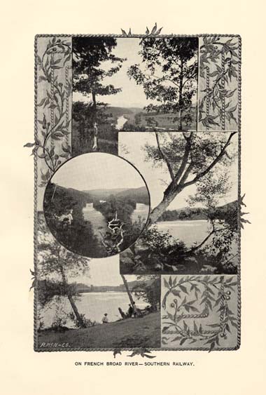
ON FRENCH BROAD RIVER--SOUTHERN RAILWAY.
Page 123
the Hiwassee, with its tributaries, the Valley and Nottely rivers, draining two counties, Clay and Cherokee, an area of about six hundred and fifty square miles, passes into southeastern Tennessee, a powerful stream with a breadth of one hundred yards, with a descent, from its sources to the State line, a distance of about seventy-five miles, of from eight hundred to nine hundred feet, providing great and continuous water-power. The Tennessee river, united with the Cheoah, the Nantahala, the Ocono Luftee and the Tuckaseegee, all large streams with a width of from fifty to one hundred and fifty yards, with united volume and resistless power, cuts its way through the Smoky mountains at the point of their greatest elevation, and constitutes one of the principal branches of the greater Tennessee, which unites with the Ohio a short distance above the junction of that river with the Mississippi. The united drainage of the Tennessee in North Carolina is about one thousand five hundred square miles, with a united length in this State of three hundred miles. The fall of each of these, from their sources to the State line, is about one thousand feet.
The Pigeon river drains a separate area of about five hundred miles. It has a course of about seventy miles in North Carolina, with a width of about eighty yards, and a fall, from its upper valleys to the borders of Tennessee, of about one thousand feet.
The French Broad river is nearly as large as the Tennessee, and is fed by several large affluents, such as Davidson's river, Little river, North river, Swannanoa, Ivy and Laurel, and drains a territory of about one thousand four hundred square miles. The fall from the mouth of Little river, in Transylvania county, to the State of Tennessee, is about one thousand feet.
The Nolechucky, formed by the union of Caney river and North and South Toe, unites with the French Broad after that stream has entered the State of Tennessee, becoming a broad and deep stream in size little inferior to the river with which it joins its waters. Its drainage is about six hundred square miles, and its fall is about one thousand five hundred feet.
Elk and Watauga rivers are smaller streams, with a course of only twenty miles or more in this State, but chief tributaries of the important Holston river in Tennessee.
The New river, alone of all the rivers of the State, flows north, or northwest into Virginia, and uniting its waters with those of the Kanawha, empties at length into the Ohio. Its aggregate length in North Carolina is nearly one hundred miles, and its fall about seven hundred feet, and its drainage surface within the State is about seven
Page 124
hundred square miles. This is one of the larger mountain rivers, of the size of the Hiwassee, Tennessee and French Broad.
Of the characteristic features of these mountain rivers, Prof. W. C. Kerr, former State Geologist, has remarked: "There is a common feature of these streams that is worthy of remark, viz: that through a very considerable part of their tortuous course across the plateau from the Blue Ridge to the Smoky, the amount of their fall per mile is frequently quite small, not greater than that east of the mountains, the greater part of their descent occurring within the gorges through which they force their way across the Smoky chain, so that many of them present navigable channels of considerable extent. The French Broad, for example, has a fall of less than three feet to the mile from Brevard to Asheville, a distance by river of forty miles." And he says: "The dominancy of the western chain of mountains frequently asserts itself in a very striking manner, notwithstanding it is obliged, sooner or later, to give passage to all the streams of the plateau. The French Broad is a striking illustration, as well as North Toe and New river (South Fork), all these being thrown off by the steeper slopes and more rapid torrents from the western escarpments and hurled against the very crests of the Blue Ridge, along which they wander lingeringly in slow and tortuous course, as if anxiously seeking the shorter passage to the sea; but finally turn, as if in desperation, and plunge with roar and foam against the frowning ramparts (of the Smokies) which bar their way to the west."
There is, on the south and a portion of the east slope of the Blue Ridge, another system which has, in the course of its streams, almost direct outlet into Georgia and South Carolina, viz: the Chatooga and Toxaway, which are the chief head streams of the Savannah river the upper waters of the Saluda; and the Green and First and Second Broad, which unite to form the Broad river of South Carolina, uniting with the Saluda at Columbia to form the Congaree.
Another and more important system is that which drains the northern half of the Piedmont Plateau, and which is represented by the Catawba and Yadkin rivers. These streams have a general course a little north of east until they leave the Mountain region, when they turn at right angles to their former direction, and pursue nearly a southerly course, and pass into South Carolina broad and placid streams, the Yadkin then taking the name of the Pee Dee and the Catawba that of the Wateree. Both of these streams receive their chief affluents from the north side, and many of these are large streams. Into the Catawba flow North Fork, Linville, John's river, and many others of less volume; while the Yadkin quickly gains
Page 125
consequence by the admission of Reddy's, Roaring, Elkin, Mitchell's Fisher's, Ararat and Little Yadkin. The combined drainage of these two great streams is more than two thousand five hundred square miles.
The Yadkin receives in its lower course a larger number of affluents than the parallel stream, the Catawba, has a greater fall in its course, and drains a wider and more continuous valley. Both are navigable in their upper courses, interruptions by shoals being infrequent and readily surmounted, works to that effect having been begun nearly three-quarters of a century ago, but never perfected. The course of the Yadkin presents remarkable features of fluctuation in placidity, in width, and in contrast of characteristics, its upper course, almost from its source, having a very slight fall, then interrupted by Bean's Shoals for a mile or more, where it expands to the breadth of two hundred yards, then resuming its gentle course, attaining a width of several hundred yards, with its flow interrupted by numerous willow-covered islands, until, as it approaches the gorge formed by the encroachment of the Uwharrie mountains upon its channel, it suddenly plunges, a bold cataract of ten or twelve feet, into the head of the Narrows through which it passes for a distance of three miles, compressed into an inconceivably swift torrent of a width of not more than sixty feet and two miles or more in length. Emerging from that, it at once expands into a channel of one thousand yards in breadth, soon loses itself in the herbage of the Grassy Islands, expands, a sea of verdure, to the width of a mile, again emerges, and passes on to the South Carolina line through a channel of several hundred yards in breadth, torn by rocks and interrupted by numerous islands, many of them large enough for profitable tillage.
Another important system is that of the Dan and its tributaries. The Dan is the largest river in the State, measured along its course from its sources in the county of Stokes to its mouth, a distance of more than three hundred miles; and is further remarkable as the only river in the State rising in the Blue Ridge and reaching within the State the waters of the Atlantic ocean. It empties into Albemarle sound, as the Roanoke. A large portion of this river is navigable; from its mouth by steamboats up to Weldon, thence past the rapids by canal to the smooth waters above Gaston, thence by canals past other similar obstructions to the borders of Stokes county, in which it has its rise.
There is another important system, having its origin in the Piedmont Plateau region, discharging its waters into the sounds and

ON ROANOKE RIVER--WELDON.
Page 126
bays of North Carolina, and giving to the people of the interior easy access to the sea and to the advantages of exterior commerce. This system includes the Tar, Neuse, Haw, Deep, and Cape Fear rivers.
The Tar river rises in the western part of Granville and among the semi-mountainous hills of Person, flows towards the southeast, drains most of the area of eight counties, embracing about five thousand square miles. Its fall from its source to tidewater is upwards of four hundred feet. Its greatest water-power is demonstrated near Rocky Mount, for three-quarters of a century the seat of one of the largest cotton factories in the State. It is navigable to Tarboro. At Washington it expands into a broad estuary, navigable for sea-going vessels, and thence takes the name of Pamlico river.
Neuse river has its sources in the hills of Person and Orange counties. It becomes navigable for steamboats at Smithfield, in Johnston county, all obstructions having been removed to that point. At Newbern it is two miles wide, and it is there joined by the Trent river, and the united streams soon widen to a width of eight miles, emptying at length into Pamlico Sound. It is navigable for vessels drawing fourteen feet of water as far up as Newbern. Its length is about two hundred miles, and it drains an area of about five thousand square miles.
Haw river and Deep river, which unite at Haywood, in Chatham county, to form the Cape Fear, rise, the first in Rockingham, the other in Guilford county, and are important from the great waterpower provided by them, utilized in Alamance and Randolph counties by numerous cotton mills, upon which streams there is a greater concentration of manufacturing industry than elsewhere in the State. The Cape Fear river, formed by the junction of these streams, becomes navigable at Fayetteville to Wilmington, a distance by water of one hundred and twenty miles, giving an interior navigation not equalled by any other river in the State. From Wilmington the Cape Fear makes directly into the Atlantic ocean, and ships drawing twenty-two feet pass its bar just below Southport. It became a very important avenue from the earliest settlement of the country for the ingoing and outgoing trade of the interior, and was early made the object of improvement by an incorporated company organized in 1795; thence by the State, which, at different times, spent nearly a million dollars in attempts to improve the upper waters above Fayetteville; and in late years by the General Government, which has taken in charge the maintenance of continuous navigation between Fayetteville and Wilmington. The aggregate length of the Cape Fear and its tributaries is about five hundred miles, and its area of drainage not less than eight thousand square miles.
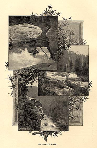
ON LINVILLE RIVER.
Page 127
Among the larger tributaries to the Cape Fear are the Black and North East rivers, both large, navigable streams.
In the south-east corner of the State are Lumber and Waccamaw rivers, both bold, navigable streams, entering South Carolina, uniting with the Pee Dee, and emptying into Winyah Bay near Georgetown.
In the northeastern section are numerous broad, navigable rivers, draining an area of about two thousand five hundred square miles, and emptying into Albemarle Sound. Of these the Chowan is the largest. It is joined by the Meherrin, the two having a united length of about one hundred miles, and giving practicable navigation into Virginia.
The chief of the other streams are Perquimans, Little river, Pasquotank and North river, all navigable, with little fall, and therefore unavailable as water-power.
The Alligator and the Scuppernong are broad, deep but short streams, emerging from the great swamps of Hyde and Tyrrell counties. They also empty into Albemarle sound.
Pungo, Bay river, and, between the Neuse and Cape Fear, several other short tidal streams, such as Newport and North river in Carteret county, White Oak river in Jones county, New river in Onslow county, and Lockwood's Folly and Shallotte in Brunswick county, contribute their testimony to the extent of the water area of the coast region, and to the evidences of a bountiful, but not excessive, annual rainfall.
The total aggregate in the length of the rivers in North Carolina--not including innumerable small rivers and creeks--is about three thousand three hundred miles, and their total fall is about thirty-three thousand feet, or an average of ten feet to the mile.
The water powers are treated under a separate and subsequent head.
LAKES.
The lakes naturally comprised in the water system of the State, compose a very small area in the water surface. They are found only in the Coastal Plain region and are comparatively of small size. In the Mountain region, evidently, in a former geological era, they had filled the areas now occupied by numerous valleys; but the barriers which once confined them long since gave way, and the tumultuous streams which now drain those valleys give no present token of their former languid life. In the Piedmont Plateau region there are now no lakes, nor any evidence that they had ever existed. In the Coastal Plain region are to be found fifteen in all, of various dimensions. The
Page 128
largest is Mattamuskeet, in Hyde county, with an area of nearly one hundred miles, of elliptical form, and in dimensions about fifteen miles in length and from five to seven in breadth. This, and Lake Phelps, Alligator lake and Pungo lake, are all situated in the great swamp between Albemarle and Pamlico Sounds; and all of them are of smaller area than Mattamuskeet. In the White Oak Swamp, in Jones and Carteret, is a group of small oval lakes, a few miles apart, and united with each other naturally or artificially. The largest of these, Northwest lake, has an area of ten or twelve miles. In the Gum Swamp, in Bladen and Columbus counties, is the Waccamaw lake, eight miles long by five broad. These lakes, being situated in the highest part of the swamps in which they lie, have no feeding waters, but most, if not all of them, discharge full and exhaustless streams. They all have sandy bottoms, and a depth of from eight to ten feet. Most of them seem to have originated in the ignition during long continued dry weather of the peaty beds which compose the body of the swamps. The aggregate lake surface of the State is estimated at about two hundred square miles. All of these lakes afford excellent rod fishing.
SOUNDS AND BAYS.
The coast of North Carolina, for a distance of nearly three hundred miles, is separated from the ocean by a succession of long narrow islands, in width from half a mile to a mile or more, compose largely of pure white sand tossed up by the winds into dunes or hillocks; occasionally there are extensive areas of marsh, covered with coarse grass, wild oats and other vegetation, forming the pasturage of the herds of wild ponies which abound on some of the banks. Through this narrow barrier the sea makes its irruptions to the sounds within, forming the inlets and outlets through which the operations of commerce are conducted. These sounds are of various dimensions, two of them being important inland seas. Of them all, Pamlico and Albemarle sounds are the most extensive, the former lying parallel with the coast, with a length of about seventy-five miles and from fifteen to twenty-five miles wide; the other lying east and west, with a length of sixty miles and a breadth of from five to fifteen miles. These two sounds are connected with each other by Croatan sound, four miles wide and ten long, and also by the narrower Roanoke sound. Currituck sound extends from Albemarle sound to the waters of Virginia through a shallow channel of four or five miles wide. By a canal of a few miles in length it forms a connection between the inland waters of North Carolina and those of Virginia, and becomes the avenue for the passage of a very large commerce. These larger sounds, all navigable
Page 129
for vessels drawing from twelve to fifteen feet of water, besides being important for the carriage of a great outward and inward trade, are the localities of the largest and most productive fisheries along the Atlantic coast, abound in oysters and other shell fish, and are the haunts of innumerable wild fowl of the most desirable varieties.
South of Pamlico sound there is a continuity of narrower and shallower sounds to within a few miles of the mouth of the Cape Fear river, where they are interrupted by a narrow isthmus of sand. These smaller sounds are Core, Bogue, Stump, Topsail, and others. All are connected with the ocean by numerous but somewhat capricious inlets, dependent for their stability upon the condition of the ocean, but in their caprices offering no permanent obstruction to navigation.
This inland water system is connected with the waters of Chesapeake bay by the Dismal Swamp and Albemarle and Chesapeake canals, and with the connection of the waters already made through Delaware and New Jersey, can easily be made part of a great interior waterway of inestimable value to the United States in the event of war with foreign nations.
The bays are chiefly enlargements or projections inland of the sounds. Under the head of Commercial Fisheries may be found a more extended description of the sounds.
SWAMPS.
Of what are known as swamp lands, there is an area of between three thousand and five thousand square miles. They lie chiefly in the counties bordering upon the sounds or upon the ocean. They are not alluvial lands or subject to overflow, but are, as a rule, elevated above the adjacent streams of which they are the sources. Some of them are peat swamps, with an accumulation of decayed or decaying vegetation of considerable depth. The value of these lands is indicated by the character of the vegetation upon them. The prevalent growth of the best swamp lands is black gum, cypress, poplar, ash and maple, and also a luxuriant growth of cane. These lands have for many years furnished an abundant supply of timber from the species of trees above mentioned.
The largest area of swamp land is known as the Hyde County Swamp, although it occupies a part of five counties. It has an area of nearly three thousand square miles. Owing to elevation above the adjacent surface, drainage is easy, and large bodies of it have been subdued to cultivation, and are among the finest farming lands in the State, the chief crop being corn. The water, after drainage, is so
Page 130
near the surface as to make these lands independent of drought, should one occur.
About one hundred square miles of the great Dismal swamp lie within this State. Dover swamp, between the Neuse and Trent rivers, has an area of one hundred and fifty square miles. In its central part it is sixty feet above the sea, and therefore susceptible of easy drainage. The other principal swamps are Holly Shelter and Angola Bay in Onslow, Duplin and New Hanover counties, Gum swamp in Brunswick and Columbus, and White marsh and Brown marsh in the same section. All of them abound in valuable timbers, cypress, juniper, poplar, maple, oak, &c., and the industries of getting shingles, staves and other products of the forest are very actively pursued.
The most productive farms in the State have been reclaimed from the borders of many of these swamps, and have proved practically inexhaustible. Lands in Hyde county, cultivated for a period of one hundred years continuously in corn, without the application of manure, show no apparent loss of fertility. The swamps themselves, and also the country around them, seem conducive rather than prejudicial to health--the timber-getters, engaged in the very depths of mire and water, appearing to be peculiarly exempt from malarial poison, if, in fact, it exists in the swamps.
CANALS.
In the construction of canals, North Carolina claims a proud pre-eminence; for as far back as 1790, was authorized by the Legislature of the State the construction of the Dismal Swamp canal, connecting the waters of Pasquotank river (North Carolina) with those of Elizabeth river (Virginia). This was required to be done by private subscription, and it was so done; and thus was completed the existing Dismal Swamp canal, undertaken thirty-five years before the great Erie canal was completed, and eighteen years before the Pioneer canal of New England--the Middlesex--was opened for use. This canal served its purpose usefully for nearly a century. Recently it has been sold, perhaps for other uses, because other means of inter-communication, swifter and more capacious, have largely superseded it.
In addition to this, early steps were taken to improve the navigation of several large streams in this State, large volumes of water in their lower courses finding entrance into good and convenient harbors, but, in their middle courses, interrupted by rocky obstructive ledges, above which, in several instances, there were long
Page 131
stretches of natural slackwater, with practicable navigation for comparatively long distances. These undertakings were made a long time since. Thus the Cape Fear Navigation Company, with power to construct canals, received a charter to improve the Cape Fear river in 1795; the Roanoke Navigation Company and the Neuse River Navigation Company in 1812; the New River, the Tar River, the Catawba River and the Cape Fear and Yadkin River companies in 1816.
Upon all these schemes vast sums were spent, and little accomplished. Projectors were all disappointed, because, in all instances, the costs far exceeded estimates, and the relative poverty of the people and communities and the inability to enlist the aid of capital abroad, as was subsequently the case in the early days of railroad construction, compelled the ultimate abandonment of the effort, and left our river-sides with here and there some partially finished section of work, like the Weldon canal, to become available in after generations as valuable water-power.
Of late years, the Albemarle and Chesapeake canal, connecting by a cut of a few miles waters in Virginia and North Carolina--the waters of Chesapeake bay with those of Albermale sound--gives navigation to sea-going vessels and opens up an inland navigation from Newbern to Norfolk, and, for smaller vessels, through the Clubfoot and Harlow canal, from the waters of Beaufort harbor.
The following statement comprises about the present condition of our waterways:
"There are eleven hundred miles of inland steamboat navigation in North Carolina. Ocean steamers of large burden come into Wilmington and Beaufort, and the Old Dominion and Clyde lines of coastwise steamers come to Newbern, Elizabeth City and Washington via the Albemarle and Chesapeake canal. The sounds are navigated by a large fleet of light-draft and fast steamboats that furnish abundant means of transportation for passengers and freight between the numerous points where they touch. Steamboats run up the Chowan and Black Water to Franklin, Va., and up the Meherrin to Murfreesboro; up the Roanoke to Halifax; up the Neuse to Kinston; up the Trent to Trenton; up the Cape Fear to Fayetteville; up the Tar to Tarboro; up the Scuppernong to Cresswell; up the Alligator to Fairfield; up the Cashie to Windsor; up the Perquimans river to Belvidere; up the Little river to Woodville; up the Pasquotank many miles above Elizabeth City; up the North river to Indian Township, and up Moccasin river and Swift creek to the head of navigation.
Page 132
PORTS AND HARBORS.
Along the coast of this State, extending from Back bay, within the Virginia boundary, nearly to the South Carolina line, is a series of narrow barriers of land, interspersed with marshy, rush-covered flats, which seem to have been purposely interposed by nature between the tumultuous outside ocean and the placid expanses of water lying within; inland seas, with all the repose and safety of interior lakes, yet with some of the features of the outside coast lines, inasmuch as the eye sweeps sometimes over a boundless stretch of waters, enlivened with all the animation of the maratime landscape, the full-spread sails of the merchantman, the white wings of the fishing craft, or the trailing smoke of the swift flying steamer, until it rests far away upon the sandy beach and the thin fringe of shrubbery that forms the background. These inland waters, the Sounds, as they are known, are in themselves so smooth as to constitute safe harbors from the perils of the ocean, deep and navigable, but interrupted by shoals and bars; yet in the deep bays and estuaries providing ports for the vessels engaged in the coasting trade, a class of shipping at one time also having a large West India trade.
But, important as these inside bays and ports are and always will be, their importance must always be controlled by the access to them from the open sea, and which is imperatively dominated by the location and permanency of the inlets, and the depth of water upon their bars.
In the history of our coast there is nothing that presents itself as so unstable and capricious as some of these inlets, almost literally here to-day, there to-morrow. Once there were inlets into Currituck sound, with good depth of water, now there are none--one closed in 1775, one in 1828. Opposite the eastern opening of Albemarle sound was once an inlet; now occupied by dangerous Kitty Hawk and the fatal Killawil dunes. A little farther south, opposite Roanoke Island, was once the deep inlet of Nag's Head, through which the earliest English adventurers made their entrance and found a convenient landing-place on the shores of the famous island. That inlet has long been closed, and on the solid land which now fills its channel stands the hotel which forms the noted summer resort of "Nag's Head." Opposite the lower end of Roanoke Island opens Oregon inlet, which for many years has provided safe entrance for vessels drawing ten to twelve feet of water into the waters of the sound. Thence down the coast, through the very thin line of "banks," are two or three unsteady, unsafe entrances, opening and closing at the will of the outside waters. Passing down the coast opens Hatteras

NEW RIVER, JACKSONVILLE--WILMINGTON, NEW BERN & NORFOLK RAILROAD.
Page 133
inlet, not far from the cape of that name; and this, with Ocracoke inlet, forms the usual most reliable access to the inland waters of the great sounds, Pamlico and Albemarle.
Along these sounds, at various points, deep and broad estuaries extend back to the mouths of large rivers, the Chowan, the Roanoke, the Tar, the Neuse, together with such streams as the Pasquotank, which in its relation to the artificial channel of the Dismal swamp canal, has given existence to one of the most thriving of these inland ports--Elizabeth City. Thus along these inland waters have grown up ports of importance, to be estimated more by their value in relation to domestic trade than to foreign commerce; for Washington and Newbern, both possessing fine harbors and easy access, are controlled by the limitations imposed by the depth of water in the inlets or on the shoals within the channels, so that the foreign trade once enjoyed by them, and carried on in a smaller class of vessels than now regarded as profitably adapted to foreign trade, is now practically suspended. But in their interior operations they are ports with a magnitude of business that emphasizes the prosperity of the sections of country tributary to them, and the waters of the sounds are enlivened with fleets bearing away the limitless variety of contributions to American commercial prosperity--cotton, lumber, shingles, naval stores, corn, the products of truck farming, etc.
Just under Cape Lookout opens, between Core and Bogue sounds, and at the mouth of Newport river, the inlet which lets into Beaufort harbor. Vessels drawing twenty feet can enter readily from the sea, and, in twenty minutes, are lying snugly at their anchorage or at their wharves. It is entered at all times, except against a north or northwest wind. It is a harbor of refuge in time of storm, from the enemy in time of war, a rendezvous chosen as the basis of naval operations, as during the war of the Revolution, when the fleet destined for the attack on Charleston first concentrated here; when, in the war of 1812, captured prizes were brought in here for adjudication, and when in the late Civil war, the harbor was filled with war vessels and transports of the Federal Government. The water within the harbor is sufficient for the largest merchant vessels, yet it is not a commercial port of value, for the reason that no great navigable stream brings to it the riches of the interior, and because the single line of railroad which reaches it has not yet been able to divert the current of traffic from its accustomed channel.
Down the coast, below Beaufort, several inlets open into the sounds at the mouths of tide-water rivers, such as White Oak and
Page 134
New river. But the water on their bars is shallow, and these bars so shifting as to forbid the expectation that they will ever add to the number, value or fame of our ports and harbors.
Between the island known as Smith's island, at the southern extremity of which is the dreaded Cape Fear, the "promontorium tremendum" of DeBry's map, and the main land on the west, pours in the Cape Fear river, the only large river in the State--the only one in fact between the Hudson and the Savannah that makes directly into the ocean, for, before reaching it, all the others are swallowed in long and wide bays, estuaries or sounds.
Here might be expected a harbor of easy entrance and ample capacity. Therefore we find a new England colony of adventurers seeking settlement and homes within its shelter in 1660, followed by a colony from Barbadoes in 1662-'63, and thenceforward continued occupation, founding of towns, opening up of plantations, enlargement of population and increase of wealth up to the present day. In early times the class of merchant vessels, or even of war vessels, was small and draft light, so that the question of depth of water on the bar and in the inner channels never seemed to have been presented. In all probability there never was occasion for it, for there was but a single entrance--that between Smith's and Oak islands, and that secured sufficient water for all vessels using the harbor. But in 1761 a long-continued tempest cut through the banks between Smith's island and what was long afterwards known as Federal Point, forming, until recently closed, what was known as New Inlet. The waters turned into this new channel in time attained a depth of water equal to that on the old or main bar, and eventually reduced the depth of water on that, in 1839, to about nine feet at low water, the New inlet bar at the same time showing ten feet, and becoming the channel through which most of the coasting trade was conducted. This reduction in depth involved diminution in trade, and Wilmington was seriously menaced with the loss of its most valuable commerce. Therefore the State of North Carolina began the work of relief, continuing it from 1823 to 1828, when the General Government very properly assumed the duty and the cost. The operations for many years consisted of efforts to deepen and clear the channel of the river for some miles down by dredging, but chiefly by the construction of jetties, and after some years of labor and a large expenditure of money, a gain of two or more feet in depth was effected. The work was suspended, and resumed in 1852, and directed to attempts to close the New inlet by closing the entrance between Smith's and Zeke's islands, and fair progress was made, when, in September, 1857, a great storm swept
Page 135
away nearly all that had been accomplished, and efforts were abandoned until 1870, when they were resumed with determined purpose and with large appropriations. This has been done until the breach between Smith's and Zeke's islands was closed, and eventually the flow through New inlet finally checked. This is not the place for the details of this important work, the present object being only to show by what methods the usefulness of the Cape Fear river, in its relation to material and domestic commerce, has been restored. This has been done by the erectiom of a solid dam more than a mile in length and with a breadth of from ninety to a hundred and twenty-five feet, knit together by natural grass and oyster shells, until it is apparently impregnable to the assaults of the fiercest tempests. The effect on the depth of water on the main bar was not at once appreciable; but in two or three years, and assisted by the process of suction dredges, a great gain has been made, so that whereas in 1878, when the shortest soundings in the Bald Head channel were nine feet, in 1882 they were fourteen feet, and now, there is twenty to twenty-two feet and more at high tide.
The Government is now at work with purpose to deepen the water on the bar to twenty-six feet, or thirty, which is thought to be practicable. Doing this, a safe and deep harbor is found inside at Southport and thence up to Wilmington, with the gains already made, in a channel which affords, up to the wharves, a depth of twenty-two feet or more.
The importance of these improvements are already recognized nationally and in their relation to the business of Wilmington. The customs receipts have quadrupled; and as vessels of large tonnage can now cross the bar and come up to the city wharves for freight, the cotton receipts of the port have mounted up annually to nearly two hundred thousand bales, and they find shipment in a class of vessels which had never entered the port until the improvements in the channel were made--the freight steamships of from one thousand two hundred to one thousand eight hundred tons burden.
The improvements which affect beneficially both Wilmington and Southport are none the less important to the latter than to the former. Southport has a capacious land-locked harbor, of great depth and free from dangerous shoals, and it becomes a safe harbor of refuge during storms, and in cases of disablement of vessels at sea by storm or other accident; and the benefits already accrued are ample compensation for the cost of the various works. The increased accessibility of the harbor also gives it great value as a coaling station, lying in the path of an enormous coasting and Gulf trade, and the first port that can be
Page 136
reached by vessels bound north who find themselves short of supplies.
Wilmington, or the Cape Fear river harbor, during the civil war illustrated some peculiar features of value. With its ease of access it was also readily defensible. One of its fortifications successfully repelled the first assaults of one of the largest and strongest squadrons and the fiercest and most terrible bombardments known in naval annals. It did indeed succumb in the second and more formidable attempt; but not until after three or more years of effort to capture or to close the port were the blockading vessels, which alone kept the Southern States in communication with the outer world and kept up some semblance of trade, effectually excluded. It is stated that the number of blockaders, as they were called, those that ran the gauntlet and got in safely with their cargoes, was, from May 20, 1863, to December 31, 1864, about two hundred and sixty; prior to May 20, 1863, fifteen; and after December 31, 1864, ten, making a total of two hundred and eighty-five.
South, or rather west, running down the coast, which at the mouth of the Cape Fear makes a course at right angles with its former direction, there are only two harbors, both of minor importance--Lockwood's Folly and Shallotte--with capacious and safe anchorage inside, but with little more than five feet water on the bar, except with favorable wind and tide.
WATER POWERS.
During the past few decades, the cheapening of coal and the necessity for locating on railroad lines in order to avoid the expensive hauling over poor country roads, have led to the greatly increased use of steam, and to a corresponding neglect of water powers in manufacturing enterprises. One after another, even a number of corn and flour mills, on the banks of North Carolina streams, have been abandoned in favor of the mills established about towns and cities and operated by steam on a larger scale.
But in spite of this tendency, many of the water powers near railroad lines have been developed to their full capacity, as at Rocky Mount, Haw river, and Rockingham; and Weldon and Roanoke Rapids promise soon to be great manufacturing centers. The builders of mills at these places have shown their faith by their works, and in reply to a recent inquiry as to the relative merits of water and steam power for operating cotton mills, these men express a preference for water power, if a good one can be had sufficiently near the railroad.

WATER POWERS--NARROWS OF THE YADKIN.
Page 137
This distance of most of the North Carolina powers from railroad transportation is the factor that has prevented their development; but the transmission of power by electricity promises to do away with this disadvantage by making it practicable to locate the factories on the railroad lines and still operate them by water power, whether one or twenty miles away. This new factor is giving a new and greater importance to our water powers than they have had before. It is rendering practicable not only the development and use of the hitherto inaccessible large powers, like the Narrows of the Yadkin, but it also renders possible in many cases the concentration of several small water powers into a single factory, though these water powers may be miles apart on one or more streams.
The largest and most important powers in the State are on the Roanoke, Yadkin and Catawba rivers, but on a number of other streams, notably on the Cape Fear and its tributaries, are many powers of sufficient magnitude to operate large factories. On the Roanoke river, in North Carolina, the possible water developments are limited to that portion of the stream between Gaston and Weldon, where there is a fall of eighty-four feet in a distance of about nine miles; and the possible developments here range in the aggregate under different conditions from twelve thousand to twenty thousand horse power. This is to be divided between two companies, the Roanoke Navigation and Water Power Company, and the Roanoke Rapids Company. The canal owned by the former of these starts at Rock island, a short distance below Gaston, and terminates just below Weldon, having a total length of about nine miles. The total available fall in this canal is seventy-eight feet, of which thirty-three feet is available at the upper locks, about three and one-third miles below the head of the canal, and the remaining forty-five feet is available at the lower end of the canal.
The canal of the Roanoke Rapids Company is only about one mile long, the lower end of it, with an available fall of twenty-five feet, emptying into the river at a point about opposite the upper locks in the old canal. The upper end of this Roanoke Rapids canal is extended up the river about a mile, by diking certain islands and connecting them with dams. It is claimed that this canal will develop from five thousand to seven thousand horse power. Already one factory has been built at its lower end (about four and one-half miles above Weldon) and others are now in process of construction.
On the Dan river and its tributaries in North Carolina there are several fine water powers, some of which have already been developed,
Page 138
especially on Smith river at Leaksville and on the Mayo river at Mayodam.
On the Tar and Neuse rivers there are but few valuable water powers; one on the Tar at Rocky Mount (fully developed) and one or two on the Neuse, near Raleigh, (partially developed); Millburnie, about six miles from Raleigh, where there is a partially developed power, with an available fall of about twelve and one-half feet; and the Falls of the Neuse, three miles above the Raleigh and Gaston railroad, which latter power can be entirely used by the paper mills erected here. On the Cape Fear river, Smileys and Buckhorn falls are undeveloped powers of some magnitude and promise. The first of these is about five miles from the Atlantic Coast Line railroad and has a fall of twenty-seven feet in a distance of three and one-half miles, and the second, at a distance of about seven miles from the Seaboard Air Line railroad, has a fall of twenty feet in a distance of one and one-half miles.
On the Deep and Haw rivers, tributaries of the Cape Fear, are a number of valuable powers, both developed and undeveloped, and located at these developed powers are more than a dozen cotton mills and a number of grist and saw mills. The most valuable of the powers on Deep river is two and one-half miles above its junction with Haw river, at Lockville, on the Seabord Air Line railroad. Here the canals formerly used for navigation purposes can now be used for operating extensive factories, though at present there are located here only a small roller mill and a grist mill. The total fall at this point is twenty-four feet, which will develop from six hundred to eight hundred horse power at all seasons of the year. Between this point and Carbonton there is only one available water power, that at Gulf, which operates McIver's mills. But from Carbonton up to Jamestown, where the river crosses the Southern railroad, there are a large number of water powers, both developed and undeveloped. The developed water powers operate some half dozen cotton factories and a number of grist and saw mills.
On Haw river, the first power occurs some three miles above its junction with Deep river, and between this point and the upper boundary of Alamance county there is a succession of powers quite similar to those on Deep river above Carbonton; eight of these powers on the main stream and three on the tributary streams operate cotton mills, and a large number of minor powers operate grist and saw mills.
The Yadkin river, at and just above the Narrows, is one of the greatest power centers in the State, and will probably be developed in

WATER POWER, TAR RIVER--ROCKY MOUNT.
Page 139
the near future. Here the river has cut its way down, in a narrow gorge, across a series of very hard and tough volcanic rocks to softer rocks below. Starting at the lower end of the Narrows gorge, three to four miles long and one hundred to five hundred yards wide, in the distance of ten miles the river has a fall of more than two hundred feet, an average of more than twenty feet to the mile. The conditions do not favor the location of factories directly on the banks of the stream, but in the near future there will probably be ten thousand to twenty thousand horse power developed and transmitted from the Narrows region to factories located and operated on the railroad a few miles distant. Below the Narrows and between that point and the Carolina Central railroad there are four prominent shoals which may be considered available for water powers: (1). Bluetts falls, about four and one-half miles above the railroad, where there is a fall of eight or nine feet in a distance of one thousand feet; (2). Grassy Island shoal, five and one-half miles above the railroad, where there is a fall of about thirty-five feet in a distance of four and one-half miles; (3). Swifts Island shoals, about seven miles below the Narrows, where there is a fall of eighteen feet in two and one-half miles; (4). Gunsmith shoals, two and one-half miles above the last named, where there is a fall of nine and one half feet in less than half a mile. Above the Narrows below the Southern railroad there are some half dozen shoals that can be developed into important water powers. Above the Southern railroad crossing, near Salisbury, are a number of smaller powers.
Of the tributaries of the Yadkin and Pee Dee rivers are a number of smaller, but valuable powers in Iredell, Davie, Surry, Wilkes. The most unique and interesting of the smaller streams in the State are those in portions of the sand hill region, such as Hitchcocks creek, in Richmond (tributary to the Yadkin), and Rockfish, in Cumberland county (tributary to the Cape Fear). The sand here serves as a sponge for the rain water, which flows by numerous springs into these creeks with but little variation between the winter and summer supply. The former of these streams is only seventeen miles long, and yet on it are located six cotton mills and several grist and saw mills. As illustrating the great benefits of such manufacturing establishments to the communities in which they are located, it may be stated that these cotton mills in Richmond county, operated by such small streams, have paid out to the people in wages, taxes and fuel during the past five years over $1,000,000.
The next great manufacturing center after Weldon on the Roanoke and the Narrows region on the Yadkin, should be somewhere on
Page 140
the western North Carolina railroad near where it crosses the Catawba river, or west towards Hickory. For several miles below this railroad crossing, and in the long bend for twelve or fifteen miles above this point, are a number of shoals or rapids in the Catawba, with a fall ranging from five to fifty feet in distances of from a few yards to two or three miles. These might be developed separately to operate independent factories, or following a larger plan, supported by larger capital, the several shoals might all be connected by electric wires and the power cencentrated at some central point. The powers included within this region are: (1). Sherrill's Ford shoals, with a fall of thirteen feet in one and nine-tenths miles. (2). Monbo shoals, with a fall of six feet. (3). Long Island or Crawford's Island shoals, with a fall of twenty-three and one-half feet in one and seven-tenths miles. (4). Buffalo shoals, with a fall of eleven and four-tenths feet in 0.66 of a mile, within a few miles below the Western North Carolina railroad crossing. Above this railroad crossing, and below the crossing of the Lenoir Narrow Gauge railroad from Hickory, (5). Lookout shoals with a fall of fifty-four feet in three and two-tenths miles. (6). Lower Little river shoals with a fall of nine and seven-tenths feet in one and one-tenth miles. (7). Canoe Landing shoals with a fall of nine feet in one and nine-tenth miles. (8). Great Falls, with a fall of fifteen feet in one mile. (9). Horsford shoals, with a fall of thirty-one feet in two and nine-tenths miles, and (10). Devil's shoals, with a fall of thirteen and eight-tenths feet in one mile. The South Fork of the Catawba, the three Broad rivers and Green river, each though much smaller streams than the Catawba have a number of water powers, many of which have already been developed and are now operating cotton mills, and a still larger number of undeveloped or partially developed powers. Also several other tributaries of the Catawba which descend rapidly from the forest-covered mountains--notably the Linville river--possess promising water powers. There are other important water powers on the Catawba, both above and below this region, several of which operate cotton, grist and saw mills.
The powers on streams west of the Blue Ridge have been little developed, and individually will not attain the importance of some of those further east; but they are numerous, and in the gorges, which are often deep and narrow, dams can be constructed at small cost. Electric transmission will in the near future, render practicable the concentration of power from several of these smaller developments.* * NOTE--For more detailed information see "Water Powers of North Carolina," Bulletiu No 8. North Carolina Geological Survey.
Page 141
COMMERCIAL FISHERIES.
The fishing industry of North Carolina ranks as one of the most important business enterprises of the State, and in the coastal regions is no doubt of greater value than any other single branch of trade. There are few States having so large a population so entirely dependent on the fisheries for a livelihood, and there are few sections in which the general facilities for prosecuting the industry are more favorable. The fisheries, therefore, possess a great economic interest to the State, and indirectly to the country at large; and a proper knowledge of the extent, conditions and needs of the industry becomes a matter of considerable importance to the citizens of the Commonwealth.
The coast of North Carolina, following the outer shores, is only about three hundred miles long, but if the sounds, estuaries and other indentations are considered, a coast-line nearly one thousand five hundred miles in length is disclosed, along the entire extent of which the prosecution of commercial fishing is made possible by the configuration of the shores and the adjoining bottom, the absence of high or rocky shores, and the preponderance of low, sandy stretches and shallow water areas, permitting the employment of pound nets, seines, and gill nets under the most favorable circumstances.
The characteristic physical features of the coastal regions of North Carolina are the low, narrow, sandy islands and peninsulas which skirt nearly the whole ocean front of the State, between which and the mainland are numerous sounds, some of large size, which are the principal fishing grounds, while the mainland is very irregular in outline and is intersected by a number of large and small streams.
The principal fishing grounds are the sounds and lower courses of the streams emptying into them. Fishing in the upper courses of the rivers is usually of a non-commercial nature, and is unimportant.
The sounds of North Carolina are Currituck, Albemarle, Croatan, Roanoke, Pamlico, Core and Bogue, each of which deserves brief notice.
Currituck sound is the most northern sound in the State. It runs parallel with the coast, and extends from the Virginia state-line to the eastern end of Albemarle sound, with which it merges. It is forty miles in length, and from three to four miles in width. For a body of water of such size the depth is extremely shallow, in no place being more than nine feet. Except during periods of dry weather the water is fresh, although at one time it communicated
Page 142
freely with the ocean by means of Caffey inlet, which was closed in the year 1800. Prior to this time the sound contained marine fish, but at present only fresh water and anadromous fishes are found in it. Black bass (locally called chub) and white perch are very abundant, and at the proper season rock and herring enter the Sound in considerable numbers. The catch of black bass is probably greater than in any other part of the State, if not the largest in the country. The region is annually visited by enormous numbers of wild fowl, and is one of the most noted hunting resorts on the Atlantic coast.
Albemarle sound and tributaries are next in order. This sound has the distinction of being the largest coastal body of fresh water in the world. Its extreme length from east to west is sixty miles, and its maximum width is fifteen miles, the average being six to eight miles; it, therefore, contains about four hundred and fifty square miles. The water is normally quite fresh, but during periods of excessively dry weather it becomes salt or brackish, especially at its eastern end, where it drains into Roanoke and Croatan sounds.
Of all the North Carolina sounds, this is the most important from a fishery standpoint, and it is probable that there are few bodies of water of similar size in the world having more extensive fisheries. It is especially remarkable for its level bottom and uniform depth of water, and the absence of strong currents and tides, except those of infrequent occurrence resulting from gales. The importance is due to the fact that the region is annually visited by enormous bodies of shad, ale-wives, striped bass and other desirable economic species, and the natural conditions permit the employment of seines, pound nets, gill nets and other devices in almost limitless numbers.
Eight rivers enter the sound, four on the north, two on the west, and two on the south, in nearly all of which more or less extensive fisheries are carried on. The Chowan and Roanoke rivers, which flow into the western end of the sound, are among the largest and most important in the State, and have large fisheries in the portion adjacent to their mouths. The North, Pasquotank, Little and Perquimans rivers, on the north, and the Scuppernong and Alligator rivers on the south are short, wide streams, the most important as regards fisheries being the Pasquotank and Alligator.
Roanoke and Croatan sounds lie to the south of the eastern end of Albemarle sound, and extend parallel with the coast; they are separated by Roanoke Island. Roanoke sound lies to the east of the island, and is eight miles long and one and one-half to two miles wide. It is very shallow throughout its length, except in a narrow channel which skirts the shore of the island. Croatan sound has
Page 143
the same length as Roanoke sound, but is two to four miles wide and is much deeper. Most of the drainage from Albemarle sound passes through it. The combined area of these bodies of water is seventy-five miles. Important gill-net and other fisheries are prosecuted in these sounds.
Pamlico sound and tributaries are of commanding importance. With the exception of Long Island sound, this is the largest sound on the Atlantic coast of the United States. It is about seventy-five miles long, and from ten to thirty miles wide, the area being about one thousand eight hundred and sixty square miles. On the north it communicates with Albemarle sound, through Roanoke and Croatan sounds, and much of the water of Albemarle sound finds entrance into the ocean through it; on the south it joins Core sound. The general depth is fifteen to twenty feet. The sound is separated from the ocean by long, narrow strips of sandy land called "Banks," through which the water of the sound finds exit at New, Hatteras, and Ocracoke inlets. The land known as the "Banks," consists chiefly of low, barren sand hills, with occasional patches of scrubby vegetation. Two important rivers, the Pamlico and Neuse, enter the sound from the west, their mouths being broad estuaries in which considerable fishing is done. Pamlico sound contains a great wealth of both fresh-water and salt-water fish. The large bodies of anadromous fish which occur in the sounds to the north all pass through it. The salinity of the water permits the entrance of menhaden, squeteague, spots, mullet, sheepshead, whiting, hogfish, bluefish, etc., in large numbers. Large areas are covered with a natural growth of oysters, a product which has recently attained marked prominence.
Core and Bogue sounds, communicating with Pamlico sound on the north, and extending first in a southwesterly and then in a westerly direction, form a long and narrow body of water about fifty miles in length, and from one to six miles in width. Their area is about one hundred and sixty-five square miles. These communicate with the ocean through Beaufort, Bear and Bogue inlets. The water is very shoal, varying from one to ten feet, and not averaging more than four or five. The people living on the shore of these sounds are very generally dependent on the water for a livelihood, and the fisheries carried on are very extensive. The principle species taken are mullet, squeteague, bluefish, spots, hogfish, Spanish mackerel and whiting. The catch of the two first-named fish is larger than in any other body of water on the Atlantic coast.
Other sounds.--South of Bogue sound the coast is fringed with five small, shallow sounds, known as Stump, Topsail, Middle, Masonboro
Page 144
and Myrtle sounds. These have but little bearing on the fisheries at present, and are chiefly important because of the possibilities they have for oyster production and cultivation. White Oak and New rivers, the only streams of importance between Beaufort entrance and the Cape Fear river, also have natural oyster beds. New river, in the opinion of Lieut. Winslow and many others, contains some of the finest oyster ground in the world, although the absence of shipping facilities until a very recent date has delayed the development of this important resource.
Fishing in the ocean is prosecuted with gill-nets and seines at many places along the coast, but is especially important on the shore between Cape Hatteras and Currituck sound, where the winter fishery for bluefish has become famous. The species taken in greatest numbers, are, in addition to bluefish, trout, spot, mullet, drum, whiting, Spanish mackerel and sheepshead.
In the vicinity of Wilmington, considerable line fishing is done at times on the blackfish banks located several miles off shore, sea bass, grunts and pigfish being the species taken.
The shore between Cape Hatteras and Bogue Inlet has a number of seine fisheries for porpoises, which congregate in this region in large numbers during the colder months.
The statistical data herewith presented cover the entire commercial fishery interests of the State, including the river basins. From the three general tables which follow, a clear conception may be gained of the condition and extent of the fisheries as they existed in 1890. (The last available census returns.)
- On vessels fishing . . . . . 251
- On vessels transporting . . . . . 175
- In shore fisheries . . . . . 7,052
- On shore, in fish houses, factories, etc. . . . . . 2,796
- Total . . . . . 10,274
I.--TABLE OF PERSONS EMPLOYED,
HOW ENGAGED.
The prominent features of the first table, showing the number of persons employed in the industry are: the small proportion of vessel fishermen, and the large number of shore and boat fishermen, the disparity being greater than in almost any other coast State. The total fishing population, numbering ten thousand two hundred and seventy-four, is much larger than that of any State in the South Atlantic group.
Page 145
| DESIGNATION. | No. | Value. |
| Vessels fishing . . . . . | 54 | $ 30,550 |
| Tonnage . . . . . | 530.72 | . . . . . |
| Outfit . . . . . | . . . . . | 12,129 |
| Vessels Transporting . . . . . | 74 | 53,000 |
| Tonnage . . . . . | 1,084.87 | . . . . . |
| Outfit . . . . . | . . . . . | 5,350 |
| Boats . . . . . | 3,816 | 162,905 |
| Steam flats . . . . . | 20 | 24,000 |
| Pontoons or pile drivers . . . . . | 26 | 1,470 |
| Apparatus of capture--Vessel fisheries | ||
| Seines . . . . . | 16 | 3,975 |
| Lines . . . . . | . . . . . | 2 |
| Tongs . . . . . | 110 | 284 |
| Apparatus of capture--Shore fisheries | ||
| Seines . . . . . | 1,257 | 95,674 |
| Pound nets . . . . . | 950 | 80,394 |
| Gill nets . . . . . | 90,980 | 154,582 |
| Fyke nets . . . . . | 36 | 384 |
| Skim nets . . . . . | 728 | 2,798 |
| Lines . . . . . | . . . . . | 55 |
| Pots . . . . . | 1,165 | 1,755 |
| Tongs, rakes and forks . . . . . | 1,369 | 4,173 |
| Miscellaneous apparatus . . . . . | . . . . . | 202 |
| Shore property and accessories . . . . . | . . . . . | 306,506 |
| Cash capital . . . . . | . . . . . | 303,800 |
| Total . . . . . | . . . . . | 1,243,988 |
The capital invested in the fishing industry was $1,243,988, and the value of vessels and their outfits was $101,029; of boats, pile drivers and steam flats, $188,375; of apparatus of capture, $344,278; of shore property and working capital, $610,306. The minor factors in the investment are brought out in the above table.
| SPECIES. | POUNDS. | VALUE. |
| Alewives, fresh . . . . . | 5,219,979 | $48,865 |
| Alewives, salted . . . . . | 11,261,084 | 115,771 |
| Black bass, fresh . . . . . | 406,330 | 20,420 |
| Black bass, salted . . . . . | 1,200 | 72 |
| Bluefish, fresh . . . . . | 1,151,380 | 29,398 |
| Bluefish, salted . . . . . | 193,814 | 4,205 |
| Catfish, fresh . . . . . | 53,685 | 1,246 |
| Channel bass, fresh . . . . . | 136,950 | 1,404 |
| Channel bass, salted . . . . . | 28,865 | 515 |
| Croakers, fresh . . . . . | 227,345 | 5,461 |
Page 146
| Croakers, salted . . . . . | 84,120 | 2,406 |
| Hels, fresh . . . . . | 160,615 | 9,726 |
| Flounders, fresh . . . . . | 48,630 | 894 |
| Hogfish, fresh . . . . . | 251,370 | 7,830 |
| Hogfish, salted . . . . . | 5,150 | 141 |
| Menhaden, fresh . . . . . | 12,410,400 | 16,171 |
| Mullet, fresh . . . . . | 974,815 | 19,178 |
| Mullet, salted . . . . . | 2,610,216 | 78,065 |
| Mullet roe, salted . . . . . | 950 | 165 |
| Perch, fresh . . . . . | 583,204 | 22,098 |
| Perch, salted . . . . . | 26,270 | 671 |
| Pike, fresh . . . . . | 40,510 | 1,765 |
| Pompano, fresh . . . . . | 9,750 | 780 |
| Red horse, fresh . . . . . | 60,550 | 1,779 |
| Sea bass, fresh . . . . . | 33,075 | 1,158 |
| Shad, fresh . . . . . | * * Number, 1,612,594. 5,675,063 |
301,942 |
| Shad, salted . . . . . | 93,350 | 4,073 |
| Sheepshead, fresh . . . . . | 90,665 | 4,000 |
| Sheepshead, salted . . . . . | 55,680 | 1,981 |
| Spanish mackerel, fresh . . . . . | 82,950 | 5,978 |
| Spanish mackerel, salted . . . . . | 8,550 | 276 |
| Spots, fresh . . . . . | 227,160 | 5,289 |
| Spots, salted . . . . . | 181,100 | 5,573 |
| Strawberry bass, fresh . . . . . | 28,075 | 1,106 |
| Striped bass, fresh . . . . . | 562,841 | 31,973 |
| Striped bass, salted . . . . . | 5,500 | 165 |
| Sturgeon, fresh . . . . . | 175,210 | 4,467 |
| Squeteague, fresh . . . . . | 1,640,160 | 39,958 |
| Squeteague, salted . . . . . | 245,517 | 8,898 |
| Whiting, fresh . . . . . | 35,300 | 1,231 |
| Miscellaneous fish, fresh . . . . . | 474,452 | 12,851 |
| Miscellaneous fish, salted . . . . . | 87,963 | 2,362 |
| Refuse fish . . . . . | 18,500 | 173 |
| Porpoises . . . . . | **
** Number, 1,747. . . . . . |
4,398 |
| Shrimp . . . . . | 144,200 | 5,435 |
| Crabs . . . . . | 47,400 | 1,185 |
| Terrapin . . . . . | 26,552 | 4,690 |
| Turtle . . . . . | 17,725 | 1,024 |
| Quahogs or clams . . . . . | * * Weight of edible part; represents 28,269 bushels. 226,152 |
12,090 |
| Scallops . . . . . | * * Weight of edible part; represents 4,000 bushels. 18,000 |
800 |
| Oysters . . . . . | * * Weight of edible part; represents 807,260 bushels. 5,650,820 |
175,567 |
| Total . . . . . | 51,799,142 | $1,027,669 |
Page 147
In the third table, the quantities and values of each of the important objects of capture are shown. All products are reduced to the common unit of a pound in order that the full extent of this phase of the industry may be given in one summary. The basis for the principal reductions is explained in a foot-note to the table. It is seen that 51,799,142 pounds were taken, with a value of $1,027,669.
The objects of fisheries may be systematically grouped as follows to show the importance of the different classes represented:--
- Mammals . . . . . $ 4,398
- Fishes . . . . . 822,480
- Reptiles . . . . . 5,714
- Crustaceans . . . . . 6,620
- Mollusks . . . . . 188,457
- Total . . . . . $1,027,669
CLASS.
The most important single product of the North Carolina fisheries is the shad, the value of which was $306,015; this sum was considerably in excess of the selling prices of the next important species, the oyster, which was $175,567. The alewives, locally called herring, had a value of $164,636, after which the principal species were mullet, worth $113,414; squeteague, locally called trout, worth $48,856; bluefish, worth $33,603; and striped bass, worth $32,138. The other products are relatively unimportant.
A knowledge of the relative and actual effectiveness of the different forms of apparatus employed in the fisheries is of great practical advantage to the fishermen.
The seine is the form of apparatus that takes the largest amount of fish and yields the greatest money returns. In 1890, 17,984,830 pounds of fish, valued at $401,036, were caught in this way.
The seine fisheries of the Albemarle section are more important than those of any other part of the State, and it is probable that the number of large shad seines there operated is greater than elsewhere in the United States. The counties bordering on the sound and its tributaries, which maintain the most valuable seine fisheries are Chowan and Bertie. In that portion of Dare county bordering on Croatan sound, there are also important seine fisheries. In Pamlico sound, Beaufort and Craven counties have valuable fisheries of this kind. Carteret county leads all others in the value of its seine fisheries, the sales of fish amounting to $86,195; Dare, the next important county, followed with $52,111; after which came Bertie, Chowan, Craven, Currituck, Onslow and Beaufort counties.

STEAM SEINE FISHING.
Page 148
Next to the seine, the pound net is the most productive means of capture, although the value of the catch is less than that of the gill nets; thus 8,282,562 pounds of fish valued at $123,606, were taken.
Few changes in the fisheries of the State during the past decade have been more remarkable than the large increase in the number of pound nets. In 1880, only one hundred and seventeen such nets were set in the State, while in 1890, there were nine hundred and fifty. The pound-nets are most numerous in the Albemarle region, but are also employed in the other sounds, and the rivers emptying into them. This form of net was introduced into Albemarle sound in 1870, since which time it has exerted a marked influence on the development of the fisheries, by supplanting to a greater or less extent the older types of apparatus because of its greater cheapness and efficiency.
Gill nets take somewhat smaller quantities of fish than pound-nets, but the catch has a greater value, owing chiefly to the large numbers of shad secured which have a relatively high valuation. Considerably more than half the shad credited to the State are taken in gill nets, the catch being 3,348,577 pounds, valued at $175,388.
Gill nets are most numerous in Dare county, in which the gill-net catch is far more valuable than in all the remaining counties combined, this prominence being due to the enormous quantities of shad taken. Carteret and Onslow counties rank next in importance, the principal part of the catch being marine species.
Of the remaining forms of apparatus used in the capture of fish, lines are the most prominent, although when compared with seines, pound nets and gill nets, they are insignificant. Line fishing on a commercial basis is followed only in Onslow, New Hanover, and Sampson counties, and quantities of fish taken are small. The aggregate catch was 380,375 pounds, having a value of $13,003, the principal species being hogfish and squeteague.
Skim nets are used in greatest numbers on the Roanoke, Tar, and Neuse rivers in the capture of shad and alewives. In 1890, 247,148 pounds of fish, worth $10,581, were taken by this means. Eel pots are sparingly employed in four counties--Currituck, Dare, Hyde, and Beaufort--and their use appears to be increasing, especially in Dare county. Pots took 153,415 pounds of eels, for which the fishermen received $9,222. Fyke nets are the only remaining apparatus used commercially in taking fish, and these are only sparingly employed in Dare and Sampson counties, where they catch small quantities of catfish, mullet, perch, red horse, sheepshead, striped bass, and squeteague. The total yield was 24,885 pounds, valued at $716.
Page 149
The porpoise industry and the fishery which it supports are of less extent than formerly, owing to the diminished inducements offered to the fisherman by the low prices received for the raw products. In 1890, only two firms were engaged in handling the porpoises, in preparing their hides, and in trying out their oil. The number of porpoises killed was 1,747, for which the fishermen received $4,398. The resulting manufactured products were valued at $10,350.
North Carolina is the most southern State in which the menhaden fishery and industry are carried on. The fishery may be said to be the only one except that for oysters in which vessels are employed, and it is the only off-shore vessel fishery in the State, although a considerable part of the fish handled, are caught in the sounds adjacent to the ocean and not in the ocean itself. The business is centered at or in the vicinity of Beaufort, where six factories were in operation in 1890. The capital invested in buildings, vessels, apparatus, etc., was $97,060, the number of persons employed was one hundred and eighty-seven, the value of the fish handled was $16,171, and the value of the manufactured products was $38,727.
Most of the matter in the foregoing sketch was prepared by Dr. Hugh M. Smith, of the division of fisheries, from data obtained in an investigation of the fishing industries of North Carolina by the U. S. Fish Commission. Valuable information on certain features has also been furnished by Mr. S. G. Worth, formerly Superintendent of Fisheries in North Carolina, and now an officer of the National Commission.
Dr. W. R. Capehart, of Avoca, Bertie county, the third of his direct generation engaged in commercial fishing, in a letter dated March, 1896, says:
"In the Albemarle sound and its tributaries, the steam and horse power seines have invested in realty approximately $100,000, and personalty $58,000, and this requires an annual expenditure of about $31,000 to keep up the wear and tear on the above valuations; and it must be born in mind that much of this annual expense is of a very perishable nature, as is the case with all coastal property, especially fishing apparatus.
These plants give employment for about two months to one thousand persons, whose combined wages for this brief period aggregate $40,000. A few competent seine riggers and menders find a few months additional employment each year, which swells the above wage account about $5,000 more.
The approximate annual value of the catch in seines for the territory under discussion, is $176,000. This includes the iced fish
Page 150
shipped in boxes to northern markets, and twenty thousand barrels of salt fish, valued at $82,000, which are sold almost exclusively in this and adjoining states.
The scrap and waste from these seine fisheries is converted into fertilizing material, and gives an additional $8,000 to the annual value. Bear in mind that all of the above refers to seine fishing alone in the Albemarle sound and its tributaries.
Now we come to pound or dutch nets, which will be considered for the same territory exclusively. As compared with seines this comprises by far the greater quantity of material. There are no less than 1,125 of these pound nets spread in the waters of the sound and its tributaries, which give employment to about 1,200 persons, with combined wages for the season of no less than $42,000. To give very briefly some idea of the cost of putting in this number of pound nets, it will not be amiss to state a few of the items. About one hundred and twenty-five boats valued at $15,625 are employed; about 32,000 pine poles, from fifteen to thirty-five feet in length are required, and cost in the aggregate $5,500; no less than 265,000 yards of netting (twelve to twenty-four feet in depth), is used and at a cost of $110,800.
The output from these 1,125 pound nets may be summarized as follows: 7,900 boxes (iced) fish, mostly shad, and 40,500,000 fish, mostly herring. The iced fish are worth about $85,000, and the others $140,000.
Thus it will be seen that from these two sources alone--seines and pound nets--that no less than $387,925 are invested in the fisheries, apparatus, and in the annual wages paid, and that the value of the catch approximates $409,000. And there are no less than 2,200 persons employed in prosecuting the work.
There is no room to make mention of the other forms of apparatus or the resulting catch from them, except to a comparatively new departure in one branch of the fishing industry. I refer to the sturgeon fishing, now conducted almost exclusively for the roe sturgeon, which are valued for the large roe. This roe is converted by a very simple process--the application of German salt in a particular proportion--into a relish of much popularity in Germany and Russia, known as caviar. This caviar is packed into oak kegs or kits holding one hundred and twenty pounds each and shipped via New York to the foreign destinations referred to. The product is worth thirty three and one-third cents per pound at present, and the price is rather upward than otherwise in its tendency.
There are more than a hundred boats and over two hundred and fifty persons employed in the prosecution of this branch of fishing.
Page 151
The increase in the volume of business done on the Albemarle and its tributaries may be briefly summarized by these facts recently obtained from transportation companies. From 1882 to 1892--ten years--the increase of iced fish shipped was from 13,700 to 23,900 boxes. From 1892 to January, 1896, the shipments have climbed to 42,400."
Very respectfully,
W. R. CAPEHART.
Comparing Dr. Capehart's later data with that of the United States Fish Commission for 1890, it will be observed that the Albemarle Sound and its tributaries present a most remarkable increase. In round numbers the 1895 value of the catch there is very nearly equal to four-fifths of the total value of the catch for the State at large for the former year:
| Source of Catch. | 1890: Value of Catch; State at Large. | 1895: Value of Catch; Albemarle Sound and tributaries. |
| Seines . . . . . | $401,036 | $184,000 |
| Pound Nets . . . . . | 123,606 | 225,000 |
| Total . . . . . | $524,642 | $409,000 |
If the increase in the whole State has kept pace with that of the Albemarle sound, the value of the 1895 catch must have reached the two-million dollar mark.
SHELLFISH.
In the saline waters of North Carolina abound oysters, clams, scallops, crabs, shrimp, and diamond-back terrapin, in perfection of flavor. In commercial importance the oyster is of far greater value than all the others combined, and will be treated accordingly in what follows.
The abundance in which oysters were found along the Atlantic coast of the United States, and their superior excellence, made them at once, upon the settlement of the country along the waters which provided them, an article both of subsistence and luxury. With the increase of interior population and the provision of quick and ready means of transportation, the use of them was enormously enlarged, and the distribution of them, in all the forms of use, became co-extensive with the American continent, and was not confined to that broad area, for Europe, in the diminution of its own supplies, and also in its recognition of the superiority of the American oyster, has been for a number of years a large consumer. The consequence is the depletion of many grounds once regarded as inexhaustible, the diminution
Page 152
in other waters where diminution seemed impossible, followed by the assertion of local rights, attempts at the exclusion of invading trespassers, contention, bloodshed; finally legislative action and the effort to define rights by law, with power to assert and secure them by force; and all this made necessary because human nature knows no moderation in the use of the abundant free gifts of Providence, or in the attainment of that which leads to competency or wealth.
The attempt to retrace the steps of past waste and neglect is what invariably follows in locking the stable door after the horse has gone--vain regrets and fruitless self-reproach. All the deep research of science, all the costly experiments of artificial breeding, all the labor of planting new territory of waters, will not bring back to Connecticut, New York, Maryland and Virginia the store they wasted and the abundance they so universally squandered.
It happens that there remains one treasure-house not yet plundered, one great water granary whose doors are not yet thrown wide open. North Carolina, overlooked and despised in the Eldorado of the Chesapeake, now, when the glories of the latter are fading, is found to possess what, with prudence, patience, legislative wisdom and local self-control, may be converted into a field quite as prolific as the once teeming oyster waters of Maryland and Virginia. Its sounds, its bays and its creeks, extending along the coast for hundreds of miles, give promise of natural conditions that will assure in time as large a product as ever existed in other waters. Some of these North Carolina waters are too much freshened by the influx of fresh-water rivers to have been the habitat of the native oyster, or to be made available as beds for artificial culture; but in all the other waters which exist in the largest proportion, to which the salt waters of the ocean have ready access, the native oyster has always been found, and of great excellence. In the depletion of the oyster grounds of the Chesapeake and other waters, the enterprise of the oystermen of those localities was on the alert to save their industries from ruin, and the invasion of the North Carolina waters was rewarded with the discovery of a large relatively untried area. To check what threatened to effect here what had been done elsewhere, and to secure the people of North Carolina in the possession of their rights, the aid of legislation was earnestly invoked.
One of the first decisive steps taken was the enactment of a law, ratified March 11, 1885, directing the State Board of Agriculture to cause a survey to be made, both of natural oyster-beds and private oyster gardens, with reference to the culture of shellfish. Under the act, the Governor was requested to ask the Federal Government to
Page 153
detail some person in the public service, expert in such matters, to make the necessary surveys. In compliance with the request Lieut. Francis Winslow, U. S. N., was detailed. He has made two reports, extracts from which are here made.
In his first report he says the waters subject to the jurisdiction of North Carolina, consist mainly of twelve sounds, extending along the coast and connected with each other from the Virginia line in Lat. 36° 33′ W. to the Cape Fear river in Lat. 34° 53′ W. These sounds are Currituck, Albemarle, Roanoke, Croatan, Pamlico, Core, Bogue, Stump, Topsail, Middle, Masonboro and Myrtle, and four estuaries known as Bogue, Bear, Brown and New inlets. The harbor of Beaufort and the mouth of the Cape Fear river form other inlets. Some of these sounds, such as Albemarle and Currituck, being principally fresh water, are excluded from the consideration of oyster culture. Albemarle Sound receives the waters of several large rivers, and contains within its own limits 5,631,400,000 tons of fresh water. The other waters are all suitable to the growth of the oyster in its native beds, or for its propagation by planting, Lieutenant Winslow says in his second report:
'Since the survey has been in progress, knowledge of the possibilities of the locality and of the business has become diffused among the citizens, not only of North Carolina, but of other States, and the effect has been to induce a large number of people to enter grounds. In Dare county, forty-three entries have been made, comprising at least twenty-six thousand acres. In Hyde county, three hundred and thirty-nine entries have been made comprising fully twenty-six thousand acres; and in Carteret County, ninety entries, comprising nine hundred acres. Of these entries sixty-eight are by residents of other States, and four hundred and four by residents of North Carolina. Entries are still being made and warrants for surveys are still coming in, and in the course of another year it is quite possible that the territory may be doubled. But, as it is, an aggregate of fifty-three thousand acres entered is a sufficiently gratifying indication of the value of the survey and of the legislation it brought about.
The cultivation of this immense tract will require a great deal of time, money and labor. Thousands of people must be employed and hundreds of thousands of dollars spent. But every dollar so expended goes to increase the material wealth of the State, and the employment of every man insures additional comforts and conveniencies to the families of the citizens of the seaboard counties. It is with pleasure that I have noted that one of the first, if not the first, to venture in this new field, is a citizen of Hyde county, who is reported to have
Page 154
abandoned a profitable lumber business for the purpose of engaging in oyster growing, and who has, I understand, the intention of making as his original outlay a sum about equal to the total value, prior to 1886, of the whole oyster industry of the State.
The natural beds have not only been defined and located, but under the recent law much additional area adjacent to them has been set apart and excepted from entry. These areas are the public grounds, and by law they include the natural beds and sufficient area adjacent and surrounding them, to provide for their natural expansion. The provision for allowance for natural expansion has been liberally construed, as will be seen by the following summary of the areas of the natural beds and public grounds:
| County. | Area Public Grounds. | Area Natural Beds. |
| Dare . . . . . | 4,604.16 | 2,118.25 |
| Hyde . . . . . | 6,891.94 | 1,642.90 |
| Pamlico . . . . . | 4,495.61 | 437.00 |
| Carteret . . . . . | 4,561.40 | 1,012.50 |
| Total . . . . . | 20,553.11 | 5,210.65 |
Or the area of the public grounds exceeds that of the natural beds by 15,343 acres. The natural beds of that portion of the State not under the operation of the new law comprise 3,381 acres; or the total acreage of natural beds is 8,591.
The area reserved for the common fishery is thus ample for all time to come, and as these areas are excepted from entry, and as they include the natural beds, not only is an entry or appropriation of a natural bed prevented, but no person can, practically, enter near a natural bed. At the same time, as the grounds open to the general fishery are defined and known, the private cultivator is free from depredation under guise of the exercise of the common right of fishery. Thus the source of complaint of all classes interested is removed.
The area entered will bring into the State Treasury over $12,000, a net gain over the entire expenses of over $7,000, and the taxes that eventually accrue to the counties and State may amount in the course of a comparatively few years to fully $10,000 per annum."
Legislation is now ample, if enforced, to protect and promote the oyster interests of the State. It is unlawful to use any instrument but hand-tongs to take oysters from State grounds, violation of which is indictable as a misdemeanor. Only residents of the State are permitted to use instruments or boats upon State grounds; and non residents, upon conviction of violation of this provision, are to be fined not less than $500, or be confined in the county jail, to be hired out by the
Page 155
Commissioners of the county for a term not less than one year. Residents must obtain a license for the use of boats, and individuals desiring to catch oysters, whether on their own account or that of employers, must take out from the Clerk of the Court an annual license, paying for the same $2.50 and a Clerk's fee of twenty-five cents, and must make oath that he has been a bona fide resident of the State for twelve months next preceding the application for license. Oysters are to be culled on the public grounds when taken, and oysters of a specified size are to be returned to the waters on the public grounds. Oysters must not be taken from the public grounds between the first day of May and the first day of October. The control of the oyster interest is placed under charge of one Chief Commissioner, to be appointed by the Governor, and to hold office; and, to enable the Commissioner to discharge his duties of visiting the grounds and repelling and capturing interlopers, a patrol boat is provided, with authority to use arms when necessary.
The oysters taken at the different points in the sounds and estuaries vary much in size, shape and flavor. The New river oysters are much prized for size and flavor, and are probably the best known abroad. But the markets of Wilmington, Newbern, Washington and other points are supplied from their various oyster grounds with a shellfish of a quality not inferior to those taken at New river. With the care in cultivation, and the protection given by law, it is only a question of time when the waters of North Carolina will yield as abundantly as the waters of the Chesapeake have done, and, in quality of the oyster, with no inferiority.
The diamond-back terrapin is found in all the coast country, a delicacy in such demand and of such value as to have become the subject of legislative protection and of artificial cultivation.
Clams abound, and are now recognized as valuable members of the family of shellfish. They are shipped in large quantities from Newbern, Morehead City, and many other points.
The same may be said of scallops, soft-shell crabs and shrimp. These delicacies are abundant and find ready sale both in local and distant markets
AGRICULTURE.
"Every part of North Carolina has some one thing
That will make it distinctly a great section."A. K. McClure.
The geographical position of the State, occupying a common ground between the sub-tropical growth of the South and the more
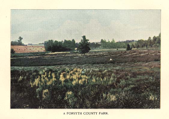
A FORSYTH COUNTY FARM.
Page 156
hardy products of northern latitudes, and its geological formation, rising from a level with the sea on the east, through every degree of increasing elevation to the mountains of the west, where Mitchell rears his supreme summit, unite in the production of greater varieties of minerals, of forest, of flora and of agricultural products than are to be found in any like amount of territory in the United States.
The palmetto, the magnolia and the live-oak are at home in the coast region, while among the mountains of the west the sugar-maple, the hemlock and white pines, the tamarack, balsam and rhododendron find congenial soil and climate for perfect development. "In the first case depression of level has associated the eastern section with the influences of the tropics; in the other the elevation has thrust it into association with Canadian atmospheric conditions. It will be readily understood, then, what a broad and fruitful field North Carolina presents, between the extremes presented, for the profitable culture of nearly all the field crops, vegetables and fruits grown in the United States--the rice of the coast and the buckwheat of the mountains; the cotton of the South and the flax of New England, the corn, the wheat, the rye and the oats, the potatoes, peas, sorghum, the tobacco, vegetables, fruits, grapes, grasses, everything,--which, if North Carolina knew herself, and if the stranger knew her as she ought to be known, would make her the most coveted and most prosperous country on which the sun sheds his fertilizing beams."
This great variety and abundance of resources of different sections of the State not only might supply the wants of her own people but tend to stimulate and exchange among themselves of their surplus products, securing thereby better prices by the saving of freights over long lines of transportation.
While, therefore, North Carolina may not compete with some of the other great agricultural states in such special product as each may excel in, yet combining the variety and universality of production, the capacity for self-sustenance, the "some one thing" that each section excels in; and added to these things the healthfulness and pleasantness of the climate, the beauty of the landscape, the hospitality of the people; the assertion is boldly and confidently made that she surpasses all the others.
The soil of the eastern counties is mostly of alluvial formation, and remarkably easy of cultivation; cotton, corn, tobacco, peanuts, sweet and Irish potatoes vie with each other in making generous response to intelligent and kindly treatment of the soil; while stone fruits and pears, small fruits and garden products attest its almost
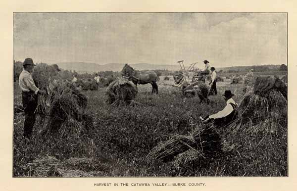
HARVEST IN THE CATAWBA VALLEY--BURKE COUNTY.
Page 157
universal adaptation to all agricultural productions for the sustenance of mankind.
It is in the eastern counties where the trucking industry has reached its highest development, rapidly increasing its productions from small beginnings, some ten years ago, to its present great commercial value. Here is the natural home of the sweet potato, North Carolina excelling all other states in the quantity and quality of its product.
The Coastal Plain region gradually merges into the Piedmont Plateau, the divisional line between which may be said in a general way to transverse the State from northeast to southwest, passing a little east of Raleigh, the capital of the State; the Piedmont extending westwardly from this line to a tier of counties, bordering the Blue Ridge, where the Mountain region fairly begins. The Piedmont is that favored region where blend harmoniously the climate, soil and products of the east and the west, the north and the south; where the invalid seeking a soft but invigorating climate, where the farmer in search of land that never fails to make a return of the kindly fruits of the earth, where the vineyardist and orchardist whose products most excel, where the stock breeder and dairyman who need positive conditions for success, where the tobacco planter, determined with his "brights" to top the market, may each come and may each find a locality with conditions to meet his especial needs.
To the westward lies the Mountain region, an elevated plateau, broken into chains and spurs of mountains and alternating valleys. No great surplus of valuable crops finds its way to distant markets from this region; few big farms require the labor of many hands; but the conditions excel for the industrious farmer, who may here surround himself with all those products of comfort and luxury which constitute an "independent living," corn, wheat, rye, oats, hay, Irish potatoes, apples, sorghum, buckwheat, butter, cheese, milk, honey and numerous vegetables. The field is a wide one for growing the finest winter apples; for dairy products, for vegetable growing, and for canning establishments. The uncleared mountains and hills grow heavy forests of valuable trees, their soil being equal if not superior to that of the valleys.
This is that "Land of the Sky," written of in poetry and romance; the home of a brave, truehearted and kindly people; the paradise alike of the millionaire and the peasant--whose soft beauty and rugged grandeur are a perpetual joy and inspiration.
Who, standing on the proud summit of Mount Mitchell and contemplating all the goodly State spread out before him, will not
Page 158
exclaim with the Hon. W. D. Kelly, of Pennsylvania: "North Carolina is the fairest portion of God's earth on which my feet have ever rested."
COTTON.
North Carolina has never been among the foremost of the cotton growing States, for although nearly all of the ninety-six counties of the State make report of the crop in the census tables, as a matter of fact, more than one-half the cotton producing area is confined to twenty-eight counties. Nor have the farmers of this cotton section been so dependent on the planting of cotton, that they might not readily increase or diminish production by adoption of other crops to correspond with ruling prices in the markets of the world; hence, as should be expected, the statistics, such as were made from 1801 to 1840, when crop returns were first enumerated in the census reports, and the census reports from 1840 to 1890, all show that the cotton production of the State has been marked by greater fluctuations than that of any other State. The following table indicates the variableness of production, and gives the total products at different periods in the State's history:
| YEAR. | POUNDS. | BALES. |
| 1801 . . . . . | 4,000,000 | . . . . . |
| 1821 . . . . . | 10,000,000 | . . . . . |
| 1826 . . . . . | 18,000,000 | . . . . . |
| 1833 . . . . . | 10,000,000 | . . . . . |
| 1839, Census . . . . . | 51,926,190 | . . . . . |
| 1849, Census . . . . . | 29,538,000 | . . . . . |
| 1859, Census . . . . . | 64,753,730 | . . . . . |
| 1869, Census . . . . . | 62,901,790 | . . . . . |
| 1879, Census . . . . . | 176,487,894 | 389,598 |
| 1889, Census . . . . . | 160,396,497 | 336,261 |
| 1895, Dept. of Agriculture . . . . . | . . . . . | 339,499 |
This fluctuation in production is undoubtedly due to variation in price, and to the ready adaptability of the soil to grow such other crops as corn, wheat, oats, tobacco, rice, hay, &c., which has wisely limited the production of cotton in large quantities to those counties where it is grown with greater profit. Even in these, the cotton acreage comprises but a small proportion of the total area.
While the average yield of cotton is shown to be less, a bale to the acre and twenty bales to the mule are not uncommon. This indeed, might be the rule under a wise system of rotation and a judicious use of fertilizers and leguminous crops.
The quality of the fibre grown is excellent, the proportion of lint weight of seed being larger than the product of any other State
Page 159
Of the seed product, 70,341 tons are reported in the census of 1890, valued at $718,741--no inconsiderable item in the value of the crop. But as the best cotton yields only about thirty-three per cent. of lint, evidently the tons of seed reported to a crop of over 336,000 bales, were less than half the actual product, which was in the neighborhood of 160,000 tons. The amount reported represented probably the sales, the balance going into home consumption.
Compared with other States, North Carolina stands eighth in amount of production. "Neither as a whole, nor in any considerable portion of its area, is the cotton production of North Carolina distinguished for its density. Of the entire land surface of the State, 3.69 per cent. was devoted to cotton planting in 1889, or little more than one-third the proportion obtaining in the adjacent State of South Carolina." (Extract Census, 1890.)
The counties producing the largest number of bales are, in descending order of production, Mecklenburg, Wake, Richmond, Robeson, Johnston, Edgecombe, Pitt, Wayne, Wilson, Anson, Cleveland and Union
TOBACCO.
The easy adaptability of the soil of North Carolina elsewhere commented upon, and the increase or decrease in the production of different crops to fit the varying conditions of the markets, is not better illustrated than in the rapid and enormous enlargement of the tobacco area and product, as cotton, the other great money producing crop of the State, has been steadily declining in value. These two great crops may be considered correlative to each other, that one being predominant which for the time returns the greater remuneration. The price of cotton declining, tobacco remaining firm, cotton planting is curtailed, tobacco acreage increased. Should the reverse in prices occur, cotton would again increase and tobacco planting decline. This rule cannot apply to all the cotton district, nor to all the tobacco district, but a large scope of territory is common to the production of both crops, and it is this common ground which gives the preponderance to the one or the other.
Nearly all the counties in the State raise tobacco, in patches for home consumption, if not for market; but the crop for market purposes was confined, as shown by the census of 1890, chiefly to thirty counties. Of these thirty, only eleven are accredited with over a million pounds, and these eleven counties produced two-thirds of the crop of '89. These are, in descending order of production: Rockingham, Granville, Stokes, Caswell, Person, Madison, Vance, Forsyth, Buncombe, Surry and Durham.
Page 160
The following table shows the production for the State at large as given in the census reports since 1850:
| Acres. | Pounds. | |
| 1850 . . . . . | . . . . . | 11,984,786 |
| 1860 . . . . . | . . . . . | 32,853,250 |
| 1870 . . . . . | . . . . . | 11,150,087 |
| 1880 . . . . . | 57,208 | 26,986,213 |
| 1890 . . . . . | 97,077 | 36,375,258 |
Since the census report of 1890 was taken, the decline in price of cotton has greatly stimulated the production of tobacco in the counties of Wilson, Nash, Edgecombe, Green, Lenoir, Beaufort, Pitt, Washington, Franklin, Wayne, Wake, Martin, Bertie and Halifax.
Some of these are now in the front rank of the tobacco producing counties of the State, both in quantity and quality of the product.
Col. Cameron in his admirable treatise on tobacco, in the Handbook of North Carolina, issued in 1893, discredits the correctness of the census report of the crop of 1889, and in support of his position quotes from a very carefully prepared address of Mr. W. W. Wood, President of the State Tobacco Association, made to that body in August, 1891. Col. Cameron exonerates the enumerators of the census from carelessness or intentional error, and explains the discrepancy of their reports with the actual amount of production. Mr. Wood makes his estimates from entirely different sources, and reaches the conclusion that the crop amounted to 76,000,000 pounds. That Mr. Wood's estimate was none too large, and showing also the enormous increase in production during the past six years, the highest possible confirmation is now adduced.
The U. S. Department of Agriculture, working carefully and constantly through its different agencies, is the most reliable authority on crop productions of any in the United States. The crop report for March, 1896, says:
"Between 1888 and 1893, no returns of tobacco were published by the department, and a comparison of the figures for recent crops with those of receipts for manufacture and net exports, published by the Treasury, leaves ample room for a suspicion that the whole product was at no time reported. The correspondents' returns of yield and acreage compared with the year before, appearing in the monthly statistical reports for 1895, having been found to give a total product considerably less than that actually brought to light in previous years, the statistician instituted in December a special investigation of the subject, a circular of additional inquiries being sent to all the tobacco producing States. The results of that investigation are embodied in
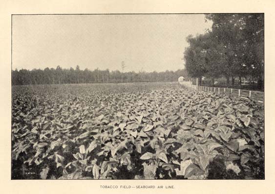
TOBACCO FIELD--SEABOARD AIR LINE.
Page 161
the following table, where the column showing farm values was computed from the prices reported in December, 1895. In most of the States where an increase appears a correction of last year's acreage is probably involved. North Carolina, however, with more than double the acreage and product reported in 1894, plainly shows the stimulus of local manufacture.
The loss to the crop was severe in Virginia and in the mountain region of North Carolina:"
| Acres. | Pounds. | Dollars. | |
| Connecticut . . . . . | 6,579 | 9,928,000 | 1,638,120 |
| Pennsylvania . . . . . | 15,600 | 14,305,000 | 1,058,570 |
| Maryland . . . . . | 15,233 | 12,796,000 | 742,168 |
| Virginia . . . . . | 88,463 | 53,432,000 | 4,274,560 |
| North Carolina . . . . . | 143,156 | 114,525,000 | 10,536,300 |
| Tennessee . . . . . | 53,890 | 43,220,000 | 3,025,400 |
| Kentucky . . . . . | 223,574 | 179,553,000 | 9,526,909 |
| Ohio . . . . . | 35,969 | 25,358,000 | 1,318,613 |
| Indiana . . . . . | 13,435 | 8,760,000 | 770,080 |
| Missouri . . . . . | 10,580 | 8,718,000 | 758,466 |
The statistics here given demonstrate the wonderful suitableness of certain sections of the State to the growth of tobacco.
Standing sixth in point of production in 1879, fourth in 1889, in 1895 North Carolina forges ahead and stands second to Kentucky only in amount of production, and first of all the States in the value of her product, exceeding Kentucky by over one million dollars.
An analysis of the figures show an average production of the State at large of eight hundred pounds per acre, worth nine and one-fifth cents per pound, giving the average value of yield per acre of $73.60.
With the exception or Louisiana, whose product of sugar and molasses does not exceed in value per acre, no other State can approach, in agricultural product, the record here made of North Carolina's crop of tobacco.
When it is considered that the bulk of a tobacco crop is necessarily of inferior grades, the superiority of our "brights" and "mahoganies" becomes apparent, which increase the average value to nine and one-fifth cents per pound, and to $73.60 per acre. To quote again from Mr. Wood's admirable paper:
"Within her borders is produced such a variety of high grade leaf, and in such quantities as is nowhere else to be found the world over. Upon her high type of cutting leaf, the great cigarrette business of the world was built up. Her unsurpassed smokers, produced in the "Golden Belt," placed her granulated smoking
Page 162
tobacco at a premium over all others in the world. Her mahogany types of fillers and wrappers, are by chewers of tobacco, everywhere preferred before all others."
RICE.
Historians tell us that the cultivation of rice dates back to nearly three thousand years B. C., and though it is indigenous to India, the first mention of its culture is among the Chinese. It was cultivated in Syria, four hundred years B. C., was introduced by the Arabs into Spain, and the fifteenth century, was planted by the Italians. The first rice raised in America was at Charleston, S. C., in the seventeenth century, and from that beginning sprang the rice crop of the present. Before the introduction of rice into this State, in 1738, the tide-water low lands were seeded to indigo, which gradually gave place to the more remunerative crop. Wild indigo still troubles the rice miller more than all other weeds, as its discoloring effect upon the cleaned product is disastrous. There are two varieties of rice, the white and the golden seed, both have adherents as to superiority. Rice can be grown upon all lands, but to be successful on an extensive scale, there should be proper facilities for irrigating the crop at its critical periods. The upland rice is inferior in size, color and weight, but makes an additional food crop under careful treatment.
The benefits derived from water in the cultivation of rice are many, the most important perhaps being the destruction of grass and weeds, and it also destroys some pestiferous insects. The water is also necessary when the grain begins to fill and the rice to ripen. Drainage is as necessary as irrigation. The whole question of water must be so handled as to be under the complete control of the planter; while rice is a water plant, it may be easily killed with too much water. The rice lands of the lower Cape Fear river, are as fertile as any in the world, and will yield from fifty to sixty bushels to the acre, though the average is considerably less. From two and a half to three bushels are seeded to the acre. To prevent floating, the seed are clayed by the use of clay and water, and then dried before sown. As soon as sown, the fields are flooded. This is the "spring flow" and remains until the plant is up, then drained and kept dry until the rice shows distinctly over the entire field, when it is again flooded with the "stretch flow," which covers the plant entirely and remains for some days, when the water is drawn to a "stand," that is, enough is taken off to allow the tips of the plants to show on the surface of the water. This "stand" of water remains until the plant has had time to regain the strength of stalk lost in the "stretch" flow, and
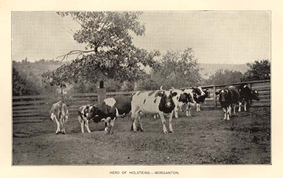
HERD OF HOLSTEINS--MORGANTON.
Page 163
the plant will straighten up within twenty days, when all the water is taken off and the fields kept dry for a like period. Then the "harvest flow" is turned on, and remains for about two months, or within a few days before the harvest begins. On August 20th, never varying more three days, the multitudinous rice bird puts in his appearance. They come in such vast flocks that men and boys with guns must be stationed at intervals in and around the fields to prevent the destruction of the crop. Six weeks after the appearance of the first head of rice, the crop is ready for harvest. A sickle is used, the laborers are paid by the acre for cutting and tying into bundles. After one day's exposure it is shocked in the field, and after ten days it is ready for the barn. The threshing is done by steam, and the grain, weighing forty-five pounds to the bushel, is shipped in bags and sold to the miller, who cleans and grades it for consumption. To Mr. Fred. Kidder, of Wilmington, must be given the credit for this article. He is a practical rice planter and has been among the most successful in this State.
In North Carolina there are about 12,200 acres devoted to this crop, divided between upland and lowland varieties, and the annual yield is stated at about 6,000,000 pounds.
At Wilmington is located the National Rice Milling Company, which handles a large portion of the crops raised in this and adjoining States. At Goldsboro, a similar mill is operated, cleaning upland as well as tide water rice.
THE PEANUT.
It is said that the peanut (Archis hypogala) has never been found growing wild, and that botanists have been unable to ascertain its nativity, though it is claimed to have originated in Brazil and in India; but it is indigenous to most all tropical countries. It is a very important crop in the United States and occupies considerable attention, especially in Virginia, the Carolinas and Tennessee, where it is grown extensively for the markets. About one-fourth of the area of North Carolina may be said to be especially adapted to the growth of high grade peanuts, though the nut flourishes in all parts of the State. The region referred to is the northeastern part of the State, where it is grown in large quantities. The annual production for this part of North Carolina may be stated in round numbers at 500,000 bushels, based upon the estimate of the census, which is considered far below the real figures. Peanuts are marketed by "factory-men," that is to say, the nuts after being dug are sold to factories which put them through a slight polishing process and sort out the faulty nuts, when the fancy factory-cleaned product is so labeled, and sold in bags to the trade all
Page 164
over the world. Not infrequently the following legend adorns the North Carolina nut: "Fancy hand-picked Virginia peanuts." This, however, does not detract from the excellence of the nut, but points out the fact that the factory is over our northern border. There is a movement among our own farmers to introduce cleaning factories and establish brands, which, if accomplished, will greatly stimulate the production as well as increase the prices received by the grower.
OTHER IMPORTANT CROPS.
Besides the crops referred to somewhat in detail above, the Department of Agriculture at Washington accredits the State with producing in 1895:
- Of Corn . . . . . 36,378,412 bushels.
- Of Wheat . . . . . 4,748,552 bushels.
- Of Oats . . . . . 7,652,333 bushels.
- Of Rye . . . . . 437,599 bushels.
- Of Buckwheat . . . . . 18,624 bushels.
- Of Irish Potatoes . . . . . 1,461,026 bushels.
- Of Hay . . . . . 273,540 tons.
For other products not given by the Department of Agriculture for the year 1895, reference must be had again to the census report of 1890. This gives:
- Of Sweet Potatoes . . . . . 5,665,391 bushels.
- Of Rice . . . . . 5,846,404 pounds.
- Of Sorghum . . . . . 1,268,946 gallons.
- Of Apples . . . . . 7,591,541 bushels.
- Of Peaches . . . . . 2,740,915 bushels.
As stated elsewhere the above product of sweet potatoes is the largest reported from any of the States.
As evidence of the importance and spread of smaller industries, the following, taken also from the census, may be given. It is confidently believed that the same rate of increase has been maintained, if not enlarged, during the last six years.
Dairy products increased from 7,212,507 lbs. butter in 1880 to 13,129,374 lbs. butter in 1890; poultry increased from 2,071,616 chickens in 1880 to 7,507,593 chickens in 1890; eggs, from 7,455,132 doz. to 11,755,635 doz.; honey, from 1,591,590 lbs. to 2,373,560 lbs. Estimated value of all farm products $50,070,530, for the last census year.
Page 165
MODEL FARMS.
North Carolina being essentially an agricultural State, it is expected that here are to be found numbers of excellent farms, well tilled. The visitor to the State will find in each of the counties some farms which are distinguished for their high state of cultivation and conspicuous because of remarkable yields annually harvested. These occur in most all of the counties, but it is not of these, numerous and profitable as they are, that reference is to be made. It is to a class of farms which may be designated as models, and which are distinguishable for some special feature, that will receive brief mention here. Beginning in the eastern part of the State, the first that comes under observation is the
GLENOE STOCK FARM.--The property of Mr. Thos. McIntyre. It is on New river a few miles below Jacksonville, in Onslow county, and embraces a large tract of level, sandy loam, which is highly improved and is growing all farm products and truck successfully. Besides, its barns are stocked with thorough and trotting-bred horses, Jersey, Holstein and other improved cattle, sheep and swine. It has a large poultry division, embracing all the leading fowls, including ducks, geese and turkeys.
OCCONEECHEE FARM.--This farm is situated in Orange county, near Hillsboro, and is the property of Col. Julian S. Carr, of Durham, and like the above, is a model in its equipment of houses, barns and of stock. Here some of the most noted horses are kept, and the best types of cattle, sheep and swine; also all kinds of poultry.
THE DUKE FARM.--This farm, also in Orange county, is at University Station, on the North Carolina branch of the Southern Railway system; it is the property of Mr. W. Duke, of Durham, and is a model in its landscape as well as its more practical agricultural features. The farm has only been in operation a few years under its present ownership, and for so brief a period exhibits remarkable development, and yet only presents a crude picture of its future beauty and usefulness.
THE ROCKWELL FARM.--The Rockwell Dairy farm in Rowan county, at Rockwell Postoffice, may be taken as a type of the dairy farms which are springing up all over the State. This is the property of E. B. C. Hambly, and comprises a herd of more than a hundred of the choicest Jersey cattle to be found in this country, and the farm is conducted with a view of keeping this herd in typical condition.
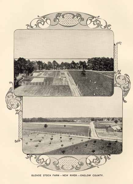
GLENOE STOCK FARM--NEW RIVER--ONSLOW COUNTY.
Page 166
BILTMORE FARMS.
The sections of the Biltmore Estate now devoted to agricultural purposes are, with the exception of the tract known as the Plateau Farm, adjacent to the French Broad and Swannanoa rivers. The farm lands cover the alluvial bottoms and the neighboring hillsides. These bottoms were (fortunately for the present owner) originally too swampy to yield their full fertility to the cultivator. Now, however, they are the most productive portion of the farming lands. This result has been attained by systematic underdraining and deep cultivation, nearly two hundred miles of drain tile having been laid in the past few years. The hillsides are a typical example of those in the South which have been left to the tender mercies of the "renter." Continuous cropping without any return of fertility, shallow cultivation, and the washing down of the thin top soils, had reduced most of the land--never originally very fertile--to a condition in which the ordinary farmer would have abandoned it to broom-sedge and scrub pines. What it is possible to do with such impoverished soils five years of persistent effort is beginning to show. The introduction of the clovers and cow peas into the rotation wherever possible, deep plowing and subsoiling, together with light yearly applications of manure or bone meal, have increased the returns threefold. The wages paid on these farms are almost double the regular rates, and it is only by securing heavy crops, far above the average, that there can be any return for the large expenditure.
Nearly all the hillside fields have been seeded down to pasture and the cultivated crops concentrated on the bottoms, where such labor-saving tools as gang-plows, grain and corn harvesters, can be profitably used.
Many small farms were included in the purchases under which the estate was acquired. The majority of these were so scattered and remote that the only rational treatment was to replant them with the most suitable forest growths. Other tracts of cleared land were turned over to the landscape gardener to beautify, or were occupied by the constantly growing nursery department. Moreover, the Aboretum road, tired of its picturesque winding among the hills and creeks comes out into the bottoms, taking in one bold dash some of the finest farming land on the estate.
Certain fairly compact bodies of cultivated land, amounting in all to some 1,800 acres, were retained for cropping, primarily for home supplies, viz: to feed the large number of work mules and horses which were needed for the heavy grading, hauling of material and road building. Manure for landscape planting was also needed, and
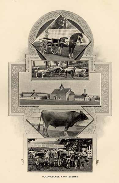
OCCONEECHEE FARM SCENES.
Page 167
this was produced by the beef cattle fed on the farms. The Sheep and Ferry farms were at the same time set aside for the production of mutton and pork, but the low price of beef made the cost of the manure too high, and after a year spent in trying to produce 3½ cent steers profitably, high grade Jersey cows were substituted. The sale of milk and butter from these was satisfactory, since previously all the fancy butter consumed in Asheville had been imported from the West. By the use of well bred Jersey sires on these grades, a good working dairy has been gradually built up.
The calls for registered stock, to form or to improve other herds in the South, have been so numerous that it has been decided to meet this demand. During the last twelve months seventy-one head of highly-bred Jerseys have been purchased from four different herds, and it is intended to continue breeding, purchasing and culling out stock, until a herd is established which will be second to none. There are now over two hundred head on the estate, half of which are registered stock.
The latest addition to the farms is an extensive Poultry Department. Its object is twofold. First, the production of broilers, eggs, etc., for the table of the owner; secondly, the improvement of the common barnyard fowl of the South by the introduction of better stock. For nearly a year an expert who acts as judge at the most important exhibitions in the United States and Canada has been commissioned to purchase the best stock procurable. That he has succeeded in this effort, all will agree who have inspected the pens of Gold and Silver Wyandottes, Barred and White Plymouth Rocks, Light Brahmas, Buff Cochin and Indian Games. The hatchings from these pens are promising to make a record at the shows next autumn.
In the market gardens a call for high-class vegetables and small fruits has been met (a demand which is heaviest during the winter months), by the erection of a very complete group of buildings, comprising forcing houses, storage and root houses, office, carpenter-shop, shipping shed, etc. This department is conducting an extended series of tests of the varieties of vegetables and small fruits most suitable to this region. Most of the land is under irrigation, and this system will shortly be extended over the whole thirty acres, making it, with the underdrainage, almost independent of the rainfall. Every soil found in this section is represented here, from the black muck to red clay and almost pure sand.
These buildings, with the sheep-barns on another farm, are the first permanent buildings to be erected for farming purposes. It is hardly necessary to say that they are constructed on the same liberal
Page 168
scale as everything else on the Estate, of the best and most permanent materials, and that they are furnished with all that is known to increase the perfection of the product or lessen the labor of the employee.
Nor are those who have a "sweet tooth" forgotten, for on the west side of the French Broad river, where the sourwood is the thickest and the wild flowers most varied and luxuriant, an apiary has been placed. Here the gentle, golden-hued, Italian bees, of which there are over one hundred colonies, produce delicious honey, both "comb" and "extracted," literally by the ton.
A flock of over two hundred Southdown sheep is kept on the Sheep Farm, and supplies mutton and lamb for consumption on the Estate. This flock will be added to largely, in the near future.
From the Ferry Farm, one hundred and forty Berkshire and grade Berkshire swine were last season made into ham, bacon and sausage, all of which has been consumed by employees of the Estate.
Only those branches of agriculture which are best suited to these mountain sections, and the study of which will be of benefit to the neighboring farmer, have been undertaken; no "fancy farming" has been indulged in, nor has anything been done for show. An elaborate system of bookkeeping for each department gives at the end of the month the difference between cost and receipts. This is done with the conviction that experiments are of but little service to the average farmer, unless it can be shown to him by actual figures that improved methods bring improved returns.
The work is conducted on so large a scale that some years are still required to bring all departments into running order and to perfect the whole scheme. When that result is attained every effort will be made to give the public the benefits of experiments, by means of institute meetings, etc., in the hope that some may be encouraged to produce the proverbial two blades of grass where one or none has grown before.
In the selection of farm help preference is given to young men, many of whom have already saved sufficient funds to purchase their own farms, and are starting in life with the determination to carry out a system which will yearly give them larger yields, and, therefore, better homes.
STATE AGRICULTURAL SOCIETY.
The State Agricultural Society will hold this year, 1896, its thirty-sixth annual fair. It has large and conveniently located grounds near the city of Raleigh; fine half mile track, with ample
Page 169
buildings to cover all classes of exhibits. The society has done much to encourage agriculture, and to promote the raising of fine horses, cattle, sheep and swine. Its annual fairs call together not only the farmers but all classes of our people, for social pleasure and to compare notes and see the progress made in the avocations of farmer, trucker, gardener and fruitgrower. The fair is always held in October.
Col. Benehan Cameron is President, and Mr. John Nichols. Secretary.
HORTICULTURE.
FRUIT GROWING.
North Carolina has such a varied climate, ranging from the Mountain region, with its white pines, hemlocks and firs to the lower edge of the Coastal Plain region where we come within the northern limit of the forest growth of palm trees, that its capacity and adaptability for fruit culture is naturally divided into a number of regions. For this purpose we will divide the Coastal Plain region into two sections, the low level country bordering on the ocean and sounds, and extending inland an average of one hundred and twenty-five miles, and the Sand Hill section intervening between this and the Piedmont Plateau region. This last Plateau we also divide into lower and upper Piedmont, the lower part extends to the line of the Uharrie mountains, Occoneechee hills and Rougemont; the upper from these to the Blue Ridge. The Mountain region we will consider as a whole. For the consideration of the capacity of fruit culture we then make after these general divisions of the State five pomological sections.
The Coastal Plain Section is an extensive region of level land at a moderate elevation above the sea. The soil is generally of a sandy nature, interspersed with occasional clay beds, and many wide stretches of black, peaty soil of an almost inexhaustible fertility. On the higher sandy lands the peach and plum find congenial homes. It is not as a rule a good apple country, the warm climate and the nature of the soil not being favorable to the apple, but there are very good apples grown in some parts, particularly of the early summer sorts for the Northern markets. But the fruit which thrives here to the greatest perfection of any of the orchard fruits is the pear. Nowhere
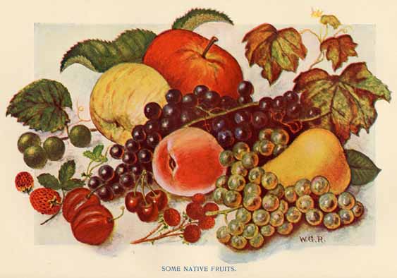
SOME NATIVE FRUITS.
Page 170
do pears attain such perfection as on the Coastal plain, and nowhere can the culture of this fruit be carried on more profitably with intelligent culture, though the culture at present there is not extensive except in a few localities. Here is the great home of the Scuppernong grape. In all the Coast region this grape attains greater perfection than any where else. It is in fact the native home of this grape and the place from which it has been disseminated. Seedling varieties of the same class of grapes have originated in this favored region. But while the Scuppernong is a russet grape the other varieties are almost invariably black. The finest of these grapes of the Rotundifolia class is the James, from Pitt Co., a grape of the largest size, fully as large as a good sized Damson plum, and decidedly the finest of its class. But it is the strawberry that has made for itself a greater place in the horticulture of the Coastal plain than any other fruit. The soil seems particularly adapted to the growing of the strawberry in the greatest perfection, and the earliness of the climate makes the crop of particular value for northern shipment. The persistent bearing of the strawberry in this section is a source of wonder to all who see it for the first time. In the North, the strawberry season is a short one and soon over, but in this favored region the plants seem to never know when the season is over. Strawberries are commonly found in abundant supply on the tables of growers there the middle of July, from fields which sent the fruit to market the first week in April. Of course the shipping season for the northern markets ceases when the supply north of us becomes plentiful, but strawberries can be had most of the summer in this region. The strawberry business has reached large proportions in the counties of Craven, Lenoir, Wayne, Duplin, Pender, New Hanover, and Columbus, and is one of the most rapidly growing interests along the Atlantic Coast Line railroad. Blackberries do equally well though there has not been so much attention paid to their culture. The Lucretia dewberry, which can be shipped from this section in May has been found to be very profitable and its culture as well as that of the high bush varieties is extending. Raspberries have not been cultivated to much extent, as they are found not to ship so well long distances. Cherries, except the Morello and Duke classes do not thrive well in the Coastal region. The Chinese quince and the fine variety known as the Champion, which does not do very well at the North, would be found profitable fruits here.
Page 171
THE SAND HILL SECTION.--This is the beginning of the great sandy ridge that extends in a southwest direction from North Carolina. through South Carolina, Georgia, Alabama, Mississippi, Louisiana and terminates in Texas. It extends in this State through parts of the counties of Harnett, Cumberland, Moore and Richmond, and is a well marked line of division between the Coastal plain and the lower Piedmont regions. It is a region of elevated sandy ridges, covered with a growth of long leaf pine, now in most sections very largely depleted by the operations of the turpentine gatherers and the lumbermen, which is being followed by a growth of scrub oaks of various species. Until recent years it has been a wild forest with little attempt to cultivate the apparently barren soil. The dry soil and the balmy climate have of late years attracted attention to the region as a winter resort for persons afflicted with diseases of the throat and lungs, and the great benefit which has been received by many who have come there for their health, has led to permanent settlements of Northern people at Southern Pines and Pinehurst in Moore county. These settlers began to experiment with the cultivation of the soil, and it was found that this apparently barren soil has a wonderful capacity for the cultivation of fruits of various kinds, particularly the grape, peach and blackberry. About the settlement know as Southern Pines, it is estimated that there are now about one thousand acres planted in grapes. These are grown entirely for shipping as fresh fruit to the northern markets, in July and August, though some experiments have been made in wine making. Grapes start from this section about the middle of July and the culture has been found remunerative to those who have given their vineyards proper attention. The Delaware and Niagara grapes grown here are noted as the best that reach the northern markets. More recently the peach has been planted. One orchard of three hundred and fifty acres paid in the fourth year, a profit of twenty per cent. on its cost in its first crop, and peaches are being planted more extensively than any other fruit; several hundred acres being set out the present spring (1896). The blackberry, mainly the Wilson Early variety, has been largely planted, and as the fruit reaches the northern market before strawberries are ripe they have been very profitable. Some have grown the Lucretia dewberry, which goes to market the last of May, and it has been found to be particularly profitable. Few experiments have been made here with strawberries, but there is evidence that in proper locations they will be a very profitable crop. It is believed that other fruits can be grown equally well here, such as the Japanese and American plums, and

SAND-HILL LAND IN VINEYARD--SEABOARD AIR LINE.
Page 172
some planting has been done. The State Horticultural Society in connection with and under the supervision of the N. C. Agricultural Experiment Station, has organized an extensive series of experiments with fertilizers on fruits of various kinds and vegetables which it is hoped will develop results of value to this section. At present it seems to be the peach and grape region par excellence of the State. The low price of land, and the ease with which it can be placed under cultivation, together with the healthy climate and splendid water, are attracting a class of intelligent settlers from the North, and the country will soon become a community of fruit growers. It is elevated above the humid climate of the coast from five hundred to six hundred feet, while the winter climate is warmer than that of the Mountain region and the dry air is very soothing to invalids, who can spend nearly all the winter in the open air.
As intimated, the peach thrives in the Sand Hill region as well as the grape, and the development of the culture of this fruit has of late outstripped even the grape there. The most notable orchard there is that owned by the J. Van Lindley Company, near Southern Pines. This Company has now in bearing over three hundred and fifty acres in peaches, and has extended its planting the present spring (1896), to the extent of about one hundred acres more. The intention is to make the orchard finally cover one thousand acres. The crop from this orchard, in 1895, was the first crop from the trees, and is said to have paid twenty per cent. on the investment on the whole tract of over one thousand acres. The same Company has planted about ten thousand pear trees, which are in a flourishing condition, but not as yet in a bearing state. The success of this large peach orchard has greatly stimulated the planting of trees in the Sand Hill country, and the available land in the immediate vicinity of the railroads, is rapidly being taken up and advancing in price.
EXPERIMENTS.--The State Horticultural Society has lately undertaken, in connection with the Agricultural Experiment Station, the most extensive experiments in the fertilization of fruit trees, vines and vegetables that have ever been attempted in the United States. The grounds are situated near the great Lindley peach orchard, in the vicinity of Southern Pines, and comprise two separate plats covering about one hundred and twenty acres of land. The grounds are accurately staked out into tenth and twentieth acre plats, with walks and drives separating them, and the experiments are made in various series to test the proper mode of applying fertilizers to promote the growth of fruits and vegetables, every conceivable variation being made so as to get at the proper combinations of the various forms
Page 173
of plant foods and re-agents. This work, being done with the greatest exactness by experts, will be of great help to those engaging in the culture of fruits and vegetables in this locality. These grounds will soon be one of the most attractive resorts to the visitors and residents of this section, and cannot fail to be of value to any student of fruit or vegetable culture.
LOWER PIEDMONT SECTION.--Less attention has been given to the culture of fruit in this section of the State than in any other. It includes the great cotton growing section, and the bright tobacco belt, and these crops have absorbed the attention of cultivators to the exclusion of everything else. But that fruits will thrive here has been proved by experience in many localities. A few years ago around Raleigh, there were extensive vineyards and the shipping of fruit paid well. But many of the growers were discouraged and the industry is not being pushed. It has been shown by the success of those who have kept at the work and have used the approved methods of spraying the vines or of bagging the fruit, that grapes can still be made a source of profit if properly managed. Apples do well in this section if properly cared for, and, on the exposed uplands, the peach and plum will make profitable crops. On the warm slopes there is always danger that the trees will bloom prematurely and be caught by late frosts. In all this section of the State, the culture of small fruits can be made a profitable industry. Around Raleigh, the culture of plums has proved profitable, particularly the Japan varieties and the American sorts like the Wild Goose.
UPPER PIEDMONT SECTION.--This section, including the great stretch of rolling uplands, from the Uharrie range to the crest of the Blue Ridge, is one of the best regions for general farming in the south, and the lands are everywhere capable of a high degree of cultivation. While considerably worn in some parts, there are wide areas of very fertile soil, particularly along the courses of the rivers flowing from the mountains. The valley of the Yadkin is famous for the fertility of its bottom lands and there are many fine bodies of land along the valley of the Catawba, while all along the foot hills of the Blue Ridge there are valley lands of exhuberant fertility. Fruits of all kinds thrive well in this favored region, and there is a greater exemption from untimely spring frosts than in any other section. Along the Blue Ridge are found the famous thermal belts, where destructive frosts are comparatively unknown, and where the fruit crops are more certain than anywhere else. These belts are found along the slopes of the Brushy mountains, in Wilkes, and other counties, particularly in Polk, and in this latter county there are quite a number of
Page 174
people from the north settled and engaged in fruit culture. The frostless belts are found along the east slopes of the mountains, and seem caused by the settling of the cold air at night into the valleys, pushing up the warm air, and they show a luxuriant green in the autumn long after frost has browned everything in the valley below. The same influences protect the blooming trees in the spring. All over these uplands, and particularly in the upper part next the mountain barrier, fruit trees of all kinds flourish with proper attention, and many diseases that affect them in more northern localities are unknown. The culture of apples will prove a most remunerative business, when undertaken by intelligent cultivators and with the proper varieties. Many apples are grown there already, but as a rule, the varieties most popular in the North, are not grown to the extent they should be. The exhibits from North Carolina and Virginia, at the Chicago Exposition, opened the eyes of apple dealers north to the great value of certain varieties that grow here to greater perfection than elsewhere. This is particularly true as to the Winesap and the York Imperial apples. The latter variety is grown to some extent under the name of Johnson's Fine Winter. During the past winter, (1895-96,) these two varieties of apples from North Carolina and Virginia, have brought higher prices in New York and in Liverpool than any other apple, not excepting the famous Albemarle Pippin, of Virginia. In the black soil of the mountain coves, the Albemarle Pippin thrives as well as in its native locality. But the Winesap and the York Imperial thrive over a wider range of country and there are fortunes in the cultivation of these two apples in this section. On the breezy uplands the peach reaches greater perfection than anywhere, except in the Sand Hill country; and in the neighborhood of Greensboro there are profitable orchards. In no section of the State do cherries reach such perfection, and the fine cherries of this section sell next to the product from California in the New York market, bringing at times as high as forty cents per pound. On the foothills the cherry will prove a most remunerative fruit crop. While the finer cherries do not thrive in the eastern part of the State, they here reach their highest perfection. Plums of the American and Japanese varieties are grown to a considerable extent and have been found to pay well. Pears also succeed well, and should be largely grown. Grapes for wine making are grown to some extent and the fruit is of remarkably fine quality. By grafting on the native roots, and paying attention to spraying to prevent mildew, the fine varieties of the European grapes can be grown to great perfection. The possibilities in this line are but just being appreciated, and it is believed that
Page 175
success will attend the experiment. Small fruits of all kinds do remarkably well, and should be grown for home use and local markets, but for northern markets the crop from this section would be forestalled by the crops of warmer soils, so that it would hardly pay to grow them for this purpose. With intelligent and skillful culture and skill in packing and shipping, the varieties of apples named will prove the most profitable fruit for this region, particularly in the upper section next the mountains. The cheapness of land, the sunny climate and short winters combine to make this section a paradise for fruit growers. And when, in addition, we find health and good water there is hardly anything left above to desire. Though somewhat colder by reason of elevation above the sea than the part of the State east of it, the upper Piedmont country is still a region of abounding sunshine in winter, and would make a delightful change to those tired of the frigid cold and deep snows of the North. The most enthusiastic admirers of this region are the settlers from the North who have made homes there.
THE MOUNTAIN SECTION.--This is the region of high plateaus and elevated valleys between the Blue Ridge on the east and the Great Smoky range that separates the State from Tennessee. This region is the home of the apple, and is destined to become the greatest apple growing region in America when its capabilities in this respect are fully known to fruit growers. Though the apple thrives here under the most negligent treatment and produces unfailing crops, there have been few attempts to grow the fruit in a systematic manner, and the ignorance among the growers as to the proper manner of culling, packing and shipping has caused the fruit of the mountain country to have a reputation that it does not deserve. From the early settlement of the country apples have been grown there from seed, and there is an embarrassment of riches in the shape of varieties that is unknown elsewhere. Many of these native seedling apples are of fine quality, while many are of inferior varieties, there having been a great tendency to grow seedlings of the Limbertwig class, because of their productiveness and keeping qualities, though of a very inferior quality. The Buff, a dry poor apple of the showy Ben Davis style is also largely grown. But that any of the finer apples can be grown there to great perfection is beyond doubt, as has been shown by those who have planted them. Then there are many of the native apples that are of such quality as to deserve propagation and increased cultivation. Here too the Winesap and the York Imperial reach great perfection, and here too they should be largely grown. The size to which apple trees attain here is a source of wonder to
Page 176
those who have been accustomed to the trees in the North. In one orchard in Haywood county was measured a tree that had a girth of eleven feet and nine inches, and in the same orchard, which had never been cultivated there were a hundred other trees that were full three feet in diameter of trunk, and all in the most luxuriant health. All that is needed here is a population of fruit growers who understand the culture and handling of winter apples. Apples of the northern varieties grown in Watauga county, are hardly recognizable because of their greater size and beauty. With good railroad connections southward (the natural market for the fruit of this section) the growing of apples cannot fail to be profitable. And when is added to this the general fertility of the soil, the pure cold water, fine grasses for dairy purposes, and the superb mountain scenery with the phenominally light snow fall, we have a region that combines all the advantages of the North in its bracing climate, with the added advantages of a short winter, abounding sunshine and little snow. It is a paradise for the stock raiser, the dairy-man and the fruit grower It must not be assumed that the apple is the only fruit that will thrive in these valleys and elevated plateaus. In some parts of the mountain region the peach grows to great perfection, while in some parts it is not as successful as further east. But cherries, plums, quinces and pears are perfectly at home, and the grape reaches a high degree of excellence, and wine of the finest kind is being made. In Buncombe county, Col. Hoyt reports that he is succeeding in growing the Vinifera grapes by grafting them on the native roots, and the wine from his vineyards is gaining an enviable reputation. Small fruits thrive with great perfection, and in the valleys of the northwestern part of this section the cranberry is indigenous.
NATIVE FRUITS.
The northern Fox grape (Vitis Labrusca) extends to a limited extent into North Carolina in the upper districts of the State. The Muscadine, (Vitis Vulpina,) the southern Fox grape has its home in North Carolina and here have originated all the valuable varieties of this species in cultivation. They have all so far as we are aware been found as wild plants and none have been the result of the gardener's efforts. The best known of the varieties of this grape is the scuppernong, so called from the Scuppernong river near which it was found several hundred years ago. This is believed to be the veritable grape alluded to by Amadas and Barlowe, Lieutenants exploring under Sir Walter Raleigh, and landing on Roanoke Island in 1584; described as follows: "We viewed the land about us, being, where
Page 177
we first landed very sandy and low toward the water side, but so full of grapes as the very beating and surge of the sea overflowed them, of which we found such plenty as well there as in all places else, both on the sand and on the green soil, on the hills as in the plains, as well as on every little shrub, as also climbing towards the tops of high cedars that I think in all the world the like abundance is not to be found; and myself having seen those parts of Europe that most abound, find such difference as were incredible to be written." In commenting on this, Dr. Hawks, in his History of North Carolina says: "The scuppernong derives its name from Scuppernong creek or river, at the north of Albemarle sound. The first vine was found in Tyrrel county by some of the first explorers under Amadas and Barlowe, and tradition relates that they transplanted a small vine with its roots, to Roanoke Island. That vine is yet alive and covers an immense extent of ground." In still further commenting he says: "In the time of Lawson (1714), there were six varieties of native grape known to him, which he particularly describes: * * two kinds of black bunch grapes * * and four varieties of fox grape * * Besides these, Lawson says he once saw a spontaneous white bunch grape in North Carolina," which we believe to be the Scuppernong of to-day and is evidently the seedling from the black grape described above. Since then some other valuable varieties of the Vulina species have been found growing wild and have been brought under cultivation. These are the Meish, Thomas, Flowers and more recently the James. This last variety has qualities which seem to place it at the head of all the grapes of its class. The berries are immense, probably the largest of any of our native grapes. The skin is thinner than any other Vulpina, and the quality is fine both for the table and for wine. The clusters are much larger than those of the Scuppernong and while the Scuppernong is of a greenish russet color the James is a glossy jet black, destitute of bloom, as all the varieties are. Grapes of this class are always grown on horizontal trellises or arbors and thrive best with this mode of training. The impression has long been prevalent that this class of grapes should never be pruned, and the result is that everywhere in the State the vines are seen with immense masses of wood scrambling over rude rail arbors, fresh support being added till they cover acres of land. The fact is that these grapes are peculiar in their mode of fruiting, and, are benefitted by proper pruning as much as any. But the pruning that suits the northern Labrusca, Aestivalis Riparia and others that bear their fruit on the one year old wood will not do for the Vulpina class which bear their fruit on wood two years old. The
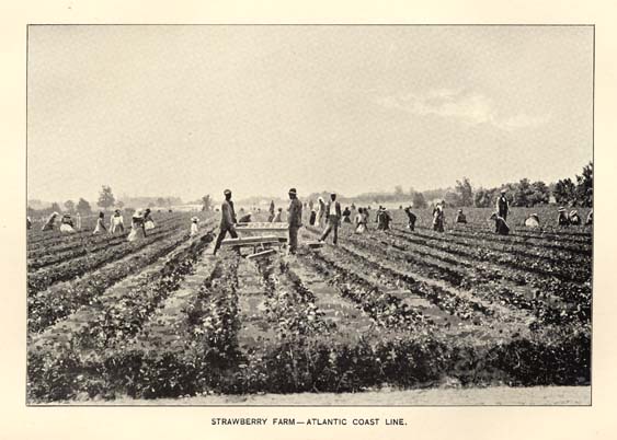
STRAWBERRY FARM--ATLANTIC COAST LINE.
Page 178
pruning must be so directed as to preserve a suitable supply of two year old canes, and cut away the old and gnarled wood. Vines treated in this way can be restrained within reasonable bounds and the production of fruit to a given area be greatly increased. This class of grapes is destined to be the great wine grape of the south, particularly on the sandy soils of the Coast plain, where they reach their greatest perfection. When subjected to skillful treatment by expert horticulturists there is no doubt that great improvement will yet be made in the quality of the grapes. Some efforts have been made in the past to cross them with the Labrusca and Vinifera species, but the cross seems to be too violent, and no success has been had in this line. The true line to work upon seems to be to select the best varieties and grow them from seed and by gradual selection and the rejection of inferior ones to gradually improve them in the desired qualities. This work will be undertaken at the North Carolina Agricultural Experiment Station, and it is hoped that varieties of value may be the result. So far the only russet colored variety of value is the Scuppernong, and it is said that the seedlings from this always result in black grapes. Still, as little has been done in the line of growing seedlings from the Vulpina class there is good reason to believe that intelligent efforts in this line will be rewarded by success.
VINEYARDS.
The Medoc Vineyard, in Halifax county, now owned by the Messrs. Garrett, is one of the largest wine-making establishments in the State. The vineyard was originally planted with scuppernong vines exclusively by Rev. Sidney Weller. Messrs. Garrett have added largely other varieties and have increased the output. Much Scuppernong wine is still made, and it is said that five barrels have been made from a single vine. In favorable seasons the crop from this vineyard is about 175,000 gallons. Good brandy is also made. The wines from this vineyard have a high reputation all over the country.
Tokay Vineyard.--A few miles north of Fayetteville is another vineyard largely devoted to the Scuppernong for wine making, belonging to Col. Wharton J. Green. He has very complete arrangements for the manufacture and storage of wine, and the product is making a national reputation. About 100,000 gallons are produced annually. A writer in a northern journal speaking of the wines of this Tokay vineyard says: "In general characteristics they resemble the Spanish and Madeira wines, and the sweet white is
Page 179
not unlike the California Mission, though much more delicate in bouquet, and, when given proper age, approaches the closest to a fine old Madeira of any wine yet produced in this country. This wine will constitute a basis for a good sherry wine when made with that view, and we have seen some samples of such from these vineyards which strongly resemble old brown sherry and would do credit to any gentleman's sideboard or private cellar. Other samples again made from the Flowers, a black Scuppernong seedling, a dry wine, resemble certain red wines of Hungary, already highly esteemed in this country, and as a sweet wine, bears a close relation to the "Spanish Red."
THE BORDEAUX VINEYARDS of Mr. James M. Pearce, near Fayetteville, are largely planted in Scuppernongs, the fruit from which is shipped to other parts of the State. There are also large vineyards of Scuppernongs near Wilmington, and near Whiteville, in Columbus county.
THE ENGADINE VINEYARDS, of Col. Hoyt, in Buncombe county, not far from Asheville, we have already noted. The Scuppernong is not grown here, as it does not do well in the mountain country, but the wines made here are of excellent quality and reputation. In the great and newly developed grape region about Southern Pines, in the Sand Hill region, no attempts of importance have been made in wine making, as the shipping of the early fruit has been too profitable to allow it. But it is likely that in the near future, the wine interest will be developed here too. This region is singularly exempt from the rot and other diseases that so annoy grape growers in other sections of the country, and this fact alone renders the culture more profitable. The exemption from disease is also another inducement for the extension of the culture of the Scuppernong and other sorts of the Vulpina species, as these seem perfectly exempt from the fungus and insect troubles that annoy growers of other species.
HAPPY VALLEY VINEYARD.--This vineyard is in Cumberland county, near Fayetteville, and is almost exclusively a Scuppernong vineyard, containing some four hundred acres. It has one vine covering a space seventy-two by eighty-four feet, illustrating very beautifully the character of the Scuppernong, and it is very productive, producing annually thirty or more bushels of grapes. Mr. G. W. Lawrence, the proprietor, is an enthusiastic advocate of the Scuppernong, both as a table and as a wine grape, his cellar being loaded with the finest bright yellow wines.
Page 180
NURSERIES.
While the nursery business has not reached the point of development in North Carolina that it has northward, there are nevertheless some extensive and well conducted establishments, which have the confidence of the people. It is a matter of great importance to planters of the peach, especially, that they should get trees grown at home, for the disease known as the "Yellows," which is decimating the orchards north, is unknown in North Carolina, and growers should take every precaution to prevent the introduction of the disease with trees brought from infected regions. The leading nurseries in the State are the following:
THE POMONA NURSERIES.--These nurseries are situated near the city of Greensboro, at Pomona. They are conducted and owned by Mr. J. Van Lindley, one of the leading members of the American Pomological Society, and of the North Carolina Horticultural Society, and who is largely interested in the culture of fruit both in North Carolina and other southern states. Mr. Lindley was born a nurseryman, as his father followed the business before him, and by his energy and enterprise in getting the newest and best adapted fruits for the State has done a great deal to advance pomology in North Carolina, and has built up an extensive business, producing fruit trees of all sorts by the million. The extent of this nursery is shown by the fact that there are now 625,000 apple trees of various ages, five acres of apple seedlings for grafting, 400,000 peaches will be budded the summer of 1896, and there are 100,000 plum stocks for grafting, besides many thousands of apricots, nectarines, cherries, mulberries, grapes, pecans, English walnuts, Japan chestnuts, with many thousands of roses and ornamental trees and shrubbery. Four greenhouses are used in the propagation and growth of ornamental plants. The nurseries occupy about three hundred acres of land.
GREENSBORO NURSERIES.--These nurseries are in the same neighborhood as the Pomona nurseries, and this business is more extensive about Greensboro than elsewhere in the State. Mr. John A. Young is the proprietor. They are east of the city of Greensboro, and have at various times been under the management of different owners, but have been under the present ownership since 1884. The nurseries occupy two hundred and seventy-five acres of fine land. Thirty to forty men are annually employed as traveling agents and the trade is mainly in this State, Georgia, Alabama, Mississippi, Louisiana and Virginia. An average of thirty-five men are employed in the nursery grounds. The Comet and the Greensboro peaches were
Page 181
introduced by this nursery and are rapidly becoming standard varieties. The Greensboro is the newest peach and is owned jointly by Messrs. Young and Lindley.
THE CEDAR GROVE NURSERIES are situated at Shore, Yadkin county, and conducted by N. W. Craft. The soil and climate are favorable to the propagation of all varieties of ornamental, nut and fruit trees, as well as vines, shrubs and plants; all of which are kept in large numbers.
UNDERDOWN NURSERIES.--These nurseries were established some twenty years ago, near Lenoir, in Caldwell county. The work is confined to fruits and grapes, and only such varieties as are known by test to suit the surrounding region are propagated. These embrace among other specialties, the following apples: Baldwin, Blackburn, Buckingham, Magnum Bonum, Edwards, Tuttle, Coffer, Cragg, Winesap and the never failing Limbertwig.
OTHER NURSERIES.--Besides the above, there are a number of important nurseries, viz.: Allen Warren & Son, Greenville; O. W. Blacknall, Kittrell; H. P. Kelsey, Kawana, Mitchell county; S. & P. Bilyeu, Southern Pines, and others.
TRUCKING.
Years ago, before the advent of Peruvian guano the cultivation of vegetables for the great city markets was confined to the immediate vicinity of the cities, where large supplies of stable manure could be had, and for years after the farmers had got to using commercial fertilizers on grain crops it was the general opinion of gardeners that their crops imperatively demanded stable manure, and that the commercial fertilizers would not produce the crops of the trucker as well as manure. The means of rapid transportation from distant points was not so perfected that the products of southern climes could be laid down at the doors of the northern consumers at unseasonable times. But as the farmers in the warm, sandy lands of New Jersey began to experiment with fertilizers, and to grow crops like early peas and potatoes with them, the growers about the vicinity of New York and other large northern cities began to admit that for these crops the fertilizers might do, but that for the early cabbage the stable manure must be had, and that many other crops which they grew were too bulky to admit of the far away growers producing, even if they could grow them without stable manure. But gradually the growers about the cities got to experimenting with the new fertilizers and found that they could use them profitably as the supplies of stable manure grew more in demand and were only to be had at a higher

TRUCKING--ATLANTIC &NORTH CAROLINA RAILROAD.
Page 182
price. Then the means of transportation became better and better, and some enterprising men began to experiment in the growing of vegetables and small fruits around Norfolk, Va. But at first they were so wedded to the old notions about stable manure that they purchased large quantities both from Norfolk and in cargoes by sea from the north, paying at times as high as ten cents per bushel for the manure on their farms. Gradually the cheaper and more easily transported fertilizers took the place of the bulky and expensive stable manure, and the business was greatly stimulated. The war broke up the Norfolk development for a time, but after its close the business was resumed with greater energy than ever. The northern people had got in the habit of expecting supplies of vegetables ahead of their season and the demand made the business of supplying it very profitable. For a time it was supposed that Norfolk had a monopoly of the early vegetable and small fruit business. But fast steamers from the southern ports got to bringing supplies from more southern points, largely at first of watermelons, and gradually taking up other things as the growers found them to pay. The completion of railroad connections in eastern North Carolina led to experiments there in this industry, and it was soon found that we had in that section a soil and climate particularly favorable to the production of the crops most in demand. When the truck industry first began to extend southward the northern growers were alarmed when they saw peas in their market before they had planted their crops, and at first assumed that their occupation was gone. But as the industry extended further south it became evident that the southern competition was not an unmixed evil, for with greater supplies the people came to expect continuous supplies, and each section fell into line in its own season. The northern gardeners no longer got the fabulous prices formerly paid for their earliest products, but they soon found that when their turn came they had the practical control of the market from their nearness and the freshness of their products. So a division of labor has been set up, and the products of each section are expected and sold in their respective seasons. The products from the south of course command the higher price from their earliness, and each section has found what it can best produce. In no part of the south has there been a greater development in this line than in North Carolina. Antedating the products of the Norfolk section by several weeks, and but little behind those of Charleston, and with lower freights than the latter place it is no wonder that the fertile soil of our eastern counties has developed the production of vegetable crops to the enormous amount they have now assumed.
Page 183
The increasing wealth of the northern cities, and the demands of luxurious living have of late years developed there another branch of the market garden industry, that of forcing vegetables and fruits under glass in winter, by the aid of fire heat distributed over large areas by means of hot water or steam pipes. About Boston and New York this business has developed to an enormous extent, and the products being of the highest quality, bring the finest prices, making the investment very profitable. This business too is beginning to extend to distances from the great centres of population until the present winter, pineapples, grown under glass in Florida in parts of the State where they were not formerly grown, sold by reason of their superior quality for $1.50 each at wholesale. Cucumbers from hothouses in Vermont are now sold every winter in New York at fancy prices. In these northern sections the winters are characterized by long spells of dark and sunless weather, the intense cold demands double glazed houses, and a very complete and expensive heating apparatus, with an enormous consumption of coal. In North Carolina our winters, even when uncommonly cold, are characterized by abounding sunshine, the value of which every one who has had any experience in the growing of plants under glass fully realizes. The general mild temperature makes cheaper houses available, less of heating apparatus and a smaller consumption of coal necessary. In fact many things that are grown profitably at the north in steam heated houses, can be grown to equal perfection here in simple cold frames, covered with loose sashes only at night and in dark and stormy weather. Boston lettuce, grown in steam heated houses aided by electric lights is shipped as far south as Washington and sold at a profit, while here we can grow equally as good a product during the whole winter, in frames, without a particle of fire heat. Lettuce is now being grown to a large extent in the neighborhood of Wilmington with the aid of protecting plant cloth, which at best is a poor substitute for glass, and the product is not so good as could be had by the use of glass. The growth of early vegetables in the open ground has developed to a wonderful extent from the small beginnings on the Atlantic Coast Line railroad near Wilmington. The development has been particularly noticeable about Newbern, where the lands in the immediate vicinity of the city are almost entirely devoted to the business. Here in the peninsula between the Neuse and Trent rivers, the gardens extend over near 10,000 acres. Having here the advantage of both water and railroad transportation there has been a wider development than any where else. The level mellow lands respond quickly to the use of fertilizers, which are applied with lavish hands.
Page 184
Not only about Newbern, but all along the Atlantic and North Carolina railroad, at Kinston and LaGrange, the market gardening industry has developed to a wonderful extent. On the Wilmington and Weldon branch of the Atlantic Coast Line the increase in this business has been equally marked. Here just north of Wilmington, the truck industry had its first beginning. Then, near Rocky Point, Mr. G. Z. French has seven hundred acres devoted to the culture of small fruits and early vegetables, and that point has become an important shipping centre. From Wilmington to Goldsboro, the development has of late tended more in the direction of strawberry growing than in vegetable culture, and the broad fields devoted to this fruit are one of the most attractive features of the country to the traveller on the railroad. Mr. J. A. Westbrook, at Mt. Olive, has made a conspicuous success in the culture of the strawberry. He bought fourteen years ago a worn out farm, and went to work growing strawberries, with a capital of $1000 and a single horse. From this small beginning he has made a fine home, and a fertile farm from a very poor one and has bought several other farms here and one in Florida. His returns, net, from strawberries, on his home place last year were $14,000 from thirty acres in this fruit. It should be stated that part of this was from the sale of the new strawberry plant, Lady Thompson. The cost of cultivating, fertilizing and shipping strawberries here will run from $100 to $125 per acre annually. Along these lines of railroad, lands suitable for the growth of garden vegetable and small fruits are rapidly advancing in value, though there are wide areas still to be had at very low prices. As has been intimated, the greatest development is yet to come here in the skillful use of glass, and there is the greatest opening for men skilled in the use of glass in green houses and frames. This culture offers the best inducement for the investment of capital and skill of any business in the trucking section. There are as yet few men there who have had any experience in the handling of vegetables and fruits under glass, and it only needs to be started by skilled men to make it an assured success from the start.
What is yet to be the future of the market garden interests in North Carolina no one can predict. Two years ago it was stated that the shipments of early truck from eastern North Carolina, amounted to over $4,000,000. From one farm, that of Messrs. Hackburn & Willett, near Newbern, $75,000 worth of products have been sold in a single season.
North of the Albemarle Sound on the line of the Norfolk and Southern railroad, from Edenton to Norfolk is another section where at various points the growing of early vegetable crops has been a
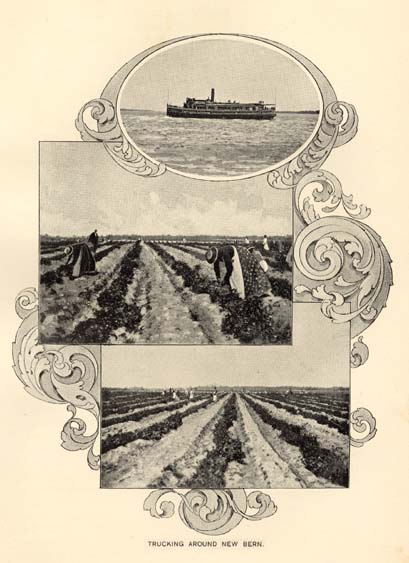
TRUCKING AROUND NEW BERN.
Page 185
source of great profit. This is particularly the case about Elizabeth City, where the transportation by water through the Dismal Swamp canal gives an additional outlet with the railroad.
To men of small means the intensive culture of the truck and small fruit business is attractive, and to the man of large means and a knowledge of the business in all its branches there is in eastern North Carolina an opening for profitable investment in this line, unsurpassed by any other section of the Union.
CULTURE OF FLOWERING BULBS.
For generations all the bulbs of ornamental plants that are produced in this way have been imported from Holland and the south of Europe. For many years our growers thought it essential that the tuberose (Polyanthus Tuberosa) must be had from Italy in order to have the best blooming bulbs. Years ago some experiments of the late Isaac Buchanan on Long Island, demonstrated that bulbs of superior quality could be grown on this side the ocean. But it was found that in the shorter northern season these evergreen bulbs could not be ripened to a blooming size from the offsets in a single season, and it was found that a more southern climate was needed. Experiments were made in Florida, but it was found that though the bulbs grew to a fine size there, the trouble was to get them to stop growing in time to prevent the flowering the same season, for this would render the bulbs worthless as the tuberose makes but one spike of flowers from a bulb, and the future bloom depends on the offsets made. Further experiments showed that the climate of eastern North Carolina was the happy medium between the short season of Long Island and the long one of Florida, and at once the business centered there. For years now the entire market for these bulbs both in America and Europe has been supplied by the growers of eastern North Carolina. Latterly, the English dealers have made an effort to promote the culture of the tuberose in South Africa, and large quantities were grown there, but their quality as acknowledged by the English Horticultural papers does not compare with that of North Carolina bulbs and the African bulbs are no longer wanted in London. But as fashion rules the demand for all classes of flowers, the tuberose has become less fashionable than formerly, and a decreased demand has caused lower prices, so that while the business is still fairly remunerative it is not so profitable as formerly. But more recent experiments have demonstrated that we have in various parts of the State, soils and climate adapted to the growth of other flowering bulbs that are in large demand by the florists near the great centres
Page 186
of fashion for forcing under glass in the winter months. It has been shown that we can grow here to as great or even greater perfection all the hyacinth bulbs for which Holland has become famous, and that the lilies can be produced here far better than those that are imported from the south of France, and that the early blooming Roman hyacinths and the white Italians, which have been the monopoly of the south of France and Italy, can be produced here of far better quality than in Europe. Professor W. F. Massey, the active Horticulturist, of North Carolina Experiment Station, a florist of long experience, has been making active efforts to interest the northern wholesale dealers in this matter, and bulbs produced at the station grounds have attracted great admiration among the New York florists, and many dealers are now endeavoring to encourage the culture here, preferring of course to get their supplies at home rather than go abroad and pay duty on them. The result of the efforts of Prof. Massey in getting a substitute or an ally or allies for the tuberose seems destined to be successful, and it looks as though the time is not far distant when North Corolina will become as famous for bulbs as Holland has been, when our growers become as skillful in the handling and curing of the various bulbs. But the general culture of flowering bulbs will not be confined to the eastern region as that of the tuberose has been, for it is found that for some of them a different soil and climatic condition are better. That section will probably excel in the growth of the tuberose, narcissus, freezia and amaryllis, while the upland sandy lands of the long leaf pine belt will become the home of the lilies, and hyacinth, and gladiolus, though the Narcissus will do equally well there. The deep sandy soils of the long leaf pine region seem especially adapted to the growth and perfection of the lily tribe, as extensive experiments have shown. A few years ago a New York importer had 100,000 lily bulbs arrive from France in a damaged condition so that they were entirely unsaleable. He sent them to Aberdeen in the sand hill country of this State, and in one season's growth, in the hands of absolutely inexperienced cultivators, they attained such perfection as to astonish all who saw them on their return to New York, and the florists who bought them for forcing were so pleased with the results that the next season they all wanted some of the same kind of bulbs. Professor Massey sent the past season bulbs of a great variety, grown at the Station grounds near Raleigh, in a soil not believed to be the best for the purpose, which were pronounced by the Garden and Forest, the leading authority in such matters, to be better by far than any imported bulbs that had ever been seen in that city. Experiments with the bulbs showed that
Page 187
they forced under glass better than the imported ones and that even the Chinese Sacred Lily (Narcissus Tazetta) made more bloom than the imported Chinese bulbs, and far superior to those that had been grown in Bermuda. So much space to the bulb industry is given because the prospect is that it is to become in many parts of the State a leading and most profitable industry, and in the hope that the facts stated may attract the attention of experts in bulb culture to the capacity of our soil and climate for this work.
An effort has been made to get a list of those engaged in the cultivation of the tuberose and other flowering bulbs, but has resulted in only a partially complete list. The following comprises a list of those along the line of the Wilmington and Weldon railroad, with the probable amount of their tuberose crops. At Wallace, in Duplin county, J. W. Stallings, 200,000; D. H. Wallace, 100,000; Milton Southerland, 100,000; Z. J. Carter & Son, 400,000;. At Teacheys: J. C. Mc'Millan, Jr., 100,000. At Rose Hill: W. B. Southerland, 100,000. At Magnolia: H. E. Newberry, 1,000,000; J. F. Croom & Bro.; 1,000,000. There are also large quantities of these bulbs grown at other points on the same road and also at Fayetteville, so that it will be perfectly safe to put the present production of the tuberose alone at near 5,000,000 bulbs annually. One of the tuberose growers has already an annual contract with a Chicago house to take all the Roman hyacinths he can produce up to a million. It is only a question of time when the bulbs that are now grown for the American market in the south of France and Italy, will be grown in North Carolina and there is no more inviting line of culture for expert gardeners than in growing these bulbs here for the trade.
MANUFACTURING.
The existence in most parts of the State of abundant water-power, the abundance, value and variety of the raw material, and its proximity to favorable seats for its conversion into the manufactured fabric, and the natural aptitude of the people for mechanical industries, early made North Carolina foremost among the Southern States in the character of a manufacturing State. In iron she was usefully conspicuous during the revolutionary war. In the manufacture of textile fabrics she may be regarded as the pioneer in the south, her cotton factories antedating similar works in both Virginia and South Carolina--her factories, at the beginning of the late civil war, exceeding those of any State in the south. The war swept away

GREAT FALLS AND BULKHEAD--ROANOKE RIVER--WELDON.
Page 188
most of the existing establishments, the invaders aiming to inflict a deadly blow upon the industries of the State as one of the surest steps at subjugation--perhaps with an eye also to the suppression of that rivalry which might grow formidable after the restoration of peace, with the advantages possessed by the south in climate, in the cost of labor, in the economy of living, in the saving of the costs of transportation, and the more decided advantage in the proximity of the cotton fields to the factories. The almost universal destruction of the existing cotton factories was a stunning blow to North Carolina, but not a fatal one, for its force was the same as that inflicted upon all the other industries of the State, corporate and individual. In all of them recuperation began from the same dead level of universal ruin and disaster. The same hopeful look into the future, the same undaunted courage in accepting calamity, the same indomitable energy in the retrieval of losses, the same steady determination to persevere against the most formidable obstacles which make up the North Carolina character, had splendid illustration when the restoration of constitutional government and the restoration of wise financial systems made it possible to engage again in those industrial pursuits demanding the application of capital and the possession of the necessary skill. And the increase of the manufacture of cotton is so great as to have become a prominent feature in the industrial history of the State. One feature is not to be overlooked: it indicates a change in systems and habits only to be wrought by the stern lessons of adversity, and must be accepted as one of the undreamed of blessings which sometimes are enforced by the teachings of war. Once it was that all the skill of managers, superintendents and machinists was introduced from the northern factories. The instances were rare when a young southern man applied himself to the acquisition of the necessary skill and experience to take charge of a factory. Now young men of the south make no hesitation in stepping on the lowest round of the ladder and ascending, by gradual but steady step, to the topmost round, qualified to take charge of all the intricate and complex details of a business for which the habits of the south once pronounced them inapt or disqualified by social position. Northern skill and experience are not discarded or excluded, but real industrial independence is only attained where those who engage in enterprises involving the problems of success or failure are themselves capable of conducting them. Thus it has come to pass that, from the seaboard to the mountains, by the use of steam or water-power, cotton factories are established, created by home capital, in large measure conducted by home skill.
Page 189
COTTON MILLS.
(Prepared by a practical Cotton Spinner.)
It is certain that no industry in the State has thriven with such rapidity or been more healthy in its growth than that of cotton manufacturing.
For many years there has been no cessation in the extension of mill plants or in the erection of new ones and at the present moment there are probably as many or more mills in the course of erection than at any other period.
The rapid progress of the past few years is clearly seen from a comparison of the number of looms and spindles now at work with the figures given in the Hand Book of 1893.
The figures at the date of the last publication were:--
| Spindles. | Looms. | |
| 1893 . . . . . | 506,342 . . . . . | 9,128. |
| and are now (1896) . . . . . | 879,740 . . . . . | 19,633. |
This growth is at a rapid rate but is none the less healthy, for the mill stocks of this State stand fully as high in the estimation of investors as those of any other State and the industry in North Carolina has suffered as little, or perhaps less, than that of any other State in the periodical waves of depression that influence cotton manufacturing all the world over.
Among the difficulties of, and the drawbacks to, manufacturing in the Old World and even in the eastern States of the Union, is the one of transit of raw material and finished product. For a hundred years the spindles of the world have depended almost entirely on America for their supply of cotton, and now, notwithstanding the large crops raised in Egypt, India, China and South America, probably two-thirds of the spindles in existence use cotton that is grown in the South. These mills have to bear heavy freight charges, both on the raw cotton and again on the reshipment of manufactured goods; goods which still to a large extent are re-imported into this country. Again the older manufacturing countries have to deal with labor that is organized in trades unions, which insist on high wages, short hours, with laws that have been passed incurring all kinds of restrictions and regulations which, however desirable they may be from a philanthropic or politico-economical standpoint, are none the less galling to the average business man. In addition, the older established mills have often to contend with worn out and antiquated plant and machinery.
The business men of North Carolina were among the first to see the opportunities of a new era of cotton manufacturing: how, by
Page 190
adopting the latest and most improved machinery and by placing it in modern mills designed for economical working, they could utilize the willing labor in their midst and the cotton around their doors, thus keeping the money representing the cost of manufacture at home. The difference in value of the average sized crop of North Carolina cotton if sold as manufactured fabrics at about 15 cents, instead of 7 cents in the bale, would amount to $16,000,000 per annum, a larger portion of which sum would remain in the State.
The advantages of North Carolina as a manufacturing section and the reasons that have made it so successful are thus obvious. Raw material at the mill door, a regular supply of cotton of even grade and staple, absence of obnoxious State restrictions and grandmotherly legislation on factory questions, plentiful supply of wood for fuel or proximity to water powers, and an abundance of cheap labor, have all had their influence.
Perhaps the most potent reason has been the labor; all through the State there seems to be an abundant supply of teachable and tractable help, especially in the foot-hills of the mountains. They make, with some little instruction, exceedingly satisfactory mill operatives, their only fault being a spirit of unrest, a desire to move about from mill to mill, rather than settle in one place. The opportunity of mill work is usually valuable to these people in consequence of their lack of elementary education and consequent unsuitability for many industrial occupations. In the cotton mills, however, this lack of education is far from being a drawback and as before stated they are found to be excellent help. Another feature of the cotton mill industry in this State is the number of small mills. Usually this is considered a disadvantage as the modern tendency is to increase the size of the mill to reduce the cost per pound of finished product. In North Carolina the small factory is a useful institution, as small communities that otherwise could not have a mill at all can often afford a small one; many small water powers can be developed and utilized, and the small mill offers facilities for close supervision and for working up local supplies of cotton while the financial results often bear comparison with those of larger concerns.
Although mills of this type exist in considerable numbers, yet there are many in the State of larger proportions, for example, the Henrietta mills, which afford employment to the inhabitants of what is now quite a town which has grown up on a site that ten years ago was one of the quietest woodland tracts in the State. Another, the Victor mill, which is one of the group of twelve mills now at work, or in course of erection in the city of Charlotte, is representative of
Page 190a

SOME COTTON MILLS.
ROANOKE RAPIDS, WELDON.
VICTOR, CHARLOTTE.
T. M. HOLT, HAW RIVER.
Page 191
the smaller type. In addition, other towns like Salisbury, Graham, Burlington and Greensboro have become quite important manufacturing centres and possess fine mills.
The future possibilities of cotton manufacturing in the State are great. The motive power applied is either water or steam. Of the former the aggregate is about 3,500,000 horse powers. Professor Kerr said that "if the whole of this were employed in manufacturing it would be adequate to turn 140,000,000 spindles. The water power of North Carolina would manufacture three times the entire crop of the country, whereas all the mills on the continent only spin one-quarter of it. Putting the crop of the State at 400,000 bales, she has power to manufacture fifty times that quantity." See chapter on water powers elsewhere.
The choice between water power and steam is determined by the comparative economy in the use of either the one or the other. In many cases there will be no hesitation in the adoption of the first, for natural conditions at once emphasize the decision. At the falls of the Roanoke, of the Tar river, on the rapid declivities of Haw and Deep rivers, on never-failing streams in Cumberland and Richmond counties, on the enormous forces of the two Catawbas, and perhaps elsewhere, a second thought would never be given to the application of any other power than that so exhaustlessly provided by nature and so easily and economically controlled. Elsewhere steam offers itself as the ready and convenient agent in such convenient form that the location of a new factory is rather made subservient to the convenience of transportation than to the character of the power to be applied; and thus it is that cotton factories are found everywhere in operation in the State, on the flat lands and by the sluggish waters of the eastern section, along the bold streams and the abundant water-falls in the middle section, or on the more turbulent torrents of the Mountain region.
As shown, there is practically no limit to the power available for mill purposes and there is no limit to the cotton available, as when the mills reach the point when they exhaust the supply available from the State, cotton will be shipped from the States less favorably situated for manufacturing, and as New England can employ 14,000,000 spindles, the Continent of Europe 27,000,000 and England 45,000,000, there is no reason why the mills in the south should not continue to multiply for many years to come.
The capital invested in Cotton mills in North Carolina, is estimated at $13,132,750, and the money paid in wages to cotton mill help annually $2,854,300, for the day work alone. As a considerable
Page 192
number of mills work day and night in brisk business times, this estimate will be largely exceeded.
The products are varied and comprise yarns from the coarse carpet warp to the skein yarns for lace curtains, while the weaving mills, in addition to sheetings, shirtings and drills, make ginghams, plaids, chambrays, stripes, cheviots, towels, etc. There are also several mills engaged in making cotton ropes, cordage and webbings as well as a number of cotton knitting mills, both for socks and underwear.
The large increase of cotton mills has been the means of introducing other industries, such as a card clothing factory, belting factories, reed and harness works, roll covering shops, machinery repair shops and many establishments for the manufacture of mill accessories, all adding to the prosperity of the State. The city of Charlotte has become recognized as the commercial centre of the cotton mill business in the south, all the important textile machinists and makers of mill supplies being represented there.
A list is appended of all the cotton mills in the State and in addition to those given, companies have been organized for the purpose of building cotton mills at the following places:--Albemarle, Charlotte, Cherryville, Hillsboro, Jamestown and Mount Pleasant.
COTTON FACTORIES.
| COUNTY AND POST OFFICE. | NAME OF MILL, PRESIDENT OR MANAGER. | No. of Spindles. | No. of Looms |
| Alamance . . . . . Elon College | Altamahaw; Holt, Grant & Holt | 6,500 | 300 |
| Alamance . . . . . Elon College | Ossipee; J. N. Williamson & Son | 4,600 | 220 |
| Alamance . . . . . Burlington | Glencoe; W. E. & J. H. Holt | 3,120 | 186 |
| Alamance . . . . . Burlington | Lakeside; Samuel M. Holt | 3,000 | 150 |
| Alamance . . . . . Burlington | Carolina; J. H. & W. E. Holt & Co. | 3,075 | 58 |
| Alamance . . . . . Burlington | Alamance, E. M. Holt & Sons | 1,000 | 94 |
| Alamance . . . . . Burlington | Aurora; Lawrence S. Holt | 4,608 | 220 |
| Alamance . . . . . Burlington | Elmira; W. L. & E. C. Holt | 3,750 | 252 |
| Alamance . . . . . Burlington | E. M. Holt; J. H. Erwin | . . . . . | 140 |
| Alamance . . . . . Burlington | Windsor; J. H Holt, Jr. & R. L. Holt | 3,120 | 160 |
| Alamance . . . . . Graham | Saxapahaw; White, Williamson & Co. | 4,704 | 71 |
| Alamance . . . . . Graham | Oneida, (No. 1); L. Banks Holt | 4,424 | 308 |
| Alamance . . . . . Graham | Oneida, (No. 2); L. Banks Holt | 4,400 | 277 |
| Alamance . . . . . Graham | Belmont; L. B. & L. S. Holt | 2,592 | 126 |
| Alamance . . . . . Graham | Sidney; Scott, Donnell & Scott | 1,000 | 101 |
| Alamance . . . . . Swepsonville | Virginia; George Rosenthal, Treas | 3,680 | 150 |
| Alamance . . . . . Haw River | Granite Mfg. Co., Chas. T. Holt, Pres. | 8,500 | 434 |
| Alamance . . . . . Haw River | T. M. Holt Mfg. Co. C. T. Holt, Pres. | 7,168 | 252 |
| Alamance . . . . . Haw River | Cora Mfg. Co., Charles T. Holt, Pres. | 7,000 | 250 |
| Alamance . . . . . Big Falls | Juanita; G. Rosenthal | 6,172 | . . . . . |
Page 193
| Alexander . . . . . Taylorsville | Taylorsville; J. H. Moore | 832 | 50 |
| Anson . . . . . Wadesboro | Wadesboro; W. T. McClendon, Pres. | 4,035 | . . . . . |
| Buncombe . . . . . Asheville | Asheville; L. Banks Holt, President | 8,448 | 420 |
| Burke . . . . . Morganton | Alpine | 3,300 | . . . . . |
| Burke . . . . . Valdese | Hosiery Mill; John Meier | . . . . . | . . . . . |
| Cabarrus . . . . . Concord | Cabarrus; J. M. Odell | 4,500 | 278 |
| Cabarrus . . . . . Concord | Cannon; J. M. Odell, President | 17,000 | 500 |
| Cabarrus . . . . . Concord | Odell; J. M. Odell, President | 25,000 | 1,328 |
| Cabarrus . . . . . Concord | Patterson Mfg. Co. G. W. Patterson | 2,080 | . . . . . |
| Caldwell . . . . . Granite Falls | Granite Falls Mfg. Co., W. P. Ivey | 3,100 | . . . . . |
| Caldwell . . . . . Patterson | Gwyn Harper; Gwyn, Harper & Co. | 2,480 | 56 |
| Catawba . . . . . Newton | Newton; B. D. Heath | 5,000 | . . . . . |
| Catawba . . . . . Newton | Newton Hosiery Mill | . . . . . | . . . . . |
| Catawba . . . . . Maiden | Union; Martin Carpenter | 6,230 | . . . . . |
| Catawba . . . . . Maiden | Maiden; H. F. Carpenter & Sons | 2,300 | . . . . . |
| Catawba . . . . . Maiden | Providence; H. F. Carpenter & Sons | 3,500 | . . . . . |
| Catawba . . . . . Monbo | Long Island; Geo. H. Brown, Treas | 3,000 | . . . . . |
| Catawba . . . . . Monbo | Monbo; C. L. Turner | 1,000 | . . . . . |
| Chatham . . . . . Bynums | J. M. Odell Mfg. Co. J. M. Odell | 4,400 | . . . . . |
| Chatham . . . . . Siler City | Hadley, Peoples & Co. | 1,536 | . . . . . |
| Cleveland . . . . . Laundale | Cleveland; H. F. Schenck | 5,700 | . . . . . |
| Cleveland . . . . . Double Shoals | Double Shoals; E. A. Morgan | 2,100 | . . . . . |
| Cleveland . . . . . Shelby | Belmont; A. C. Miller, Treasurer | 4,500 | . . . . . |
| Cleveland . . . . . Shelby | Lauraglen; R. B. Miller, Secretary | 3,500 | . . . . . |
| Cleveland . . . . . Stubbs | * * In course of construction. Buffalo Manufacturing Company |
. . . . . | . . . . . |
| Craven . . . . . Newbern | Newbern Knitting Mill, H. Rishton | 3,000 | . . . . . |
| Cumberland . . . . . Hope Mills | Hope Mills (No. 1) S. H. Cotton | 2,800 | 90 |
| Cumberland . . . . . Hope Mills | Hope Mills (No. 2) S. H. Cotton | 14,908 | 395 |
| Cumberland . . . . . Fayetteville | Beaver Creek & Bluff; H. W. Lilly | 3,800 | 65 |
| Cumberland . . . . . Fayetteville | Fayetteville; A. A. McKeathan, Sec | 3,230 | . . . . . |
| Cumberland . . . . . Fayetteville | Phoenix, J. D. McNeill, Secretary | . . . . . | . . . . . |
| Cumberland . . . . . Fayetteville | * * In course of construction. W. L. Holt, Pres |
. . . . . | . . . . . |
| Cumberland . . . . . Manchester | Manchester; John F. Clark | 2,200 | 69 |
| Davidson . . . . . Lexington | Wennonah (Nos. 1 & 2) W. E. Holt | 8,700 | 440 |
| Durham . . . . . Durham | Erwin; B. N. Duke, President | 12,000 | 360 |
| Durham . . . . . Durham | Durham Hosiery Mill; Geo. Graham | . . . . . | . . . . . |
| Durham . . . . . Durham | Golden Belt Knitting Mill; J. S. Carr | . . . . . | . . . . . |
| Durham . . . . . Durham | Commonwealth; V. Ballard | 11,016 | 244 |
| Durham . . . . . East Durham | Pearl; W. H. Branson | 10,000 | 180 |
| Durham . . . . . East Durham | Durham; W. H. Branson | 13,000 | 340 |
| Durham . . . . . Willardsville | Willard; A. G. Cox | 1,650 | 82 |
| Edgecombe . . . . . Tarboro | Tarboro; A. M. Fairly | 12,000 | . . . . . |
| Forsyth . . . . . Salem | South Side; H. E. Fries | 5,000 | 100 |
| Forsyth . . . . . Salem | Arista; F. & H. Fries | 5,184 | 150 |
| Franklin . . . . . Franklinton | Sterling; S. C. Vann, Treasurer | 2,500 | . . . . . |
| Franklin . . . . . Laurel | Laurel; J. F. Jones | 6,500 | . . . . . |
| Gaston . . . . . Cherryville | Cherryville; David Manny | 6,100 | . . . . . |
| Gaston . . . . . Crowder's Mt. | Crowder's Mount.; R. H. Garrett, Pres | 2,500 | 100 |
| Gaston . . . . . Dallas | Dallas; L. L. Suggs | 2,080 | . . . . . |
| Gaston . . . . . Harden | Harden; O. D. Carpenter | 2,080 | . . . . . |
| Gaston . . . . . Stanley Creek | Stanley Creek; A. P. Rhyne, Pres | 4,160 | . . . . . |
| Gaston . . . . . Gastonia | Gastonia; R. G. C. Love. President | 10,000 | 136 |
| Gaston . . . . . Mt. Holly | Mt. Holly; A. P. Rhyne & Co. | 2,800 | . . . . . |
| Gaston . . . . . Mt. Holly | Albion; A. P. Rhyne & Co. | 2,800 | . . . . . |
| Gaston . . . . . Mt. Holly | Nims; M. R. Dewstoe | 2,000 | . . . . . |
Page 194
| Gaston . . . . . Mt. Holly | Tuckaseegee; A. P. Rhyne, President. | 6,000 | . . . . . |
| Gaston . . . . . Gastonia | Modena; J. D. Moore | 4,032 | 200 |
| Gaston . . . . . Gastonia | Trenton; G. U. Ragan, Treasurer | 3,100 | . . . . . |
| Gaston . . . . . Gastonia | * * In course of construction. G. A. Gray; G. A. Gray |
10,000 | 250 |
| Gaston . . . . . McAdensville. | McAden; Dr. J. H. McAden | 15,000 | 320 |
| Gaston . . . . . Mountain Is. | Mountain Island; W. J. Hooper & Co. | 6,250 | 150 |
| Gaston . . . . . King's Mt. | Dilling; F. Dilling | 11,200 | 552 |
| Gaston . . . . . King's Mt. | Enterprise; W. O. Ware | 2,080 | 80 |
| Gaston . . . . . King's Mt. | King's Mountain; J. S. Mauney | 5,000 | 90 |
| Gaston . . . . . Bessemer City | Southern Cotton Mills; J. M. Odell | 7,000 | 350 |
| Gaston . . . . . Lowell | Spencer Mountain; J. S. Wilson, Jr. | 6,000 | . . . . . |
| Gaston . . . . . Stanley Creek | J. G. Morrison | 1,664 | . . . . . |
| Gaston . . . . . Belmont | Stowesville; T. H. Gaither | 2,500 | . . . . . |
| Gaston . . . . . Lowell | Gaither | . . . . . | . . . . . |
| Guilford . . . . . Highpoint | Empire Plaid Mills; E. H. C. Field, Tr's | . . . . . | 112 |
| Guilford . . . . . Kimesville | Mt. Pleasant; W. M. Kime, Treas | 1,872 | 101 |
| Guilford . . . . . Jamestown | Oakdale; J. S. Ragsdale, Treas | 7,000 | . . . . . |
| Guilford . . . . . Gibsonville | Mineola; L. S. Holt | 1,300 | 120 |
| Guilford . . . . . Gibsonville | Hiawatha; B. Davidson | 2,000 | . . . . . |
| Guilford . . . . . Greensboro | * * In course of construction. Proximity; F. J. Murdoch |
7,644 | 800 |
| Guilford . . . . . Greensboro | Guilford; (Corporation) | 5,500 | . . . . . |
| Guilford . . . . . Greensboro | Crown Mills; G. D. Devenish, Treas | 6,000 | . . . . . |
| Guilford . . . . . Greensboro | Hocamuga Mills | . . . . . | 107 |
| Halifax . . . . . Scotland Neck | Scotland Neck; A. McDowell | . . . . . | . . . . . |
| Halifax . . . . . Weldon | * * In course of construction. United Industrial Co.; of Roanoke |
2,500 | . . . . . |
| Halifax . . . . . Weldon | * * In course of construction. Roanoke Cotton Mills; W. Parker |
12,000 | . . . . . |
| Henderson . . . . . Flat Rock | Carolina Knitt'g Mills; P. W. Hart & Co | . . . . . | . . . . . |
| Henderson . . . . . Hen'rsonville | Hendersonville Mills; (Hosiery) | . . . . . | . . . . . |
| Iredell . . . . . Turnersburg | Turnersburg; Stimpson & Steele | 1,200 | . . . . . |
| Iredell . . . . . Statesville | Statesville; W. Wallace | 6,000 | 180 |
| Iredell . . . . . Mooresville | Mooresville, J. E. Sherrill | 3,500 | 106 |
| Lincoln . . . . . Lincolnton | Elm Grove, R. S. Reinhart, Treas | 3,500 | . . . . . |
| Lincoln . . . . . Long Shoals | Long Shoals | 2,080 | . . . . . |
| Lincoln . . . . . Lincolnton | Laboratory; D. E. Rhyne & Co. | 7,000 | . . . . . |
| Lincoln . . . . . Lincolnton | Lincoln; J. A. Abernathy | 5,000 | . . . . . |
| Lincoln . . . . . Lincolnton | Dearmouth; J. L. Keistler | 1,500 | . . . . . |
| Lenoir . . . . . Kinston | Orion Knitting Mills; J. F. Taylor | . . . . . | . . . . . |
| Mecklenburg . . . . . Charlotte | Charlotte; R. M. Oates | 9,984 | 248 |
| Mecklenburg . . . . . Charlotte | Atherton; D. A. Tompkins | 10,000 | . . . . . |
| Mecklenburg . . . . . Charlotte | Ada; M. C. Mayer | 7,920 | . . . . . |
| Mecklenburg . . . . . Charlotte | Victor; Geo. E. Wilson | 13,600 | . . . . . |
| Mecklenburg . . . . . Charlotte | Alpha; C. Scott | 6,500 | . . . . . |
| Mecklenburg . . . . . Charlotte | Highland Park; W. E. Holt | 6,000 | 500 |
| Mecklenburg . . . . . Charlotte | * * In course of construction. O. A. Robins Co., (Sash Cord) |
1,000 | . . . . . |
| Mecklenburg . . . . . Charlotte | Crowley; John Crowley | . . . . . | 110 |
| Mecklenburg . . . . . Charlotte | Louise; H. S. Chadwick | 10,000 | . . . . . |
| Mecklenburg . . . . . Charlotte | Charlotte Oil & Fert. Co. (Batting) | . . . . . | . . . . . |
| Mecklenburg . . . . . Huntersville | Virgin | . . . . . | 100 |
| Mecklenburg . . . . . Davidson | Cornelius; J. B. Cornelius | 4,800 | . . . . . |
| Mecklenburg . . . . . Davidson | Linden; J. P. Monroe | 2,500 | . . . . . |
| Mecklenburg . . . . . Pineville | Dover; J. P. Wilson | 5,376 | . . . . . |
| Moore . . . . . Jonesboro | Jonesboro; E. F. Acree | 3,000 | . . . . . |
| Montgomery . . . . . Milledgeville | Yadkin Falls; F. J. Murdoch | 4,000 | . . . . . |
| Montgomery . . . . . Milledgeville | National Mfg. Co. | 6,000 | 200 |
| Nash . . . . . Rocky Mount. | Rocky Mount; Thos. H. Battle | 25,000 | . . . . . |
Page 195
| New Hanover . . . . . Wilmington | Wilmington; Hugh MacRae | 8,000 | 226 |
| Orange . . . . . Hillsboro | * * In course of construction. Hillsboro Cotton Factory; Hock Co. |
. . . . . | . . . . . |
| Pasquotank . . . . . Elizabeth City | * * In course of construction. Elizabeth City; Dr. McMullen |
5,000 | . . . . . |
| Pasquotank . . . . . Elizabeth City | Fowler; S. Fowler | 1,000 | . . . . . |
| Randolph . . . . . Randleman | Randleman; J. H. Ferree, Treasurer | 5,000 | 224 |
| Randolph . . . . . Randleman | Powhattan; J. S. Walker, Treasurer | 1,800 | 68 |
| Randolph . . . . . Franklinsville | Randolph; Hugh Parks, Treasurer | 1,900 | 52 |
| Randolph . . . . . Cedar Falls | Cedar Falls; J. M. Worth | 3,936 | . . . . . |
| Randolph . . . . . Ramsuer | Columbia; J. S. Spencer | 9,400 | 248 |
| Randolph . . . . . Franklinsville | Franklinsville; B. Moffitt, Treasurer | 2,200 | 40 |
| Randolph . . . . . Worthville | Worth (No. 1); J. M. Worth | 12,000 | 370 |
| Randolph . . . . . Randleman | Naomi Falls; S. Bryant, Treas | 5,000 | 200 |
| Randolph . . . . . Coleridge | Enterprise; J. A. Cole, Treas | 1,800 | . . . . . |
| Randolph . . . . . Staley | Staley; | 1,080 | . . . . . |
| Randolph . . . . . Randleman | Randleman Hosiery Mill; S. G. Newlin | . . . . . | . . . . . |
| Randolph . . . . . Gray Chapel | Piedmont Hosiery Mill; W. M. Courts | . . . . . | . . . . . |
| Randolph . . . . . Worthville | Engleworth; H. M. Worth | . . . . . | 70 |
| Randolph . . . . . Randleman | Plaidville; James. H. Ferree, Treas | 2,500 | 193 |
| Randolph . . . . . Ashboro | Ashboro Knitt'g Mills; A. C. McAllister | . . . . . | . . . . . |
| Richmond . . . . . Rockingham | Ledbetter; T. B. Ledbetter | 2,080 | . . . . . |
| Richmond . . . . . Laurel Hill | Richmond; M. Morgan | 5,000 | . . . . . |
| Richmond . . . . . Laurel Hill | Ida; M. Morgan | 3,024 | . . . . . |
| Richmond . . . . . Laurel Hill | Springfield; M. Morgan | 2,304 | . . . . . |
| Richmond . . . . . Rockingham | Roberdel; Robt. L. Steele | 6,000 | 300 |
| Richmond . . . . . Rockingham | Pee Dee; W. C. Leak | 6,112 | 300 |
| Richmond . . . . . Rockingham | Great Falls; W. I. Everett, Treasurer | 4,585 | 132 |
| Richmond . . . . . Rockingham | Midway; Leak, Watt & McRae | 2,050 | . . . . . |
| Richmond . . . . . Rockingham | Steele's; Robt. L. Steele | 10,304 | 300 |
| Robeson . . . . . Maxton | Maxton; W. L. Field | 1,500 | . . . . . |
| Rockingham . . . . . Reidsville | Edna; J. W. Arrington | 10,500 | 300 |
| Rockingham . . . . . Leaksville | * * In course of construction. Spray; Dr. George Mebane. |
10,080 | . . . . . |
| Rockingham . . . . . Mayo | Mayoden; W. C. Ruffin, Secretary | 15,168 | . . . . . |
| Rockingham . . . . . Madison | Madison; S. Mead | 1,000 | 100 |
| Rowan . . . . . China Grove | Patterson; J. W. Cannon | 4,160 | 130 |
| Rowan . . . . . China Grove | Braiding W'ks. S. Littman (Cordage) | . . . . . | . . . . . |
| Rowan . . . . . Salisbury | Rowan Knitting Mills, T. Bearbaum | 640 | . . . . . |
| Rowan . . . . . Salisbury | Salisbury; F. J. Murdoch | 15,250 | 503 |
| Rowan . . . . . Salisbury | Vance; F. J. Murdoch | 10,000 | . . . . . |
| Rowan . . . . . Salisbury | Kestler | 5,000 | . . . . . |
| Rutherford . . . . . Henrietta | Henrietta (Nos. 1 & 2); J. S. Spencer | 62,000 | 2,000 |
| Rutherford . . . . . Forest City | * * In course of construction. Florence; R. R. Haynes |
12,200 | . . . . . |
| Surry . . . . . Elkin | Elkin; T. J. Lillard | 1,853 | . . . . . |
| Surry . . . . . Elkin | Chatham Mfg. Co. | . . . . . | 40 |
| Surry . . . . . Laurel Bluff | Laurel Bluff; A. J. Thompson | 3,122 | 30 |
| Surry . . . . . Mount Airy | Hamburg; L. F. Ross | 800 | . . . . . |
| Stanly . . . . . Albemarle | Efird Mfg. Co.; J. W. Cannon | 4,100 | 130 |
| Union . . . . . Monroe | Monroe; W. C. Heath, Treasurer | 8,500 | . . . . . |
| Wake . . . . . Raleigh | Caraleigh; F. O. Moring | 7,280 | 264 |
| Wake . . . . . Raleigh | Pilot Mills; J. N. & W. H. Williamson | 3,000 | 154 |
| Wake . . . . . Raleigh | Raleigh; C. G. Latta | 10,800 | . . . . . |
| Wayne . . . . . Goldsboro | Wayne; Solomon Weil | 3,808 | 88 |
| Wilson . . . . . Wilson | Wilson; A. Branch | 7,200 | . . . . . |
Page 196
WOOLEN MILLS.
| COUNTY AND POST OFFICE. | NAME OF MILL, OWNER OR PRESIDENT. | No. of Spindles. | No. of Looms |
| Alamance . . . . . Snow Camp | Dixon; T. F. McIver | 476 | 13 |
| Ashe . . . . . Helton | Helton; Perkins, Waugh & Co. | 312 | 8 |
| Buncombe . . . . . Weaverville | Reems Creek; John Cairns | . . . . . | . . . . . |
| Chatham . . . . . Patterson | Gwyn Harper Co.; S. F. Harper | 480 | 20 |
| Forsyth . . . . . Salem | Salem; F. & H. Fries | 684 | 58 |
| Guilford . . . . . Freeman | Freeman's; Bodie & Freeman | . . . . . | 12 |
| Haywood . . . . . Waynesville | Richland; D. Drayton, Perry & Co. | 250 | 8 |
| Surry . . . . . Mt. Airy | Green Hill; M. J. Hawkins | 425 | 35 |
| Surry . . . . . Elkin | Elkin; Chatham Mfg. Company | 700 | 39 |
| Surry . . . . . Mt. Airy | A. Allred | 240 | 4 |
COTTON BY-PRODUCTS.
Among the most important by-products of cotton is the business of crushing the seed for oil, which is again followed by the value of the meal for both stock food and as a source of nitrogen in fertilizers, and of the hull as a stock food. The seed as they come from the gin are per ton, physically composed about as follows:
- Short lint . . . . . 75 pounds
- Hull . . . . . 915 pounds
- Oil . . . . . 300 pounds
- Meal . . . . . 610 pounds
The short lint has a limited sale for use in batting and wadding. The hull is now extensively used as stock feed--it was formerly used as fuel at the mills. The oil is used to make lard, soap, candles, table or "olive" oil, to pack sardines, as a lubricant and for illumination in mines, &c. It is sold through commission merchants in our great cities. The meal is used as a stock food and largely in the manufacture of fertilizers. The hull and meal mixed in proper proportions, make a very nearly complete food for the fattening of beef cattle.
Appended is a table showing the distribution of the cotton seed, fertilizer and bone mills in the State:
Page 197
COTTON SEED, FERTILIZER AND BONE MILLS.
| COUNTY AND POST OFFICE. | INDUSTRY. | OWNER OR MANAGER. |
| Carteret, Beaufort | Fish Scrap | Bell, Westbrook & Co. |
| Columbus, Wilmington | Fertilizers | Acme Mfg. Co. |
| Craven, Newbern | Fertilizers | E. H.&.J. A. Meadows Co. |
| Cumberland, Fayetteville | Cotton Seed Oil & Meal | J. R. Williams |
| Durham, Durham | Fertilizers | Durham Fertilizer Co. |
| Edgecombe, Battleboro | Cotton Seed, Oil & Cake | Dr. R. H. Speight |
| Edgecombe, Conetoe | Cotton Seed, Oil & Cake | N. B. Dawson |
| Edgecombe, Tarboro | Cotton Seed, Oil & Cake | W. N. Smith |
| Edgecombe, Tarboro | Cotton Seed, Oil & Cake | E. V. Zeoller |
| Edgecombe, Tarboro | Fertilizers | F. S. Royster Guano Co. |
| Guilford, High Point | Cotton Seed, Oil & Meal | Joseph Crudup |
| Guilford, Jamestown | Bone Meal | Henry Potter |
| Guilford, Jamestown | Bone Meal | Ragsdale & Smith |
| Mecklenburg, Charlotte | Fert. & Cotton Seed Oil. | Charlotte Oil & Fert. Co. |
| Mecklenburg, Charlotte | Cotton Seed Oil & Meal | N. C. Cotton Oil Co. |
| New Hanover, Wilmington | Fertilizers | Navassa Guano Co. |
| New Hanover, Wilmington | Fertilizers | Powers, Gibbs & Co. |
| New Hanover, Wilmington | Fertilizers | J. F. Garrell & Co. |
| New Hanover, Wilmington | Cotton Seed Oil & Meal | N. C. Cotton Oil Co. |
| Pasquotank, Elizabeth City | Cotton Seed Oil & Meal | Cotton Seed Oil Co. |
| Richmond, Laurinburg | Cotton Seed Oil & Meal | Robt. Covington |
| Richmond, Gibson Station | Acid Phosphates | Marlboro Mill Co. |
| Rockingham, Reidsville | Fertilizers | Reidsville Fert Co. |
| Wake, Raleigh | Fertilizers | Caraleigh Phos Fert. Wks |
| Wake, Raleigh | Fert. & Cotton Seed Oil | N. C. Cotton Seed Oil Co. |
| Wayne, Goldsboro | Fert. & Cotton Seed Oil | Goldsboro Oil Co. |
TOBACCO MANUFACTURING.
This is one of the State's most important industries; it has been, perhaps, the most stimulating in its effects upon trade and in developing the energy and enterprise of the people, especially in the towns. Indeed, it may be called the "town-building industry" of the State, amply illustrated in Durham, Winston, Reidsville, Henderson and in many other towns of less prominence, or in less degree attributable to the manufacture of tobacco. There can be no questioning the influence of this industry on the cities named, and all over the tobacco growing area of the State there are busy, thriving villages and communities which owe much to the presence of tobacco in one form or another. It has been a potent factor in building up the fortunes of the people, and will continue to be of great value to the State. As a matter of interest, the following table will show the distribution of the factories in North Carolina.
Page 198
TOBACCO FACTORIES.
| County. | Name of Factory and Owner or Manager | Post Office. |
| Alexander | Taylorsville Tobacco Co., R. P. Matheson | Taylorsville. |
| Alexander | Tobacco Factory; Smith & Beckham | Hiddenite. |
| Buncombe | Cigars; Asheville Cigar Co. | Asheville. |
| Buncombe | Cigars; A. Trifield | Asheville. |
| Buncombe | Tobacco Factory; E. I. Holmes & Co. | Asheville. |
| Buncombe | Tobacco Factory; C. C. Mc.Carty | Asheville. |
| Buncombe | Tobacco Factory; Porter & Yates | Asheville. |
| Buncombe | Tobacco Factory; Ashworth & Jason | Fair View. |
| Burke | Sally Michael Tobacco Co. Laxton Bros | Morganton. |
| Caswell | Tobacco Factory; King Bros | Blackwell. |
| Caswell | Tobacco Factory; N. E. Oliver | Milton. |
| Catawba | Sherrill's Tobacco Co.; J. F. Long | Catawba. |
| Cleveland | Tobacco Factory; H. C. Burrus | Mooresboro. |
| Cherokee | Tobacco Factory; Jno. R. Martin | Cobbs. |
| Davie | Tobacco Factory; J. G. Peebles | Elbaville. |
| Davie | Tobacco Factory; H. T. Smithdeal | Advance. |
| Davie | Tobacco Factory; C. D. Ward | Advance. |
| Davie | Tobacco Factory; Sanford & Williams | Mocksville. |
| Davie | Tobacco Factory; Robertson & Son | Mocksville |
| Davie | Tobacco Factory; S. A. Jarvis & Co. | Farmington. |
| Davie | Tobacco Factory; James Sheek | Mocksville. |
| Davie | Tobacco Factory; Rufus Bowles | Farmington. |
| Davie | Tobacco Factory; J. R. Cornelison | Farmington. |
| Davie | Tobacco Factory; H. W. Dulin | Redland. |
| Davie | Tobacco Factory; E. Frost | Canna. |
| Davie | Tobacco Factory; Wm. F. James | Farmington. |
| Davie | Tobacco Factory; T. F. Atkinson | Dulins. |
| Davidson | Tobacco Factory; A. A. Springs | Lexington. |
| Davidson | Cigar Factory; J. A. Leach & Co. | Thomasville. |
| Davidson | Tobacco Factory; T. S. Dale & Co. | Yadkin College |
| Davidson | Tobacco Factory; Green, Rea & Co. | Yadkin College |
| Davidson | Tobacco Factory; R. Everhart | Arnald. |
| Durham | Blackwell's Durham Tobacco Co.; J. S. Carr | Durham. |
| Durham | Morris Manufacturing. Co.; S. F. Tomlinson | Durham. |
| Durham | American Tobacco Co., W. Duke Sons Co. | Durham. |
| Durham | Mallory Durham Cheroot Co. | Durham. |
| Durham | Cigars; Sam'l Cramer & Co. | Durham. |
| Durham | J. Y. Whitted Tobacco Co., Corporation | Durham. |
| Durham | Lyon & Co., Tobacco Works, Corporation | Durham. |
| Durham | Cigars & Cigarettes; S. R. Carrington | Durham. |
| Durham | Cigars; Lyon & Reed | Durham. |
| Durham | Tobacco Factory, Farmers' Alliance Mfg. Co. | Durham. |
| Forsyth | Tobacco Factory; Bailey Bros | Winston. |
| Forsyth | Tobacco Factory; J. A. Bitting | Winston. |
| Forsyth | Tobacco Factory; Blackburg-Harvey & Co. | Winston. |
| Forsyth | Tobacco Factory; F. M. Bohannon | Winston. |
| Forsyth | Tobacco Factory; Brown Bros. & Co. | Winston. |
| Forsyth | Tobacco Factory; Bynum & Crutchfield | Winston. |
| Forsyth | Tobacco Factory; Brown & Williamson | Winston. |
| Forsyth | Tobacco Factory; R. L. Candler & Co. | Winston. |
| Forsyth | Tobacco Factory; Casey & Wright | Winston. |
| Forsyth | Tobacco Factory; Casper-Efland-Miller Co. | Winston. |
| Forsyth | Tobacco Factory; W. S. Clarey & Co. | Winston. |
| Forsyth | Tobacco Factory; Dalton, Farrow & Co. | Winston. |
| Forsyth | Tobacco Factory; Dalton, & Ellington | Winston. |
| Forsyth | Tobacco Factory; W. B. Ellis & Co. | Winston. |
Page 199
| Forsyth | Tobacco Factory; Hamlen Liipfert & Co. | Winston. |
| Forsyth | Tobacco Factory; B. F. Hanes | Winston. |
| Forsyth | Tobacco Factory; P. H. Hanes & Co. | Winston. |
| Forsyth | Tobacco Factory; Ed. Rintels & Co. | Winston. |
| Forsyth | Tobacco Factory; Hodgins Bros. & Lunn | Winston. |
| Forsyth | Tobacco Factory; H. B. Ireland & Co. | Winston. |
| Forsyth | Tobacco Factory; Kerner Bros | Winston. |
| Forsyth | Tobacco Factory; Lockett, Vaughn & Co. | Winston. |
| Forsyth | Tobacco Factory; S. A. Ogburn | Winston. |
| Forsyth | Tobacco Factory; Ogburn, Hill & Co. | Winston. |
| Forsyth | Tobacco Factory; M. L. Ogburn | Winston. |
| Forsyth | Tobacco Factory; Reynolds Bros | Winston. |
| Forsyth | Tobacco Factory; R. J. Reynolds & Co. | Winston. |
| Forsyth | Tobacco Factory; Ed. Rintels & Co. | Winston. |
| Forsyth | Tobacco Factory; Taylor Bros | Winston. |
| Forsyth | Tobacco Factory; T. L. Vaughn & Co. | Winston. |
| Forsyth | Tobacco Factory; Cox & Co. | Winston. |
| Forsyth | Tobacco Factory; O. J. Sheppard | Winston. |
| Forsyth | Tobacco Factory; Walker Bros | Winston. |
| Forsyth | Tobacco Factory; W. A. Whitaker | Winston. |
| Forsyth | Tobacco Factory; T. F. Williamson & Co. | Winston. |
| Forsyth | Tobacco Factory; N. S. & T. J. Wilson | Winston. |
| Forsyth | Tobacco Factory; W. W. Wood & Co. | Winston. |
| Forsyth | Smoking Tobacco; Byerly & Son | Winston. |
| Forsyth | Smoking Tobacco; W. C. Lassiter & Co. | Winston. |
| Forsyth | Smoking Tobacco; T. F. Leak & Co. | Winston. |
| Forsyth | Smoking Tobacco; Mosley & Martin | Winston. |
| Forsyth | Tobacco Works; Central Commercial Co. | Winston. |
| Forsyth | Tobacco Works; Ebert, Payne & Co. | Winston. |
| Forsyth | Smoking Tobacco; Walker Bros | Winston. |
| Forsyth | Cigars; J. D. King | Winston. |
| Forsyth | Cigars; Liipfert & Jones | Winston. |
| Forsyth | Cigars; V. O. Thompson | Winston. |
| Forsyth | Cigarettes; Liberty Tobacco Works | Winston. |
| Forsyth | Cigarettes; Brown Bros & Co. | Winston. |
| Forsyth | Cigarettes; W. F. Smith & Son | Winston. |
| Forsyth | Tobacco Factory; J. G. Fulton | Goodwill. |
| Forsyth | Tobacco Factory; J. F. Shaffner | Salem. |
| Forsyth | Tobacco Factory; F. A. Crews | Walkertown. |
| Forsyth | Tobacco Factory; N. D. Sullivan | Walkertown. |
| Forsyth | Tobacco Factory; Greenfield & Galloway | Kernersville. |
| Forsyth | Tobacco Factory; J. M. Greenfield | Kernersville. |
| Forsyth | Tobacco Factory; Lowery Sons & Co. | Kernersville. |
| Forsyth | Tobacco Factory; Leak Bros. & Hasten | Kernersville. |
| Forsyth | Tobacco Factory; Beard & Roberts | Kernersville. |
| Forsyth | Tobacco Factory; J. F. Kerner & Co. | Kernersville. |
| Forsyth | Tobacco Factory; B. A. Brown | Kernersville. |
| Forsyth | Tobacco Factory; Shore, Atkins & Co. | Kernersville. |
| Forsyth | Tobacco Factory; O. J. Lehman | Bethania. |
| Franklin | Tobacco Factory; R. R. Holmes | Franklintown. |
| Granville | Tobacco Factory; Alonzo Mitchell | Wilton. |
| Granville | Tobacco Factory; E. L. Harris | Wilton. |
| Granville | Tobacco Factory; D. C. Farrawbow | Stem. |
| Granville | Tobacco Factory; J. Walter Howell | Clay. |
| Granville | Tobacco Factory; Elias J. Jenkins | Zacho. |
| Guilford | Tobacco Factory; W. P. Pickett & Co. | High Point. |
| Guilford | Cigar Factory; W. H. Snow | High Point. |
| Guilford | Tobacco Factory; H. C. Brittain | Summerfield. |
| Guilford | Tobacco Factory, Jno. F. Highfill | Scalesville. |
Page 200
| Guilford | Tobacco Factory; Ogburn & Co. | Summerfield. |
| Guilford | Tobacco Factory; Jno. L. King & Co. | Greensboro. |
| Guilford | Tobacco Factory; E. J. & A. J. Stafford | Greensboro. |
| Guilford | Tobacco Factory; Leak Bros. & Hasten | Greensboro. |
| Guilford | Tobacco Factory; Lea & Tate | Greensboro. |
| Guilford | Cigar Factory; S. B. Kersey | Greensboro. |
| Guilford | Cigar Factory; P. C. Heath | Greensboro. |
| Guilford | Cigar Factory; J. A. Hodgin | Greensboro. |
| Guilford | Cigar Factory; W. F. Clegg | Greensboro. |
| Iredell | Tobacco Factory; Irwin & Poston | Statesville. |
| Iredell | Tobacco Factory; Miller & Clifford. | Statesville. |
| Iredell | Cigars; Louis Clark | Statesville. |
| Iredell | Smoking Tobacco; J. H. McElwee | Statesville. |
| Iredell | Tobacco Factory; Iredell Tobacco Co. | Statesville. |
| Iredell | Tobacco Factory; Rankin Bros. Tobacco Co. | Statesville. |
| Iredell | Tobacco Factory; Benson & Plyer | Mooresville. |
| Iredell | Tobacco Factory; Kee & Co. | Statesville. |
| Iredell | Tobacco Factory; H. Clark & Son | Statesville. |
| Iredell | Tobacco Factory; Ashe & Sons | Statesville. |
| McDowell | Tobacco Factory; Morgan Tobacco Co. | Marion. |
| Mecklenburg | Cigar Factory; E. L. Martin | Charlotte. |
| Mecklenburg | Cigar Factory; C. H. Eckstein & Son | Charlotte. |
| Nash | Tobacco Factory; Atlantic Tobacco Works | Rocky Mount. |
| Nash | Tobacco Factory; Rocky Mt. Tobacco Wks. | Rocky Mount. |
| Orange | Tobacco Factory; N. W. Brown & Bro | Hillsboro. |
| Orange | Tobacco Factory; R. C. Hill | Hillsboro. |
| Orange | Tobacco Factory; H. P. Jones & Co. | Hillsboro. |
| Orange | Tobacco Factory; S. T. Forest | Efland. |
| Person | Tobacco Factory; J. N. Ranes & Co. | Bethel Hill. |
| Person | Smoking Tobacco; Long & Hubbard | Roxboro. |
| Rockingham | Tobacco Factory; J. C. & E. B. King | Leaksville. |
| Rockingham | Tobacco Factory; D. F. King | Leaksville. |
| Rockingham | Tobacco Factory; J. B. Taylor Tobacco Co. | Leaksville. |
| Rockingham | Tobacco Factory; Wm. Shultz & Co. | Leaksville. |
| Rockingham | Tobacco Factory; B. F. Ivie | Leaksville. |
| Rockingham | Tobacco Factory; Alliance Mfg. Co. | Stoneville. |
| Rockingham | Tobacco Factory; Joyce, Garrett & Stone | Stoneville. |
| Rockingham | Tobacco Factory; W. P. Grogan | Grogansville. |
| Rockingham | Tobacco Factory; R. P. Price | Price. |
| Rockingham | Tobacco Factory; C. L. Smith | Price. |
| Rockingham | Tobacco Factory; Dez. Martin | Madison. |
| Rockingham | Tobacco Factory; J. W. Mangum | Madison. |
| Rockingham | Tobacco Factory; Pegram & Penn | Madison. |
| Rockingham | Tobacco Factory; F. R. Penn & Co. | Reidsville. |
| Rockingham | Smoking Tobacco; R. P. Richardson, Jr. | Reidsville. |
| Rockingham | Tobacco Factory; R. T. Stone & Co. | Stoneville. |
| Rockingham | Tobacco Factory; Robert Harris & Bro | Reidsville. |
| Rockingham | Tobacco Factory; Watt, Penn & Co. | Reidsville. |
| Rockingham | Tobacco Factory; A. H. Motley Co. | Reidsville. |
| Rockingham | Tobacco Factory; Johnston Bros | Reidsville. |
| Rockingham | Tobacco and Cigar Fac'y; Wm. Lindsay & Co. | Reidsville. |
| Rowan | Tobacco Factory; D. L. Gaskill | Salisbury. |
| Rowan | Tobacco Factory; Holmes & Miller | Salisbury. |
| Stokes | Tobacco Factory; J. R. Jewell | Jewell. |
| Stokes | Tobacco Factory; A. J. Fair | Walnut Cove. |
| Stokes | Tobacco Factory; J. G. Fulton | Walnut Cove. |
| Stokes | Tobacco Factory; M. Smith, Sr. | Francisco. |
| Stokes | Tobacco Factory; D. N. Dalton | Dalton. |
| Stokes | Tobacco Factory; Culler & Co. | Pinnacle. |
Page 201
| Stokes | Tobacco Factory; D. W. Dodd | King. |
| Stokes | Tobacco Factory, Culler & Sons | Culler |
| Stokes | Tobacco Factory; Bernard & Sullivan | Culler |
| Surry | Tobacco Factory; R. G. Franklin | Elkin. |
| Surry | Tobacco Factory; Forkner & Key | Forge. |
| Surry | Tobacco Factory; J. R. Forkner | Forge. |
| Surry | Tobacco Factory; W. R. Doss & Bros | Copeland. |
| Surry | Tobacco Factory; Samuel Forkner & Co. | Dobson. |
| Surry | Tobacco Factory; G. W. Samuels & Co. | Dobson. |
| Surry | Tobacco Factory; J. R. Lewellyn & Co. | Dobson. |
| Surry | Tobacco Factory; H. Holyfield | Rockford. |
| Surry | Tobacco Factory; W. P. Dobson & Co. | Rockford. |
| Surry | Tobacco Factory; Forkner, Redman & Son | Pilot Mountain. |
| Surry | Tobacco Factory; Redman Bros | Pilot Mountain. |
| Surry | Tobacco Factory; Dix, Flippin & Co. | Pilot Mountain. |
| Surry | Tobacco Factory; V. Boyles' Tob. Co. | Pilot Mountain. |
| Surry | Tobacco Factory; Dobson & Bros | Pilot Mountain. |
| Surry | Tobacco Factory; E. J. Stone & Son | Pilot Mountain. |
| Surry | Tobacco Factory; Key, Simmonds & Co. | Pilot Mountain. |
| Surry | Tobacco Factory; Sparger Bros | Mt. Airy. |
| Surry | Tobacco Factory; Ashby's Sons, L. W. | Mt. Airy. |
| Surry | Tobacco Factory, Forkner, Olive & Co. | Mt. Airy. |
| Surry | Tobacco Factory; R. L. Gwynn & Bros | Mt. Airy. |
| Surry | Tobacco Factory; W. E. Patterson & Co. | Mt. Airy. |
| Surry | Tobacco Factory; Fulton Bros | Mt. Airy. |
| Surry | Tobacco Factory; J. D. Satterfield & Co. | Mt. Airy. |
| Surry | Tobacco Factory; Prather & Whitlock | Mt. Airy. |
| Surry | Tobacco Factory; Wm. C. Moore | Mt. Airy. |
| Surry | Tobacco Factory; Hadley & Smith | Mt. Airy. |
| Surry | Tobacco Factory; W. L. Moody | Mt. Airy. |
| Surry | Tobacco Factory; Lowery, Sons & Co. | Mt. Airy. |
| Surry | Tobacco Factory; McKinney & Bro | Mt. Airy. |
| Surry | Cigar Factory; W. E. Cox | Mt. Airy. |
| Surry | Cigar Factory; Armfield & Co. | Mt. Airy. |
| Surry | Tobacco Factory; L. J. Key | Belo. |
| Surry | Tobacco Factory; G. L. Matthews | Siloam. |
| Surry | Tobacco Factory; H. H. Marion | Siloam. |
| Vance | Tobacco Factory; Corolina Tobacco Co. | Henderson. |
| Vance | Cigars and Cigarettes; D. Aycock | Henderson. |
| Vance | Tobacco Factory; Davis Tobacco Co. | Henderson. |
| Wake | Tobacco Factory; J. E. Pogue | Raleigh. |
| Wake | Smoking Tobacco; Jesse G. Ball | Raleigh. |
| Wake | Cigars; J. M. Norwood | Raleigh. |
| Wake | Cigars; W. A. Sutton | Raleigh. |
| Warren | Smoking Tobacco; Bright Belt Tobacco Co. | Warrenton. |
| Warren | Tobacco Factory; J. D. Scott | Ridgeway. |
| Wayne | Smoking Tobacco; Michie Tobacco Co. | Goldsboro. |
| Wilkes | Tobacco Factory; R. H. Spainhour | Moravian Falls. |
| Wilkes | Tobacco Factory; Gilliam Bros | Lucile. |
| Wilkes | Tobacco Factory; J. C. Green & Co. | Clingman. |
| Wilkes | Tobacco Factory; Hall & Davidson | Wilkesboro. |
| Wilkes | Tobacco Factory; W. H. Reeves | Roaring River. |
| Wilkes | Tobacco Factory; Joshua Spicer | Ashboro. |
| Wilkes | Tobacco Factory; J. T. Welborn & Co. | Wilkesboro. |
| Wilson | Tobacco Factory; Wilson Tobacco Works | Wilson. |
| Yadkin | Tobacco Factory; W. L. Kelly | Yadkinville. |
| Yadkin | Tobacco Factory; E. L. Jarvis | Yadkinville. |
| Yadkin | Tobacco Factory; J. E. Zachary | Yadkinville. |
| Yadkin | Tobacco Factory; James Spear | Boonville. |
Page 202
| Yadkin | Tobacco Factory; J. H. Vestal | Footville. |
| Yadkin | Tobacco Factory; V. S. C. Way | Cross Roads Ch |
| Yadkin | Tobacco Factory; W. E. Bovender | Republic. |
| Yadkin | Tobacco Factory; Morse & Wade | East Bend. |
| Yadkin | Tobacco Factory; R. G. Patterson | East Bend. |
| Yadkin | Tobacco Factory; Jno. A. Martin | East Bend. |
| Yadkin | Tobacco Factory; J. H. Warren | Tilden. |
| Yadkin | Tobacco Factory; E. C. Kirkman | Jonesville. |
| Yadkin | Tobacco Factory; Vestal & Wooten | Mount Nebo. |
MISCELLANEOUS INDUSTRIES.
Scattered all over the State may be found great numbers of small industries, some employing steam, some water power and others worked by hand. These include the manufacture of buggies, carriages, wagons, hubs, spokes, handles, furniture, sash, doors and blinds, buckets and leather, and tanneries, grist mills, canneries, ice factories and other industries of miscellaneous character. Comparatively insignificant taken singly, but taken collectively showing an aggregate of energy and thrift wholly commendable. Without an attempt to separate or classify beyond designating the county and post office where located, the very imperfect list is appended.
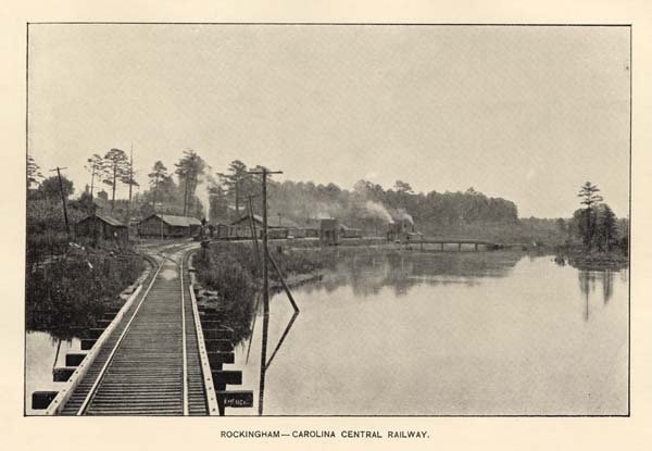
ROCKINGHAM--CAROLINA CENTRAL RAILWAY.
| COUNTY AND POST OFFICE. | INDUSTRY AND OWNER OR MANAGER. |
| Alamance . . . . . Haw River | Roller Flour Mills; Granite Mfg. Co. |
| Alamance . . . . . Burlington | Harness Works; C. C. Townsend & Co. |
| Alamance . . . . . Burlington | Buggy Works; T. J. Fonville. |
| Alamance . . . . . Burlington | Roller Flour Mills; S. Ireland & Son. |
| Alamance . . . . . Mebane | Furniture; White Brothers. |
| Alexander . . . . . Taylorsville | Roller Flour Mill; U. S. Alspaugh. |
| Alexander . . . . . Taylorsville | Tannery; J. M. Matherson. |
| Alexander . . . . . Dealsville | Tannery; S. M. Deal & Sons. |
| Alexander . . . . . Dealsville | Saddle & Harness Co; J. M. Deal. |
| Alexander . . . . . Vashti | Spokes & Handles; Campbell & Williams. |
| Anson . . . . . Wadesboro | Wagon and Buggy Factory; D. L. Saylor & Son. |
| Anson . . . . . Wadesboro | Wagon Works; H. D. Pinkston. |
| Anson . . . . . Goodman | Tannery; J. C. Goodman. |
| Anson . . . . . Cedar Hill | Wagon Works; Springer & Green. |
| Ashe . . . . . Helton | Roller Flour Mill; W. E. Perkins & Bro. |
| Ashe . . . . . Creston | Wagons and Buggies; N. J. Lillard. |
| Ashe . . . . . Jefferson | Tannery; Foster Brothers. |
| Ashe . . . . . Transon | Tannery; S. M. Transou. |
| Ashe . . . . . Treetop | Tannery; G. W. Ray & Son. |
| Ashe . . . . . Sussex | Wagons, Carts, &c.; R. L. Pierce. |
| Ashe . . . . . Grassy Creek | Tannery; George Collier. |
| Ashe . . . . . Grassy Creek | Furniture; F. H. Hatch. |
| Bertie . . . . . Aulander | Wagons and Buggies; W. D. Hoggard. |
| Bertie . . . . . Aulander | Creamery; A. J. Demming & Son. |
| Bertie . . . . . Aulander | Wagons and Buggies; Louis Donaldson & Co. |
| Bertie . . . . . Windsor | Wagons and Buggies; E. S. Dail. |
Page 203
| Bertie . . . . . Kelford | Wagons and Buggies; Parker & Norfleet. |
| Bertie . . . . . Merry Hill | Wagons and Buggies; Granby Cooper. |
| Bertie . . . . . Quitsna | Spoke & Lumber Co.; O. H. Perry. |
| Bladen . . . . . Bladenboro | Gem Canning Co.; W. R. Davis. |
| Bladen . . . . . Council Station | Turpentine Tools; J. P. Council. |
| Buncombe . . . . . Asheville | Ice; Asheville Ice Co. |
| Buncombe . . . . . Asheville | Roller Flour Mills; H. I. Collins. |
| Buncombe . . . . . Biltmore | Furniture; G. W. Vanderbilt. |
| Buncombe . . . . . Biltmore | Brick and Tiles; G. W. Vanderbilt. |
| Buncombe . . . . . Candler | Roller Flour Mills; J. B. Cole. |
| Buncombe . . . . . Weaverville | Tannery; W. B. Cheek. |
| Buncombe . . . . . Weaverville | Pottery Works; M. Shuford. |
| Buncombe . . . . . Grace | Creamery; W. H. Calvern. |
| Burke . . . . . Morganton | Roller Flour and Corn Mill; W. G. Hagan. |
| Burke . . . . . Morganton | Wagons and Buggies; J. H. Coffee & Bro. |
| Burke . . . . . Morganton | Tannery; W. F. Camp, Manager. |
| Burke . . . . . Morganton | Sash, Blinds, &c.; Morganton Mfg. & Trad. Co. |
| Cabarrus . . . . . Mt. Pleasant | Wagon and Buggy Works; Heintz & Lefler. |
| Cabarrus . . . . . Concord | Roller Flour Mill; Lippard & Barrier |
| Cabarrus . . . . . Concord | Tannery; G. W. Brown. |
| Caldwell . . . . . Lenoir | Roller Flour Mills; Moore & Lutz. |
| Caldwell . . . . . Lenoir | Land and Lumber Co.; Corporation. |
| Caldwell . . . . . Lenoir | Blue Ridge Furniture Co.; E. M. Winsyead. |
| Caldwell . . . . . Lenoir | Furniture; Keitz Bros. |
| Caldwell . . . . . Lenoir | Blue Ridge Spring & Mattress Co.; J. R. Widby. |
| Caldwell . . . . . Lenoir | Sash, Doors and Blinds; P. L. Baker. |
| Caldwell . . . . . Cora | Fruit Cannery; A. G. Corpening. |
| Caldwell . . . . . Granite | Roller Mills; Russell & Moore. |
| Caswell . . . . . Milton | Roller Flour Mills; W. B. Lewis. |
| Caswell . . . . . High Towers | Roller Flour Mills; J. L. Warren. |
| Catawba . . . . . Hickory | Piedmont Wagon Co.; F. J. Long. |
| Catawba . . . . . Hickory | Tannery; C. Gaither. |
| Catawba . . . . . Hickory | Tannery; A. S. Abernathy. |
| Catawba . . . . . Hickory | Roller Flour Mills; A. Y. Sigmon. |
| Catawba . . . . . Newton | Tannery; M. J. Rowe. |
| Catawba . . . . . Newton | Roller Flour Mills; Corporation. |
| Catawba . . . . . Catawba | Tannery; J. J. Smith. |
| Catawba . . . . . Clairmont | Roller Flour Mills; John Setzer. |
| Chatham . . . . . Lockville | Roller Flour Mills: John Barringer. |
| Chatham . . . . . Bynums | Roller Flour Mills; C. W. Bynum & Bro. |
| Chatham . . . . . Gulf | Roller Flour Mills; J. M. McIver. |
| Chatham . . . . . Ore Hill | Roller Flour Mills; O. T. Edwards. |
| Cherokee . . . . . Murphy | Cannery; Alfred Morgan. |
| Cherokee . . . . . Andrews | Cannery; C. M. Watson. |
| Chowan . . . . . Edenton | Lumber Mills; J. W. Branning. |
| Clay . . . . . Hayesville | Sash, Doors, Blinds, &c.; C. W. Culberson. |
| Clay . . . . . Hayesville | Tannery; J. J. Scroggs. |
| Clay . . . . . Hayesville | Tannery; Snider & Hill. |
| Clay . . . . . Hayesville | Tannery; W. E. Angle. |
| Clay . . . . . Hayesville | Tannery; A. B. Thompson. |
| Clay . . . . . Hayesville | Wagons, Buggies, &c.; G. T. Cheek. |
| Clay . . . . . Hayesville | Furniture; R. M. Webb. |
| Clay . . . . . Hayesville | Wagons & Buggies; John Palmer. |
| Clay . . . . . Tusquittee | Wagons and Carts; W. H. Poteat. |
| Clay . . . . . Sweet Water | Wagons and Carts; T. R. Griffin. |
| Clay . . . . . Irena | Wool Carding and Cleaning; W. S. Ledford |
| Cleveland . . . . . King's Mountain. | Tannery; A. T. Cansler & Rhyne. |
| Cleveland . . . . . King's Mountain. | Roller Flour Mills; W. O. Wair & Son. |
| Cleveland . . . . . King's Mountain. | Wagon Works; George Cornwell. |
Page 204
| Cleveland . . . . . Shelby | Roller Flour Mills; S. Hoard. |
| Cleveland . . . . . Shelby | Roller Flour Mills; B. Blanton. |
| Cleveland . . . . . Shelby | Wagons and Buggies; J. W. Lineberger. |
| Cleveland . . . . . Laundale | Fruit Cannery; W. C. Lee. |
| Cleveland . . . . . Sharon | Fruit Cannery; J. W. Bowen. |
| Cleveland . . . . . Lattimore | Implements, &c.; W. T. Calton & Co. |
| Cleveland . . . . . Bellwood | Tannery; P. M. Knatt. |
| Cleveland . . . . . Bellwood | Tannery; W. Hoyle. |
| Cleveland . . . . . Polkville | Tannery; T. Elliott. |
| Columbus . . . . . Hub | Butters Lumber Co.; H. Butters. |
| Craven . . . . . New Bern | Ice; B. S. Guion. |
| Craven . . . . . New Bern | Lumber; Congdon & Co |
| Craven . . . . . New Bern | Lumber; Stimson & Co. |
| Craven . . . . . New Bern | Lumber; J. B. Clark. |
| Craven . . . . . New Bern | Lumber; W. B. Ellis. |
| Craven . . . . . New Bern | Lumber; J. S. Basnight. |
| Craven . . . . . New Bern | Lumber; J. L. Moody. |
| Craven . . . . . New Bern | Lumber; W. B. Blades. |
| Craven . . . . . New Bern | Roller Flour Mill; J. A. Meadows. |
| Craven . . . . . New Bern | Carriages and Buggies; H. Wingfield. |
| Craven . . . . . New Bern | Barrel Factory; Jones Manufacturing Co. |
| Craven . . . . . New Bern | Elm City Barrel Factory, B. B. Neal. |
| Craven . . . . . New Bern | Barrels, Crates, &c.; George Bishop. |
| Craven . . . . . New Bern | Castings, &c., W. J. Boyd. |
| Craven . . . . . New Bern | Shuttle Block Works; C. L. Ives. |
| Craven . . . . . New Bern | Lumber; Broadus & Ives. |
| Craven . . . . . New Bern | Lumber; S. E. Sullivan. |
| Craven . . . . . New Bern | Gaskill Mattress Co.; F. T. Patterson. |
| Cumberland . . . . . Fayetteville | Castings, &c.; J. N. Emmett. |
| Cumberland . . . . . Fayetteville | Castings, &c.; Thomas Ward. |
| Cumberland . . . . . Fayetteville | Furniture; Newberry & Son. |
| Cumberland . . . . . Fayetteville | Shuttle Blocks; L. A. Weeden. |
| Cumberland . . . . . Fayetteville | Woodenware; C. S. Taylor. |
| Cumberland . . . . . Fayetteville | Carolina Machine Mfg. Co.; Russell Bros. |
| Cumberland . . . . . Fayetteville | Ice; J. B. Starr. |
| Cumberland . . . . . Fayetteville | Oak Barrels, R. M. Nimocks. |
| Cumberland . . . . . Fayetteville | Turpentine Tools; Walter Watson. |
| Cumberland . . . . . Fayetteville | Cedar Works; A. A. McKeithan, Jr. |
| Cumberland . . . . . Fayetteville | Buggies and Wagons; A. A. McKeithan, Jr. |
| Cumberland . . . . . Fayetteville | Bent-wood Works, Coil Hoops; J. P. Denny. |
| Cumberland . . . . . Fayetteville | Cross Creek Mfg. Co. (Wood). D. Rose. |
| Currituck . . . . . Moyock | Mattresses; C. R. Van De Car. |
| Davidson . . . . . Lexington | Roller Flour Mills; Grimes Brothers. |
| Davidson . . . . . Lexington | Wagons; Rothrock Brothers. |
| Davidson . . . . . Lexington | Roller Flour Mills; M. K. Gray. |
| Davidson . . . . . Lexington | Castings, &c.; C. A. Thompson. |
| Davidson . . . . . Lexington | Sash, Doors and Blinds; Wm. Frank. |
| Davidson . . . . . Lexington | Furniture; Plummer & Gray. |
| Davidson . . . . . Fairmount | Roller Flour Mills; Smithy Spain. |
| Davidson . . . . . Jackson Hill | Tannery; J. M. Badgett. |
| Davidson . . . . . Thomasville | Roller Flour Mills; T. S. F. Lambeth. |
| Davidson . . . . . Thomasville | Coffins; Petree & Riles. |
| Davidson . . . . . Thomasville | Chairs; D. S. Westmoreland & Son. |
| Davidson . . . . . Thomasville | Furniture; J. H. Lambeth. |
| Davidson . . . . . Tyro Shops | Roller Flour Mills; Owens & Co. |
| Davidson . . . . . Linwood | Roller Flour Mill; S. Spain. |
| Davidson . . . . . Denton | Roller Flour Mill & Wool Carding. |
| Davie . . . . . Mocksville | Roller Flour Mills; Horn Bros. & Johnson. |
| Davie . . . . . Mocksville | Lumber; Denny, Owens & Co. |
Page 205
| Davie . . . . . Mocksville | Copper Stills; W. A. Weant. |
| Davie . . . . . Farmington | Roller Flour Mills; A. W. Ellis. |
| Davie . . . . . Advance | Sash, Doors and Blinds; A. C. Wood. |
| Davie . . . . . Cana | Roller Flour Mills; J. W. Etchison. |
| Davie . . . . . Cana | Spokes and Handles; Green & Son. |
| Duplin . . . . . Warsaw | Crate Factory; T. B. Pierce. |
| Duplin . . . . . Faison | Crate Factory; J. W. Mallard. |
| Durham . . . . . Durham | Soap Works; Corporation. |
| Durham . . . . . Durham | Roller Covering Co.; Corporation. |
| Durham . . . . . Durham | Carriages and Buggies; Seeman & Son. |
| Durham . . . . . Durham | Carriages and Buggies; R. T, Howerton. |
| Durham . . . . . Durham | Golden Belt Bag Factory; Corporation. |
| Durham . . . . . Durham | Woodenware; Corporation. |
| Durham . . . . . Durham | Cannery; J. T. Pinnix & Co. |
| Durham . . . . . Durham | Woodenware; Lee & Wheeler. |
| Durham . . . . . Durham | Ice; W. W. Whitted. |
| Durham . . . . . South Lowell | Roller Flour Mills; Corporation. |
| Durham . . . . . Willardsville | Roller Flour Mills; Cox & Christain. |
| Edgecombe . . . . . Tarboro | Carriages and Buggies; M. L. Hussy. |
| Edgecombe . . . . . Tarboro | Carriages and Buggies; J. T. Hyatt. |
| Edgecombe . . . . . Tarboro | Chewing Gum; J. W. Powell. |
| Edgecombe . . . . . Tarboro | Creamery; C. H. King. |
| Edgecombe . . . . . Tarboro | Creamery; J. W. Powell. |
| Edgecombe . . . . . Tarboro | Creamery; L. L. Staton. |
| Edgecombe . . . . . Rocky Mount | Flag Marsh Creamery; T. H. Battle. |
| Edgecombe . . . . . Rocky Mount | Dunbar Creamery; R. H. Battle. |
| Forsyth . . . . . Winston | Tobacco Casing Machinery; Corporation. |
| Forsyth . . . . . Winston | Roller Flour Mills; D. L. Shore. |
| Forsyth . . . . . Winston | Wagons; S. W. Farrabee. |
| Forsyth . . . . . Winston | Machinery; Kesler Bros. |
| Forsyth . . . . . Winston | Wood Workers; Miller Bros. |
| Forsyth . . . . . Winston | Wagons and Carts; S. J. Nissen. |
| Forsyth . . . . . Winston | Wagons and Carts; Spaugh Bros. |
| Forsyth . . . . . Winston | Pumps; C. H. Tise. |
| Forsyth . . . . . Winston | Buggies and Coaches; J. A. White & Son. |
| Forsyth . . . . . Winston | Tiles and Brick; Winston Brick & Tile Co. |
| Forsyth . . . . . Winston | Cigarette Machines; Cigarette Machine Co. |
| Forsyth . . . . . Salem | Builders of Wood Work; Fogle Bros. |
| Forsyth . . . . . Salem | Fruit and Vegetable Cannery; C. F. Jenkins. |
| Forsyth . . . . . Salem | Broom Factory; C. F. Jenkins. |
| Forsyth . . . . . Salem | Metal Cornice W'ks; Senseman & Brickenstein. |
| Forsyth . . . . . Salem | Machinery; C. A. Hege & Co. |
| Forsyth . . . . . Salem | Carriages and Buggies; F. C. Meinung. |
| Forsyth . . . . . Salem | Chairs and Tables; Holland & Weisner. |
| Forsyth . . . . . Salem | Wagons and Carts; C. F. Nissen & Co. |
| Forsyth . . . . . Salem | Wagons and Carts; G. E. Nissen & Co. |
| Forsyth . . . . . Salem | Tobacco Boxes; Spaugh Bros. |
| Forsyth . . . . . Salem | Woodworking Machinery; J. A. Vance. |
| Forsyth . . . . . Salem | Pipes, Earthenware &c.; D. T. Crouse. |
| Forsyth . . . . . Salem | Coffins and Furniture; F. C. Vogler & Son. |
| Forsyth . . . . . Salem | Roller Flour Mill; F. & H. Fries. |
| Forsyth . . . . . Blakely | Roller Flour Mill's; Eugene A. Conrad. |
| Forsyth . . . . . Bethania | Wagon Works; W. A. Stoltz. |
| Forsyth . . . . . Bethania | Roller Flour Mills; J. F. Miller. |
| Forsyth . . . . . Bethania | Roller Flour Mills; E. T. Kapp. |
| Forsyth . . . . . Kernersville | Wood Manufacturing Co.; Lewis & Huff. |
| Forsyth . . . . . Kernersville | Cannery; Edwards & Stone. |
| Forsyth . . . . . Kernersville | Wagons and Buggies; Pendry & Phillips. |
| Forsyth . . . . . Kernersville | Tannery; I. Herner. |
Page 206
| Forsyth . . . . . Kernersville | Roller Flour Mills; Wm. Helper. |
| Forsyth . . . . . Kernersville | Roller Flour Mill; H. E. Harman. |
| Forsyth . . . . . Kernersville | Wagons and Buggies; B. Y. Clark. |
| Forsyth . . . . . Walkertown | Tobacco Boxes, &c.; Leight Bros. |
| Franklin . . . . . Laurel | Creamery; J. F. Jones. |
| Franklin . . . . . Laurel | Wagons and Buggies; J. F. Jones. |
| Gaston . . . . . Stanley Creek | Cannery; R. M. Johnson. |
| Gaston . . . . . Mt. Holly | Roller Flour Mills; R. M. Jenkins. |
| Gaston . . . . . Belmont | Cannery; Hall & Stone. |
| Gates . . . . . Gatesville | Carriages and Buggies; W. H. Standin. |
| Gates . . . . . Adair | Carriages and Buggies; J. H. Brooks. |
| Gates . . . . . Sunbury | Wagons, Carts, &c.; Pierce & Speight. |
| Guilford . . . . . Pomona | Sewer Pipes, Tilings, &c.; J. Van Lindley. |
| Guilford . . . . . Gibsonviile | Sash, Doors and Blinds; W. C. Michael. |
| Guilford . . . . . Gibsonville | Roller Flour Mills; O. L. Huff. |
| Guilford . . . . . Gibsonville | Cannery; J. V. Wagoner. |
| Guilford . . . . . Gibsonville | Tannery; Thomas Overman. |
| Guilford . . . . . Brown's Summit | Doggett Roller Flour Mill; A. Hines. |
| Guilford . . . . . Liberty Store | Tannery; J. J. Busick. |
| Guilford . . . . . Colfax | Cannery; Cude Brothers |
| Guilford . . . . . High Point | Sash, Doors and Blinds; W. C. Michael. |
| Guilford . . . . . High Point | Roller Flour Mills; Teague & Horney. |
| Guilford . . . . . High Point | Sash, Doors, Blinds, &c.; R. F. Dalton. |
| Guilford . . . . . High Point | Furniture; T. F. Wrenn. |
| Guilford . . . . . High Point | Furniture; J. H. Willis. |
| Guilford . . . . . High Point | Furniture; W. H. Ragan. |
| Guilford . . . . . High Point | Furniture; J. H. Tate. |
| Guilford . . . . . High Point | Castings, &c.; O. U. Richardson. |
| Guilford . . . . . High Point | Chair Factory; J. B. Best. |
| Guilford . . . . . High Point | Mattresses and Lounges; J. C. Callum. |
| Guilford . . . . . High Point | Spokes and Handles; J. Elwood Cox. |
| Guilford . . . . . High Point | Furniture; J. P. Redding. |
| Guilford . . . . . High Point | Cannery (Fruit and Veget'ble); J. B. Best &Bro. |
| Guilford . . . . . High Point | Cotton and Fruit Baskets; W. H. Snow. |
| Guilford . . . . . Greensboro | Roller Flour Mills; North & Watson. |
| Guilford . . . . . Greensboro | Roller Flour Mills; T. J. Willis. |
| Guilford . . . . . Greensboro | Roller Flour Mills; Causey & Lewis. |
| Guilford . . . . . Greensboro | Furniture; Greensboro Furniture Company. |
| Guilford . . . . . Greensboro | Wagons, Carts, &c.; C. E. Landreth. |
| Guilford . . . . . Greensboro | Hogsheads, Boxes, &c.; R. W. Brooks. |
| Guilford . . . . . Greensboro | Mattresses, Sofas, &c.; J. C. Callum. |
| Guilford . . . . . Greensboro | Stoves, Agric'lt'ral Imp., &c.; G. Sergeant &Co. |
| Guilford . . . . . Greensboro | Steel and Iron Furnace; J. M. Worth. |
| Guilford . . . . . Greensboro | Castings, Mach'y, &c.; G. T. Glasscock & Son |
| Guilford . . . . . Greensboro | Ice; Wm. E. Worth. |
| Guilford . . . . . Greensboro | Ice; L. S. Barnes. |
| Guilford . . . . . Greensboro | Eagle Foundry and Mch. Wks.; W. J. Teague. |
| Guilford . . . . . Greensboro | Sash, Doors, Blinds &c; W. D. Mendenhall & Co. |
| Guilford . . . . . Greensboro | Southern Varnish & Paint Co.; Corporation. |
| Guilford . . . . . Greensboro | Sash, Doors, Blinds, &c.; J. R. Mendenhall & Co. |
| Guilford . . . . . Greensboro | Spokes and Wood Works; Scott & Eldridge. |
| Guilford . . . . . Greensboro | Brick and Tile; Greensboro B. & T. Co. |
| Guilford . . . . . Greensboro | Spokes and Handles; B. H. Merrimon. |
| Guilford . . . . . Greensboro | Cannery; Gilmer & Smith. |
| Guilford . . . . . Greensboro | Cannery; G. L. Anthony. |
| Guilford . . . . . Greensboro | Cannery; John Tucker. |
| Guilford . . . . . Greensboro | Carriages, Buggies, &c.; Lewis & Huff. |
| Guilford . . . . . Greensboro | Cultivators; Gilmer, Trexler & Phipps. |
| Guilford . . . . . Greensboro | Sash, Doors, Blinds, &c.; Stock Company. |
Page 207
| Guilford . . . . . Colfax | Cannery; Cude Brothers. |
| Guilford . . . . . Guilford College. | Leather and Shoe Co.; S. W. H. Smith. |
| Guilford . . . . . Guilford College. | Harness and Leather; George Edgerton. |
| Halifax . . . . . Hobgood | Cannery; E. P. Hyman. |
| Halifax . . . . . Scotland Neck | Southern Sweet Gum Co.; W. H. White & Co. |
| Halifax . . . . . Scotland Neck | Buggies, &c.; J. E. Woodward. |
| Halifax . . . . . Weldon | Roanoke Corn Mill; Navigation & Water-P-Co. |
| Halifax . . . . . Tillery | North Carolina Lumber Co.; Mr. Turner. |
| Harnett . . . . . Dunn | Plows, Castings, &c.; J. A. McKoy Co. |
| Harnett . . . . . Dunn | Wagons, Carts, &c.; W. D. Thornton. |
| Harnett . . . . . Dunn | Southern Paige Mfg. Co.; A. R. Wilson. |
| Haywood . . . . . Waynesville | Wagons and Carts; McKeehan & Co. |
| Haywood . . . . . Waynesville | Spokes, Handles, Pins, &c.; B. F. Smathers. |
| Haywood . . . . . Waynesville | Barrels, Pumps, Staves, &c.; W. H. Cole. |
| Haywood . . . . . Waynesville | House Furnishing Material; C. E. Satterwait. |
| Haywood . . . . . Waynesville | Insulator Pin Factory; Hellams & Ellis. |
| Haywood . . . . . Waynesville | Cheese and Butter; A. Howell. |
| Haywood . . . . . Waynesville | Tannery; W. A. Herrin. |
| Haywood . . . . . Clyde | Roller Flour Mills; Morgan & Killiam. |
| Henderson . . . . . Zirconia | Handles, Spokes, Rims, &c.; W. T. Davis & Co. |
| Henderson . . . . . Dana | Blue Ridge Canning Co., P. T. Ward & Co. |
| Henderson . . . . . Flat Rock | Carolina Canning Co.; P. W. & R. R. Hart. |
| Henderson . . . . . Hendersonville | Sash, Doors, Blinds, &c.; T. W. Bennett & Co. |
| Henderson . . . . . Hendersonville | Tannery; Taylor & Williams. |
| Henderson . . . . . Hendersonville | Cannery; J. P. Shepard. |
| Henderson . . . . . Horse Shoe | Cannery; W. B. Ledbetter. |
| Hertford . . . . . Murfreesboro | Agricultural Machinery; F. Furguson. |
| Hertford . . . . . Winton | Buggies, Wagons, &c.; H. B. Vann. |
| Hertford . . . . . Winton | Buggies, Wagons, &c.; C. Banks & Co. |
| Hertford . . . . . Winton | Lumber; W. P. Taylor. |
| Hertford . . . . . Union | Buggies, Wagons, &c.; H. F. Duke. |
| Hertford . . . . . Tunis | Lumber; Chowan Lumber Co. |
| Hertford . . . . . Tunis | Lumber; J. A. Isham. |
| Hyde . . . . . Fairfield | Buggies and Carts; W. A. Williams. |
| Hyde . . . . . Swan Quarter | Buggies and Carts; George Hodges. |
| Hyde . . . . . Englehard | Furniture; G. T. Burrus. |
| Iredell . . . . . Statesville | Roller Flour Mill; Stimson & Co. |
| Iredell . . . . . Statesville | Buckets, Boxes, Tubs, &c.; C. L. Wagoner. |
| Iredell . . . . . Statesville | Tannery; S. A. Sharp. |
| Iredell . . . . . Statesville | Tannery; J. T. Allison. |
| Iredell . . . . . Statesville | Creamery; Dr. J. J. Mott. |
| Iredell . . . . . Statesville | Spokes, Handles, &c.; Stock Company. |
| Iredell . . . . . Statesville | Roller Flour Mills; Mott & Sullivan. |
| Iredell . . . . . Mooresville | Roller Flour Mills; Templeton, Williams & Co. |
| Iredell . . . . . Mooresville | Tannery; W. C. Patterson. |
| Iredell . . . . . Mooresville | Shoes and Harness; W. A. Wilson. |
| Iredell . . . . . Cool Springs | Garden Valley Roller Mill; Turner & Holeman |
| Iredell . . . . . Eagle Mills | Roller Flour Mills; J. E. Stimpson. |
| Iredell . . . . . Scotts X Roads | Roller Flour Mills; Morrison & Co. |
| Iredell . . . . . Scotts | Roller Flour Mill; Henry Gilbert. |
| Iredell . . . . . Troutman's | Roller Flour Mills; J. S. Troutman. |
| Lenoir . . . . . Kinston | Buggies; Ellis & Randolph. |
| Lenoir . . . . . Kinston | Buggies, Carriages, &c.; C. Randolph. |
| Lincoln . . . . . Lincolnton | Pioneer Roller Flour Mills; A. Costner. |
| Lincoln . . . . . Lincolnton | Indian Creek Roller Mills; Rudisil & Son. |
| Lincoln . . . . . Lincolnton | Castings and Implements; F. H. Turner. |
| Lincoln . . . . . Lincolnton | Fruit and Vegetable Cannery; J. T. McLain. |
| Lincoln . . . . . Lincolnton | Sash, Doors and Blinds; W. W. Motz. |
| Lincoln . . . . . Lincolnton | Furniture; William Motz. |
Page 208
| Lincoln . . . . . Lincolnton | Castings; Carry & Babbington. |
| Lincoln . . . . . Lincolnton | Mica Mill; Samuel Lander. |
| Lincoln . . . . . Lincolnton | Furniture; Edward James. |
| Lincoln . . . . . Lincolnton | Roller Flour Mills; T. J. Ransom & Son. |
| Macon . . . . . Ellijay | Furniture; John Ammons. |
| Martin . . . . . Williamston | Furniture; Martin & Biggs. |
| Martin . . . . . Everetts | Lumber; Martin Lumber Co. |
| Martin . . . . . Robersonville | Buggies; Robersonville Buggy Works. |
| Martin . . . . . Parmele | Parmele-Eccleston Lumber Co. |
| Martin . . . . . Hamilton | Barrel and Hoop Factory; J. P. Boyce. |
| Martin . . . . . Hamilton | Carriages, &c.; Slade & Jones. |
| Madison . . . . . Marshall | Roller Flour Mills; W. B. Rumsey. |
| Madison . . . . . Marshall | Roller Flour Mills; J. W. Roberts. |
| Madison . . . . . Halewood | Roller Flour Mills; M. Bruce. |
| McDowell . . . . . Marion | Tannery; Blanton & Co. |
| McDowell . . . . . Marion | Furniture; D. R. Roper. |
| McDowell . . . . . Marion | Tannery; Dysart & Co. |
| McDowell . . . . . Marion | Locust Pins; J. N. McNaughton. |
| Mecklenburg . . . . . Charlotte | Machine Works; Liddell & Co. |
| Mecklenburg . . . . . Charlotte | Tompkins Machine Shop; D. A. Tompkins Co. |
| Mecklenburg . . . . . Charlotte | Mecklenburg Iron Works; John Wilkes. |
| Mecklenburg . . . . . Charlotte | Batting Works; F. Oliver, President. |
| Mecklenburg . . . . . Charlotte | Moffitt Machine Shops; J. R. Pharr. |
| Mecklenburg . . . . . Charlotte | Machine Shops; Park Manufacturing Co. |
| Mecklenburg . . . . . Charlotte | Furniture; J. A. Elliott. |
| Mecklenburg . . . . . Charlotte | Broom Company; J. Roessler, Agent. |
| Mecklenburg . . . . . Charlotte | Card Clothing; James Leslie. |
| Mecklenburg . . . . . Charlotte | Loom Reeds and Harness; Lazelle, R. & H. Co. |
| Mecklenburg . . . . . Charlotte | Leather Beltlng; J. P. Wilson. |
| Mecklenburg . . . . . Charlotte | Bagging and Ties; Margolins & Co. |
| Mecklenburg . . . . . Charlotte | Flour Mills; Julian & Thompson. |
| Mecklenburg . . . . . Charlotte | Iron Fronts and Furnaces; I. N. McCousland. |
| Mecklenburg . . . . . Charlotte | Sash, Doors and Blinds; R. E. Cochrane. |
| Mecklenburg . . . . . Charlotte | Mantels & Interior Fin.; Asbury & Finger. |
| Mecklenburg . . . . . Charlotte | Roller Covering Works; D. A. Tompkins. |
| Mecklenburg . . . . . Charlotte | Mantels & Interior Finishing; F. W. Ahrens. |
| Mecklenburg . . . . . Charlotte | Cotton Mill Machinery; D. A. Tompkins Co. |
| Mecklenburg . . . . . Charlotte | Cheese and Butter; J. M. Davis. |
| Mecklenburg . . . . . Charlotte | Candies; J. Fasnach. |
| Mecklenburg . . . . . Charlotte | Spokes, Handles and Rims; J. H. Carson. |
| Mecklenburg . . . . . Charlotte | Candies; J. W. Lewis. |
| Mecklenburg . . . . . Charlotte | Ice; A. J. Hagood. |
| Mecklenburg . . . . . Charlotte | Saddles and Harness; Shaw-Howell Harn. Co. |
| Mecklenburg . . . . . Charlotte | Wagons and Buggies; W. S. Wearn. |
| Mecklenburg . . . . . Charlotte | Brick and Drain Pipes; W. H. Houser. |
| Mecklenburg . . . . . Charlotte | Mattresses; E. M. Andrews. |
| Mecklenburg . . . . . Charlotte | Blacksmith's Bellows; J. H. Weddington. |
| Mecklenburg . . . . . Charlotte | Star Broom Factory; A Brown. |
| Mecklenburg . . . . . Charlotte | Harness and Saddles; W. E. Shaw. |
| Mecklenburg . . . . . Hopewell | Fruit Cannery; D. I. Sample. |
| Mecklenburg . . . . . Hopwell | Fruit Cannery: J. S. McElory. |
| Mecklenburg . . . . . Bristow | Fruit Cannery; W. M. Kerns. |
| Mecklenburg . . . . . Croft | Fruit Cannery; W. D. Alexander. |
| Mecklenburg . . . . . Caldwell | Roller Flour Mills; J. V. Bost. |
| Montgomery . . . . . Troy | Roller Flour Mills; J. L. Hall. |
| Montgomery . . . . . Troy | Sash, Doors and Blinds; B. C. Beckwith. |
| Montgomery . . . . . Mt. Gilead | Tannery; F. McAuley. |
| Montgomery . . . . . Mt. Gilead | Coffins and Furniture; J. A. Lisk. |
Page 209
| Montgomery . . . . . Mt. Gilead | Wagons and Buggies; Mr. Blalock. |
| Montgomery . . . . . Mt. Gilead | Steam Flour Mill; F. McAuley. |
| Montgomery . . . . . Eldorado | Tannery; N. M. Thayer. |
| Montgomery . . . . . Eldorado | Shoe and Harness Co.; N. M. Thayer. |
| Montgomery . . . . . Star | Roller Flour Mills; B. L. Allen. |
| Moore . . . . . Southern Pines | Crates and Baskets; Fred Chandler. |
| Moore . . . . . Carthage | Carriages and Buggies; Tyson & Jones. |
| Moore . . . . . Carthage | Lumber; Walter Mills. |
| Moore . . . . . West End | House Builders' Supplies; W. E. Lumber Co. |
| Moore . . . . . Sanford | Sash, Doors and Blinds; J. W. Scott. |
| Moore . . . . . Sanford | Furniture; Scott & Lemon. |
| Moore . . . . . Sanford | Casting and Machines; M. M. Moffitt. |
| Moore . . . . . Sanford | Carriages and Buggies; O. M. Kelly. |
| Moore . . . . . Aberdeen | Lumber; R. N. & H. A. Page. |
| Moore . . . . . Aberdeen | Lumber; Adams & Co. |
| Moore . . . . . Aberdeen | Lumber; J. Rollins. |
| Moore . . . . . Aberdeen | Wagons, Carts, &c.; Aberdeen Mfg. Co. |
| Moore . . . . . Aberdeen | Castings and Implements; Aberdeen Foundry. |
| Moore . . . . . Jonesboro | Agr. Implements & Machinery; Kelly Bros. |
| Moore . . . . . Jonesboro | Pottery, Tiling, Drain Pipes; T. N. Campbell. |
| Nash . . . . . Battleboro | Creamery; T. B. Braswell. |
| Nash . . . . . Rocky Mount | Creamery; R. H. Ricks. |
| New Hanover . . . . . Wilmington | Broom Factory; J. P. & L. Taylor. |
| New Hanover . . . . . Wilmington | Roller Flour Mills; Boney & Harper. |
| New Hanover . . . . . Wilmington | Engines, Boilers & Agr. Machinery; H. A. Burr. |
| New Hanover . . . . . Wilmington | Creosote; Carolina Creosote Company. |
| New Hanover . . . . . Wilmington | Roller Flour Mills; W. P. Oldham. |
| New Hanover . . . . . Wilmington | Ice; Wm. E. Worth & Co. |
| New Hanover . . . . . Wilmington | Harness; Fennell Harness Co. |
| New Hanover . . . . . Wilmington | Sash, Doors and Blinds; Fore & Foster. |
| New Hanover . . . . . Wilmington | Castings and Machinery; Burr & Bailey. |
| New Hanover . . . . . Wilmington | Wood Alcohol, &c.; Imperial Pine Product Co. |
| New Hanover . . . . . Wilmington | Carriage and Wheel Works; W. P. Boney & Co. |
| New Hanover . . . . . Wilmington | National Rice Milling Co.; Norward Giles. |
| New Hanover . . . . . Wilmington | Oyster Canning Co.; T. D. Meares |
| New Hanover . . . . . Wilmington | Carriages and Buggies; P. H. Hayden. |
| New Hanover . . . . . Wilmington | Carriages and Buggies; W. T. Ketchum. |
| New Hanover . . . . . Wilmington | Lumber; Pike Lumber Co. |
| New Hanover . . . . . Wilmington | Engines, Boilers, Castings; C. M. Whitlock. |
| New Hanover . . . . . Wilmington | Lumber; Hilton Lumber Co. |
| New Hanover . . . . . Wilmington | Lumber; Peregoy Lumber Co. |
| New Hanover . . . . . Wilmington | Lumber; Kidders' Lumber Co. |
| New Hanover . . . . . Wilmington | Lumber; William Chadbourn & Co. |
| Northampton . . . . . Woodland | Carriages and Buggies; Whitty & Co. |
| Northampton . . . . . Jackson | Wagons, Carts and Buggies; Wright Bros. |
| Northampton . . . . . Jackson | Harness Factory; W. T. Picard. |
| Orange . . . . . Hillsboro | Alliance Shoe Factory; Farmers' Alliance. |
| Orange . . . . . Hillsboro | Alliance Tannery; Farmer' Alliance. |
| Onslow . . . . . Jacksonville | Wagons, Buggies, &c.; J. G. Gardner. |
| Onslow . . . . . Jacksonville | Lumber; Parmele-Eccleston Lumber Co. |
| Pamlico . . . . . Bayboro | Truck Barrels and Crates; Hooker & Sawyer. |
| Pamlico . . . . . Stonewall | Lumber; Pamlico Lumber Co. |
| Pamlico . . . . . Oriental | Lumber; Oriental Lumber Co. |
| Pasquotank . . . . . Elizabeth City | Castings and Implements; T. M. Lilliston. |
| Pasquotank . . . . . Elizabeth City | Ice; W. E. Dunston. |
| Pasquotank . . . . . Elizabeth City | Lumber, Mouldings, &c.; J. B. Blades. |
| Pasquotank . . . . . Elizabeth City | Lumber, Mouldings, &c.; John Cramer. |
| Pasquotank . . . . . Elizabeth City | Lumber, Mouldings, &c.; Wm. Straughn. |
| Pasquotank . . . . . Elizabeth City | Lumber, Mouldings, &c.; Foreman & Co. |
Page 210
| Pasquotank . . . . . Elizabeth City | Lumber, Mouldings, &c.; W. W. Griffin & Co. |
| Pasquotank . . . . . Elizabeth City | Nets and Twine; F. S. Brown. |
| Pasquotank . . . . . Elizabeth City | Sash, Doors and Blinds; Thos. Commander. |
| Pasquotank . . . . . Elizabeth City | Carriages, Buggies &c.; J. F. Saunders. |
| Pasquotank . . . . . Elizabeth City | Roller Flour Mills; White & Roper. |
| Pasquotank . . . . . Elizabeth City | Roller Flour Mills; William Parlin. |
| Pasquotank . . . . . Elizabeth City | Sash, Doors & Blinds; C. E. Kramer. |
| Perquimans . . . . . Hertford | Carriages and Buggies; Toms & McMullin. |
| Perquimans . . . . . Hertford | Carriages and Buggies; W. H. Ward. |
| Perquimans . . . . . Hertford | Lumber; Fleetwood & Jackson. |
| Perquimans . . . . . Hertfold | Lumber; Major & Loomis. |
| Perquimans . . . . . Winfall | Box Lumber; Alouzo Winslow. |
| Perquimans . . . . . Belvidere | Tannery; M. White. |
| Person . . . . . Roxboro | Wagons and Buggies; R. E. Daniel & Son. |
| Person . . . . . Roxboro | Wagons and Buggies; Cheek & Co. |
| Person . . . . . Roxboro | Roller Flour Mills; I. C. Pass. |
| Person . . . . . Roxboro | Buggy Factory; C. C. & J. S. Critchner. |
| Person . . . . . Roxboro | Lake Roller Mills; J. A. Long & Co. |
| Person . . . . . Roxboro | Buggies, Wheels, Rims, &c.; O. Bullard. |
| Person . . . . . Chublake | Loche Lilly Roller Mills; Winstead & Long. |
| Randolph . . . . . Coleridge | Enterprise Roller Mills; J. A. Cole. |
| Randolph . . . . . Ramsuer | Alberta Chair Works; A. W. E. Copel. |
| Randolph . . . . . Ashboro | Wood Finishing & Lumber; C. C. McAlister. |
| Randolph . . . . . Ashboro | Roller Flour Mill; R. R. Ross. |
| Randolph . . . . . Ashboro | Wood and Iron Works; C. J. Cox. |
| Randolph . . . . . Ashboro | Furniure; P. H. Morris. |
| Randolph . . . . . Ashboro | Sash, Doors and Blinds; Guilford Mfg. Co. |
| Randolph . . . . . Ashboro | Wagons; S. W. Kivett. |
| Randolph . . . . . Archdale | Archdale Roller Mills. |
| Randolph . . . . . Worthville | Fruit Cannery; H. M. Worth. |
| Richmond . . . . . Laurinburg | Fruit & Vegetable Cennery; D. Stewart. |
| Richmond . . . . . Rockingham | Fruit & Vegetable Cannery (1); A Stewart. |
| Richmond . . . . . Rockingham | Fruit & Vegetable Cannery (2); A. Stewart. |
| Rockingham . . . . . Pelham | Roller Flour Mills; Candler & Bethel. |
| Rockingham . . . . . Leaksville | Carriages and Buggies; J. W. Harper. |
| Rockingham . . . . . Leaksville | Carriages and Buggies; Hampton & Co. |
| Rockingham . . . . . Berry | Fruit and Vegetable Cannery, Settle Bros. |
| Rowan . . . . . Rockwell | Creamery; E. B. C. Hambly. |
| Rowan . . . . . Mill Bridge | Roller Flour Mills; Harrison & Page. |
| Rowan . . . . . Mill Bridge | Creamery; J. M. Harrison. |
| Rowan . . . . . Enochville | Roller Flour Mills; C. J. Deal. |
| Rowan . . . . . Cleveland | Roller Flour Mills; P. M. Brown. |
| Rowan . . . . . China Grove | Roller Flour Mill; M. M. Ketchie. |
| Rowan . . . . . Salisbury | Roller Flour Mills; J. S. McCubbins. |
| Rowan . . . . . Salisbury | North Side Flour Mills; D. R. Julian. |
| Rowan . . . . . Garfield | Roller Flour Mills; Phillips & Pool. |
| Rowan . . . . . South River | Roller Flour Mill; J. Lindsay, Manager. |
| Rutherford . . . . . Ayr | Tannery; Frank Reynolds. |
| Rutherford . . . . . Ellenboro | Roller Flour Mill; Beam & Co. |
| Rutherford . . . . . Rutherfordton | Sash, Doors and Blinds; L. E. Powers. |
| Rutherford . . . . . Rutherfordton | Rims, Spokes and Handles; J. S. Rowland. |
| Rutherford . . . . . Rutherfordton | Roller Flour Mills; J. S. Rowland. |
| Rutherford . . . . . Bostic | Carders and Spinners; Bostic Card. & Wool Co. |
| Sampson . . . . . Autryville | Carriages and Buggies; Lewis & Co. |
| Sampson . . . . . Clinton | Crates and Butter Dishes, &c.; A. F. Johnson. |
| Sampson . . . . . Clinton | Furniture; David Clifton. |
| Sampson . . . . . Clinton | Cannery; George Smith. |
| Sampson . . . . . Warsaw | Baskets, Crates, &c.; T. P. Pierce. |
Page 211
| Stanly . . . . . Whittey | Roller Flour Mills; J. S. Efird. |
| Stanly . . . . . Big Lick | Roller Flour Mills; D. E. Efird & Co. |
| Stanly . . . . . Norwood | Roller Flour Mills; M. E. Blalock. |
| Stanly . . . . . Albemarle | Wagons and Buggies; Albemarle W. & B. Co. |
| Stanly . . . . . Millingport | Roller Flour Mills; E. Eudy. |
| Stanly . . . . . Richfield | Roller Flour Mills; Ritchey Bros. |
| Stanly . . . . . New London | Sash, Doors and Blinds; James Beatty. |
| Stokes . . . . . Dalton | Wagon Works; A. H. Hargrove. |
| Stokes . . . . . Walnut Cove | Sash, Doors and Blinds; Walnut Cove Lb'r Co. |
| Stokes . . . . . Walnut Cove | Foundry; Miller & Cook. |
| Stokes . . . . . Walnut Cove | Wagons, Carts, &c.; Clodfelter & Lancaster. |
| Stokes . . . . . Walnut Cove | Roller Flour Mills; J. J. Blockham. |
| Stokes . . . . . Walnut Cove | Plows, Castings, &c.; Miller Iron Co. |
| Stokes . . . . . Pine Hall | Sash, Doors and Blinds; Capell & Binford. |
| Stokes . . . . . Pine Hall | Roller Flour Mills; L. W. Andrews. |
| Stokes . . . . . Dillard | Tobacco Boxes; R. W. Mitchell. |
| Stokes . . . . . Germanton | Roller Flour Mills; H. A. Morris. |
| Stokes . . . . . Sandy Ridge | Tobacco Boxes; S. Amos. |
| Stokes . . . . . Sandy Ridge | Tobacco Boxes; J. E. Shelton. |
| Stokes . . . . . Sandy Ridge | Wagon Works; John Hutcherson. |
| Stokes . . . . . Sandy Ridge | Roller Flour Mills; J. E. Shelton. |
| Stokes . . . . . Sandy Ridge | Tannery; J. C. Andrews. |
| Stokes . . . . . Francisco | Roller Flour Mills; R. W. George. |
| Stokes . . . . . Slate | Roller Flour Mills; John Slate & Sons. |
| Stokes . . . . . Danbury | Wagons; H. M. Joyce. |
| Stokes . . . . . Danbury | Tannery; J. F. Pepper. |
| Stokes . . . . . Danbury | Roller Flour Mill; D. W. Dodd. |
| Surry . . . . . Elkin | Lumber; Wm. Poindexter. |
| Surry . . . . . Elkin | Lumber; L. H. Carter. |
| Surry . . . . . Elkin | Castings, Plows and Potware; D. Brookshire. |
| Surry . . . . . Elkin | Shoes; Elkin Manufacturing Co. |
| Surry . . . . . Elkin | Wagons and Carts; Hubbard & Roth. |
| Surry . . . . . Elkin | Roller Flour Mills; Elkin Manufacturing Co. |
| Surry . . . . . Elkin | Furniture; Green & Gray. |
| Surry . . . . . Boonville | Buggies and Carr'g's; M. S. Woodhouse & Bro. |
| Surry . . . . . Pilot Mountain | Wagons and Carts; J. S. & S. E. Marshall. |
| Surry . . . . . Mt. Airy | Buggies, Carriages, &c.; L. H. Huff. |
| Surry . . . . . Mt. Airy | Furniture; Mt. Airy Furniture Co. |
| Surry . . . . . Mt. Airy | Roller Flour Mills; A. E. Sides. |
| Surry . . . . . Mt. Airy | Sash, Doors and Blinds; Galloway & Belton. |
| Surry . . . . . Mt. Airy | Sash, Doors and Blinds; Marshall Mill Co. |
| Swain . . . . . Bryson City | Insulator Pins, Staves, &c.; B. B. Lake. |
| Swain . . . . . Bryson City | Sash, Doors, Blinds, &c.; Coffin & McDonald. |
| Swain . . . . . Bryson City | Tannery; John Sutton. |
| Swain . . . . . Bryson City | Insulator Pins, &c.; A. B. Allison & Co. |
| Swain . . . . . Bryson City | Insulator Factory; E. Everett. |
| Swain . . . . . Swain | Tannery; H. McHan. |
| Tyrrell . . . . . Columbia | Wagons and Carts; D. A. Sampler. |
| Union . . . . . Waxhaw | Roller Flour Mills; J. D. Adams. |
| Union . . . . . Alton | Jugs and Pottery; Thomas Gay. |
| Union . . . . . Love's Level | Cannery; T. L. Love. |
| Union . . . . . Monroe | Cannery; Stock Company. |
| Union . . . . . Monroe | Sash, Doors and Blinds; J. Shute & Sons. |
| Union . . . . . Monroe | Fruit and Vegetable Cannery; Stock Co. |
| Union . . . . . Ruben | Barrels, Crates, &c.; James Moore. |
| Vance . . . . . Henderson | Wagons, Buggies, &c.; Crow & Manton. |
| Vance . . . . . Henderson | Cannery; Henderson Canning Co. |
| Vance . . . . . Henderson | Sash, Doors and Blinds; Robert Baum. |
| Vance . . . . . Henderson | Roller Flour Mills; Silas Powell. |
Page 212
| Vance . . . . . Henderson | Sash, Doors and Blinds; R. Pinkston. |
| Vance . . . . . Henderson | Roller Flour Mill; J. S. Pothress. |
| Washington . . . . . Plymouth | Pine and Juniper Lumber; Plymouth Lum. Co. |
| Washington . . . . . Roper | Pine and Juniper Lumber; R. L. Roper. |
| Washington . . . . . Scuppernong | Barrels, Boxes, Crates, &c,; T. J. Basnight. |
| Washington . . . . . Creswell | Barrels, Boxes, Crates, &c.; A. Alexander. |
| Wake . . . . . Raleigh | Wagons and Carts; J. A. Mills. |
| Wake . . . . . Raleigh | Ice; Jones & Powell. |
| Wake . . . . . Raleigh | N. C. Car Company; W. E. Ashley, Supt. |
| Wake . . . . . Raleigh | Lobdell Car Wheel Works; W. E. Ashley, Supt. |
| Wake . . . . . Raleigh | Wagons and Carts; J. W. Evans. |
| Wake . . . . . Raleigh | Candies; A. D. Royster. |
| Wake . . . . . Raleigh | Engines, Boilers, Agr. Mch.; Allen & Cram. |
| Wake . . . . . Raleigh | Leather Manufacturers; E. F. Wyatt & Son. |
| Wake . . . . . Raleigh | Candies; Barbee & Pope. |
| Wake . . . . . Raleigh | Brooms & Mattresses; Institute for Blind. |
| Wake . . . . . Raleigh | Roller Flour Mills; J. A. Mills. |
| Wake . . . . . Raleigh | Ice & Refrigerator Co.; T. L. Eberhardt. |
| Wake . . . . . Raleigh | N. C. B'ldg. & Sup. Co.; Hicks, Ellington & Co. |
| Wake . . . . . Raleigh | Blank and Rec. Books; Edwards & Broughton. |
| Wake . . . . . Raleigh | Furniture; R. Roles & Son. |
| Wake . . . . . Raleigh | Wagons and Carts; W. H. Holloway. |
| Wake . . . . . Raleigh | Blank and Rec. Books; E. M. Uzzell. |
| Wake . . . . . Raleigh | Wagon Works; A. Bowen. |
| Wake . . . . . Raleigh | Foundry & Machine Shops; J. H. Gill. |
| Wake . . . . . Raleigh | Tobacco Flues; Charles Lumsdon. |
| Wake . . . . . Raleigh | Carriages and Buggies; T. B. Yancy. |
| Wake . . . . . Raleigh | Tobacco Flues; J. Lewis Hardware Co. |
| Wake . . . . . Raleigh | Printing and Wrapping Papers; J. N. Holding. |
| Wake . . . . . Wake Forest | Wire Mattresses; A. F. Purefoy. |
| Wake . . . . . Wake Forest | Agricultural Implements; W. B. Dunn & Co. |
| Wake . . . . . Wake Forest | Bed Springs; Corporation. |
| Wake . . . . . Cary | Wagons, Plows and Impl'ts; J. P. H. Adams. |
| Wake . . . . . Rogers' Store | Tannery; Louis Wilson. |
| Warren . . . . . Warrenton | Roller Flour Mill; R. D. Fleming. |
| Warren . . . . . Warrenton | Spokes and Handles; A. & W. B. Crinkley. |
| Warren . . . . . Warrenton | Carriages and Buggies; J. M. Ransom. |
| Warren . . . . . Warrenton | Carriages and Carts; W. E. Davis. |
| Watauga . . . . . Boon | Tannery; Coffee Brothers. |
| Watauga . . . . . Boon | Tannery; H. W. Hardin. |
| Watauga . . . . . Watauga Falls | Tannery; E. M. Green. |
| Watauga . . . . . Vilas | Roller Flour Mill; J. P. Council. |
| Watauga . . . . . Most | Roller Flour Mill; Horton & McBride. |
| Wayne . . . . . Goldsboro | Sash, Doors, Blinds, &c.; N. O'Berry. |
| Wayne . . . . . Goldsboro | Furniture; W. H. Borden. |
| Wayne . . . . . Goldsboro | Plows and Castings; W. H. Smith. |
| Wayne . . . . . Goldsboro | Barrels, Hoops and Lumber; F. C. Overman. |
| Wayne . . . . . Goldsboro | Agricultural Machinery; Dewey Brothers. |
| Wayne . . . . . Goldsboro | Ice; Goldsboro Ice Co. |
| Wayne . . . . . Goldsboro | Crates and Baskets; Stock Co. |
| Wayne . . . . . Goldsboro | Wagons and Buggies; Moore & Robinson. |
| Wayne . . . . . Goldsboro | Bricks and Tiles; H. L. Grant. |
| Wayne . . . . . Goldsboro | Handles; Dean, Pearson & Co. |
| Wayne . . . . . Goldsboro | Cleaning and Grinding Rice; Stock Co. |
| Wayne . . . . . Mt. Olive | Crates, Baskets, Boxes, &c.; G. W. Bridges. |
| Wilkes . . . . . Wilkesboro | Wool Carding; Moravian Wool Carding Co. |
| Wilkes . . . . . Wilkesboro | Ins'l'r. Pin & Bracket Wks.; R. A. Spainhour. |
| Wilkes . . . . . North Wilkesboro | Tannery; C. C. Smoot & Sons Co. |
| Wilkes . . . . . North Wilkesboro | Shuttle Blocks; J. L. Turner. |
Page 213
| Wilkes . . . . . North Wilkesboro | Sash, Doors and Blinds; Wallace & Barnes. |
| Wilkes . . . . . North Wilkesboro | Pottery; Kennedy & Co. |
| Wilkes . . . . . Dehart | Ship Pin Works; D. E. Page. |
| Wilkes . . . . . Miller's Creek | Roller Flour Mill; Turner & Wyatt. |
| Wilson . . . . . Wilson | Buggies and Carriages; Hackney Bros. |
| Wilson . . . . . Wilson | Roller Flour Mill, J. T. Wiggans. |
| Wilson . . . . . Wilson | Creamery; C. T. Finch. |
| Wilson . . . . . Wilson | Iron Works; Geo. H. Wainright. |
| Yadkin . . . . . East Bend | Cannery; Morse & Wade. |
| Yadkin . . . . . East Bend | Buggies and Carriages; J. G. Huff. |
| Yadkin . . . . . East Bend | Buggies and Carriages; T. A. Smitherman. |
| Yadkin . . . . . East Bend | Cannery; R. Patterson. |
| Yadkin . . . . . East Bend | Roller Mills; J. G. Huff. |
| Yadkin . . . . . Boonville | Tannery; J. H. Williams. |
| Yadkin . . . . . Boonville | Buggies and Carriages; M. L. Woodhouse. |
| Yadkin . . . . . Yadkinville | Furniture; John James. |
| Yadkin . . . . . Yadkinville | Tannery; S. H. Mackey. |
| Yadkin . . . . . Yadkinville | Roller Flour Mill; Benj. Shore. |
| Yadkin . . . . . Hamptonville | Tannery; S. M. Haynes. |
| Yadkin . . . . . Hamptonville | Tannery; G. W. Miller. |
| Yadkin . . . . . Hamptonville | Tannery; Luther Miller. |
NOTE--The above list represents only such industries as are reported by voluntary correspondents to the Department of Agriculture, and does not claim to be accurate or nearly so.
RAILROADS AND STEAMBOATS.
The history of railroad construction in North Carolina would make an interesting chapter, but it would be out of place in these pages. With such an history, the name of Dr. Joseph Caldwell, at one time president of the University, would be inseparably linked.
The first line chartered in the State was that between Fayetteville and Salisbury, 1833; it was surveyed and finally failed for lack of funds. The Raleigh and Gaston railroad was begun in 1836, and completed in 1840. In the same year, the Wilmington and Weldon railroad was completed between the terminals. This road was one hundred and forty-six miles in length and was then one of the longest roads on the continent; and, indeed, longer than any at that date in Europe.
The North Carolina railroad--Goldsboro to Charlotte--two hundred and twenty-three miles in length, was completed in 1856, and the next year saw the completion of the Atlantic and North Carolina railroad from Goldsboro to Morehead and Beaufort harbor; it is ninety-seven miles long and links the east with the great Piedmont region. Later the western links of the system were completed, from Salisbury
Page 214

STEAMER NEUSE--ELIZABETH CITY DEPOT--NORFOLK & SOUTHERN RAILWAY.
to Morganton first, and then after delays; hindrance in time of war and lack of funds after, the road finally reached Asheville, at which point it divided; the Paint Rock branch was completed in 1882 and the Murphy branch in 1890. These older roads formed the back-bone to the many other lines now operated in the State, and all make connections with or form part of the great main lines of the United States. The total length of railroad from Murphy in Cherokee county, to Beaufort harbor on the Atlantic, is 538.20, miles, and is full of interest and scenic beauty from the shell bedecked shores of old Ocean to the towering crests of the cloud-kissed Balsams. The total number of miles of railroad in the State is 3,616.58.
The following statement shows the railroads, steamboats, telegraph lines, other property and their valuation:
| NAME OF ROAD. | Mileage | Valuation per Mile. | Value of Track. | Rolling Stock. | Other Property. | Total Valuation. |
| Atlantic Coast Line System. | ||||||
| Albermarle and Raleigh | 54.28 | $ 4,000 | $ 216,920 00 | $ 31,370 00 | $ 11,745 00 | $ 260,035 00 |
| Cheraw and Darlington | 14.41 | 3,000 | 43,230 00 | 2,998 25 | 2,520 00 | 48,748 25 |
| Petersburg | 7.67 | 10,000 | 76,700 00 | 11,125 08 | 1,000 00 | 88,825 08 |
| Wilmington, Columbia& Augusta | 66.64 | 10,000 | 666,400 00 | 95,942 44 | 9,772 00 | 772,114 44 |
| Wilmington, Chadburn & Conway. | 25.53 | 2,500 | 63,825 00 | 4,080 00 | 500 00 | 68,405 00 |
| Wilmington and Weldon | 174.08 | 10,000 | 1,740,800 00 | 279,322 00 | 80,440 00 | 2,100,562 00 |
| Norfolk and Carolina | 68.73 | 8,500 | 584,205 00 | 112,529 16 | 9,210 00 | 705,944 16 |
| Tarboro Branch | 15.10 | 8,500 | 128,350 00 | 16,455 00 | 5,400 00 | 150,205 00 |
| Scotland Neck Branch | 88.63 | 6,000 | 531,780 00 | 96,353 00 | 22,170 00 | 650,303 00 |
| Midland Branch | 21.63 | 3,000 | 64,890 00 | 4,000 00 | 85 00 | 68,975 00 |
| Wilson & Fayetteville Branch | 121.50 | 10,000 | 1,215,000 00 | 224,748 00 | 26,285 00 | 1,466,733 00 |
| Nashville Branch | 19.53 | 3,500 | 68,355 00 | 12,207 00 | 2,940 00 | 83,502 00 |
| Clinton Branch | 13.54 | 3,500 | 47,390 00 | 8,758 00 | 1,260 00 | 57,408 00 |
| Washington Branch | 25.69 | 4,000 | 102,760 00 | 18,587 00 | 15,320 00 | 136,667 00 |
| Total | 716.91 | $5,550,605 00 | $918,474 93 | $189,347 00 | $6,658,426 93 | |
| Southern Railway System. | ||||||
| Atlanta and Charlotte Air-Line | 48.87 | 10,000 | 488,700 00 | 40,623 98 | 5,430 00 | 534,753 98 |
| Atlantic, Tennessee and Ohio | 45.43 | 5,500 | 249,865 00 | 5,930 00 | 6,650 00 | 262,445 00 |
| Asheville and Spartanburg | 43.95 | 7,000 | 307,650 00 | 17,921 89 | 3,250 00 | 328,821 89 |
| Charlotte, Columbia & Augusta | 14.68 | 8,500 | 124,780 00 | 23,049 34 | 3,890 00 | 151,719 34 |
| Danville and Western | 75 | 3,000 | 2,250 00 | . . . . . | . . . . . | 2,250 00 |
| H. Pt., R., Ashboro & Southern | 30.25 | 3,500 | 105,875 00 | 8,565,00 | 4,140 00 | 118,580 00 |
| Coster & Thomas, Trustees | . . . . . | . . . . . | . . . . . | . . . . . | . . . . . | 10,000 00 |
| North Carolina | 226.20 | 8,000 | 1,809,600 00 | 114,708 00 | 150,309 00 | 1,802,767 00 |
| North Carolina Midland | 26.98 | 2,500 | 67,450 00 | . . . . . | 3,860 00 | 71,310 00 |
| Northwestern North Carolina | 29.74 | 6,500 | 420,830 00 | 27,115 00 | 12,300 00 | 460,245 00 |
| Northwestern North Carolina | 75.84 | 3,000 | ||||
| Oxford and Clarksville | 51.96 | 4,500 | 233,820 00 | 14,756 80 | 5,875 00 | 254,451 80 |
| Oxford and Henderson | 14.39 | 3,500 | 50,365 00 | 8,765 00 | 2,500 00 | 61,630 00 |
| Piedmont | 46.57 | 10,000 | 465,700 00 | . . . . . | 4,630 00 | 470,330 00 |
| State University | 10.56 | 2,000 | 21,120 00 | 2,515 00 | 1,000 00 | 24,635 00 |
| Statesville and Western | 21.12 | 2,000 | 42,240 00 | . . . . . | 3,950 00 | 46,190 00 |
| West'n N. Carolina. 120.35 @ 8,500 | 331.50 | 8,500 | ||||
| West'n N. Carolina. 85.60 @ 8,000 | 331.50 | 8,000 | 2,147,200 00 | 118,645 00 | 43,230 00 | 2,309,075 00 |
| West'n N. Carolina. 125.55 @ 3,500 | 331.50 | 3,500 | ||||
| Yadkin | 43.90 | 2,500 | 109,750 00 | 8,310 00 | 4,000 00 | 122,060 00 |
| Total | 1,062.69 | $6,647,195 00 | $390,905 01 | $255,014 00 | $7,031,264 01 | |
| Seaboard Air-Line System. | ||||||
| Palmetto | 7.33 | 2,000 | 14,660 00 | 1,598 00 | 75 00 | 16,333 00 |
| Carolina Central 205.29 @ 4,500 | ||||||
| Carolina Central 53.10 @ 9,000 | 283.97 | . . . . . | 1,555,185 00 | 211,477 00 | 26,655 00 | 1,793,317 00 |
| Carolina Central 25.58 @ 6,000 |
Page 215
| Durham and Northern | 43.87 | 4,500 | 197,415 00 | 17,420 00 | 5,800 00 | 220,635 00 |
| Georgia, Carolina and Northern. | 15.86 | 9,000 | 142,740 00 | 4,324 94 | 2,500 00 | 149,564 94 |
| Louisburg | 10.33 | 3,000 | 30,990 00 | . . . . . | 450 00 | 31,440 00 |
| Murfreesboro | 6.29 | 2,000 | 12,580 00 | . . . . . | 200 00 | 12,780 00 |
| Pittsboro | 12.30 | 2,000 | 24,600 00 | . . . . . | 400 00 | 25,000 00 |
| Raleigh and Gaston | 113.53 | 10,000 | 1,135,300 00 | 301,570 00 | 23,375 00 | 1,460,245 00 |
| Raleigh and Augusta | 10.72 | 3,000 | 32,160 | 24,058 00 | 13,800 00 | 1,016,638 00 |
| Raleigh and Augusta | 105.18 | 9,000 | 946,620 | 24,058 00 | 13,800 00 | 1,016,638 00 |
| Roanoke and Tar River | 35.71 | 4,000 | 142,840 00 | . . . . . | 4,420 00 | 147,260 00 |
| Seabord and Roanoke | 20.38 | 10,000 | 203,800 00 | 43,000 58 | 2,900 00 | 219,700 58 |
| Total | 665.47 | $4,438,890 00 | $603,448 52 | $ 80,575 00 | $5,122,913 52 | |
| Miscellaneous. | ||||||
| Aberdeen and Rock-Fish | 16.00 | 1,750 | 28,000 00 | 3,000 00 | 200 00 | 31,200 00 |
| Aberdeen and West End | 4.00 | 2,000 | 74,937 50 | 14,105 00 | 2,400 00 | 91,442 50 |
| Aberdeen and West End | 29.75 | 2,250 | 74,937 50 | 14,105 00 | 2,400 00 | 91,442 50 |
| Atlantic and North Carolina | 102.26 | 5,000 | 511,300 00 | 64,450 00 | 43,350 00 | 619,100 00 |
| Atlantic and Danville | 22.40 | 5,000 | 112,000 00 | 19,774 90 | 750 00 | 132,524 90 |
| Cape Fear and Yadkin Valley | 355.90 | 5,000 | 1,779,500 00 | 225,540 00 | 36,250 00 | 2,041,290 00 |
| Carthage | 21.60 | 2,000 | 43,200 00 | 3,800 00 | 1,200 00 | 48,200 00 |
| Cashie and Chowan | 29.00 | 1,250 | 36,250 00 | 4,000 00 | . . . . . | 40,250 00 |
| Wellington and Powellsville | 26.00 | 1,000 | 26,000 00 | 6,150 00 | . . . . . | 32,150 00 |
| Ohio River and Charleston | 66.24 | 4,000 | 264,960 00 | 75,205 00 | 6,500 00 | 346,665 00 |
| Danville, Mocksville & Southw'n. | 8.00 | 2,500 | 20,000 00 | . . . . . | 1,000 00 | 21,000 00 |
| E. Tennessee & W. N. Carolina | 3.00 | 3,100 | 9,300 00 | 2,835 00 | 1,350 00 | 13,515 00 |
| Egypt | 8.00 | 2,000 | 16,000 00 | 12 365 00 | . . . . . | 28,365 00 |
| Glendon & Gulf Mfg. & Min. Co. | 8.58 | 2,000 | 17,160 00 | 1,525 00 | . . . . . | 18,685 00 |
| Northampton and Hertford | 9.00 | 2,000 | 18,000 00 | 2,750 00 | 325 00 | 21,075 00 |
| Hoffman and Troy | 3.50 | 1,500 | 5,250 00 | 3,200 00 | . . . . . | 8,450 00 |
| Jamesville and Washington | 7.00 | 2,000 | 14,000 00 | 2,800 00 | 7,000 00 | 23,800 00 |
| Chester and Lenoir | 64.53 | 3,000 | 193,590 00 | 9,815 00 | 2,320 00 | 205,725 00 |
| Marietta and North Georgia | 13.25 | 4,000 | 53,000 00 | 3,100 00 | 600 00 | 56,700 00 |
| Norfolk and Southern | 62.07 | 6,000 | 372,420 | 111,853 00 | 40,300 00 | 621,593 00 |
| Norfolk and Southern | 32.34 | 3,000 | 97,020 | 111,853 00 | 40,300 00 | 621,593 00 |
| New Hanover Transit Co. | 3.12 | 2,000 | 6,240 00 | 1,320 00 | . . . . . | 7,560 00 |
| Norfolk and Western | . . . . . | . . . . . | . . . . . | . . . . . | . . . . . | . . . . . |
| Roanoke & Southern Division. | 49.66 | 6,500 | 322,790 00 | 16,072 52 | 17,479 00 | 356,341 52 |
| Lynchburg & Durham Division. | 43.57 | 5,000 | 217,850 00 | 19,216 77 | 4,731 00 | 241,797 77 |
| Moore County | 12.50 | 1,500 | 18,750 | 5,280 00 | 342 00 | 25,072 00 |
| Moore County | 7.00 | 100 | 700 | 5,280 00 | 342 00 | 25,072 00 |
| Raleigh and Western | 1.00 | 1,000 | 1,000 00 | . . . . . | . . . . . | 1,000 00 |
| Suffolk and Carolina | 25.50 | 2,500 | 63,750 00 | 10,605 97 | 922 50 | 75,278 47 |
| Suffolk Lumber Company | 9.00 | 2,500 | 22,500 00 | 7,000 00 | . . . . . | 29,500 00 |
| Warrenton | 3.12 | 2,000 | 6,240 00 | 2,500 00 | 700 00 | 9,440 00 |
| Wilmington, Newbern & Norfolk. | 90.49 | 3,500 | 316,715 00 | 43,560 00 | 20,670 00 | 380,945 00 |
| Wilmington Railway Bridge Co. | 2.40 | . . . . . | 80,000 00 | . . . . . | . . . . . | 80,000 00 |
| Wilmington Sea Coast | 11.81 | 3,000 | 35,430 00 | 4,000 00 | 200 00 | 39,630 00 |
| Winton | 15.00 | 2,000 | 30,000 00 | 8,350 00 | 150 00 | 41,000 00 |
| Winton | 5.00 | 500 | 2,500 00 | 8,350 00 | 150 00 | 41,000 00 |
| Total | 1,171,51 | $4,816,352 50 | $684,203 16 | $188,739 50 | $5,689,295 16 |
| TELEGRAPH COMPANIES-- | Poles, Wires and Batteries. | Valuation. |
| Western Union Telegraph Company . . . . . | $ 176,392 24 | |
| Atlantic Postal Telegraph Company . . . . . | 31,645 48 | |
| Carthage Telegraph Company . . . . . | 210 00 | |
| Pittsboro Telegraph Company . . . . . | 250 00 | |
| Louisburg Telegraph Company . . . . . | 250 00 | |
| Norfolk and Southern . . . . . | 975 00 | |
| United Telegraph Company . . . . . | 120 00 | |
| Cleveland Springs Telegraph Company . . . . . | 50 00 | |
| Oak Ridge and Stokesdale Telegraph Company . . . . . | 210 00 | |
| Elizabeth City and Norfolk Telegraph Company . . . . . | 1,090 00 | |
| Lenoir and Blowing Rock Telegraph Company . . . . . | 480 00 | |
| Swepsonville Telegraph Company . . . . . | 225 00 | |
| Carolina Postal Telegraph Company . . . . . | 205 00 | |
| Wilmington and Southport Telegraph Company . . . . . | 500 00 | |
| Total . . . . . | $212,602 72 | |
| Pullman Palace Car Company . . . . . | 81,043 65 |
Page 216
| STEAMBOATS.-OWNERS. | Kinds of Property. | Total Assessed. Value. |
| Moccasin River Steamboat Company | Steamers | $ 1,500 00 |
| Cape Fear River Towing and T. Company | Steamers | 21,000 00 |
| Albemarle Steam Navigation Company | Steamers | 1,000 00 |
| Pamlico Towing Company | Steamers | 1,000 00 |
| Home Transportation Company | Steamers | 3,000 00 |
| Fairfield Canal Company | Canal Property | 6,453 00 |
| A. W. Styron | Steamers | 500 00 |
| Styrons Transportation Company | Steamers | 4,000 00 |
| Cashie Steam Navigation Company | Steamers | 1,000 00 |
| J. G. and F. Wood | Steamers | 3,500 00 |
| Fleetwood and Jackson | Steamers | 1,200 00 |
| Farmer's Co-operation Company | Steamers | 850 00 |
| New Bern Lumber Company | Steamers | 400 00 |
| D. W. Raper & Company | Steamers | 800 00 |
| Dixon & Dixon | Steamers | 500 00 |
| David Styron | Steamers | 600 00 |
| Old Dominion Steamship Company | Steamers and Wharves | 42,000 00 |
| Albemarle and Chesapeake Canal Company | Canal Property | 100,000 00 |
| M. E. Sutton | Steamers | 1,000 00 |
| Jno. W. Harper | Steamers | 8,000 00 |
| Walter Taft | Steamers | 1,500 00 |
| W. H. Ward | Steamers | 1,000 00 |
| Black River Steamboat Company | Steamers | 7,100 00 |
| Cape Fear River Transportation Company | Steamers | 6,200 00 |
| J. T. Harper | Steamers | 3,000 00 |
| Chas. Wessell | Steamers | 700 00 |
| Branning Manufacturing Company | Steamers | 6,000 00 |
| New Bern and Snow Hill Steamboat Company | Steamers | 1,000 00 |
| Chas. L. Ives | Steamers | 800 00 |
| J. J. Lassiter | Steamers and Wharves | 1,300 00 |
| J. C Whitty | Steamers | 1,000 00 |
| Roanoke and Tar River Steamboat Company | Steamers | 6,500 00 |
| Lake Drummond Canal and Water Company | Canal Property | 1,600 00 |
| Wilmington Steamship Company | Steamers | 50,000 00 |
| Fairfield and Elizabeth City Transportation Company | Steamers | 1,000 00 |
| J. H. Riley | Steamers | 1,000 00 |
| A. J. Gatlin | Steamers | 1,000 00 |
| $289,003 00 |
| Atlantic Coast Line System | 716.91 miles, valuation, | $ 6,658,426 93 |
| Southern Railway | 1,062.69 miles, valuation, | 7,031,264 01 |
| Seaboard Air Line | 665.47 miles, valuation, | 5,122,913 00 |
| Miscellaneous | 1,171.51 miles, valuation, | 5,689,295 16 |
| 3,616.58 miles. | $ 24,501,899 62 | |
| Pullman Palace Car Company | 81,043 65 | |
| Steamboats | 289,003 00 | |
| Telegraph Companies | 212,602 72 | |
| $ 25,084,548 99 |
NEWSPAPERS.
There are semi-monthly, monthly and yearly publications in North Carolina, but here it is only intended to present a list of newspapers, circulated in daily, semi-weekly and weekly editions.
Page 217
| COUNTY. | TOWN. | Name of Paper. |
| Alamance | Graham | Alamance Gleaner . . . . . Weekly |
| Alamance | Burlington | Burlington News . . . . . Daily and Weekly |
| Anson | Wadesboro | Wadesboro Messenger . . . . . Weekly |
| Anson | Wadesboro | Wadesboro News . . . . . Weekly |
| Alleghany | Sparta | Alleghany Star . . . . . Weekly |
| Alexander | Taylorsville | Index . . . . . Weekly |
| Beaufort | Washington | Washington Progress . . . . . Weekly |
| Beaufort | Aurora | The Progressive Age . . . . . Weekly |
| Beaufort | Washington | Washington Gazette . . . . . Weekly |
| Beaufort | Washington | Evening Messenger . . . . . Daily |
| Bertie | Windsor | Windsor Ledger . . . . . Weekly |
| Brunswick | Southport | Southport Leader . . . . . Weekly |
| Buncombe | Asheville | Asheville Citizen . . . . . Daily and Weekly |
| Buncombe | Asheville | Morning Gazette . . . . . Daily |
| Buncombe | Asheville | Western Carolina Advocate . . . . . Weekly |
| Burke | Morganton | Morganton Herald . . . . . Weekly |
| Cabarrus | Concord | Concord Times . . . . . Weekly |
| Cabarrus | Concord | Daily Standard . . . . . Daily and Weekly |
| Caldwell | Lenoir | Lenoir Topic . . . . . Weekly |
| Caswell | Yanceville | Caswell News . . . . . Weekly |
| Caswell | Milton | Chronicle . . . . . Weekly |
| Catawba | Hickory | Hickory Mercury . . . . . Weekly |
| Catawba | Hickory | Press . . . . . Weekly |
| Catawba | Newton | Newton Enterprise . . . . . Weekly |
| Carteret | Beaufort | Beaufort Herald . . . . . Weekly |
| Chatham | Pittsboro | Chatham Record . . . . . Weekly |
| Cherokee | Murphy | Murphy Bulletin . . . . . Weekly |
| Cherokee | Murphy | Cherokee Scout . . . . . Weekly |
| Chowan | Edenton | Courier . . . . . Weekly |
| Cleveland | King's Mountain | Progressive Reformer . . . . . Weekly |
| Cleveland | Boiling Springs | Rural Reformer . . . . . Weekly |
| Cleveland | Shelby | Shelby Aurora . . . . . Weekly |
| Cleveland | Shelby | Cleveland Star . . . . . Weekly |
| Columbus | Whiteville | Columbus News . . . . . Weekly |
| Columbus | Vineland | Star of Columbus . . . . . Weekly |
| Columbus | Whiteville | The Sun . . . . . Weekly |
| Craven | New Bern | Journal . . . . . Daily |
| Craven | New Bern | Journal . . . . . Weekly |
| Cumberland | Fayetteville | North Carolina Baptist . . . . . Weekly |
| Cumberland | Fayetteville | Fayetteville Observer . . . . . Daily and Weekly |
| Davidson | Lexington | Davidson Dispatch . . . . . Weekly |
| Davidson | Thomasville | Thomasville News . . . . . Weekly |
| Davie | Mocksville | Davie Times . . . . . Weekly |
| Durham | Durham | Durham Daily Sun . . . . . Daily |
| Durham | Durham | Morning Herald . . . . . Daily |
| Durham | Durham | Durham Weekly Globe . . . . . Weekly |
| Durham | Durham | Durham Recorder . . . . . Weekly |
| Edgecombe | Tarboro | Tarboro Southerner . . . . . Weekly |
| Forsyth | Winston | Union Republican . . . . . Weekly |
| Forsyth | Winston | Sentinel . . . . . Daily and Weekly |
| Forsyth | Winston | Southern Tobacco Journal . . . . . Weekly |
| Forsyth | Kernersville | Silver Advocate . . . . . Weekly |
| Franklin | Franklinton | Franklinton Weekly . . . . . Weekly |
| Franklin | Louisburg | Franklin Times . . . . . Weekly |
| Gaston | Gastonia | Gastonia Gazette . . . . . Weekly |
| Granville | Oxford | Public Ledger . . . . . Weekly |
| Greene | Ormondsville | Free Will Baptist . . . . . Weekly |
| Guilford | Greensboro | The Record . . . . . Daily and Weekly |
| Guilford | Greensboro | The Patriot . . . . . Weekly |
Page 218
| Guilford | Greensboro | Christian Advocate . . . . . Weekly |
| Guilford | Greensboro | Carolina Methodist . . . . . Weekly |
| Guilford | High Point | Enterprise . . . . . Weekly |
| Halifax | Weldon | Roanoke News . . . . . Weekly |
| Halifax | Scotland Neck | The Commonwealth . . . . . Weekly |
| Harnett | Dunn | Central Times . . . . . Weekly |
| Harnett | Dunn | County Union . . . . . Weekly |
| Haywood | Waynesville | Western North Carolina Baptist . . . . . Weekly |
| Haywood | Waynesville | Waynesville Courier . . . . . Weekly |
| Haywood | Clyde | Clyde Register . . . . . Weekly |
| Henderson | Hendersonville | The Times . . . . . Weekly |
| Hertford | Murfreesboro | Index . . . . . Weekly |
| Iredell | Statesville | The Mascot . . . . . Weekly |
| Iredell | Statesville | The Landmark . . . . . Semi-Weekly |
| Iredell | Mooresville | The Toiler . . . . . Weekly |
| Jackson | Sylvia | Tuckaseegee Democrat . . . . . Weekly |
| Jackson | Webster | The Herald . . . . . Weekly |
| Johnston | Smithfield | Herald . . . . . Weekly |
| Lenoir | Kinston | Free Press . . . . . Semi-Weekly |
| Lincoln | Lincolnton | Lincoln Courier . . . . . Weekly |
| Lincoln | Lincolnton | Lincoln Democrat . . . . . Weekly |
| Macon | Franklin | Franklin Press . . . . . Weekly |
| Martin | Williamston | Martin County Sun . . . . . Weekly |
| Mecklenburg | Charlotte | Charlotte Observer . . . . . Daily and Weekly |
| Mecklenburg | Charlotte | The Messenger . . . . . Weekly |
| Mecklenburg | Charlotte | Charlotte News . . . . . Daily |
| Mecklenburg | Charlotte | Mecklenburg Times . . . . . Weekly |
| Mecklenburg | Charlotte | Register . . . . . Weekly |
| Mecklenburg | Charlotte | Africo-American Presbyterian . . . . . Weekly |
| Mecklenburg | Charlotte | Charlotte Democrat . . . . . Weekly |
| Mitchell | Bakersville | Times . . . . . Weekly |
| Moore | Carthage | Carthage Blade . . . . . Weekly |
| Moore | Aberdeen | Aberdeen Telegram . . . . . Weekly |
| Moore | Jonesboro | Progress . . . . . Weekly |
| Moore | Sanford | Sanford Express . . . . . Weekly |
| McDowell | Marion | Free Lance . . . . . Weekly |
| McDowell | Marion | Marion Herald . . . . . Weekly |
| Nash | Rocky Mount | Argonaut . . . . . Weekly |
| Nash | Rocky Mount | Phoenix . . . . . Weekly |
| Nash | Whitakers | The Rattler . . . . . Weekly |
| New Hanover | Wilmington | Review . . . . . Daily |
| New Hanover | Wilmington | Messenger . . . . . Daily and Weekly |
| New Hanover | Wilmington | Dispatch . . . . . Daily |
| New Hanover | Wilmington | Morning Star . . . . . Daily and Weekly |
| New Hanover | Wilmington | North Carolina Presbyterian . . . . . Weekly |
| Northampton | Lasker | Patron and Gleaner . . . . . Weekly |
| Orange | Hillsboro | Orange County Observer . . . . . Weekly |
| Orange | Hillsboro | Hillsboro Recorder . . . . . Weekly |
| Orange | Chapel Hill | Tar Heel . . . . . Weekly |
| Onslow | Peanut | Onslow Blade . . . . . Weekly |
| Pasquotank | Elizabeth City | Elizabeth City News . . . . . Weekly |
| Pasquotank | Elizabeth City | North Carolinian . . . . . Weekly |
| Pasquotank | Elizabeth City | Economist-Falcon . . . . . Weekly |
| Pasquotank | Elizabeth City | Fisherman and Farmer . . . . . Weekly |
| Person | Roxboro | Person County Courier . . . . . Weekly |
| Perquimans | Hertford | Perquimans Record . . . . . Weekly |
| Perquimans | Hertford | Eastern Courier . . . . . Weekly |
| Pitt | Greenville | King's Weekly . . . . . Weekly |
| Pitt | Greenville | Eastern Reflector . . . . . Daily and Weekly |
Page 219
| Randolph | Ashboro | Ashboro Courier . . . . . Weekly |
| Richmond | Rockingham | The Rocket . . . . . Weekly |
| Richmond | Rockingham | Spirit of the South . . . . . Weekly |
| Richmond | Rockingham | Southern Index . . . . . Weekly |
| Robeson | Maxton | Maxton Blade . . . . . Weekly |
| Robeson | Maxton | Scottish Chief . . . . . Weekly |
| Robeson | Lumberton | Robesonian . . . . . Weekly |
| Rockingham | Reidsville | Webster's Weekly . . . . . Weekly |
| Rockingham | Reidsville | The Review . . . . . Weekly |
| Rockingham | Reidsville | Reformer . . . . . Weekly |
| Rockingham | Leaksville | Leaksville Gazette . . . . . Weekly |
| Rowan | Salisbury | Truth . . . . . Weekly |
| Rowan | Salisbury | Star of Zion . . . . . Weekly |
| Rowan | Salisbury | The Evening World . . . . . Daily |
| Rutherford | Forest City | Ledger . . . . . Weekly |
| Sampson | Clinton | Sampson Democrat . . . . . Weekly |
| Sampson | Clinton | Caucasian . . . . . Weekly |
| Stanly | Albemarle | Stanly News . . . . . Weekly |
| Stokes | Culler | North Carolina Voice . . . . . Weekly |
| Stokes | Danbury | Danbury Reporter . . . . . Weekly |
| Surry | Elkin | Elkin Times . . . . . Weekly |
| Surry | Mt. Airy | Yadkin Valley News . . . . . Weekly |
| Swain | Bryson City | Herald . . . . . Weekly |
| Swain | Bryson City | Bryson City Times . . . . . Weekly |
| Transylvania | Brevard | Transylvania Hustler . . . . . Weekly |
| Union | Monroe | Monroe Enquirer . . . . . Weekly |
| Union | Monroe | Monroe Journal . . . . . Weekly |
| Union | Beaver Dam | Our Home . . . . . Weekly |
| Vance | Henderson | Gold Leaf . . . . . Weekly |
| Vance | Henderson | The Hustler . . . . . Weekly |
| Wake | Raleigh | Progressive Farmer . . . . . Weekly |
| Wake | Raleigh | Biblical Recorder . . . . . Weekly |
| Wake | Raleigh | Press--Visitor . . . . . Daily |
| Wake | Raleigh | The Gazette . . . . . Weekly |
| Wake | Raleigh | Christian Sun . . . . . Weekly |
| Wake | Raleigh | North Carolinian . . . . . Weekly |
| Wake | Raleigh | News and Observer . . . . . Daily and Weekly |
| Wake | Raleigh | The Lodge Weekly . . . . . Weekly |
| Wake | Raleigh | The National Outlook . . . . . Weekly |
| Wake | Raleigh | State Republican . . . . . Weekly |
| Wake | Raleigh | Caucasian . . . . . Weekly |
| Warren | Warrenton | The Record . . . . . Weekly |
| Warren | Warrenton | Warrenton Gazette . . . . . Weekly |
| Washington | Plymouth | Roanoke Beacon . . . . . Weekly |
| Watauga | Boon | Watauga Democrat . . . . . Weekly |
| Wayne | Goldsboro | The Headlight . . . . . Weekly |
| Wayne | Goldsboro | Argus . . . . . Daily and Weekly |
| Wilkes | North Wilkesboro | North Wilkesboro News . . . . . Weekly |
| Wilkes | North Wilkesboro | The Hustler . . . . . Weekly |
| Wilkes | Wilkesboro | Chronicle . . . . . Weekly |
| Wilson | Wilson | Wilson Times . . . . . Weekly |
| Wilson | Wilson | Wilson Advance . . . . . Weekly |
Page 220
POPULATION.
This is a topic of interest to the people of North Carolina from the marked fact of their present homogeneousness, excepting, of course the important and large element of the African race, and the small and inferior remnant of the aboriginal Indian, still in possession of a large territory in the western part of the State, and the still smaller body of half-breeds, known as the Croatans, occupying a portion of Robeson county, and believed, fancifully or otherwise, to be the descendants of the members of the lost colony of Captain John White, the first effort at permanent settlement made by Anglo-Saxon whites on the American continent. The whites of this State, now so intermingled and blended by intermarriage and industrial intercourse as to present between them few distinctive traits of their origin, are the descendants, mediately or immediately, of the dominant European races coming directly to our shores, but more largely the off-shoots of the northern colonies grown populous and powerful enough to indulge in that early development of the American characteristic, love of change and adventure, or the more practical motive of bettering their condition by the acquirement of new lands, unrestricted in limit, of nearly nominal cost, and with the fame of unbounded fertility and unequalled salubrity.
Of those coming direct to our shores, the immigrating colonies were small and infrequent. After the efforts of colonization on the waters of the north-eastern section of the State, in 1584, under the auspices of Sir Walter Raleigh and his successors, had failed, a long interval passed away before decided or successful effort was made to plant other colonies on our shores. Among the more ambitious and well considered schemes was that of Sir John Yeamans, who, about the year 1659-'60, landed within the mouth of the Cape Fear river a body of several hundred colonists of English birth or descent, from the island of Barbadoes. A settlement at about the same spot had previously been made by adventures from New England, who thus made this section favorably known, and who eventually abandoned it, disappointed in over-wrought expectation. In like manner the colony of Sir John, or the larger body of it, moved first to Port Royal, in South Carolina, and subsequently to the spot where they founded the present city of Charleston, but leaving behind them the impress of a good name and a high character, permanently stamped and manifesting itself upon their descendants in the present city of Wilmington and other points on the lower Cape Fear.
Page 221
In 1709, the Baron De Graffenreid, with a colony of Swiss, established himself at the confluence of the rivers Neuse and Trent, and there founded the present city of New Bern--a settlement destined to be permanent, but of slow growth, and receiving few farther accessions from the native land of the founder.
A small colony of Huguenots found a refuge from persecution in the same section, but, beyond the impress of their principles and their names, contributed only in small degree to the settlement of North Carolina.
Perhaps the largest body of native Europeans coming approximately at one time, and constituting a distinctive foreign element, was the Scotch or Highland colony, which occupied the country along the upper waters of the Cape Fear, now know as the counties of Bladen, Cumberland, Moore, Robeson, Richmond and Harnett. These came, some voluntarily, most of them by compulsion, after the disastrous defeat of Culloden, in 1746. They have also blended with the other European families, but still retain in marked degree their national characteristics of piety, morality, and care of education.
The Lords Proprietors, through their influence and inducements offered, added to the population, which, however, came in singly or in small groups and increased slowly, though early in the colonial history making the Coastal Plain region the most populous in the State.
The other chief elements of settlement were refugees from religious persecution in Virginia, who gradually filled up the north-eastern peninsula around the waters of Albemarle sound and contiguous territory. In process of time, bodies of immigrants arrived from New Jersey and Pennsylvania, hearing of the rich lands and fine climate of the upper country. Some bodies of these were of German descent. A still larger body was Scotch-Irish. Both planted themselves in harmonious contiguity from Orange county on the east to Catawba county--as that county became eventually known--along the rich bottoms or the finely timbered uplands of the Eno, the Yadkin and the Catawba rivers, and became the foundation of that population destined to prove in coming years its love of liberty, its hostility to oppression, its indomitable courage, its wakeful care of education, its intense religious fervor, its energies and its industry; a population, withal, so widely diffused as to have been greatly instrumental in forming the character of the North Carolinian by the domination of these leading traits and qualities.
The location of his large colony of Moravians by Count Zinzendorff, in 1754, in the present county of Forsyth, is the only instance of attempted complete isolation, of the seclusion of an entire colony,
Page 222
and the culture of peculiar ideas and creeds--ideas and creeds more in harmony with the real aim and ends of a pure Christianty than human philanthropy has often aimed to put in practical force. This, like all other colonies, has in process of time blended with the great mass, but with the distinct and triumphant survival of its nobler characteristics--benevolence, integrity, devotion to morality, religion and education, and that untiring energy which brought prosperity to the wilderness colony, and future increase of growth and wealth to those fine towns, Salem and Winston, the matured or rather still growing and maturing outgrowth of the simple, pious, un-ambitious, religious Moravian colony.
Of the negro population it suffices to say that it is chiefly descended from the slaves captured in former years in Africa, and introduced into the South by English, Dutch, and, in later years, New England slave-ships. Importation of slaves into North Carolina was very rare after the beginning of this century. The increase, therefore, has been from natural causes, a genial climate, a humane public system and the kindly temper of the owners, a temper softened as much by humanity--very often by affection--as it was influenced by interest. Through these combined causes, the negro population increased until it early attained the ratio to that of the whites it has held and still holds--about one-third of the whole.
Since the emancipation of the race, the policy of the State government, sustained by a just and humane public sentiment, has done everything consistent with the existence of insuperable and ineradicable ethnical antagonisms, to efface all the badges of former slavery. The negro has all the rights of the citizen, and is secured and protected in the exercise of them with the same jealous safeguard of the law as the white citizen. He testifies before the courts without question as to race competency; he accumulates, if he will, property, personal and real; he is admitted on the same terms with the whites to the practice of the learned professions; he has the amplest freedom in the exercise of his religious beliefs, and the most absolute control in his ecclesiastical affairs. His infirm, the deaf, the dumb, the blind and the insane, are cared for by the State in institutions, proportionately to the number of patients, as large, as well built, as costly, and as well supervised by competent heads, as those of the whites. His education is well provided for, and though he pays a little more than one-third of the poll-tax, and one-thirtieth of such property tax as is assigned to the maintenance of the school fund, his allotment of that fund is in proportion to population, not to that of race contribution.
Page 223
The Indian portion of the population is confined to the mountain counties of Jackson, Swain and Graham. They are a remnant of the tribe which was removed in 1836 to the trans-Mississippi reservation, and which obtained the consent of the government to be exempted from the decree of expatriation. They were allotted in the counties above named a tract of about 100,000 acres, and left in the enjoyment of their former habits and customs. They are for the most part christianized, and speak both English and their native tongue. They are peaceable and generally law-abiding, but do not accumulate property, are only industrious enough to meet daily wants. There are about 1,800 of them, and they increase slowly.
Of the Croatans of Robeson county, little definite can be said. Their origin is involved in doubt, though it is clear that they form a mixed and distinct class of the blended Indian and white races. These people are provided by the State with their separate schools, and they take great interest in the education of their children.
The total population of North Carolina, by the last census, was 1,617,947. These are divided as follow: Whites, 1,049,191; colored, 567,170; Chinese and Japanese, 15; Indians (exclusive of the Croatans), 1,571. The normal rate of increase is about 250,000 each decade, but during the last few years considerable immigration from the north and northwest has come to the State, and it will be entirely within bounds to estimate for the present (1896) population at not less than 1,750,000
It is interesting to note that the same census puts the entire foreign-born population of the State at 3,742. This illustrates the homogeneousness of the mass of population. No immigration from foreign countries comes directly to North Carolina, but the immigration mostly coming into the State, and which is mostly desired, comes from New England, the Middle and Northwestern States.
Following is a table, showing the population by counties, made up from the last census:
| WHITES. | COLORED. | TOTAL. | |
| Alamance . . . . . | 12,688 | 5,583 | 18,271 |
| Alexander . . . . . | 8,588 | 842 | 9,430 |
| Alleghany . . . . . | 6,061 | 462 | 6,523 |
| Anson . . . . . | 10,237 | 9,790 | 20,027 |
| Ashe . . . . . | 15,033 | 595 | 15,628 |
| Beaufort . . . . . | 11,869 | 9,203 | 21,072 |
| Bertie . . . . . | 7,885 | 11,291 | 19,176 |
| Bladen . . . . . | 8,646 | 8,117 | 16,763 |
| Brunswick . . . . . | 6,139 | 4,761 | 10,900 |
| Buncombe . . . . . | 28,640 | 6,626 | 35,266 |
Page 224
| Burke . . . . . | 12,378 | 2,561 | 14,939 |
| Cabarrus . . . . . | 12,683 | 5,459 | 18,142 |
| Caldwell . . . . . | 10,737 | 1,561 | 12,298 |
| Camden . . . . . | 3,347 | 2,320 | 5,667 |
| Carteret . . . . . | 8,528 | 2,297 | 10,825 |
| Caswell . . . . . | 6,639 | 9,389 | 16,028 |
| Catawba . . . . . | 16,073 | 2,616 | 18,689 |
| Chatham . . . . . | 17,214 | 8,199 | 25,413 |
| Cherokee . . . . . | 9,655 | 321 | 9,976 |
| Chowan . . . . . | 4,010 | 5,157 | 9,167 |
| Clay . . . . . | 4,055 | 142 | 4,197 |
| Cleveland . . . . . | 17,301 | 3,093 | 20,394 |
| Columbus . . . . . | 11,804 | 6,052 | 17,856 |
| Craven . . . . . | 7,175 | 13,358 | 20,533 |
| Cumberland . . . . . | 14,952 | 12,369 | 27,321 |
| Currituck . . . . . | 4,731 | 2,016 | 6,747 |
| Dare . . . . . | 3,362 | 406 | 3,768 |
| Davidson . . . . . | 18,174 | 3,528 | 21,702 |
| Davie . . . . . | 8,769 | 2,852 | 11,621 |
| Duplin . . . . . | 11,600 | 7,090 | 18,690 |
| Durham . . . . . | 10,712 | 7,329 | 18,041 |
| Edgecombe . . . . . | 8,513 | 15,600 | 24,113 |
| Forsyth . . . . . | 19,433 | 9,001 | 28,434 |
| Franklin . . . . . | 10,755 | 10,335 | 21,090 |
| Gaston . . . . . | 12,927 | 4,837 | 17,764 |
| Gates . . . . . | 5,539 | 4,713 | 10,252 |
| Graham . . . . . | 3,137 | 176 | 3,313 |
| Granville . . . . . | 12,122 | 12,362 | 24,484 |
| Greene . . . . . | 5,281 | 4,758 | 10,039 |
| Guilford . . . . . | 19,820 | 8,232 | 28,052 |
| Halifax . . . . . | 9,614 | 19,294 | 28,908 |
| Harnett . . . . . | 9,453 | 4,247 | 13,700 |
| Haywood . . . . . | 12,829 | 517 | 13,346 |
| Henderson . . . . . | 11,211 | 1,378 | 12,589 |
| Hertford . . . . . | 5,906 | 7,945 | 13,851 |
| Hyde . . . . . | 4,962 | 3,941 | 8,903 |
| Iredell . . . . . | 19,516 | 5,946 | 25,462 |
| Jackson . . . . . | 8,680 | 832 | 9,512 |
| Johnston . . . . . | 19,917 | 7,322 | 27,239 |
| Jones . . . . . | 3,885 | 3,518 | 7,403 |
| Lenoir . . . . . | 8,517 | 6,362 | 14,879 |
| Lincoln . . . . . | 10,028 | 2,558 | 12,586 |
| McDowell . . . . . | 9,114 | 1,825 | 10,939 |
| Macon . . . . . | 9,436 | 666 | 10,102 |
| Madison . . . . . | 17,095 | 710 | 17,805 |
| Martin . . . . . | 7,838 | 7,383 | 15,221 |
| Mecklenburg . . . . . | 23,141 | 19,532 | 42,673 |
| Mitchell . . . . . | 12,252 | 555 | 12,807 |
| Montgomery . . . . . | 8,982 | 2,257 | 11,239 |
Page 225
| Moore . . . . . | 13,985 | 6,494 | 20,479 |
| Nash . . . . . | 12,186 | 8,521 | 20,707 |
| New Hanover . . . . . | 10,089 | 13,937 | 24,026 |
| Northampton . . . . . | 9,224 | 12,018 | 21,242 |
| Onslow . . . . . | 7,392 | 2,911 | 10,303 |
| Orange . . . . . | 9,705 | 5,243 | 14,948 |
| Pamlico . . . . . | 4,767 | 2,379 | 7,146 |
| Pasquotank . . . . . | 5,201 | 5,547 | 10,748 |
| Pender . . . . . | 5,967 | 6,547 | 12,514 |
| Perquimans . . . . . | 4,719 | 4,574 | 9,293 |
| Person . . . . . | 8,251 | 6,900 | 15,151 |
| Pitt . . . . . | 13,192 | 12,327 | 25,519 |
| Polk . . . . . | 4,807 | 1,095 | 5,902 |
| Randolph . . . . . | 21,848 | 3,347 | 25,195 |
| Richmond . . . . . | 10,989 | 12,959 | 23,948 |
| Robeson . . . . . | 16,629 | 14,854 | 31,483 |
| Rockingham . . . . . | 15,197 | 10,166 | 25,363 |
| Rowan . . . . . | 17,142 | 6,981 | 24,123 |
| Rutherford . . . . . | 15,073 | 3,697 | 18,770 |
| Sampson . . . . . | 15,960 | 9,136 | 25,096 |
| Stanly . . . . . | 10,629 | 1,507 | 12,136 |
| Stokes . . . . . | 14,386 | 2,813 | 17,199 |
| Surry . . . . . | 16,926 | 2,355 | 19,281 |
| Swain . . . . . | 5,652 | 925 | 6,577 |
| Transylvania . . . . . | 5,368 | 513 | 5,881 |
| Tyrrell . . . . . | 3,000 | 1,225 | 4,225 |
| Union . . . . . | 15,712 | 5,547 | 21,259 |
| Vance . . . . . | 6,434 | 11,147 | 17,581 |
| Wake . . . . . | 26,093 | 23,114 | 49,207 |
| Warren . . . . . | 5,880 | 13,480 | 19,360 |
| Washington . . . . . | 4,961 | 5,239 | 10,200 |
| Watauga . . . . . | 10,180 | 431 | 10,611 |
| Wayne . . . . . | 15,115 | 10,985 | 26,100 |
| Wilkes . . . . . | 20,633 | 2,042 | 22,675 |
| Wilson . . . . . | 10,884 | 7,760 | 18,644 |
| Yadkin . . . . . | 12,421 | 1,369 | 13,790 |
| Yancey . . . . . | 9,197 | 293 | 9,490 |
| State total . . . . . | 1,055,382 | 562,565 | 1,617,947 |
RELIGION.
The religious denominations of North Carolina stand upon absolute equality in respect to the laws. The vigorous temper of the people during Colonial days in resisting the imposition of a State religion has never relaxed; and the absolute severance of church and
Page 226
State became a cardinal and inviolable principle in the assumption of popular sovereignty. The laws and the constitution extend no special favor to creed or denomination, assuring freedom to all who worship God according to the dictates of their own consciences.
The following table, carefully calculated by those in authority in the several denominations, will serve to show the names of the denominations and the number of communicants or members in each for the year 1895-96:
- Methodist Episcopal Church South, (white) . . . . . 129,040
- Methodist Episcopal Church South, (colored) . . . . . 17,000
- African M. E. Zion, (colored) . . . . . 121,000
- Methodist Protestant . . . . . 16,416
- Methodist Episcopal Church, [Northern] (col.) . . . . . 7,200
- Quakers (or Friends) . . . . . 5,466
- Lutherans (white) . . . . . 16,000
- Lutherans, (colored) . . . . . 1,000
- German Reformed Church . . . . . 3,200
- Moravians . . . . . 3,829
- Presbyterians . . . . . 30,292
- Associate Reformed Presbyterians, (white) . . . . . 2,300
- Christians, (O'Kellyites) . . . . . 14,508
- Episcopalians . . . . . 9,000
- Baptist, (Missionary, white and colored) . . . . . 265,579
- Baptist, (Anti-Missionary) . . . . . 9,750
- Baptist, (Campbellites) . . . . . 6,000
- Baptist, (Free Will) . . . . . 20,081
- Baptist, (Free Will, colored) . . . . . 19,000
- Roman Catholics, (white) . . . . . 3,800
- Roman Catholics, (colored) . . . . . 200
GOVERNMENT AND TAXATION.
The government of North Carolina is a pure democracy. It is based upon the will of the people as expressed in the Constitution, an instrument framed by them in their sovereign capacity through delegates appointed for that purpose. The will of the people of this and of each State, when thus expressed, and in conformity to the Constitution of the United States--for the will of the people of each State is subordinate to the collective will of the people of all the States--is the supreme law. The State Constitution thus made is the measure and test of all laws passed by the Legislature, and these laws must stand or fall by their agreement or disagreement with it.
Page 227
The Constitution is a short instrument but wide in its scope and bearing. It contains a brief statement of the fundamental principles of civil and individual liberty, creates the different departments of government--Executive, Legislative and Judicial--and prescribes the powers of each; establishes educational, charitable and penal institutions; directs who shall be liable to duty in militia; and prescribes the rights of citizenship.
The Legislature enacts laws. The Judiciary passes upon them when a question arises as to their constitutionality, and expounds them when a question is presented as to their meaning. The execution of the law is intrusted to the Executive. The Executive in this State possesses no veto upon the acts of the Legislature. When the law is once made, his duty, as that of every other citizen, is obedience in his sphere.
The rights of citizenship are the only points for consideration here; and these depend upon age, residence and previous citizenship.
A citizen of a foreign country can make himself a citizen here by becoming a resident; declaring before the proper tribunal his purpose to become a citizen; and taking the prescribed oath of allegiance.
A citizen of any other of the United States becomes a citizen here by changing his residence from that State to this.
All persons who are born and continue to reside within this State are citizens thereof.
The chief privilege of citizenship is suffrage. The Constitution ordains that, "every male person born in the United States, and every male person who has been naturalized, twenty-one years old, or upward, who shall have resided in this State twelve months next preceding the election, and ninety days in the county in which he offers to vote, shall be deemed an elector."
Citizenship under the Constitution of North Carolina, carries with it high and important rights apart from suffrage. It confers a right to an education by the State, such as will qualify the citizen for the duties to be performed. If he be without property, it gives him a right to support from the county, if incapable of earning it by sickness or old age. If he has property and is overtaken by irremedial misfortune, it exempts from execution personal property to the value of five hundred dollars, and vests in the owner in fee-simple the homestead and the dwellings and the buildings used therewith not exceeding in value one thousand dollars, to be selected by him. The unfortunate have thus a secure refuge in case of disaster in business.
It regulates taxation by providing that the General Assembly levying a tax shall state the object to which it is to be applied, and enjoins
Page 228
that it be applied to no other purpose. It establishes an equation between the property and the capitation tax by directing that the capitation tax levied on each citizen shall be equal to the tax on property valued at three hundred dollars in cash. The capitation tax is levied on every male inhabitant in the State over twenty-one and under fifty years of age, and shall never exceed two dollars on the head. The effect of this limitation upon the capitation tax restricts the tax on each hundred dollars worth of property to sixty-six and two-thirds cents. It further directs that the amount levied for county purposes shall not exceed the double of the State tax, except for a special purpose and with the approval of the Legislature.
The rate of State tax now levied for the present year is twenty-one and two-thirds cents on one hundred dollars valuation, besides eighteen cents for school purposes, and three and one-third cents for pensions. In addition there are taxes levied on certain pursuits, industries and interests devoted to certain purposes, some in aid of the general school fund, some for interest on public debt.
The following statement from the State Auditor's Report for the year ending November 30, 1895, sets forth the aggregate number and value of the various subjects of taxation in the State, and the gross amount of the State, school and county taxes derived from the same.
| Number. | Valuation. | |
| 27,602,376 acres of land | $115,081,323 00 | $253,178 91 |
| 70,219 town lots | 43,006,741 00 | 94,614 83 |
| 152,343 horses | 6,862,284 00 | 15,097 03 |
| 115,038 mules | 5,698,825 00 | 12,537 42 |
| 860 jacks and jennies | 45,833 00 | 100 83 |
| 36,850 goats | 32,901 00 | 72 38 |
| 621,188 cattle | 4,543,555 00 | 9,995 82 |
| 1,198,027 hogs | 1,778,924 00 | 3,913 64 |
| 376,052 sheep | 361,723 00 | 795 79 |
| Farming utensils, &c | 12,323,375 00 | 27,111 43 |
| Money on hand or on deposit | 3,576,726 00 | 7,868 79 |
| Solvent credits | 18,924,240 00 | 41,633 33 |
| Stock in incorporated companies | 3,310,924 00 | 7,284 03 |
| Railroads, steamboats, telegraph and express companies | 25,084,548 99 | 62,711 37 |
| Privilege taxes | . . . . . | 55,454 27 |
| All other personal property | 18,932,527 00 | 41,651 56 |
| Total valuation | $259,564,449 99 | $634,021 43 |
| 167,300 white polls . . . . . | $250,458 85 |
| 63,931 colored polls . . . . . | 94,436 58 |
| Bank stock . . . . . | 5,177 25 |
Page 229
| Railroad property . . . . . | 39,205 99 |
| General property--white . . . . . | 363,258 68 |
| General property--colored . . . . . | 12,861 92 |
| From other sources . . . . . | 111 00 |
| Total school taxes . . . . . | $765,510 27 |
| County purposes . . . . . | $693,809 12 |
| Special county taxes . . . . . | 345,558 64 |
| Total county taxes . . . . . | $1,039,367 76 |
The executive power of the State Government is vested in a Governor and a Lieutenant Governor, elected by the popular vote for the term of four years, the Governor ineligible for two successive terms; an Attorney General, a State Treasurer, an Auditor, a Secretary of State, and a Superintendent of Public Instruction, all of whom are eligible for re-election.
The legislative department, also elected by the popular vote, elected for the term of two years, and holding biennial sessions. The Senate consists of fifty members, and is presided over by the Lieutenant Governor of the State, and the House of Representatives, of 120 members, presided over by a speaker elected from among the members of the same. The sessions are limited by the Constitution to sixty days, but may be prolonged on emergency, but with suspension of the per diem pay. Extra sessions may be called by the Governor should urgent cause make it necessary; but such sessions are limited to twenty days, but may be extended farther, under the limitations of pay that govern the regular sessions.
The Judicial department consists of a Supreme Court, presided over by a Chief Justice, and, in conjunction with four Associate Justices, forming the highest court in the State. The Justices are elected for a term of eight years, and are eligible to re-election.
The Circuit or Superior Court is composed of twelve members, elected by the people of a like number of districts, and are elected for the same length of term and the same eligibility to re-election as the Justices of the Supreme Court.
In addition to these are two criminal circuits, embracing a few counties each, having original jurisdiction in all criminal matters originating in their respective circuits, but having none in civil causes of action.
The above, together with the magistrates' courts, having jurisdiction over small sums and minor offences, and the Boards of County Commissioners, having supervision over the direction and administration of county affairs, constitute the Judicial system of North Carolina.
Page 230
STATE DEBT.
The State's bonded debt, at present, stands as follows:
- New 4 per cent Consolidated Bonds . . . . . $3,347,750
- 6 per cent. N. C. R. R. Construction Bonds . . . . . 2,720,000
- Total bonded debt . . . . . $5,067,750
The interest on the 4 per cent. bonds is due semi-annually, in January and July, and is paid upon presentation of coupons, out of special taxes levied for the purpose.
The interest on the 6 per cent. bonds is provided for out of the rental coming into the State Treasury from the N. C. railroad.
- The Amount of this 6 per cent. interest per annum is . . . . . $163,200
- The rental coming from State's stock in the N. C. R. R. lease has been . . . . . 180,012
- For six years it is to be . . . . . 210,014
- Then for 93 years finishing out the 99 yrs. lease . . . . . 225,015
The total interest then will be:
- On 4 per cent. bonds, per annum . . . . . 133,910
- On 6 per cent. bonds, per annum . . . . . 163,200
- Total interest . . . . . $297,110
The State owns $136,750 of the 4 per cent. bonds, and the State Board of Education, $143,250 of the 4 per cent. and $2,000 6 per cent. bonds, as an investment.
There are old refundable bonds still outstanding, which will require $270,910 new 4 per cent. bonds, provided they shall be presented before January 1, 1897, at which time the law expires.
The 6 per cent. bonded debt, $2,720,000 was incurred for the construction of the North Carolina railroad, which is in great part owned by the State. The income from the dividends realized by the road is not only sufficient to pay the interest but leaves a surplus which is regularly funded from year to year, the aggregate of which will extinguish the debt at the maturity of the bonds. This debt does not now impose nor will it in the future impose, one cent of taxation upon the people of the State. The first amount, $3,347,750, therefore represents the entire debt for which the property of the State is subject to be taxed.
The total valuation of real and personal property in North Carolina is, according to the auditor's report for 1895, $259,564,449.99. But the valuation of property in this State is known to be much
Page 231
below its real value. Taking, however, the valuation as given in the auditor's report, it will be seen that a very small tax is required to meet the annual interest on the 4 per cent. bonds, amounting to only $133,910 per annum.
GEOLOGICAL SURVEY.
The North Carolina Geological Survey, as at present organized, was authorized by the General Assembly in 1891, and in May, of the same year, Professor Joseph A. Holmes was commissioned as State Geologist. The object of the survey was two fold, as expressed in the act creating it: "the thorough examination of the nature and extent of the mineral and timber resources of the State." During the first years after his appointment, Professor Holmes devoted his energies to the gathering of the unpublished information of former Geologists--Emmons and Kerr--many of the results from both having been lost by not being published; and in connection with this a large amount of exploration was found necessary before entering more directly upon the special new work contemplated by the framers of the law. After this reconnoisance work, he associated with him an able corps of assistants, and has issued the following bulletins: Iron Ores; Gold Deposits; Road Materials and Road Construction; The Forests, Forest Lands and Forest Products; Forest Fires; Monazite and Monazite Deposits; Corundum and Basic Magnesian Rocks, and besides these he has in preparation or in press the following additional Bulletins: Building Stone in North Carolina; Timber Trees; Water Powers; Gold Mining in North Carolina; Drinking Water Supplies; Clay Deposits and Clay Industries; Mica Deposits and Mica Mining; Mineral Waters; List of Elevations and an Historical Sketch of North Carolina Scientific and Economic Surveys, and Bibliography of North Carolina Geology and Mineralogy. These Bulletins are mailed to those desiring information on the special subjects treated, on receipt of the postage; address the State Geologist, at Chapel Hill, or Raleigh, N. C. The progress of the work has been most gratifying and the appreciation of its usefulness is steadily growing among the people of the State.
Page 232
AGRICULTURAL DEPARTMENT.
North Carolina being essentially an agricultural State, it is but natural to find provision in the State Constituion for an Agricultural Department, which is fully sustained by legislation wholesome and wise. The existence of the department amply demonstrates the breadth and determination of the intelligence of the State to elevate its chief industry to its rightful dignity and prominence as an avocation. The Department has a peculiar and a particular work, a work devoted to the promotion of the interests of the agricultural masses; the broadening of their opportunities and guaranteeing them protection from the purchase of fraudulent fertilizers. The laws governing and directing the State Board of Agriculture have been changed from time to time, bringing it in closer touch with the people and rendering it more effective in the discharge of its duties relating to the fertilizer control, the analytical part of which is done by the Experiment Station under its direction. Its equipment of suitable and conveniently arranged buildings is ample; its revenue is sufficient for its present needs, and its powers abundant. The Agricultural Department came into existence with the sanction of popular sentiment and under the shield and protection of the public law, and stands not only as a monument to the enlightened spirit of the age, but a beacon light of hope and encouragement to that great fundamental interest which, more than all others, has been the victim of neglect, the least consideration of statesmanship.
The Department occupies a building in the city of Raleigh, arranged so as to be specially adapted to its many uses and, in the prosecution of the work assigned to it it has done--and this will suffice to illustrate its usefullness--what is expressed in the words of another: "It has saved to the State thousands of dollars annually, it has induced investments of large amounts in the mines, forests and agricultural lands of the State, and has developed the phosphate beds, the oyster grounds, and the mineral deposits and coal fields of the State; it has gathered statistics and published valuable books descriptive of the whole State, and distributed them so wisely that this is among the best advertised States; and has, as its last and greatest effort, the organization of the successful College of Agriculture and Mechanic Arts." In its relation to the former it has been, and continues to be, of inestimable value to the farmer. For as in the advancement of agriculture into the ranks of a science, so was there enormous application of the presumably scientifically compounded
Page 233
artificial fertilizers. Here was opened a wide and gaping door to fraud, which the Department was empowered to step forward and close. This has been done so vigorously, watchfully and effectively that fraudulent fertilizers are banished from the market, trustworthy brands have replaced them, and at the same time a great reduction in the cost has been made.
The Board of Agriculture has been the most potent factor in bringing the advantages of soil and climate and the natural resources of the State to the notice of the world. It has been faithful and true to the trust imposed by law and it has led in every move looking to the development of the State and the prosperity of its people.
Mr. S. L. Patterson is the Commissioner of Agriculture and Immigration, and Mr. T. K. Bruner is the Secretary and Auditor.
The Department is in a sense, a "bureau of information" for the State, and all inquiries addressed to the Commissioner touching agriculture, lands, immigration, natural resources, or upon any subject inviting to investment in the State, will be promptly answered with the best information at hand.
THE STATE MUSEUM.
The State Board of Agriculture has enlarged and perfected the State Museum. This was made possible by the wise provision of the Act of the Assembly in 1891 which provided that all nonperishable material used by the State in its presentation of resources at the great Columbian Exposition at Chicago in 1893, should revert to the Board for the purpose of adding to its then small collection. Thus has the Board had the first substantial aid from the State in this work, and very wisely has it been administered. The Board also has the hearty co-operation of the State Geological Survey in the museum work, especially in those divisions devoted to metalliferous ores, minerals and building stones.
Prof. J. A. Holmes, State Geologist, and T. K. Bruner, Secretary of the Board of Agriculture, are the Custodians, and Mr. H. H. Brimley, Naturalist, is the Curator in charge of the rooms.
The entire second floor of the Agricultural Building is now devoted exclusively to this purpose--there is a Geological room, a Forestry room, an Agricultural room, a Natural History room and a room devoted to photographic representation of some of the State's notable features of scenery, fisheries, forests, farms, trucking, naval stores and other objects and industries.
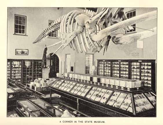
A CORNER IN THE STATE MUSEUM.
Page 234
The rooms are handsomely furnished with oak cases; the floors comfortably carpeted and the whole steam-heated. In material and arrangement, there is no collection south of Washington to compare with it. The contents of these several rooms are classified and arranged with reference to giving the greatest facility to the student, sight-seer, or investor.
AGRICULTURAL EXPERIMENT STATION.
The functions of the Station are two-fold. First, as a fertilizer control station, and second, as an agricultural experiment station in the broadest sense of the word.
It is under the control of the Board of Agriculture. It was established in 1877, and was the first Experiment Station in the Southern States, and the second in America. Its first work was in the control of the fertilizer trade by a chemical analysis of the fertilizing ingredients offered for sale, thus preventing fraud and causing the manufacturers to furnish the materials they claimed to sell. It continues to occupy this position for the protection of all classes of farmers, and it is safe to say that in twenty years of its existence it has saved the farmers of the State many millions of dollars by preventing the sale of such adulterated and worthless fertilizers. In the early years of its life, chemical investigations were its main work. Besides analyzing fertilizers, it also examined thousands of samples of marls, mucks, soils, cotton seed products, phosphates, waters, home-made composts, miscellaneous fertilizing ingredients and chemicals. It has spread broadcast hundreds of thousands of its publications, giving information on almost every subject connected with agriculture. It thoroughly examined the natural phosphate deposits of the State, the pyrite deposits, the by-products of the rice industry, of cotton and tobacco products, also the jute and sugar beet industry, and others of importance.
Later on an experimental farm was added to the agencies at work. Then a State Weather Service was organized as a part of the Station, and various benefits were secured such as the foreknowledge of frosts and cold waves, and miscellaneous weather conditions.
There are various divisions of the Station, in which are trained experts. Some of the principal subjects studied in these divisions are here mentioned:
The Chemical Division includes all chemical work of the Station, such as are embraced in the fertilizer control, also the analysis of milk,
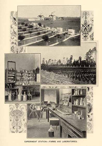
EXPERIMENT STATION--FARMS AND LABORATORIES.
Page 235
butter, food and fodders, marls, phosphates, mucks, soils, chemicals, waters, etc. The Agricultural Divisions embraces work done in the field, stable, and dairy, and tests varieties of wheat, oats, cotton and corn, grasses, clovers and other forage plants. The value of fodders and grasses, ensilage, cotton-seed products for fattening and maintenance, and the digestibility of different food stuffs are determined by actual feeding trials. In dairy work, various implements are tested, improved methods tried, with the view of extending the dairy industry throughout the State, recognizing that the judicial keeping of stock is the salvation of our people. The Botanical Division tests the purity and vitality of field and garden seeds, grasses and clovers, identifies plants and ascertains their value, examines diseases of plants and investigates the best remedies; disseminates practical information upon the best agricultural grasses, and upon the most troublesome weeds and how to eradicate them. The Entomological Division studies the various insect pests which infest the field, orchard and garden crops, and suggests remedies and methods of extermination. The Horticultural Division investigates the different varieties of fruits and vegetables, and their adaptability to our soil and climates, together with the best methods of cultivation, gathering and shipment to markets. It originates and improves new and promising varieties which may become valuable to the State. A most important work now being conducted is in connection with the North Carolina State Horticultural Society at Southern Pines, where extensive field tests with fertilizers are conducted upon various fruit and vegetable crops. The Poultry Division seeks to aid the poultry interests of the State, testing different breeds and crosses and otherwise to cause it to become a more paying industry than at present. The Meteorological Division is organized as the State Weather Service, operating in conjunction with the U. S. Weather Bureau. It collects meteorological data, and thus determines the essential features of the State's unexcelled climatic conditions. Telegrams giving forcasts of weather for the following day are distributed; also cold wave and frost warnings for the protection of fruit, tobacco and trucking interests. A weekly bulletin, showing the effect of the weather on the crops, is also issued during the growing season.
The Station issues numerous publications. The following are some of the subjects treated: The best agricultural grasses; plant diseases and how to combat them; silos and ensilage; some enemies of truck and garden crops; tobacco curing; some experiments in wheat culture; the culture of orchard and garden fruits; some leguminous crops and their economic value; the chestnut and its weevil,
Page 236
rational stock feeding; propagation of flowering bulbs; seed testing, its uses and methods; marls and phosphates; trucking in the South; tests of dairy implements and practices; tuberculosis and its prevention; cotton-seed meal and hulls for the production of beef; cultivation of the peach tree; hill-side terraces or ditches; types of tobacco and their analyses; forage grasses and hay-making.
The chemical laboratories and the city offices of the Station, occupy the first floor of the right wing of the Agricultural Building, in Raleigh. In this building also are located the botanical and entomological laboratory, and the rooms of the meteorological division. Upon the roof are the meteorological instruments, and the signal flags to disseminate the weather forecasts. The experimental farm, upon which are the barn, stable, dairy house, plant house, is located one and one-half miles west of Raleigh, adjoining the State Fair Grounds.
The Director of the Station is Dr. H. B. Battle, who is aided by a corps of fourteen, comprising the Station staff.
RAILROAD COMMISSION.
By an act of the General Assembly of North Carolina, ratified March 5, 1891, a Railroad Commission was created, consisting of three members to be elected by the Legislature, charged with the general supervision of railroads, steamboat and canal companies, and express and telegraph companies doing business in North Carolina; restraining on the part of railroad and other public transportation companies the exaction of more than a reasonable compensation for the carriage of freight or passengers, under penalty of fine, to be adjudged sufficient under conviction for extortion; and also empowering the Commission with authority to forbid such companies to give undue preference to patrons of their lines, and authorizing it to make rates for freight and passenger tariffs, forbidding unjust discriminations, the giving of rebates and the charging of more for a shorter than a longer distance. Empowering it to approve special excursion rates, empowering it to fix the charges for the transportation of passengers and freight, to make schedules that shall meet the general public convenience, and take such other steps and do such other acts as shall conduce to the protection of the business and traveling public from oppression and injustice, allegations of which induced the creation of the Commission.
Page 237
The Commission is invested with judicial powers; authorized to hear and decide complaints, to hear and adjust the differences between railroads. The same principles that govern railroad and other transportation management are made to apply also to telegraph and express companies.
The Commission consists at present of J. W. Wilson, Chairman; S. O. Wilson and E. C. Beddingfield, associate Commissioners and H. C. Brown, Secretary. Its sittings are held in Raleigh.
BUREAU OF LABOR STATISTICS.
The Bureau of Labor Statistics was established by the Legislature of 1887, and its first Commissioner was Hon. W. N. Jones, who was succeeded two years later by Hon. J. C. Scarborough, who held the office until 1892, when he was elected State Superintendent of Public Instruction. Governor Carr, who has ever proved himself the friend of the laboring classes, appointed as Commissioner Mr. B. R. Lacy, a representative labor man who, as Chairman of the Locomotive Engineers of the S. A. L. system between Portsmouth, Va., and Atlanta Ga., had, by his wise and conservative course, succeeded in doing what was considered almost an impossibility, that was, gained the respect and confidence of both the railroad officials and the men whom he represented. His nearness to, and his intimate knowledge of the wants of the people for whom the office was created gave new life to the work.
The purpose for which the Bureau was established is to collect information upon the subject of labor, its relation to capital, the hours of labor, the earnings of laboring men and women, and their educational, moral and financial condition. This class of investigation has received a great deal of attention during the last three years, and the importance of accurate statistics on this subject is beginning to be felt as never before. This is shown by the fact that thirty-four of the forty-eight States of the Union have established labor bureaus.
The Bureau is fast making friends among the employers as well as the employees of the State, for they are beginning to realize the importance of the work. Information is furnished more promptly and each succeeding report is more accurate and complete. The Bureau, which was long an experiment, is now an established fact.
Page 238
It is not only valued by the wage-earners, who feel that it is peculiarly their property, but the ministers and educators are studying the reports and are virtually sustaining it with their moral support. It is doing great good in creating a healthy sentiment between employers and employees, and as its objects, workings and what it is accomplishing become better known it is winning friends of all patriotic citizens.
As the State is rapidly becoming a manufacturing center and factories are being built every day, the work of the Bureau is increasing and the statistics gathered and compiled in its reports are eagerly sought after, not only in the United States but in foreign countries. To such an extent has the demand for the reports of the Bureau increased, that it has been necessary to publish a larger number each year, and even then one or two numbers have been exhausted.
It is gratifying as it is just, to say that in no State in the Union are there more cordial relations existing between capital and labor than in North Carolina. The more serious labor troubles such as strikes and boycots, do not exist. There is a condition of general contentment among the masses of the people, including both races.
PUBLIC CHARITIES.
The Constitution prescribes that the charitable and penal institutions of North Carolina, including all State institutions for benevolent or correctional purposes, and all county and municipal jails, workhouses and "homes" shall be under the supervision of the Board of Public Charities, elected by the General Assembly, or appointed by the Executive in case of failure to elect, for the term of five years. The present Board consists of Dr. Charles Duffy, Chairman, Craven county; Lawrence J. Haughton, Chatham; Wesley N. Jones, Wake; Wm. A. Blair, Forsyth; S. W. Reid, Mecklenburg; with C. B. Denson, Wake, Secretary. The members of the Board receive no salary, and their labors have been effectual in systematizing the work of the State, and elevating the standard of the care and treatment of the prisoners and the poor in the several county institutions. In this work the leading authorities on such subjects in this country have esteemed North Carolina as a "pioneer" in the south. Complete information in reference to these subjects may be found in the reports of the Board, published annually. In these the needs of the institutions
Page 239
are presented to the General Assembly, and neglect on the part of officials is reported to the Judge and Solicitor on service in the county of its occurrence.
INSANE ASYLUM,
was one of the institutions that honored the labors of the lamented Miss D. L. Dix. It was opened for patients in February, 1856, having been seven years in construction. The original design was that of a cross, with main building one hundred and sixteen feet long, eighty feet eight inches wide and eighty-six feet two inches from first floor to top of dome, an arcade eighty feet eight inches long, and twenty-six feet four inches wide. The wings are each three hundred and twenty-five feet long, forty feet eight inches wide and fifty feet high, at right angles.
This was intended for two hundred and twenty-four patients, but by the use of an associated dormitory and the placing of two patients in a certain number of rooms, three hundred patients were cared for.
On the 29th of August, 1894, an infirmary building for female patients, with associate dining room attached, was opened, furnishing accommodations at present for three hundred and eighty-two. This is connected by a covered corridor thirty-one and a half feet long with the south wing, and has a front section three stories high, sixty feet by forty, with spacious verandas. There are one hundred and eighty acres in cultivation; value of farm products $9,145; appropriation for support for 1896 was $65,245. The daily average of patients for 1895 was three hundred and thirty-six, and the percentage of cures upon admissions was forty-six. The standard of this institution has always been high and notable for success. At one period under Dr. Eugene Grissom, the percentage of cures reached sixty-eight. It is now under the skillfull care of Dr. George L. Kirby. During the past year a reservoir of four hundred thousand gallons of water has been added.
STATE HOSPITAL.
This is the model institution for the insane south of the Potomac river, and was authorized by the Legislature in 1875, and built by Nereus Mendenhall, M. D., Eugene Grissom, M. D., M. Whitehead, M. D., Col. T. G. Walton, and Capt. C. B. Denson, Commissioners. It was not finally completed until 1886, and is on the linear plan, having a greater frontage than the Capitol at Washington. About 600 acres belong to the institution. During 1895 there were under

STATE HOSPITAL--MORGANTON.
Page 240
treatment 733; admissions 191, and recoveries 77, 40 per cent. of admissions. All modern improvements are to be found here, in every department of its operation, and the farm management is a feature unexcelled in the Union. It is situated on a commanding eminence southeast of Morganton. The late Samuel Sloan, Architect of the Philadelphia Centennial buildings, was its designer, and Dr. Kirkbride, the greatest authority of his day, pronounced it the most perfect institution of its kind that human ingenuity could construct within the limits of its cost. It has been under the charge of Dr. P. L. Murphy as Superintendent from the beginning, and he has brought it to the present stage of efficiency. Its farm products reach nearly $20,000, with 30,000 pounds of pork in addition. An excellent fire department is maintained by the employees. There has been added recently a training school for nurses, which bids fair to satisfy a great need in the State.
EASTERN HOSPITAL.
This asylum, for the colored insane, is the first ever designed and built for that class in the world, and was opened August 1st, 1880. The plan includes a center building for administration and officers' quarters, and wings for patients. It is supplied with water by an artesian well 570 feet deep, and from Little river; is heated, ventilated[,] sewered, &c., by approved modern apparatus, and supplied with electric lights. The rooms are 10×7, with 13 feet pitch. On account of the rapidly increasing number of the insane of the colored population, the hospital has been enlarged twice by the addition of three story wings at each end. Its original capacity was for 233 patients. In 1895 there were treated 427, of which number 40 were cured, being 33 per cent. of 120 admitted during the year. About 125 acres are in cultivation. Dr. J. F. Miller adds to his medical accomplishments such practical ability as an architect, that he has made many improvements at small expenditure. A very large proportion of the inmates are happily employed at work, and the modern congregate dining rooms are used with perfect satisfaction. The institution is a short distance west of Goldsboro.
OTHER PROVISION FOR THE INSANE.
There are certain patients that have been returned from the institutions to the counties, as not needing hospital treatment as much as acute or violent cases, because they are harmless and incurable. These, in the larger counties especially, have been provided for in county asylums connected with the county "Homes" for the
Page 241
aged and infirm. Aided by the steady and sympathetic inspection of the county board of visitors, consisting of citizens volunteering, upon request, for this duty, and reporting regularly to the Board of Public Charities, and under the medical charge of the County Superintendent of Health, these institutions have been much improved.
INSTITUTE FOR THE BLIND.
The act for its establishment was passed January 12, 1845; school opened May 1st of the same year, but the building now occupied was not completed until January, 1849. Main building of four stories, with two wings at right angles, three stories each. Scholastic course in full with library of 16,500 volumes, trades are also taught, and music and other accomplishments for the girls. Enlarged at several periods and finally had accommodations for 250 pupils. But it was deemed best to separate the deaf and dumb from the blind, and on October 1st, 1894, the former class was transferred to the North Carolina School for the Deaf and Dumb, at Morganton. The old institution in Raleigh was thoroughly repaired and improved, and devoted altogether to the blind, having a capacity of 155 of that class. It is doing good work, and has at this time a remarkable orchestra of thirty musicians, string and brass, among its pupils. W. J. Young, Esq., is principal. It is located on one of the squares reserved by the State when the Capital City was laid out. A kindergarten department has been a recent and valuable addition.
INSTITUTE FOR COLORED DEAF, DUMB AND BLIND.
Is situated in the southeastern part of Raleigh, and erected in 1875, being the first in the world for the colored race. Has three stories, with parlor, chapel, music room, infirmary, recitation rooms, dormitories, &c. Heated by steam, lighted by gas. Has good water supply. In the summer of 1895 a new three story wing with handsome cupola was built on the south side. Built originally for forty inmates, it now accommodates 65 boys and 55 girls. Proposals have been advertised for the building of a similar addition on the north side. Shoemaking, chair and mattress making, cane seating and dressmaking are taught, in addition to the regular scholastic work. A new workshop is in contemplation.
SCHOOL FOR DEAF AND DUMB.
This admirable new institution under the charge of Superintendent E. McK. Goodwin, has already been alluded to. The act for its
Page 242
creation was passed in 1891, and its Board organized April 23rd, 1892. The building is located upon a tract of 213 acres near Morganton. It is of three stories above the basement in the form of a capital Roman T, and is 256 feet long with 162 feet from front through center building and dining room. Heated by steam and lighted by electricity, with an artesian water system and sewerage, the sanitary conditions are perfect. Accommodations for 250; there are 150 rooms. This is known to be one of the best buildings in America for the deaf and dumb. Carpentry, cabinet-making, shoemaking, printing, freehand and industrial art, mattress making, sewing, practical farming, gardening, &c., are the divisions of the industrial department. There were at the last report 161 pupils. The deaf mutes at this institution print the "Kelly Messenger," which is a creditable specimen of the printer's art.
SOLDIERS' HOME.
In October, 1889, the Confederate Veteran Association of North Carolina adopted a resolution that a home for helpless and disabled veterans was a necessity, and instructed the secretary (at that time Mr. W. C. Stronach) to open a book for subscriptions. By August 29th, 1890, the amount of $3,000 was thus secured. The executive committee then authorized the secretary to rent a building, which was soon filled. The Legislature, February 16th, 1891, appropriated $3,000 per annum, and gave the Camp Russell property of five acres. The appropriation is now about $8,500, with which about one hundred veterans are maintained with the strictest economy. This would be impracticable but for the benevolence of private parties, and the generosity of the railroads in transporting the veterans to their homes, there being an average per cent. daily of about sixty-five. The State owes a debt of gratitude to Mr. W. C. Stronach, chairman of the executive committee of the Board of Managers, who is always adding to the comfort and welfare of the disabled heroes.
OXFORD ORPHAN ASYLUM.
This orphanage was opened in 1872 by the Grand Lodge of Masons of North Carolina, at the annual communication, by resolution to change St. John's College, to Oxford Orphan Asylum. In 1873 the State made an annual appropriation of $5,000, increased in 1885 to $10,000, which is the present amount. The children are in school two-thirds of their time, and work one-third. The Grand Lodge contributes $3,500 annually, other contributions about $1,800 and asylum earnings, $3,250, making a total of about $18,500. It has
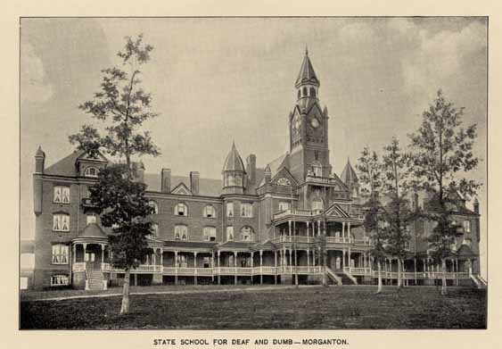
STATE SCHOOL FOR THE DEAF AND DUMB--MORGANTON.
Page 243
220 inmates, equally divided as to sex. Children received from 6 to 14 years of age. There are 253 acres of land, one-half in cultivation. Mr. N. W. Lawrence, Superintendent, is steadily improving the institution. Homes are procured for the children as they become fitted for self-support.
COLORED ORPHAN ASYLUM.
This is also in Oxford, and was opened in the year 1886. The buildings can accommodate one hundred and fifty. The average daily number in 1895, was seventy-five. Of these sixty-three are without father and mother. Receipts, chiefly from the State, were a little over $4,000. The Legislature of 1895, doubled the former appropriation. Rev. Robt. Shepard, (colored), is the Superintendent, and is receiving increased contributions, through the confidence of the people in his management.
STATE PENITENTIARY.
The main building is six hundred and twenty-five feet long, by fifty-eight and one-half in width, with administrative buildings in front eighty-four by seventy feet and domestic thirty-six by one hundred and sixty-eight feet. The wings are two and one-half stories, administrative four. Will contain eight hundred cells, five by eight feet, each cell having independent ventilating flues running entire height, and ending in large air chamber, with globe ventilator, in which is a coil of steam pipe to insure constant ventilation. Stone foundation up to four feet above ground line; heavy brick wall; covered with slate. Has a reservoir of 3,000,000 gallons capacity, with two steam pumps. Females in separate building. The discipline is mild but firm. Has an excellent infirmary and maintains a Sunday School taught by eminent citizens of Raleigh; religious services five times a month.
Confinement in the penitentiary proper is only enforced upon those sentenced for the highest crimes; it contains, however, chronic invalids sent to the central hospital. Of the total number under control, 1,237, there are two hundred and seventy-one at Raleigh. The others are distributed upon five farms, embracing 15,000 acres, in different sections of the State, under guard and controlled by State officers (not the lease system). The great majority, eighty per cent. being colored, are at work in the employment they have been accustomed to. The value of their products amounts to about $200,000 annually, and renders the institution nearly absolutely self-supporting.
Page 244
Indeed, it is probable that a surplus may be made for the State Treasury, with a return to normal prices for agricultural products. While the main operations are in the raising of all kinds of agricultural products and live stock, and the digging of phosphate rock, the mechanical work supplies all the shoes and the clothing, but not the cloth; also harness and wagons, wheelbarrows, and wood and iron work used by the convicts, and laundry work for the institution and others. Each farm has a superior and a physician. The health of the convicts is better than under any former system. The immense stone wall, at one place sixty feet high from the valley below, is of solid granite, built by the convicts, as was the entire structure.
Hon. A. Leazar, is General Manager.
ORPHANAGES AND HOSPITALS.
There are many institutions of this character supported by churches, societies and private citizens, and not under the immediate charge of the State authorities. Among these are the
THOMASVILLE ORPHANAGE.
Rev. J. B. Boon, Superintendent. Opened November 11th, 1885, at Thomasville, has three hundred and six acres of land, and twenty buildings provides for one hundred and fifty to two hundred orphans, supported chiefly by the Baptist Church.
THE THOMPSON ORPHANAGE.
Rev. E. A. Osborne, Superintendent, organized about 1883. Situated at Charlotte. Has eighty acres of land, and cares for about sixty children. Is supported by voluntary contributions mainly by Episcopalians.
THE ORPHANS' HOME.
Situated at Barium Springs, Iredell county, and under the charge of Rev. R. W. Boyd, Superintendent, who is the representative of a Board, chosen by the Synod of North Carolina (Presbyterian). Has property worth $15,000. The institution began operations only a few years ago, and in 1895 had seventy-two children.
Page 245
ODD FELLOWS' ORPHAN HOME.
Is located at Goldsboro, and liberally supported by that benevolent order. It began operations in May, 1892. Had twenty-eight in 1895 with the number gradually increasing; Mr. J. T. Deams, Superintendent. In addition to the original structures, a fine modern building has just been added, to more completely fulfill its design.
THE FRIENDS' ORPHANAGE.
Is near High Point, and was organized in 1895. While this latest of the family of orphanages in North Carolina is only in its infancy, it is doing most effective work. Dr. J. M. Tomlinson of Archdale, is the Chairman of the Friends' Committee having its interest in charge. There can be no doubt that this good work will grow and multiply.
THE CHILDRENS' HOME,
located at Asheville, was established in March, 1890. This was organized to meet the needs of the county of Buncombe, and its history renders it a model for the State. At last report (October 1895) it was caring for thirty-one children, and had had charge of one-hundred and fifty-seven children since its organization, many of whom had been placed in good homes.
THE MISSION HOSPITAL,
founded in 1885 and managed by a committee of ladies from the Episcopal, Baptist, Methodist and Presbyterian ladies of Asheville. Supported by voluntary contributions and a small sum from the county. Cares for about one hundred patients during the year.
WILMINGTON CITY HOSPITAL.
Organized in 1881, and its support is given, three-fifths from the county and two-fifths from the city. Dr. W. W. Love, is Superintendent. In 1894, it had two hundred and two charity patients, sixty-eight pay; total two hundred and seventy. Is admirably situated near the city of Wilmington.
ST. PETER'S HOSPITAL,
opened January 1st, 1876, in the city of Charlotte. Managers are nine female communicants of St. Peter's (Episcopal) Church. Mrs. Jane Wilkes, Secretary. Cares for eighty patients annually. Maintained by voluntary subscriptions.
Page 246
THE GOOD SAMARITAN HOSPITAL
is in the same city. This has a handsome brick building erected by the efforts of the same noble women, and is devoted to colored patients, being a part of the mission work of St. Peter's Church.
THE WATTS' HOSPITAL.
This is the gift of Mr. George W. Watts, of Durham, to the town of his residence. It was built and equipped at a cost of $30,000, and he endows it with $20,000 more, to insure its successful working. The administration building is 38×36 feet; two stories and basement; male and female pavilions, 31×62 feet and surgical building 17×27 feet. It is fitted with all modern conveniences, has twenty-two beds and is surrounded by five acres of grounds. The physicians give their services without charge, and the citizens will increase the endowment fund.
REX HOSPITAL.
This institution is located in Raleigh, and was established by a fund left by a long deceased citizen. The hospital maintained for a number of years by St. John's Guild, and located at the south end of Salisbury street, was purchased in 1893, and after improving the same by several thousand dollars worth of repairs and additions, and the erection of a building for colored patients, the whole was opened as Rex Hospital May 15th, 1894. In the first two years it has admitted three hundred and fifty-six patients, including one hundred and six white males, 102 white females; seventy-five colored males and seventy-five colored females. To this has been recently added by private benevolence, a well arranged ward for sick children. The city contributes annually $2,000 to the support of the hospital. Col. Benehan Cameron has recently given a fund as an endowment for the "P. C. Cameron Memorial Cot," R. H. Battle, Esq., is chairman of the board of Trustees.
It may justly be said no department of the State Government is more liberally supported than her charities, which have become the pride of the State. And private efforts are freely given whenever a necessity is shown to exist, for the relief of suffering or misfortune.
PUBLIC BUILDINGS
The State Capitol is a massive granite structure, in plain but classic style, and for many years was regarded as the finest of the State Capitols. It is situated in a square of four acres, laid off in broad
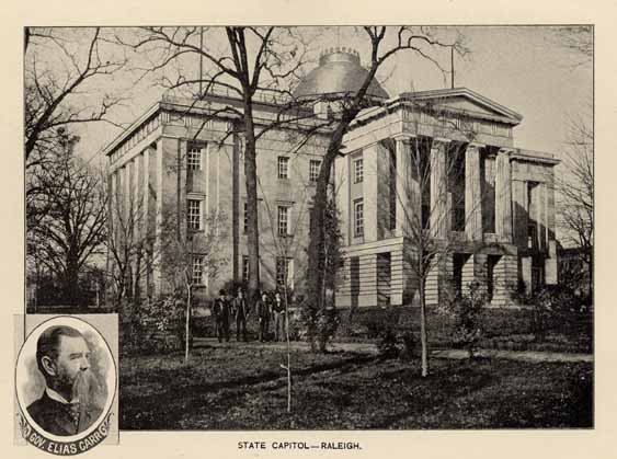
STATE CAPITOL--RALEIGH.
Page 247
and convenient walks, shaded in part by native oaks, survivors of the original forests, and it is adorned with flowers and shrubbery. In the grounds are a handsome bronze statute of Washington and a monument to the Confederate dead, about 75 feet high, adorned with bronze figures. The building contains the Legislative halls, the Executive offices, the Treasury Department, the Auditor's office, those of the Secretary of State, the rooms of the keeper of the Capitol, Legislative Committee rooms and other needed apartments, is lighted both by gas and electricity, is well ventilated, and in winter is heated by steam. The whole is surrounded by an iron fence based upon a granite foundation.
The Governor's Mansion is situated in the northeastern part of Raleigh, on one of the public squares--Burke. It is a three story brick structure, elegant in design, and complete in all its details, pleasing in exterior, elegant, convenient and comfortable in the interior. It is trimmed with native brownstone and marble, and is surrounded by a beautiful lawn, which is adorned with small shrubbery.
The Supreme Court Building is situated on the north side of Edenton street, adjoining the Agricultural Building and fronting Capitol square. It has a plain exterior, but is well built and arranged for its various uses. It is three stories high and contains the Supreme Court room, consulting rooms, the Attorney General's office, the office of the Superintendent of Public Instruction, the office of the Commissioner of Labor, the Supreme Court Library, which contains, besides a large and valuable collection of law volumes, portraits of many of the members of the Court from its organization to the present time; and also the State Library of 46,000 volumes, and portaits of eminent North Carolinians, prominent in the State annals, in civil, professional, military and naval life.
The other public buildings have been sufficiently alluded to under their appropriate heads.
EDUCATION.
"The good name, as well as the substantial prosperity of a State, is indissolubly associated with, and dependent upon, the initial direction given to the minds of the young. Care on the one hand, neglect on the other, bring forth responsive fruit, to tell in after years in the grateful form of public virtue and enlightment, or in the melancholy spectacle of public vice or popular ignorance and abasement.
Page 248
The wisdom of statesmanship is never so wisely directed as when it aims to establish the one and guard against the other. And such statesmanship knows that it must act always by anticipation; knows that it is dealing with functions in a state of constant change and progression; that it is moulding and shaping that which, though incorporeal and intangible, bears direct analogy to that which is corporeal and material, in that it is impressible to good or to evil, retains the shape and form to which it is moulded, and, in its matured powers, presents the perfection of the wise directing hand, or the distortion of neglect or of wicked design.
The solicitude of our Revolutionary fathers was never allayed, even amid the clash of arms and the uncertainties of a pending desperate strife, until they have given expression in their tentative efforts in the formation of a new government to the purpose which was uppermost in their minds. Never in human history did a solemn determination to discharge a duty, apparently altogether irrelevant to the cause they then had in hand--the conduct of war and the achievement of liberty--have expression so noble, so wise, so disinterested. Liberty might be won, but at ruinous cost, but whatever befell, posterity must be educated. That was a sacred charge not to be neglected or evaded. It was the education of the leaders in the cause of liberty that had taught the value of liberty; it was essential that that liberty when assured should be preserved by the same means that had demonstrated its value. Therefore, posterity must be educated; and while the enemy was still thundering at the gates, and while the roar of the battle was still deafening the startled ear, calmly, unmoved by the awful commotion, brave as to their present, confident as to their future, they decreed in their first Constitution "that a school or schools should be established by the Legislature for the convenient instruction of youth, with such salaries to the masters, paid by the public, as may enable them to instruct at low prices; and all useful learning shall be encouraged in one or more universities."
Such was the beginning of our school system; such was the mandatory obligation and formation of the State University.
Public financial confusion, general private pecuniary distress, materially delayed action upon the wise determination of the founders of our State government. Yet under all untoward circumstances, the University was chartered in 1786, and entered upon its work in 1795. It lit the torch of public education, if at the time it could do no more. Its own career grandly illustrated its own usefulness Its example and influence kept alive that broader ultimate plan and purpose of an education to be brought to every child in the land."
Page 249
FREE PUBLIC SCHOOLS.
The first step toward free public schools was taken by Judge Murphey, in the session of the Legislature of 1816, in a report urging the establishment of a judicious system of public education. But no further legislative action on the subject was taken until the session of 1825, in which year a fund for the establishment of common schools was created by the General Assembly, "consisting of the dividends arising from the stocks then held or afterwards acquired by the State in the banks of New Bern and Cape Fear, the dividends arising from the stocks owned by the State in the Cape Fear Navigation Company, the Roanoke Navigation Company, and the Club Foot and Harlowe Creek Canal Company, the tax imposed by law on license to retailers of spirituous liquors and auctioneers, the unexpended balance of the agricultural fund, all moneys paid to the State for the entries of vacant land, and all the vacant and unappropriated swamp lands of the State, together with such sums of money as the State may find it convenient to appropriate from time to time."
In 1789, the Legislature in session in Fayetteville, by anticipation, had cut off by far the largest resources applicable to the school fund. The largest body of vacant land then owned by the State, included all the territory of the present State of Tennessee. But as a heavy debt rested upon the National Government for the costs of the Revolutionary War, Congress had frequently urged upon the States owning western territory, the policy of ceding the whole or part of such territory to aid in the extinguishment of such debt. North Carolina, with responsive generosity, gave up the territory of Tennessee, with all her prospective school lands, and fell back upon her other resources and the relief or aids of future legislation.
Such legislation was had, and by the transfer to the Literary Fund by the State Government in 1837 of the State's share of the surplus deposit fund, in the United States Treasury distributed to the States by the Act of Congress of June 23, 1836, the Literary Fund for the "Common Schools" was increased by $1,133,757.39. The total "Surplus revenue" fund turned over by the Treasurer of the United States to the State comptroller was $1,433,757.39. Of this the State Treasury used $100,000, and $200,000 was applied to draining swamp lands.
The common school system, as it was designated, was adopted in 1839, and continued in force until superceded by the results of the war. Under that system in 1850 the number of schools was 2,657; of teachers, 2,730; of pupils, 104,095. The income being in that year $158,564, increased in 1860 to $268,719.
Page 250
As a result of the war, the whole Literary Fund was lost, and new provision had to be made.
Without going into details involving the legislation of several years, it is enough to say here that in 1894-5, from the general poll-tax, general property tax (18 cents on the $100), special poll-tax, special property tax under local acts, special poll-tax under local acts, fines, forfeitures and penalties, liquor licenses, auctioneers, estrays and other sources, all of which are specially applied to the school fund, and from the State Board of Education, there was realized the sum of $777,079.29, as against the receipts of 1884 of $580,311.06; and for 1894-5 the expenditures were $783,405.09.
The school census of 1894-5 shows the number of persons between six and twenty-one years of age to have been--white, 389,709; colored, 212,191; total, 601,900; of which there was an enrollment of--white, 235,486; and of colored, 123,899; total, 359,385. The average attendance during the same time was, for whites, 149,046 for colored, 71,246. Average length for school terms--for whites 12.85. for colored, 12.12. Average salary of teachers--white males, $25.53; white females, $23.08; colored males, $23.08; colored females, $19.27.
The value of public school property in 1894-5 for whites was $817,148.08; for colored, $301,149.80. The number of public school houses in the same year was--for whites, 4,556; for colored, 2,010. Number of schools taught in same period, for whites, 4,811; colored 2,296. Number of school districts, for whites 5,123; for colored, 2,424; and the statistics of the Normal Schools for 1894-5 for the colored race, show an attendance at Fayetteville of 236; at Salisbury, of 236; at Franklinton, 215; at Plymouth, 301; and at Goldsboro, 277.
For the fiscal year ending November 30th, 1895, there had been levied for school purposes on white polls, $250,458.85; and on colored polls, $94,436.58. On general property there had been levied on the whites $363,258,68, and on colored $12,861.92. Total from all sources for 1895, $765,510.27.
The population of North Carolina by the census of 1890 is--white, 1,049,191; colored, 567,170; all others, 1,586; a total of 1,617,947, the colored population being a little more than one-third of the whole. In the contribution to the support of schools, the whites contribute nearly five-sixths of the whole, and the colored little more than one-sixth. Nevertheless, the appropriation is made ridgidly pro rata, as if the contribution had been on the same basis.
Besides the levy, which is now 18 cents on the $100 worth of property, and the other subjects upon which taxation is laid for the benefit of the public schools, the State has received large benefactions
Page 251
from the Peabody Fund, appropriated in aid of public, normal and graded schools, and to holders of scholarships in the Nashville Normal School. There are twenty of these scholarships, each worth $100 per annum, and railrod fare to and from Nashville, Tenn., each session for two years. The average annual appropriation to the State from this fund is about $8,500.
The present public school system exists under that feature of the State Constitution providing for a State Board of Education, consisting of the Governor, Lieutenant-Governor, Secretary of State, Treasurer, Auditor, Attorney-General and Superintendent of Public Instruction. The latter is the head of the system of public schools. Each county has its Board of Education and County Examiners. The County Board consists of the commissioners. The normal system was adopted in 1877 for the whites as well as the colored people, and eight normal schools have been established for the former and seven for the latter. The Normal and Industrial School for white women has superceded the eight white normal schools. A normal department is provided at the University for young men with a summer school for both sexes of white teachers. The seven colored normal schools are still continued, for which the State pays annually $10,000.
It need scarcely be added that while the provision for the schools for both races is made with strictly impartial appropriation of the public funds, the schools themselves are separate; and a still further separation is made in the schools of the Croatan Indians of Robeson county, which are detached from both the white and colored schools; and the State appropriates $500 annually for training teachers for Croatan schools.
UNIVERSITY OF NORTH CAROLINA.
The University was chartered in 1789, and opened in 1795. It is the oldest university in the south; up to 1860 it had a very large patronage from all the southern States. Its roll of alumni includes many names of national repute, and it may be doubted whether so large a percentage of the alumni of any other American college have achieved eminence in public life. Among them may be named President, Jas. K. Polk; Vice-President, Wm. R. King; Senator, Thomas H. Benton; Wm. A. Graham, Secretary of the Navy, Whig candidate for the Vice-Presidency; Major General Francis P. Blair, U. S. A., Democratic candidate for the Vice Presidency; John Y. Mason, Leonidas Polk, John Branch, Willie P. Mangum, Jacob Thompson, Aaron V. Brown, James C. Dobbin, John H. Eaton,
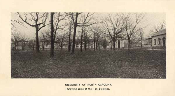
UNIVERSITY OF NORTH CAROLINA.
Showing some of the Ten Buildings.
Page 252
Francis L. Hawks, Cyrus L. Hawks, Wm. M. Green, Archibald M. DeBow, Zebulon B. Vance and James Johnston Pettigrew.
The University embraces the College, the Law School, the Medical School, and the Summer School for teachers. The College contains fourteen departments offering one hundred and one courses of instruction, arranged both for graduate and undergraduate instruction. The Law School and the Medical School each offers two years instruction. The Summer School for Teachers is held during the month of July, and offers about forty courses of instruction. There is also a Summer Session of the Law School (July-September).
The University includes thirty-five teachers (who represent the training of twenty-one American and European Universities;) the student-roll numbers five hundred and thirty-four. It possesses property worth about $600,000, being $500,000 worth of land, buildings and apparatus and $100,000 in endowment funds. The campus contains fifty acres of land, with five hundred acres of forest land adjoining. There are eleven large brick buildings, containing lecture rooms, museums, laboratories and student rooms. The library contains forty thousand volumes. The gymnasium is the largest in the south. The University is administered with great economy. The total expense of an education there for four years need not exceed $1,000. Tuition is $60.00 a year. About the fourth of the students are self-supporting. Eighty scholarships are given annually to needy boys, and loans are made to the very needy.
The seat of the University is Chapel Hill, about twenty-eight miles northwest of Raleigh. It is a beautiful, healthful village, free from vice and extravagant life.
Mr. Edward A. Alderman is President.
COLLEGE OF AGRICULTURE AND MECHANIC ARTS.
Some years ago a small but able and earnest set of men became convinced that the industrial growth of North Carolina was being retarded by the lack of technically trained men to assist and to guide this development. To supply this need these men began to advocate the establishment of an industrial school. The times were ripe for the success of such a movement; all over the State the movement was taken up, and the North Carolina College of Agriculture and Mechanic Arts was the result of their endeavors.
The college opened its doors for students in October of 1889, and has had a healthy and steady growth ever since. Like all new enterprises it had to encounter some hostility, and a great deal of indifference and incredulity as to power to do the work that was wanted.
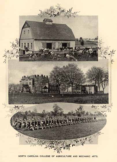
NORTH CAROLINA COLLEGE OF AGRICULTURE AND MECHANIC ARTS.
Page 253
These, its friends think, the College has now entirely overcome. The success of its graduates is the best guarantee that the institution was needed and that it is supplying that need.
When the college opened in 1889, it had only one building, very little equipment, and only five professors present for duty. In the six years that have passed since then, nine other large and comfortable buildings have been added, equipment and apparatus have been bought for all departments, and the faculty has increased from five to twenty.
In equipping the institution, the trustees wisely decided that a technical college to be at all successful, must be completely furnished; hence the shops, the drawing-rooms, the chemical, the physical, the horticultural, the electrical laboratories, the barn, the dairy, and all the class rooms have been provided with the best modern apparatus and machinery. Every department of the College is now equipped to do thorough and practical work.
"What is the specific object of the Agricultural and Mechanical College?" is a question often asked. The object is to give young men, while they are getting a general education, also a technical training that will make them self-sustaining in life and also make them intelligent directors of agricultural and mechanical enterprises. It does not, however, aim to make them mere machines, for its students have a regular college course minus the classical languages but plus scientific studies in particular lines. While its purpose is to give its graduates definite callings in life, its idea of education is no more narrow, no more "Brodwissenschaften," than is the special college or seminary for the doctor or the minister. The object of these colleges or seminaries is to train a man for what he is to do; the object of any technical college is the same. It assumes as a fundimental postulate that a man who wants to farm, to run a grapery, to direct a dairy, to make his living by mechanical engineering, to support himself as a civil engineer is entitled to as good and as special training as a man who expects to preach or to practice medicine. It also holds that there is time and opportunity for a man, while he is getting a general education, to get also, and at the same time, special training for the work in which he expects to engage.
The institution is supported by grants from the general government and by an appropriation from the state. Tuition is made low in order that as many as possible of the sons of North Carolina may be gathered together to be trained for work in their own State and for their own people.
The faculty consists of the following members: President and
Page 254
Professor of History, A. Q. Holladay, LL. D.; Professor of Horticulture, W. F. Massey, C. E.; Professor of Chemistry, W. A. Withers, A. M.; Professor of English, D. H. Hill, A. M.; Professor of Agriculture, B. Irby, M. S.; Professor of Civil Engineering and Mathematics, W. C. Riddick, A. B., C. E.; Professor of Mechanical Engineering, N. R. Craighill, S. B.; Professor of Physics, Electrical Engineering and Military Science, Lt. Col. N. H. Barnes, A. M., Ph. D.; Adjunct-Professor of Mathematics, R. E. L. Yates, A. M.; Assistant Professor of Agriculture, F. E. Emery, M. S.; Instructor in Drawing and Shop Work, C. M. Pritchett, M. E.; Superintendent of Shops, C. B. Park; Assistant in Farm Practice and Superintendent of Farm, B. S. Skinner; Instructor in Veterinary Science, F. P. Williamson, D. V. S.; Assistant in Chemistry, J. A. Bizzell, B. S.; Assistant in Physics, W. K. Davis, Jr., B.S.; Assistant in Drawing and Shop, David Clark, M. E.; Assistant in Chemistry, G. S. Fraps, B. S.; Assistant in Dairying, A. H. Prince, B. S.; Tutor of Sub-Freshman Class, A. A. Wilson.
STATE NORMAL AND INDUSTRIAL SCHOOL.
The State Normal and Industrial School for women, located at Greensboro, was established by act of the General Assembly of 1891, and began its work in October, 1892. It is supported mainly by the State, but receives liberal aid from the Peabody Fund, and has considerable revenue from tuition fees.
$30,000 and ten acres of land were given to secure its location at Greensboro. The management of the institution is in the hands of a Board of Directors, consisting of one member from each congressional district. The State Superintendent of Public Instruction is, ex-officio, president of the Board.
The purpose for which the institution was created is stated in section 5 of the Act establishing it, which reads as follows:
"The objects of this institution shall be (1) to give to young women such education as shall fit them for teaching; (2) to give instruction to young women in drawing, telegraphy, typewriting, stenography and such other industrial arts as may be suitable to their sex, and conducive to their support and usefulness. Tuition shall be free to those who signify their intention to teach, upon such conditions as may be prescribed by the Board of Directors."
That the Normal and Industrial School fills a long felt need in North Carolina, its liberal patronage alone is sufficient proof. Its enrollment of students this year is 444, besides 97 pupils in its Practice School. During the four years of its existence, it has matriculated 931 students, representing all the ninety-six counties of the State except three.
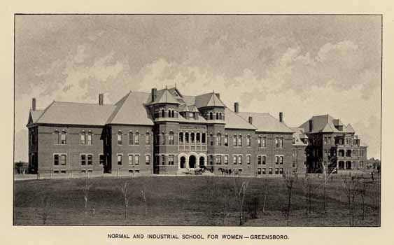
NORMAL AND INDUSTRIAL SCHOOL FOR WOMEN--GREENSBORO.
Page 255
The Normal and Industrial School has an able faculty, consisting of twenty-seven officers and instructors, who have been prepared for their work in the best institutions in the country. It has good laboratories, libraries, and other equipment. Prof. Chas. D. McIver, is President.
DAVIDSON COLLEGE.
This College is the Presbyterian institution of higher learning and may be regarded as the legitimate, if somewhat remote, successor to Queen's College, or Liberty Hall, as it was called after Royal recognition of the former had been denied. After many efforts at revival, and against strong opposition to the creation of a distinctly denominational college, Concord Presbytery, in the spring of 1835, adopted resolutions looking to the establishment of a Presbyterian College in their Presbytery; and in the fall of the same year a site was selected in the northern part of Mecklenburg County, at which has been called the literary and geographical centre of the State. The institution was named in honor of General William Davidson, the revolutionary hero.
The College was opened in March, 1837, with 66 students. A charter was granted by the Legislature in 1838. The manual labor system was at first adopted, but as at Wake Forest, it proved a failure and was abandoned. In 1855, Maxwell Chambers, Esq., of Salisbury, made the munificent bequest of $258,000 to the College, and this relieved it of all existing financial trouble and assured its future freedom from embarrassment. The terms of the charter limited the endownment to $200,000, and only that amount could be realized from the bequest. About $100,000 of this endownment was lost by reason of the war. In addition to the proceeds arising from the interest of this endownment, the College has endowed scholarships, such as the Maxwell Chambers scholarship of $3,000, endowed by the Presbyterian Church of Salisbury; the D. A. Davis scholarship of $1,500, endowed by the same church; the George Bower scholarship of $1,000, endowed by Mrs. A. C. Davis, of Salisbury, and the Thomas Brown scholarship of $1,000, endowed by Brown Bros., of Winston, and one of $500, endowed by Gen. Rufus Barringer and Mr. George E. Wilson, of Charlotte, one of $1,500, the Kate Williams scholarship, endowed by G. W. Williams, Esq., of Wilmington; one of $1,000, J. S. Carr, Esq., Durham; one of $1,000, by S. H. Wiley, Esq., Salisbury; the Oates scholarship of $500, by R. M. Oates and Oates Bros., Charlotte; the P. T. Penick scholarship of $500, by the Presbyterian Church at Mooresville, and the Willie J. Brown scholarship of $500, endowed by Col. Jno. E. Brown of Charlotte.
Page 256
Two regular courses of study, leading to the degrees of Bachelor of Arts and Bachelor of Science, each requiring four years, are provided. The requirements for admission are much the same as at the State University. A post-graduate course, leading to the degree of Master of Arts, is available. The course of instruction is thorough, and many distinguished men of the State are alumni of the institution.
The Faculty numbers eight professors. The Rev. John Bunyan Shearer, D. D., LL. D., is President. There is a regular and full attendance, made up largely from this and the States adjoining.
TRINITY COLLEGE.
The leading Methodist College of North Carolina, is the outgrowth of the Grammer School, established by the Rev. Brantly York, in 1838, in the north-west corner of Randolph county, five miles south of the town of High Point, on the North Carolina Railroad, and about one hundred miles west of Raleigh. In 1842, Dr. York, resigned the charge of the school, and the Rev. B. Craven, then only nineteen years old, was elected as successor. In 1851, the school was re-chartered and the name changed to "Normal College." By this charter, the school was brought under the State supervision, and the Governor of the State became ex officio President of the Board of Trustees, and the Superintendent of Common Schools, Secretary. The object of this connection was to secure a higher grade of teachers for the common schools, and, by a provision of the charter, a certificate from the Normal College was made ample lawful evidence of qualification to teach in such schools. At the annual session of the North Carolina Conference of the Methodist Church, held in Salisbury, in 1851, the connection between the school and the Conference was adopted, and the Trustees of the College agreed that young men preparing for the ministry should be educated without charge. In 1853, the charter was amended, and the College was authorized to confer degrees. In 1858-'9, the management of the institution was transferred to the North Carolina Conference of the Methodist Episcopal Church, South and by act of the Legislature, the College was vested in the Conference with all the the rights and privileges usually granted in such cases, and the name was changed from Normal to Trinity College. The College suffered from the effects of the war, and in 1865, for a short time, exercises were suspended. Dr. Craven, in that year, was re-elected President, and the next year exercises were resumed. In 1882, Dr. Craven died, with disastrous influence on the fortunes of the institution, which fell so low as to
Page 257
threaten its existence. Prominent laymen came to the rescue, and its strength was renewed, its curriculum broadened, its scholastic standard raised, and it took rank with the other colleges of the South.
In 1890, in accordance with the order of the Board of Trustees of the College, of the North Carolina and of the Western North Carolina Conferences Methodist Episcopal Church, South, and of the General Assembly, amending the charter, the institution was ordered to be removed to Durham, where Blackwell's Park, consisting of sixty-two and a half acres of eligibly situated land, was secured as a site for the buildings and grounds. Liberal donations made by citizens of Durham, and other munificent aid enabled the management to proceed so rapidly with the construction of the necessary buildings that the session of 1892-'3 was opened at Durham. These buildings consist of the main College, the Technological building, the College Inn, the Gymnasium buildings and seven residences for the Faculty and officers, altogether constituting a mass of well constructed and architecturally imposing edifices. The grounds are well laid off, and the whole is an independent municipal corporation, with its own mayor, commissioners and peace officer.
At present, the institution has eleven chairs of instruction and six assistant instructors, distributed among the several departments of instruction in which the work of the College is divided. The work of instruction is organized under the following departments, viz.: The Department of Philosophy and Letters; the Scientific Department; the Technological Department; the Department of History, Political and Social Science; the Theological Department; the Law Department; and the Commercial Department.
The College fees for the session are $60; board and incidentals, $95 to $140; commencement tax, $2.50; total, $157.50 to $202.50.
John C. Kilgo, D. D., is now President.
WAKE FOREST COLLEGE.
This college was chartered at the session of the General Assembly of 1833. A tract of land containing 615 acres sixteen miles north of Raleigh, at the point now known as Wake Forest, was purchased, and the erection of buildings begun. The institution was opened in February, 1834.
The system first adopted, which was that of manual labor, associated with the ordinary college curriculum, was soon abandoned as impracticable and unproductive of satisfactory results, and the collegiate system only retained. Laboring under the embarrassments of debt in the early years of its existence, it was at length relieved in
Page 258
1849. Since that period, by the earnest and liberal zeal of prominent members of the Baptist Church, an endowment fund has been accumulated, now amounting to more than $220,000. In the number, excellence and elegance of the college buildings, Wake Forest is the equal of any like institution in the country. Among these may be mentioned the "Lea Laboratory," the "Wingate Memorial Hall," the "Old Dormitory" and the "Heck-Williams Library Building."
The standard of scholarship is high, and among the graduates are very many prominent men, not only in the pulpit, but in all the learned professions and in business and industrial avocations. These are now living in thirty-one states of the union.
The faculty now consists of C. E. Taylor, president, professor of Moral Philosophy; W. B. Royall, professor of Greek; L. R. Mills, professor of Pure Mathematics; B. F. Sledd, professor of English; W. L. Poteat, professor of Natural History; C. E. Brewer, professor of Chemistry; J. B. Carlyle, professor of Latin; J. F. Lanneau, professor of Physics and Applied Mathematics; W. J. Ferrell, assistant professor of Mathematics; R. W. Haywood, assistant professor of Languages; T. H. Briggs, Jr., director of Physical Culture. The number of students in 1895-96 was 261.
Ministers receive free tuition. Those who have been licensed to preach and are unable to command the means necessary to defray the cost of board, may receive aid for this purpose from the Board of Education of the Baptist State Convention, so far as the means may be at its disposal. Among the other aids to indigent young men, is the "Bostwick Loan Fund," created by the late J. A. Bostwick, of New York City, who has given to the college $12,000, to be held in perpetuity, the annual interest to be used in making loans to students to pay their tuition bills, and nothing else, to be loaned at 4 per cent. payable semi-annually, on terms agreed upon.
"The North Carolina Baptist Students' Loan Fund," incorporated March, 1877, lends money arising from the interest of its invested fund to indigent young men wishing to study in the college, the loan to be re-paid with interest after the completion of the course.
The Law School, inaugurated in 1894, has proved a signal success and is largely patronized.
The preparatory school in medicine has steadily grown in value and in popular estimation.
Page 259
ELON COLLEGE.
This institution is situated at a station of the same name, in a beautiful oak grove on the North Carolina division of the Southern railroad, in Alamance county. It is under the control of the General Convention of the Christian Church South, and is non-sectarian in spirit. It is co-educational, the sexes being admitted on equal terms, which after years of trial, has proven to be a benefit to both. It has a Faculty of progressive specialists, a healthy climate, library, and three Literary Societies with elegant halls. It has Literary, Music, Art and Commercial Departments, and gives degrees in the following courses: A. B., Ph. B. and A. M. Rev. W. W. Staley, D. D., is President, Rev. J. O. Atkinson, Chairman of the Faculty, and S. A. Holeman, Bursar.
GUILFORD COLLEGE.
This institution was founded by North Carolina yearly meeting of Friends, and was opened in the year 1837, under the name of "New Garden Boarding School," being chartered by the Legislature in 1834. From 1837, it has been in continuous operation, and has been open alike to both sexes.
In 1888, the Institution was chartered under the name of Guilford College. New buildings having been erected, the course of study extended, and the Faculty increased to ten members; and authority was given to confer degrees.
The buildings are located on a well cultivated farm of two hundred and sixty acres, six miles west of Greensboro, in Guilford county, near the Winston and Salem railroad; and consist of the original building, Founders Hall, erected in 1835-'7; King Hall and Archdele Hall, both built in 1885; Y. M. C. A. Hall, erected in 1891; and a gymnasium, seventy-five by fifty feet, constructed in 1896, which is under the directorship of a graduate of the Boston Normal School of Gymnastics.
There are three extended courses of study provided, the Classical, Scientific and Latin Scientific. Bryn Mawr College, annually grants to a lady graduate of Guilford, a graduate scholarship at Bryn Mawr, of the value of four hundred dollars, and young men receive a like recognition at Haverford College.
Besides the large, substantial, well furnished buildings, the Museum of Natural History, College and Society libraries, the college possesses a cash endowment of $60,000.
There is also a dairy of fifty jersey cows owned by the college and a large silo barn.
Page 260
The equipment of the college has come largely from friends in Maryland, and some northern and western states, and in England.
BINGHAM SCHOOL.
The Bingham School was established in 1793, by the Rev. William Bingham, a native of Ireland, at Pittsboro. The School, in its succession through three generations of the same name and family, has long been pre-eminent in the South, and noted throughout the whole Union. Mr. Bingham, for five years, from 1801 to 1805, was Professor of Latin in the State University, and then resigned to reopen his School at Hillsboro. At his death, 1826, he was succeeded by his eldest son, William J. Bingham, who continued it for twenty years at Hillsboro, with a reputation that brought him pupils from all parts of North Carolina and from all the Southern States. Subsequently the School was removed to Oaks, in Orange County, where the Principal was assisted by his sons William and Robert Bingham, both graduates of the University. On the death of the elder Bingham, the School was removed to a point near Mebanesville, in the same county. William Bingham soon after died, and was succeeded by his brother Robert, by whom the institution was still conducted. In addition to thorough classical and English and business education, the military feature has been added, an officer of the United States Army having been detailed as commandant of the cadets. Owing to the destruction of a portion of the School buildings by two successive fires, Major Robert Bingham was induced to remove the School to Asheville, where it now is, without abatement of its usefullness or reputation.
Gov. Elias Carr, in speaking of this school says:
"After a careful personal inspection of the present location and the sanitary arrangements, made recently, I am impressed with the great improvement over the old plan of buildings used in my school days; and I have no hesitancy in pronouncing the location most desirable, the buildings excellent, the sanitary arrangements unequaled."
HORNER SCHOOL.
This excellent school was established in Oxford in 1851 by James H. Horner, the course of instruction is thorough, embracing the classical, mathematical, scientific and military features. Each course is arranged for four years. The classical course embraces the studies in the schools of Latin, Greek, Mathematics, English Grammar and Rhetoric, Geography and History. The scientific and English course embraces Mathematics, Natural Science, Metaphysics, English Grammar and Rhetoric, Geography, History.
Page 261
French, German and Bookkeeping are elective studies. The School is strictly military in its organization and discipline.
DAVIS MILITARY SCHOOL.
The Davis Military School is situated just outside the city of Winston. The buildings are handsome and commodious, the grounds contain thirty-five acres. For many years the school has commanded extensive patronage from nearly every section of the United States, and some foreign countries. This school was founded by Col. A. C. Davis, and for a number of years did work preparatory for college. Afterward it became an incorporated institution with full power to grant diplomas and confer degrees. Boys and young men complete their education there, or receive preparation for any college. In addition to military tactics there is a complete Business College department.
SALEM FEMALE ACADEMY.
This grand old institution was founded by the Moravians in 1802. There have been private schools in the State so excellent as to have drawn to them patronage from distant parts of the State, but the honor must be ascribed to the Moravians of having located the first institution of a public nature, and which now, after the lapse of ninety-four years, grows rather than loses, in usefulness and reputation, for it draws to it annual recruits from all and the most distant southern, northern and western States, and from foreign countries to fill the places of those sent forth to illustrate the solidity and splendor of their mental and social equipment.
The school is regularly graded with a four-years classical course, also a post graduate course, and is entitled by law to confer all degrees usually given by institutions of learning, with most thorough cultivation in music, painting, drawing and needle-work, commercial and industrial branches. The corps of instructors is from thirty to thirty-five. The whole number of alumnae is more than ten thousand.
For many years it was the only institution of wide repute in the South for female education. Its pupils, therefore, have been well represented in the leading families in the South. A large number of these alumnae became teachers and heads of seminaries and academies, with the best and most useful influences upon the subjects of their training.
The buildings and accommodations of this school are elegent and commodious.
Page 262
PEACE INSTITUTE.
Peace Institute is located in an eight acre grove of native oaks just outside the northern limits of Raleigh. The main building, which contains nearly one hundred rooms, is probably one of the largest and one of the best school buildings in the State. There are parlors, dining-room, music and recitation rooms, fifty-seven chambers and a large auditorium which will seat eight hundred people.
This institute is the outgrowth of prominent men in the North Carolina Synod of the Presbyterian Church to establish at the State Capital a school of high grade for young ladies. At the inception of the project William Peace, of Raleigh, headed the list with a gift of $10,000, and in recognition of his generosity the institute was honored with his name.
Peace Institute has had only two principals. It began its career under Rev. Robert Burwell, D. D., in 1872, and is the continuation of a school conducted by him commencing in 1837. The present principal, James Dinwiddie, A. M., took charge in 1890. The institute does not aim at large numbers, but at thorough scholarship and a high standard of attainments of character.
Instruction is given in the following departments: Mental and Moral Philosophy and Evidences of Christianity, Mathematics and Sciences, Chemistry and Physics, English Literature and Criticism, Latin and Greek, French and German. Music--Instrumental, Piano, Organ, Violin, Guitar and Vocal. Fine Arts--Drawing, Painting in Oil and Water Color and China, Modeling. Physical Culture and Elocution, Bookkeeping, Stenography and Typewriting, Cutting and Fitting, &c., employing twenty-three officers and teachers.
Diplomas are given in Art, in Music, in Literature and Science, and in Literature and Language, and also the full graduate A. B. diploma. Certificates of proficiency are given upon the completion of the full course of study in any department.
ST. MARY'S.
St. Mary's is a college for girls and young ladies at Raleigh. The grounds are very ample; a great park indeed, which is much admired for its natural beauty. They were applied to their present uses in May, 1842, when Rev. Dr. Albert Smedes founded the present St. Mary's School, under the auspices of the Episcopal Church in North Carolina. The exercises have been maintained continuously ever since, the son of the founder, the Rev. Dr. Bennett Smedes succeeding to the control on the death of his father. The patronage is
Page 263
from this State and many of the other southern States. The course of education is ample, embracing all the substantial branches, as well as the ornamental, to the extremest point of culture. The course is arranged for five years.
BAPTIST FEMALE UNIVERSITY.
This institution was chartered in 1891, and is to be the leading school of the Baptist denomination in North Carolina. The main building for the University is now in course of construction at Raleigh, on a very eligible location near the center of the city. This building when completed will cost over $40,000. It is expected that the University will be opened in September, 1897, and as it is to be the head of female education for this denomination, a large patronage is expected
CHOWAN FEMALE BAPTIST INSTITUTE.
This prosperous institute is located at Murfreesboro, Hertford county. It has very fine buildings, situated on highly ornamented grounds, containing twenty-eight acres. This institution originated in the purpose of the Bertie Union Meeting (Baptist,) embracing the counties of Northampton, Bertie and Hertford, to establish in their midst a high school for girls, and a school building was provided at Murfreesboro and opened October 11, 1848, with the Rev. A. McDowell, of South Carolina and a graduate of Wake Forest College, as President. The prosperity of the institution was so rapid and so marked as to demand the erection of large buildings, and in 1851, a joint stock company took charge of the school, selected a new site and completed a large and handsome brick building. The value of the property is now estimated at $50,000. The funds were chiefly contributed by the Chowan Association. With its greater facilities, the institution was soon filled with young ladies from most of the southern States and some from the north. It has had successively as its presidents, Dr. McDowell, Rev. William Hooper, D. D., LL. D., Rev. Mr. Forney, and again Mr. McDowell, who returned to the presidency in 1862, and died in 1881, to be succeeded by Prof. John B. Brewer, who resigned this year and is succeeded by Rev. W. O. Petty. In the college there are two departments, the preparatory, requiring two years for completion, and the collegiate, four years. In the latter the course is as full and satisfactory as in the other female colleges in the State.
Page 264
OXFORD FEMALE SEMINARY.
In 1850 there was established by the Baptists an institution in the town of Oxford for the higher education of girls, known as the Oxford Female College. Under various administrations this school was continued until the year 1880, when it passed under the control of Prof. F. P. Hobgood, who for ten years had been President of the Raleigh Female Seminary. Under his control it is still flourishing. It has ample buildings, large grounds and a teaching force representing in their acquirements the most noted American colleges and some European institutions. It is doing work of a very thorough character.
GREENSBORO FEMALE COLLEGE.
This college occupies a fine brick building in a fine natural park of forty acres in a pleasant part of Greensboro. It is a Methodist institution, the original suggestion of the Trustees of the Greensboro Female School, to the Virginia Conference of the Methodist Episcopal Church, asking that a female college under their auspices, be established at Greensboro. This was in 1837, when the North Carolina Conference had no separate existence. It acquired such the same year; and in 1838 the North Carolina Conference obtained a charter from the State Legislature. This was the first female college chartered in North Carolina, and the first south of the Potomac, except Wesleyan Female College at Macon, Ga. The institution was opened for students under the presidency of the Rev. Solomon Lea, succeeded as the result of successive resignations, by the Rev. A. M. Shipp, D. D., the Rev. Chas. F. Deems, and the Rev. T. M. Jones. The school building was destroyed by fire in 1863, and not rebuilt until 1871. It was opened in 1873 under the presidency of the Rev. T. M. Jones, and continued under him with great success until the period of his death which occurred in 1889, when he was succeeded by the Rev. B. F. Dixon.
The faculty is a full one, and the attendance of pupils is from 150 to 200, representing several southern and western States.
ASHEVILLE FEMALE COLLEGE.
The Asheville Female College has been for more than half a century the leading institution of learning in the western part of the State. It possesses one of the best collegiate buildings in the State, located in a grove of seven acres almost in the heart of the City of Asheville. It maintains always a first-class faculty in all the departments, Languages, Mathematics, Sciences, Literature, Music, Art, Physical Culture and Elocution.
Rev. James Atkins, A. M., D. D., is the president of the college.
Page 265
THE LUTHERAN COLLEGE FOR WOMEN.
The Lutheran College for the higher education of women has just been organized under the auspices of the Evangelical Lutheran Synod of North Carolina, and will be located at Charlotte. This institution is now in process of construction, and the plans provide for a $50,000 structure to be ready for the fall term, beginning in September, 1897. Rev. C. B. King is the President, and Professor C. L. T. Fisher, Vice-President.
PRIVATE SCHOOLS AND COLLEGES.
Many institutions in North Carolina, some private and some ranked in the reports of the Superintendent of Public Instruction under the above title, have merit sufficient to advance them into the class of colleges, but some of them being placed under the supervision of the public school authorities, can be considered only as they are above entitled. There are so many of them that they can only here be referred to briefly.
Among them are:
| NAME. | PRINCIPAL. | POST OFFICE |
| Southern Business College | M. M. Lemmond | Asheville. |
| Hoyl's Academy | T. C. Hoyle | Burlington. |
| Taylorsville High School | . . . . . | Taylorsville. |
| Anson Institute | D. A. McGregor | Wadesboro. |
| Graded Institute | J. A. McLauchlin | Wadesboro. |
| Southerland Seminary | J. W. Jones | Jefferson. |
| Trinity School | N. C. Hughes | Chocowinity, |
| High School | J. B. Newton | Aulander. |
| Horner's Academy | W. D. Horner | Windsor. |
| Ashe's Academy | S. A. Ashe, Jr. | Bladenboro. |
| Lipsie's Academy | T. E. Lipsie | Southport. |
| Young Men's Institute | Misses Dole and Miller | Asheville. |
| Female College | Rev. B. E. Atkins | Asheville. |
| Mt. St. Joseph Academy | . . . . . | Asheville. |
| Normal School | President Lawrence | Asheville. |
| Ravenscroft School | . . . . . | Asheville. |
| College | Prof. M. A. Yost | Weaverville. |
| Davenport College | J. D. Minick | Lenoir. |
| Finley High School | . . . . . | Lenoir. |
| High School | H. W. Reinhart | Morehead Cit |
| High School | Rev. W. Q. A. Graham | Marshallberg. |
| Catawba College | Rev. J. C. Clapp | Newton. |
| Concordia College | Rev. R. A. Yoder | Conover. |
| Claramont College | S. P. Hatton | Hickory. |
| St. Paul Seminary | . . . . . | Hickory. |
| Academy | A. B. Stalvey | Pittsboro. |
| Academy | C. D. Graves | Edenton. |
| M. F. College | H. P. Bailey | Hayesville. |
| Agusta Seminary | J. D. Hodges | Augusta. |
| High School | C. G. Wells | Warsaw. |
Page 266
| High School | W. B. Scarborough | Kernersville. |
| Boys School | J. F. Brower | Salem. |
| Female College | J. A. Green | Louisburg. |
| Mars Hill College | Rev. A. E. Booth | Mars Hill. |
| Academy | R. B. White | Franklinton. |
| Military School | J. H. Horner | Oxford. |
| High School | R. L. Madison | Cullowhee. |
| Academy | P. Dalrymple | Selma. |
| Military School | Ira T. Turlington | Smithfield. |
| Academy | J. R. Williams | Clayton. |
| Female College | Dred Peacock | Greensboro. |
| Institute | J. H. and M. H. Holt | Oak Ridge. |
| Fairview Institute | W. T. Whitsett | Whitsett. |
| Music School | J. C. Brockman | Greeensboro. |
| Institute | J. M. Weatherly | High Point. |
| High School | C. B. Williams | Winton. |
| Academy | A. B. Justice | Winton. |
| Lucknow Institute | Prof. J. C. Clifford | Dunn. |
| Academy | . . . . . | Lincolnton. |
| Female College | Miss L. W. Long | Charlotte. |
| High School | H. A. Grey | Huntersville. |
| Institute | W. S. Snipes | Carthage. |
| High School | J. H. Sledd. | Jonesboro. |
| High School | C. F. Siler | Sanford. |
| M. and F. Academy | A. A. Pippin | Finch. |
| M. and F. Academy | M. A. Griffin | Springhope. |
| Carolina Institute | Prof. Eure | Nashville. |
| Male Academy | F. S. Wilkinson | Tarboro. |
| Female College | D. G. Gillespie | Tarboro. |
| Cape Fear Academy | Washington Catlett | Wilmington. |
| Seaboard and Roanoke Institute | W. C. Parker | Seaboard. |
| Male Academy | P. J. Long | Graysburg. |
| Male Academy | J. W. Fleetwood | Severn. |
| Presbyterian High School | Herbert Bingham | Mebane. |
| High School | Rev. Tilley | Richlands. |
| Academy | S. L. Sheep | Elizabeth City. |
| Academy | W. L. Foushee | Roxboro. |
| Institute | Rev. J. A. Beam | Bethel Hill. |
| Academy | W. H. Ragsdale | Greenville. |
| Trinity High School | . . . . . | Trinity. |
| High School | . . . . . | Ashboro. |
| High School | D. M. Weatherly | Ramseur. |
| High School | J. M. Hill | Salisbury. |
| Neave Music School | Prof. & Mrs. W. H. Neave | Salisbury. |
| Female Seminary | Miss Annie Hughes | Reidsville. |
| Military School | Capt. W. T. R. Bell | Rutherfordton. |
| High School | Stockard & Phillips | Monroe. |
| Male Academy | J. A. Gilmer | Henderson. |
| Male Academy | Morson and Denson | Raleigh. |
| Wake Forest Academy | H. A. Chappell | Wake Forest |
| Cary High School | Rev. C. W. Blanchard | Cary. |
| Academy | Hugh Long | Wakefield. |
| Military School | Col. T. J. Drewery | Fayetteville. |
| Institute | Capt. J. Duckett | Lumberton. |
| Kinsey Semiuary | . . . . . | Lagrange. |
| Vine Hill Female Academy | . . . . . | Scotland Neck. |
| Francis Hilliard School | . . . . . | Oxford. |
| Academy | John Graham | Ridgeway. |
| Bouie's Creek Academy | Rev. J. A. Campbell | Poes. |
Page 267
| Skyland Institute | . . . . . | Blowing Rock. |
| Cronly High School | . . . . . | Cronly. |
| Paw Creek Academy | . . . . . | Paw Creek |
| Amherst Academy | . . . . . | Cora. |
| Gaston College | . . . . . | Dallas. |
| Judson College | . . . . . | Hendersonville. |
| Kinston College | . . . . . | Kinston. |
| Littleton Female College | . . . . . | Littleton. |
| Mt. Amoena Seminary | . . . . . | Mt. Pleasant. |
| North Carolina College | . . . . . | Mt. Pleasant. |
| St. Mary's College | . . . . . | Belmont. |
| Shelby Female College | . . . . . | Shelby. |
| St. Paul Seminary | . . . . . | Hickory. |
| Trenton High School | . . . . . | Trenton. |
| Normal and Industrial | . . . . . | Kittrell. |
| State Normal | . . . . . | Elizabeth City. |
| State Normal | . . . . . | Salisbury. |
| State Normal | . . . . . | Franklinton. |
| State Normal | . . . . . | Plymouth. |
| State Normal | . . . . . | Fayetteville. |
| Bennett Seminary | . . . . . | Greensboro. |
| Waters Institute | Rev. J. C. Brown | Winton. |
| Christain Institute | . . . . . | Franklinton. |
AGRICULTURAL AND MECHANICAL COLLEGE FOR THE
COLORED RACE.
Recognizing the need of practical training for the young men of the colored race, and with a view to aid them in maintaining themselves in the higher grades of industrial life, the Legislature of North Carolina, at the session of 1891, enacted "that a College of Agriculture and Mechanic Arts, be established for the colored race, to be located at some eligible place within the State, to be selected by the Board of Trustees" charged with the management of the institution. The corporate name is "The Agricultural and Mechanical College for the colored Race."
The selections of the location was open to the offers of the various communities desirous of the presence of the institution, and Greensboro became the successful bidder.
In addition to the annual appropriation of $2,500, the State appropriates $5,000 a year for improvements. The United States, under the "Morrill Act" appropriates $7,500 to this institution. This money cannot be used for the construction of buildings or purchase of land.
The main building contains offices and class rooms on first and second floors, and a large chapel on second floor. In the basement
Page 268
are kitchen and large dining room, also a fully equipped kitchen for instruction in cooking. This is a very handsome brick building with slate roof costing $16,000. It is heated by steam. There is a good library in this building which contains a fine selection of books which is being added to each year.
The Mechanical building, which cost $7,000 was constructed during the summer and fall of 1895. It is the finest building of the kind in the southern states. The equipment is of the highest standard. The blacksmith shop and the wood working department are complete. The chemical laboratory is temporarily located in this building and is complete in all its appointments. In this building are taught all the trades, and every branch of Mechanics. The building is heated by steam and lighted by gas.
The Agricultural Department is fully equipped, with the exception of barn for instruction, which will be built soon. There is a complete green-house connected with Botanical Department.
A building in which is a steam laundry for instruction, as well as use, is in the rear of the main building.
A large dormitory with rooms to accommodate one hundred students completes the number of buildings. This building is heated by hot water. Cost $8,000.
The course of instruction in the college embraces English and Mathematics, and everything relating to the science of agriculture and the mechanic arts.
Board of Trustees 1896--First Congressional District, Hugh Cole; Second Congressional District, W. W. Long; Third Congressional District, H. R. Tyson; Fourth Congressional District, T. F. Debnam; Fifth Congressional District, T. B. Keogh; Sixth Congressional District, J. B. Dudley; Seventh Congressional District, J. B. Holman; Eighth Congressional District, E. W. Gray; Ninth Congressional District, W. H. McClure; President, T. B. Keogh, Greensboro, N. C.; Secretary, J. B. Dudley, Wilmington, N. C.; Treasurer, R. W. Murrey, Greensboro, N. C.
SHAW UNIVERSITY.
This institution had its origin in the interest of the Rev. H. M. Tupper, D. D., of Manson, Mass., who was a private during the war, and, after the cessation of hostilities, was sent to Raleigh, N. C., as a missonary to the colored people, founding a church and opening the school which gradually expanded into the now extensive and well endowed Shaw University. The University owes its name to
Page 269
the benefaction of Hon. Elijah Shaw, of Wales, Mass., who pledged to the aid of Dr. Tupper's movement the sum of $5,000.
The property of the late General Daniel M. Barringer was soon afterwards purchased for $13,000.
The University is now well established, with grounds, handsome and capacious buildings, all brick, with collegiate and missionary training buildings, boarding-houses, chapel, medical, pharmaceutical and law-school buildings and all the appliances for a University course.
There is the Theological department, in which young men are trained for the ministry; the missionary training school in which christian women are trained for missionary service; the Leonard Medical school, with a fine building and a corps of competent teachers; the Law department, and the female department, provided with a capacious four-story brick building; the whole with ample and shaded and ornamented grounds, giving token of a very remarkable change in the condition of the colored race. The value of the whole property is estimated at $175,000, free from encumbrance. Chas. F. Meserve, A. M., is successor of Rev. H. M. Tupper, who died in 1893.
Among the students are representatives from most of the southern States, some from the northern States, two from the West Indies, four from South America, one from the gold coast of Africa and three from the Congo.
The total attendance for the last term was 362.
ST. AUGUSTINE NORMAL SCHOOL.
This is a normal school and collegiate institute for colored students of both sexes. It is under the control of the Episcopal Church of North Carolina, and was established out of the proceeds of a bequest of $40,000 made by a citizen of Pennsylvania. It is situated in the suburbs of Raleigh, and is provided with large four-story buildings for the accommodation of young men and girls. It also has a beautiful stone chapel, a stone library and a large industrial building. The school was established in 1867 and has trained several hundred teachers. About twenty of the colored clergy of the Episcopal church received here their entire training. In 1894 the theological department was given up in order that greater attention might be paid to the collegiate studies of young men preparing for the ministry.
There are now twelve teachers and 225 students. $7.00 per month will pay board and tuition, and all the students pay part of this by their own work.
Page 270
The girls are carefully trained in cooking and sewing, and some of the young men in carpentering and brick-laying. The Rev. A. B. Hunter is Principal.
SLATER INDUSTRIAL ACADEMY AND STATE NORMAL
SCHOOL.
This institution, named for John F. Slater, who bequeathed a million dollars for the industrial training of the negroes of the South, was established in 1892, through the interests and liberality of citizens of Winston and Salem, and was adopted by the State as a Normal school in 1895, the General Assembly appropriating $1,000 per annum towards its support.
Its mission is for the industrial and higher training of the colored youth of both sexes, and has four departments of instruction, viz:--Normal, Grammar School, Primary and Industrial. Under the latter, are included Sewing, Cooking, Shoe-making, Agriculture, Wood-working, &c.
A large number of pupils are in attendance, and many actual teachers are attending the Normal department.
The site of the institution is Columbian Heights, a suburb of Winston-Salem. Its high and rolling elevation places it within easy reach of the mountain breezes, thus affording a climate pure and wholesome. Professor S. G. Atkins, Winston, is President.
Of this institution, Col. A. K. McClure, of Philadelphia, said recently: "It promises most for the South of any institution I know anything about."
LIVINGSTONE COLLEGE.
This institution, originating in the North Carolina Conference of the African Methodist Episcopal Zion Church, is located at Salisbury.
The institution was originally chartered under the name of Zion Wesley College--subsequently changed to Livingstone College. Beginning with three teachers and three pupils, there are now twelve instructors and two hundred and fifty students. The institution is conducted in four large buildings, with fifty acres attached, the whole property being valued at $100,000. Besides the main building, there are seven or eight cottages for the use of the instructors. The school is owned, taught and controlled by negroes. The entire teaching force is paid by the colored people themselves.
This institution is supported by the African Methodist Episcopal Zion Church. They appropriate $6,000 for its maintenance every year. In addition to this amount, the churches give $2,000 every
Page 271
year as "Children's Day" money. The students pay towards their own support about $4,000 every year.
The late president, Rev. J. C. Price, D. D., a full-blooded negro, a man of fine ability and with remarkable gifts of oratory, made the following statement:
"As range of instruction we have three regular departments--preparatory, normal and classical. The last course is also termed college course, and the person completing the studies of this course, receives the degree of A. B. The special work of the normal, of course, is the preparation of teachers and for others who cannot or do not take the college course. Number of faculty twelve, including officers.
Our buildings are large and commodious. One building is 100×40 and four stories high, brick; another is 60 × 40, four stories, brick; another is 91 × 38, three stories, frame; another is 66 × 36, two stories, brick. Students not admitted under twelve. Of 250 students, 200 are from other towns and States. Last year we had seventeen States and seventy-five towns and cities represented in the institution. The sexes are about equally divided. The buildings have been donated the institution by such men as the late Hon. Wm. E. Dodge, Senator Leland Stanford, Hon. C. P. Huntington and Mr. Stephen Ballard. We have more than a score of friends north and south, who give scholarships to the institution for the purpose of aiding (not supporting) students."
Dr. W. H. Goler succeeded Dr. Price as president, and has successfully conducted the affairs of the institution. Improvements have been made upon the grounds and buildings, and the College continues to improve in every respect. In addition to the Literary, there is a Theological course, which prepares young men for the Christian ministry, thus improving the manner of worship among the colored people.
BIDDLE UNIVERSITY.
Biddle University, located at Charlotte, is a collegiate institution, under the auspices of the Presbyterian Church, or, more specifically, under the care of the Board of Missions for Freedmen of the Presbyterian Church in the United States, Pittsburg, Pa. The university occupies large and fine buildings in Charlotte, and is named in honor of Major Henry J. Biddle, of Philadelphia, whose widow is now one of its most liberal supporters. The objects of the institution are the education of colored preachers and teachers, and fitting pupils for the useful avocations of life. It has a Theological department, with a corps of five professors, with a course of three years; a College
Page 272
course, with a corps of six professors and a course of four years, with the usual college designation of classes. The College course embraces two courses of study--the classical and the scientific--the students of the former receiving the degree of Bachelor of Arts on graduation; the other that of Bachelor of Science. There is also a Preparatory and Normal department, with its appropriate faculty; and Industrial department, in which the mechanical trades are taught, and the Home department, which embraces chiefly the domestic and internal order of the college buildings and grounds. The whole number of students for 1895-6 is 249, in all the departments, viz.: Theological, 22; Collegiate, 62; Preparatory and Normal, 162. The president of University is the Rev. D. J. Sanders, D. D.
SCOTIA SEMINARY.
Scotia Seminary, located at Concord, Cabarrus County, is an institution for colored girls, under the auspices of the Northern Presbyterian Church. The buildings are large and handsome. he object of the institution is to give an education to colored girls of a useful and practical kind, as well as a due share of the ornamental branches, and with special regard to religious and moral training. The Rev. D. J. Satterfield, D. D., is President. The patronage is good, as shown by the following general summary:
- Normal and Scientific Departments . . . . . 12
- Grammar School Departments . . . . . 141
- Preparatory Departments . . . . . 132
- Total . . . . . 285
- Boarding Pupils . . . . . 281
- Day Scholars . . . . . 4
- Total . . . . . 285
FRANKLINTON CHRISTIAN COLLEGE.
This institution, located at Franklinton, in Franklin county, furnishes free tuition for all colored youth residing in North Carolina and Virginia. It was founded in 1880 and was chartered in 1891. It has three courses of study--Scientific, Normal and Theological. It is supported by the Christain denomination, and is managed by a board of control elected by the American Christain Convention. There are three buildings situated in a beautiful oak grove--College building, Boarding hall and the President's residence. Its special work is fitting teachers and ministers for their work.
The enrollment of students for 1895-96 was one hundred and fifty one.
Page 273
TEACHERS' ASSEMBLY.
North Carolina teachers are progressive, and to promote the best educational interests of the State an organization known as the North Carolina Teachers' Assembly was effected some years ago. This has grown to such proportions both in interest and numbers, as to be really a great educational convention. It brings together annually the teachers from every section, and from every grade of school and college work. Questions relating to the methods of teaching or affecting the educational system of the State are discussed with the view, always, of bettering the opportunities of the people for education. The State Normal and Industrial School for women was established largely through its efforts, and its influence has been recognized by legislative bodies in other educational matters. The leading teachers of the State are its supporters. Formerly its meetings were regularly held at Morehead, but a plan of alternation now adopted takes it to the mountains or seashore at the pleasure of the Association. Its officers have always been men of ability and leaders in educational thought. J. Y. Joyner, Greensboro, is President, W. L. Poteat, Wake Forest, Vice-President, and Charles J. Parker, Raleigh, Secretary.
HEALTH.
The geographical location and the geological formation of the State are peculiarly adapted to the production of those conditions which make for health in general. As to climate, we occupy the vantage-ground of the golden mean, inclining somewhat to the warmer side. It is neither too hot nor too cold. While we have a generous summer, long enough to mature two crops of many kinds, the thermometer does not rise as high as it often does far to the northward of us, and the summer temperature is not usually oppressive. We also have a sufficiency of winter, with occasional light snows, and once in every few years, ice thick enough to skate on in safety, and with rain and dark days, but on the whole it is bright and sunshiny. The late Bishop Lyman, who lived many years in Italy, said that the climate of Raleigh was superior to that of Florence--more sunshine in it. Our winters are just long enough and severe enough to restore the snap and vigor and elasticity that may have been weakened by the summer--we are enabled to fully recoup any physical wastes attributable to long
Page 274
continued heat. The conditions, so far as they relate to the proportion of heat and cold, are just those which, while permitting easy and comfortable living from the opportunities afforded for work throughout the entire year--the special advantage of the South--do not enervate and weaken the desire and power of work. In a word, the conditions are exactly suited to the healthful and pleasant existence of the average man.
Although it is not as dry as it is in some sections of our country, still in our long-leaf pine, sand-hill region, where the porus soil takes up the water so rapidly that one can walk dry-shod in a half-hour after the heaviest rain, it is dry enough for the consumptive, and yet he can enjoy the sight and smell of the "blessed rain from heaven," and be lulled to sleep by its patter on the roof. Neither can we boast so great elevation as some other localities, but in the matter of altitude we have sufficient variety, from the sea-level to Mitchell's Peak of nearly 7,000 feet, to suit any constitution. Roan mountain, which it is interesting to know has a greater variety of flora between its summit and half-way to its base than the whole continent of Europe, is noted for the relief its rare pure air affords to the sufferer from hay-fever. For consumptive, the high mountain plateau of Asheville and vicinity, including particularly, the country about Highlands and Blowing Rock, affords very favorable conditions. To those of this class who do not bear high altitudes well, the pure dry air of the pine-clad sand-hills, of Moore and adjoining counties, of which Southern Pines is the centre, often proves a healing balm. It is said by many who have tried the pine-country further south and that of our State, both, that they prefer the latter because the climate is not so enervating.
Although it must, in candor, be said that malarial diseases occur in certain sections of the State--as they do in many favored sections of higher latitude--they are of a milder type, less malignant than in warmer regions. This class of diseases has, however, been robbed of its terrors since the recent demonstration of the fact that they are chiefly, if not entirely, attributable to the drinking of surface water and not to bad air. (For evidence on this point apply to the Secretary of the State Board of Health, at Raleigh, for a copy of the health pamphlet on "Drinking Water in its Relation to Malarial diseases.") It is now practically in the power of every person to protect himself from malaria, if he desires to do so by confining himself to the water of cisterns and deep bored wells. And it is to be noted as an interesting fact that some of the more serious and fatal diseases common to every section of the globe, as typhoid fever, for
Page 275
example, are of a milder type and less deadly than in other localities not fequented by the plasmodium malariae.
In this day of scientific accuracy, an appeal to carefully collated facts is desirable. Upon turning to the mortuary tables of the Fifth Biennial Report of the State Board of Health, we find that the average total death-rate in the larger cities and towns where the records are carefully kept is 15.5 per thousand--for the whites 12.5, and for the colored 20. It is interesting to note that in those located in the so-called malarious section the death-rate is actually less than the average for the whole number.
The machinery provided by the State for protecting the health of its citizens, consists of a State Board and of County Superintendents of Health--to say nothing of municipal organizations for that purpose. The former has general supervision of the sanitary interests of the people, and the latter are charged with the particular care of those in their respective counties. Any special information that may be desired can be obtained by addressing the Secretary of the State Board at Raleigh.
MINERAL SPRINGS.
Perhaps this state, with all its advantages of health, climate, soil and natural resource, stands as little in need of the health-giving waters so widely distributed by nature's munificent hand, as any on the continent. But it seems that the scriptural assertion that "unto every one that hath shall be given," holds good with North Carolina. Certainly most all parts of the State boast of some mineral spring whose waters bring health by assisting nature in restoring the afflicted. True, these are mostly of local fame, but there are some, which, without disparagement to the others, may be briefly alluded to because of accessibility and that indispensible desideratum--good hotels
HOT SPRINGS.
Some thirty-seven miles west of Asheville, on the French Broad river, is located the Hot Springs, known for nearly a century as Warm Springs, and famed for the virtue of its thermal waters. The waters bubble in bold volume near the river at a temperature varying from 98° to 104°, and it is claimed are very effective in baths and for drinking, for rheumatism, gout, nervons prostration, dyspepsia and in some forms of malarial trouble.
The location on the Western North Carolina railroad, a branch of the Southern, is most desirable; the springs are in a beautiful valley nearly a mile in width by three or four miles in length, surrounded
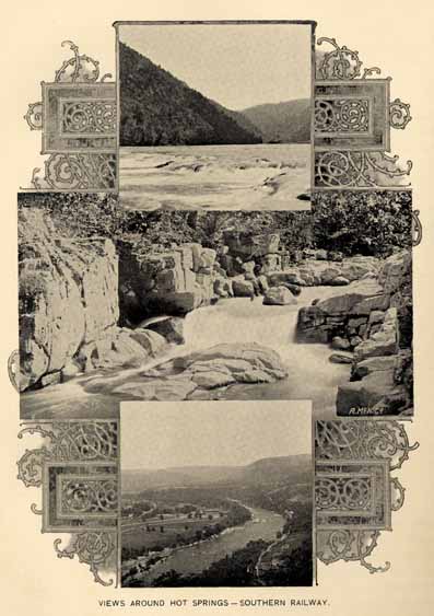
VIEWS AROUND HOT SPRINGS--SOUTHERN RAILWAY.
Page 276
by towering mountains, save where the river cuts its way. All the conveniences of modern fashionable hotels are provided. The bathing facilities are ample and lavish. It is the resort of fashion and wealth as well as the afflicted.
HAYWOOD WHITE SULPHUR SPRINGS.
Within a fraction of a mile from the town of Waynesville on the Murphy branch of the Western North Carolina railroad, is the charmingly located White Sulphur Springs. The water is distinctly sulphur, is cool and not unpleasant to the taste, and is claimed to be efficient when taken fresh from the spring, in troubles requiring either diuretic or diaphoretic treatment. It is not a portable water. One of the chief (aside from the beneficent water) pleasures of a visit to this resort is the fine climate and unsurpassed scenery. The beauties of Richland creek alone would fill a volume on art, while the Balsams, more than 6,000 feet in height, rise in majestic grandeur on all sides. The hotel is well equipped to entertain the guests who flock to its hospitable board each season. And in this respect the town of Waynesville divides the honors, as it is a much frequented resort.
GLEN ALPINE SPRINGS.
Beautifully situated among the South mountains in Burke county and some eleven miles from Morganton, and which may also be reached from Glen Alpine station on the Western North Carolina railroad, is the Glen Alpine Springs. The water contains quite a variety of beneficial mineral, such as potassium and sodium sulphate, calcium and magnesium carbonate, carbonate of iron, &c. There a small but comfortable hotel awaits the guests.
CONNELLY SPRINGS.
This favorite resort is ten miles west of Hickory, at Connelly station, on the Western North Carolina railroad. It has been growing in popularity for a number of years, and to its chalybeate waters are attributed many virtues, being diuretic in effect, as well as efficacious in dyspepsia and like troubles. The hotel is large and affords many comforts and conveniences. It is within a few yards of the railroad track, and far enough west to afford a pleasant summer climate for its large patronage.
Page 277
SPARKLING CATAWBA SPRINGS.
Eight miles north from Hickory, on the Western North Carolina, and Chester and Lenoir railroads, situate in a vast grove of forest trees, may be found the ever popular Sparkling Catawba Springs. The country surrounding the springs is beautiful, partly wooded and partly in field and orchard, affording luscious fruits in season.
"The hotel accommodations are very full, and the Springs have maintained good repute for excellence of fare. The waters of the Springs embrace blue and white sulphur, and chalybeate, and, from the known benefit derived by well-attested cures in their use as an alterative and tonic influence over the lymphatic and secretive glands they are unsurpassed, and never fail to strengthen the gastric juices of the stomach, and increase the appetite, assist the digestion and promote the assimilation of food, thereby imparting tone and health to the person. By the use of these mineral waters, diseases of the liver, dyspepsia, vertigo, neuralgia, ophthalmia or sore eyes, paralysis, spinal affection, rheumatism, scrofula, gravel, diabetes, kidney and urinary diseases, are greatly relieved."
BARIUM SPRINGS.
A few miles from Statesville, in Iredell county, is situated, as formerly known, the "Poison Spring." It is now called the Barium Spring. Analyses show that it contains, in varying proportions, barium, chloride and sulphate, iron, soda, sulphur, magnesia and phosphoric acid, in such combinations as to render it a curative and tonic agent, the equal of any mineral water known. It has no visible outflow, and the water remains at a constant level, never freezes, never stagnates, and it will keep pure and retain its curative efficiency indefinitely. These remarkable springs were well known to the Indians and their waters were so highly esteemed by them for their potent curative properties that they made the locality a regular rendezvous, as is proven by tradition and by numerous evidences of their former occupation.
There is no development of the locality as a resort, but the Presbyterian Orphanage is located near the spring. It is a remarkably healthy locality.
MOORE SPRING.
Not far from Danbury, in Stokes county, is situate the Moore Spring, which is said to be remarkable for its efficacy in the treatment of cutaneous affections and blood impurities. It is not a resort, but is remarkable from the mineral contents of its waters. Chemists
Page 278
report potassium and sodium sulphates, sodium chloride and phosphate, calcium and magnesium carbonates in rather astonishing quantities.
PIEDMONT SPRINGS.
Also in Stokes county, near Danbury, are to be found the Piedmont Springs, which are in high repute, as a tonic and alterative water. There is a good hotel large enough to accommodate the visitors annually seeking the elevated climate and curative waters.
BROMINE-ARSENIC SPRINGS.
This mineral spring is located at Crumpler Post Office, in Ashe county, on north fork of New river, and in a picturesque, healthy climate. The water, as shown by analysis, contains beside the usual ingredients sodium arseniate and sodium bromide--hence the name. It is a portable water and is recommended for eczema, nausea, debility, dyspepsia, rheumatism and all blood, skin, stomach, kidney and nervous complaints. A hotel which will accommodate an hundred guests, royal porcelain baths and a good table await the guests. The water is sold in many parts of the United States. The springs are reached only by hacks or private conveyance over good mountain roads from the Virginia side and from points on the Western North Carolina branch of the Southern railroad in North Carolina.
CLEVELAND SPRINGS.
These are about two miles from Shelby, which place is reached both by the Carolina Central and the Three C's roads, and are situated in a region of grandly rolling hills. The hotel accommodations are ample and agreeable in all particulars, and the resort to these springs is large. The springs are many and of varied character, the waters flowing in large volume. In the midst of its verdant hills and shady groves flow waters from a dozen springs, each one containing mineral qualities varying in their combinations and effects to such a degree that for the treatment of certain diseases the White Sulphur is the panacea; for some others the Red Sulphur and Iodine are required; for others the Chalybeate is best suited, whilst for others the best results are obtained by drinking the waters of several alternately. The ailments which seem to be mostly under the control of these waters are dyspepsia, rheumatism, malarial troubles, insomnia, etc.
LINCOLN LITHIA SPRINGS.
These springs are located one mile from the town of Lincolnton on the Seaboard Air Line railroad, and in the Piedmont Plateau region of the State, and surrounded by a beautiful undulating farm
Page 279
country noted for its salubrious climate. The spring is bold, and the waters contain, as shown by analyses, in each gallon of 277 cubic inches, 2.81 grains bicarbonate of lithia, besides sulphate of potash and lime, and bicarbonates of iron, lime, magnesia and soda. It is noted among the better lithia waters of the country, and is highly recommended in the treatment of Bright's disease, bladder and kidney troubles, gout, rheumatism, dyspepsia and nervous diseases. It is a portable water and has a wide distribution, and it is highly praised by those who have tested its virtues. The Lincoln Lithia Inn is a new hotel with modern appointments; is well kept and guests find in it a pleasant environment. In the autumn and winter months guests may find abundant quail shooting in vicinage.
ELLERBEE SPRINGS.
These springs are situated about twelve miles north of Rockingham in Richmond county, and are locally much valued. The waters have an abundant flow and consist largely of iron and sulphur in their mineral contents. Remarkable as it may seem, the waters of this resort are reported as an effective remedy for hay fever. While the patients suffering from this malady have been few, there is no failure to cure recorded against the springs.
JACKSON SPRINGS.
This health resort is situated in Moore county, four miles from West End, on the Aberdeen and West End railroad, and some fifteen miles west of Southern Pines. The flow of the springs form a rivulet of clear, cool water. The value of the springs "as a remedy for and cure of indigestion in all its forms, particularly dyspepsia and diarrhoeal diseases, kidney and bladder troubles, dropsy, cystitis and all debilitating causes is well-known." The location of the hotel, which is entirely comfortable, near the springs, is in the heart of the long-leaf pine and the deep sand section of the State, the natural sanitarium for those afflicted with lung diseases, makes the springs all the more valuable. The healing influence of inhaling the odors of the long-leaf pine and living in and breathing the pure atmosphere of this deep sand drainage is not to be underestimated.
RED SPRINGS.
In Robeson county, on the Cape Fear and Yadkin Valley railroad, at a station bearing its name, are located the Red Springs the medicinal virtue of whose waters has been known for an hundred years. There are two springs, both are strongly chalybeate, showing respectively 1.35 and 1.90 per cent. of bicarbonate of iron,
Page 280
while their other mineral contents are desirable in a health water. The Hotel Townsent is open all the year, is new and modern in its appointments, and is beautifully located in a grove of trees. The surrounding country and streams afford sport during winter and summer with gun and rod to guests who are able or inclined to take the exercise.
PANACEA SPRINGS.
These celebrated springs are situated near Littleton, on the Raleigh and Gaston branch of the Seaboard Air Line railroad. There is a good hotel on the premises, but as the water is portable, its patronage is very nearly local.
The waters have only become widely known during the past few years, but have already acquired fame at home and abroad. The claims for efficacy in many maladies are very extensive, but appear to be well sustained. For dyspepsia they are said to be very beneficial; also for chronic diarrhoea, scrofula, kidney troubles and other deseases. The waters lose none of their virtues by transportation, and are sold by the drug stores throughout this and the adjoining States.
THE SEVEN SPRINGS.
They are as remarkable for their locality and the nature of their surroundings as for their genuine virtues. They are in the southeast corner of Wayne county, eighteen miles from both Kinston and Goldsboro, but most readily and quickly reached from LaGrange, on the Atlantic and North Carolina railroad, seven miles north of the springs. The springs lie almost immediately on the banks of the Neuse river.
"The springs, as their title implies, are seven in number, all bubbling up in clear, strong volume, in close contiguity and enclosed and encased in a spring-house of remarkably limited though absolutely convenient dimensions. The waters are as different in their qualities as they are in their numbers, and prove effective in malarial diseases, indigestion, insomnia, kidney troubles, including Bright's disease, weakness and inflammation of the eyes, loss of appetite, etc. These springs have been known for many years, and have been the resort of the surrounding country, but only recently have they become known to the more distant public. A good and capacious hotel now makes it practicable to distribute their benefits among a much larger circle of health-seekers."
Page 281
SEASIDE RESORTS.
NAG'S HEAD.
This noted seaside resort is in Dare county, just opposite Manteo, on Roanoke Island. It is annually frequented by large numbers of visitors who lave in the blue waters of mother ocean and feast upon its gastronomic rarities. Mr. Frank Vaughn says of this resort: "It is in the midst of a cluster of high sand hills, with ocean on one side and sound on the other, the two but half a mile apart, is one of the most delightful places for summer residence in the State. From the tops of the bald, yellow hills, the scenes on a clear summer evening, at the sunsetting are glorious in the extreme. Away in the east, reaches the rolling, moaning sea; in the west, the red sun sinking down into the waters of Albemarle, and on the south, Roanoke Sound and historic Roanoke Island, green and beautiful in the midst."
NEW BERN.
New Bern has held its enviable place as a social center ever since the early colonial days. It is now becoming a winter resort. Mr. Charles Hallock, at present chief editor of the new "Western Field & Stream," published at St. Paul, says:
"During my six consecutive winters at New Bern, I have observed that when the winter was at all stormy in that locality, it was sure to be reported very much worse in the regions adjacent, by the Signal Service. For instance, if we had a slight flurry of snow in New Bern, there would be a severe blizzard northwards, extending over a wide area of country, or, if a hurricane came up from the tropical seas, wrecking and inundating the Georgia and South Carolina coasts, its force would be spent before it reached here, and we would get only the feather edge of it. If the weather is at all foul in this section, at any season, it is a short duration. The rainfall is light in winter and cloudiness the exception. Quiescence is the normal condition, and there is seldom a meteorological disturbance.
"From these observations, I make the unavoidable deduction that New Bern has the most equable winter climate on the coast; and is therefore a desirable place for invalids as well as those merely in quest of warm and sunny weather. Visitors, who come each year in increasing numbers, express themselves surprised and delighted. Winter is the most favorable season for yachting. There is a profusion of ivy, magnolia and other glossy leaved evergreens, and some kinds of flowers persist in blooming all the winter long. Violets are always

PIER AND BEACH AT NAG'S HEAD.
Page 282
in evidence. Sportsmen find shooting and fishing in variety. Macadmized roads afford pleasant ways for carriages and bicycles. The people are sociable and hospitable, and the colored people as civil as those whom they like to imitate.
"I do not see what it is to prevent New Bern from becoming first choice of all who go south for the winter; and it is claimed by residents to be equally delightful in summer."
BEAUFORT AND MOREHEAD.
The proximity of Beaufort and Morehead City together with the near resemblance of their topographical conditions renders a separate description of these two healthful watering places unnecessary. In distance apart they are about two miles, and about the same distance from the Atlantic Ocean, and about twelve miles northwest from Cape Lookout; in latitude 34.75 north and longitude 0.50 east from Washington. They are situated in Carteret county, on the extreme eastern border of the mainland, the shores of which are washed by the waters of Bogue sound.
Morehead is built upon a point of land reaching out into the sound, which gives it a delightful exposure to the summer breezes from almost every direction. It is immediately on the line of the Atlantic and North Carolina railway near its eastern terminus, and on this account is the more accessible to visitors.
Beaufort is separated from the terminus of the railroad in a direct line, by an arm of the sound and is reached from this direction by ferryboats, which make close connection with all the trains. Beaufort is preferred by some on account of the ocean view, and more direct breeze.
The soil upon which these places stand is a white sand free from mud or dust. The water supplied from cisterns and bored wells is good, and the air, coming as it does during the summer months, almost constantly from the Atlantic charged with ozone is as fine as can be found on the face of the globe.
Fish and game abound in the neighboring waters and forests which are easily accessible to sportsmen.
The boating and bathing facilities are rarely excelled in any other watering place, the beach for surf bathing being exceptionally fine.
These places are rapidly growing in popularity and are frequented by large numbers of most agreeable visitors every year. The hotel accommodations are ample.
Page 283
SOUTHPORT.
No place in North Carolina, or the South, possesses so many natural advantages as an all-the-year watering place, as Southport. Its summers have no extreme heats, its winters have no snows, and its occasional low temperatures are of short duration, dry and of a bracing character. The mean temperature is 77 degrees for summer and 47 degrees for winter.
The attractions in and near Southport are of a kind to interest every class of tourists, from the sportsman to the antiquary. Fishing is good in every month, and deer and wild fowl are plentiful in the winter season. For the invalid, the climate is unsurpassed, and outdoor recreation can be indulged in almost uninterruptedly, as the ground is always dry, the drainage being sufficient to carry off and prevent any standing water; the town lying twenty to thirty feet above sea level.
The tourist at Southport has many points of interest to visit within a short distance. Fort Caswell, less than two miles away across the harbor is one of the best preserved, interesting and historical ruins in the South. Smith's Island less than four miles across the harbor, is a wonderful sub-tropical island, with palmettoes upon it thirty and forty feet in height. The upper portion of it is covered with a dense growth of plants and trees, and the waters around it abound in terrapin and fish. Fort Fisher, five miles up the Cape Fear river is a historical spot; it may easily be reached from Southport. These are a few of the most noted places, there being a number more well worth visiting.
The town of Southport has pleasant walks; its live oaks give a fine shade during the summer months and preserve their green appearance during the winter. Good bathing may be had along the town front, and by a short sail to the ocean beaches.
CAROLINA BEACH.
Carolina Beach is a summer seaside resort reached by boat and rail from Wilmington, about an hour's ride from that city, and is situated on a fine stretch of sandy beach directly facing the Atlantic Ocean. It is the favorite resort during the summer months for families who own or rent cottages. Its bathing is very fine, and the celebrated "Pig fish" is caught in countless numbers along the shore. In the season a hotel is open for the accommodation of guests.
WRIGHTSVILLE.
Wrightsville, or Wrightsville sound, is eight miles east from Wilmington, and in full view of the Atlantic Ocean one mile distant
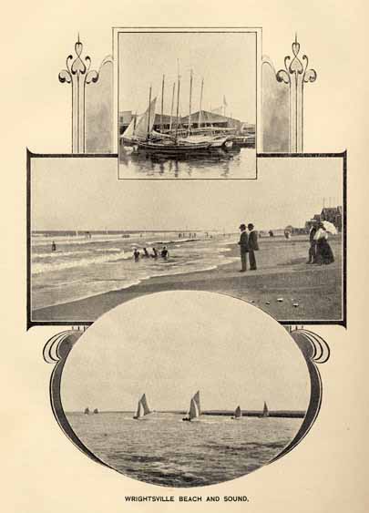
WRIGHTSVILLE BEACH AND SOUND.
Page 284
across the sound. Between the sound and the Ocean is Wrightsville beach, a narrow strip of sand two hundred yards wide. The Seacoast railroad runs from Wilmington to Wrightsville, thence across the sound and along the beach for two miles. In winter there are four trains a day from Wilmington, and during the summer there are from ten to twenty trains daily. There is a free delivery of mail twice a day, and telephone and telegraph communication with Wilmington.
The surf at Wrightsville is within a few feet of where the cars stop, and is nearer by rail to persons in Goldsboro, Raleigh, Durham, Greensboro, Charlotte and all points in the interior of the State west of the W. & W. Railroad, than that of any other watering place in the State. The still water bathing in this sound is within two hundred yards of the surf.
The climate at Wrightsville and the Beach is exceptionally fine for summer or winter residence. The fishing, too, is fine, and there is always at the disposal of sportsmen and pleasure parties, a number of "sharpies" manned by experienced sailors ready to take them upon the waters of the sound, or outside upon the Ocean.
The sound may be safely entered from the Ocean through Wrightsville Inlet. Many pleasure yachts passing to and from northern and southern ports enter here and find safe anchorage during stormy weather.
At Wrightsville and at the Beach there are fully 150 cottages, hotels and boarding houses. At least 100 families spend the summer here, and during the months of June, July and August, it has a large number of visitors.
Many of the cottages are not only costly and commodious, but they are striking models of beauty and convenience.
On the beach the water supply comes from an artesian well of pure cool water.
PINY-WOODS RESORTS.
"Our Pines are trees of healing."
North Carolina has a large region of piny-woods noted as a resort for those suffering from throat, lung and kindred diseases. The healing touch of nature, though seeming slow, is yet more cunning than science. Once disease takes hold in the harsher northern climates, the sufferer must find a milder and more benignant sky, and find in its genial, dry and invigorating air a balm to heal. There are healing
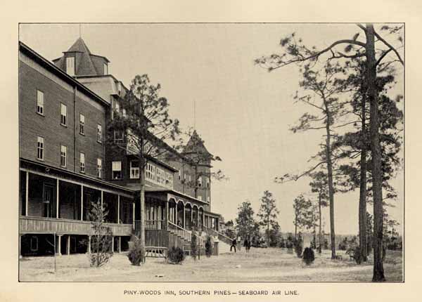
PINY-WOODS INN, SOUTHERN PINES--SEABOARD AIR LINE.
Page 285
virtues in the balsamic breath of the long leaf pine. Professor Schrieber of Vienna, states: "that turpentine exhaled from the pine is the most effective agent known for converting the oxygen of the air into ozone," and Mr. Tufts in his booklet, says: "Ozonized oxygen is a powerful antiseptic and disinfectant. Its presence in the atmosphere gives the latter a remarkably healing quality for diseased throat and lungs." Thus we have the secret which brings health and hope to the pilgrims to our Mecca of Pines.
SOUTHERN PINES.
Among the piny-resorts of North Carolina, Southern Pines justly ranks first, not only because it was the first established, but because of the excellent location and the salubrious, invigorating and health giving air, laden with the healing fragrance of the "bled" pines. This favorite resort is located in Moore county, near the central part of the State, and on the Seaboard Air Line railroad. It is on the culmination of an immense sandy ridge, running in a northeast and southwest direction through the State, and traceable in its gradually diminished elevations and characteristics in several of the states to the southward. Locally, this is known as "Shaw's Ridge," the name coming from a prominent family long resident here. The waters falling upon the roof of the old Shaw homestead divide and find their ways to the Little and Pee Dee rivers, each some twelve or fifteen miles distant. This ridge and all the adjacent country for many miles is practically covered with the long leaf pine--Pinus palustris, Mill--which constitutes the chief forest growth of the region. The selection of this dry, elevated ridge, pointed out by the late Professor Kerr, State Geologist, as a health resort met the happy medium, in climate being located exactly in the center of the temperate zone. Those in search of health or pleasure are here exempt from the rigors of the north and west, and are also free from the enervating influences of locations in the more southern and warmer latitudes.
Dr. G. H. Sadelson, the first to adopt the region as a home, says: "A little more than fifteen years ago, in quest of health, I was directed to this section by the late State Geologist, Professor W. C. Kerr, as the highest, dryest section in the whole long leaf pine belt. I came, and getting off the train at Manly, the then nearest point to "Shaw's Ridge," I found myself half shoe deep in clean sand and surrounded by a dense pine forest, and breathed an air saturated and made gratefully fragrant by the balsamic odor of the turpentine pine. Having made remarkable improvement in a short time, I examined the surrounding country including "Shaw's Ridge;" making almost daily
Page 286
journeys, mostly on foot, and was so favorably impressed with its natural sanitary advantages that I expressed my views through the press, at the same time giving my views to Professor Kerr, with whom I corresponded." At that time the State Geologist was employed by the State Board of Agriculture, and reported to it at its regular meeting. The Board was impressed with the facts presented by the State Geologist, supplemented and amplified by the correspondence of Dr. Sadelson, and placed the matter in the hands of its then Immigration Agent, Mr. J. T. Patrick. Continuing, Dr. Sadelson, speaking of the further effort of the Board's Agent, says: "Mr. Patrick, whose business it was to induce immigration and capital into the State, after some correspondence and many interviews developed the plan of Southern Pines, and securing an appropriation from the State Board of Agriculture, which was afterwards supplemented by citizens of this section, enough was secured to survey a tract of about 800 acres exactly on the top of 'Shaw's Ridge.' This was the starting point, the foundation of the Southern Pines of to-day. It is now fully established among the health resorts of the United States, and is well and favorably known to the medical profession of this great country. People from all parts of the United States visit the place, on the advice of physicians, and year by year sees its expansion; the boarding houses giving way to hotels, and the hotels to the more pretentious 'Inns.' There are churches, stores, bakeries, shops and dwellings--in fact a town, and a handsome one at that--whose door yards are neatly kept, nearly all making good displays of flowers, shrubs and decorative plants. Two good church buildings are completed and two more are to be built soon; there are five good hotels and half a dozen boarding houses, besides a goodly number of furnished cottages for rent to those preferring light house-keeping. Two private schools are well patronized." The Seaboard Air Line railroad has encouraged, fostered and promoted the growth and development of Southern Pines and should not be omitted even in so brief a sketch as this must be of this resort. Southern Pines is within twenty-two hours of New York city.
PINEHURST.
"Rest" the pines say to the pale health seeker, "the noises and the cares that have infested thy life elsewhere come not here. Rest, and be healed by day. Sleep, and be healed by night. Night and day we will not fail to encompass thee with life giving influences."
The magic wand of wealth and philanthropy, in the hands of Mr. J. W. Tufts, of Boston, Mass., has caused to spring from the virgin forest of Moore county, a beautifully built city, as a resort for
Page 287
the afflicted. Five thousand acres are included in the holding, and on it has been laid out picturesque Pinehurst. The celebrated landscape artist, Frederick Law Olmstead, was employed, and his taste and skill are amply displayed in the work at this resort. The Board of Agriculture also rendered assistance in locating this enterprise. As its field is rather unique in that its philanthropic originator has built with a view of relieving the afflicted with small means, as well as the more fortunate, financially, it will be worth while to reproduce a paragraph from his little book: "Pinehurst is not intended to be a sanitarium for hopeless invalids. It has no hospital features. It is a bright cheery village, artistically laid out, possessed of all modern comforts and conveniences, carefully controlled so as to make its sanitary and other attractive conditions permanent. It invites those in whom disease has not progressed so far as to render recovery impossible. To such, whether of large or small means, it offers advantages absolutely unequalled."
Pinehurst is located six miles from Southern Pines, on the Seaboard Air Line railroad, and four miles from Aberdeen, on the Aberdeen and West End railroad. An electric car line connects Southern Pines with Pinehurst. The Holly Inn, new, modern in all appointments, is the chief hostelry at Pinehurst. The water is exceptionally fine, being supplied from a system of deep bored walls.
MOUNTAIN RESORTS.
"I will lift up mine eyes unto the hills,
from whence cometh my help."
How many of us, when beset with cares, and wearied by the trifles which pull us down as if they fain would bury us in the Valley where we live, have thought of these words and turned to look away to where the mountains couchant and strong seem from afar to answer our unspoken wish with proffer of welcome and peace.
How mighty and helpful they are, these circling hills, there is no fitful show of power about them such as wind and plain and sea afford; day and night, sunshine and storm find them and leave them just as they were thousands of years ago. Calm and aloft they call us from their solemn heights, they bid us trust ourselves to their great embrace, to breathe their serene and unvexed air, to dwell amid the silences of deep-bosomed clefts, and, along their vast reaches, more and more lordly as we look, over many degrees of latitude and longitude, to forget the slighter measures of the lands and life below.
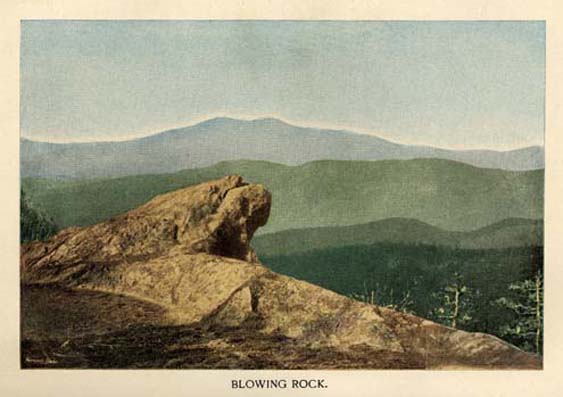
BLOWING ROCK.
Page 288
De Quincey fiercely attacked the use of the word "magnificent," common in his day, with names of ordinary things, "great-making" is the meaning he said, and to speak of jewels, dinners, horses, men or women in that way, is absurd. Nothing is worthy of this great epithet that does not ennoble or uplift the beholder or the hearer; a drama of Shakespear's, the book of Job, the Iliad, a sight of the sea in its mood or a splendid sunset, may deserve the adjective. We who have lived among them do not need the hint of David to know that of all material works of God none better deserve to be called magnificent, none so easily bring strength, so take to themselves the half-dead man and re-create him, as the mountains of our West. But they do not welcome an abrupt approach, nor unveil their secrets to the rude adventurer; one should essay them with reverent tread and let their first study be as they show cloud-like against the distant sky. Little by little let the contrast grown between their billowy ranges, shutting in half the horizon, and the tame level of the champaign whence we gaze. Then as we trace their grand contour north and west, noting how with each mile and hour of our advance they tower yet higher before us, as peak detaches itself from range and ranges, taking distance, separate themselves one from another, stretching over State after State only to fade away, yet dominant on the furtherst verge, we may begin to claim the freedom of the hills, enroll ourselves among the clients of these mighty patrons and seek to make their mysteries our own.
The tourist from the north or east gets his first view of the mountains from Hickory, Catawba county, at the junction of the Western North Carolina with the Narrow-gauge railroad leading from Chester, S. C., to Lenoir.
HICKORY.
a vigorous town, is hardly a mountain resort, but is the gate-way to one of the most attractive, borrowing from the hills above and the plains below qualities of scenery, climate and people which make it, its denizens and surroundings typical of both.
Unsurpassed for dryness, for it lies between the wet belts of summit and lowlands, sunshine and salubrity, its air supplied from the great cataract falling down from the hills to be met and tempered by the warmer currents from the south; its population combining the strength of the sterner with the polish of the milder sections, it is a place where one may well spend some days before going higher to accustom himself to the sight of the mountains, and the effect of the mild yet bracing atmosphere.

THE NANTAHALA MOUNTAINS--SOUTHERN RAILWAY.
Page 289
Fifteen hundred feet above sea level it has a country about it that yearly attracts many sportsmen for quail shooting. It also boasts of one of the most charming hostelries in the land, Hickory Inn, accommodating 150 guests and with all the modern conveniences. The piazzas are broad and sheltered, and the lofty tower at the top of the building looks out upon the great mountain system. One hour by rail brings the tourist to
LENOIR.
This pretty town marks the western terminus of the Chester and Lenoir railroad, and here the tourist forsaking the cinders and dust of the railroad takes private conveyance for the resorts on the mountain tops, now visably piled in great blue heaps against the western sky. This little town, filled with cultured, hospitable people, and nestling close to the mountains, is a charming half way place. It is not so cool as the mountains; has good markets, good hotels and boarding houses, good livery and a hearty welcome to the traveller. A few weeks of rest and recreation can be spent here. Indeed, its climate is preferred by those who find the mountain resorts too cold. But those bent on the glorious scenes from the crest of the Blue Ridge, take carriage, and in a few hours over a fine turn-pike of twenty miles reach the goal.
BLOWING ROCK.
is the name generally applied to designate the mountain resort. But there are two ends to the resort, and each having a post-office, they are separated in name; thus the Green Park and Blowing Rock contingents of the same straggling village, more than two miles in length, and along this distance are scattered hotels, churches, cottages, stores, livery stables, &c.
From Blowing Rock one of those enormous spurs, branching off from the Ridge like ribs from a back-bone, reaches to the sea below Georgetown, S. C. Its whole route can be travelled without crossing any natural water course, from the highest point at Blowing Rock between the tributaries of the Catawba or Santee system on the west and the Yadkin and Pee Dee system on the east. Up along this spur, crossing and recrossing, now on its narrow ridge, now on one of its sloping sides, the turnpike runs giving frequent glimpses of the famous Jonas Ridge peaks, Hawksbill and Table Rock to the left, and as far as Pilot mountain in Surry county to the right. Cool and refreshing springs are abundant.
These places are about 4,200 to 4,300 feet above the sea; 2,300 feet higher than Lookout mountain or the Catskill Mountain House.
Page 290
There, summer reigns with moderate sway, during the season 85° is the highest temperature recorded; for two successive Augusts the daily maximum ranged from 67° to 84°. The days are pleasant, the nights more pleasant if possible; a seat by an open fire and a sleep under blankets make the dark hours delightful, nerves regain tone, muscles grow strong, blood reddens, dyspepsia and headaches flee away in the life giving atmosphere above the clouds of the valleys.
Points of vantage for views abound. No two give the scores of mountain sides or tops from the same direction or at the same angle, the sights are almost kaleidoscopic in variety.
At one place and hour there spreads below you a white and silent sea of mist, in a moment the vast still surface begins to heave, to toss, to break, green peaks emerge from snowy billows, hillsides next appear, and then the gathered waves float upward to be clouds, disclosing in all its bravery of field and forest, winding streams and rocky cliffs the great valley which drains the waters from the southern slope of the Appalachian range. From another point and as the evening sun tips the crests with flame you see, as if they grew loftier while you look--the giant tops of Roan and Grandfather, Bald, Yellow and Black, scores with no name at all, clean cut against a clear blue sky, so calm and still, so mighty and reposeful, lifting the soul as they seem to lift themselves.
Where the great spur already mentioned joins the Blue Ridge an overhanging shelf of rock projects from the top so far over the "Globe" or valley of John's river, as to catch and for a time confine the currents of air sent up from the depths, as the northerly winds, finding no outlet, strike against the face of the cliff. The air presently finds egress over the top, and the force with which it boils up gives the name of Blowing Rock to the beetling crag. When the winds are right any light article, handkerchief, scarf, hat or bush thrown from the apex, instead of reaching the bottom thousands of feet below, is born upward and back again to the spot whence it was dismissed. The name of the cliff has become that of the village near by where the road to Boon intersects with the old turnpike.
GREEN PARK HOTEL.
Within five minutes walk of the Rock, near the crest of the Ridge, just between the springs of New river and Yadkin, is Green Park hotel so exactly placed as to turn the rainfall from the roof partly toward the Ohio and partly toward the Pee Dee rivers.
The hotel, a handsome thoroughly modern structure, has all the "improvements," warmed by fire-places, with hot and cold baths,
Page 291
&c., and is supplied from the springs alluded to with purest cold water. It is fully carpeted, it has a fine billiard room, shooting gallery, bowling alley, tennis court and other modes of amusement. Telegraph and post-office in the building.
BLOWING ROCK HOTEL.
Also on the crest of the ridge, about one and a half miles north of Green Park, on a bold cliff-like projection affording from its piazzas charming views of the valley below and of the distant peaks beyond. Its commanding location, good table and home-like associations make it one of the most charming hostelries on the mountain.
It has nine hundred feet of piazzas, telegraph, livery stable, ball room, &c., for the convenience of patrons.
WATAUGA HOTEL.
This is the pioneer hotel and is at the extreme north end of the village, about two miles from Green Park. It has undergone several remodelings and is now a comfortable place, with ample grounds and the finest spring of water on the mountain.
Besides, there are the Brady House, the Stewart House, and numerous boarding houses, all open for the accommodation of the five thousand visitors annually flocking to this favored region for rest and recuperation.
BOON.
Eight miles northward lies Boon, the county seat of Watauga, named for the famous hunter and pioneer, whose lodge fires blackened the heap of stones yet remaining and to be seen in a meadow there and cherished as Boon's chimney.
Here, several hotels, with good cookery and cheerful attendance, make the place a resort. It is a quiet, restful town, suited for study and retirement, albeit now connected with the world by a new and admirable turnpike. A score of years ago, whoso ventured to fare thither felt dismay, now the drive from the Rock done in an hour is a pleasurable event. Then too, whoever wished to travel from the Rock to Linville started, trembled and went back; now a road, the most beautiful and of easiest grade in all the hill-country woos the traveler over its broad ribbon-like track. He may ride, drive or walk, at any pace he will, nothing obstructs his path; no thoroughfare in the county, unless it may be the military pike at the National Chickamauga Park can compare with it. So perfect a mountain road, its unlikeness to what is looked for in its surroundings, there is something humorous almost whimsical in such a drive-way on such a
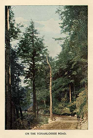
ON THE YONAHLOSSEE ROAD.
Page 292
mountain side, and it affords quite a new sensation. To whirl along at the horses' best speed, as smoothly as if bowling along a drive in Central Park, is to enjoy the utmost luxury of locomotion through an exhilarating atmosphere scented with pine and balsam on the most stony mountain of the Appalachain chain, among rocks gray with lichens, bare crags, bush and tree yet in their primitive savagery, to sweep by and amid the silence of the wildest forest, to see on either hand the pathless tangle of the steeps, brings the world in so sudden nearness to the jungle that the contrast startles.
By this road from Blowing Rock or by a shorter one from Cranberry, a station on the E. T. & W. N. C. R. R., can and should be reached the renowned Linville, with its great scope of well governed land, its matchless scenery, its range of flora and fauna, temperature and climate, hill and valley, from the crown of Grandfather mountain to the smooth green meads bordering fair Linville river and among other good things its home-like
ESEEOLA INN.
This is a mountain resort which begun at the other end from most of them. Usually the public builds them from a spring and cabin to a fountain and a town. In this instance, capitalists bought a dukedom so far as territory goes, laid it out for country and city, farms and gardens, with a picturesque town plot on the river, at the junction of Grandmother creek, cleared undergrowth, opened forest glades, views and groves, cut paths, built bridges and best of all "Yonahlossee" pike from Blowing Rock along the southern slope of Grandfather. Built an inn, cottages and then called the Nation's attention the fact that at Linville, with ten miles of trout stream and thirty miles of graded driveways, was a town ready made, a watering and breathing place without mark of wear and use, which by the magic of money, taste and foresight, had sprung up as yet untenanted, all fresh, sweet and new, ready for guests.
From points here, one hundred and fifty miles of mountains can be traced, more than a score of peaks rivalling its own monarch, Roan and Yellow, Otter and the giant brood of Blacks, all in a country where reigns summer almost like spring or fall and where winter is not much more than a joke and an excuse for roaring fires in great generous fire places in a cosy inn.
CLOUDLAND HOTEL.
Roan mountain, cloudland and empire of the sky, the highest of resorts, loftiest of hotels, most picturesque of summits, can be readily

ROAN MOUNTAIN--HIGH BLUFF--EAGLE CLIFF--VIEW FROM ROAN.
Page 293
reached from Linville, or from Johnson City, E. T. & V. R. R., via Cranberry; 6342 feet above sea level. Commanding views, as indescribable as they are numerous, attract and keep the beholder; the top of this most beautiful mountain is seven miles long, a natural prairie, interspersed with groves, dotted with flowers and shrubbery; it no longer serves merely as a pasture for the flocks and herds of the farmers below, a nobler destiny has been found for it, and travelers swarm over its broad expanse. It does not boast of hunting or fishing, such sports are not to be looked for above the clouds, but scenery, the world spread out below, wholesome wine-like air, pure water, zest for food amply provided, comfortable lodging, it challenges the best of our hill country resorts.
HIGHLANDS.
At Highlands, in Macon county, a colony of health seekers from the North, blended with southern settlers, have made this spot, near the southern verge of the Blue Ridge, at an elevation of nearly 4000 feet above the sea level, a very desirable location. It has well kept hotels and many visitors.
ASHEVILLE.
Buncombe county and its superb capital, Asheville, have for years been the best advertised places in the State. Asheville holds peculiar prominence as a resort, by reason of its location, its railroad facilities, its many fine hotels, and its easily accessible views--splendors of scenery. Then the location of the vast Vanderbilt domain has given it additional importance. It is thronged with visitors winter and summer. In winter by those who seek a milder residence for the extreme cold of the north, and especially by those who suffer with pulmonary troubles; while in the summer the majority of its guests come from the warm slopes of the South Atlantic States, seeking a cooler and more salubrious climate for the heated term.
BATTERY PARK.
Asheville's hotels are famous all over the nation. Battery Park on a hill in the centre of the city of Asheville, commanding prospects of the whole country around "rus in urbe," also withdrawn enough for quiet but not selfishly excluded, its drives, its electric car line, its whole environment make the guest feel at home, the master of his time; his views, his comings and his goings. An hour's contemplation of Mount Pisgah majestic against the sky would furnish an army of exhausted preachers with new metaphors.
Page 294
The hotel, a Queen Ann edifice, is three stories high 300 × 175 feet in dimension, with broad verandahs which in winter are closed in by glass.
SWANNANOA HOTEL.
The Swannanoa in the centre of the business part of town, a four storied brick building, keeps up its old and well-deserved reputation.
HOTEL BERKLY.
Hotel Berkly is close to the Court House, Postoffice, Banks and other business places, is well kept and furnished, open the year round.
OAKLAND HEIGHTS;
Something more than a mile from the Court House, on a gently sloping hill, large, capacious and of beautiful design, overlooking a beautiful landscape and in all respects a first-class hotel.
KENILWORTH INN,
At Biltmore, adjoining the Vanderbilt domain and two miles from Asheville, claims the best air, as it certainly has one of the best buildings for the seeker after rest, health or pleasure in the State. It is a vast, many gabled, many porched and most picturesque pile, on the crest of a knoll, commanding splendid views of mountain and valley. It is but five minutes from a station and can be reached by through sleepers from New York and Cincinnati.
It goes without saying that the house is perfect in all modern improvements and appointments, admirably kept, and provided with golf and tennis grounds. It has twenty acres of lawn and a superb woodland park of 140 acres in extent, with miles on miles of accessible drives.
ARDEN PARK,
Between Asheville and Hendersonville, nine miles from the former on the Asheville and Spartanburg R. R., has an excellent hotel largely patronized by exclusive guests from the cotton and cane States, as well as by the same class from the North.
HENDERSONVILLE.
Hendersonville, long a favorite resort for the aristocracy of the south, is warmer and dryer than other towns along the Ridge, well laid out and shaded streets, good water and charming scenery. Its hotels are comfortable, well kept, at moderate prices, and attract a steady custom year after year.
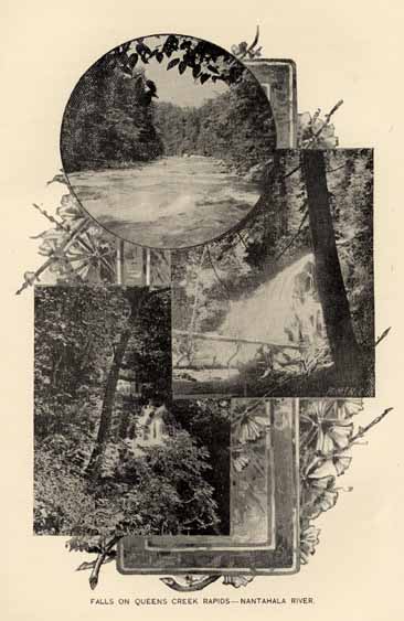
FALLS ON QUEEN CREEK RAPIDS--NANTAHALA RIVER.
Page 295
FLAT ROCK.
Also on the Asheville & Spartanburg railroad is a collection of exquisite stone villas surrounded by beautiful grounds, built by the wealthiest class of South Carolinians. It has to some extent lost the exclusive character of its former years, and is one of the most delightful and interesting villages in the south. As a resort it is unsurpassed for healthfulness, beauty and romantic associations. "St. John's-in-the-Wilderness," a sanctuary erected by the people from the low country is attractive to all who have read "The Land of the Sky." Count and Countess du Choiseul sleep quietly in their tombs near the entrance, and a finely graded road leads to their lonely Chateau.
HOT SPRINGS.
This resort is treated elsewhere under the head of Mineral Springs. Until its recent development by the Southern Improvement Company it had not the facilities for entertaining guests all the year round. The Company owns 4,000 acres at this point and has made it a most successful rival of the resorts hitherto more widely advertised.
This place is on the picturesque French Broad river, near the Tennessee line in a region of attractions in the way of scenery has especially to boast of its climate and healthfulness. Its altitude of 1700 feet, freedom from fog, and pure dry air make it most desirable for the debilitated.
Mountain Park Hotel is new, with the best modern appliances, elevators, toilets on all floors, steam heat and fire places, a quarter of a mile of broad verandahs, excellent cuisine and service make it a most desirable home. An orchestra, music hall and ball room, good livery, billiards, bowling, golf links and tennis courts, and even a dark room for the photographer to await the patrons.
Other towns, Old Fort, Marion, Black Mountain and Morganton are all, more or less summer resorts. Morganton has occupied an enviable reputation as a resort for more than half a century, and is still much frequented; in fact all the towns in the mountain region may be classed as resorts, since each has an increasing number of summer visitors.
ROARING GAP.
Within the last few years Roaring Gap, Alleghany county, has attained the importance of a resort. A large and well arranged hotel has been built on a site commanding charming views and vistas. It is on the Blue Ridge at an elevation of 2914 feet, and is reached over the Northwestern and North Carolina railroad, a branch of the Southern
Page 296
system. Leaving the train at Elkin, a drive of sixteen miles brings you to the hotel.
This whole region is easily accessible--Pullman cars leave New York at 4:30 P. M., and Cincinnati at 8 P. M., arriving at most any of these resorts next afternoon.
Taken all together this mountain region is a wonderful section; the late Col. J. B. Wheeler, United States Army, who had served all over the Union, used to remark that in no region with which he was familiar could be counted in a year so many days when the sun shone. Bishop Lyman, who had lived for years in Rome and California was fond of sayiny all manner of gracious things of this region.
No part of the South offers greater attractions to the investor and the seeker for health or pleasure, or is more interesting to the student than this. Incalcubly rich in minerals and timber, perfectly suited for growing grasses, cereals and fruits; with a climate bland, strong, stimulating and restful, it also has the purest strain of Anglo-Saxon blood in the country, and with the possible exception of Kent and Devon the purest in the world. Descendants of great houses famous under Plantaganet and Tudor, children of ancestors who flew from the tyranny of Stuart and Hanoverian, occupy slopes of the Appalachian chain. No latin or celtic admixture has dimmed the bright current which flows in the veins of the heirs of the gentry and yeomanry of the mother isle, and the scholar will observe the frequency with which, in the houses of men whose ancestors fought Charles at home and Ferguson here, he may listen to the unmatched English of Shakespeare.
Indeed it is not too much to say that more individuals in such a gathering as is normally found at church or court in Western North Carolina will understand and relish an Elizabethian drama than can be brought together under the same conditions elsewhere in the land.
WITH GUN AND ROD.
Among all the States, North Carolina stands near the head as a resort for the hunter and fisherman, but among those within easy access of the centers of population and wealth, it undoubtedly possesses advantages equalled by few other States, which are fully appreciated by the local sportsmen as well as those residing in other States

SOME NATIVE GAME BIRDS.
Page 297
cognizant of the facts. The fact that so ardent a hunter and fisherman as President Cleveland selects the shores and sounds of North Carolina as his hunting ground (which, by the way, was sometimes practiced of his illustrious predecessors), and that the wealthy Eastern Field Club holds its annual trials on the stubble covered fields of the Piedmont region of the State, are significant proofs of the fact that "good hunting" may be had here. The scope of this chapter will be to point out briefly some particulars of interest to the lover of gun and rod.
Virginia Deer, (cariacus virginianus) and Black Bear, (ursus americanus,) are the representative big game animals found in North Carolina, and they are both sufficiently abundant to be an object of sport in the localities in which they abound, in fact, in some sections of the State, the bears often become a nuisance to the farmer on account of their depredations on the hog-pen and sheep-fold. And then the hunt begins, although it is not sport, but revenge and self preservation that urges the farmer forward on bruin's trail.
The Coastal Plain region, the land of the big swamps and pocosons, is the natural home of the bear, and almost any one of the extreme eastern tier of counties can still show good sport in bringing him to bay. The mountains of the west, too, produce some enormous specimens, and a good many of them, and many deer still gladden the hunters among the peaks and valleys of the Blue Ridge and Great Smoky ranges. Deer are also plentiful in the Coastal Plain region of the State, as well as in the west, and are found in varying numbers all over, except perhaps, in a few of the older and more thickly settled counties. Many men who hunt regularly, still use the smoothbore, with its load of twelve or fifteen buckshot, but the later type of hunters are rapidly replacing it with the rifle, a smaller percentage of lost cripples being the natural result of the change. Wildcats are common in about the same sections that produce the bear and deer, and some wolves yet rouse the wrath of the sheep farmers in the mountain counties.
To anyone wishing to indulge in a taste of a genuine, old fashioned before the war "possum hunt" it may be stated that no other State can produce more, or larger, or better Opossums in any way.
The stately wild turkey is yet a common bird nearly the whole length of the State, and fine specimens are killed frequently within a few miles of the State Capital at Raleigh. While not as common, of course, as formerly, yet it will be many years before this noble bird becomes even rare in North Carolina. They are abundant in many localities.
Page 298
But it is, perhaps, as a wild fowl resort that we stand without a rival on the whole Atlantic seaboard. The enormous extent of the great sounds, estuaries, rivers, marshes and beaches of the Coastal Plain region makes it the home almost the whole year round of a greater number of more different kinds of waterfowl and shorebirds than perhaps can be found in any other like area on the American Continent. In fall and winter it is the vast hordes of waterfowl on the sounds and open reaches that attract the hunter from afar and, not infrequently, large bags of Canvass back are the reward of his pleasant toil. Redhead, Mallard and Black Duck, Teal, Widgeon and Pintail all abound, while Wild Geese and Brant are to be killed in numbers unheard of in less favored localities. The Snow Goose occurs here during winter in larger numbers than in any other locality on the Atlantic seaboard. The great white Whistling Swan is a common bird on the northern sounds and, with the exception of a few arctic and sub-arctic species, about all the members of the duck family known along the western shores of the Atlantic ocean occur, usually abundantly, on the North Carolina sounds. In spring and fall too, the beaches and marshes are the resort of innumerable shore and marsh birds. The different species of Rails or Marsh Hens, including the toothsome Sora, the gamey English Snipe, Yellowlegs--both kinds--Willets, Curlews, Plovers; the marshes resound to their shrill cries, while on the sand beaches run great crowds of Robin Snipe, Sanderling, Redbreasted or Grayback Snipe, Turnstone, Oyster Catchers and simply clouds of the smaller members of the snipe family.
Large bags of Woodcock can be made in suitable localities almost anywhere in the Coastal region, and it is a tolerably common bird all over the State, in situations suited to its habits. All through the Mountain region the silent woods echo to the drumming of the Ruffed Grouse, this fine game bird being well distributed through that part of the State, although not as abundantly as a few years ago. We, in the South, call this bird "Pheasant," an erroneous name, while in the northern States, the equally erroneous name of "Partridge" is in common use.
Bob White, the Quail of the North and the Partridge of the South, is found nearly everywhere except on the mountain peaks, but is perhaps most plentiful in the Piedmont Plateau region. But anywhere in the State, from the tide water region of the East to the foot hills of the West, Bob White is thoroughly at home, and lots of him too. Of all land game birds of the State, in his ability to take care of himself, to exist through extremes of both summer and winter temperatures, to thrive and grow fat on what he can pick up and to furnish the best

FALLS ON PICTURESQUE TROUT STREAMS--MOUNTAIN REGION.
Page 299
of sport to the most exacting gunner, Bob White stands pre-eminently first. To rise with whirring wing while you are off guard, to dash down from a pine top until he skims the ground, to swerve behind the nearest tree or bush that will stop your load--all with the rapidity of lightning--seems to be as easy to him as a straight-away flight. May his cheery whistle long echo over the land! Bags of twenty-five to fifty are not uncommon with our best gunners, and occasionally a round hundred will be the count when the game bag is emptied at the close of a day's sport.
In the upper waters of the cold and sparkling streams that have their source all through the Mountain region of the State, the Brook Trout abounds and is here, as elsewhere, the same dashing, gamey sprite of the waters whose rise to the fly will always cause the nerves of even the veteran angler to tingle. Black Bass of fair size and large fighting capacity are also caught in these streams a little lower down, while the Piedmont Plateau region yields some excellent still water fishing for Bass, Sunfishes of several kinds, Pike and Perch.
In some of the coast localities can be had that rather rare and very exciting experience that comes with surf-fishing for the Red drum or Channel Bass. Huge specimens of fifty pounds or over are often taken and any one who has ever fought a fifty pound bass while wading waist deep in the roaring surf has had an experience that he will not soon forget.
Trolling for Bluefish and Spanish Mackerel may be indulged in to a surfeit, and some of the finest sail boats for this sport, fully equipped with lines and bait can be found for hire at many points along our coast. An occasional King fish or Sero (scomberomorus cavalla) of from fifteen to twenty-five pounds weight will vary the monotony of hauling in the beautiful mackerel; but the lucky fisherman to whose line such a prize comes does not get him to the boat without some hard work and skill, too.
Still fishing for Gray and Speckled Trout (cynoscion regalis and c. nebulosus) known further north as Weakfish, is a fascinating sport and is very productive almost anywhere along the whole line of our coast, and along with the trout are caught Sea Bream, Croakers, Sea Cats, Spots and many others, in large numbers. Several hundred is no uncommon total for a day's catch off one rod, and when once a biting school is struck the fun can hardly be equalled if quantity of fish and quality of sport in catching them be taken into consideration. The toothsome and gamy Black Sea Bass (centropristis striatus) is often the commonest fish caught in still fishing, and under favorable circumstances they may often be hauled in as fast as the line can be
Page 300
rebaited and thrown out. Now and again a heavy old Flasher (lobotes surinamensis) comes to hand in the more southern waters, and his pull on the line is so constant and powerful that the fishermen of Bald Head (Smith's Island) have named him the "Steamboat." Flounders are often caught on the hand line, but an additional interesting method of taking them is with the gig or spear at night. Our shallow sounds are particularly good grounds for flounder spearing and it is a novel and exciting experience to many an angler almost tired of other forms of his favorite recreation. Sheepshead of large size are caught in the neighborhood of old wrecks and around wharves and old piles where they resort to feed on the flinty shelled barnacles growing thereon, and it may be remarked, in passing, that it takes a Sheepshead's mouth, with its broad incisors and millstone grinders, to properly crush the stony envelope that encloses the juicy barnacle. Considerable skill may be shown in this branch of angling, as the Sheepshead is an expert and experienced hook robber. Fiddler crabs are the bait used, and it is no mean test of an old fisherman's skill for him to be able to bait his hook so attractively and securely as to cover the bottom of his skiff with fine old Sheapshead at the close of a day's fishing. Of course, many other kinds of salt water fishes than those enumerated may be and are taken, often in some numbers, by the angler, but the space alloted to this article forbids further details.
In the large bodies of fresh and brackish water and their tributaries, near the eastern seaboard, including some of the larger sounds and lakes, may be had some of the best fresh water fishing in the country. Striped Bass of enormous size occur in numbers and afford excellent sport. Pike, two species, Pike Perch, Speckled Perch or Strawberry Bass, White Perch, several species of the Sun Perches, &c., are all caught in quantities by the local fisherman on the rudest kind of tackle; what might then be done with the improved tackle of the up to date angler? But beyond all of the foregoing, the noble Black Bass swims to the front. Both species--the large mouthed and small mouthed--occur, and it is no exaggeration to call the Black Bass really plentiful throughout this region. It runs to a large size, too, six and seven pound specimen being by no means uncommon, while ten to fourteen pounders occassionally occur. To give some idea of the abundance of these species, it may be noted that in 1890--the latest available statistics--the catch for market in one county alone was upwards of 335,000 pounds, a catch that could hardly be equalled by other like area in the country. The Bass are caught locally with a rude outfit, but they are the same tough old fighters as ever, and
Page 301
fish that give sport with a reed pole cut in the nearest swamp and the line tied to the end of it, will certainly give so much additional with a modern split bamboo or lancewood and line and other tackle to match. As Dr. J. A. Henshall, the greatest living authority on the subject, says: "I consider him inch for inch and pound for pound, the gamest fish that swims." Our Black Bass is known locally as "Chub" and "Welshman" and in the extreme southern part of the State he is even called a "Trout."
DESCRIPTION OF COUNTIES.
There are ninety-six counties in North Carolina, and each has an interest peculiarly its own. The space allotted is necessarily small, but this volume would be incomplete without special reference to the features of soil, climate, natural resource, or other condition peculiar to any county. It is the purpose of the Board of Agriculture to present impartially the characteristics and advantages of the several counties, and to that end sought the aid of prominent and well informed residents of each, to whom public acknowledgment is due for the careful and valuable assistance rendered. The substance of all revisions has been incorporated, and forms part of the presentation of the counties, which follow in their alphabetical order. The statistics are from the report of the Auditor, for 1895.
ALAMANCE.
Historically, this county possesses great interest. It was the focus of the troubles of the Regulators, and on its soil was fought the decisive battle between the Royal forces and those of the rebellious colonists, a preliminary to the struggle between the Crown and the colonies, to be continued until American Independence was secured by the success of the latter. The county was formed in 1848, from parts of Guilford and Orange.
This county is drained by the upper waters of the Cape Fear river, and one of its principal tributaries, the Haw river, crosses it from the northwestern to the southeastern corner. The soils of this county are largely fertile red clay loams, with oak and hickory forests. Slate hills, which rise to the elevation of low mountain chains, occupy the southern end of the county, and have oak and pine forests and thin, sandy loam soils. The northern portion consists of alternating tracts of gray sandy loams and red clays. The cotton belt barely touches the southern edge of the county. The upper end is devoted to the production of tobacco, and the whole of it to grain crops, of which the yield is large.
The manufacturing facilities of the county are very great, and, in number of cotton-looms and spindles, Alamance stands first of all
Page 302
the counties in the State. There are also gold deposits, both vein and placer, in the middle and southern sections.
The North Carolina railroad runs through the center of the county, and has been an important stimulus to its industries and general prosperity. Graham is the county seat and has a population in excess of 1000. It contains the Saxapahaw, Oneida (Nos. 1, 2 and 3,) and Belmont cotton mills. Haw River (town,) is the seat of the Granite, the Thos. M. Holt, and the Cora cotton mills, and has a population of 1750. Burlington, with a population of more than 2,000, has nine cotton factories, as follows: Glencoe, Lakeside, Juanita, Carolina, Alamance, Aurora, Elmira, E. M. Holt and Windsor. There are twenty-three cotton factories in the county.
The leading product is tobacco; annual production reaches from 800,000 to 1,000,000 pounds. Some cotton is produced in the southeastern part of the county. The production of wheat, oats and corn is large, while the fruits are abundant and of excellent flavor. Clover and the better grasses flourish and much attention is given to stock raising.
Alamance contains 265,776 acres of land, valued at $2,306,910; and 948 town lots, valued at $679,499.
Of domestic animals there are--horses, 3,113; mules, 1,039; cattle, 6,781; hogs, 10,574; sheep, 3,946.
The receipts from taxation give the general State tax--$10,143.02; pensions, $1,885.92; schools, $13,986.34; county, $16,810.23.
The population; whites, 12,688; colored, 5,583; all others 3; total, 18,271.
ALEXANDER.
Alexander, one of the smallest counties in the State, lies south of Wilkes, from which it is separated by the Brushy mountains, and north of the Catawba river. The county, especially in the northern and western sections, is traversed by spurs and high ridges, many of which rise to an elevation of 2000 feet. The drainage is southward into the Catawba and eastward into the Yadkin. The tributaries descending from the mountains afford ample water power easily accessible. A greater part of this is yet undeveloped, though there are numerous grain mills and two cotton factories are now in course of erection.
The southeastern and middle sections are characterized by oak forests and red clay soil, the higher divides and ridges showing a large admixture of pine and chestnut, and a more open light colored soil.
The mineral resources of the county, supposed to be extensive, are as yet undeveloped. It is noted chiefly for the hiddenite gem, fine emeralds and beautiful specimens of quartz crystals; but gold, monazite and other minerals are found. There are numerous mineral springs in the county, and in many instances the waters have been tested and found to contain valuable curative properties.
The cultivation of cotton is confined almost exclusively to the southern and eastern sections. The middle section is well adapted to the growth of tobacco, where some fine grades are produced, and more
Page 303
attention is paid to this crop every year. The principal crops of the county are corn, wheat, rye and oats. Many sections produce fine varieties of fruits. The sides and coves of the Brushy mountains are especially noted for their apple orchards, yielding fruit of delicious flavor, large size and a never failing crop, being protected by the existence of a thermal belt on the sides of the mountains. There is a great future for fruit in this county.
The tax returns for 1895 show 156,835 acres of land, valued at $632,239, and 181 town lots, valued at $52,363.
Domestic animals in the county: 1,015 horses; 1,356 mules; 4,229 cattle; 4,420 hogs; 2,554 sheep.
The receipts for taxation are: For general State purposes, $2,169.44; pensions, $482.46; schools, $1,787.81; county, $4,805.12.
The population is--whites, 8,558; colored, 842; all others, 3; total 9,403.
ALLEGHANY.
Alleghany county is situated on the Virginia border, and is bounded southward in part by the curves of the Blue Ridge. In its middle section is a parallel and higher chain. Almost its entire surface is drained northward into the New and Kanawha rivers, this, with the two following counties, constituting the New river plateau or basin, the only part of the State drained by the Ohio. It lies on the northeastern end of the long, narrow, elevated transmontane plateau, and has an average elevation of not less than 2,800 feet. Its forests are of oak, walnut, poplar, chestnut and pine, with an admixture of white pine in the coves of the Blue Ridge and between that and the Peach Bottom range. Its soils are the common gray and yellow upland loams. Along the banks of the New river, and its principal tributaries, especially Little river, are considerable tracts of bottom lands. Its agriculture is divided between the production of grains and grasses and cattle-raising. The most improved herds of beef cattle to be found in the State, are in this county. Its products of buckwheat and rye are next to the largest in the State.
It has some mineral of importance--iron and copper of good quality are found in inviting conditions.
It is a region well suited to the grasses, and the industry of dairy farming, its elevation assuring a temperate but not a cold climate in winter, and exemption from the heats of summer.
This county contains 144,919 acres of land, valued at $374,511, and 66 town lots, valued at $8,775.
The number of domestic animals is--horses, 1,851; mules, 142; 6,899 cattle; 5,743 hogs; 8,045 sheep.
Receipts for taxation are: For State use, $1,345.99; pensions, $303.38; schools, $2,636.09; county, $1,801.06.
Population: white, 4,967; colored, 519; total, 5,486.
ANSON.
Anson county lies on the southern border of the State in the Piedmont Plateau, and is bounded on the east by the Pee Dee river. About one-third of its territory, in the southern portion, belongs to
Page 304
the long-leaf pine belt, with its characteristic soils and forests. The northwestern and northern sections of the county consist of slate soils (gray, gravelly clays), occupied by forests of white oak, short-leaf pine, hickory, dogwood, etc. The river hills near the Pee Dee have a sandy and gravelly loam, becoming more red and clayey on the lower slopes. There lies across the middle of the county, in a northeast and southwest direction, a low, nearly level tract, five or six miles wide, of brown, yellow and gray sandy and clay loam soils, derived from the clays and sandstones of the Trias. These lands are naturally quite productive, and have been devoted mainly to the culture of cotton, which is the most important industry of the county, although the corn crops are quite large. For many years cotton was the chief agricultural product of the county, it being the largest producer in the State, and the quality of the staple ranking higher than that of any upland staple produced anywhere in the cotton area of the United States, north of Mobile. The annual average for the cotton crop is about 12,000 bales. The county is traversed from east to west by the Carolina Central railroad, and is connected with Cheraw, S. C., on the south, by another railroad of a length of twenty-two miles. On the Carolina Central lie valuable and exhaustless quarries of brown sandstone of superior quality, and largely used throughout the State for building purposes. There are also granites, gray and blueish, which are attracting attention.
Wadesboro is the county seat, on the Carolina Central railroad, and at the northern terminus of the Wadesboro and Cheraw railroad. It has a population, by the last national census, of 1,198. It is a large interior cotton market, the annual receipts varying from 15,000 to 20,000 bales. It has a cotton factory and a silk-mill, the only one in the State, where silk yarns are converted into thread for northern silk-weaving establishments. Near the town are noted quarries of much valued sandstone. Polkton has a population of 247, Lilesville of 222, and Morven a smaller one.
There has been a great advance move along the southern half of the county, upon the sandy soils, in the quantity and quality of the crops there produced. By a judicious system of crop rotation in this part of the county and by the free use of the cow pea as a fertilizer, it has been shown that good paying crops of wheat may be produced on the sandy lands, and the output of cotton quite doubled per acre. Intelligent farmers by actual experiment on these sandy lands have shown that grapes may be grown thereon of many different varieties.
It is, however, with the clay and cow pea that the most pronounced changes and improvements have been wrought, not only in the sandy, but also in the entire lands of the county. The ash element fertilizers have proven an excellent manure for peas in the sandy lands. They have disappointed those who have used them under peas on the red clay soils of the county.
Every variety of clover can be grown with success in this county. Water meadows prove very valuable to our people. It may be said that the husbandry of the county is decidedly improved; the establishment
Page 305
of a State farm in the county, whereon convicts are worked, is an object lesson to our labor and people.
The county contains 330,625 acres of land, valued at $920,587, and 743 town lots, valued at $227,613. Of domestic animals there are 1,117 horses; 1,912 mules; 8,130 hogs; 1,588 sheep. Product of taxation--for State use, $3,822.53; pensions, $854.38; schools, $7,815.73; county, $11,385.64. Population--white, 10,237; colored, 9,790; all others, 3; total, 15,628.
ASHE.
Ashe county lies in the northwest corner of the State, adjoining the States of Virginia and Tennessee, its southeastern edge resting upon the summits of the Blue Ridge mountains. It is a valley of hills, with an elevation of more than 3,000 feet, and with an occasional mountain of more or less prominence. It is drained by the north and south forks of New river, which meet in the northeast corner. In the main, its soil is fertile, and superior in quality to that of contiguous counties. Wheat, as well as the other cereals, are grown to perfection, especially in the northeast part of the county. Ashe produces more rye than any other county in the State, and stands among the first in the production of buckwheat. Grass and cattle count for much in this region, the raising and shipping of live stock forming an important industry. It is the finest grass county in the Mountain region. In no part of western North Carolina do fruits and vegetables attain a higher degree of perfection. White pine and all the oaks, as well as poplar, sugar maple, locust and wild cherry become important constituents of the forests in many places. Ashe county is rich in mineral deposits such as native copper, ores of gold and silver, together with large bodies of magnetic iron ore are found. The mineral resources are comparatively undeveloped.
Jefferson is the county seat, with a population of 473.
Ashe county contains 254,652 acres of land, valued at $773,782, and sixty-eight town lots valued at $18,220.
The number of domestic animals is 3,757 horses; 620 mules; 14,576 cattle; 11,505 hogs; 17,708 sheep.
Product of taxation--for State purposes, $2,866.90; pensions, $686.15; schools, $6,205.29; county, $5,680.27.
Population--white, 15,033; colored, 595; total 15,628.
BEAUFORT.
Beaufort was erected into a separate county prior to 1775, and named in honor of the Duke of Beaufort, one of the original Lords Proprietors of Carolina.
Beaufort county lies south of Washington county, on both sides of the Pamlico River, which in this part of its course, is an arm of the sound of the same name, from two to six miles wide, and throws off several wide projections or bays into the county on both sides. It is bounded on the east by Pungo river, another broad arm of Pamlico sound, whose waters also penetrate the county in numerous wide navigable bayous. In the northern section, and across its whole
Page 306
breadth, lies the western extremity of the great intersound swamp, which attains its greatest elevation here of forty feet above tide. In this culminating swell, between the Roanoke and Pamlico rivers, rise numerous tributaries of these rivers and of the sounds. Along the courses of the streams, as they flow out from this swell, are considerable marginal tracts of semi-swamp and oak flats, which are very productive. There are also belts of cypress swamp near Pamlico river and the other streams on both sides, and south of the swamp, in the middle as well as along the western edge of the county, the land is mostly a level piny woods, with a light sandy soil.
In the last two or three years it has been discovered that a large part of these lands will produce the fine bright tobacco so much sought for by manufacturers, and already a considerable number of farmers from the old tobacco counties of Granville, Vance and others in that section, have come to this county and engaged in tobacco growing.
The lands near Pamlico river, on both sides are also well adapted to the production of early vegetables, and the trucking interest is already quite extensive and growing--as many as 50,000 barrels of early potatoes have been shipped from the county to northern markets in a single season.
In the eastern portion of the county, and on both sides of the Pamlico river are large tracts of oak flats and semi-swamp, which are among the most productive soils of the region. Near the mouth of the Pungo river occurs one of the largest prairies or natural meadows, (Savannas,) in the State, embracing an area of 1,200 or 1,500 acres. It is treeless and fringed by short-leaf pine and oak forests, and has a fine, close, gray sandy soil, as impervious as clay. Its subsoil is of the same character, but is more clayey, and is of a slightly yellowish color. Marl is found in various parts of the county, but is little used.
Fishing is an industry of considerable importance. The catch of herrings and shad is second only in importance to the catch in the Albemarle section. Great quantities of these fish are shipped fresh, packed in ice, to the northern markets, and are also sent into the interior of the State. The same conditions exist in this county as are found in other counties for the raising of cattle. The Scuppernong grape and all of its varieties are indigenous. The celebrated Meish grape, named in honor of its discoverer, Mr. Albert Meish, a native of Westphalia, Germany, had its origin in this county.
Outside of farming and trucking, the manufacture of lumber is the largest interest. In the town of Washington, the county seat, are four large saw mills, two large planing mills and five or six small mills engaged in wood work of various kinds. There is also one large rice mill, one grain elevator and one foundry and machine shop, and many other smaller manufacturing works. There are four trains a day on the railroad that connects Washington with the Coast Line system, besides numerous steamers running to Norfolk and other points on the river and sounds.
To those seeking a home, there is no more important factor than a good healthy climate. In this particular Beaufort is especially
Page 307
blest. In the winter months there are few cold spells, lasting from two days to a week, and during which the thermometer shows a general average of about 32° Fahrenheit. These cold spells soon give way to the warm exhilarating sunshine, and the thermometer rises again to its normal average for the winter, which is between 50° and 65° Fahrenheit. In summer the thermometer seldom records a temperature of over 90° Fahrenheit in the middle of the day, and even this is tempered by the gentle breezes which come from the broad expanse of salt water to the east. The general average for the summer months is about 80°.
The average depth of the channel of the Pamlico river from its mouth to the western line of the county is about ten feet, and any vessel drawing not more than eight feet loaded, can easily go to the extreme western end of the county. The county is divided by it nearly into equal parts, and, with its numerous tributaries, it serves a most useful purpose as a means of getting to market the results of labor. By means of it a large commerce is carried on, both by steam and sailing vessels, with the ports to the north, and some foreign commerce. Its banks are lined with farms and steam-mills.
The swamp lands are considered to be among the best in the world, being equal in fertility to the bottom lands of the Nile, though, unlike them, not depending upon an annual overflow for their fertility. These lands are, in all cases, found at the head of the numerous streams, which rise in the county and feed Pamlico and Pungo rivers. Washington is the county seat, and is a place of considerable commercial importance, with a population of 5,000.
The number of acres in this county is 363,111, valued at $1,223,070; and 686 town lots, valued at $566,987. The number of live stock is--horses, 1,895; mules, 881; goats, 336; cattle, 9,870; hogs, 20,183; sheep, 4,581. Taxes--State, $5,790.94; pensions, $1,198.39; schools, $9,987.70; county, $12,812.94. Population--white, 11,869; colored, 9,203; total, 21,072.
BERTIE.
Bertie county lies south of Hertford, in the angle between Roanoke and Chowan rivers, and consists, for the most part, of level piny uplands, having a sandy loam soil; but the northern part of it is largely pine flats, having a fertile ash-colored fine sandy soil. Recent experiments have demonstrated that these lands are well suited to the production of the finest bright tobaccos. In the southern part, near the Roanoke river, and along its chief tributary, the Cashie, are wide tracts of level oak and pine lands, which are very productive. The Roanoke river, through almost the whole length of this county, is bordered by a tract of alluvial lands from three to six miles wide, subject to annual overflows, and covered with heavy forests of cypress, maple, ash, etc., which is among the most fertile of the continent. While these Roanoke lands are subject to overflow, they are very valuable and can be easily reclaimed by a system of dykes; the native grasses are so abundant, as to maintain great herds of cattle, while the reed grazing lasts the year around. In the middle region,
Page 308
on and near the Cashie and its tributaries, are considerable bodies of valuable swamp and semi-swamp lands. Cotton, corn, tobacco, peanuts, potatoes, fish and lumber make up the list of industries of this county. The fish industry is very extensive and profitable; the water frontage suitable to this business is one hundred miles in length. Marl is found in the southern and middle sections. Fruits of all kinds may be raised; peaches and pears to great perfection. The fruit crops seldom fail, as the frosts are rarely late enough to do damage. With improved railroad and ample water facilities, trucking and fruit growing are becoming important industrial features.
The public schools of the county have been carried to a high state of proficiency, and in every neighborhood there are churches and academies.
Windsor is the county seat, with a population of 750. Lewiston has a population of 375. There are twenty-one post offices in the county.
The number of acres in this county is 382,331; valued at $1,450.04; and 376 town lots, valued at $191,345.
The number of domestic animals is--horses, 2,230; mules, 1,148; goats, 158; 10,609 cattle; 25,422 hogs; 5,261 sheep.
The product of taxation is--for State purposes, $5,406.31; pensions, $1,119.55; schools, $9,434.85; county, $8,675.27.
Population--white, 7,885; colored, 11,291; total, 19,176.
BLADEN.
Bladen county lies south of Cumberland, and, like it, on both sides of the Cape Fear river. It has narrow zones of pines running parallel to the river courses nearly the whole length of the county, and it also abounds in cypress swamps and alluvial "bottoms" along its streams. There are also large bodies of level piny woods. Marl is found in the bluffs of the river. On many of the streams are extensive bodies of gum and cypress swamps. This county has a considerable area of pine lands, with fine clay sub-soil, which when properly cultivated, produce a bale of cotton to the acre. Its agriculture is largely confined to cotton, corn, potatoes, peas, and forage crops. The production of naval stores and the lumbering interests still occupy the attention of a considerable number of her people. The river swamps contain large quantities of oak, ash, gum and other valuable timbers, for which there is an increasing demand. On the western side of the Cape Fear river the lands are higher and less occupied by swamps than on the eastern, but there are fine productive lands along the Cape Fear--productive in corn, and excellent for tobacco and trucking as well as for certain fruits. The eastern side, near the river, has good bottom lands extending back some distance from the river, and these are succeeded towards the east by entensive swamps extending along the margins of South and Black rivers, and including the large area of Colley swamp; therefore the area of arable land is relatively small. On this side are found a number of small lakes.
The Carolina Central railroad traverses the western portion of the county, which together with the streams, affords ample facilities
Page 309
for transporting to market the leading products of farm and forest. Elizabethtown is the county seat.
Bladen county contains 456,848 acres of land, valued at $871,590; and 82 town lots, valued at $23,847. The number of domestic animals is--horses, 649; mules, 759; goats, 1,010; cattle, 8,258; hogs, 21,801; sheep, 3.478. The product of taxation is--general taxes, $2,807.95; pensions, $639.99; schools, $5,863.61; county, $7,661.71. Population--white, 8,646; colored, 8,117; total, 16,763.
BRUNSWICK.
Brunswick county lies on the west side of the Cape Fear river, and touches the Atlantic on the south. Its central and western portion is occupied by the great pocoson known as Green Swamp, which, with its many projections, covers nearly half the territory of the county. The resources of this swamp are not well established, though it is believed to contain large quantities of valuable timber of various kinds within its borders, as well as a good deal of arable land. That portion of Green Swamp which lies in Brunswick county, is owned by a non-resident corporation, and has not for several years been actively worked, and does not therefore contribute to the general prosperity of the county, beyond its value for taxation. The production of naval stores, formerly the principal occupation of the people, has given place to agriculture, and with this change, a condition of greater prosperity has begun. There are many fine farms, producing a sufficient food supply for all the citizens of the county. Lumber is produced only in sufficient quantity to supply local wants, very little being exported out of the county.
The production of fish and clams has largely increased, both for domestic and market purposes.
The productions of Brunswick county are, therefore, mostly agricultural, and consist of rice, corn, potatoes, peanuts and cotton. To which may be added the production of the sea, bordering the whole south of the county.
The abandonment of the turpentine business, made necessary by the death of the pines and the exhaustion of the trees, has proved a blessing in disguise, and the change to the clearing up and cultivation of the land has been very beneficial; enlarging the minds of the people and causing them to pay more attention to education. There are more schools and churches, and with better railroad facilities, Brunswick would be a fine field for the settler who wants productive land, a genial climate, and a friendly people to dwell among.
Southport, the county seat of Brunswick, is situated at the mouth of the Cape Fear river, within view of the Atlantic Ocean, and only about four miles from the bar, over which vessels drawing about twenty-two feet of water can now safely be brought, with good prospect of further increase of depth in the future.
Southport occupies a commanding though undeveloped position for the purpose of commerce, having a capacious and safe harbor with deep water on its front. It also possesses the important requisite of healthfulness and freedom from insect pests. A railroad is now under
Page 310
construction connecting with other existing railroads at a point near Wilmington.
Southport is better known to the old residents of the Cape Fear section, as Smithville. It was for sometime the residence of the late Gov. Benjamin Smith, whose memory has been suitably honored by the University of North Carolina, of which institution he was a great friend in the early period of its history.
It has a population of about 1,200. In its immediate vicinity is Fort Caswell, now in ruins, and many other spots of historic interest. It was known as Fort Johnson before it became Smithville and has been a military position from the earliest times.
It is expected that an extensive coaling station will shortly be erected.
The number of acres of land in the county is 388,255, valued at $640,564; and 313 town lots, valued at $163,475.
The number of domestic animals is--horses, 424; mules, 224; goats, 950; cattle, 7,834; hogs, 15,019; sheep, 4,296.
Proceeds of taxation--State, $2,323.12; pensions, $514.80; schools, $5,413.14; county, $3,185.16.
Population--white, 6,139; colored, 4,767, total, 10,900.
BUNCOMBE.
Buncombe county, once so ample in its area as to receive, and almost merit, the title of the "State of Buncombe," is now much reduced in extent, and is no larger than many of the counties of which it is the parent. Its eastern boundary follows the line of the Blue Ridge, its crests forming the dividing line between McDowell and Buncombe. On the west the New Found range marks the separation from Haywood county. Madison on the north, and Henderson on the south, have no natural boundaries, the lines of division being artificial.
The area of the county is 620 square miles. Nearly the whole surface is susceptible of improvement, for, though the mountains predominate as natural features, there are few without deep soil to the top, and much of the best pasture land and a large portion of land now used for the culture of fine yellow tobacco is mountain side or mountain top.
Buncombe county is bisected by the French Broad river, which, rising in Transylvania, pursues a course nearly north, and passes out of the State into Tennessee at Paint Rock. It is a stream of considerable volume and of surprising width for a mountain stream. At Asheville it is 110 yards wide, and little less than that for twenty miles above. Below, the character of the stream changes and the width varies. At Asheville the rapids begin; above that point the current is gentle, and there is natural navigation, with some obstructions which the National Government has partially removed, up to Brevard, in Transylvania, a distance by water of forty miles. The water power of the river has not been utilized. The Swannanoa is the only other river in the county of any importance--more noted for its beauty than for its usefulness, but also offering immense water
Page 311
power, as yet not developed. Numerous small streams prove much more useful in their applications to mills and machinery than the larger bodies of water.
The valleys of Buncombe county are rather limited in extent. The general surface of the county is hilly, rather than mountainous, offering facilities for agricultural operations largely used, though the mountains are sufficiently lofty and abundant to give a mountainous character to the landscape.
The soil of Buncombe is sufficiently productive in all the cereals, the grasses and fruits of the temperate zone. Dairying, and the raising of dairy stock is pursued under many advantageous circumstances. Wheat produces an average of ten bushels to the acre, but with the introduction of clover and improved cultivation this is largely increased. Oats yield exuberantly; corn thrives and produces from thirty to fifty bushels to the acre; clover and all the grasses are so well favored by soil and climate as to appear indigenous. The fruits find a congenial home here, especially the apple, which, in size and flavor, and in abundant, healthy yield, is seldom equalled. The Irish potato here finds a favoring soil and climate, the yield being great and of superior quality. All kinds of vegetables grow with luxuriance, and the cabbage is especially noticeable for size and good quality.
The timber of this county includes all the varieties known in the mountains--oak, hickory, walnut, elm, beech, birch, sycamore, maple, locust, buckeye, pine, the hemlock, spruce and others, with an undergrowth of chinquepin, dogwood, laurel, kalmia, azalea and other shrubby trees.
Among the products of the county is tobacco, the one which has most largely and most rapidly added to the profits of agriculture. It has been cultivated as a general crop only within the past fifteen years and the soil of the hills down the French Broad, and back a few miles from the river, seem better adapted to its culture than the southern portion of the county. The quality produced is almost altogether the bright yellow, of a quality that commands the highest prices. The culture is increased under growing demand and convenient markets, and it has become the money crop of a greater part of the county.
Buncombe county is traversed by three railroads, all owned by the Southern Railway company, the main stem, or Western North Carolina road, enters the county from the mouth of the Swannanoa tunnel. From Asheville to the State line at Paint Rock, forty-three miles, the road is a part of the fourth division of the Southern. The Murphy branch connects Asheville and Murphy, 130 miles distant. The Asheville and Spartanburg division is seventy miles in length. There is a double daily service over the main line, also on the A. & S. division.
Asheville is the county-seat, a city containing now a population of upwards of 12,000, with all the conveniences of a city, with numerous fine hotels unsurpassed in the South, electric and gas lighting, electric railways, waterworks, sewerage, improved paved streets, telephone
Page 312
exchange, ice factories, etc. A complete system of public schools for both races, several private schools of merit, including the famous Bingham Military School for boys are in operation. Its fame as a health and pleasure resort extends over the continent.
Buncombe county contains 381,388 acres of land, valued at $3,227,695, and 4,433 town lots, valued at $3,739,710. The number of domestic animals is 4,086 horses, 1,875 mules, 12,070 cattle, 9,709 hogs and 3,463 sheep. Taxes--State, $20,543.77; pensions, $3,766.15; schools, $27,889.29; county, $49,189.51. Population--white, 28,640; colored, 6,626; all others, 11; total, 35,266.
BURKE.
Burke county lies southwest of Caldwell on both sides of the Catawba river, which traverses its middle section and drains its entire territory. Its southern flank lies upon the crests of the South Mountains, which here reach an elevation of over 3,000 feet above the sea and send off spurs in a northerly and northeasterly direction almost to the middle of the county. The northern end is elevated upon two of the most massive spurs of the Blue Ridge, Linville and Table Rock, which here rise to an elevation of over 4,000 feet; and from this are thrust out numerous long and rugged spurs and ridges in a southeasterly course. A large part of the territory of this county, therefore, is mountainous, and the average elevation is not less than 1,300 feet. In its middle section are considerable tracts of red clay soils, with forests predominantly of oak, hickory, etc., while the remainder of the county is characterized in this respect by mixed forests of oak, pine, chestnut, etc., with white pine in the mountains of the south and north. The river and creek bottoms are very extensive and fertile, and have light-colored clays, loams, and sandy soils. In the middle section, on both sides of the river, the uplands usually have a red clay soil and oak forests. The other parts of the county have soils of a lighter color, yellowish to gray loams, and forests of the usual mixed character of the region--oak, pine, chestnut, sourwood, dogwood, etc. Placer gold mines are numerous in the South Mountains, and there are several vein mines on the north side of the county. Cotton and tobacco have been added to the list of cultivated crops within a few years, but grain forms the chief crop.
The diffusion of gold through this county is remarkable. It is found chiefly on the south side of the line of the Western North Carolina railroad, and most largely among the South Mountains, on its spurs and among its valleys. The gold area extends into the adjoining county of Rutherford, the placer workings of which have been only surpassed in profit by those in California, and at one time the resort to them was as large and tumultuous as ever animated the immortal "Forty-niners." The quantity of gold taken here between 1832 and 1842 was so great, and the needs of a circulating medium for the convenience of miners and the country around so pressing, that the General Government authorized the issue, by Dr. Bechtler, of Rutherford, of gold pieces of the denomination of $1.00, $2.50 and $5.00 pure gold, without alloy; and so great was the trust reposed in the knowledge
Page 313
and the integrity of the coiner, that the issue of this private, unique mint, passed current without question throughout the State.
Morganton, the county seat, is the site of the great and hansomely built Western Asylum for the Insane; and the Asylum for the Deaf and Dumb for the whites at Raleigh, having become in danger of being overcrowded with patients with the growth of population, the Legislature made provision for the erection of another institution at Morganton for the same class of unfortunates, to be known as "The North Carolina School for the Deaf and Dumb," which is now complete and in successful operation, with some two-hundred white deaf-mutes. Here also is a cotton factory and an extensive steam tannery, one of the largest and best equipped in the south. The population is 2,475, exclusive of the State institutions. The town has well graded streets which are being macadamized and the side walks paved with brick. A first class electric light system supplies light for streets and buildings. Morganton is much frequented as a summer resort, and has, besides its exceptionable climate and magnificent scenery, a cultured and hospitable people to charm the visitor. Glen Alpine has a population of 260.
There are in Burke county 245,484 acres of land, valued at $778,593; and 500 town lots valued at $233,165. The number of domestic animals is--horses, 1,276; mules, 1,492; cattle 5,277; hogs, 6,707; sheep, 2,161. Taxes--State $3,030.68; pensions, $655.96; schools, $6,056.89; county, $10,453.96. Population--white, 12,378; colored, 2,561; total, 14.939. This by last census--it is now over 16,500.
CABARRUS.
Cabarrus county is not unlike the adjacent counties in general features, its topographical character being similar, and its agricultural products the same. It is drained by the upper waters of Rocky river, one of the chief affluents of the Yadkin, and abounds in water-courses, which traverse its territory from northwest to southeast, dividing it into narrow zones or flattish swells, the higher parts of which are comparatively level and are covered with a growth of oaks and pines and have a characteristic gray to yellow loam soil, while along the borders of the streams there are numerous and often extensive tracts of alluvial bottom lands, which, as well as large tracts of red clay and dark gravelly loam soils, are covered with heavy forests of oak, hickory, walnut, poplar, maple, etc. Along the eastern margin of the county lies a narrow belt of a few miles in breadth of slate hill-land, in the forests of which the short-leaf pine predominates. The soils of this tract are much less productive than the average of the county. Cotton enters as a large element into the agriculture of this county, and divides almost equally the attention of its population.
Cabarrus was early famed for the discovery within its territory of the largest mass of pure gold ever found in the eastern part of the United States. The search for that metal was continued for many years with great success by placer mining, and is still continued in that form and also by vein mining. During this year (1896) a nugget weighing more than twenty-three pounds was found.
Page 314
Concord, the county seat, on the Southern railroad, is a thriving town, with a population of 6,000, and contains cotton mills and other manufacturing establishments, among them the Odell Manufacturing Co., the Cannon's Manufacturing Co. and the Cabarrus Mills. Mount Pleasant has a population of 400; here is located Mount Pleasant College, under the auspices of the Lutheran denomination.
The county contains 227,339 acres of land, valued at $1,372,286; and 770 town lots, valued at $499,621.
The number of domestic animals is--horses, 2,265; mules, 1,631; goats, 147; cattle, 6,353; hogs, 8,171; sheep, 1,888.
Taxes produce--for State purposes, $6,046.70; pensions, $1,161.60; schools, $9,281.74; county, $13,366.44.
Population--white, 12,863; colored, 5,459; total, 18,142.
CALDWELL.
Caldwell county lies upon the flanks of the Blue Ridge, and extends southward beyond the Brushy mountains, a smaller and parallel range 2,000 feet and more in altitude. It is drained by the upper tributaries of the Catawba river and of the Yadkin, the larger of which rise in the summits of the Blue Ridge and its culminating region in Grandfather Mountain, which touches the elevation of 6,000 feet above the sea. This mountain throws off a number of long, heavy spurs down to the middle of the county, which is traversed midway, in a direction parallel to the other two chains, by the Warrior Mountains, so that its surface is for the most part broken and rugged; but the different chains are separated by extensive open valleys, and there is a great area of river and creek bottoms. The lands in the middle and southern sections generally have a red clay or yellow sandy loam soil, naturally fertile and easily responsive to proper treatment, while its higher regions on the ridges and spurs of the mountains are frequently slaty ledges, with gray sandy and gravelly soils of medium quality. Its forests are predominantly of oak in the middle section, and of pine and oak in the southern and northern--that is, in the more mountainous regions, while, in the latter section, white pine, hemlock and chestnut constitute a considerable element of the forest growth. The chief crops are grain, but tobacco culture has been recently introduced, and fruits, especially apples, are of large size and fine flavor; but peaches, pears, grapes and small fruits all grow to perfection. Corn, wheat, oats, rye, barley and buckwheat, winter cabbage and Irish potatoes, as well as grass and cattle, form the chief products.
Through the northern part of this county run the Yadkin river and some of its upper tributaries, along which lie that beautiful system of broad and fertile valleys which so early in the history of this section of the State attracted settlement, the immigration being marked by the preponderance of brave, energetic men, able to secure their hold against the resistance of the Indians, as well as to subdue the forces of nature, resulting in that lenghtened period of repose and the reduction of the valleys to that finish of culture and stage of refinement which they now present to the eye. The valley of the
Page 315
Yadkin is conspicuous through its entire length for its beauty, fertility and productiveness.
Lenoir is the county seat, a pretty town of 1,046 people, and long noted as an educational centre. It is the terminus of the Chester and Lenoir Narrow Gauge railroad, connecting at Hickory with the Western North Carolina railroad. At this place is located one of the largest lumber plants in the western part of the State, which has constructed some ten miles of railroad into the denser timber; here is also a furniture factory, a roller flour mill and other industries. The county is also rich in mineral; several gold mines of importance, as well as iron and asbestos deposits are worthy of mention. There are also good water powers in the county.
The number of acres of land is 323,751, valued at $961,438, and 296 town lots, valued at $101,391. The number of domestic animals is--horses, 1,476; mules, 1,236; cattle, 6,741; hogs, 8,411; sheep, 2,965. Taxation yields--for State purposes, $3,479.27; pensions, $725.75; schools, $6,011.39; county, $4,620.94. Population--white, 10,737; colored, 1,561; total, 12,318.
CAMDEN.
Camden county is a long narrow strip of territory, parallel to Currituck. Northwestward it reaches the Dismal swamp, and southward, Albemarle sound, and lies between two of its projecting arms, Pasquotank river and North river. The northern and larger portion of this county belongs to the description of semi-swamp or oak flats, and along the main rivers, and frequently for a mile or two from their margins, are gum and cypress swamps. At a distance from the streams these lands, as in the adjoining county, are characterized by a heavy growth of oak, hickory, short-leaf pine, etc. The middle portion of the southern end of this county, along the divide between its two bounding water-courses, has a narrow zone of sandy loam soil, with long-leaf pine forests. The main crops are corn and cotton, with some small grains; but fishing and truck-farming are also among the common and profitable industries, and several thousand bushels of flax-seed are annually exported. Shipments are made to Norfolk by the Dismal Swamp canal and by rail.
The lumbering and trucking interests are of considerable importance, and the possibilities of the latter are very great. Camden is the county seat, with several hundred population, and there are several other villages where various industries are pursued.
Camden county contains 120,490 acres of land, valued at $349,214, and 82 town lots valued at $22,927. The number of domestic animals is 1,034 horses, 398 mules, 7,820 hogs, 2,932 cattle and 1,625 sheep. Taxation produces--for State purposes, $1,253.74; pensions, $275.98; schools, $2,421.99; county, $2,804.79. Population--white, 3,347; colored, 2,320; total, 5,567.
CARTERET.
Carteret county occupies a long strip of country south of Craven county and of Pamlico sound, and is bounded southward by the Atlantic Ocean. It is traversed east and west through the middle
Page 316
by a succession of swamps, the largest of which, occupying its eastern peninsular projection, is called the Open Ground Prairie swamp. This is a peat swamp, quite barren in its middle parts, but fringed around its margin with oak flats and gray silty soil. There is also a line of sand islands (sand dunes) along the coast, and inland, parallel to the coast, are several ridges of long-leaf pine sandy lands. The highest part of the county is only thirty-seven feet above tide. Carteret has the advantage of the best harbor on the coast of this State.
This county lies immediately on the sea coast; its general direction is east and west or nearly so. The prevailing winds in summer being from the south and southwest, blowing directly from the Atlantic Ocean, over Beaufort and Morehead City, make these towns exceedingly healthy seaside resorts. It is protected from the ocean by narrow strips of beach and sand hills, that are known as the "banks." Between these banks and the mainland are two narrow sounds, navigable for small vessels, known as Core sound and Bogue sound. There are several navigable creeks emptying into these sounds, giving facilities to farmers for the shipment of their crops. The soil is generally light and sandy, and will produce all of the cereals and cotton, also melons of very large size and of exquisite flavor; also sweet potatoes, Irish potatoes, and all kinds of vegetables. The season is very early, owing to proximity of the ocean.
The Atlantic and North Carolina railroad terminates at More-head City, which lies immediately on Beaufort harbor; the waters are of sufficient depth to admit vessels of very large size. On the bar there are twenty feet of water at mean tide. In this county, on the "Banks," are droves of wild hardy horses, known as bank ponies. These animals, though small, make very efficient farm horses.
The principal industry of the county is fishing. Carteret boasts of having a greater variety of food fish than any other section of same area in the United States. There are also several menhaden oil and guano factories doing a profitable business. Oysters and clams of the best quality are taken in abundance.
There is another industry, that is carried on profitably by the people of Carteret county--whaling. At certain seasons, these hugh monsters of the deep visit the shores of North Carolina and are frequently seen and caught.
Beaufort is the county seat, with a population of 2,900, including the township; and Morehead City, the terminus of the Atlantic and North Carolina railroad, has a population of 1,200.
The number of acres of land in the county is 143,776 valued at $300,740, and 8,996 town lots, valued at $252,684.
Number of domestic animals--horses, 1,277; mules, 93; goats, 111; cattle, 6,260; hogs, 9,117; sheep, 1,422.
Product of taxation--for State uses, $1,771.94; pensions, $436.39; schools, $4,232.15; county, $10,346.28.
Population--white, 8,528; colored, 2,297; total, 10,825.
Page 317
CASWELL.
Caswell county has a somewhat thin gravelly soil, though with rich bottoms along Dan river, which flows along and through its northern border and along Country Line and Hyco creeks. The larger part of its territory is devoted to the production of bright yellow tobacco, while grain crops occupy a comparatively subordinate position, and are produced principally along the river and creek bottoms which abound in the northern and eastern sections of this county. The northeastern section consists largely of red clay lands, with oak and hickory forests, while the lighter tobacco soils occupy most of the southern and western portions. Caswell ranks third among the tobacco counties in aggregate product. The crop averages annually 2,500,000 pounds, and more occasionally.
It has only a few urban settlements, the population being distributed on their farms, well cultivated and largely adorned with handsome and commodious houses. Yanceyville is the county seat, noted for its elegant court-house, costing $35,000. The population of the town is 350. Milton is the principal town in the county and has a population of 700. It is an important tobacco market, handling no less than 2,000,000 to 3,000,000 pounds annually in its three sales warehouses. It is situated in the northern part of the county and the northern corporate limits of the town is the Virginia line. The lands around Milton, being on the Dan river, are very fertile, producing fine corn and tobacco.
Leasburg, a little village of 150 inhabitants, is surrounded by a fertile country, also producing fine crops of tobacco, &c. The chestnut finds its eastern limit here; quite a number of bearing trees are to be found.
Caswell contains 257,163 acres of land, valued at $713,474 and 246 town lots, valued at $95,706.
Of domestic animals it has--horses, 1,771; mules, 944; cattle, 3,299; hogs, 7,350; sheep, 1,088.
Taxes yield--for State purpose, $3,152.77; pensions, $679.54; schools, $6,021.59; county, $5,450.10.
Population--white, 6,639; colored, 9,389; total, 16,028.
CATAWBA.
Catawba county lies on the northern border of the cotton belt and on the margin of the Piedmont region of the State. It is bounded northward and eastward by the Catawba river, and has its western end on the foot hills of the South mountains. As to its middle, southern and eastern parts, it resembles the county of Iredell, from which it is separated by the Catawba river. Through the middle region of it, and in a northeast and southwest direction, is a broad belt of oak and hickory forest with a red clay soil, while that of the western section is a light to yellow sandy loam. The streams of this county, all of which flow into the Catawba, are occasionally bordered by considerable tracts of alluvial lands, and along the course of the Catawba are extensive bottoms. These and the red lands of
Page 318
the county are very productive. In the southeastern corner, as well as along the northwestern border, are mountain spurs which rise to an elevation of 1,500 feet and more, above sea-level. A broad flattish plateau crosses the county in a northwest and southeast direction between these mountain spurs, which, for the most part, is characterized by sandy and gravelly loams, and its oak forests are intermingled with much pine.
The culture of cotton has been introduced into the county since 1870, and has become one of the money crops. The larger part of its territory is still devoted to grain, of which more than half a million bushels are produced. Tobacco has been added to the list of its products within a few years, nearly half of the county being well adapted to the better grades of this crop.
This county was largely settled by immigrants of German origin, who retain, unimpaired, their thrift, industry and skill, both as farmers and in mechanical industries. Few counties have better railroad facilities, and not many counties in the State are better cultivated. A large proportion of the population belongs to the (German) Reformed and Lutheran denominations; their churches dot the county and towns; other denominations are also well represented. It is traversed from east to west by the Western North Carolina railroad, now a part of the Southern Railway system; and from north to south by the Chester and Lenoir Narrow Gauge. On the former of these roads are situate the towns of Catawba, Claremont, Newton, Conover, and Hickory.
Newton is the county seat and has a population of about 1,500. It has good schools, good hotels, churches, &c., also one large cotton mill, two flouring mills, one hosiery mill and other manufacturing interests. Catawba College, of the (German) Reformed Church is located here.
Hickory is the largest town in the county; its population at last census was 2,023, but has increased considerably since. It is an important business place, containing a large wagon factory, wood-working establishments, &c., good schools, hotels and churches. Lenoir and Claremont colleges are located here. The famous Sparkling Catawba Springs are eight miles from Hickory, ten from Newton and seven from Conover. Within two miles of Newton, Yount's Spring has recently been found; its waters are said to be effective in dyspepsia and kidney troubles.
Maiden, a village of five-hundred inhabitants, contains two cotton factories, with other evidences of thrift.
Catawba, Conover and Claremont are well located towns, with populations of 300, 350 and 200 respectively. Concordia College is located at Conover.
There are seven cotton mills in the county; and on the Catawba river, within the limits of this county, there are quite a number of water-powers, within easy reach of railroad, awaiting improvement.
The county contains 256,423 acres of land, valued at $1,347,980; 887 town lots, valued at $377,119.
Domestic animals--Horses, 2,786; mules, 1,668; cattle 7,614; hogs, 10,139; sheep, 2,738.
Page 319
Proceeds of taxation--for State purposes, $5,905.90; pensions, $1,177.02; schools, $9,771; county $8,117.44.
Population--white, 16.073, colored, 2,616; total, 18,689.
CHATHAM.
Chatham county lies contiguous to the long-leaf pine belt, and includes a small strip of it along the southern edge. It is drained by the waters of the Cape Fear river, the main affluents of which unite near its southeast corner. The principal of these, Deep river, has, on both sides, extensive bottom lands, covered with oak and short-leaf pine forests, which are very productive. A large part of its surface is hilly and broken, especially near the rivers, and in the middle and northwestern sections these hills rise to an elevation of from six hundred to seven hundred feet above the sea, attaining, in a few cases, the elevation and designation of small mountains. The average elevation is five hundred feet. The soils are, for the most part, those of the oak uplands, generally sandy gray to yellowish loams, alternating here and there with belts of red clay soil. Toward the southern border, occur the sandy and gravelly oak and pine hills. With the exceptions noted, the forests consist mostly of oak, hickory, etc. Along the eastern margin of the county is a wide, level tract of oak and pine lands, with a gray clay loam soil of Triassic origin. Only a minor portion of Chatham, in the southern and eastern parts, is devoted to the culture of cotton, grain crops constituting its predominant agricultural interest. The tobacco crop reaches very nearly half a million pounds annually, sometimes more. Its facilities for manufacturing are unsurpassed. Two large and two other considerable rivers cross its territory, with a fall of from three hundred to four hundred feet, and develop a force of more than 40,000 horsepower. The rivers provide only meagre facilities for navigation, but this defect is supplied by the Raleigh and Augusta Air-Line railroad, which passes through the southern part of the county, and which connects Pittsboro, the county seat, by a branch road of twelve miles, with Moncure. The Cape Fear and Yadkin Valley road runs through the whole western end of the county, and its construction has stimulated the growth of numerous villages, such as Egypt, Gulf, Goldston, Richmond, Ore Hill, Siler City and others, all of which have become centers of industrial pursuits, and locations of good schools. At Egypt, is a coal mine, the most extensive in the State, opened before the war, and now again operated with success. The coal is semi-bituminous. At Ore Hill, is a very valuable iron mine, worked during the Revolutionary war, and again during the late Civil war, and is now to be largely utilized in connection with the steel works in process of erection at Greensboro.
Pittsboro is the county seat. Its population, including the township, is about 2,500.
The total number of acres of land in the county is 459,487, the value of which is $1,803,550, and there are 690 town lots, valued at $136,255.
Page 320
Of domestic animals there are 2,556 horses; 2,677 mules; 811 goats; 13,305 cattle; 25,299 hogs; 15,051 sheep.
Product of taxation--State, $6,195.13; pensions, $1,281,64; schools, $10,984.41; county, $13,481.82.
Population--white, 17,214; colored, 8,199; total, 25,413.
CHEROKEE.
Cherokee county occupies the extreme western corner of the State, of which it includes the whole breadth, at this point less than twenty miles. It is bounded in part on the north by the Smoky mountains, and touches the states of Tennessee and Georgia on the west and south. The valley of the Valley river is open and level, with extensive bottoms and bordering hilly lands. This valley is nearly twenty miles long and from three to five miles broad, and contains a large proportion of fine agricultural lands. Its agriculture is divided between the culture of grains and grasses and cattle-raising.
The timbered land amounts to at least four-fifths of the entire area and is covered generally with a heavy growth of almost all the varieties of the oak, interspersed with white and scaly bark hickory; tulip, or poplar, of two varieties, cucumber and wahoo, white ash, wild cherry, black and white walnut, black and sweet gum, red, white, mountain and ash-leaved maples, persimmon, dogwood, chestnut and chinquapin, red, yellow and black birch, sassafras, white, yellow and black pines, hemlock, linn, snowdrop tree, black, yellow and honey locust, yellow wood (Cladastis tinctoria), crab apple, service, hornbeam and ironwood, sycamore, etc. Portions of Cherokee, Graham, Swain and Macon counties contain very large quantities of chestnut oak as well as hemlock, and can thus furnish the materials for the largest tanning operations, as the climate and waters are so mild and pure as to offer great inducements in this line.
Besides the valley of Valley river already named, the valley of the Hiwassee and Nottely rivers, of Peach Tree, Brass Town and other creeks, extend an area of fertile and level arable lands found to wider extent than elsewhere in the mountains, the recession of the Blue Ridge into north Georgia permitting a large area of lands, hilly but not mountainous, together with the valleys, offering with favorable climate and fertile soil every encouragement to agricultural pursuits.
In minerals this county is exceedingly prolific. Gold is found in numerous localities and has amply rewarded research. Iron in abundance and of superior quality is of such quantity and value as long since to have attracted industry and capital; marble of all colors and varieties underlays many sections, and is worked to advantage; talc or soapstone is found in great abundance and of peculiar excellence, and the quarries in Nottely river have long furnished exhaustless supplies to a Georgia company. Manganese is found in addition to other minerals.
The Western North Carolina railroad is now completed to Murphy, and the North Georgia and Marietta road connects that town with Atlanta. With the addition of these facilities to access and transportation,
Page 321
capital has already been attracted to the county, and its rich resources are being developed. Several colonies have recently located here.
Murphy, the county seat, has a population of 900.
There are 322,527 acres of land in the county, valued at $1,018, 360, and 571 town lots valued at $149,987.
The number of domestic animals is--horses, 1,260; mules, 663; cattle, 6,805; hogs, 7,486; sheep, 6,043.
Products of taxation--State, $3,163.84; pensions, $615.94; schools, $4,713.37; county, $11,113.67.
Population--white, 9,655; colored, 321; Indians, 48; total, 10,124.
CHOWAN.
Chowan county lies in the angle of the Chowan river and Albemarle sound. Northward it consists of sandy, upland piny woods, except narrow tracts along the river and some of its tributaries, where cypress swamps of considerable extent are found; and there are also large areas of oak-flats. The southern portion of the county, lying near the sound and south of the Yeopim river, is characterized by a gray clay-loam soil and a mixed oak and pine forest growth, and is for the most part very productive. Bear swamp, which crosses the county in a northeast and southwest direction, is more properly a semi-swamp from three to five miles wide, very level, with a very rich gray silty soil, and the characteristic growth of such lands comprises short-leaf pine, oaks, maple, ash, dogwood, occasionally cypress and gum, and frequently a large admixture of holly, which here attains the size of oaks and furnishes a superior cabinet wood. Its fisheries are among the largest and most profitable in the country. Being surrounded on three sides by navigable waters and crossed by a line of railway, the county has abundant means of transportation.
The fisheries referred to are probably the largest and most profitable in the section devoted to that industry, lying along the shores of Albemarle sound and the lower waters of Chowan river. The seine fisheries engage much capital and numerous hands; the seines; including the handling ropes, are upwards of three and a half miles in length, and are laid out by steam flats and drawn into the shore by steam power. The fishing season begins in February and continues until early in May. In addition to the seines, the pound net fishing is a very large industry, and the pound nets being more numerous, probably catch more fish in the aggregate than the seines. Sturgeon fishing and the production of caviar from the roe is an additional and profitable industry for the fishermen. The principal catch is shad, now chiefly packed in ice and sent fresh to the Northern markets; herring, caught in immense numbers, often from 60,000 to 100,000 in one haul, largely shipped fresh on ice, but mostly salted and packed in barrels; rock fish, sturgeon, perch and other fish, are also caught in abundance.
Edenton, the county seat, is one of the oldest towns in North Carolina, prettily situated on Edenton Bay, and has the benefit of water and railroad transportation, by the latter with Elizabeth City
Page 322
and Norfolk, and by the former with the navigation of the sound and other waters of the State. Chowan is crossed by two lines of railroad, viz: The Norfolk and Southern and the Suffolk and Carolina. These transportation facilities have greatly stimulated the business of truck farming. The population of Edenton is 3,500. The lumber interest of the county is large and important; a single saw mill plant, located at Edenton, has a daily output of 150,000 feet.
The county contains 101,632 acres of land, valued at $546,904, and 549 town lots, valued at $307,109.
Of domestic animals there are--horses, 948; mules, 578; goats, 124; cattle, 2,476; hogs, 9,246; sheep, 682.
Proceeds of taxation--for State, $2,944.26; pensions, $569.77; schools, $4,492.42; county, $3,908.14.
Population--white, 4,010; colored, 5,157; total, 9,116.
CLAY.
The county of Clay is bounded on the south by Georgia, on the west by Cherokee county, on the north and east by Macon county.
The northeastern portion of the county is very mountainous and furnishes fine natural pasturage for the raising of stock. The county is drained in a westerly direction by the Hiwassee river and its many tributaries, and has ample waterpower for floating timber or running machinery of any description. The timber of this county is immense and of very fine quality. The river and creek valleys furnish fine farming lands which are very productive, and are well adapted to the raising of corn, oats, wheat, rye, grass, tobacco, &c. The county abounds in minerals, such as gold, mica, corundum, &c. Clay is small and not very densly populated.
The county is finely diversified with mountains and valleys. Those bordering on the Hiwassee, alternately broad and contracted, are very fertile; those on the Tusquittee equally productive, though not so extensive. The broad rolling lands on the south along the Brasstown and some smaller streams, and bounded on the south by the Chestatoe and other spurs of the Blue Ridge, are well adapted to wheat and other small grains, and to grass. The mountains along the eastern and northeastern sides are high and rugged, forming a landscape of great picturesqueness. The soil throughout the county is well adapted to grass, and hay is cured in large quantities, and large numbers of cattle and some horses and mules are annually driven to market. The lands are well tilled, and the number of improved implements for agriculture exceeds that of any county of its size in the western section.
The county seat is Haysville, with a small population, that of the township being 1,500.
The county contains 178,999 acres of land, valued at $323,779, and 75 town lots, valued at $13,350.
Of domestic animals there are 674 horses; 595 mules; 3,283 cattle; 4,567 hogs and 4,856 sheep.
Page 323
Product of taxation--for State, $1,044.55; pensions, $217.30; schools, $1,750.74; county, $3,299.11.
Population--white, 4,055; colored, 142; total, 4,197.
CLEVELAND.
Cleveland county is situated on the southern border of the State. Its northern end rests upon the summits of the South mountains, at an elevation of nearly 3,000 feet above sea-level, while along its southern border runs the lower King's mountains range; from any of the elevations in the county the Blue Ridge is plainly visible. It is drained by several large tributaries of the Broad river, which rise in this chain and cross the county southward into South Carolina. Its agricultural and topographical features are very similar to those of Catawba county, to which its territory is contiguous. Its soils consist of alternating tracts of red or reddish clay and gray and yellow gravelly loams (chiefly the latter), and have their corresponding forests of oak, and of oak mingled with pine. This county produces cotton throughout its territory, even up to the flanks and on the slopes of the South mountains, although this form of agriculture is the growth of two decades, the product having increased twenty-fold in that time. Gold mining is also practiced, placers being common in the north, and vein mines in the south end of the county.
The soil is generally well adapted to grain, especially to wheat, which is of fine quality and unusually productive, fifty-two bushels to the acre having been reported, and twenty-five bushels is not uncommon. Oats and corn thrive in unusual luxuriance. Tobacco proves well adapted to both soil and climate, and the finer varieties are in no way inferior to those raised in the counties which for generations have brought up their culture to the dignity of a fine art. And this is the result of diversities in the characteristics of the soil, there being found those alternations from the deep rich mould of the lowlands and the lighter covering of the uplands, not less abounding in the elements of fertility. The surface of the county is undulating, but it is watered by several large rivers and creeks, among which are the two Broad rivers and Buffalo creek. Along these stretch large areas of rich alluvial bottoms, unsurpassed in fertility. Among the subjects of cultivation to which there is every encouragement is that of the grape, which, in the past, received more attention than now.
Among the minerals found in the county is tin, near King's mountain, of which great ultimate expectation is entertained; monazite, of which large shipments have been made north and to foreign countries; mica, of which some of the largest pieces yet found have been obtained; gold, copper, corundum, kaolin, etc.
The water-power of the county is great and exhaustless, and is applied to eight cotton mills and other industries. In addition to the water-power, Cleveland has the aid of three important railroads--the Carolina Central, bisecting it nearly from east to west, with its eastern terminus at Wilmington; and a part of the great Seaboard Air-Line system, connecting with Norfolk and Atlanta, and the Ohio
Page 324
river and Charleston, connected on the south with Charleston, with ultimate northern terminus on the Ohio river, but at present completed only to Marion, on the Western North Carolina railroad. These roads pass by Shelby. The main line of the Southern system passes through the southern end of the county touching Grover and King's Mountain.
Shelby is the county seat, finely situated on a high plateau, well drained on all sides and, in beauty of location and elegance of construction, is unsurpassed by any town of its size in the State. It is intersected by broad, straight and shaded streets, and is adorned with a large, well-planted square, in the center of which is the court-house, the culmination of fine prospects commanding the surrounding country and the distant mountains. An excellent quality of lithia water is piped to the court square from the lithia spring, three miles distant. Here there are good hotels, fine churches, flourishing schools and an industrious population. Two miles east are the Cleveland Springs, celebrated for their varied curative powers, their comfortable accommodations and their agreeable environments. Four miles south are Patterson's Springs and the same distance north McBrayer's Springs--both held in high repute. Shelby has a population of 2,200; Kings Mountain, 1,200; and a number of small villages are scattered through the county. At the two former places are located cotton and roller flour mills. A portion of King's Mountain is in Gaston county, and it has four cotton mills which are included in the eight referred to above.
The material condition of the people of this county is improving; while there has been no decrease in the cotton crop, the county is producing a surplus of breadstuffs which is shipped out, and during the last decade personal debt has been steadily decreasing among the people.
The environment of hills on three sides of the county, with an open southern exposure gives to it an exceptionally fine winter climate, singularly free from snow; therefore very inviting to sufferers from pulmonary diseases, while its altitude and proximity to the mountains makes it one of the most desirable of summer residences.
The county contains 278,752 acres of land valued at $1,647,705; and 811 town lots, valued at $295,632.
Of domestic animals there are 2,574 horses; 2,951 mules; 7,607 cattle; 8,247 hogs; 2,321 sheep.
Products of taxation--For State uses $6,674.81; pensions, $1,365.40; schools, $11,487.93; county, $18,219.97.
Population--white, 17,301; colored, 3,093, total, 20,394.
COLUMBUS.
This county lies in the southeast corner of the State bordering upon South Carolina. It contains a considerable portion of upland piny woods. It is penetrated through all its parts by narrow belts of gum and cypress swamps and considerable tracts of oak and pine flats. The average soil of its upland piny woods is of moderate fertility, well adapted to the growth of cotton, but the richer swamp and
Page 325
gray-loam lands are devoted principally to corn. Brown marsh and White marsh are two large bodies of swamp in the eastern side of the county, and Gum swamp and others of less extent are found in the south and west. The production of cotton, potatoes and rice divides with lumber and naval stores the interest of its people. Marl is found in several parts of the county.
The climate is mild, and from its proximity to the Gulf stream, has some features of the semi-tropical; to such extent that the sugar cane is cultivated in patches by almost every family for domestic use, and cane sugar has been successfully made. It is a climate and soil well suited to the grape, and wine has long been made on a considerable scale.
The swamps furnish large quantities of timber, shingles and staves, which are transported to market through the Waccamaw and other streams having their sources in the county; or by the railroads which traverse the county, the Carolina Central, the Wilmington, Columbia and Augusta, and the Wilmington and Chadbourne. In this county is the beautiful and extensive sheet of water known as Waccamaw lake, ten or twelve miles long, and from six to eight wide, from ten to fifteen feet deep, with clear waters, abounding in fish, and on two of its sides with clean sandy beach. It is a frequent resort for pleasure parties from Wilmington and elsewhere.
Whiteville is the county seat, with a population of 600.
A large number of northern and western settlers have located in Columbus, and these colonies are growing.
The lumber and shingle business is extensively carried on at Whiteville, Hub and Hallsboro, thriving communities.
The trucking interest of the county is annually increasing in volume, as its warm climate gives it a pre-eminence in successfully producing early crops for northern markets. Improved methods characterize the agriculture of the county.
Columbus county contains 540,109 acres of land, valued at $1,126, 334, and 345 town lots, valued at $90,888.
Of domestic animals it contains 730 horses; 731 mules; 3,369 goats; 9,678 cattle; 26,703 hogs; 6,971 sheep.
Proceeds of Taxation--State, $3,839.35; pensions, $834.07; schools, $8,344.16; county, $6,806.19.
Population--white, 11,804; colored, 6,027; total, 17,831.
CRAVEN.
Craven is a large, straggling county, stretching sixty miles along the lower reaches of the Neuse river, which passes through its centre and drains its entire area. The physical description of its territory, especially the southern and eastern sections, is identical with that of the two adjoining counties. It consists largely of swamps, pocoson and oak flats. The section lying north of the Neuse river, belongs for the most part in its agricultural features to the second subdivision or long-leaf pine belt, having considerable tracts of pine flats and long-leaf pine ridges, with a soil often very sandy and unproductive, when compared with other sections of the county. Near its upper
Page 326
margin it is penetrated by considerable tracts of swamp and semi-swamp lands, which project southward from Pamlico river and form properly the western extension of Bay river swamp. Along the southern shore of the Neuse river, the soil is mainly a close gray loam. The great Dover pocoson, occupying more than one hundred square miles in the southwestern angle, is elevated sixty feet above tide in its central part, and is very flat and sterile for the most part, but has strips of oak and pine flats radiating in all directions from the centre along the numerous streams.
Craven county is interesting historically, as being one of the original Proprietary counties. It was formed from Bath county, and derives its name from William, Earl Craven, one of the Lords Proprietors. It is more interesting, perhaps, from its having been selected by the Baron De Graffenreid, as the locality of his Swiss colony, which was planted here in the early years of the eighteenth century, the point of settlement at the junction of the Trent and Neuse rivers, having been named after Bern, the principal city of the Swiss canton from which the colonists were transplanted. The colony did not flourish; yet in process of time it became the seat of refinement and high intellectual culture, and some of the leading men of North Carolina draw their origin from this place. During this year, (1896,) the city of Bern, in Switzerland, presented through the Swiss Minister, Mr. Pioda, a flag bearing the emblem of the Swiss and the colors of Bern, to the city of New Bern.
The city is beautifully situated at the junction of Neuse and Trent rivers, the Neuse forming its eastern, and the Trent its southern boundary: both wide and beautiful streams. The soil upon which it is built is light and sandy, and gently slopes to the rivers; consequently the drainage is perfect. Owing to its situation at the junction of two wide rivers, and only twenty-eight statute miles from the ocean, the winters are mild, and the summer heats are greatly modified by the daily sea breeze from the southwest and southeast.
This is the largest trucking centre in the State. Thousands of boxes and barrels of potatoes, cabbage, melons, asparagus, lettuce, spinach, cucumbers, early peas, beans, &c., are shipped annually. Also small fruits; but this is hardly second to the immense business done in fish and game. These subjects are treated under their several heads.
Craven county possesses one valuable peculiarity in a land so near the flat sandy ocean beach. The entire county is underlaid either with marl or with a conglomerate of shells as hard and as durable as stone, which is used for building purposes and also for the manufacture of lime. On the Trent river it is found in inexhaustible quantities, and on the sides of the river it rises in banks to the height of fifteen or twenty feet.
New Bern, the county seat, and the only considerable town in the county, has a population of 7,843. It is beautifully laid off and well shaded, handsomely built, with fine public buildings, numberless fine residences, extensive business houses, mills and factories, and does a very extensive business in fish and trucking.
Page 327
Craven county contains 316,726 acres of land, valued at $695,362; and 1,511 town lots, valued at $1,194,268.
Of domestic animals there are--1,239 horses; 849 mules; 6,082 cattle; 445 goats; 14,101 hogs; 1,792 sheep.
Product of taxation--for State, $5,990.70; pensions, $1,216.10; schools, $10,543.35; county, $27,573.96.
Population--white, 7,175; colored, 13,358; total, 20,533.
CUMBERLAND.
Through the middle of Cumberland county, from its western margin, on the Moore county line, to the Cape Fear river, which crosses the eastern side of the county, lies a broad, irregular zone of "pine barrens," with a very sandy soil and an almost exclusive growth of long-leaf pine. On both sides of this zone, along the northern and southern sections of the county, with unimportant exceptions, and in the section eastward of the Cape Fear river, the soils belong to the class of gray sandy loams of the average upland piny woods. Near the river, on both sides, are large tracts of semi-swamp and oak and pine flats, which are very productive. Many of the streams which flow from the central pine barrens of the county contain narrow fringes of gum and cypress swamp, and the swampy tracts along the river often contain a considerable percentage of cypress. The turpentine and lumber interests are still important, though of diminishing importance each year with the gradual and certain consumption of the pine forests. The west side of the river, after rising from the river bottoms, is a rolling sandy country, occasionally presenting broad flats of lands susceptible of high improvement, producing grains and fruits of marked excellence. The river lands are devoted to cotton and corn, and fruits. The soil and climate are just right for the production of the finer grades of tea, such as come from China and Japan. Before the Civil war, the then U. S. Commissioner of Agriculture began experiments in tea culture, and the trees there planted still flourish, and some tea is annually produced. The possibilities in this direction present opportunities for future successful work.
Through the pine lands run numerous bold, strong and swiftly flowing streams, never diminished by drought and rarely excited by freshet. These, from the earliest settlement, furnished convenient mill-sites, and originated that active lumber industry so stimulating to the prosperity of the county and that of the towns on the Cape Fear river; and, upon the successful introduction of the cotton manufacture into the State, their power was speedily applied to the use of cotton-mills, which were built in the town of Fayetteville, on Cross and Blount's creek, on Buckhead, Beaver Dam and Rockfish (two of these) creeks, and on Lower Little river; and on all of these there are now large and flourishing cotton factories.
Cumberland county, of which Fayetteville is now the chief commercial city, was formed in 1734, and taken from that extensive territory then called "Bladen," and was named in compliment to William, Duke of Cumberland.
Page 328
In 1736 a ship-load of emigrants came over from the Highlands of Scotland and located in Cumberland, on the Cape Fear, near the mouth of Cross creek, where they found a number of their countrymen already settled. For several years, and immediately after the battle of Culloden, 1746, large companies of the Highlanders continued to come, until the colony became quite numerous; so that, in 1760, the settlement began to assume importance, and was formally set apart for a town. It was called "Campbellton," in honor of Mr. Farquhard Campbell, who was the principal personage among them.
Fayetteville, the county seat, is situated at the head of steamboat navigation on the Cape Fear river, 120 miles by water above Wilmington. Its position, both with relation to the seaport of Wilmington and to the interior, gave it an early and a very great importance, and after the Revolutionary war it became the chief receiving and distributing point for a greater number of the interior towns and counties. It lost much of its importance by the construction of railroads, which largely diverted its traffic to other points. By enlarging the operations of its business, which it was enabled to do by the addition of naval stores to the subjects of its business, and by the construction of several railroads, it is rapidly regaining what it had lost. It now has the Cape Fear and Yadkin Valley road, extending from Mt. Airy, in Surry county, passing through Greensboro and terminating at Wilmington, with a branch from Fayetteville to Bennettsville, S. C., a total of upwards of 325 miles. In addition to this, the Coast Line system has completed its short-cut from Wilson, N. C., to Florence, S. C., thus shortening the distance between north and south, on this great highway of travel, by sixty miles. These additions to railroad facilities make Fayetteville an important railroad centre, through the good influences of which it must develop and prosper. Fayetteville is situated on the right bank of the Cape Fear river, and has a population of 5,000, and, including Cross township, of 7,500.
Cumberland county contains 483,402 acres of land, valued at $1,367,750; and 1,331 town lots, valued at $759,660.
Of domestic animals there are 1,117 horses; 1,403 mules; 1,668 goats; 8,030 cattle; 22,480 hogs; 4,444 sheep.
Product of taxation--For State Purposes, $6,247.06; pensions, $1,278.33; schools, $11,537.50; county, $22,874.32.
Population--white, 14,952; colored, 12,369; total, 27,321.
CURRITUCK.
Currituck county is bounded on the north by Virginia, east by the Atlantic ocean, south by Dare county, Kitty Hawk bay and Albemarle sound and west by North river and Camden county. It is traversed north and south by the Currituck sound, which is on an average about six miles wide. Between this sound and the Atlantic ocean, lies a narrow strip of sand beach about half a mile in width. This beach is interspersed with sand-dunes, which rise to a height of about fifty feet. That part of the beach called Kitty Hawk is covered
Page 329
with a growth of short leaf pine, oak, hickory, dogwood, holly, &c. The body of the county is generally level and has a growth of oaks, hickory, short leaf pine, holly, gum, maple, juniper or white cedar, cypress, poplar, etc.
The soils in this county are of different varieties--peaty, clay, clay loam, sandy loam and sandy; they are adapted to the culture of corn, oats, cotton, potatoes, both sweet and irish, melons and vegetables of all kinds. Peaches, apples, pears, strawberries and other fruits also thrive well, and blackberries and huckleberries grow wild in profusion. All of these are shipped in season to cities north as far as New York and Boston. The shipping facilities are abundant both by rail and water. The Norfolk and Southern railroad passes through the county, but the chief shipping route is by the Albemarle and Chesapeake canal, which connects Currituck sound with Chesapeake bay.
Currituck sound abounds in fish of different varieties, which are caught and shipped to market. Large quantities of fish are also caught in the ocean and shipped from Currituck county. Wild fowl, such as geese, ducks, brant and swan, arrive in large numbers about the first of October, and inhabit the waters of Currituck sound, until the first of April, being equalled in numbers nowhere along our coast, and the food they obtain being abundant and conducive to high flavor, this section is much resorted to by gunners for market, as well as sportsmen. Their shooting is almost entirely upon the public waters of the sound, from batteries, bush blinds, etc.
The sound is interspersed with numerous islands of low marsh lands, and considerable marsh land is also attached to the beach, both of which are used for grazing purposes. Islands, marshes and beach lands on the east side of the sound are almost entirely owned by wealthy amateur sportsmen, who resort here in the game season.
Currituck county contains 127,865 acres of land, valued $310,885.
The number of domestic animals is--horses, 1,407; mules, 294; goats, 93; cattle, 3,441; hogs, 10,403; sheep, 2,389.
Product of taxation--for State uses, $1,316,95; pensions, $314,01; schools, $3,235,49; county, $4,178.36.
Population--white, 4,731; colored, 2,016; total, 6,747.
DARE.
The surface of Dare county is mainly water, the land, made up of a succession of long, narrow islands and peninsulas, being interpenetrated throughout by great bays, sounds and navigable bayous. The county is bounded eastward by the Atlantic ocean, westward by Alligator river and southward by Pamlico sound. The larger portion, on the main-land, is a swamp, which lies a few feet above tide-level. Around the margins of this portion, next the sound, are tracts of a few miles, in places, of drainable, cultivable land belonging to the general description of oak flats, having a gray-loam soil of a close texture. It is also fringed by considerable bodies of marsh land next to the sound, from which large crops of cranberries are gathered. Roanoke Island, a part of this county, lies within the upper portion
Page 330
of Pamlico sound, and is a narrow tract twelve miles in length and from two to three miles in width. The upper portion is for the most part sandy, with a short-leaf pine growth, intermixed with oaks, and the southern half is mainly swamp and marsh. The easternmost part of the county, like the corresponding portion of Currituck, is a narrow fringe of sand reef, properly a dune, which was originally covered with a forest of short-leaf pine, oaks, hickories, dogwood, etc., with abundance of grape-vines. Here it was that the Scuppernong or its parent vine, was discovered by Amadas and Barlowe, and thus referred to in Dr. Hawk's history of the State, describing the landing on Roanoke Island in 1584: "We viewed the land about us, being where we first landed very sandy and low toward the waterside, but so full of grapes, as the very beating and surge of the sea overflowed them, of which we found such plenty as well there as in all places else," &c. These have in part disappeared, leaving a tract of sand waves, which are moving, under the impact of the trade winds, constantly toward the south-west into the sound, and sometimes rise to a height of more than 100 feet. There is comparatively little tillable land in the county.
This county was formed in 1870 from the county of Hyde, to which was added portions of Carteret and Tyrrell counties, and derives its name from Virginia Dare, the first white child born on the continent. A very large portion of Dare county is swamp land, and there are large bodies of it heavily timbered with cypress and juniper. On the side bounded by Pamlico sound there are lands that will produce grasses, vegetables, corn, peas and potatoes. No portion of eastern Carolina presents better facilities for cattle-raising, the feed being abundant and the climate mild. The chief industry is fishing, which is carried on to a great extent. Roanoke Island forms a part of this county. Upon this island is Manteo, the county seat, named in honor of the Indian chief Manteo, the first of his race on the new continent to embrace the Christian religion. This island was the first place on the continent colonized by the English.
In this county, on the banks lying immediately upon the sea coast, is the far-famed place of summer resort, known as Nags Head. This delightful resort is noted for its health, the sea-bathing, and its fine drives.
Dare county has 188,178 acres of land, valued at $175,165, and 79 town lots, valued at $25,555.
Domestic animals are--549 horses; 33 mules; 137 goats; 2,026 cattle; 2,726 hogs; 1,140 sheep.
Product of taxation--for State use, $771.89; pensions, $185.35; schools, $1,704.16; county $2,494.69.
Population--white, 3,362; colored, 406; total, 3,768.
DAVIDSON.
Is one of the largest and finest counties in the State. It was established in 1822, from Rowan, and was "named in compliment of Gen. William Davidson, who fell at the passage of the Catawba river,
Page 331
at Chowan's Ford during the Revolutionary war, first of February, 1781."
It is situated in the central portion of the State, in the Piedmont region. Whether viewed from its eastern and western or from its southern and northern boundaries, it is nearly in the center of the State, although Lexington, its county seat, is one hundred and seventeen miles west of Raleigh. It is bounded on the north by Forsyth, east by Guilford and Randolph, south by the Yadkin river, which separates it from Stanly and Rowan, and on the west by the same river which separates it from Rowan and Davie.
The county early attracted attention through the great fertility of the soil, especially in the southwestern part and that lying along the Yadkin river and its lower tributaries, and it was in this section that was formed the famous Jersey Settlement, or a portion of it--a name given by immigrants chiefly from New Jersey and portions of Pennsylvania--retaining to this day its name, its fertility and the agricultural skill and industry of its early settlers.
The county is still one of the leading producers of corn, oats and wheat, and in the latter probably has no equal in the State. The lands are as a whole, fertile and easily responsive to proper treatment. It is also a large producer of the better grades of tobacco, fine hay and excellent fruits and vegetables. Some cotton is also grown and of excellent quality. It has still immense and valuable forests of oak, hickory, poplar, ash and pine.
It is one of the leading counties in its mineral wealth, being in the "gold belt," yet producing in the past more silver than the rest of the State put together. The Silver Hill and Silver Valley mines are among the best known in the State, and the former has been developed to a depth of near eight hundred feet. Besides these may be mentioned the Conrad Hill mines, the Lalor, the Ward, the Welborn, the Hoover and the Emmons.
The county is traversed from northeast to southwest by the North Carolina division of the Southern Railway system, and along the line are a number of thriving towns. The Legislature at its session of 1889, cut off a portion of Davidson and credited it to the county of Forsyth.
Lexington is the capital, a most flourishing and beautiful village of 2,000 inhabitants. It contains several manufacturing establishments, including two large cotton mills. Thomasville is noted for its good schools; it has a population of 500, and has manufacturing and other industries. There are a number of smaller villages in the county, all of which are centers of some industry.
The climate is pleasant, not being subject to the extremes of heat and cold, an abundance of pure cold water, a rich soil, good church and school facilities, accessibility to good markets and an hospitable people, all make it one of the most desirable counties for business and residence to be found in the State.
Davidson county contains 314,482 acres of land, valued at $1,839,727, and 623 town lots, valued at $329,186.
Page 332
Domestic animals are--horses, 3,846; mules, 1,624; cattle, 8,008; hogs, 13,213; sheep, 5,692.
Product of taxation--for State uses, $7,273.49; pensions, $1,422.62; schools, $11,291.37; county, $9,623.38.
Population--white, 18,174; colored, 3,528; total, 21,702.
DAVIE.
This is a small county lying in the angle between the Yadkin and South Yadkin rivers. In the southern half of this county the soils belong largely to the class of red clays, and are covered with heavy oak forests, while the middle and northern portions have a mixed growth of oaks and pines, and a light gray, sandy and gravelly soil. This section of the county is mainly devoted to the culture of tobacco. The river hills, flanking both the Yadkin and its chief tributaries, are quite broken, and have a productive gravelly loam soil and forests predominantly of oak. The elevation of the surface ranges from 700 to 1,000 feet, the average being about 850 feet above sea-level. The culture of cotton has recently entered the southern and western townships. The grain crop is quite large, and latterly, also, tobacco has been cultivated to a considerable extent in the north and west sections, the soils of a large part of its territory being well adapted to the higher grades. There are several valuable iron ore deposits in the county.
Along the Yadkin there is much fine bottom land, prolific in wheat, corn, and other small grains, forming an important proportion of the beautiful "Valley of the Yadkin," one of the most beautiful and productive on this continent, of perpetual fertility, maintained by frequent but not destructive overflows, the usually placid current permitting the gradual subsidence of a rich sediment which adds to the soil, as do the waters of the Nile to that of Egypt.
The soil is well adapted to the production of grass, and stock of all kinds are profitably raised. It is also a good fruit county, excellent peaches, pears, grapes and apples are produced.
The county is now traversed by a railroad, at present in operation from Winston to Mocksville, and ultimately to be extended to some point on the Western North Carolina road. The northern and northeastern sections are not far remote from the Winston and Wilkesboro railroad; and the two lines give reasonably ample facilities for travel and transportation.
Mocksville is the county seat, and, including the township, contains 2,500 inhabitants.
Davie county contains 163,792 acres of land, valued at $963,238 and 242 town lots, valued, at $105,603.
Of domestic animals there are--1,762 horses; 1,125 mules; 3,848 cattle; 7,064 hogs; 1,452 sheep.
Product of taxation--for State purposes, $3,459.30; pensions, $705.64; schools, $5,558; county, $7,950.89.
Population--white, 8,769; colored, 2,852; total, 11,621.
Page 333
DUPLIN
Adjoins Lenoir and Sampson, and, like them, has considerable variation of soil and surface. The northern portion consists of level piny uplands, penetrated with frequent streams margined with swamps. It is drained by North-east Cape Fear river, which flows southward through its middle section, and both this and the numerous tributaries are bordered by belts of alluvial and often swampy lands. Near its northern and eastern borders are two small pocosons, and within its southern section lies one half of the great Angola Bay pocoson, an almost impenetrable jungle of the average character of pocoson lands, with fringes of rich swamp lands on the streams that issue from it. This pocoson is flanked on the westward toward the North-east Cape Fear river by a fringe of fertile white-oak flats and semi-swamp lands, and on the north by a strip of sandy pine flats, dotted here and there with fertile spots. The "sandy pine hills" are not confined to any part of the county, and are of insignificant size. The cotton lands which are of limited extent, are the level piny woods of the usual description; but corn is a more valuable crop, and the product of potatoes and upland rice and trucking are of considerable importance. On and near the Wilmington & Weldon railroad stations, strawberries, cabbages, peas, beans, Irish potatoes and other vegetables, for the northern markets, are produced in large quantities, and the business is increasing; while thousands of dollars are brought into the county to pay for huckleberries. One of the largest crate and basket factories is located near Warsaw and supplies not only local demands but also those of many shippers in the southern States.
Good unimproved lands may be bought for as low as $3 an acre while improved lands cost only a few dollars more, according to location and proximity to transportation. Besides trucking, tube-rose and other bulb growing gives farmers profitable employment.
The county has still valuable resources in timber and turpentine lands. Marl (blue and white) is abundant, though but little used.
The county is traversed in its whole length by the Wilmington and Weldon railroad, and, with its water-ways, has convenient access to markets.
Kenansville, the county seat, has a population of 300: Magnolia, with a population of 500; Faison's, of 275, and Warsaw, of 450, are small towns lying on the Wilmington an Weldon Railroad. From Warsaw a railroad of twelve miles extends to Clinton, in Sampson county.
Duplin county has 457,247 acres of land, valued at $957,251, and 475 town lots, valued at $131,514.
Of domestic animals there are--1820 horses; mules, 876; goats, 2,687; cattle, 9,678; hogs, 30,622; sheep, 5,093.
Product of taxation--for State use, $1,644.06; pensions, $838.78; schools, $8,103.59; county, $6,023.80.
Population--white, 11,600; colored, 7,090; total, 18,690.
DURHAM.
This county was formed from the eastern part of the county of Orange, and part of the northwestern corner of Wake. This was
Page 334
made necessary by the rapid growth of the town of Durham, and the creation of peculiar interests to be best guarded and advanced by an administration of county affairs more directly addressed to those interests.
A large portion of the territory of this county lies in that sandstone belt or old sea-basin extending across the State from northeast to southwest, and which in this county assumes its greatest breadth. The northern and western part of the county is of a different geological period, with a stiffer soil. In the northeastern part the parent streams of the Neuse river unite--the Eno, Flat and Little rivers--and their borders are all margined with broad rich bottom lands, an extent of fertile low grounds rarely found to such extent in the interior of the State, and productive in cotton, corn, wheat, oats and other grains, and the grasses. In the hill country along their valleys, and in the gray lands towards the county of Granville, are found the best tobacco lands, producing that fine quality which has added so much to the fame of the State and the magnitude of the Durham tobacco market. The lands not in cultivation are covered with oak, hickory, short-leaf pine and other woods, but the timber is nowhere large except in the still uncleaned bottoms, where the trees attain a magnitude scarcely surpassed anywhere in the State. Dairying and stock raising, have recently been successfully added to the agriculture of the county.
The staple crops of the county are cotton of fine quality, tobacco of the highest grade, wheat, corn, oats, &c. The lands on the river bottoms referred to, and in the valleys of New Hope creek and its tributaries, produce large crops of the grains of all kinds, and also good crops of cotton, but are not adapted to fine tobacco.
Durham, the county seat, is almost the sole instance in this State of a town springing from a cross-road station to the importance of a city, all in less than the lapse of a generation. It was a petty village in 1870. It is now known all over the world. It is bisected by the North Carolina railroad, and is the terminus of the Lynchburg and Durham, and of roads with through connections from Durham to Oxford and to Henderson. It is the seat of the largest smoking tobacco factory in the world--the original Blackwell and Carr; of the largest cigarette factory in the world--Duke and Son; of numerous other smoking tobacco factories; of a snuff factory; of sales warehouses, selling from 15,000,000 to 18,000,000 pounds of leaf a year; of a business which extends not only over the United States but over the Western Hemisphere, over the whole world; of five cotton factories and two hosiery mills; of a fertilizer factory, of other important industries, and it is also the seat of Trinity College, the chief Methodist College of the State; numerous churches, graded and other schools for both races; has water-works, gas and electric lighting and telephone exchange, in addition to which it has all the advantages derived from the use of a belt line of railroad.
Durham county contains 164,863 acres of land, valued at $1,633,214, and 793 town lots, valued at 1,520,100.
Of domestic animals there are--1,596 horses; 899 mules; 3,827 cattle; hogs, 6,953; sheep, 990.
Page 335
Proceeds of taxation--for State uses, $16,668.39; pensions, $2,812.00; schools, $19,485.85; county, $22,539,85.
Population--white, 10,712; colored, 7,329; total, 18,041.
EDGECOMBE.
Edgecombe is a typical county of the long-leaf pine region. It is traversed through its middle portion by the Tar river, and is drained by its numerous tributaries. The soils are characteristically gray sandy loams, with a yellow to brown subsoil, and belong to the region of level piny uplands. Along the borders of the various streams are frequent and extensive tracts of alluvial lands, and on some of them occur cypress and gum swamps. This is one of the leading cotton counties of the State, and its corn crop is also among the largest. The longleaf pines have been thinned until they are a subordinate element, so that the remaining forests are mainly of short-leaf pine and oak.
Both commercial fertilizers and the native marls have been more largely used than elsewhere in the State, and, in connection with compost, most effectively; so that Edgecombe has long been foremost in this special agriculture of the east.
Edgecombe was formed from Craven, in 1733, by Governor Burrington and his council, and this action was confirmed by the Legislature which met in Edenton in 1741. During the period of the Revolution the county of Edgecombe was foremost in resisting the exactions of the mother country.
The soil of the county has every variety, from the black peaty soil to the stiff clay. The predominating soil is a light friable loam, being about four inches in depth, shading off in most places to a subsoil of yellow sand. When fresh, it is of a darkish color, wearing white by use when not well manured and properly cultivated. This soil is easy to till at all seasons of the year.
The variety, excellence and abundance of the products indicate alike the character of the soil and the intelligence and industry of the farmers. Those who at an early period assisted or directed nature in the use of her forces, and by the skilful application of fertilizers, and by the careful husbanding and skilful manipulation of all domestic stores of fertility, made Edgecombe conspicuous as one of the best and most profitably cultivated counties in the State. Corn and cotton constitute the most valuable field crops, but wheat, oats, rice, potatoes, peas, tobacco, etc., are cultivated largely and successfully. Truck farming is enlisting enterprise and capital, and is remunerative. Dairy farming is pursued to considerable extent, with satisfactory results. Tobacco is being cultivated to a considerable extent, no less than 5,000 acres will be set to this crop in 1896, and 4,000,000 pounds of bright tobacco will reward the farmers. The effect of this increase in this and adjacent counties is to transfer to this section much of the interest once centered on the counties in the Piedmont region, and to have necessitated the erection of sales warehouses, tobacco factories and all the agencies needed for the handling of the annually increasing crops.
Page 336
Tarboro, the county seat, is situated at the head of navigation on Tar river, and, with four railroad outlets, has commercial advantages surpassed by few towns in the State. It has a population of 2,000, or, including Princeville and Tarboro township, of 4,500.
There are four cotton seed oil mills situated at Tarboro, Swift Creek, Conetoe and Shilo, each doing a profitable business, milling all the surplus seed of this and adjacent counties.
At Tarboro is the Tarboro Cotton Mills, $165,000 capital stock, 12,000 spindles and 250 employees. The Tar River Knitting Mills, also located at Tarboro, employs about one hundred and twenty hands and sells most of its goods in the northwest. Trucking is decidedly on increase and large quantities of cabbage, potatoes and asparagus are shipped annually.
There are two large tobacco sales houses in Tarboro that sell at least 3,000,000 pounds bright tobacco annually; several large prize houses; one peanut factory and one bag factory for manufacturing peanut sacks.
The peanut industry has been particularly advantageous to the county in increasing the amount of meat raised by the farmers.
Rocky Mount, partly in Edgecombe and partly in Nash, and bisected by the line of the Wilmington and Weldon Railroad, has a population of 1,000. The branch road for Tarboro begins at this point. In the vicinity, at the Falls of Tar River, are the Battle Cotton Mills, the oldest in North Carolina.
Edgecombe county has 306,757 acres of land, valued at $1,464,396, and 983 town lots, valued at $514,701.
Of domestic animals, there are--horses, 1,595; mules, 2,300; cattle, 4,929; hogs, 19,259; sheep, 2,060; goats, 506.
Product of taxation--for State use, $6,658.52; pensions, $1,348.85; schools, $11,274.06; county, $17,016.75.
Population--white, 8,513; colored, 15,600; total, 24,113.
FORSYTH.
In common with all the other western counties of this State, Forsyth has borne a series of names, having been a part successively of Anson, Rowan, Surry and Stokes, as they were divided and subdivided. It was erected January 16, 1849, and named after Col. Benjamin Forsyth, of Stokes Co., who served in the Revolution and was killed in a skirmish in Canada, in 1814.
Forsyth lies among the foothills of the Blue Ridge, and is well watered, a broad swell across the central portion forming the divide between the Dan and Yadkin, with their numerous branches. The tributaries of the Yadkin, which drain the southwestern section, abound in bottom lands of great fertility, and have heavy oak forests, interspersed with hickory, walnut, poplar, etc., while in the northern and eastern sections, oak and pine predominate. The soils are red clay, and a gray sandy loam, which is admirably adapted to the cultivation of tobacco. Wheat grows finely, as well as corn, oats and other grains, and the grasses; while fruits, vegetables, grapes and melons of almost every variety grow in the greatest profusion.
Page 337
When, in 1753 the Unitas Fratum, or Moravian Church, decided to purchase land and establish a settlement in North Carolina, its agents travelled over all of Earl Granville's possessions, from the Atlantic into Tennessee, and chose, as the land best suited to their purpose, a tract in what is now Forsyth county, whose fertile meadows, wooded hills and numerous water courses attracted them more than the mountains of the west or the lowlands of the east. This tract they named "Wachovia," and the first town, Bethabara, was begun on November 17 of the same year. In 1766 the town of Salem was commenced, and rapidly attained importance as the principal seat of the Moravian Church in the South. The people were noted for their energy, industry and thrift, and these traits have been inherited not only by the later inhabitants of that town but by the adjoining town of Winston as well, and have made possible the great strides of improvement that have marked the recent years.
When Forsyth county was divided from Stokes, the State Legislature appointed five Commissioners, Francis Fries being Chairman, who were to select and buy a site for a courthouse and a jail, the nucleus of a county town which a later Legislature christened "Winston." They purchased fifty-one and one-quarter acres just north of Salem, at $5.00 an acre, located the courthouse in the centre, and laid out the streets to correspond with those of the older town, and to-day the "Twin City" joins hands across an imaginary line on the south side of First Street. Two towns, which no stranger can separate; two municipal governments, and but one Chamber of Commerce; two water-works, and but one street railway and one system of electric lights; where can the match be found to this anomaly!
In addition to the modern life and improvements that have come to her through contact with her sister town, Salem retains a number of distinctive features. The Moravian Church, almost a century old, gathers large congregations from Sunday to Sunday and at her special services, and has built a number of chapels in more distant parts of the community. The Cedar Avenue and the adjacent graveyard charm every visitor; and the Salem Female Academy, established in 1802, the oldest and most widely known institution of its kind in the South, draws large numbers annually within its hospitable doors. The most important industries in Salem are the cotton, woolen and flouring mills of F. and H. Fries, the South Side Cotton Mills, Salem Iron Co., Vance's Iron Works, Fogle Bros. Woodworking Establishment, several tobacco factories, Broom Factory, Canning Factory and the Wagon Works of Spaugh Bros., C. F. Nissen & Co. and Geo. E. Nissen & Co., the last being one of the largest in the South.
Winston, the county seat, has grown with great rapidity and to great wealth through its adaptation to the tobacco trade and the sagacity of its people in improving their opportunities. The paved streets, handsome hotels, business houses, City Hall and market house, near the Square, where an imposing court house is being erected, bespeak the enterprise of the people; while the wide residence streets and well-kept boulevards, deserve more than a passing glance. Among the churches, almost every denomination is represented.
Page 338
The largest congregations are the Methodist Episcopal, the Presbyterian and Baptist, and in addition are the Episcopal, Moravian, Lutheran, Protestant, Methodist, Christian and Catholic churches. The Wachovia National, People's National and First National Banks and the Wachovia Loan and Trust Company afford unusually good banking facilities, and are increasing in importance with every day. Tobacco is the staple manufacture, and Forsyth and all the neighboring counties look to Winston as the market where the leaf they raise will find a ready sale at satisfactory prices. The four warehouses sell an average of more than 15,000,000 lbs. annually. The factory of R. J. Reynolds, is the largest in the State, and several other firms have a business almost as large. The total annual output of the thirty-five plug factories is over 12,000,000 lbs. per year, worth over $3,000,000, and paying about $750,000 revenue tax. Several of the firms also make smoking tobacco, and there are five smoking tobacco factories. There are twenty-five leaf houses, three cigar factories and four cigarette factories, which make a grand total of seventy-eight houses in the tobacco business.
Winston-Salem is well supplied with railroads, and has become an important railroad centre. The Northwestern North Carolina Railroad--part of the Southern Railway system--for a long time began at Greensboro and had Winston-Salem as its terminus, but has been extended up the valley of the Yadkin, a distance of seventy-five miles to Wilkesboro, in Wilkes Co. Another branch has been built to Mocksville, in Davie Co. The Roanoke and Southern, now belonging to the Norfolk and Western system, connects with the main line of that road at Roanoke, Va., and will probably be extended south from Winston-Salem, in the near future.
The population of Winston-Salem, is about 18,000, of which Winston claims 14,000, and Salem 4,000.
Several thriving towns are scattered about in the county, the largest being Kernersville, with about 2,500 inhabitants.
Forsyth county contains 247,452 acres of land, valued at $1,461,077; and 4,145 town lots, valued at $2,464,187.
Of domestic animals there are--horses, 2,973; mules, 1,386; cattle, 6,051; hogs, 9,172; sheep, 1,467.
Product of taxation--for State uses, $15,709.62; pensions, $2,886.01 schools, $21,578.26; county, $28,097.92.
The population of Forsyth county is about 30,000, of which 24,000 are white, and 6,000 colored.
FRANKLIN.
The western portion of this county is a rolling hilly country, with clay predominant in the soil, and bearing a natural growth of oak, hickory and other hard woods, and, when cultivated, producing the cereals, cotton and tobacco. The eastern, and especially the southeastern section, contains a considerable proportion of long-leaf pine as a constituent of the forests. This county is drained by Tar river and its tributaries. The middle portion belongs to the region of oak and pine gravelly and sandy hills, and the western end rises into
Page 339
the oak uplands. The large cotton product of this county is of recent date, but here and in the adjoining counties it has greatly increased in the last dozen years. The western half is largely devoted to the culture of tobacco.
By a division of old "Bute," one of the Colonial counties, in the year 1779, Franklin and Warren were established. The name, "Bute," was cast aside on account of Earl Bute's hostility to the cause of liberty, and the names Franklin and Warren were given to the divided territory in honor of the distinguished philosopher and statesman, Dr. Benjamin Franklin, and Dr. Joseph Warren, the patriot-hero, who fell at Bunker Hill.
The Raleigh and Gaston railroad passes for fourteen miles through this county, and in addition to the facilities afforded by it, a road has been constructed from Franklinton, on the Raleigh and Gaston road, to Louisburg, the county seat, a distance of nine miles.
The county singularly abounds in minerals, considering its close proximity to the tertiary belt. Asbestos and mica are found, and granite of fine quality, susceptible of high polish, is found abundantly in some localities. But the most remarkable of all the discoveries is that of gold. In the northeastern portion of the county, near where it corners with Warren, Nash and Halifax, is situated the celebrated Portis gold mine, which received its name from its original owner, John Portis, in the mud daubing of whose log cabin the shining particles were first discovered. It has been successfully worked for nearly three quarters of a century, more than a million of dollars having been taken from it. Most of this large amount was washed from the top soil and gravel beds just underneath at a small cost. Stamp mills and other machinery for crushing the inexhaustible beds of quartz have been but recently introduced. This quartz, when crushed and assayed, has been found to carry from $6 to $12 worth of gold to the ton. And several other discoveries of nearly equal value have been made in the county.
As before stated, cotton and tobacco are the chief crops raised for market. The yield of cotton is from 8,000 to 10,000 bales annually, and of tobacco many hundred thousand pounds.
The lowlands upon the river and smaller streams are well adapted to the production of corn, small grain, the grasses and rice, only requiring proper drainage and cultivation to make bountiful crops, one hundred bushels of corn having been raised to the acre.
The uplands are of a variety of soils; in the lower part of the county light sandy, with clay subsoil; in the middle and upper portions granite, mainly with red and yellow clay subsoil.
Large areas of these uplands, well adapted to the growth of corn, cotton, tobacco, wheat, rye, oats, peas, beans, sweet and Irish potatoes, clover and grass, produce, with proper cultivation and manuring, most satisfactory yields.
There are two well equipped modern cotton mills in the county, besides other industries.
Louisburg, the county seat, has a population of 700. Franklinton, on the Raleigh and Gaston railroad, has 600.
Page 340
Franklin county has 284,385 acres of land, valued at $149,769; and 449 town lots, valued at $319,735.
Of domestic animals it has--horses, 2,234; mules, 1,151; goats, 146; cattle 7,314; hogs, 16,089; sheep, 2,846.
Product of taxation--for State uses, $5,703.97; pensions, $1,213.27; schools, $10,418.92; county, $9,752.85.
Population--white, 10,755; colored, 10,335; total, 21,090.
GASTON.
Gaston, a small county, lies on the southern border of the State, and is bounded eastward by the Catawba river, whose tributaries drain its entire surface. In the southern section are several small mountain chains and spurs, the highest of which, Kings Mountain, reaches an altitude of nearly 1,700 feet above sea-level. Most of the county is quite broken, and partakes of the character of the Piedmont Plateau region. It is characterized by mixed forests of oak and pine and by gray and yellow gravelly soils of moderate fertility, with occasional areas of red clay soils. In the northwestern section are the largest tracts of oak and hickory forests, with their corresponding red clay soils.
There are many valuable beds of iron ore in the county, and the manufactures of cotton and mining of iron have attained considerable importance. It is one of the oldest iron manufacturing regions of the South, some of its furnaces dating back nearly one hundred years. In water power it has superior advantages. It has also several noted gold mines. The waters of the Catawba river provide great water power, long utilized for manufacturing purposes; and, lying within the cotton belt, a stimulus has been given to the manufacture of cotton goods to such extent as to have created independence of the rude powers of nature. Numerous factories, operated by steam, have been erected at Mount Holly, Gastonia, Stanly Creek, Dallas, Bessemer City, King's Mountain, Lowell and other points, a large coffin factory at Gastonia being among the number.
Within this county rises the eminence, culminating on the South Carolina line in Cleveland county, of King's Mountain, the scene of one of the most remarkable and, in its consequences, one of the most decisive battles of the Revolutionary War.
The county is well supplied with railroad facilities. No home in the county is more than eight miles from a railroad. The Carolina Central passes through it from southeast to northwest, the Chester and Lenoir Narrow Guage from north to south, and the Charlotte and Atlanta Air-Line through the centre in an undulating line from east to west. This has given every section access to market, and has stimulated industrial activity in marked degree, resulting in the building and prosperity of a number of towns and villages. Among these are Dallas, the county seat, with about 500 population; Gastonia, a thrifty manufacturing town of 2,313; McAdensville and Mount Holly, with from 1,000 to 1,500 population; and with Lowell, Belmont, Stanly, Bessemer City, and part of King's Mountain following close on the heels of those named before.
Page 341
The staple crops of the county are cotton, wheat and corn; and tobacco has been successfully tested as a profitable addition. Fruits, and especially the grape, succeed well. On the Catawba bottoms are some fine tomato and melon farms. Grasses grow well, and there are two or three excellent dairy farms in the county.
Gaston county has 223,250 acres of land, valued at $1,826,609, and 705 town lots, valued at $330,507.
Of domestic animals there are--horses, 1,482; mules, 2,153; cattle, 6,122; hogs, 8,685; sheep, 2,618.
Product of taxation--for State uses, $7,422.36; pensions, $1,367.36; schools, $11,405.87; county, $9,699.32.
Population--white, 12,926; colored, 4,837; total, 17,754.
GATES.
Gates county lies between the Chowan river and the Dismal swamp, of which it includes a considerable section. The body of the county consists of level piny uplands, with a sandy loam soil. It has a narrow strip of very sandy long-leaf pine land near the Chowan river and also in the southeastern corner of the county. Along the Chowan river and its tributaries are tracts of cypress swamp from one to two and three miles wide. Near the smaller streams are narrow tracts of pine and oak flats, having a gray-clay loam soil. Marl is found in the banks of the Chowan river and in the southern end of the county.
The Blackwater river (lower down assuming the name of Chowan,) flowing along the western border, a deep, tortuous but navigable stream, used by steamboats of considerable size as high up as Franklin, Va., has added greatly to the business, convenience and profit of the inhabitants, but the construction of a railroad across the county, forming other and speedier connections, has diminished its importance.
The Norfolk and Carolina railroad runs through the western part of the county.
The products of the county are those of the section--cotton, corn, wheat, peas, potatoes, etc.; and an increased inducement to truck farming tends to give new character to the agriculture of the county.
There is large attention given to timber, lumber, shingles and staves.
Gatesville, the county seat, is a village of three hundred inhabitants. The village of Sunbury, ten miles east of Gatesville, on the Suffolk and Carolina railroad, is a thriving little place, with schools, churches, and lumber and grist mills. It is surrounded by good trucking lands.
Gates county contains 209,408 acres of land, valued at $664,325, and 72 town lots, valued at $33,080.
Of domestic animals there are 1,501 horses; 599 mules; 778 goats; 6,005 cattle; 16,248 hogs; 2,200 sheep.
Product of taxation--for State use, $2,403.70; pensions, $509.30; schools, $4,611.68; county, $3,669.66.
Population--white, 5,539; colored, 4,713; total, 10,252.
Page 342
GRAHAM.
Graham county, lying south of the Tennessee river, is bounded on the west by the Smoky mountains, which separate it from the State of Tennessee. The river of the same name separates it from the county of Swain, the Long Ridge from the county of Cherokee, and a high and almost precipitous line of mountains from the county of Macon. It is largely isolated on account of difficulty of access, and therefore retains, in large degree, its primeval wildness. The surface in the interior of the county is intersected with numerous streams, tending to a union with the Cheoah river; and the united waters, a large, bold stream, flow into the Tennessee. Along these waters are stretches of fertile valley, and these constitute at present almost all the land reduced to cultivation. The remainder of the county is still clothed with forest, composed of all the varieties of trees found in the mountains, and of the greatest size. This forest is now invaded by timber cutters from the Northwestern States, who avail themselves of freshets to float their logs down the smaller streams into the Cheoah, thence into the Tennessee, down which they float through the mountain rapids, until in calmer waters below they are caught and detained in booms.
Agricultural industry is limited chiefly to domestic uses, difficult access to market, prevents the more extensive operations for which the soil is so well fitted by reason of its fertility. The soil everywhere is fertile, as indicated by the size of the trees and density of the forests. The chief remunerative pursuit of the inhabitants is in the rearing of cattle on the native ranges, from which they are driven in the fall, to be transported now by railroad to distant markets. The cattle industry is capable of greater expansion, and should be the the means of a very greatly increased income to the county. The adaptibility of the region to cattle raising, the extent and cheapness of pasturage, make it a suitable place for intending settlers of small means, who may wish to grow beef for market.
Robbinsville, a small village, is the county seat.
Graham county has 322,582 acres of land, valued at $523,820, and 36 town lots, valued at $8,262.
Of domestic animals there are 493 horses; 191 mules; 3,326 cattle; 3,481 hogs; 3,111 sheep.
Product of taxation--for State use, 1,348.71; pensions, $261.60; schools, $1,964.46; county, $4,865.76.
Population--white, 3,137; colored, 137; Indians, 161; total, 3,435.
GRANVILLE.
Granville county is north of the central portion of North Carolina adjoining the Virginia line. It is drained partly toward the north by the tributaries of the Roanoke river, partly in its middle region by Tar River and in its southern portions by Neuse river, and is about 500 feet above tide-water level. The land is rolling for the most part and varied in character of soil, being partly gray and partly red, possessing much fertility, and easy of cultivation.
Page 343
Its woodland consists of oak, hickory, pine, dogwood, persimmon, &c. The soil is adapted to all variety of crops--corn, wheat, oats, rye, grasses, clover, bright and dark tobacco, fruits and vegetables. No part of the globe is healthier. The climate is bracing and health-giving, the water abundant and of best quality. While the lands of Granville county produce either bright or dark grades of tobacco, there are certain sections of the county adapted to the cultivation of a golden-colored tobacco of extraordinary quality, greatly in demand, and selling sometimes at almost fabulous prices on home markets, at public auction on the warehouse floor. The profits to the farmer raising this noted grade of bright tobacco are very remunerative. The dark tobacco, though heavier in weight, seldom proves so profitable. The average tobacco crop will reach 5,000,000 pounds. Granville is quite a grain-growing county; its aggregate being about 750,000 bushels.
Rich copper ores are found in northern Granville, gold is found in various sections, and immense deposits of iron are only awaiting development.
Oxford, the county seat, has about 2,500 inhabitants, and has ever been famous for its splendid institutions of learning, of which Oxford Female Seminary, and the Horner Classical and Military School are the most prominent. Here is the Orphan Asylum supported jointly by the Masonic Fraternity of North Carolina and the State, at which over 200 orphan girls and boys are clothed and fed and taught the rudiments of an education. There is also a colored Orphan Asylum near Oxford, supported by an appropriation from the State, and contributions from charitably disposed white and colored people. Oxford has good railroad facilities, being connected with the Raleigh and Gaston railroad (Seaboard Air Line system) and with Richmond by a railroad from that city, via Keysville, Virginia, to Durham, North Carolina, under the Southern system.
Granville county contains 316,018 acres of land, valued at $1,507,514, and 638 town lots, valued at $470,159.
Of domestic animals there are 2,916 horses, 1,278 mules, 166 goats, 6,240 cattle, 12,873 hogs, 2,623 sheep.
Product of taxation--for State purposes, $6,607.25; pensions, $1,346.50; schools $11,165.58; county, $10,899.49.
Population--white, 12,122; colored, 12,362; total, 24,484.
GREENE.
The small county of Greene, adjoining Pitt on the south and west, and drained by the Moccasin river, (which crosses it through the middle) and its numerous tributaries, has the same general features, both as to its natural characteristics and as to the development of its agriculture, as Edgecombe county, but there are considerable areas of sandy pine lands and pine flats in the eastern angle and in the southern section. Its streams are also, for the most part, bordered by narrow fringes of alluvial land and of gum and cypress swamps. It has also along the courses of some of its tributaries considerable tracts of semi-swamp land, characterized by a dark-gray
Page 344
loam of great fertility, notably Wheat swamp, near the southern border. Like the preceding counties, Greene finds marl and compost essential to successful cotton farming. There are still considerable areas of pine and cypress timber in the county.
Much of the land of Greene, including nearly all of its uplands, is suitable to cotton, the production of which is from 13,000 to 15,000 bales per annum. It is also a productive corn region, as would be indicated by the character of its best lands reclaimed from swamps. Oats, rice, peas and potatoes are largely cultivated, the soil being admirably adapted to them. The cultivation of hay, an industry that had not a beginning here seven years ago, has grown into considerable proportions, more than 3,000 acres having been devoted to this crop in 1895, and the area of its production is yearly increasing. Stock raising is receiving intelligent attention among the farmers and will soon become a leading and important industry. The cultivation of tobacco is conducted with great success here, the soil and climate both inviting to the production of the highest grades. Their superior adaptability to this crop had not become known before the last census, which reported only 6,650 pounds for the year 1889. The tobacco crop of 1895 in Greene could not have fallen short of 1,200,000 pounds, and the present year will show a largely increased acreage, and there is every reason to believe that the crop of 1896 will reach at least 1,700,000 pounds, possibly more.
Greene county contains 159,719 acres of land, valued at $936,959, and 170 town lots, valued at $52,852.
Domestic animals--924 horses; 1,137 mules; 158 goats; 1,440 cattle; 13,158 hogs; 302 sheep.
Product of taxation--for State purposes, $3,027.58; pensions, $625.28; schools, $5,003.41; county, $7,168.64.
Population--white, 5,281; colored, 4,758; total, 10,039.
GUILFORD.
Guilford county, 24×28 miles square, lies near the middle of the Piedmont Plateau region, and its higher part on the water-shed between the Cape Fear and Dan rivers, which crosses its territory nearly midway in a west and east direction, at an average elevation of between eight hundred and one thousand feet above tide. Its forests consist mainly of oaks of various species and hickory, with a subordinate growth of pine scattered quite uniformly over most of its area. Along its river and creek bottoms, which are in many parts of the county extensive, and in the southeastern section of the county, even on the uplands, are heavy forests of oak, intermingled with hickory, walnut, poplar, maple, etc. These lands have generally a reddish clay loam soil. The soil of the higher and broad-backed ridges and swells is quite uniformly a yellowish sandy and gravelly loam, underlaid by a yellow and red clay subsoil. The cotton zone touches the southern border, the chief crops of the county consisting of grains, grasses, fruits and tobacco. Cherries, except in 1893, have not failed for the last fifty years. Gold, copper and iron are found in many places, and have been mined on a considerable scale.
Page 345
The county of Guilford was formed in 1770, from Rowan and Orange counties, and was named in honor of Lord North, who was Earl of Guilford. In 1808, the county seat was removed from Martinsville to Greensboro, (named in honor of General Green,) five miles southeast of the site of the battle-ground. This battle-ground was the site of the memorable "battle of Guilford Court House," fought on the 15th of March, 1781, between the American forces, under Gen. Nathaniel Green, and those of the British, under Lord Cornwallis, the latter nominally victorious, but in effect defeated, soon abandoning the field and rapidly retreating to Wilmington, thence to Yorktown, Va., where they eventually surrendered to General Washington, thus closing the war and securing American Independence. A monument recently erected on the battle-ground commemorates the real victory.
In regard to the climate; the mean temperature is 50°, the thermometer rarely climbs above 92° and then only for short periods of one or two days at a time; ice seldom forms to a greater depth than one inch, perhaps once each two years it is thicker. Roses bloom out of doors for nine months in the year.
Guilford is divided into eighteen townships, fifteen of which are penetrated by its 111 miles of railroads, radiating out from the centre, Greensboro, which contains 10,000 inhabitants. At this point are located five tobacco factories, twelve large leaf houses with over 200,000 feet of floor space, all in actual use; three foundries and machine shops, three cotton factories and one other now building; two roller mills, the Cone Export and Finishing mill, five large wholesale grocery stores, one exclusive wholesale dry goods store, twelve churches, four graded schools supported nine months by public tax; State Normal and Industrial College for girls, at which 500 are now in attendance; the Greensboro Female College, a large institution under the control of the Methodists of the State; the Agricultural and Mechanical College for the colored race, also Bennett Seminary, a high-grade institution of learning for the same race. Wetmore's Business College for Whites affords cheap business training. Besides these, there are four other colleges of high grade in the county. Guilford College, six miles west of Greensboro, co-educational, has been in continuous successful operation since 1838, and is a Quaker College.
Guilford county has several nurseries, producing hundreds of thousands of fruit trees and vines which are sold in dozens of States; terra cotta works which supply sewer pipes for neighboring cities and railroads, drain pipes, chimney flues, &c., on a large scale; two spoke and handle factories, twelve furniture factories using our native woods and shipping north, east and south, into more than twenty states.
The population is about one-fourth colored, and the standing of the colored people will compare favorably with that of any other section, no race trouble ever having existed.
The two center townships work their public roads by taxation. One of them levies 7½ cents, the other 10 cents on the $100 valuation.
Page 346
Over 5,000,000 pounds of tobacco was sold on the Greensboro market last year. It is a profitable industry to the farmers, many of them realizing over $100 per acre for their crops.
Within a radius of twenty-five miles around Greensboro there are thirty-five cotton factories, and others are being built.
Guilford county has six banks carrying large deposits and all of them withstood the panic of 1893.
Our usual crops are one to five tons of clover hay, twenty-five to one hundred bushels of corn, five to thirty-five bushels of wheat, ten to sixty bushels of oats per acre, according to the energy and judgment of the farmer.
Agricultural lands sell from $5 to $25 an acre, according to fertility and proximity to market.
Guilford county has 400,760 acres of land, valued at $2,285,700 and 2,264 town lots, valued at $2,033,952.
Of domestic animals there are--horses, 4,021; mules, 1,703; cattle, 10,707; hogs, 12,842; sheep, 4,682.
Product of taxation--for State uses, $13,654.11; pensions, $2,515.57; schools, $19,745.40; county, $18,847.05.
Population--white, 19,820; colored, 8,232; total, 28,052.
HALIFAX.
Halifax county lies between the Roanoke river on the north, and Fishing creek, one of the confluents of the Tar river, on the south. The eastern and larger part of this county belongs to the normal type of upland piny woods; the western third to the oak uplands. Long-leaf and short-leaf pines are commonly mingled with a subordinate growth of oaks, hickory, dogwood, etc. The surface is generally level, or a little rolling, with small, often abrupt, hills and ravines near the streams. The soil is a gray sandy loam, with a yellow to brown subsoil. The creeks and larger streams nearly all flow southward into the Tar river, the water-shed, according to a curious topographical law previously referred to, lying quite close to the south bank of the Roanoke. The western section belongs in large part to the oak uplands region, having its characteristic gray, yellow and reddish clay loam and sandy loam soils and rolling surface, and predominant oak forests, with an intermixture of short-leaf pine. The crops of this section are largely grains (corn, wheat, etc.) and tobacco. The bulk of the cotton product is made in the eastern section. The streams in the eastern section have often narrow swampy tracts of gum and cypress along their margins, but there are extensive alluvial areas or bottoms, on the larger rivers, especially the Roanoke, whose bottoms are of unsurpassed fertility. In the great bend of Scotland Neck are some of the finest cotton lands of the State. Marl is abundant in the middle and eastern sections. Halifax is one of the most prosperous cotton counties, and produces very large crops of grains besides, chiefly corn.
Like others of the eastern counties, Halifax has largely increased the culture of tobacco, the quality being of the best. The average annual crop of tobacco is 1,000,000 pounds.
Page 347
The work of the Roanoke Navigation Company, embraced chiefly in a canal from Gaston to Weldon, overcoming the succession of rapids between those points from navigable water above to steamboat navigation below, is now owned by a company which has opened the canal so as to avail itself of water-power for manufacturing purposes, eventually to obtain such power as will be unequaled in the United States. The company has erected a large grist mill, and grinds corn in transit, that arrangement having been effected with the railroads. It also has roller mills.
The county of Halifax has every needed facility attained by railroads, the first railroads in North Carolina extending from points in this county to the then chief towns in this State and the leading commercial towns in Virginia. The Raleigh and Gaston road was begun in 1836, and completed to Raleigh, and also connected, by a road to Belfield, Va., with the line built in 1833 from Blakely, in Northampton county, to Petersburg, Va.; and the Wilmington and Weldon road, also begun in 1836, and completed to Wilmington, was also early connected with Portsmouth, Va., by the Seaboard and Roanoke, extending from Weldon, from which point also connection was made with Petersburg by addition to the road built to Blakely. Subsequently, a road (a branch of the Wilmington and Weldon road) was built to Scotland Neck, and this extended to Kinston, thus making two nearly parallel lines belonging to that company, and adding very greatly to the prosperity of Halifax county.
Halifax, the county seat of Halifax county, is situated on the Roanoke river, a town of great historic interest, but now of small importance. It has a population of 450. Scotland Neck, growing into consequence since the war, has 1,250; Enfield, 800; Littleton, 1,100; Weldon, 1,800; and Ringwood, Palmyra, Tillery and Brinkleyville are small but interesting villages.
The enterprising town of Scotland Neck has erected a commodious knitting factory, now in successful operation for several years, giving employment to a number of operatives. Another enterprise of very great importance has been undertaken and brought to successful issue, in the erection of two large brick factories, in the new town of Roanoke Rapids, situated about midway between Gaston and Weldon, on the Raleigh and Gaston railroad. The lower terminus of the Great Falls canal is 100 feet wide, and its embankment on the riverside are heavily rip-rapped. This canal is a grand structure, being so substantially built as to stand the ravages of time, and bringing as it does, into further practical development, the immense and incalculable water powers of the Falls of Roanoke, which for so many years has been lying dormant, begging to be harnessed.
This rapidly growing town--Roanoke Rapids--with a population now of 900, has three large two story brick stores, two beautiful churches (Methodist and Baptist,) commodious school houses and one hundred two story dwelling houses, occupied, and one hundred more in process of contruction.
Page 348
Halifax county has 414,443 acres of land, valued at $2,104,295, and 961 town lots, valued at $593,395.
Of domestic animals there are 2,389 horses, 1,393 mules, 111 goats, 9,608 cattle, 20,885 hogs, 2,974 sheep.
Product of taxation--for State use, $8,337.59; pensions, $1,670.46; schools, $14,734.74; county, $12,644.37.
Population--white, 9,614; colored, 19,924; total, 28,908.
HARNETT.
Harnett county lies on both sides of the Cape Fear river, on the northwestern margin of the long-leaf pine belt. Near the river, and for several miles on both sides, its surface is quite hilly in its upper portion, and here the soil is of the intermediate character described as oak and pine sandy and gravelly hills. On the tops of the ridges and river hills, these soils are gray sandy loams, but on the slopes they approach the character of clay loams, and are covered mainly with forests of oak and short-leaf pine. The body of the county belongs strictly to the long-leaf pine belt, and has the general characteristics of that region. The western section, as well as a narrow belt in the middle, near the south bank of the river and some portions of the south side, partakes in part of the character of the pine barrens. Near the river, and along its principal tributaries from the west, and in the angles between these and the river, are wide tracts of gray, clayey, silty lands (oak and pine flats) and occasional narrow strips of gum and cypress swamp. Cotton production is the principal industry of the county, but grain, lumber and turpentine are also important products. Like the rest of this vast region throughout the State, these pine lands are valuable for trucking and for small fruit culture.
The Cape Fear river passes through the county, but it affords no facilities for navigation, except in giving passage during high water to rafts of timber and lumber.
The branch of the Wilmington and Weldon railroad from Wilson to Florence, S. C., by way of Fayetteville, passes through the county, and has greatly stimulated industrial activity, several thriving and busy towns having been built along the line, and the agricultural and naval store interest greatly stimulated. At Poe's, in this county, is situated the Buie's Creek Academy, with a well-known reputation for its educational work.
Lillington is the county seat, a small village. Dunn, on the line of the "Short-cut" railroad, is the largest and the most important business point. It contains 650 inhabitants. The value of this section for the production of bulbs for florists use, in addition to its fruit and trucking facilities makes it of peculiar interest to the home seeker.
Harnett county contains 329,836 acres of land, valued at $757,419, and 479 town lots, valued at $77,383.
Of domestic animals there are--horses, 723; mules, 1,129; goats, 1,763; cattle, 6,862; hogs, 18,838; sheep, 4,242.
Page 349
Product of taxation--for State uses, $2,654.81; pensions, $617.43; schools, $5,642.33; county, $4,123.68.
Population--white, 9,453; colored, 4,274; total, 13,700.
HAYWOOD.
This large and beautiful county is as remarkable for the long extent of its mountain ranges and the height of its numerous peaks as it is for the extent of its valley system and the fertility of its soil. The Pisgah range skirts it partly on the east, culminating in the pyramidal cone of Pisgah mountain, rising to the height of 5,750 feet. This range, interrupted by a depression of several miles is continued by the New Found range, extended to the Tennessee line. A spur projects northward between the East and West Forks of Pigeon river, the highest peak of which is Cold mountain, rising to the height of 6,063 feet. Along the western border extends the massive line of the Balsam mountains, in this county attaining their greatest elevation. Here are fifteen peaks of more than 6,000 feet in height. The Western North Carolina railroad, by the Murphy branch, crosses this range at Balsam Gap, at an elevation of 3,357 feet.
The mountain lands, except on the summits of the higher ranges, which are densely wooded with the balsam fir, are very fertile. The sides and summits of the lower ridges, when cleared, prove adapted by nature to the production of grasses in great luxuriance. Herds grass, timothy, red-top and clover take readily to the soil. Kentucky blue grass has been a natural production of the county for the last one hundred years. It springs up spontaneously and makes a thick sod in a short time under proper conditions. All the grasses, red and crimson clover, do well. Red clover is a soiling crop and is much grown. Stock raising is an important feature of the agriculture of the county. Haywood has better blooded horses, cattle and sheep, than any county in the State.
Fruits grow to great perfection, and the apples of Haywood are famous all over the mountain regions. The acreage in apples has increased ten fold in the last few years. This is the home of the apple.
Tobacco, in portions of the county, has become an important article of industry, and the superiority of the product must tend to the increase of culture, the bright yellow tobacco proving little inferior to that of Granville, while the darker grades have characteristics in common with the famous Henry county tobacco of Virginia. The northern section of the county is best adapted to its successful culture. Wheat is one of the main crops, and so successfully is it produced, that two large roller mills have been built to handle part of the product. Corn is the leading grain crop.
In mineral wealth there has been no development, except in mica, which has been worked to considerable extent at Micadale, near Waynesville. Gold, copper, iron, lead, asbestos and other minerals are known to exist, but no mines are in operation just now.
Page 350
The mountains are clothed to their summits with forests of a great range of species. On the lower slopes and in the rich coves, besides the usual characteristic oaks, hickories, cucumbers, poplar, chestnut, etc., are found in abundance walnut, black locust, cherry and ash, and a little higher sugar maple, linden, black birch and beech, and on the highest ranges two species of fir. Since the advent of the railroad, lumbering is rapidly becoming an important industry.
Waynesville is the county seat, with a population of over five hundred. It is finely situated in the valley of Richland creek, overtopped by some of the grandest summits of the Balsam mountains. It is a noted summer resort, and in the vicinity are the White Sulphur Springs, equipped with a commodious hotel surrounded with ample grounds. The Murphy branch of the Western North Carolina railroad passes through Waynesville.
Clyde, a thriving village, and Pigeon river town, both on the railroad are growing towns.
Haywood county has 294,041 acres of land, valued at $1,071,676,417 town lots, valued at $213,921.
Of domestic animals there are 2,303 horses, 803 mules, 9,702 cattle, 8,729 hogs, 6,384 sheep.
Product of taxation--for State use, $3,879.18; pensions, $790.80; schools, $5,759.71; county, $10,687.03.
Population--white, 12,829, colored, 517; total, 13,346.
HENDERSON.
Henderson county is a continuation southward of the French Broad valley described in Buncombe County, and its topographical features are very similar, except that there are broader areas of comparatively level and undulating lands, the soils being predominantly light gray gravelly loams, and its forests being mixed growths of oak and pine, with hemlock and chestnut. Near the water-courses in the mountain coves are found walnut, cherry, maple and occasionally white pine.
This county is divided by the Blue Ridge into two unequal parts, a considerable portion of it lying on the south, on the South Carolina line, and on the east bounded by Polk County. The remainder, is bordered on the east and south by the same range, and intersected at wide intervals by low ranges of mountains extending toward the north-west, it is closed in by the Pisgah range, the peak of that name being the common centre for the county lines of Henderson, Transylvania, Buncombe and Haywood.
The county is intersected by numerous streams. Green river at the foot of the Blue Ridge, flows eastward between that range and the Saluda mountains, and is an affluent of the Broad river flowing south into South Carolina. The French Broad flows through the northwestern part of the county, and, receiving the waters of Mills river, Ochlawaha and other considerable streams, becomes a bold, broad
Page 351
stream, which by appropriations from the Government, has been made navigable for small steamboats.
A remarkable feature of this county is the apparent great depression of its surface, and the width of the valleys along the streams, assuming, as on the Ochlawaha, the character of wide swamps. The whole interior of the county presents the aspect of one valley, into which project, like elongated promontories, small ranges of mountains. Looking northwest from Hendersonville, the eye sweeps over a level expanse of twenty miles, closed at that distance by the Pisgah range. This depression, however, is apparent rather than real, the most depressed portions being above the mean level of the Blue Ridge plateau, 2,250 feet, and presenting the appearance of a broad uplifted valley.
The soil of this county is good, though not so fertile as some other mountain counties, with the exception of the valleys, which are productive in grains and grass. Fruits are abundant and excellent. The mineral wealth of the county is great, but largely undeveloped. Limestone of excellent quality for the kiln is found on the west side of the French Broad, and is largely burned for the Asheville market.
The agricultural industry of the county is quite largely directed to the cultivation of cabbage and other vegetables for the southern market and much attention is given to the canning of fruits and vegetables. Among the minerals found in this county is zircon, found in large deposits in the valley of Green river, and exhumed in large quantities to be exported to Germany. This perhaps, is the largest deposit of this mineral in the United States.
Hendersonville, the county seat, is credited with a population of 1,600. This town is a noted summer resort for the citizens of South Carolina and other southern States. It is reached by railroad, the Asheville and Spartanburg line passing through it. There is a new railroad from Hendersonville to Brevard, up the French Broad valley. Two miles south of Hendersonville is Flat Rock, originally a summer settlement of wealthy South Carolinians, who surrounded themselves with ample ornamental grounds and erected handsome dwellings. It is also a general summer resort, a spacious hotel being always open.
Henderson county has 260,699 acres of land, valued at $1,244,241; and 2,370 town lots, valued at $337,025.
Of domestic animals there are--horses 1,406; mules, 674; cattle 6,956; hogs, 7,250; sheep, 4,754.
Product of taxation--for State uses $4,556.86; pensions, $878,50; schools, $6,861.49; county, $15,967.13.
Population--white, 11,211; colored, 1,378; total, 12,589.
HERTFORD.
Hertford county lies on the northern border of the State, and is bounded eastward by the Chowan river. The soils are, for the most part, of the general region of upland piny woods lands, but near the water-courses there are considerable tracts of oak and pine flats and
Page 352
alluvial land. Along the margin of the Chowan and some of the other water-courses are fringes of gum and cypress swamp. Marl in abundance underlies the surface. Besides the culture of cotton and corn, there are the fish, lumber and naval stores industries. Cotton, lumber, and other products are shipped by steamer and rail to Norfolk.
Until recently this county has been without railroad facilities, depending for transportation on the Meherrin and Chowan rivers, which flow through it or along its borders. Now, the Norfolk and Carolina railroad, extending southward to Tarboro, and a branch road giving connection with Murfreesboro, have been provided.
This county is in the trucking region, and this business is engaging the attention of the farmers; peanuts also are grown to some extent. There is an abundance of native pasturage.
Murfreesboro is the most populous town in the county, with a population of 700, and is the seat of a flourishing female college.
Winton, the county seat, has a population of about 600; has two steam saw mills, one knitting factory and a number of fine schools.
Hertford county has 207,102 acres of land, valued at $1,020,000; and 472 town lots, valued at $209,210.
Of domestic animals there are--horses 1,636; mules, 734; cattle, 5,079; hogs, 17,174; sheep, 2,650; goats, 475.
Product of taxation--for State uses, $4,131.08; pensions $831.85; schools, $6,869.90; county, $5,673.74.
Population--white, 5,906; colored, 7,945; total, 13,851.
HYDE.
Hyde county is enveloped by sounds and great bay-like rivers, and its middle portion is occupied by a large lake, Mattamuskeet, twenty miles in length and six miles wide with two other lakes in its northern portion. Two-thirds of its land-surface is occupied by the great Alligator swamp. A fringe of from one to two miles in width around the central lake is the highest portion of the county, and is from six to ten feet above tide. It was originally covered with a heavy swamp growth of cypress, gum (tupelo), maple, ash, etc. These lands have been cultivated for a century, and still produce fifty bushels of corn to the acre, without manure or rotation. This ridge slopes off in every direction from the lake--eastward into a tract of oak and pine flats which extends to the sound. The southwestern portion of the county is within the projecting arms of Pungo river, and other bays from Pamlico sound, and may also be described as oak and pine flats, with a soil which, in general terms, is a gray silty loam. The northern portion of this county, throughout its whole extent from east to west, is a low-lying savannah or peaty cypress and juniper swamp, resembling the Great Dismal, called Alligator swamp. The productions of this county are chiefly corn, wheat and cotton, sweet and Irish potatoes, to which has been added rice. Lumbering and fishing complete the list of its industries.
The exhaustless fertility of the lands of Hyde, affected neither by heat nor drought, have made them an assured granary. A large
Page 353
number of coasting vessels make numerous trips to Charleston, Wilmington, New Bern and other markets. In the damp soils on the borders of Mattamuskeet Lake originated one of the best flavored and possibly the best keeping winter apple known--Mattamuskeet--perfecting best in its original home, but doing well elsewhere.
The remarkable character of the soil of Hyde county, its fertility and its unchangable qualities, led Professor Emmons, a former State Geologist, to the following observations:
"The character of the Hyde county soil has never been understood. The cause of its fertility has never been explained, and many persons who are good judges of land have over-rated the value of swamp lands in consequence of the close external resemblance they have borne to those of Hyde. Analysis, however, will, in every case, detect the difference in the common swamp lands and those of Hyde. The color is black or dark brown, and the whole mass near the surface looks as if it was composed entirely of vegetable matter. We see no particles of sand or soil in it. On the sides and bottoms of the ditches, a light gray or ashy soil is discernable; indeed, it is regarded as ashes, and is so called, and is supposed to have been formed by the combustion of ancient beds of vegetable matter. The cultivated lands of Hyde are not chaffy--that is, when dry, like tinder, liable to take fire from a spark originated by a gun-wad. There are, it is true, tracts lying in connection with them of this character, which are quite limited, but their occurrence does not affect this general characteristic."
Swan Quarter is the county seat, with a population of several hundred.
Hyde county has 245,207 acres of land, valued at $551,082, and 114 town lots, valued at $20,132.
Of domestic animals there are--1,535 horses; 211 mules; 116 goats; 6,912 cattle; 9,488 hogs; 2,438 sheep.
Product of taxation--for State uses, $2,292.59; pensions, $495.90; schools, $4,168.36; county, $6,490.18.
Population--white, 4,962; colored, 3,941; total, 8,903.
IREDELL.
Iredell is a county of rolling uplands, and lies on the waters of the Catawba on the west, and of the Yadkin on the east, being mainly drained by the latter. It is divided in a north-westerly and south-easterly direction by the course of the tributary streams, into broad flattish, elevated zones, the summits of which have generally a gray and yellow loam soil, with mixed oak and pine forests and occasional tracts of red-clay oak-covered soils, while along the streams, which abound in alluvial bottoms, forests of oak, walnut, hickory, etc., predominate. One of these high swells or divides lies along and quite close to the course of the Catawba river, and has an elevation of 900 feet in its southern portion, rising to 1,000 feet and upward at its northern limit. The average elevation of the county is but little below 1,000 feet above sea-level.
Page 354
The cotton crop has increased tenfold since 1870, and is confined mainly to the southern half, this form of agriculture having only recently passed beyond the middle of the county. The northern section produces tobacco as its chief market crop, but corn and the small grains occupy the larger portion of the tilled surface of the county, and aggregate more than 800,000 bushels. The grasses and clover do well also, but it is essentially a grain and grass region. Fruits of remarkable flavor abound.
The tobacco crop is an important one, reaching an annual average of 2,000,000 pounds and over. At Statesville and Mooresville and other points in the county are large tobacco factories, and at the former place sales warehouses which give it some prestige as a tobacco market.
Iredell county has good railroad facilities, the Western North Carolina railroad passing through it, and the Atlantic, Tennessee and Ohio railroad connecting it with Charlotte on the south, and another branch line of twenty-five miles with Taylorsville on the north. With its varieties of soil and of products, its water-power and conveniences for manufacture, the whole county is undergoing rapid development and improvement.
Statesville, the county seat, on the Western North Carolina railroad, has a population of 3,000. It has a United States public building, a female college, manufactories of various kinds, including a cotton mill, and is a prosperous town.
Mooresville, on the A. T. & O. railroad, is a thrifty village; has a cotton mill and other industries. Near it are quarries affording monumental granite of great beauty. The stone is also used for other purposes.
Turnersburg has a cotton mill and there are other villages in the county, all in prosperous condition.
Iredell county has 344,003 acres of land, valued at $1,746,074, and 1,044 town lots, valued at $736,041.
Of domestic animals there are--3,066 horses; 2,530 mules; 181 goats; 8,491 cattle; 12,483 hogs; and 3,533 sheep.
Product of taxation--for State use, $7,944.94; pensions, $1,584.70; schools, $12,909.89; county, $14,175.97.
Population--white, 19,516; colored, 5,946; total, 25,462.
JACKSON.
Jackson county extends from South Carolina on the south nearly across the State, being separated by the narrow county of Swain from the State of Tennessee. The general form is one broad valley, lying between the Balsam mountains on the east and the Cowee mountains on the west. But the term valley would convey an erroneous idea, since the space between these two dominant ranges is filled with numerous cross chains, making the mountain character predominant, while the valleys are exceptional.
Little encroachment has yet been made on the massive forests which clothe the hills and mountains. Nowhere in the mountain country is the timber more varied in kind or more majestic in size.
Page 355
With the exception of the high plateau at the south end of the county, where Cashier's valley is situated, and where the soil is light and somewhat thin, the soil is of great fertility, remarkable for the high percentage of productive arable lands. The lands of the entire southern portion of the county are adapted to the growth of cabbage and potatoes for winter use, and of the finest quality. There is no better section anywhere for grass, offering, therefore, exceptional advantages for sheep and cattle raising.
The usual crops and fruits of the mountain section thrive luxuriantly. Tobacco is found to be well adapted to both soil and climate, and its culture is increasing.
This county is very rich in minerals, though there has been little development of quantity or value. Several copper veins of ascertained richness have been opened. Chromic iron is found in large quantities near Webster. Nickel ores (genthite), are found in the same locality. Other ores of iron are abundant. Mica, asbestos and corundum are also abundant.
In the northern part of the county, along the Tuckaseege river and along the waters of Soco creek, is an Indian reservation inhabited by families of Cherokees, who are also distributed through the adjacent counties of Swain and Graham. The whole number in these counties is nearly 1,500. They have adopted the habits of the white men, and are engaged in agricultural pursuits. They have their schools and churches, and are under the guardianship of their chief, James Blythe, an educated and intelligent native.
The county is now intersected by the Western North Carolina branch of the Southern railway system, and from Sylva, a station on that road, a branch line has been constructed to Webster, the county seat.
Among the mineral substances applied to use is kaolin, found in great abundance near the valleys of Scott's and Savannah creeks, and prepared for the use of potteries and porcelain works at Sylva and Dillsboro. The manufactured product is very beautiful.
Cattle raising in the mountain ranges engages the industry of the inhabitants, and large numbers of animals are annually driven to market.
Webster, the county seat, has a population of 250. Sylva and Dillsboro are flourishing villages on the line of railroad.
Jackson county has 350,664 acres of land, valued at $855,642; and 271 town lots, valued at $57,880.
Of domestic animals it has--horses, 1,690; mules, 396; cattle, 7,448; hogs, 7,520; sheep, 7,489.
Product of taxation--for State uses, $2,629.62; pensions, $539.66; schools, $4,370.37; county, $7,890.77.
Population--white, 8,630; colored, 528; Indians, 375; total, 9,512.
JOHNSTON.
Johnston county lies on the upper waters of the Neuse river and its larger tributaries, which traverse it in a southeast direction, and consists, for the most part, of level and gently rolling piny uplands,
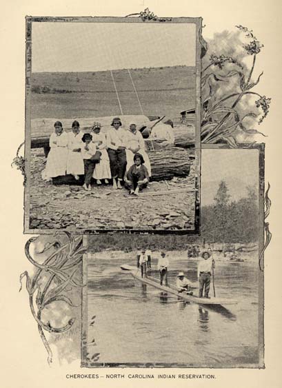
CHEROKEES--NORTH CAROLINA INDIAN RESERVATION.
Page 356
with a few small bodies of more sandy and barren pine lands. It lies on the western margin of the long-leaf pine region, its southeastern half being characterized in its general features by the same soils and growth as the average of that belt, while along the northwestern margin the lands are more hilly and the piny belts are alternated along the streams and more hilly portions with oak and pine forests and gravelly loam soils. There are tracts of quite sandy soil in the eastern section, while in the middle section are large bodies of pine flats.
Johnston is one of the most prosperous counties, as, besides its large cotton crop, the grain product reaches nearly 500,000 bushels, and its crop of potatoes exceeds 200,000 bushels. Cotton is the principal crop of the county, and prospers in almost all parts, especially on the broad belts of bottom lands lying along the Neuse river, Swift creek and other streams.
Until recently cotton has been the only money crop, but lately the people have learned that the soil is splendidly adapted to the growth of the brightest tobacco, and its culture is spreading rapidly. Hundreds of acres are being set this year in tobacco; last year many who had never grown it before realized $100 an acre from its cultivation.
The growing of truck for northern markets is an increasing and profitable industry along the railroads. Along the streams are large quantities of hard wood and furniture timbers, which are in great demand; much ash, oak, poplar, maple and gum is being shipped to furniture and veneer works.
The county is traversed from east to west by the North Carolina railroad, from north to south by the "Short-cut" line from Wilson to Florence, S. C., and is penetrated by the Midland railroad, extending from Goldsboro to Smithfield, a distance of twenty-five miles. The navigation of the Neuse river has been opened as far as Smithfield for steamboats, but is not kept regularly open, and the markets are sought through the railroads.
Smithfield is the county seat, and has a population of 550. Clayton has a population of 478, Selma of 527, Boon Hill of 243, and Pine Level of 264. All those last mentioned are on the North Carolina railroad. Kenly has a population of 245; Four Oaks, 260; Benson, 257. These villages are on the Short-cut. Wilson's Mills, Bagley and Jerome are stations at which large saw mills are established, but they are not incorporated towns.
Johnston county has 486,546 acres of land, valued at $1,825,909; and 971 town lots, valued at $223,231.
Of domestic animals there are--horses, 1,587; mules, 2,261; goats, 3,487; cattle, 11,338; hogs, 40,805; sheep, 7,381.
Product of taxation--for State uses, $6,923.20; pensions, $1,485.71; schools, $13,486.97; county, $10,535.94.
Population--white, 19,917; colored, 7,322; total, 27,239.
JONES.
This county is bounded on the north by Craven, on the south by Onslow, on the east by Carteret, and on the west by Duplin.
Page 357
It has two railroads, the Atlantic and North Carolina and the Wilmington, New Bern and Norfolk, and one navigable river running through it. It also has rich beds of marl and phosphates, with a good fertile soil that yields abundantly all the crops that are grown anywhere this side the Mississippi river, and the people are generally happy and contented.
A great tract of swamp land lies between the Neuse and the White Oak rivers, a large, or the largest portion being in Jones county, and is crowned with a number of small lakes, one being quite large, covering an area of five miles or more, and the others are a little less in size. This region is covered with an inestimable amount of the finest timber of all kinds known in this section of the State. And there is still another important feature to be considered. The pocoson that lies between these two rivers runs northwest and southeast to very near the Duplin line for twenty-five miles, with an average width of about eight miles of as rich land as the Mississippi Valley, and around the lakes covered with a growth of the finest quality of timbers known here. There is still another pocoson known as the Dover pocoson, lying between the counties of Jones and Craven on the Atlantic and North Carolina railroad, which is very fertile and heavily timbered.
The soils of this county are of two kinds--the one a light loamy soil, more or less mixed with sand, with a subsoil of gray clay, easy of cultivation, returning good crops of cotton and grain, and an excellent soil for truck farming. It also produces excellent bright tobacco. The other is a heavy loam, underlaid with a substratum of stiff red clay, producing abundantly cotton, grains or tobacco. The fertility is largely due to the presence in the soil of decomposed shells or carbonate of lime. This material is also found undecomposed, in solid masses, often outcropping above the soil and providing an easily accessible building material or material for burning into lime.
Trenton is the county seat, and has a population of over 400.
Jones county has 220,754 acres of land, valued at $729,754, and 630 town lots, valued at $54,049.
Of domestic animals there are--630 horses; 725 mules; 503 goats; 4,102 cattle; 11,304 hogs, and 3,028 sheep.
Product of taxation--for State purposes, $2,239.69: pensions, $455.66; schools, $3,809.90; county, $5,600.32.
Population--white, 3,885; colored, 3,518; total, 7,403.
LENOIR.
Lenoir county lies on the lower course of the Neuse, east of Wayne. The northern half consists of level piny uplands of the same general character as those of the counties adjoining it on the north, while in its western and northern parts there are wide tracts of level semi-swamp lands, which are characterized by a dark fine loam of great fertility. The southern half of the county, south of the Neuse, is characterized generally by a more sandy soil. The water courses in this half of the county are also bordered by cypress and gum swamps, and, to some extent, by oak and pine flats. Shell marl
Page 358
(blue), chalk marl and green sand are all found in this county--one or the other in almost every neighborhood. The face of the country may be described as level, though there are some portions where the land is rolling.
On the north side of the Neuse there is a section of country extending from Wayne on the west to Falling Creek on the east, a distance of about ten miles, and known as Buckleberry pocoson. From the river to the foot of the hills where the piny-woods region begins is from four to five miles wide. This section embraces what may be properly called the Valley of the Neuse, and is sufficiently elevated above high water to be free from overflow. The soil is of a brown or snuff color, and is very fertile; producing from 300 to 500 pounds of lint cotton to the acre, and averaging thirty to forty bushels of corn per acre; and also makes fair crops of wheat. The surface soil is rich in humus and the clay sub-soil only five to eight inches from the surface. This is an ideal condition and is capable of the highest improvement.
East of this section, on the same side of the river, is a region known as the "Neck," being situated between Moccasin and Neuse rivers; it is very fertile, and extends from Falling creek on the west to Pitt county on the east--a distance of eighteen or twenty miles. This is the finest portion of the county. North of this valley is the piny-woods region, which extends eight or ten miles to Greene county. This soil is not so fertile, but is of fine quality, and will produce the highest grades of fine yellow tobacco, and other crops if properly treated. On the south side of the Neuse, the soil is not so fertile, is more sandy, but of such character as to be capable of being brought to a high state of cultivation. It is more sparcely settled than the north side.
The question of proper water for drinking purposes has been settled by the driven-well system. Excellent water for table is found at thirty to thirty-five feet from the surface.
Cotton is the great staple. The soil is well adapted to the cultivation of corn and all other cereals; also Irish and sweet potatoes. All the fruits of the temperate regions can be successfully grown, and the cultivation, if made a specialty, would be attended with profit. There are no lands in the entire State of North Carolina better adapted to the cultivation of bright yellow tobacco than the lands of Lenoir county. Owing to the great prosperity of this county, land is in demand. There is a high order of intelligence among the farming population, and they are well abreast with the recent improvements in farming and are well informed in agricultural chemistry. They take rank with the most successful farmers of the South. Their lands are scientifically cultivated, and their farms are models of neatness.
The Atlantic and North Carolina railroad traverses the county, giving access to all the markets; and this facility has given an impetus to truck farming, for which soil and climate are well adapted, and all the early vegetables cultivated on the shores of navigable waters are sent to market from Lenoir with equal facility and profit.
Page 359
The Neuse is navigable to Kinston and for a few miles above, and is navigated by regular lines of freight steamboats.
Kinston, the capital, is situated on the Neuse river, and also on the Atlantic and North Carolina railroad; and is also the southern terminus of a branch of the Wilmington and Weldon railroad, extending from Weldon via. Scotland Neck, a distance of 112 miles. Kinston is a considerable cotton market, and forwards annually between 10,000 and 12,000 bales. The population is 1,800; La Grange has a population of 800.
Lenoir county has 241,183 acres of land, valued at $873,797, and 854 town lots, valued at $345,451.
Of domestic animals there are--1,293 horses; 1,316 mules; 3,784 cattle; 18,175, hogs; 1,069, sheep and 820 goats.
Product of taxation--for State use, $4,173.33; pensions, $874.35; schools, $7,443.62; county, $10,705.20.
Population--white, 8,517; colored, 6,362; total, 14,879.
LINCOLN.
Lincoln county, named for Gen. Lincoln of Revolutionary fame, lies south of Catawba county and west of the Catawba river, and its features, agricultural and topographical, are those of that county, and may be described in nearly the same terms. Its territory is drained by the parallel courses of the numerous tributaries of the South Fork of the Catawba. The average elevation is nearly 1,000 feet above sea-level. In its middle and eastern portion along the Catawba river are north and south zones, several miles in breadth, of red-clay soils, with oak and hickory forests. For the rest, its forests are mixed oak, pine, walnut, ash, maple, dogwood, cherry, birch and poplar, and its soils are gray and yellow gravelly loams. The eastern side of the county is hilly near the river.
This county, once one of the largest in the State, has been so reduced by the formation of Catawba and Gaston counties from its territory as to be one of the smallest. It, however, retains much of its former consequence, owing to the productiveness of its soil, the variety of its crops, the value of its ores, and its fine water-power and consequent adaptation to the uses of manufactures.
It produces tobacco of good quality and in considerable quantity, and a cotton crop of about 4,000 bales, besides wheat, corn and other grains. It is naturally the home of the grape, and it is here the celebrated Lincoln grape had its origin. It has been long noted for its productive iron mines, producing the best grade of magnetite, which have been worked since ante-Revolutionary days. It has abundant water power, both from the main stream of the Catawba river and from the South Fork of the same stream, and upon both of them are large cotton factories. The first cotton factory south of the Potomac was at the Laboratory (Rhyne) site, and much of the machinery was made by native mechanics. There are now seven cotton and two woolen mills in the county.
There is a roller flour mill, lime quarries, and a number of gold mines, two of which are in active operation at this time. There is a
Page 360
bold vein of manganese crossing the county from north to south, and fine quarries of granite and soapstone. There are also several noted mineral springs--"Lincoln Lithia" and "Old Catawba." These waters are famed for their medicinal properties.
Lincolnton is the county seat, and has a population of 975. It is on the Carolina Central road, which is here intersected by the Chester and Lenoir Narrow Gauge railroad, thus giving the town and the county ample facilities for travel and transportation.
Lincoln county has 183,253 acres of land, valued at $1,043,431 and 374 town lots, valued at $139,605.
Of domestic animals there are--horses, 1,522; mules, 1,640; cattle, 4,808; hogs, 6,856; sheep 1,789.
Product of taxation--for State uses, $4,065.49; pensions, $801.57; schools, $6,450.96; county, $9,293.67.
Population--white, 10,028; colored, 2,558; total, 12,586.
MCDOWELL.
McDowell county lies on the eastern flank of the Blue Ridge, near its highest parts, which exceed in this region an elevation of 5,500 feet, and its territory may be described as mountainous. Its average elevation is more than 1,500 feet, and it is for the most part drained by the headwaters of the Catawba river. The southern and broader end of its triangular territory is traversed east and west by the South mountains, a long eastward projection from the Blue Ridge. Along the course of the Catawba river and some of its chief tributaries are wide tracts of sandy and alluvial bottoms, which are very productive. The hilly and mountainous tracts have the usual variety of gray and yellowish oak uplands soils of medium fertility and mixed forests of oak, pine, chestnut, etc. Reddish clay loam soils, with a preponderant oak forest, are found in patches here and there in the middle and southeastern sections. A large proportion of the soils of the county are well adapted to the better grades of tobacco, and the agriculture of the county has the great advantage of an abundance of limestone in the northern and middle sections. The forests abound in large quantities of the finest timber; walnut, oak, poplar, chestnut, pine and locust being the chief varieties. There is a large amount of valuable timber on the slopes of the Blue Ridge and in the mountain coves, which must become the foundation of important manufactures, and then there is an indefinite amount of water-power.
Col. H. C. Demming, Secretary and General Manager of the Marion Bullion Company, gives the following in regard to mines and minerals:
"In the townships of Brackett, Dysartville and Old Fort, corporations known as the Marion Bullion Company and the Marion Improvement Company have been operating during the past 11 years. They have erected machinery, and adapted labor-saving appliances from time to time, until now their various operations do the work of more than 1,500 men. The pay-roll in addition, numbers from 5 to 100 hands, depending upon the men and character of work, and the season of the year. The principal operations are gold mining by placer,
Page 361
sluice washing and hydraulic; also quartz mining,--more than thirty veins have been opened. The total output of the properties from the first mining more than sixty years ago is estimated at $1,176,000. In addition there has been a large quantity of mica mined, and five veins have been opened. Monazite has been extensively mined, most of the mineral going to Europe. In addition they have been mining quantities of garnet, white granite, flagstone, vitrified brick clay and many gems--the total product in gems amounting in value to $66,000 May 1, 1896. During 1895 and 1896 thirty-three small diamonds were found, also a number of rubies and sapphires from corundum deposits, which have also been mined to some extent. The companies have recently had classified 156 species of minerals found on their properties. Exhibits from mines--almost altogether of gems--received highest awards both at the Columbian Exposition, Chicago, 1893, and at Atlanta, Georgia, 1895."
Considerable attention has been given to the culture of tobacco, a clear, bright tobacco of fine texture being produced. The chief crops are corn, wheat, oats, rye and buckwheat, and in the matter of fruits, apples of fine flavor and size are conspicuous. All fruits do well, but the winter apples cannot be excelled.
Fine bottom lands are found along the Catawba river, which rises on the mountain sides of this county, and thence flows through the county in a continuity of broad fertile valley. Other fine valleys are those of Turkey Cove and North Cove. Besides the Blue Ridge on the north and west, the South mountains and their continuation lie on the south side of the county, and continue to be, as they have been for more than half a century, productive fields of gold placer mining.
The Western North Carolina railroad passes through the county, and the Charleston, Cincinnati and Chicago road is complete as far as Marion, and gives new and independent connections east and south.
Marion, the county seat, now has a population of about 1,000. It is the trading center of the county and of the counties of Yancy and Mitchell, it being their nearest railroad point. It has improved rapidly for the last year or two and is still improving. A bank has begun business in the last few months, and a furniture factory and a locust pin factory are now being erected in the town.
It is especially adapted for all kinds of wood-working factories on account of the cheap timber and good railroad facilities. The great number of trees, the bark of which is used in tanneries, makes it especially favorable as a location for a tannery. It now has two tanneries, a tobacco factory, a rectifying establishment and several minor industries.
Old Fort, at the foot of the mountains, before the Revolutionary war the seat of a fort planted there to hold the Cherokee Indians on the other side of the mountains, is a summer resort, has some manufactures, and a population of 300.
McDowell county has 309,265 acres of land, valued at $608,801; and 1,360 town lots, valued at $104,732.
Of domestic animals there are--648 horses; 974 mules; 1,461 cattle; 6,588 hogs; 1,817 sheep.
Page 362
Product of taxation--for state uses, $1,999.45; pensions, $453.71; schools, $4,891.19; county, $12,705.24.
Population--white, 9,114; colored, 1,825; total, 10,939.
MACON.
Macon county extends from the South Carolina and Georgia lines, on the south, northward to the southern boundary of Swain county. It lies between the Cowee range on the east and the Nantahala mountains on the west, while along the southern border stretches the Blue Ridge, here assuming bold, precipitous, and picturesque forms, the precipices of Whitesides, Black Rock, Fodder Stack, Satulah and Scaly breaking down towards the south with perpendicular faces, of a depth of from 1,000 to 1,500 feet. The highest peak in the Cowee range is the Yellow mountain, 5,133 feet high. The Nantahala mountains are a majestic range, beginning with Pickens Nose, 4,926 feet high; thence extending northward with a uniform general height of about 5,000 feet, the highest point being the Wayah, near where the State road crosses the Gap at a height of 4,138 feet, that mountain being 5,494 feet in height. Between the Tennessee river and its tributary, the Cullasagee, a range extends northward from the Blue Ridge, terminating near the confluence of these streams, the highest point of which is the Fish Hawk, 4,749 feet. Numerous shorter spurs project at right angles from the main chains of Cowee and the Nantahala, between which are streams of ten or twelve miles in length flowing through broad and fertile valleys. The chief of these are Cartoogajay, Wayah, Cowee and Ellijay.
The Tennessee river is the principal stream, rising in Georgia, near Rabun Gap, and flowing northward through a fine valley of great fertility, until it unites with the Tuckaseegee. The current of this stream is more gentle than any found among the mountains, and the fall is so gradual that it is selected as a railroad route, the grade not exceeding forty-seven feet to the mile through the whole length of Macon county. The valley of the Tennessee is in cultivation, the whole being very fertile.
The next largest stream is the Cullasagee, or Sugar Fork of the Tennessee. This stream has a tumultuous course, rising on the high plateau of the Highlands, 4,000 feet above sea-level, and cutting its way down to the level of the Tennessee through the opposing mountains in a series of rapids, cascades and catracts, adding greatly to picturesque effect, but, except as water-power, adding nothing of economical value until it approaches the Tennessee, within eight or ten miles of which it opens into a very fertile and prosperous farming section. Nantahala is a beautiful mountain stream, having its bed in a trough on almost the top of the Nantahala mountains, the depression between that range and the Valley river or Tusquittah mountains being very small.
The area of open land, assimilating in character to the features of the Piedmont country, is greater than in any other western county. Farms are more numerous and more continuous, and population more dense. The soil is productive.
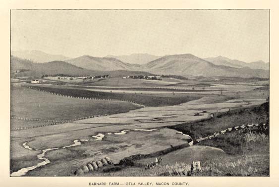
BARNARD FARM--IOTLA VALLEY, MACON COUNTY.
Page 363
The chief crops are wheat, corn, rye and oats, and grass grows luxuriantly wherever seeded, on hill-side or in valley. Some tobacco is raised--once quite largely--but it has now ceased to be a market crop.
Minerals are abundant, but no mines are worked except those of corundum and mica. The former, near the Cullasagee, are worked extensively, the product being about thirty tons a month. Mica is mined extensively in several localities.
Franklin is the county seat. Its population is 500; it occupies a prominence above the Tennessee river and the situation is picturesque; the climate and water can not be excelled.
Highlands is a new village established by northern settlers as a sanitarium, on the crest of the Blue Ridge, on a broad plateau, at an elevation of 3,750 feet above the sea. It is thriving, and has a population of about 500, representing thirty-one States and Territories.
Macon county has 301,270 acres of land valued at $710,842; and 322 town lots valued at $93,740.
Of domestic animals it has--1,710 horses; 968 mules; 7,525 cattle; 8,738 hogs; and 8,217 sheep.
Product of taxation--for State uses, $2,555.91; pensions, $551.32; schools, $4,755.10; county, $6,543.72.
Population--white, 9,436; colored, 666; total 10,102.
MADISON.
This county lies north of Buncombe, which is its southern boundary. The Smoky mountains separate it on the north from Tennessee, Yancey county bounds it on the east, and Haywood on the west.
The county is essentially a mountain territory. There is but little of valley lands, nearly the whole surface being traversed by ranges of mountains, ranging from 2,500 to 4,500 feet above sea-level. None of them rise to the stupendous height they attain in the adjoining counties of Yancey and Haywood, the Great Smoky range even being depressed below its average height. But though mountainous, almost the whole soil is of surpassing fertility. In few counties does the timber attain such vast dimensions, and in some favored localities its size might appear fabulous. On the Laurel river walnut eight feet in diameter, poplar ten or twelve, wild cherry three or four, buckeye of the same, black birch of the same size and of proportionate height, are the common growth of the county. And to them may be added other trees too many in variety to enumerate.
From such exurberance of soil much of agricultural prodigality of wealth might be expected. Nor is there disappointment in expectation, though from absence of the means of transportation agricultural effort was limited to the production of little more than the necessaries of life until the discovery that these mountainous hills had peculiar adaptation to the production of superior tobacco. For ten years or more Madison county has been foremost in the production of a very superior bright yellow tobacco. The impulse given by its culture has had marked effect upon the condition of the county. Land held at nominal prices has increased in value. Mountain sides and
Page 364
tops that seemed destined forever to wear their vesture and crown of forest have been brought into cultivation. Men that ten years ago scarcely knew the sight or name of money have become prosperous and relatively rich, and the county is now one most forward in improvement.
The soil is prolific in other products. All the grains yield well, and the grasses flourish in remarkable luxuriance, stock-raising being a very considerable source of revenue which might be indefinitely enlarged.
The mineral wealth of the county is known to be great, but is undeveloped. Magnetic iron and other ores of the same metal are found in numerous localities. Corundum of good quality is found on Ivy river and tributaries. Barytes is mined to some extent below Marshall. Lime exists in a vein of half a mile in breadth, exhibiting itself in lofty and picturesque cliffs a mile below the Hot Springs.
The French Broad river bisects the county, passing through it a broad roaring torrent between precipitous hills encroaching so closely upon the river as to leave little room for human habitation or enterprise. Laurel river and Ivy river both come in on the right bank, large bold streams, each cutting its way through the mountains, presenting characteristics similar to those of the French Broad and equally unavailable as water power.
The tobacco crop is annually about two and a-half million pounds, a large proportion of which is bright yellow. It is marketed chiefly at Asheville, and to some extent at Lynchburg and Danville.
The Paint Rock branch of the Western North Carolina railroad, winding through the confined gorge of the French Broad river, gives ready access to market, and is now one of the great highways of continental travel.
Marshall, the county seat, is situated in a narrow strip of land between overtopping hills and the river, with a breadth of less than a hundred yards and a length of less than half a mile. It has a population of about 300, active and enterprising, and is the centre of a large tobacco business, there being here two tobacco sales warehouses.
Hot Springs, sixteen miles below Marshall, is the most noted spot in the county, celebrated for its warm baths, its extensive hotel, and the beauty of its surroundings. Its importance is confined chiefly to its character as a health and pleasure resort.
Madison county has 267,405 acres of land, valued at $1,161,705; and 171 town lots, valued at $60,741.
Of domestic animals there are--1,814 horses; 1,602, mules; 8,010 cattle; 9,939 hogs, and 4,770 sheep.
Product of taxation--for State uses, $3,789.06; pensions, $871.43; schools, $8,286.84; county, $15,374.86.
Population--white, 17,095; colored, 710; total, 17,805.
MARTIN.
Martin county has an area of 500 square miles. Williamston, its county seat, is situated on the south bank of the Roanoke river, which forms the northern boundary of the county, and has a population of 800.
Page 365
On the bank of the same river stands Hamilton, thirteen miles above Williamston, with a population of 785, and Jamesville, eleven miles below Williamston with a population of 400. Robersonville, Everetts and Parmele are towns within the county situated on the line of the railroad.
The county is well watered by numerous creeks and other streams, which for the most part drain it northward into the Roanoke river. Along the Roanoke and some of its tributaries are extensive bottoms or alluvial lands, and at the heads of its tributaries are considerable tracts of swamp lands, which are as fertile as any lands in the State. Many of the bottom or alluvial lands are covered with a dense growth of reeds making them the best of cattle ranges, and often keeping the cattle fat as late in winter as January. The larger part of the territory of the county belongs to the region of level piny uplands having a sandy loam soil. The higher ridge land near the river has generally a lighter and more sandy soil. All of the timbers and woods common to the eastern piny region of the State are found in abundance, while the swamp lands along the river furnish every variety of swamp growth.
The agriculture of the county corresponds in its main features to that of the adjoining counties, and its uplands are as fertile, though it has not as much low, flat swampy land. Because of its large and profitable lumber industry in the great cypress swamps of the Roanoke and its turpentine forests and fishing interests, its agriculture is less advanced. Its waters abound in fish and its forests in game. The fisheries of the Roanoke are extensive and valuable.
Cotton, peanuts, corn, tobacco, oats and every variety of grain grow well on its soil. Its lighter sandy soils are fine for trucking, while on its stiffer lands clover and grapes grow finely. Grapes and all kinds of fruits may be raised with little effort. Marl is abundant and is used to a moderate extent.
The county has good railroad facilities. The Albemarle & Raleigh railroad, now a part of the Tarboro branch of the Wilmington & Weldon extends through the county a distance of thirty-five miles, and the Scotland Neck branch a distance of sixteen miles. These roads, with the river, which is navigable for any boats which can enter the sounds of the State, give good shipping advantages. There is perhaps not a home in the county distant more than ten miles from a depot.
Martin county has 297,676 acres of land, valued at $1,026,134, and 655 town lots valued at $214,677.
Of domestic animals there are--1,110 horses; 918 mules; 237 goats; 6,152 cattle; 18,574 hogs, and 2,694 sheep.
Product of taxation--for State use, $4,263.83; pensions, $870.26; schools, $7,431.68; county, $7,270.12.
Population--white, 7,838; colored, 7,383; total, 15,221.
MECKLENBURG.
Mecklenburg county is located in the Piedmont Plateau region, and is bounded on the south by South Carolina, and on the west by the Catawba river. The county was originally largely settled by
Page 366
Scotch, with Irish, German and English intermingled. The elevation varies between 600 and 900 feet, the average being about 700 feet above the sea. This is one of the largest and most productive, as well as one of the most populous, counties in the State, A considerable portion of the territory of this county belongs to the class of red-clay lands which were originally covered with heavy forests of oak--pine coming in as a constituent of the forests only on the summits of the ridges and divides between the streams, where the soils are gray and yellow sandy loams. The higher portion of the county, which lies along the water-shed between the Yadkin and the Catawba in a north and south direction, belongs, in the main, to the latter class of soils, but has here and there small tracts of red clay. This county shows a large product of cotton, ranking third in this respect; and also produces corn and the small grains on a large scale.
Gold and copper mining are important industries in several sections of the county. The principal minerals are gold, silver, copper, soapstone and barytes. For over fifty years the gold mines have been famous for their yield of rich ores. A large capital is now invested in these mines, some of which are being successfully worked.
The numerous railways entering the county, and all centering in Charlotte, have stimulated all industries and encouraged all enterprises. Agriculture has advanced with the encouragement of ready markets and promoted by the operations of the stock law. Good roads facilitate the work of the farmer in his resort to the market, and have advanced materially the value of rural property. This county leads in the cause of "good roads" and really good Macadam roads radiate from Charlotte. The railroads also radiate from Charlotte in all directions. The first built is the branch of the South Carolina road, now known as the Charlotte, Columbia and Augusta road; then the North Carolina road, of which Charlotte was the western terminus, and which is now a part of the Southern system--one of the great through lines of travel and traffic; and this line is extended to Atlanta, going from Charlotte through the southwestern part of Mecklenburg, and developing greatly the resources of a country before much secluded. The Carolina Central, beginning at Wilmington, passes through Charlotte, to find its present terminus at Rutherfordton, thus giving Charlotte another east and west line; and the Atlantic, Tennessee and Ohio road, connecting at Statesville with the Western North Carolina, a branch of the Southern, makes additional valuable connections and develops another part of the county. Charlotte is also directly connected with the new line recently opened from Monroe to Atlanta, and thus is provided with railroad facilities unequalled in North Carolina. The effect, not only upon Charlotte, but the whole county, has been very great; and no city and no county exibits more solidly attained or more permanently secured prosperity.
Mecklenburg is historically a very interesting county by reason of the "Mecklenburg Declaration of Independence" which was adopted more than a year (May 20, 1775) prior to that by the Congress at Philadelphia (July 4, 1776); and this event is annually celebrated at Charlotte, and May 20 is a State holiday.
Page 367
Charlotte, the county seat, has by recent police census in the city and suburbs a population of 19,650. The city is well laid out, has well-paved streets, lines of electric street cars, electric lighting, water works, sewerage, telephone exchange, public parks, and all the conveniences and necessities of healthy corporate existence; has numerous and elegant churches, schools, opera-houses, capacious and elegant hotels, a United States Assay Office, an elegant public building for Federal courthouse and postoffice.
Charlotte is a manufacturing centre, among the more prominent, the following plants may be mentioned:
Ada Manufacturing Co., yarn mills, capital stock $128,600, spindles, 8,000; Alpha Mills, capital stock $100,000, spindles, 6,500; Atherton Mills, capital stock, $175,000, spindles, 10,000; Charlotte Cotton Mills, capital stock, $131,500, spindles, 9,000; Victor Cotton Mills, capital stock $150,000, spindles 11,616; Louise Mills, capital stock $200,000, spindles 10,000, in course of erection, has paid $10,000 and will begin business with 5,000 spindles; Highland Park Manufacturing Company, capital stock $198,000, spindles 6,000, looms 410; Myrton Hosiery Mills, capital stock $45,000; The Lidell Iron Works Company, capital stock $100,000; Mecklenburg Iron Works, Southern Card Clothing Manufacturing Company, Mecklenburg Roller Flouring Mills; Q. A. Robins & Co., sash, cord and clothes lines; Park Manufacturing Company; Crowley's Mills; Charlotte Clothing Manufacturing Company; Dixie Pants Company; Charlotte Trouser Company; North Carolina Cotton Oil Company, capital stock $50,000; Charlotte Oil and Fertilizer Company, capital stock $200,000. Will soon have under contract a new court house to cost $50,000. The City Building cost $50,000. Charlotte has a crematory now in operation.
Davidson College, the seat of the college of that name, has a population of 500, Matthews of 350, Huntersville of 450.
Mecklenburg county has 324,648 acres of land, valued at $2,465,474, and 2,974 town lots, valued at $3,023,155.
Of domestic animals there are--2,863 horses; 3,987 mules; 9,748 cattle, 11,576 hogs; 1,393 sheep; 151 goats.
Product of taxation--for State uses $19,823.24; pensions, $3,565,74; schools, $27,227.07; county, $71,198.55.
Population--white, 23,141; colored, 19,532; total, 42,673.
MITCHELL.
Mitchell county lies between the Blue Ridge on the south and east, and the Roan and Iron mountain on the north, the west having a conventional boundary. The whole county is to a great degree mountainous, there being little valley formation except on the upper waters of the Toe and Linville rivers. The highest mountain is the Roan, which rises to the height of 6,334 feet. The north Toe river is the principal stream flowing out of the State under the name of the Nolechucky and one of the main affluents of the Holston river in Tennessee. The Linville river flows southeast into the Catawba.
Page 368
The soil of Mitchell is mostly fertile, the timber of large size and of great variety. The cereals grow to great perfection. Apples, peaches, pears, cherries and grapes are of great excellence, and much of the land proves well adapted to the production of very fine tobacco. The grasses flourish, and cattle are reared for maket in considerable numbers.
The mineral products of this county are confined at present to mica and iron; copper and other metals have been found. The famous Cranberry mines are in the northeastern corner of the county, and now extensively worked. They are connected by railroad with the Norfolk and Southern railroad at Johnson City, Tennessee.
The mica mines are the most extensive in the United States, and produce a large proportion of the mica put on the market. The most productive mines are those once worked by an aboriginal race.
Tobacco of fine quality is grown to considerable extent, the average crop being about 50,000 pounds. The timber industry is a great and growing one.
In this county is the Roan mountain, 6,334 feet high, on whose long grass-covered summit is a fine hotel, made easily accessible, and one of the most, if not the most, elevated health and pleasure resorts in the United States.
Bakersville, the county seat, has a population of about 400, and Elk Park of 350.
Mitchell county has 194,119 acres of land, valued at $606,963, and 373 town lots, valued at $5,974.
Of domestic animals there are--1,723 horses; 533 mules; 6,583 cattle; 5,806 hogs; 8,087 sheep.
Product of taxation--for State use, $1,987.69; pensions, $475.60; schools, $4,324.52; county, $6,381.26.
Population--white, 12,252; colored, 555; total, 12,807.
MONTGOMERY.
In its topographical features, Montgomery county may be described in nearly the same terms as Chatham. Several low chains of mountains or high ranges of slate hills cross the county in a direction nearly north and south. The county is drained by the Yadkin river and two of its chief tributaries--the Uwharrie and Little rivers. Its territory therefore, in river sections, is quite broken in surface. Its soils are mostly sandy and gravelly loams with occasional tracts of red clays. Centrally and extending to and along the eastern border there are large bodies of valuable long-leaf pine timber, while the other sections abound in hard woods. In the long-leaf pine section the soil is usually lean, but open and excellent for trucking and fruit culture, being much the same as that at Southern Pines, but a little better. From Troy across the county south is the cotton growing section, while the other sections are best adapted to corn, wheat and other cereals, grasses and fruits.
The water power of its rivers is very great, the Yadkin having a fall within the county of more than two hundred feet, and a force per foot of above three hundred and fifty horse power. There are many
Page 369
valuable gold mines, both vein and placer. One of the latest developments is a vein near Cotton Stone mountain, about four miles north, running from selected ore as high as $140 per ton. There are whole townships which show gold at every step, by use of the ordinary pan. Recent investigations have developed vitrified clay, kaolin, graphite, fine sandstone, coal and iron.
The growing scarcity of pine timber in the more accessible pine belt has led to the construction of two railroads into the county from Aberdeen on the Seaboard Air Line railroad; the Moore county railroad crossing Browning creek near the county line of Richmond county and taking the direction of Mt. Gilead; the Aberdeen and West End railroad to Camden and Star with a branch at the junction three miles below Star, seven miles to Troy, and the road is now being graded from Star to Ashboro, Randolph county and will be completed by January, '97, bringing the fresh forests into use and numerous mills into operation.
Troy is the county seat, and, including the township, contains 1,500 inhabitants. A cotton mill and sash and blind factory is now being built at Troy and other enterprises contemplated, inducing thrift and progress. Upon the completion of the enterprises now under way, Montgomery will have three cotton mills, numerous saw mills, roller mills, &c.
Montgomery county contains 314,100 acres of land, valued at $897,772, and 150 town lots, valued at $38,131.
Of domestic animals there are--805 horses; 995 mules; 152 goats; 1,300 cattle; 6,000 hogs; and 2,700 sheep.
Product of taxation--for State use, $2,727.95; pensions, $591.33; schools, $4,980.93; county, $3,611.02.
Population--white, 8,982; colored, 2,257; total, 11,239.
MOORE.
Moore county lies on the western margin of the long-leaf pine belt. Its middle and southern portions belong largely to the class of lands called "sand hills." The northern part of this triangular territory partakes more of the character of the oak uplands agricultural division, being very hilly and broken, with sandy and gravelly soil on the higher ridges, having a mixed oak and pine growth, and on the slopes of the hills partaking of the character of clay loams.
Near the middle (a little north of east), as well as in the southwestern region, and in the eastern one, are considerable bodies of level and rolling upland piny woods. These are the best cotton soils. The tributaries of the Cape Fear, which rise along the southeastern section of the county, are fringed with gum, cypress and juniper swamps, and on many of the streams, large and small, are patches, and sometimes considerable tracts, of alluvial "bottom" lands. The agriculture of the county is divided between cotton and grain crops, and recently the cultivation of peaches, grapes and small fruits has produced a lucrative diversion in the agriculture; but the lumber and turpentine interests are quite important, and there are yet large turpentine forests untouched.
Page 370
A broad belt of the "old sea-basin" runs diagonally through the county, having a warm, productive, but not enduring soil, yet favorable to cotton and grain and fruits. In this belt are found valuable qualities of sandstone, attractive in color, working easily, and very durable. Quarries of this material have been opened in several localities and the stone is being shipped all over the country.
Gold is found in considerable quantities in the western part of the county, and placer mining has been pursued with considerable success, the Cagle mines at one time attracting to them large numbers of miners and adventurers. Valuable quarries of millstone grit have long been worked and favorably known, and on the waters of Deep river are large deposits of finely grained and richly colored soapstone or talc.
The Cape Fear and Yadkin Valley railroad passes through the northeastern part of the county, and the Raleigh and Augusta Air-Line passes from northeast to southwest, following nearly parallel with the southeastern boundary of the county through its whole length, giving ample means for transportation, and stimulating the growth of frequent villages. A branch road of ten miles connects the Raleigh and Augusta Air-Line at Cameron with Carthage, the county seat.
At Carthage a short railroad has been built out into the forests, called the Carthage and Western railroad; pine timber is still abundant in this part of the county. The brownstone is inexhaustible, and several gold mines have recently been opened, with good prospects; there are indications of coal recently discovered; the lands here are adapted to the growth of orchards and vineyards, and water power is plentiful on both Deep and Little rivers.
Carthage has a population of 1,000, Cameron of 300, Jonesboro, on the Cape Fear and Yadkin Valley railroad, of 850, Manly of 150, Aberdeen of 965, Keyser of 150, and Sanford of 850. All these are new villages along the lines of the railroads. At Sanford two sandstone quarries are being worked, and a new line of railroad is projected uniting Lillington with Sanford.
In the southern part of the county there has been rapid growth followed by a healthy business development. The most notable points are Manly, Southern Pines, Pinehurst, Aberdeen and Keyser. From Aberdeen, on the Seaboard Air-Line, several short railroads have been constructed: the Aberdeen and West End, touching at Pinehurst and on to Troy in Montgomery county (38 miles); the Aberdeen and Rockfish road running east thirteen miles into Cumberland county; the Moore county railroad from Aberdeen in a south-west direction twelve into Montgomery county. Besides these six miles of road operated by electricity connect Southern Pines with Pinehurst. In two of the southwestern townships no less than 2,500 acres are set to peaches, grapes, and small fruits. Annual export of lumber from this section of the county, 35,000,000 feet.
Pinehurst and Southern Pines are health resorts, and the population is chiefly composed of northern and eastern people, who combine health-getting and fruit-growing with excellent results.
Page 371
Moore county has--499,706 acres of land, valued at $1,338,825, and 4,799 town lots, valued at $326,695.
Of domestic animals there are--1,604 horses; 1,187 mules; 856 goats; 10,380 cattle; 18,319 hogs; and 9,571 sheep.
Product of taxation--for State use, $5,362.31; pensions, $1,132.97; schools, $10,383.53; county, $10,393.83.
Population--white, 13,985; colored, 6,494; total, 20,479.
NASH.
The general topographical and agricultural features of Nash county correspond quite closely to those of Halifax, to which its situation is similar. It lies south of that county, and also on the borders of the oak uplands to which the western part of it belongs. It is drained for the most part by the Tar river, together with several large tributary creeks, along which are narrow strips of lowland of alluvial soil. A small portion of this lowland has been reclaimed and produces large crops of corn, the remainder is heavily timbered with its original forest. The divides between these streams through the middle and eastern portions of the county belong to the region of level upland piny woods. These soils are generally gray, of average fertility, and well adapted to the culture of cotton, tobacco, grain, peas, potatoes, grasses and clover. This county lies largely within the area of the most productive cotton and tobacco section of the State. Marl is abundant in the eastern section, but has not been extensively used. The county is well timbered. The long leaf and short leaf pine, red, white and Spanish oak, blackjack, hickory and dogwood are the predominant varieties on the upland. The red, white and Spanish oak, water oak, cypress, gum, ash, poplar and maple on the lowland.
The improved farms produce from three-fourths to one and one-fourth bales of cotton of 450 pounds, and from thirty to forty bushels of corn and twenty bushels of wheat to the acre. The unimproved from one-fourth to three-fourths of a bale of cotton, and from ten to twenty bushels of corn. No wheat is grown on the unimproved land worthy of mention. Dairy farming is also of some importance; from two farms on the gray land in the eastern portion of the county over 10,000 pounds of butter was made and sold last year: 6,000 bales of cotton were raised in the county last year, which is about one-half its former production. Of tobacco, 5,500 acres was planted in 1895, yielding 4,500,000 pounds. Within the past few years there has been rapid development in the cultivation of tobacco, the quality being a superior bright yellow. So encouraging is the success of the industry, and so suitable the soil, that tobacco has largely superceded cotton. Markets have been established near at hand--that at Rocky Mount having assumed large proportions. A new market was established last year at Nashville, and has been liberally patronized. Below are given the exact figures of the number of pounds and prices per pound of the tobacco sold on Rocky Mount market, from 1890 up to April 1st, 1896.
Page 372
| YEAR. | CROP IN POUNDS. | AVERAGE PRICE. | AGGREGATE. |
| 1890 | 425,000 | 15c. | $ 63,750.00 |
| 1891 | 1,125,000 | 12½c. | 140,625.00 |
| 1892 | 2,215,000 | 12c. | 265,800.00 |
| 1893 | 3,500,000 | 11c. | 385,000.00 |
| 1894 | 4,768,232 | 10c. | 476,283.20 |
| 1895 | 7,239,871 | 10⅕c. | 738,466.85 |
| 6 | 19,273,103 | 11.75⅓c. | $2,069,925.05 |
The above figures do not give the re-sales of "Pin Hookers," if they were added they would increase the amount fully one-half million pounds.
This county is especially favored in climate, location and transportation facilities. The Wilmington and Weldon road runs along its eastern border, with a branch from Rocky Mount to Tarboro and thence to Williamston; and the Albermarle and Raleigh railroad penetrates the county as far as Springhope. Rocky Mount has become a great railroad center, being the crossing point of the two great railway systems of the South, as well as the terminus of several smaller roads.
The river, at its falls, near Rocky Mount, affords exhaustless water power. It is here the Battle Cotton factory was erected about the year 1816--the first cotton mill built and operated in North Carolina--yet running with greatly added power and productiveness.
Nash county was once famous for its apple orchards and its apple brandy. The orchards have fallen into decay, and the brandy has little more than local reputation.
The gold formation which characterizes the northeastern corner of Franklin county extends over into the adjacent territory of Nash. The Arrington mine is the only one in active operation at present. The Argo Mining Co. is rapidly erecting additional machinery so as to give its milling plant a capacity of 120 tons of ore per day. This ore averages $7.50 per ton.
Nashville is the county seat, with a population of 500. Castalia has a population of 175; Springhope, 250; Rocky Mount, (the Nash portion) has a population of 500. Near this place is situated the Battle Cotton factory, and in the town are tobacco sales warehouses. An improvement company has recently made large investments in land within the corporate limits, and proposes to engage in extensive enterprises.
The county has 335,534 acres of land, valued at $1,965,256; and 680 town lots, valued at $296,554.
Of domestic animals there are--1,589 horses; 1,560 mules; 1,119 goats; 6,553 cattle; 23,416 hogs; 4,571 sheep.
Product of taxation--for State uses, $6,945.07; pensions, $1,399.13; schools, $11,462.80; county, $9,598.51.
Population--white, 12,186; colored, 8,521; total, 20,707.
NEW HANOVER.
New Hanover is one of the smallest, yet, perhaps, one of the most important counties of the State. Certainly this is true when its commercial
Page 373
importance is referred to. It consists of a triangular wedge between the Cape Fear river on the west, and the Atlantic coast on the east, with its narrow fringe of sounds, marshes and sand dunes. The margins of the streams and sounds are bordered in many places by strips of oak and pine flats, with a gray silty soil. There are tracts of alluvial and swampy river bottoms along the Cape Fear, which produce large crops of rice. These are cultivated in the usual overflow or irrigating process, adopted in rice culture long years ago. There are other lands especially valued for trucking and small fruit growing. The county contains the largest city in the state--Wilmington. This is an important seaport, and has a large foreign and domestic trade. The city was founded in 1725, and has been the seat of culture and refinement for more than a century. Its position south of the dangerous capes makes it a welcome harbor to storm-tossed seamen.
On the bar at present, at mean low water, there is a depth of 17.5 feet straight channel, or 18 feet crooked channel; from Wilmington to the bar we have from 16.7 to 18 feet at low water, with a rise of 4½ feet. This enables vessels drawing 21.2 feet to pass from Wilmington to sea, or vessels drawing 22.5 feet to cross the bar.
The lower waters of the Cape Fear are the only localities in which tidewater rice can be successfully cultivated, because here alone can the growing crop be flooded with the waters of a full freshwater river in combination with the flow of the tide from the sea. Rice has, therefore, for more than a century, been cultivated here, and its culture constituted the wealth of a body of planters noted for their intelligence, their social culture, their intellectual force and accomplishments, their courage and their public spirit.
The soil around Wilmington is most admirably adapted for truck farming, for fruit cultivation, for raising stock and for poultry. The soil is light and loamy, with a strong, rich clay subsoil, and every kind of vegetable, all the small fruits, pears, peaches, plums, etc. thrive and are profitably grown. The strawberry business alone engages the attention of many farmers, and besides providing for the local supply are shipped to northern cities during the season. Potatoes, asparagus, lettuce, tomatoes, blackberries, whortleberries, are only some of the sources of revenue to the truck farmer. The season here being about two weeks ahead of Norfolk, and following after the Florida crop is exhausted, enables the shipment of goods to advantage, realizing remunerative prices, with a home market to fall back upon when shipping becomes unprofitable. Wilmington has a first-class service to all northern cities, the railroads running through truck trains during the season; it is also in easy reach of the large cities of the west and northwest. Proper service in this respect is guaranteed, as the lines compete for the business, thus insuring reasonable terms and time.
The exceeding mildness of the winters, the cold weather not exceeding two months in duration, makes expensive sheltering of stock unnecessary, and it is only during that period that they are entirely dependent upon the barn for food. Grazing is possible during the
Page 374
other ten months of the year. The native grass (crab) furnishes good grazing and makes a fine hay. The feeding during the two months mentioned is comparatively inexpensive, as supplies can be had from a local oil mill of both cotton seed meal and cotton seed husks, furnishing a cheap and nutritious food. The raising of poultry can also be made successful and lucrative.
On the coast, and in the Cape Fear there are profitable fisheries, and oysters are also plentiful. This is a source of unending revenue. A half million pounds of fresh fish are now shipped yearly, but this does not include the shipments of shad (fresh) nor the immense quantity of mullet and other fish which are barreled and salted. A large shipping business is also done in oysters and clams.
Wilmington, the county seat, has, by the census of 1890, a population of 20,056. There has been considerable growth since that date. The city is situated on the east side of the Cape Fear, at the junction of the northwest and northeast branches of the river, assuring a deep, safe and commodious harbor, vessels able to cross the bar coming up directly to the wharves, a distance of thirty miles. The harbor is resorted to by vessels of every nation and from all the ports of the world. The exports are chiefly cotton, cotton goods, timber, lumber, naval stores, and numberless miscellaneous goods. Cotton is largely exported to European ports, chiefly in steamers. Naval stores are mostly transported in Norwegian and German vessels of the class of barks. Domestic or coastwise trade is carried on by lines of steamers and large schooners. There are annual fluctuations in business from various causes. The President of the Chamber of Commerce makes the following statement:
The receipts for the year ending March 31, 1896, compared with those of the year before, are as follows:
| 1896. | 1895. | ||
| Spirits | 46,553 | 45,954. | Increase of 599 bbls. |
| Rosin | 205,137 | 198,170. | Increase of 6,976 bbls. |
| Tar | 67,198 | 61,657. | Increase of 5,541 bbls. |
| Crude | 13,365 | 12,043. | Increase of 1,322 bbls. |
| Cotton | 165,977 | 235,296. | Decrease of 69,319 bales. |
Shipment of lumber, cotton, peanuts, cotton goods, pitch and shingles, for the year ending December 31, 1895, as compared with those of the previous year, are as follows:
- Lumber 35,888,031 feet, against 35,323,412 feet, increase of 534,619 feet.
- Peanuts 77,889 bushels, against 71,666 bushels, increase of 6,223 bushels.
- Cotton goods 2,266 bales, against 1,969 bales, increase of 297 bales.
- Pitch 2,965 barrels, against 3,099 barrels, decrease of 134 barrels.
- Shingles 4,763,000, against 5,091,963, decrease of 328,963.
The trade of our city is good and is improving. We have three substantial banks, who do all that the trade can expect of them. The railrords are doing better for us than ever before. Wilmington has been placed on the railroad tariffs as a South Atlantic port; and the railroads leading to such ports from the West give them better rates than ever enjoyed before.
Wilmington ranks as the seventh cotton port of the country, having steadily increased its handling of this staple for several years past. The cotton is shipped to all parts of Europe, as well as to northern cities. That which is shipped to foreign ports is compressed, the service of four large compresses being required to accomplish proper
Page 375
handling of the entire export. The cotton for domestic points is shipped by rail and steamship, sometimes compressed and sometimes in original bales, but all that for export is compressed and is shipped mainly in steamships carrying as high as 11,000 bales in one cargo.
In addition to the cotton trade, a large business is transacted in naval stores, this being one of the principal markets of the United States for that product. A large lumber business is done in Wilmington and in the country tributary to it. Between 20,000,000 and 25,000,000 feet of hewn timber and logs were received here last year. There are several large lumber mills in the city, whose product goes by rail to many interior points, and by vessel to both domestic and foreign ports. During the past year 105 steamships and 209 sailing vessels cleared from this port, with an aggregate tonnage of 162,247 tons.
Recently a coal supply depot has been located at Southport, twenty miles from Wilmington, at the mouth of the river, where steamers may call for coal, as well as a supply had for those bound to or from this port.
Wilmington has a direct line of steamers to New York, and it is the terminus of five separate railroads, the Carolina Central, under control of the Seaboard Air Line; the Wilmington, Columbia & Augusta and the Wilmington & Weldon, under control of the Atlantic Coast Line; the Cape Fear & Yadkin Valley, and the Wilmington, New Bern & Norfolk railroads. Besides these it has a railroad extending to the coast, which facilitates the handling of fish, oysters and other marine products, which are brought down the sounds in small craft.
Wilmington has advantages as both a winter and summer resort. There are two beaches within easy reach of the city, and daily steamboat connection with Southport at the mouth of the river. Fish and game are abundant in winter.
New Hanover county has 79,532 acres of land, valued at $615,055; and 4,266 town lots, valued at $4,784,993.
Of domestic animals there are--676 horses; 237 mules; 408 goats; 1,887 cattle; 2,579 hogs; and 148 sheep.
Product of taxation--for State use, $15,553.14; pensions, $2,660.65; schools, $18,718.57; county, $38,860.05.
Population--white, 10,089; colored, 13,937; total 24,026.
NORTHAMPTON.
Northampton county lies between the Virginia border and the Roanoke river. Its soils belong to the general region of level piny uplands, merging toward the western limit into oak uplands and a more hilly surface, with an elevation of 150 feet above sea-level. Its numerous streams have general fringes of oak flats, alluvions, or gum and cypress swamps, and the Roanoke river has in its extensive "bottoms" some of the best corn lands in the State.
The product of cotton in Northampton is large in view of its relatively high latitude, reaching annually between 10,000 and 15,000 bales. Corn has always been a leading crop, especially on the rich
Page 376
lands of the Roanoke, which, however, are seriously exposed to the disasters of occasional overflow. Only a small quantity of tobacco is now reported as being cultivated.
Northampton county is connected by railway by the Petersburg and Weldon railroad with Petersburg, Va., and by the Seaboard and Roanoke road with Portsmouth, Va., and it has good navigation down the Roanoke from the falls below Weldon. The first railroads built in North Carolina passed through this county.
Jackson, the county seat, has 750 inhabitants, Rich Square 650, and Woodland 250.
There is some attention given to the production of early truck for shipment, and peanuts are grown to some extent.
Northampton county has 319,241 acres of land, valued at $1,695,969, and 250 town lots valued at $93,695.
Of domestic animals there are--2,313 horses; 1,097 mules; 223 goats; 10,044 cattle; 25,582 hogs; 3,230 sheep.
Product of taxation--for State use, $7,017.51; pensions, $1,231.20; schools, $10,654.23; county, $8,707.82.
Population--white, 9,224; colored, 12,018; total, 21,242.
ONSLOW.
Onslow county resembles in large degree the adjoining counties of Carteret and Jones. Nearly one-half of the White Oak swamp lies in its northern section, and from it flow most of the streams by which the northern portion of the county is drained. Some of the best agricultural lands of the county lie along the margin of this swamp. A great part of it is drained southward into New river, which traverses the entire length of the county from north to south. This river, for one-half of its length, is a broad, navigable bay, from one to three miles wide, and is famous for its fine oysters and fish. On both sides of it are large tracts of upland piny woods, with gray sandy soils, which are admirably adapted to the production of cotton. Nearer the sea-coast the soils are more sandy, and are covered with long-leaf pines as their principal growth, a similar large tract occupying its northwestern section. There are numerous narrow fringes of cypress swamps along the various streams. A portion of the southwestern side of this county is penetrated by the Holly Shelter pocoson. The productions of this county are similar to those of Jones.
Jones and Onslow were settled early in the eighteenth century by French Huguenots and German Palatinates; their descendants to this day are fine types of both races; and the names of their ancestors are still preserved in their families. There is a large body of land lying in these two counties known as the White Oak swamp. It covers an area of eighty-six thousand acres. On its borders it is one of the heaviest timber tracts in the Atlantic States. The oaks are of huge dimensions, unknown in northern climes: the pines are of enormous girth, and frequently attain a height of one hundred and fifty feet, the poplars and cypress are also of huge dimensions. This body of swamp lands belong to the School Fund of the State. This region--an open savannah--affords immense pasture grounds of good
Page 377
succulent reeds. The Quaker Bridge road traverses this body of fine land.
The coasts of Onslow are lined with the "Banks," from which they are separated by sounds of from a half a mile to two miles in width, and of depth only navigable for small vessels. Through these banks, generally opposite a stream making out from the mainland, there is a break or inlet, with a shifting bar of from three to nine feet deep, and through this give access to the inner waters. Within the bars and up these streams is the great store of fish and oysters now engaging public attention and the care of legislation. The finest oysters on the continent are found here.
The soil of Onslow is productive in cotton, corn, peas, potatoes, and is especially favorable to the perfection of the ground-pea or peanut, which, in the decomposed shelly soils in the vicinity of the coast, claims the chief attention of the farmers and constitutes the most profitable crop.
The Wilmington, New Bern & Norfolk railroad connects the county with both Wilmington and New Bern.
Jacksonville, the county seat, contains 400 inhabitants and Richlands 200.
New river, lying almost wholly in the county, is perhaps the largest river in proportion to its length in the world, and is a stream of exceptional beauty among the eastern waters. Along it and its tributaries are fine bodies of pine and hard woods, and at Jacksonville, is located the large plant of the Parmele-Eccleston Lumber Co., one of the most complete equipments to be found in the State, with a daily capacity of some 125,000 feet. A few miles down the river from Jacksonville is the Glenoe Model Farm of Mr. Thomas McIntyre; this is a charming location and presents most vividly the possibilities of development for that whole region.
Onslow county has 320,439 acres of land valued at $975,493; and 183 town lots, valued at $60,810.
Of domestic animals there are--874 horses; 722 mules; 381 goats; 7,170 cattle; 19,550 hogs; 4,504 sheep.
Product of taxation--for State use, $3,318.56; pensions, $695.95; school, 5,933.29; county, $7,997.25.
Population--white, 7,392; colored, 2,911; total, 10,303.
ORANGE.
Orange county, historically, is one of the most interesting counties in the State. It was formed about the year 1752, and its healthfulness and the richness of its soil soon made it populous and prosperous. It took a very decided part in the troubles that led to Tryon's suppression of the opposition of the Regulators, and also in the war of the Revolution. It was in this county that Lord Cornwallis prepared himself for the struggle at Guilford Court House; and it was at its county seat (Hillsboro) that the convention to discuss the Constitution submitted to the States for ratification was held; and for generations the county was noted for the prominence of its public men.
Page 378
This county is at an elevation of about 600 feet above the sea. The climate is remarkably healthful and free from malaria. The winters are very mild and the summers are not oppressive. The county is rolling, and is well drained by natural streams. The products are corn, wheat, oats, cotton, rye, barley, grass, tobacco and potatoes. The soil is especially adapted to the raising of fine-grade tobacco, wheat, hay and potatoes. Cattle, horses, hogs, sheep and goats are easily raised and thrive here. Apples, pears, peaches, grapes, plums and figs grow in the greatest abundance and of fine quality. There is a large and growing industry in drying fruits and also in shipping them fresh to the northern markets. Deposits of gold and iron are found all through the county. The Iron mountain, near Chapel Hill, contains inexhaustible ores of excellent quality. Soapstone and whetstone quarries of the finest grain exist in large deposits.
The southeastern section of the county is drained by the tributaries of the Cape Fear river, and has a low, undulating tract of land, with gray and yellow sandy and clay loam soils and mixed oak and pine forests. The larger part of this county is characterized by oak forests and red-clay soils, with an intermixture in the poorer sections and on the slaty hills of short leaf pine. The region described as slate hills is characterized mainly by a gray gravelly loam soil. Cotton is cultivated to considerable extent, the crop reaching about 2,000 bales a year. It has long had pre-eminence, along with that of Anson county, of being the best upland cotton raised in the United States. Tobacco is a large and valuable crop, much of it being "bright yellow." The crop averages about 1,000,000 pounds annually.
The University of North Carolina is located at Chapel Hill, in this county.
At Hillsboro, in the old Military Academy, the Farmers' Alliance has established headquarters; a great tannery is being built, and also a large shoe factory. Other industries are to be added. At Hillsboro there is being built a cotton factory, and a barrel-stave factory is in operation. Near this place is the famous Occoneechee farm and dairy, the property of Mr. J. S. Carr. Mr. B. N. Duke has a fine stock farm near University Station. These are models in the way of farms and illustrate most forcibly the adaptability of the soil and climate to the highest forms of agriculture.
Hillsboro, the county seat is on the N. C. railroad, and has a population of 900. Chapel Hill, connected by rail at University Station, has a population of 1,000.
Orange county has 243,482 acres of land, valued at $1,106,515; and 423 town lots, valued at $254,125.
Of domestic animals there are--2,020 horses; 924 mules; 201 goats; 4,998 cattle; 8,493 hogs; 3,478 sheep.
Product of taxation--for State uses $4,490.45; pensions, $885.38; schools, $8,237.01; county, $8,041.75.
Population--white, 9,705; colored, 5,243; total, 14,943.
PAMLICO.
This county was formed from the counties of Craven and Beaufort. It is penetrated to the interior by an arm of Pamlico sound called Bay
Page 379
river, and also by a stream (Broad creek), both navigable for vessels drawing eight feet of water. It is washed on the south side by the waters of Neuse river, on the east by the Pamlico sound, and on the north by Pamlico river. By far the larger portion of the county is in forest, there being only about one-tenth of the land under cultivation.
The land mostly is very fertile, underlaid with shell marl which is found from two to eight feet below the surface. The soil is generally deep black and gray, the former from one to two feet deep and underlaid with a strata of stiff clay under which the marl may be found. The gray soil is from six to twelve inches deep, with a subsoil of clay underlaid by marl. Some portions of the county have sandy lands, which are generally timbered with long-leaf or pitch pine, still in its virgin or unbled state. The timber growth of the county includes pine, poplar, ash, gum, oak, holly, beech, maple, cypress and juniper; all good merchantable timber. The drainage of these lands is easy as innumerable small streams make out from the Neuse, Pamlico and Bay rivers, and also from Pamlico sound, which penetrate the heart of the forests with sufficient fall, ten to fifty feet, to effectively drain the lands for agricultural purposes. These lands are adapted to the growth of corn, cotton, potatoes, peas, tobacco, rice &c. The average of the following crops are well established; corn, eight to ten barrels; seed cotton, one to two thousand pounds, and potatoes, 200 to 600 bushels. The cleared lands sell from $40 to $100 an acre, while the forest lands, just as good, bring only from $5 to $20 an acre, according to location and market advantages. There are good schools and churches, accessible to every neighborhood. The citizens are hardy, intelligent and prosperous, and give a hearty welcome to all worthy new-comers.
There are three flourishing villages situated on Bay river--Stonewall, Bayboro and Vandemere. Bayboro is the county seat, and has a population of 300.
The county has no railroad, and depends for its transportation altogether on the water. But in this it has magnificent advantages, for its situation is nearly insular, and the broad estuary of Bay river nearly bisects it. This body of water is noted for its fine oysters, and all the shores abound in fish.
Pamlico county has 152,937 acres of land, valued at $408,208; and 157 town lots, valued at $28,415.
Of domestic animals there are--610 horses; 364 mules; 203 goats; 4,080 cattle; 8,947 hogs; and 1,482 sheep.
Product of taxation--for State use, $1,391.86; pensions, $330.03; schools, $2,982.16; county, $7,046.95
Population--white, 4,767; colored, 2,379; total, 7,146.
PASQUOTANK.
Pasquotank is a long, narrow strip of territory, parallel to Camden county, and is of similar topographical situation and agricultural features. It is bordered eastward and westward by two bay-like arms of the sound, Pasquotank river and Little river, both of which take their rise in the Great Dismal swamp. The upper and middle portions,
Page 380
therefore, belong to the general description of swampy land and semi-swamps. Near the streams there are generally strips of swamp proper, with gum, cypress and juniper forests, but farther from them are semi-swamps and oak and pine flats, with oak, hickory, short-leaf pine, ash, maple, black gum and holly. These lands are of great fertility. The southern end of the peninsula on the sound is, as usual, sandy, piny woods. Much cotton is produced, and lumbering still constitutes an item of consequence, as in all these Albemarle counties. Truck farming is also assuming large proportions, and the raising of early potatoes for the northern market has become one of the most profitable industries. All these Albemarle counties have unlimited facilities for transportation through their numerous bays, rivers and sounds, which are connected with Norfolk harbor through the Dismal Swamp and Albemarle & Chesapeake canals, and also by railway.
The great water facilities possessed by Pasquotank county, the existence of railroad communication, and also canal navigation through the Dismal swamp, both to Norfolk, and thence to the Northern cities, together with the favor of soil and climate, have given great impetus to truck farming, which, at many points, has superceded other agricultural interests. The same facilities of transportation give activity to the business of shipping fish on ice, and during the fishing season the animation is unceasing.
Elizabeth City, the county seat, has a population of 3,500. Favorably situated on Pasquotank river, at the head of navigation, also at the southern end of the Dismal Swamp canal, being traversed by the railroad from Norfolk to Edenton, it possesses advantages it is prompt to improve. Its commerce is large, and its lumber and fishing interest is very great, and the trucking business is likewise large and annually increasing in volume.
Work is now in progress, enlarging the old Dismal Swamp Canal into a ship channel, which, when completed, will give a new impetus to the commerce and business of the section. Lately attention has been turned to the culture of the cranberry, found wild in abundance, and which promises to become a source of revenue to the county. Locally, the trucking interest covers the interval between the New Bern and Norfolk crops, and good lands for the purpose may be had at less cost than at either of these points.
Pasquotank county has 136,960 acres of land, valued at $673,017, and 1,255 town lots, valued at $649,439.
Of domestic animals there are--1,713 horses; 473 mules; 473 goats; 3,987 cattle; 9,207 hogs; 1,731 sheep.
Product of taxation--for State use, $4,096.50; pensions, $804.83; schools, $6,440; county, $9,471.66.
Population--white, 5,201; colored, 5,547; total, 10,748.
PENDER.
Pender county is bounded in part on the south by the Atlantic Ocean, with its fringe of sounds, marshes, and dunes, and is drained southward by the waters of the northeast Cape Fear river. Holly Shelter pocoson occupies a large part of the southeastern section, and
Page 381
from it flow numerous creeks into the above mentioned river, while others flow directly into the Atlantic. The central portion and larger part of this great pocoson, which contains about one hundred square miles, is very nearly barren, but around its margin, especially toward the river, are considerable tracts of white-oak flats, canebrake, and swamp lands, with their characteristic growths and soils. In the northeastern section lies the half of another similar pocoson nearly as large, called Angola Bay, and in the centre of the western half of the county is a third but much smaller swamp of the same general character. The western side of the county for the breadth of from six to eight miles belongs to the region of upland piny woods, the principal growth being long-leaf pine, with an undergrowth of oaks, hickory, dogwood, etc., and a sandy soil; but some of it approaches the character of the regular "sandhills," with pine and oak flats here and there. Along the streams are generally alluvial belts or swamps and oak flats, which are the corn lands of the county. A savannah of several square miles is found in the upper end of the county, which merges northward into a barren pocoson of still greater extent. Marl abounds in all parts of the county, and eocene limestone is found along the principal river above named. These add greatly to its agricultural advantages.
The cotton product is inconsiderable; the remaining products are corn, rice, potatoes, lumber, naval stores and trucks.
The presence of marl and of the eocene limestone, especially along the western margin of the northeast river, is indicated by the vigorous forest growth of hardwood trees, and when they are removed by the generous response of the soil to cultivation. The locality known as Rocky Point very early drew attention to it from its exuberant fertility, and for more than a century and a half has been noted for its exhaustless productiveness. In recent years this section of Pender has been advantageously applied to truck farming in all its branches, early vegetables of all kinds, small fruits and berries maturing at a period so early as to bring them on the northern markets in quick succession to the early crops of the more southern States.
The Wilmington and Weldon railroad passes through the county from north to south, and the northwest and northeast branches, of the Cape Fear river, and Black river, provide ample avenues for transportation. The Wilmington, New Bern and Norfolk railroad passes through the southeastern part of the county, and the Cape Fear and Yadkin Valley railroad through the southwestern part. The building of the former has enhanced the value of property along the seacoast, and extended the trucking area of the county.
Burgaw, the county seat, has a population of 375, and Point Caswell and Lillington, villages, have respectively populations of 150 and 90.
Pender county has 358,829 acres of land, valued at $819,550, and 240 town lots, valued at $41,850.
Of domestic animals there are 615 horses, 580 mules, 6,320 cattle, 16,880 hogs, 4,383 sheep, and 1,286 goats.
Page 382
Product of taxation--for State use, $2,505.01; pensions, $556.48; schools, $5,699.46; county, $3,820.82.
Population--white, 5,967; colored, 6,547; total, 12,514.
PERQUIMANS.
Perquimans county is in every respect twin to Pasquotank, and northward it reaches the Great Dismal swamp. A considerable percentage of the surface of Perquimans is occupied by what is commonly called swamp land, though for the most part it is drainable and cultivatable. Large areas of these lands have been reclaimed, and constitute some of the most fertile and valuable lands in the county, and they are admirably well suited to the production of early market trucks. These swamp lands, which are better described as semi-swamps and oak and pine flats, are a repetition of those before described, and have a similar soil, which varies from a fine gray loam to a dark mucky soil of high fertility. Along the Perquimans river, which is an arm of Albemarle sound, lie in a southeasterly direction narrow zones of cypress swamps, beyond which, northward and southward, are narrow tracts of sandy soil, with forests mainly of pine. These pine tracts, which occupy the divides between the streams, project in the form of promontories into the margin of the sound. The pines, cypress and juniper timber gives employment to a large number of mills, which annually turn out large quantities of valuable lumber. These promontories, extending between sheets of navigable water, deeply indenting the land, offer uncommon facilities to the farmer, who has transportation for his produce ready at hand, and the richness of the soil and mildness of the climate assures him of large returns for his labor. The numerous waterways, and the passage of railroad through such an extent of the county, has greatly promoted the trucking business, the market of New York being at no greater distance than is overcome in a trip of twenty-four hours. The same facilities favor the fishing interests. The shores of all the rivers, bays and creeks abound with shad, herring, rock and other fish.
Hertford, the county seat, has a population of about 1,000.
Perquimans county has 142,199 acres of land, valued at $703,687, and 315 town lots, valued at $134,905.
Of domestic animals there are--1,472 horses; 587 mules; 617 goats; 5,165 cattle; 11,358 hogs, and 1,969 sheep.
Product of taxation--for State use, $3,029.10; pensions, $600.45; schools, $4,873.58; county, $4,097.27.
Population--white, 4,719; colored, 4,574; total, 9,293.
PERSON.
Person county belongs to the bright tobacco section known as the "Golden Belt" of North Carolina.
The county is twenty miles square and is divided into nine townships.
Near the middle of it rise several low mountain ridges of granite and slate, with oak and pine forests. These attain an altitude of
Page 383
about 1,000 feet (the general elevation being from 600 to 700 feet) and have a thin gravelly and sandy soil, while the other sections are alternately of this character and of red clay soils of greater fertility. To the latter class belongs especially the northwestern and southeastern sections.
The chief agricultural interest is the production of tobacco of a high grade, in which industry this is one of the leading counties. To this crop the light sandy soils are particularly adapted. These light soils with a yellow porous subsoil, are best for bright smokers and wrappers, and these are surpassed by no other county in the State. The southern side of the county most abounds in these soils, but in the northern section among the high rolling lands of Hyco river, the product is equally abundant and in no way inferior. The Hyco river lands are adapted to the growth of corn and grain, and the grasses, as well as the fine yellow tobacco for which Person is celebrated. The crop of tobacco is 3,000,000 pounds, when a full crop is planted and there is a good season for cultivating and harvesting. Wheat, corn, clover, oats, vegetables and all grasses thrive. A perfect climate above a fertile soil yields to the husbandman an ample reward for his labor.
The mineral riches are confined to copper, mines of which are found in the northeastern corner of the county; the veins extending over into Granville are believed to be of great value. Iron ores of value are found in the Mt. Tirzah township, and have been turned to profitable account, especially during the war, when they supplied castings for household and farm use. There is also in Cuningham township, iron ore of excellent quality, and mineral water that has proved efficacious in a number of cases. There are two mountains in the county. The elevation of Person makes it the fountain-head of the tributaries to the Neuse and Tar rivers, and streams flowing northward into Dan river.
The Lynchburg and Durham railroad passes through the county.
Roxboro, the county seat has a population of over 1,000 and is rapidly growing. It is one of the leading tobacco markets of the State, and sells from five to six millions pounds annually; handling the product of this and adjoining counties in North Carolina and Virginia.
The beautiful residences, mammoth warehouses, tobacco factories and stores and other buildings, numbers of which are of brick, attest the enterprise and progress of the people.
The people of the county are believers in education, and besides the common schools which are well patronized, there are several high schools of repute.
The Roxboro Institute is in a flourishing condition, and the Bethel Hill Institute stands high, not only in the central section, but all over the State.
Person county is one of the wealthiest counties of North Carolina, and the people are industrious, hospitable and kind to visitors, and extend a cordial welcome to good immigration, and offer them superior advantages to make their future homes here.
Lochlily is famous for fishing, and fish weighing as high as fifteen to twenty-six pounds have been caught in its waters.
Page 384
There are hickory trees in the county over ten feet in circumference, and walnut ten feet.
Person county has 239,179 acres of land, valued at $996,765; and 309 town lots, valued at $172,037.
Of domestic animals there are--2,026 horses; 994 mules; 4,336 cattle; 8,691 hogs; 2,702 sheep.
Product of taxation--for State use, $4,199.12; pensions, $875.02; schools, $7,487.58; county, $5,926.34.
Population--white, 8,251; colored, 6,900; total, 15,151.
PITT.
This county lies west of the county of Beaufort and is penetrated its whole length by Tar river, which is navigable at all seasons for light draft steamers. The soil is extremely varied, probably more so than in any other county of the Pamlico section. In the eastern part on the south side of the Tar river, adjoining Beaufort county, the soil may be characterized as a light sandy loam, with a greyish clay subsoil. In the upper part, or rather the northwestern part, the soil is generally underlaid with a stiff red clay; immediately on the left or the north side of Tar river, the lands lying along the river the entire length of the county east and west are of a more distinctive character, of a light sandy loam. Farther north, toward the Martin county line, they assume a different character and are what may be classed as a heavy loam. There are also bodies of swamp lands cleared that partake of the fertility characteristic of that class of lands in eastern Carolina. The soil of the county is generally fertile and yield excellent crops of cotton, corn, oats and rye. Cotton is at present the most important crop, the annual yield being from 12,000 to 16,000 bales. The land is productive in every other subject of culture--corn, wheat, rice, peas, potatoes--and the whole soil being underlaid with marl, perpetual fertility is assured. Fruits thrive luxuriantly, and nowhere is the grape more prolific or more certain in its yield. The finest varieties of native grapes have originated here, among them that new choice variety of the Vitis Vulpina, the James grape, a black variety of the scuppernong, but larger and better flavored, and bearing transportation better.
During the last five years, Pitt county has enjoyed a material development that is most encouraging. Since 1890, many latent industries have sprung into existence, and there are to-day manufacturing enterprises of various kinds which give profitable employment to our people. Exclusive cotton growing has been abandoned, and instead of the one crop system, the farmers are diversifying their agriculture. The soil is particularly adapted to trucks, and the soft genial climate, with a general immunity from disastrous frosts in the spring, has led to considerable fruit growing.
About five years ago the culture of tobacco began to interest our farmers, and during this time it has been amply demonstrated that Pitt county produces the choicest of bright tobacco. As a result, farmers whose lands a few years ago were incumbered and mortgaged, have by the production of fine tobacco, cleared themselves of debt, and
Page 385
are to-day in a prosperous condition. The crop reaches into the hundreds of thousands of pounds annually.
Recently an impetus has been given to stock raising, and our farmers are introducing better cattle, and are utilizing the richer soils in the production of clover and grasses. The outlook for this industry is most promising.
The farmers have more money, produce more of their supplies, and are more generally content than for a long time, and with the superior advantages of climate and soil, they look forward to a still greater prosperity.
Pitt county is supplied with water transportation by Tar river, which passes through its center, and by Moccasin river, which washes its southern border, the navigation of which has been opened by the General Government.
A railroad from Weldon via Scotland Neck, a branch of the Wilmington and Weldon railroad, passes through Greenville, with its present terminus at Kinston.
Greenville, the county seat, is situated on Tar river, has the benefit of steamboat navigation, and has a population of more than 2,000.
Pitt county has 389,838 acres of land, valued at $1,758,741, and 728 town lots, valued at $327,082.
Of domestic animals there are--2,620 horses; 1,852 mules; 1,031 goats; 9,829 cattle; 29,137 hogs, and 1,962 sheep.
Product of taxation--for State use, $7,014.60; pensions, $1,465.38; schools, $12,521.17; county, $9,583.40.
Population--white, 13,192; colored, 12,327; total, 25,519.
POLK.
Polk is the southernmost of the mountain counties, lying upon the border of South Carolina and of the cotton belt, which barely enters its southeastern corner. One-half of the territory of the county is mountainous, as it is bounded westward by the Blue Ridge, and its western and northern sections are penetrated by heavy and long spurs, thrown out from that range. It is crossed from west to east and nearly its entire territory is drained by the waters of Green river, one of the principal tributaries of the Broad. Along this river valley, as well as on some of the tributaries, are wide stretches of bottom lands of clay and sandy loams. The middle part of the county is a somewhat broken plateau of 1,000 feet elevation, and has a gravelly and slaty soil of a light color and loose texture and fair fertility, and inferior forest, as to size, of pine, oak and chestnut. The southeastern section is of the same character, but of greater fertility. A large part of the uplands and of the mountain slopes in the west and north has forests largely of oak and a yellowish or gray loamy soil of good quality. In the higher parts, where the soil is of the better grades, chestnut and chestnut oak are abundant. The principal agricultural pursuit is the production of grain crops. There are several gold mines in the middle and southern sections. Here also is found monazite, which is mined to some extent.
Page 386
The cotton crop of the county does not exceed 500 bales yearly. Grains and fruits are the chief objects of industrial pursuits. The most famous of the thermal belts lies in this county, and is largely engaging the attention of orchardists and vineyardists. The climate is regarded as favorable in pulmonary weakness, and health resorts have been established at several points, notably at Tryon City, Columbus and Spring Mountain Park.
The county is traversed by the Asheville and Spartanburg Railroad.
Columbus is the county seat.
Polk county has 134,705 acres of land valued at $569,477; and 271 town lots valued at $112,785.
Of domestic animals there are--horses, 451; mules, 599; goats, 3,097; cattle, 5,072, and 1,473 sheep.
Product of taxation--for State use, $2,012.98; pensions, $393.69; schools, $3,121.66; county, $2,667.08.
Population--white, 4,807; colored, 1,095; total, 5,902.
RANDOLPH.
This county, in general profile, is an inclined plane, dipping southward, and making a descent of more than 400 feet from an altitude of about 800 feet on the north to an altitude of 300 or 400 feet on the south, a rate of fourteen or fifteen feet per mile. The surface is diversified by subordinate plains and extensive hilly districts, and marked in the west and southwest by enormous hills that "approach the measure and dignity of mountains." The most important of the physical features are the two river basins that extend from north to south across the county in nearly parallel depressions. The Deep river basin comprises most of the northern and all of the eastern portion of the county--Deep river entering the county near the middle of the northern boundary and running a tortuous course to the southeast corner. The Uwharrie basin occupies the western side, the Uwharrie river running parallel to the western boundary, and only a few miles from it. Both of the above-named rivers have numerous and large tributaries, fed by bold and constant springs, which afford an ample water-supply. Between these two river basins is the divide, or water-shed, extending from the northwest corner to the centre of the county, thence southward into Moore and Montgomery.
The western and southern sections of the county are characterized by the occurrence of sharp ridges and hills of slate, with light-gray, sandy, gravelly soil; but the upper portion is much less broken, and consists of broad, flattish swells, which constitute the divides between the upper waters of the Haw, Deep and Uwharrie rivers, the latter being one of the tributaries of the Yadkin. The soils of this portion of the county are, for the most part, gray, gravelly loams, alternated here and there with red-clay lands. Cotton is produced in only a small part of the southern half of the county, the production of small grains constituting its principal agricultural feature.
Page 387
Agriculture is the leading industry in the county. The bottom lands along the water-courses, and the adjacent coves and hills, are naturally very productive, ranking among the best farming lands on the Atlantic slope, while the uplands possess a fair degree of fertility, and return generous results under improved methods of cultivation.
This great variety of soil--the alluvial bottoms, the clayey slopes, the rocky hills, and the sandy plains--gives rise to great variety in the productions of the county. It may be safely said that Randolph can produce successfully and profitably everything that can be produced in the State. It can produce the rice peanut, cotton and sweet potato of the east and the grains, grasses, fruits, and fine tobacco of the west.
The range of hills known as the Uwharrie mountains, in the southwestern part of the county, constitute a part of the same formation so prolific in the adjoining county of Montgomery in gold; and this metal has been produced in several mines of note in Randolph, and has long been an object of unsystematic search.
The county is traversed by Deep river, and as that stream cuts through the high hills which become, as they roll away to the south, the Uwharrie mountains, provides great water-power, applied to nine cotton factories which have been prosperously at work for many years. These factories are now made accessible both by railroad from High Point, on the North Carolina road, and from a point on the Cape Fear and Yadkin Valley road. There are fifteen cotton factories in the county.
Trinity College, in the northwest corner of the county, was founded in 1842 by Rev. B. Craven, D. D. It is now run as a high school, since the removal of the college to Durham.
The county is touched on the northwest corner by the North Carolina railroad, and on the northeast corner by the Cape Fear and Yadkin Valley road, and is penetrated by the branches of those roads already referred to. The first named branch extends to Asheboro, the county seat, which has a population of 1,500. Randleman has a population of 1,754; Worthville, 375; Archadale, 224; Trinity, 380; and Liberty, 500. Franklinsville, a considerable village, has its population included in the returns of the township.
Ramseur, the terminus of the branch of the C. F. & Y. V. railroad is now a flourishing town with a population of 1,250, and has several industries.
Cedar Falls, a prosperous village on Deep river, has two cotton mills.
Randolph county has 436,652 acres of land, valued at $2,190,846; and 436 town lots, valued at $317,194.
Of domestic animals there are--3,411 horses; 2,747 mules; 197 goats; 11,321 cattle; 18,167 hogs, and 11,940 sheep.
Product of taxation--for State use, $7,915.85; pensions, $1,603.05; schools, $13,229.22; county, $10,756.24.
Population--white, 21,848; colored, 3,347; total, 25,195.
Page 388
RICHMOND.
Richmond county lies on the border of the long-leaf pine belt, its eastern and southern portions (forming not less than three-fourths of its territory) belonging to the latter, while its western and northern parts, lying along and near the Great Pee Dee river, belong more properly, in their agricultural features, to the zone of oak and pine sandy hills, being quite hilly and in some places rugged. The slopes of the hills on the river front and its tributaries are quite steep and broken, and have a clay loam soil, which is covered by oak and short-leaf pine forests. In the northwestern corner, on the Pee Dee and its tributaries, are wide tracts of level gray loam soils, originally covered with heavy oak forests. Through the eastern portion of the county, in a north and south direction, lies a considerable tract of "pine barrens," which is very sandy and not yet turned into orchards and vineyards, for which it is adapted. The streams which drain the southeastern section of the county (one-third of its territory) flow into Lumber river, and are margined through their whole course by alluvial tracts and cypress swamps, the divides between these parallel and south-flowing streams being occupied by level upland piny-woods tracts having a gray sandy loam soil of fair productiveness. Cotton is the chief single interest, but the product of grain is large, and the turpentine and lumber interests are still important, though there has been rapid diminution, almost extirpation, of the pine forests along the lines of the railroads, where saw-mills were erected at every convenient point.
No county presents more striking contrasts in its soils, timbers and productions than does Richmond. Its eastern and southeastern sections are interlaced with swamps, but readily drained, and productive in cotton and corn. The northern and western sections are hilly, with a red or rocky gray soil. These last, especially such as lie along the Pee Dee, are the most productive cotton lands, and in the production of this staple the county has long held high rank, the product being from 12,000 to 15,000 bales annually. The streams which originate in the pine lands and tend towards the Pee Dee river, at Rockingham encounter a sudden and violent change of geological formation--encounter ledges of rock, precipitate themselves below in lofty cascades, and give that commanding water-power which has concentrated at Rockingham six large cotton factories. Besides these, there are three large cotton mills at Laurel Hill in this county.
Rockingham, the county seat, is situated immediately on the line of division between the sandy and red-clay lands. It is important as the seat of the factories above referred to. It has a population of 3,500, including Rockingham township and Great Falls village. Laurinburg, on the Carolina Central railroad, has a population of 1,500.
The Carolina Central road, connecting Wilmington and Charlotte, passes through the county; the Raleigh and Augusta Air-Line road has its terminus at Hamlet, and from the same point the Palmetto road extends to Cheraw, S. C., and also from Hamlet a railroad extends to Gibson, with ultimate terminus at Bennettsville, S. C.
Page 389
Richmond county has 441,101 acres of land, valued at $1,411,259; and 599 town lots, valued at $262,180.
Of domestic animals it has--1,238 horses; 2,116 mules; 599 goats; 4,587 cattle; 11,241 hogs; 850 sheep.
Product of taxation--for State uses, $5,676.49; pensions, $1,185.90; schools, $10,707.28; county, $12,534.50.
Population--white, 10,989; colored, 12,559; total, 23,948.
ROBESON.
The soils of Robeson county are mainly those of the ordinary level piny woods, but there are belts of gum and cypress swamp along nearly all of its water-courses, those on the two main streams being quite large. The county is drained by the upper waters of Lumber river. The lands are chiefly devoted to the culture of cotton and corn, but the value of the potato and rice crops is quite considerable. Turpentine and lumber are also large interests. Marl is found abundantly in the lower half of the county.
Robeson is now the largest county in the State. From its extreme northern limit, where it meets the counties of Cumberland and Richmond, to its southern boundary, near Fair Bluff, in Columbus county, it is nearly seventy miles long, while its mean breadth is from twenty-five to thirty miles. Much of the county is covered with swamps, the numerous streams being all margined with or hid away in a dense growth of cypress, gum and other woods, but accessible to drainage, and, when drained, producing good crops of cotton, corn and rice. But the principal object of drainage is to obtain access to the timber for making shingles, staves, etc., obtained from cypress and juniper. The black gum abounds in these swamps. Of this wood it is said: "This timber has never been developed. It cannot be split--not even by lightning. In its green state it is heavy and soft; when seasoned it is the strongest and lightest wood we know of, equaling hickory in strength and surpassing it in lightness. It is specially adapted to the manufacture of tool-handles, wagon-tongues, coupling-poles, etc. It is suitable for making paper pulp."
Immense deposits of marl are found underlying the great swamps, a suggestive cause of their fertility when drained. These swamps discharge great quantities of water into the streams that empty into Winyah Bay, South Carolina, and have been the channels through which vast quantities of timber and other products of the State have been taken beyond its borders. The construction of railroads has diminished that current of trade. The most extensively pursued avocation is that connected with the products of the forest--timber, lumber, shingles, staves, turpentine and rosin.
Cotton is produced to the extent of about 15,000 bales annually. The crops of corn and some other of the grains are large, and great quantities of peas and sweet potatoes are made. About a million and a half pounds of rice are made on the uplands and beds of drained swamps or along marshy borders of streams. The country is suitable to most of the fruits, and especially the native varieties of the grape. The Flowers grape, a sport of the V. Vinifera, and very much prized
Page 390
for its wine making qualities, originated here. It is a notable fact that in this county every crop necessary to the comfort, support, and maintenance of both man and beast can be produced.
The upper part of the county received a large share of that Scotch immigration which followed the defeat at Culloden in 1746. The middle and southern portions of the county contain numbers of mixed breed, in which Indian blood predominates. It is asserted that they are the descendants of the lost colony of Capt. John White, which, despairing of help from its founder, united its fortunes with the Croatan Indians, and eventually ended its wanderings in Robeson county. The State of North Carolina provides distinct schools for these people under the name of Croatans.
The Carolina Central railroad passes through the county, and also the Bennettsville (S. C.) branch of the Cape Fear and Yadkin Valley, and the Short-cut stem of the Wilmington and Weldon road, connecting Wilson, N. C., and Florence, S. C.
Lumberton, the county seat, on Lumber river, has a population of 850, and Maxton of 750. Many settlers are finding homes in Robeson.
Robeson county has 610,233 acres of land, valued at $2,135,858; and 838 town lots, valued at $301,239.
Of domestic animals there are--horses, 1,801; mules, 2,769; goats, 1,428; cattle, 9,365; hogs, 36,339; sheep, 4,259.
Product of taxation--for State purposes, $7,368.94; pensions, $1,586.09; schools, $14,669.48; county, $11,525.43.
Population--white, 16,629; colored, including Croatans, 14,854; total, 31,483.
ROCKINGHAM.
Rockingham is a border county, and belongs to the famous bright tobacco belt. It is traversed in a northeasterly course by the waters of the Dan river, and its southern section is drained by the upper tributaries of the Cape Fear (Haw) river. The northwestern corner, constituting about one-third of its territory, near the Virginia line and north of the Dan river, consists for the most part of elevated flattish ridges and swells, having gray, yellow, gravelly loam soils, while the southern and eastern two-thirds of the county consist of alternating belts of these loams and of red clays. Besides tobacco in which this county ranks second, large crops of grain are produced. Dan river, with its tributaries, furnishes abundant water power, and the former stream is navigable in a small way for flatboats. A bed of semi-bituminus coal, three feet in thickness, and of good quality, outcrops in the eastern section, but it has been but little mined.
This is one of the largest tobacco producing counties--the larger portion of it, even on the heavier bottoms of the Dan and tributaries, being largely devoted to that purpose. The annual average crop approximates 5,000,000 pounds. But the lands are also suitable to wheat and other grains, of which large crops are made.
The Dan river runs through the northwestern corner of the county, with a gentle current through a broad, very fertile valley. This valley is part of an old sea-basin, and
Page 391
is believed to contain valuable stores of coal. On the north side of the Dan, Mayo and Smith rivers break into the valley over its rim of sandstone and provide valuable water power. At Spray the water power has long been used in application to a large cotton factory and woolen mill. It has been used also to drive the machinery of the acetylene gas works, whose product has created such a stir in the scientific world. Another large cotton mill will be harnessed to this water-power, the contract for its erection having been let. Population, 500.
The water-power at Lewis' falls, on Mayo river, has been utilized to drive the machinery of a large cotton mill, erected last year. The thriving village of Mayodan has grown up around the mill.
The Roanoke & Southern, now the property of the Norfolk & Western Railroad Company, connecting Roanoke, Va., and Winston, N. C., passes through Rockingham county. The Southern railway passes through the eastern part of the county.
Wentworth is the county seat.
Reidsville, on the Southern railway, is an important tobacco manufacturing town with a population of 5,000. It contains three tobacco warehouses, numerous factories, the second largest cotton mill in the State, patent roller flour mill, foundry, guano factory, two banks, two newspapers, a first class graded as well as several private schools, five white churches, electric lights, seventy-five or more mercantile establishments, etc.
Leaksville has a population of 726, is reached by the Danville, Mocksville & Southwestern railroad; has two warehouses, several tobacco factories, one carriage and buggy factory, two newspapers, one bank, and several mercantile establishments.
Madison has two tobacco warehouses and manufactures considerable plug. Population, 1,000. Located in fork of Mayo and Dan rivers; fine water power right at hand; two railroads meet (Cape Fear and Yadkin Valley, and Roanoke and Southern) there. It also has a weekly newspaper, four white churches, a first-class high school, as well as several stores.
Stoneville, on the Roanoke and Southern railroad, is a live tobacco town of 250 population. Two factories, a warehouse, a successful school of high grade, several mercantile establishments, etc.
Rockingham county contains 341,803 acres of land, valued at $1,637,921, and 1,456 town lots, valued at $779,000.
Of domestic animals there are--2,033 horses; 1,546 mules; 5,704 cattle; 8,200 hogs; 1,379 sheep.
Product of taxation--for State uses, $7,784.70; pensions, $1,546.04; schools, $12,934.57; county, $11,045.07.
Population--white, 15,197; colored, 10,166; total, 25,363.
ROWAN.
Rowan county lies on the west bank of the Yadkin river and south of its principal tributary, the South Yadkin, and resembles very closely in its agricultural and topographical features the county of Davidson. Its entire surface is drained by the tributaries of the
Page 392
Yadkin, which traverse its territory in a southeasterly course. Its middle and northern sections, which lie for the most part above the level of 800 feet, rising at one point above 1,000 feet, are characterized by an abundance of red clay soils and heavy oak forests, interspersed with hickory, walnut, etc., only the higher parts of the water-sheds between the streams showing any growth of pine (short-leaf), and having gray and yellow sandy loam soils. The southeastern corner of the county, amounting to one-third of its territory, is quite broken, and is traversed by low ranges of mountains or high hills, which rise in places to a level of 1,000 feet and more above the sea. These consist geologically, for the most part, of ledges of granite. The hills of this region have a light gray and yellow sandy loam soil.
The culture of cotton, while greatly increased in the past decade, still occupies a secondary place in the agriculture of the county, most of its territory being better adapted to the growth of corn and small grains, of which the total is the largest in the State. The upper portion produces also a considerable quantity of tobacco. There are many gold mines in this county, mostly in the southern and southeastern part, and several copper veins.
This is, perhaps, the finest grain-growing county in the State; more oats, corn and wheat are produced, on an average, annually, than in any other county. More hay beyond any comparison is raised here. Formerly it found an outside market to the extent of 1,400,000 pounds in a single year, but this is now more profitably employed in feeding horses and cattle at home. From 8,000 to 10,000 bales of cotton are produced annually, and tobacco, in certain portions of the county, is raised with great profit and in abundance. There are twenty-five flouring mills in the county, all run by water, half a dozen or more steam roller mills, which manufacture fine grades of flour
The gold mining operations in Rowan are on a larger and more expensive scale than elsewhere in the State. The seat of the chief mining industry is at Gold Hill, a village of several hundred inhabitants. "Gold Hill" and its associated mines, where the veins have been followed, in a single instance, to the depth of 800 feet, and in a linear distance of 1,500 feet, have been credited with a production of $3,000,000. This includes the total output from the several Gold Hill veins. There are other auriferous veins of great value in the county.
The Dunn's Mountain Granite Quarry, four miles southeast of Salisbury, is one of the most valuable in the country, the stone being in exhaustless mass, of fine homogeneous grain, and of color almost white. It was used in the construction of the government building at Raleigh. There are numerous quarries on this granite range; some of the granite being of a pinkish or flesh color, is much esteemed for building, ornamental and monumental purposes.
The North Carolina branch of the Southern system runs through Rowan, and at Salisbury the Western North Carolina railroad, making connection with Paint Rock and Murphy, and with all the systems of the great West, begins. A railroad has been recently opened south
Page 393
from Salisbury to Norwood, in Stanly county, via the quarries on Dunn's Mountain, and the village of Gold Hill.
Salisbury, the county seat, has a population of 7,800. It is admirably situated for trade and manufactures, having the amplest railroad facilities, and surrounded by a remarkably productive country. The Southern railway system has recently located its principal shops at Salisbury, and there are now in process of erection seven large shops, at a cost of $250,000, where there will be employed about 1,000 hands. This is expected to add about 5,000 to the population of the City. It has three large Cotton mills, a Knitting mill, Braided Cord works, besides other industrial establishments. Salisbury is well provided with high, graded and normal schools for both white and colored races, and is the seat of Livingstone College, the chief literary institution of the A. M. E. Zion Church.
China Grove is a prosperous little town, nine miles southwest of Salisbury, on the Southern railroad; it is making progress in manufacturing and is building up a trade of considerable importance.
The county contains numerous other small, but prosperous villages.
Rowan county contains 314,585 acres of land, valued at $1,851,072; and 1,449 town lots, valued at $967,213.
Of domestic animals there are--3,628 horses; 1,757 mules; 8,717 cattle; 11,511 hogs; 2,250 sheep.
Product of taxation--for State use, $9,605.06; pensions, $1,823.11; schools, $14,462.89; county, $8,096.29.
Population--white, 17,142; colored, 6,981; total, 24,123.
RUTHERFORD.
The topographical features of Rutherford county may be described in the same terms as those of Cleveland, which bounds it on the east. Like that, it is traversed from its northern limit, in the South Mountains, by the parallel southerly courses of several large tributaries of the Broad river. Its northern half is, in many places, quite rugged and mountainous (being properly a part of the Piedmont Plateau region), and its northwestern corner rests on some of the summits of the Blue Ridge, at an elevation of nearly 4,000 feet. The scenery of this region is unsurpassed. Its soils and its agriculture correspond in all their features to those of Cleveland county, and its cotton product has increased seventeen-fold since 1870. Gold mining is also an industry of some importance, especially in the northern section, where placers are abundant and extensive on the flanks of the South mountains and in the beds of the streams at their base.
From the southern slope of the South mountains, and from the eastern slope of the Blue Ridge, several large streams have their exit, and pass through this county to unite in forming the main stream of Broad river, which passes into South Carolina. The principal of these are Main Broad, which is on the western side of the county, and then turning to the east and passing along the southern side; the Second Broad, which runs through the centre of the county from
Page 394
north to south; and the First Broad, which passes through the northeast corner; and all of these are swelled by numerous affluents. All of these, when beyond the influence of the mountains, are margined with broad belts of bottom lands of great fertility, productive as grain and grass farms, and, to a considerable extent, as cotton farms--the yield of the county being from 2,000 to 3,000 bales annually; and Rutherford county is practically the western limit of cotton culture in North Carolina. The whole county is favorable to fruit--apples, peaches, cherries, melons and grapes--and also to potatoes.
The mineral wealth of the county is very great. Among the South mountains placer-mining has been pursued for many years. These deposits are found about the head-waters of First and Second Broad rivers and Muddy and Silver creeks, and have been worked in a rude way since 1830, producing several millions of dollars. Here, also, the mineral monazite is found and mined.
Rutherford county is penetrated by the Carolina Central railroad, its present western terminus being at Rutherfordton, a distance of 286 miles from Wilmington. The Ohio River and Charleston railroad enters the county from Cleveland, passes through Rutherfordton, and has its present terminus at Marion, thus giving the county all needed facilities for transportation.
Rutherfordton is the county seat, and including the township, has a population of 1,500. Forest city has a population of 500.
There are four cotton mills in the county. Henrietta mill No. 1. is the largest factory in the State; No. 2, just now completed and receiving its plant, is a still larger mill. Both of these mills are on Second Broad river.
Rutherford county has 318,724 acres of land, valued at $1,411,695; and 484 town lots, valued at $164,378.
Of domestic animals there are--1,393 horses; 2,178 mules; 7,515 cattle; 10,441 hogs; 2,997 sheep.
Product of taxation--for State use, $4,584.20; pensions, $1,011.76; schools, $9,043.50; county, $16,335.66.
Population--white, 15,073; colored, 3,697; total, 18,770.
SAMPSON.
Sampson county lies in the middle of the long-leaf pine belt, and much the larger part of its territory represents the average character the soils and forests of that belt. It is drained by South river, one of the principal tributaries of the Cape Fear, whose streams divide its territory into north and south-lying belts or zones--flattish swells, the higher portions of which are characterized by sandy soils, and forest predominantly of long-leaf pine. In places near the southern and western margins, and again near the northern end, there are tracts which are quite sandy, and approach the character of pine barrens. There are also extensive pine flats, especially on the waters of Six Runs, Big and Little Coharie, with here and there considerable bodies of pine and oak flats.
Page 395
The corn crop of the county is much more important than that of cotton, and the crops of potatoes and rice are both unusually large. There are also large bodies of virgin-pine timber, still valuable both for turpentine and for lumber. Marl is abundant, and is used with the best results in some sections, chiefly the northern. The cotton crop is a considerable one, reaching from 6,000 to 8,000 bales annually. Fine tobacco has been cultivated to an extent, and with a success to justify larger enterprise. Corn and peas constitute an important crop, and sustain the ability of the farmers to make that large quantity of bacon for which the county has long been noted. The lightness, and at the same time the fertility of the soil, enable the farmers to make large quantities of sweet potatoes, and the large bodies of flat marsh land are favorable to the culture of upland rice. Sampson county is noted for the immense quantities of the whortleberry (or huckleberry) which cover the country. These berries are remarkably fine, and have become invested with such value as a subject of trade as to have become the subject of legal protection. The fruit, fresh and dried, is in great demand in the markets of the northern cities. The huckleberry crop--wild--of 1895, brought fully $100,000 into the county.
Sampson county has water communication with Wilmington by way of Black river, navigable for some distance into the county. A branch of the Wilmington and Weldon railway extends to Clinton, and the Cape Fear and Yadkin Valley railroad traces the western border of Sampson for a distance of forty miles.
Clinton, the county seat, has a population of 850.
Sampson county has 526,514 acres of land, listed for taxation, valued at $1,189,163; and 629 town lots, valued at $136,763.
Of domestic animals there are--1,783 horses; 1,784 mules; 4,863 goats; 11,633 cattle; 38,768 hogs; and 6,370 sheep.
Product of taxation--for State use, $4,267.04; pensions, $1,005.17; schools, $9,578; county, $8,175.94.
Population--white, 15,960; colored, 9,136; total, 25,096.
STANLY.
Stanly county was formed in 1841 out of a portion of Montgomery county, and was named in honor of John Stanly. The county has an area of 435 square miles; and measures twenty-six miles from north to south and twenty-eight miles from east to west. On the east is the Yadkin river, and on the south and southeast is Rocky river, and numerous large creeks and branches traverse the county, being tributaries to the rivers mentioned.
Its soils are derived from the clay and chlorite slates of the great central slate belt of the State, and are gray and gravelly loams or red clays, according as the underlying rock is of the former or of the latter description. The principal crops are wheat, oats and corn, the grasses and fruits. It is famous for the quality of its wheat, which also averages a higher weight per bushel than wheat grown elsewhere; sixty-five and even seventy pounds to the bushel being made. Cotton and tobacco are also grown, the former in from 2,000 to 3,000 bales annually. Both Irish and sweet potatoes, vegetables
Page 396
and fruits, such as apples, peaches, pears, plums, small fruits and grapes all do well.
The forests are of pine, oak, hickory, ash, maple and kindred growths; large areas are still in forest, and this constitutes one of the chief items of its natural wealth. The mineral wealth of the county is extensive, especially in gold bearing ores of high grade. Among the most prominent gold mines in the county the following may be mentioned: The Stanly Freshold, the Barringer, the Crawford, the Thompson and others. The future of gold mining is most promising.
The county is well supplied with excellent academies and schools and these are well attended. There is a large cotton mill in the county and several wood-working establishments. The water powers of the county are immense, and may be found on both the Rocky and Yadkin rivers, including the famous "Narrows of the Yadkin," treated of elsewhere in this volume.
The Yadkin railroad, a branch of the Southern, connects Salisbury with Norwood in Stanly, and gives the only outlet by rail of the resources of the county.
Albemarle, the county seat, has a population or 400; Norwood, 350; Bilesville, 250, and Palmersville, 50.
Stanly county has 246,483 acres of land, valued at $334,350 and 433 town lots, valued at $120,838.
Of domestic animals there are--1,551 horses; 1,416 mules; 5,213 cattle; 5,213 hogs; 3,815 sheep.
Product of taxation--for State uses, $3,156.46; pensions, $668.31; schools, $5,595.97; county, $11,143.38.
Population--white, 10,629; colored, 1,507; total, 12,136.
STOKES.
Stokes is another border county, and belongs also to the bright tobacco belt. It is drained by the upper tributaries of the Dan, and belongs to the Piedmont Plateau region of the State. Its surface is for the most part quite rugged and broken, containing the terminal spurs and ridges of the Brushy mountains, which here attain an elevation of more than 2,500 feet above the sea. The general elevation is above 1,000 feet. A new species of oak makes its appearance, the chestnut oak, which occupies the crests and upper slopes of the poorer stony and gravelly ridges of the whole mountain region. The proportion of sour-wood also increases to such an extent as to become a marked characteristic of its forrests. It is worthy of note that, with the extinction of the herbage which originally mantled the soil and kept it moist, the chestnut has almost disappeared in half a century from the upper midland counties.
The soils of this county resemble those of Rockingham, being predominantly yellow and gray gravelly loams, with occasional red clay belts, the former well adapted to the production of the higher grades of tobacco, which constitutes the chief element of its agriculture, and in the total product of which this county stands very high. Its manufacturing facilities are great but undeveloped, and it is rich in iron ores. Its agriculture has the advantage of the presence of several
Page 397
limestone beds, and there are also outcrops of semi-bituminous coal in the southeastern section.
The Sauraton mountains, a short, but bold and picturesque range, uplift themselves about the centre of the county to an elevation of about 1,800 feet above the mean level of the adjacent country, and as a continuation of that chain, the solitary Pilot, with its high castellated crest, stands out alone upon the landscape, the wonder and also the guide of the aborigines, and the admiration of their civilized successors. Around the bases of these mountains, the country is rough and broken, abounding in minerals and also in mineral springs of marked value. This broken formation lies in the northwestern part of the county.
Along the Dan and its tributarities the land partakes much of valley formation, much of it being included in what is known as the Dan river coal basin, a pre-historic sea-basin, whose surface is exceedingly fertile, and from whose bowels it is hoped great treasure of coal is to be drawn. Besides coal, which is proven to exist, and lime, which is known to abound, vast beds of iron are found, and their value demonstrated and in process of development.
Few counties in the State have greater agricultural resources. The rich valleys bear enormous crops of corn, and wheat and other grain crops flourish everywhere. The great crop of the county is tobacco, for which Stokes has long been noted--the dark rich leaf that characterizes the adjacent counties in Virginia, the product of dark, rich soils, and the bright yellow, the gift of the lighter soils, being equally responsive to culture. The crop will average, annually, from 3,000,000 to 4,000,000 pounds, most of which finds a market in Winston, though some of it is manufactured in the county.
There are now good railroad facilities in the county, the Roanoke and Southern running through its southeastern corner, and the Cape Fear and Yadkin valley road through the southwest corner and western edge.
Danbury is the county seat, and, like the other villages of the county, has a small population.
Stokes county has 209,032 acres of land, valued at $1,137,014, and 436 town lots, valued at $97,444.
Of domestic animals there are--1,386 horses; 1,675 mules; 5,180 cattle; 6,659 hogs; 1,484 sheep.
Product of taxation--for State use, $3,863.56; pensions, $861.39; schools, $7,753.40; county, $5,625.62.
Population--white, 14,386; colored, 2,813; total, 17.199.
SURRY.
Surry is a north border county, contiguous to the Blue Ridge, and belongs to the Piedmont Plateau region of the State. The Yadkin river is its southern boundary. Its western section is quite mountainous, and there are small mountains in the middle, so that its surface is quite broken, and its average elevation is nearly 1,400 feet. Its soils and forests are like those of the neighboring counties--Stokes and Forsyth; the high slaty ridges and mountains, as well
Page 398
as much of the rolling surface, having a light gray sandy loam soil and forests of oak and pine, with sourwood and chestnut, while the better tracts of reddish clay loams have a predominant growth of oaks, hickory, poplar, etc., with little or no pine.
The agriculture of the county is like that of Stokes, tobacco of the better grades being the chief market crop, but of greatly less value than the grain product. The water power of the county is notable, a number of large tributaries of the Yadkin crossing its territory with a fall of several hundred feet. This is a feature common to the whole Piedmont region. There are several cotton factories and iron mines and forges in the county.
The Blue Ridge, in part of its course, is remarkably prolific in bold streams, which rapidly contribute to the formation of the large river Yadkin, which catches all these affluents on the south border of the county. Among these streams are the Ararat, Fisher's, Mitchell's and Elkin, all within the territory of Surry, all with productive valleys, and all with remarkably fine water power.
The mineral interest of the county is confined chiefly to iron, large and valuable deposits of which are clearly defined; in fact the deposits have been exploited and the quality and quantity of the ores amply demonstrated. Other minerals are found in the county.
Tobacco is the most important money crop, and the annual average of the crop is about 1,500,000 pounds. The other principal crops are corn, wheat, rye, oats, fruits, grass and live stock. About one-half the county is still in original forest, and is well timbered with pine, oak, chestnut, poplar, hickory, walnut, locust and cherry.
The most noted manufactures of the county are, twenty-one tobacco factories, four woolen mills, two cotton factories and two shoe factories and various other lesser plants.
The Cape Fear and Yadkin Valley railroad extends from Mt. Airy to Wilmington, and makes good connections. The Northwestern North Carolina railroad, a branch of the Southern system, passes through the southern portion of the county, the two lines affording ample transportation for the products of the county.
Dobson, the county seat, is situated near the center of the county, and has a population of 275; Mount Airy, the largest town in the county has a population of 3,000; Elkin and Pilot Mountain, about 600 each, besides which are Rockford, Siloam, White Plains and other thrifty towns. There are many places of special interest in Surry; Pilot Mountain is a favorite point, and is annually visited by scores of tourists, and the White Sulphur Springs has gained a reputation from the curative qualities of its waters. The Mount Airy Granite Co-operate the quarries of the same name, which are the largest in the State, 90 acres being the extent of the quarry; stone of any dimensions may be had, and when in full operation from 300 to 400 men are employed.
Surry county contains 302,299 acres of land, valued at $1,257,067, and 1,447 town lots, valued at $72,151.
Of domestic animals there are--2,006 horses; 1,665 mules; 6,325 cattle; 7,267 hogs; and 2,456 sheep.
Page 399
Product of taxation--for State use, $5,684.71; pensions, $1,204.37; schools, $10,390.67; county, $8,018.58.
Population--white, 16,926; colored, 2,355; total, 19,281.
SWAIN.
Swain county lies north of Macon and west of Jackson, along the waters of the Tennessee river, and on the flanks of the great Smoky Mountains on the north, which here reach their culmination in elevations of nearly 6,700 feet. With the exception of many open valley tracts near its centre, along the before-mentioned river and its tributaries, the territory of this county is hilly and broken. The proportion of cultivable land is very nearly three-fourths of the whole, as many of the hill sides and mountain tops are tilled. It is heavily timbered, even to the highest summits of the Smoky mountains, with the prevalent mountain forest growths. The higher levels of the Smoky mountains, above 5,000 feet above sea level, are covered with forests of firs, while the more elevated coves abound in white pine and hemlock, and its deep gorges and lower slopes with maple, poplar, linden, hickory, chestnut, buckeye, walnut, magnolias and cherry. The summits of the high mountains furnish fine natural pasturage, and grazing has always been a profitable industry.
Clingman's Peak, in the Smoky range, is 6,660 feet high, the loftiest of the whole range, and is in a group of mountains between Pigeon and Tennessee rivers, where this long chain attains its maximum elevation. The south faces of these mountains are very fertile, and covered with trees of enormous magnitude. Their varieties are named above. The soil of these mountains is so deep and fertile that with the exception of an occasional "bald" or grass-covered summit the growth of heavy timber extends to the top, the balsam fir here attaining its greatest height and diameter, not equalled elsewhere in the North Carolina mountains.
The soil, similar to that of Madison county, has proved very suitable to the culture of fine tobacco, and the lands are being applied to that use. Corn, wheat, rye and oats, tobacco and the grasses are the chief crops.
The Western North Carolina railroad finds its way through the county down the banks of the Tuckaseege and then up that of the Tennessee and the Nantahala to the Macon county line.
These rivers, and the Ocona Luftee, are the chief streams in the county. There are other large mountain streams, such as Forney's, Hazel and Deep Creek, famous for trout, and also for wild game along their borders.
Along the Ocona Luftee, the Soco, and a portion of the Tuckaseege rivers, lies the greater part of the reservation for the Cherokee Indians. They number, according to the census returns for 1890, 711 souls. They have adopted the habits of the whites, are christianized, go to school, pay taxes and vote. At Yellow Hill, on the Ocona Luftee, the Government has provided them a farm connected with a school, where they are well instructed in elementary branches and in mechanical, agricultural and domestic pursuits.
Page 400
The Baptist, Methodist, Presbyterian and Congregationalist churches are all represented in the county, and there are numerous well conducted schools in operation.
Bryson City is the county seat. It is the seat of several steam saw mills and wood-working establishments. Whittier is a small village, similarly occupied.
Swain county has 417,409 acres of land, valued at $725,271; and 239 town lots, valued at $82,202.
Of domestic animals there are--613 horses; 308 mules; 4,742 cattle; 4,779 hogs; and 2,745 sheep.
Product of taxation--for State use, $2,155.39; pensions, $419.20; schools, $3,419.98; county, $7,676.35.
Population--white, 5,652; colored, (including 711 Indians) 925; total, 6,577.
TRANSYLVANIA.
Transylvania is a true mountain county, having on its whole southern border the Blue Ridge in its most massive and imposing form; and also being the starting point for the Pisgah and Balsam ranges, which stretch through the county towards the north. The only exception to the rugged nature of the surface is presented by the valleys along Davidson's river, and along the French Broad and its tributaries, all of which flow through broad and fertile valleys, and all of these in cultivation and in a high state of improvement. These valleys are the foundation of the stock-raising which at present is the great source of revenue to the county; and great efforts by intelligent men are made to improve breeds, and still further develope this important industry. Much the larger portion of the county is in forest, and the great bulk of the timber growth is of the deciduous hardwood species, oaks predominating. Besides these are maple, beech, hickory, gum, poplar, hackberry, spruce and pine. The balsam fir and the magnolia give a sharp contrast, and exhibit the breadth of climate in a purely mountain region. And this is also a land of flowers; azalea, rhododendron, laurel and flowering ash spread over hill and dale in a profusion as lavish as entrancing. But to the fruit grower, this region is a veritable paradise. Its apples are in flavor, size and quantity unequalled elsewhere. An orchard of 500 seedlings may be seen without a worthless fruit among them. For growing winter apples their is no finer region on the continent. Small fruits, though late to ripen, grow to perfection. The blackberry, raspberry, strawberry and grape grow wild in abundance. A prolific cranberry also grows wild in the woods, while the "Balsam huckleberry," the fruit as large as a cherry and very delicious, grows in such numbers as to become the feeding grounds of wild bear.
As a health resort this county is conspicuous. Dr. Charles W. Hunt, of Brevard, who has made this subject one of study, says: "From personal experience of more than twelve years in this section, and from a careful study during that time of this climate, I unhesitatingly state, without fear of successful contradiction, that it is pre-eminently bracing, invigorating and healthful."
Page 401
Next to climate and general healthfulness is the quality and distribution of the water supply. Springs, cold, limpid and sparkling, gush from the hillsides everywhere. Were it necessary, all the bottom or valley lands could be irrigated, the churns and sewing machines operated and each family could have its own water system, all by gravitation. The water power of the county is almost limitless.
The soil produces grasses, the cereals, tobacco and all the fruits; in fact, everything grown in the United States as market crops, except cotton, sugar cane and rice, which have been tried here, grow to perfection.
In minerals, gold, silver, lead, nickel, copper, asbestos, corundum and mica are known to exist. The Hendersonville and Brevard railroad has just been completed to Brevard, and will prove a great stimulant to the development of the resources of the county. The exceeding fertility of the soil and the excellent natural conditions all point this out as the most desirable region in the magnificent mountain counties of the State.
The south end of the county is an elevated plateau of considerable breadth and of unique characteristics. A portion of it is a broad valley of such dimensions as to give birth and dignity to a river of considerable size, which runs through a wide area of cultivation for fifteen miles or more, and then tumbles into the valley of the French Broad, 1,000 or 1,200 feet below, over the steep escarpment which guards the plateau on all sides, in a series of water falls, the highest and fullest among the mountains.
The French Broad river, which, in its upper course, is a placid stream with little perceptible fall; has been made navigable from Brevard to within twelve miles of Asheville by the work of the General Government. But though a steamboat was placed on the river, no useful results have followed except in the improved facilities for floating logs and timber to the mills below.
Brevard is the county seat.
Transylvania has 235,607 acres of land, valued at $633,168 and 111 town lots, valued at $30,625.
Of domestic animals there are--871 horses; 884 mules; 4,106 cattle; 5,655 hogs, and 5,500 sheep.
Product of taxation--for State uses, $1,899.85; pensions, $380.68; schools, $2,957.37; county, $2,376.19.
Population--white, 5,368; colored, 513; total, $5,881.
TYRRELL.
The description of Tyrrell county may be given by simply repeating that of Washington, except that the great intersound swamp extends over a larger part of the county. Its northern third, lying on Albemarle sound, resembles in all its features the corresponding portion of Washington. No part of it rises twenty feet above sea-level. It is bounded on the east by the great projection from Albemarle sound known as Alligator river, which has a depth
Page 402
nearly equal to that of the sound and a breadth of from three to five miles. A portion of the rich border land of Lake Phelps lies within this county. In the southeastern corner, along Alligator river and its tributaries, and on the western side, these lands are semi-swamps and oak flats, and have a gray silt and clay loam soil.
What is said of the resemblances between these two counties will be more fully said in the account of Washington. Tyrrell produces about 1,500 bales of cotton annually, a good crop of corn, potatoes, peas, and about half a million pounds of rice, to which the drained swamp land is well adapted. Its chief industry is in the products of the forest, abounding in juniper, cypress and gum. On its shores are valuable fisheries. It is washed on its north side by Albemarle sound and in the east by Alligator river, an arm of the sound nearly as wide as the parent body.
The lands on the south of Albemarle sound are well adapted to the production of early trucks for shipment, and the future promises remunerative employment to those entering this branch of agriculture. This county is the home of the scuppernong grape, so much prized both for its table and wine making qualities.
Columbia is the county seat, and has a population of several hundred.
Tyrrell county has 149,414 acres of land, valued at $317,979, and 51 town lots valued at $26,955.
Of domestic animals there are--408 horses; 283 mules; 3,364 cattle; 7,841 hogs; 1,909 sheep.
Product of taxation--for State uses, $1,177.79; pensions, $258.20; schools, $2,215.47; county, $1,517.51.
Population--white, 3,000; colored, 1,225; total, 4,225.
UNION.
Union county borders on South Carolina, and lies between Anson and Mecklenburg, from parts of both of which it was formed. The southern portion of the county is penetrated to a distance of several miles by belts of long-leaf pine (sandy lands) on the level-backed divides between the streams. This portion of the county is drained southward into the Pee Dee through South Carolina.
The soils of a larger part of the county are of a slaty origin, and are gray gravelly and sandy for the most part, with occasional areas of red clays. The forests are mixed pine and oak, hickory, etc. The soils of a narrow belt along the west side are granitic. The cotton product belongs mainly to the southern half, the northern portion being devoted to small grains, of which it produces large crops. The chief crop is cotton, of which about 12,000 bales are annually produced. Corn and the small grains constitute the remainder of the agricultural products. Frequent creeks, with rich alluvial bottoms, traverse the county and provide a large extent of fertile arable land.
The Carolina Central railroad passes through Union county, opening up the markets of Wilmington and Charlotte; and the Georgia, Carolina and Northern road has recently been finished from Monroe to Atlanta, Ga., and, in connection with the Seabord system, has added another great through line of freight and travel.
Page 403
Monroe is the county seat, and contains a population of 3,000. It is a town of great business activity, with cotton factories, banks and public institutions, and will no doubt feel the impulse of its added railroad facilities.
Waxhaw, on the Georgia, Carolina & Northern railroad, and Marshville, on the Carolina Central railroad, are thriving towns with good business houses, churches and schools.
Union county has 383,971 acres of land, valued at $1,428,365; and 630 town lots, valued at $314,899.
Of domestic animals there are--1,690 horses; 2,651 mules; 8,196 cattle; 10,811 hogs; and 4,967 sheep.
Product of taxation--for State use, $5,991.70; pensions, $1,248.10; schools, $10,709.50; county, $12,589.00.
Population--white, 15,712; colored, 5,547; total, 21,259.
VANCE.
Vance is a new county, formed in 1881, out of Granville, Franklin and Warren, and combines the best qualities of those three important counties. It is well situated as to railroad communication, and also as to water-power, character of soil and diversity of crops. The county is traversed by numerous streams, with fertile lowlands, and the uplands are equally adapted to cotton, tobacco and the cereals. The cotton crop yields annually about 3,000 bales, and the annual tobacco crop averages about 2.000,000 pounds. For diversity of crops, Vance yields the palm to none. The principal market crops are tobacco and cotton, which are marketed within the county at fair and remunerative prices. The cotton is of an unusually fine staple, and the tobacco is the fine yellow, known to be the finest tobacco raised in the world. Vance is happily located in the center of the "golden belt" district. In addition to tobacco and cotton, wheat, corn and oats are raised in abundance, while the usual yield of rye, potatoes, millet, peas, beans, peanuts and melons is large and somewhat above the general average of the State. Apples, peaches, pears, plums, cherries, stawberries and grapes have done well and are raised in large quantities in many parts of the county. Along the railroad these fruits are raised for shipment to northern markets, and, when properly cared for, yield large profits. There are several large vineyards, where the different varieties of wine of superior quality are manufactured in quantities, and profitably.
The county is traversed by the Raleigh and Gaston railroad, a part of the Seaboard Air Line System, and by the Oxford and Henderson railroad, a branch of the Southern Railway system.
Henderson, the county seat, has a population of 5,000, has several tobacco factories, sales warehouses, in which are annually sold between 8,000,000 and 12,000,000 pounds of leaf tobacco, and is the market for from 6,000 to 8,000 bales of cotton. The growth of Henderson has stimulated the industrial activity of the surrounding country to very marked extent. The town proved to have been most advantageously situated. The tobacco and cotton crops here overlap each other. Until within the past few years very little or no tobacco was raised
Page 404
of Henderson, and very little or no cotton west. Now the bright yellow tobacco, for which this section is so famous, is raised in large quantities east as well as west of Henderson; and cotton is planted successfully west as well as east of this town.
Henderson has a $125,000 cotton mill. The county and town governments are well managed and tax rates are kept at the minimum. In the county are many northern settlers who are doing well.
Kittrell has a population of 317. Middleburg and Williamsboro have smaller populations.
Vance county has 165,217 acres of land, valued at $863,943, and 914 town lots, valued at $616,157.
Of domestic animals there are--1,692 horses; 499 mules; 3,508 cattle; 7,997 hogs, and 562 sheep.
Product of taxation--for State use, $5,394.70; pensions, $1,044.45; schools, $8,573.26; county, $7,201.35.
Population--white, 6,434; colored, 11,147; total, 17,581.
WAKE.
Wake county, in which the Capital of the State is situated, is one of the largest counties in the State, and shows the largest product of cotton. It is drained by the tributaries of the Neuse, and lies on the eastern margin of the oak uplands, its southern and eastern sections partaking of the agricultural features of the oak and pine gravelly hills, the forests being made up of long-leaf and short-leaf pines, oaks, hickories, dogwoods, etc. The northern portion of the county, as well as the western, is quite hilly and broken in surface, especially along the streams, and the soils are predominantly gray and yellow sandy and gravelly loams, with occasional areas of red clay.
Wake county was established in the year 1770, and was named in honor of the Wake family, into which the then Governor of North Carolina (Tryon) had married. It was formed from portions of Orange, Johnston and Cumberland counties, and lies midway between the Blue Ridge mountains on the west and the Atlantic Ocean on the east.
Politically the centre of the State, by singular coincidence it appears to be the agricultural centre--a common ground on which the crops of opposite sections find congenial soil. Thus, it is the largest cotton-growing county in the State, the crop reaching as much as 40,000 bales some years. The tobacco crop yields from 500,000 to 800,000 pounds annually, its corn crop is the largest in the State, its wheat crop is a large one, its oat crop is a good one, and it has proven high capacity for grasses and clover, and excellent adaptation to dairy-farming. It is well suited for fruits of all kinds, and is of surpassing virtue in the perfection of the grape.
The county has some mineral deposits. For many years an extensive vein of plumbago has been known to lie in the vicinity of Raleigh, which, at one time, was extensively worked. Serpentine. asbestos and steatite abound in some localities, and excellent granite is found near Raleigh and in the vicinity of Rolesville. Out of the granite obtained on the eastern margin of Raleigh, the State Capitol was built.
Page 405
The county is intersected by railroads, all centering upon Raleigh--namely, the Raleigh and Gaston, with its extension southwest, the Raleigh and Augusta Air Line; and the North Carolina road, now a part of the Southern Railway system with its east and west connections, which so cross each other at right angles as to divide the county into four equal sections thus giving all equal advantages.
Neuse river passes through the center of the county from northwest to southeast, fertilizing along its course a large body of productive land and providing great water power, utilized for paper, saw and flouring mills.
Raleigh is the capital, with a population of 13,081, by a census taken by the Mayor, within city limits, in March, 1896. The population of Raleigh township, of two miles square is about 20,000. Here are the State Capitol, the Supreme Court buildings and Library, the Agricultural Department, the State Hospital for the Insane, the Blind Asylum for the whites, and the colored race, the State Penitentiary, the State Agricultural and Mechanical College, the State Fair buildings, St. Mary's School (female), Peace Institute (female), the Baptist Female Seminary building in process of erection, Shaw University (colored), hotels, the Governors's Mansion, the United States Court building and Post Office, churches for all denominations, etc. There is a liberal system of electric street railroad, electric and gas-lighting, water-works, sewerage, telephone exchange and other conveniences, a cotton exchange and cotton compress, and numerous manufactories and industrial works, among them three cotton factories and two fertilizer factories. The city has a fine system of graded (public) schools for both races, also a good high school in which boys are prepared for college. Wake Forest College, under the control of the Baptist denomination is in Wake county.
Cary, a village lying both on the North Carolina and the Raleigh and Augusta Air Line roads, has a population of 450; Apex, a population of 275; Rolesville, of 150; Holly Springs, of 225; Morrisville, of 150. Wake Forest College town has a population of 853.
Wake county contains 530,941 acres of land, valued at $3,553,860, and 2,602 town lots, valued at $3,437,972.
Of domestic animals there are--3,046 horses; 3,168 mules; 321 goats; 9,372 cattle; 21,958 hogs; 2,413 sheep.
Product of taxation--for State use, $22,093.28; pensions, $3,991. 76; schools, $30,470.26; county, $50,038.01.
Population--white, 26,093; colored, 23,114; total, 49,207.
WARREN.
Warren county lies on the northern border of the State, and is bounded in part by the Roanoke river, the tributaries of which drain about one-half of its territory, the southern half being drained by the Tar river. Through the middle of the county, along the divide between these rivers, lies a wide, level, and undulating tract, with forests of oak and short-leaf pine, hickory, dogwood, etc., having generally a soil of the class of gray and yellowish gravelly and sandy
Page 406
loam, and frequently belts of red clay loam. Northward and southward the land becomes more hilly, and near the streams the soil is more clayey and often reddish in color. Many of these streams are bordered by narrow strips of level bottom land. The tributaries of the Tar on the southern side are separated by wide tracts of nearly level oak uplands, and are bordered by extensive bottoms. This portion of the county is also less broken than the northern. The agriculture of the county is divided between the production of cotton, tobacco, and the cereals; but the vine and the peach flourish, especially in the northern and western sections lying within the hill country. The western border of the county rises to an elevation of 500 feet, so that there is abundant water-power developed by the fall of its numerous streams, many of which leave its territory at an elevation of less than 200 feet. Gold mining has been a profitable industry in the southern corner of the county and the neighboring parts of Halifax, Nash and Franklin.
Cotton is a crop of much importance, the annual yield being between 8,000 and 10,000 bales. Tobacco has always been a heavy crop, the quality being mostly of the bright yellow grades, and the annual yield is about 1,000,000 pounds. The darker, heavier grades of tobacco are also produced in parts of the county. Wheat grows with healthful luxuriance, and the yield is very great, and all the other cereals produce abundantly.
The county is traversed by the Raleigh and Gaston railroad, from which there is a branch road to Warrenton.
Warrenton is the county seat and has a population of 1,000, Littleton of 560. Warrenton is a tobacco market of importance, and there is a smoking tobacco factory and other industries in the town.
Warren county has 250,752 acres of land, valued at $1,186, 493, and 309 town lots, valued at $215,458.
Of domestic animals there are--1,864 horses; 390 mules; 7,106 cattle; 11,196 hogs, and 1,671 sheep.
Product of taxation--for State use, $4,400.48; pensions, $907,13; schools, $7,865.65; county, $10,987.98.
Population--white, 5,880; colored, 13,480; total, 19,360.
WASHINGTON.
Washington county lies on the southern shore of Albemarle sound and Roanoke river, and extends southward into the great intersound, or Alligator swamp. Only about one-half of its territory, next to Albemarle sound, has been brought into cultivation to any extent, the southern half remaining in its original condition. The cultivatable portion consists mainly of oak flats, having a close gray loam soil and a growth of oak, hickory, beech, maple, and short-leaf pine, with flattish ridges here and there which have an intermixture of long and short-leaf pine and sandy loam soils. The former are generally quite fertile. The southern portion of the county is swampy, and is characterized by the presence of two considerable lakes, Phelps and Pungo, which occupy the highest portion of the swamp, and from which many of the streams of the county take their rise. Around the margins of
Page 407
these lakes are narrow belts or ridges of swampy, mucky land, which were originally covered by heavy forests of gum, ash, maple, cypress, poplar, juniper, etc. The soils are of great depth and indefinite fertility. Much of the swamp land of this portion of the county is peaty and worthless, except for timber. The southwestern section consists partly of semi-swamps, with gray, fertile loams, and partly, in the "Long-acre" country, of pocoson, with a small growth of pine and scrub oaks, very flat, with an ashen soil of close texture, silicious, but as impervious as clay.
More cotton is produced than would be predicted from the prevalence of swamps. But the land is very rich, and the crop reaches from 3,000 to 3,500 bales annually. Large crops of corn are raised, and also of sweet potatoes. A considerable quantity of rice is raised. Along the shore of Albemarle sound there are productive fisheries of shad and herring. The chief industry of the southern half of the county is in the products of the forest. There is every facility of water transportation. Pungo lake and Lake Phelps are connected with the sound by canals large enough to admit access to the sail vessels used in shipping the products of the farms.
Plymouth, the county seat, on the Roanoke river, has a population of more than 2,000 including the suburbs. It has five steam woodworking and lumber mills, and one steam grist mill.
Roper, a prosperous unincorporated town of 800 inhabitants, has three steam mills working up juniper, cypress and pine; and Cresswell, a thriving villag of 350 souls, has one steam lumber mill.
Washington county has 190,568 acres of land, valued at $480,953; and 272 town lots, valued at $113,217.
Of domestic animals there are--831 horses; 476 mules; 133 goats; 3,799 cattle; 8,846 hogs; 1,443 sheep.
Product of taxation--for State uses, $2,059.52; pensions, $465.05; schools, $4,217.36; county, $3,009.18.
Population--white, 4,961; colored, 5,239; total, 10,200.
WATAUGA.
Watauga county is bounded for the most part northwestward by the Stone mountains (a part of the Great Smokies), and southeastward by the Blue Ridge, in the direct Appalachian system. There are intervening upheavals, cross-chains or spurs between these greater parallel systems, which give the county a very broken physiographical aspect and lend much to enhance the grandeur and beauty of the scenery for which it is so justly celebrated. Among these may be mentioned Rocky mountain, Flat Top, Rich mountain, Elk Knob, Beech mountain and Hanging Rock.
The average elevation would about equal that of Ashe county--3,500 feet. Its whole surface is rugged and mountainous, with the exception of a few tracts along the principal rivers and their affluents, where considerable valleys open out, with occasional stretches of bottom lands. The soils and forests, as well as the predominant agricultural features of this county, are like those of Ashe. The less precipitous mountain slopes are fertle and produce excellent
Page 408
crops; while on the more level hill tops grass luxuriates. There is great abundance of chestnut in its forests, and on the Rich mountains there are great quantities of linden. Its high levels and benches are the best grass lands in the State, and in consequence cattle-raising enters largely into its agriculture. It also produces corn and small grain in considerable quantities, including wheat, rye and buckwheat, the county leading in the last named crop. Of the county area, 20 per cent. is tilled land.
Watauga is one of the best of the mountain counties of North Carolina, and behind none in its natural resources as a grain, grass, live stock, dairy, fruit and lumber region. It is famous for its cabbage, Irish potatoes and apples. It abounds in undeveloped mineral wealth, one of the many copper mines in and around Elk Knob being the only one which has as yet been actively worked, and extensive operations on it have been commenced and profitably pursued, but, for sufficient causes, operations were suspended for a time, but recently have been resumed.
Boon, the county seat, is at an elevation of 3,342 feet above sea-level, the most elevated county seat in the United States.
The famous summer resort, Blowing Rock, is on the southern margin of the Blue Ridge. It is an elevation of 4,090 feet above the level of the sea, and is equipped with good hotels for the entertainment of yearly increasing swarms of visitors. Within a short distance is the famous Grandfather mountain, the highest point in the Blue Ridge, and is the culminating height in the direct Appalachian chain. There are loftier altitudes in the system--Mount Mitchell, for instance--but in tracing the direct Appalachian chain across the continent the Grandfather lifts its hoary head above them all.
Some twenty miles from Blowing Rock, the most entrancing of the mountain resorts in both scenery and climate, is picturesque Linville, in Mitchell county. This is reached over the famous Yonahlossee road, bringing the traveller anon to ever changing views of unsurpassed scenery.
The name, Blowing Rock, originated from the constant current of air passing from the great valley, a quarter of a mile below, over a projecting ledge of rock on the crest of the mountain, and which is often strong enough to return a handkerchief or hat tossed from its precipitous height.
Watauga county contains 219,586 acres of land, valued at $808,092, and 171 town lots, valued at $38,725.
Of domestic animals there are--1,857 horses; 466 mules; 8,246 cattle; 8,076 hogs; 13,040 sheep.
Product of taxation--for State use, $2,564.77; pensions, $572.68; schools, $4,909.09; county, $4,609.69.
Population--white, 10,180; colored, 431; total, 10,511.
WAYNE.
Wayne lies eastward of Johnston county, south of Wilson county, and west of Greene, on the waters of the Neuse, which crosses its middle portion and drains almost the whole of it directly and by its tributaries. This county resembles in all respects the adjoining
Page 409
counties already described. Along the Neuse river and some of the other streams are considerable bodies of alluvial land and semi-swamp, and not infrequently fringes of cypress and gum swamp. Along the south bank of the Neuse is a narrow zone of pine, conforming in its general trend to the curves of that river, and having a breadth of from one to three miles. Both this county and Johnston have still considerable areas of turpentine and timber lands.
The cotton and grain products of Wayne county are large, and those of rice and potatoes are considerable. There is an abundance of marl, and it has been used very profitably in former years; but latterly, as in the cotton region generally, commercial fertilizers have usurped the place of nearly all others.
The cotton crop of Wayne is its largest money crop, amounting to from 12,000 to 14,000 bales annually. The fertility of the soil along the margins of the rivers and streams, where careful drainage has been effected, assures abundant returns in corn, wheat, potatoes, peas, and also in rice, which has become in recent years a large remunerative crop. Truck farming is also pursued on a large scale, and also the culture of berries and small fruits for northern markets, abundant railroad facilities creating the means of successful competition with all southern rivals. And these facilities, extended in all directions, have stimulated all industries, agricultural and mechanical, to the extent of greatly advancing the prosperity of the whole county.
The Wilmington and Weldon road passes through the county; the Atlantic and North Carolina road connects it with New Bern and Morehead City; the North Carolina road. of 223 miles in length, unites with all points of the State west of it; and the Midland road connects it with Smithfield and the short-cut of the Wilmington and Weldon road, contributing to create at Goldsboro a commanding and important railroad centre. The Neuse river is navigable from New Bern through Wayne county, but is little used by steamboats above Whitehall, in the southeast corner of the county.
At or near Whitehall are the mineral springs known as the Seven Springs, valued for their varied and efficient curative qualities.
Goldsboro is the county seat, favorably situated at the intersection of the railroads already named. It has a population of 4,500. The city contains a cotton factory, rice-mill, furniture factory, agricultural works, knitting factory, cotton-seed oil-mill, lumber mills, cigar factory, and other minor industrial works. Recently the tobacco interest has developed to considerable business proportions: Goldsboro has one successful warehouse, and another is being built; then there are three large prize houses for manufacturing plug and one smoking tobacco factory.
Fremont has a population of 400.
Wayne county has 333,700 acres of land, valued at $1,802,306; and 1,726 town lots, valued at $1,315,625.
Of domestic animals there are--1,936; horses; 2,371 mules; 2,894 goats; 7,246 cattle; 38,976 hogs; 1,312 sheep.
Product of taxation--for State use, $10,366.60; pensions, $1,984.68; schools, $15,929.24; county, $13,807.15.
Population--white, 15,115; colored, 10,985; total, 26,100.
Page 410
WILKES.
Wilkes county lies west of Surry, and differs from it only in being more mountainous and rugged and having a greater average elevation, not less than 1,500 feet. Its northern margin rests on the summits of the Blue Ridge (at an elevation of from 3,000 to 4,500 feet), its southern on the Brushy mountains (from 2,000 to 2,500 feet above sea-level), and its whole surface is carved into a succession of mountain ridges and intervening valleys by the Yadkin and its numerous tributaries. Its agriculture and its forests may be described in the same terms as were those of Surry, except that, with the increase of elevation, the growth of chestnut increases, and a new forest element enters, to a small extent, in the white pine (P. stobus), both in the South mountains and on the flanks of the Blue Ridge. The soil and climate of the Brushy mountains are peculiarly adapted to fruit growing; in abundance and flavor the apples, peaches and grapes are unexcelled anywhere. These fruits seldom fail, because above the frost line--or in the isothermal belt. Along the margin of the Yadkin river and its larger tributaries are frequent and wide tracts of sandy and clay bottom lands. In various parts of the county are small areas of reddish clay soil, but much the larger part of it shows the average oak upland soil, yellow or gray sandy loam. The lighter soils are well adapted to the highest grades of tobacco, the culture of which begins to enter largely into its agriculture. The water power of the county is very large, the sources of its multitude of rivers having an elevation of from 2,000 to 3,000 feet above tide, and their exits from the county less than 1,000 feet. This county lies mainly between the highest ridges of the Blue Ridge on the northwest, and those of the Brushy mountains on the southeast. The slopes of those two mountain ranges furnish the watersheds which meet in the Yadkin river. These watersheds abound in streams of much beauty, furnishing at the same time, by means of their many waterfalls and shoals, very abundant water power, while along their banks there is very fertile and beautiful land for farming purposes. The number of these streams is somewhat remarkable. Among them are the Mulberry, Roaring river, Reddie's river and Little Elkin on the north side, and Moravian and others on the south, whose united waters soon create the flood-tide of the Yadkin, serving the double purpose of mighty and exhaustless water power and the presentation of a series of broad and fertile valleys, scarcely equalled on the American continent. These valleys are all remarkable for their productiveness in corn, fertilized by the sediment deposited at every overflow, but an overflow so gentle and gradual as to involve no damage to the land or growing crops. Wilkes is a producer of tobacco, but not on a very extended scale, yet its soil invites to the larger culture of it, and recent added facilities of access to market encourage the ambitious energy of the farmers. The tobacco taken to Vienna some years ago from this county, was awarded the first prize. But in all the small grains, in potatoes and in fruits, everywhere in Wilkes is exuberance and excellence. The clovers and grasses are well adapted to both the mountain sides and valleys; orchard grass, blue-grass and
Page 411
timothy are profitably grown, and cattle raising enters largely into the agriculture of the county.
The Winston and Wilkesboro railroad, an extension of the Northwestern North Carolina road, extending from Winston to North Wilkesboro, a distance of seventy-five miles, opens up a section heretofore accessible with difficulty, touching innumerable mainsprings of prosperity and giving promise of the speedy development of a most fertile country, rich in all the elements of industrial wealth, and enjoying all those advantages of healthfulness and scenic beauty common to the whole Blue Ridge country of North Carolina.
Wilkesboro is the county seat, with a population of 400. United with North Wilkesboro, on the north side of the Yadkin, by elegant iron bridges. North Wilkesboro the present terminus of the railroad, is a new and growing town.
The climate of parts of Wilkes has been compared by both Professor Emmons, of Massachusetts (at one time N. C. State Geologist) and the late Bishop Lyman, as more nearly approaching that of Italy, than any other spot on this continent.
Wilkes county has 425,466 acres of land, valued at $1,092,593; and 780 town lots, valued at $155,921.
Of domestic animals there are--1,934 horses; 1,467 mules; 10,056 cattle; 12,992 hogs, and 5,964 sheep.
Product of taxation--for State use, $3,766.44; pensions, $867.25; schools, $7,802.65; county, $13,347.62.
Population--white, 20,633; colored, 2,042; total, 22,675.
WILSON.
Wilson county lies on the western border of the long-leaf pine belt, and its soils belong almost exclusively to the region of level upland piny woods, and correspond in some respects to those of Edgecombe. This county is traversed by numerous streams, the most notable of which is Moccasin river along which, as well as its tributaries, are found considerable tracts of alluvial land and swamps (gum and cypress). Wilson has more variety of soil than Edgecombe; the upper portion of the county corresponds more nearly with Wake; the farms are small, population largely white, and the water excellent and free from malaria. Marl is found in the eastern half of the county.
Wilson is a large cotton producing county, the crop averaging from 10,000 to 15,000 bales annually.
It is altogether a thrifty, prosperous county with numerous elements of prosperity. It is traversed by the Wilmington and Weldon railroad, advantageous to its industry and promotive of the creation and growth of several thrifty towns. Wilson, the largest of these, is the county seat, with a population of 4,000. Here is a cotton factory, tobacco sales houses, fruit and flower nurseries, a military college, graded schools, churches, etc. Black Creek has a population of 200, Saratoga of 130, and Toisnot of 500.
Tobacco culture has recently developed with rapidity in Wilson county, almost altogether in the best qualities. The Board of Trade
Page 412
reports the production of the county for 1895 at 4,000,000 pounds. The prospect for the current year (1896) is most favorable for an increased production, as more than 5,000 acres will be in cultivation of this crop. There are four sales warehouses, which handled combined in 1895, 7,500,000 pounds. There are two banks in the town of Wilson, which afford ample facilities for handling both the cotton and tobacco crops.
In Wilson county there are 213,189 acres of land, valued at $1,385,200; and 783 town lots valued at $656,347.
Of domestic animals there are--1,019 horses; 1,856 mules; 1,981 goats; 4,330 cattle; 20,725 hogs; and 1,398 sheep.
Product of taxation--for State use, $6,840.35; pensions, $1,333.50; schools, $10,917.86; county, $9,532.
Population--white, 10,884; colored, 7,760; total, 18,644.
YADKIN.
Yadkin county lies immediately north of Davie, in the bend of the Yadkin river, which bounds it northward and eastward. It is traversed in a nearly east and west course by the Brushy mountains, which here drop down into low spurs and swells, the average elevation of the county being probably not greater than 1,200 feet. Its soils and forests are like those of Davie county. Its agricultural interests are divided between the production of tobacco and grain crops, the product of the latter nearly reaching half a million bushels. Cotton culture has invaded its southern border to a small extent within a few years. There are several iron mines in the county, but they have been little worked, as they are too far from market. The soil is peculiarly adapted to the production of fruits, such as apples, peaches, pears, plums, grapes and berries.
The tobacco crop will annually average about 400,000 pounds.
Yadkin county being bounded on the north and east by the Yadkin river, has the benefit of the Winston and Wilkesboro road which runs along the north bank of that stream. There is no railroad in the county.
Yadkinville is the county seat with a population of 200
Yadkin county has 210,888 acres of land, valued at $922,289, and 354 town lots, valued at $55,578.
Of domestic animals there are--1,394 horses; 1,440 mules; 4,574 cattle; 7,058 hogs; 2,173 sheep.
Product of taxation--for State use, $3,022.06; pensions, $667.30; schools, $5,678.46; county, $4,006.26.
Population--white, 12,421; colored, 1,369; total, 13,770.
YANCEY.
Yancey county lies on the west of Mitchell. This county is preeminently mountainous. The Black mountains penetrate it from the southeast and extend to its centre near Burnsville, the county seat. There are eighteen summits of this range in this county rising above 6,300 feet; the highest, Mount Mitchell, being 6,711 feet, the highest point in the United States east of the Rocky mountains. The Smoky
Page 413
mountains separate this county from Tennessee, the highest peak within its limits being the Bald mountain, 5,550 feet in height. Numerous cross-chains intersect the county in all directions, leaving very little valley land except along the margins of numerous small streams, with broader ones along the larger streams, Toe and Caney rivers. But mountains are the characteristics of the county. These, without exception, are fertile to the very top, covered with deep, rich and friable soil, in their natural condition bearing trees of great size. The walnut often attains the diameter of eight feet, the wild cherry a height of sixty feet to the first limb, and with a diameter of four feet, the poplar with a diameter of ten feet, the black birch or mountain mahogany, the oak of several species, the hickory, maple and ash, the yellow locust and other trees, all of giant size. The quantity, magnitude and excellence of forest stores has attracted attention from abroad, and large supplies are now annually cut, sawed and shipped.
Brought into cultivation, the soil is very fertile, producing all the grains, grasses and fruits, the apples being of notable excellence. The mountain sides, when cleared, are finely adapted to all the grasses; large quantities of sheep are raised, and cattle in large numbers are annually driven off to the Virginia markets.
This county is rich in metals and minerals. Magnetic iron abounds but is not yet mined. Other ores of iron are abundant. Copper has been found. Five miles northeast of Burnsville is a very fine bed of chromic iron, which is said to yield 52 per cent. of chrome. Nine miles east of Burnsville may be found kaolin of excellent quality for the manufacture of fine china and porcelain ware. Asbestos, corundum and mica are abundant, one of the most prolific veins in the United States being worked near Burnsville.
Tobacco of excellent quality is produced to the extent of several hundred thousand pounds annually. Corn, potatoes and cabbage are grown in abundance.
Burnsville, the county seat, has a small population. It is situated at an elevation of 2,840 feet above the level sea.
Yancey county has 185,440 acres of land, valued at $345,379 and 43 town lots, valued at $11,100.
Of domestic animals there are--1,265 horses; 875 mules; 4,599 cattle; 5,818 hogs; 4,520 sheep.
Product of taxation--for State use, $1,144.39; pensions, $319.06; schools, $3,181.52; county, $4,025.00.
Population--white, 9,197; colored, 293; total, 9,490.
[Link to Map of North Carolina]
Return to Menu Page for North Carolina and Its Resources. by North Carolina. Board of Agriculture.
Return to The North Carolina Experience Home Page
Return to Documenting the American South Home Page