
Driving Through Time - The Digital Blue Ridge Parkway

Search Results:
-
Regional Sketch Map
1935
-
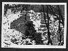 Bridge Construction
December 1, 1936
-
Land Acquisition Maps Section 2-A
1938
-
 Picnic Shelter
March 28, 1938
-
Fire Hazard Map
1939
-
Land Use Map
1946
-
Land Use Map
1946
-
 Sign at NC/VA State Line
September 1948
-
Concession for Picnic Supplies
Page 1 of 1.
Items in Query
Results: 9
Refine Your Search
Types (3)
Maps (6) Photographs (2) Drawings, Plans, and Projections (1)Locations (4)
Cumberland Knob (4) Section 2A (3) Cumberland Knob Park (1) NC State Line (1)Sections (1)
2A (9)Counties (2)
Alleghany (8) Surry (1)

